Not much to this walk at all, a mile and a bit maybe if that. It’s on my doorstep though and when you need a quick fix, 5 minutes down the road and you are there. This was the leap year day and I’m not sure I’ve walked on the 29th Feb before. We started at Jennycliff and walked towards Mountbatten and back around the road, so nothing difficult, but it blew away the cobwebs, the sun shone and the wind blew a fair bit. Shame we didn’t go a bit further really as I’m starting to get more of a taste for the coastal walks now and there will be more of them this year for sure.

© Crown copyright 2020 Ordnance Survey FL 2020 SF
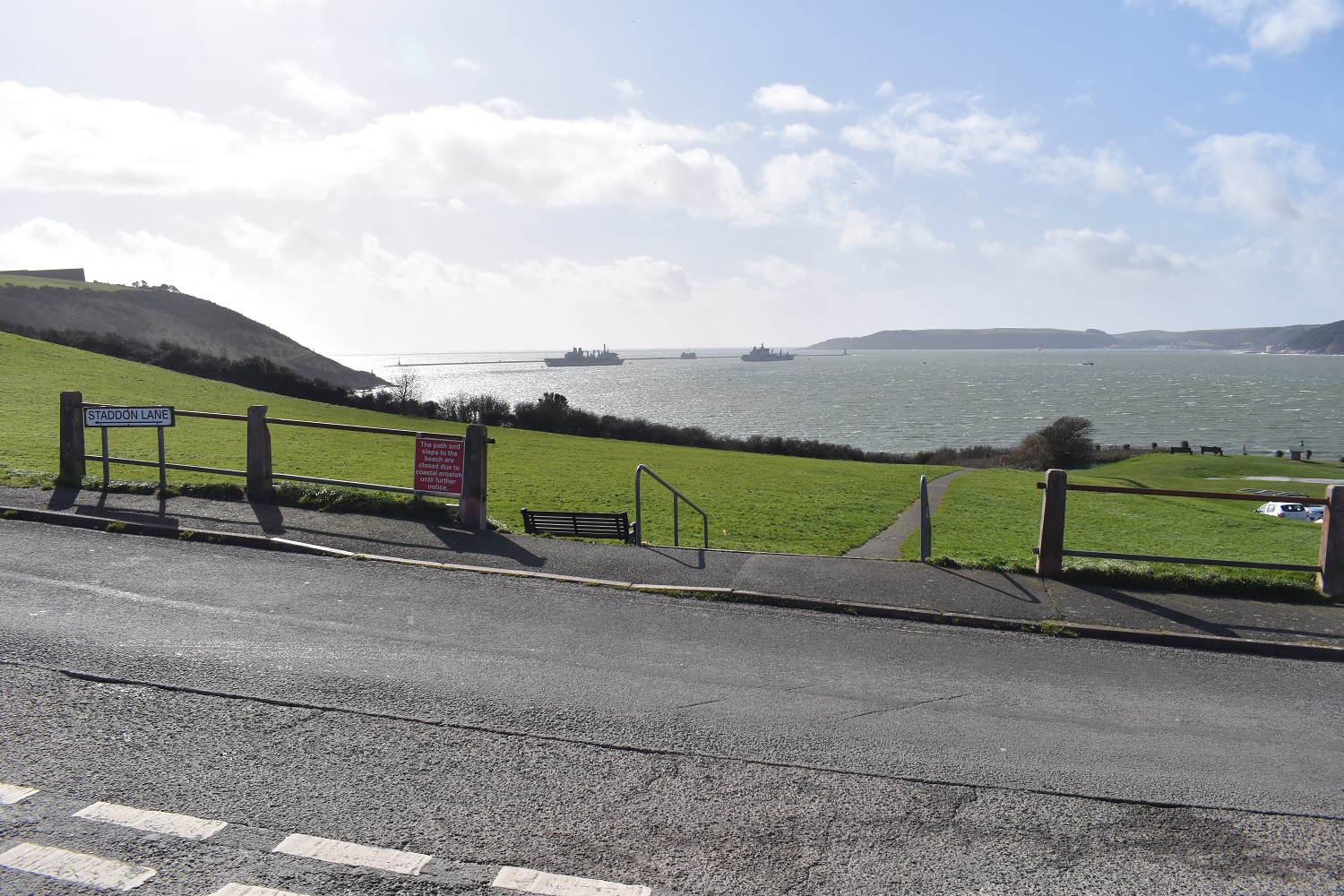
Plymouth Sound. A couple of naval ships in, as normal. Rame Head in Cornwall over to the right

Drake’s Island in the centre over the Jennycliff Cafe. The sun was nice and warm and it looks like it should be a warm day, the wind however was over 30mph and absolutely freezing

Jennycliff can be seen below as we set off towards Mountbatten

Posts and signs everywhere here for the south west coastal path. Plymouth Hoe and Mountbatten behind the boys
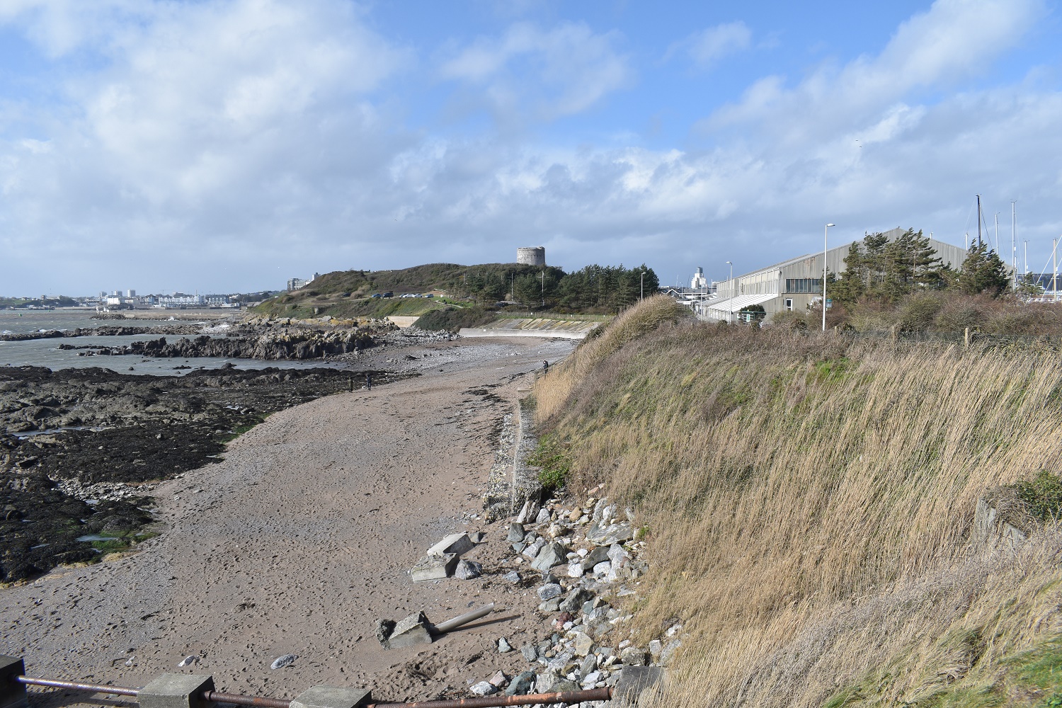
Mountbatten Fort in sight

And the other way back to Jennycliff. The two masts at the back identify Fort Staddon. A major defense fort against French attack in the 1860s

Mountbatten Fort or Mountbatten Tower as it is known. The tower was built in the early 1650’s to protect the River Plym and Cattedown (where the main naval section of Plymouth was based) from invasion. This was mainly from the Dutch, who Oliver Cromwell took umbridge to in 1651.

Not long after the tower was completed, the hostilities with the Dutch continued and by the time of 1670 a new Citadel had been built to protect Plymouth. The naval base moved more around to the Tamar side of Plymouth (beyond the end of the pier in this picture) and as such the Tower wasn’t needed as much. The area of Mountbatten changed when the RAF formed in 1918, to become an RAF base with sea planes and flying boats being based here. A certain T.E Lawrence was based here, also known as Lawrence of Arabia!
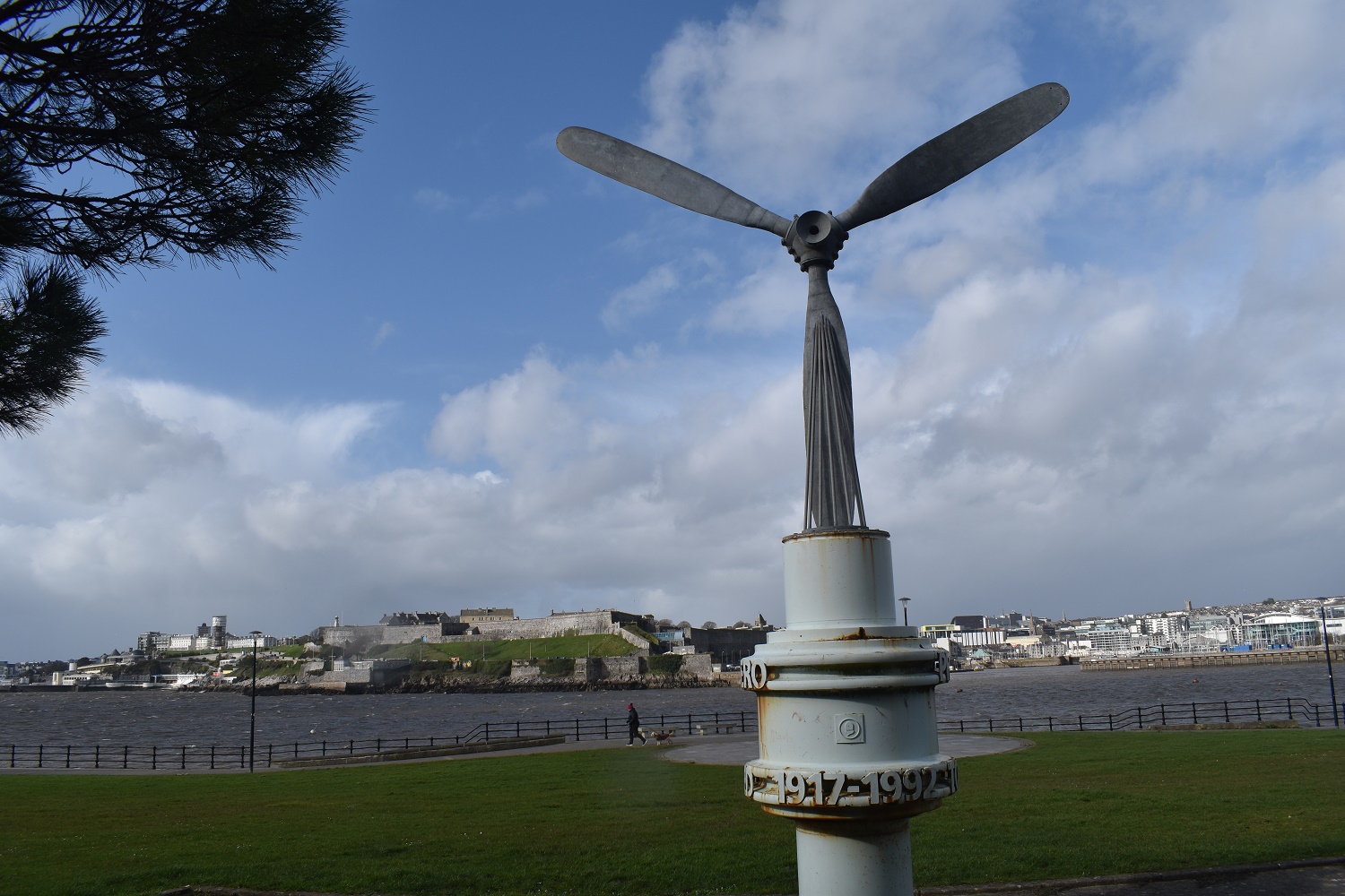
The citadel sits high on Plymouth Hoe behind the propeller replica from a Sunderland flying boat (1929). A link to the heritage of the flying boats from RAF Mountbatten

Around the corner a bit the boats turn to more recreational. The wind was whipping through here and the lines were clanking against the masts and the wind was making a howling noise as it passed through the lines of rigging.

Climbing up to the road now with Lee Moor, on Dartmoor in the distance. That’s the River Plym below

If you like your forts then this is the area. Up the hill is Fort Staddon, across the water in Cornwall near Rame Head is Fort Picklecombe but this one is Fort Stamford. This site was fortified in the 1640s by the Royalists in the Civil War. Plymouth was steadfast in holding as Parliament stronghold, and the Royalists used this spot to bombard Plymouth and cut off any sea supplies. Its current state and huge block walls owes much to the French battles in the 1860s and helped create a ring around Plymouth Sound to prevent entry into Devonport Dockyard, one of, and still is, a major Naval port

Back down the road to Jennycliff. Plymouth Sound is still shining in the sun and the wind is still blowing a hoolie


Semi-urban coastal walk with interesting stuff along the way. Not to shabby at all for a quick fix! 😀
LikeLiked by 1 person
I’ve done the walk loads but never really paid any attention to why the forts were there or what the propeller was from. Good to do a bit of research of a place so near to home
LikeLiked by 1 person