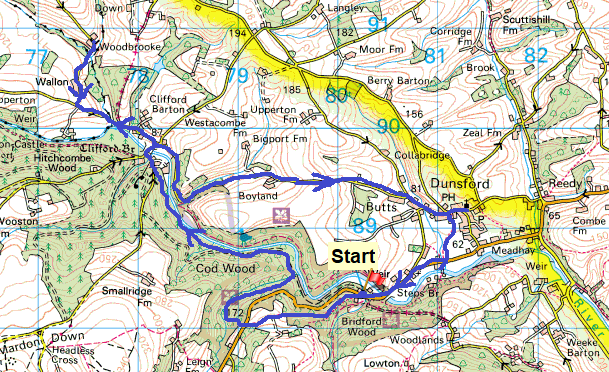
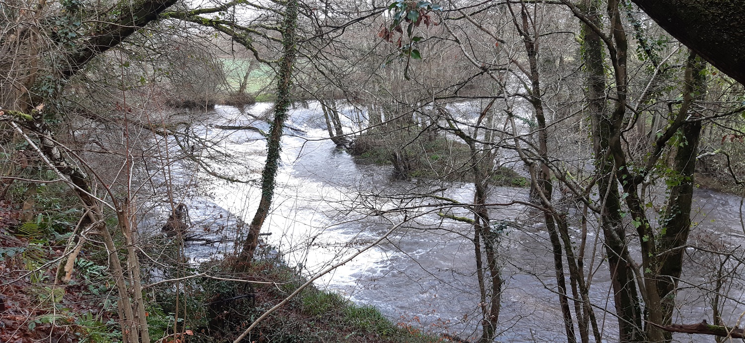
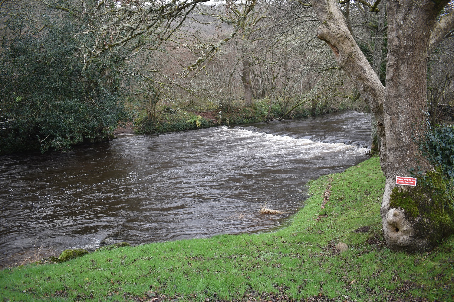
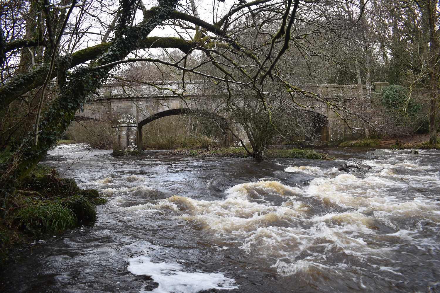
This walk involves a fair bit of water and bridges over it. There are weirs and bridges galore in this area alongside a set of stepping stones which also cross the river. The river is question here is the River Teign and in winter is nearly always running fairly high, on this day it was running very high which meant the stepping stones were out of the question unfortunately. Before I get into the walk I must apologise for being a little tardy with my updates recently, I had a decent run of walking over Christmas and managed 4 walks before I had to go back to work, 2 of these I have published and this is the 3rd one. I then got Covid and ended up stuck in the bedroom glumly looking out the window at blue skies for this last week. This was a bit of a downer, the weather for the whole of December was damp with low cloud in Plymouth which carried on into January, and then the day I got Covid was the day it brightened up for a week!! Typical. Still the virus wasn’t a bother, I had a bit of a stuffed up nose but that was it, however it meant I felt robbed of the decent weather and being cooped up just left me crawling the walls. As a result of this I find myself now writing about a walk which was done on New Years Eve! I’d had enough of the Plymouth’s dank weather and decided to chance a visit to the eastern side of Dartmoor to see if it was better over there, it normally is if the prevailing south westerly weather is coming in. I was spot on with my hunch and enjoyed a bit of sunshine on this side, a fine way to end the year with my 64th walk of 2021.
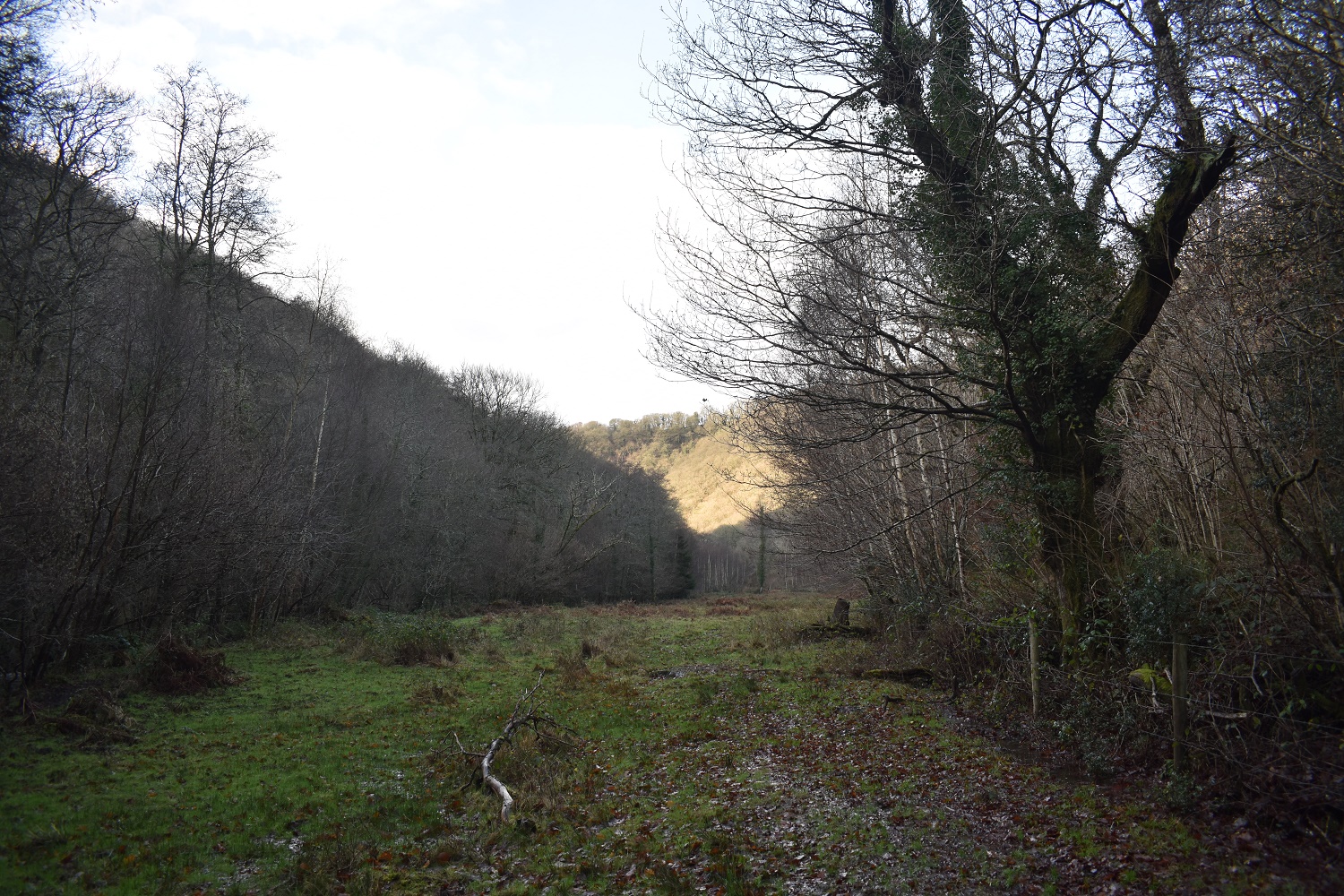
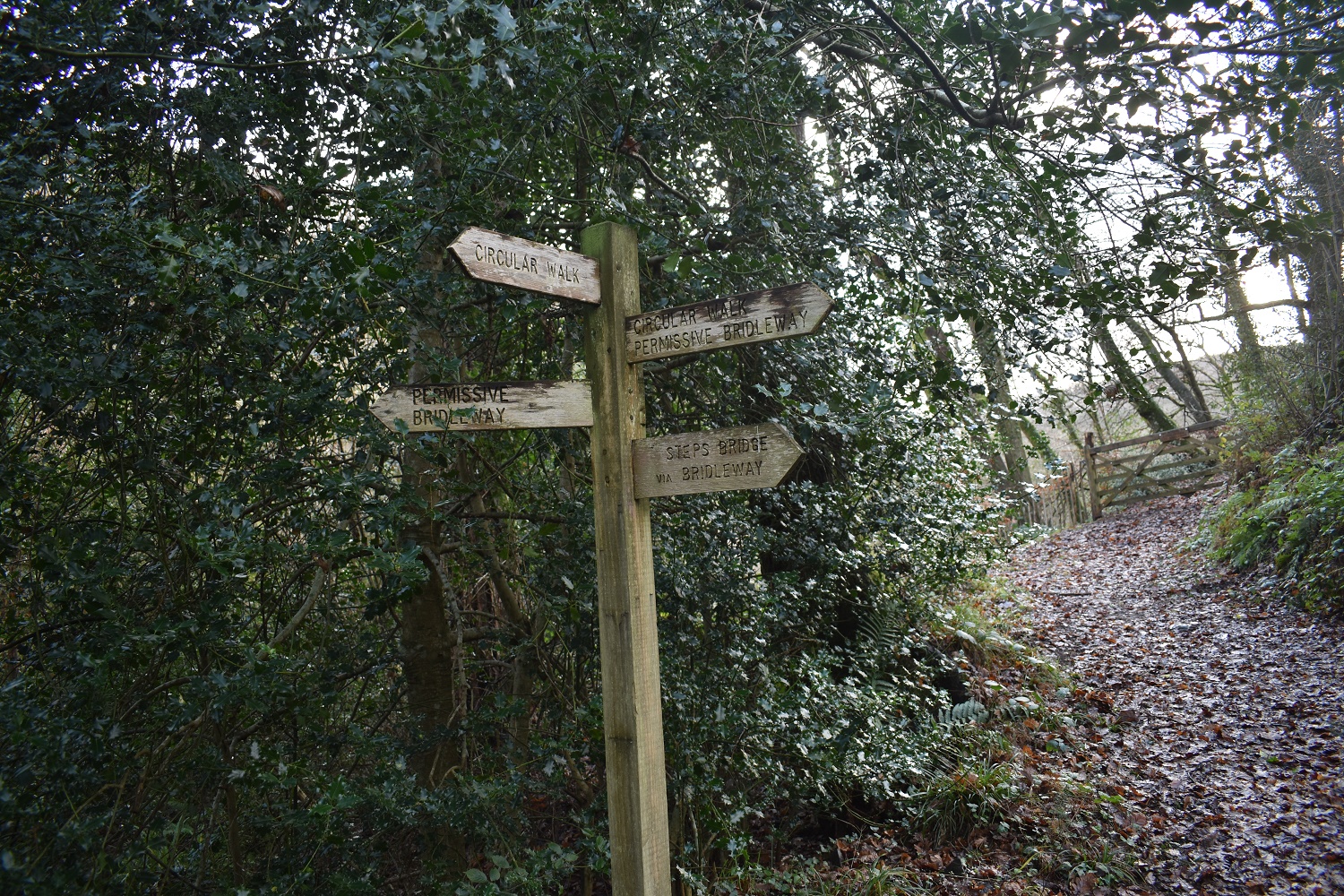
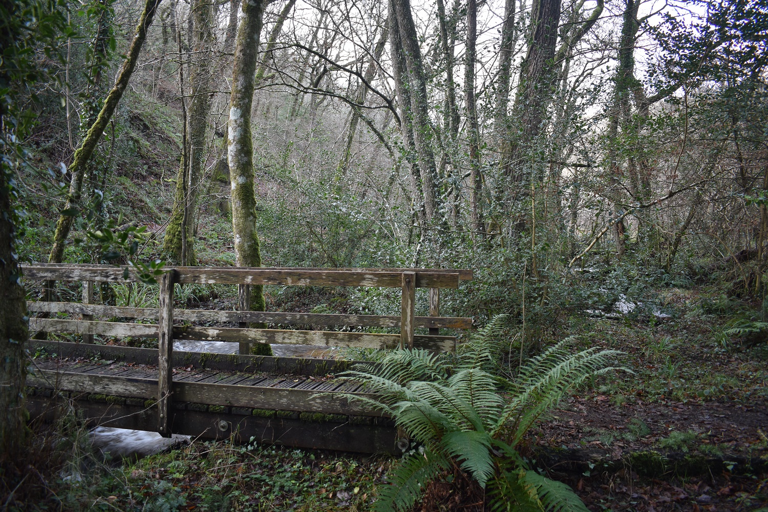
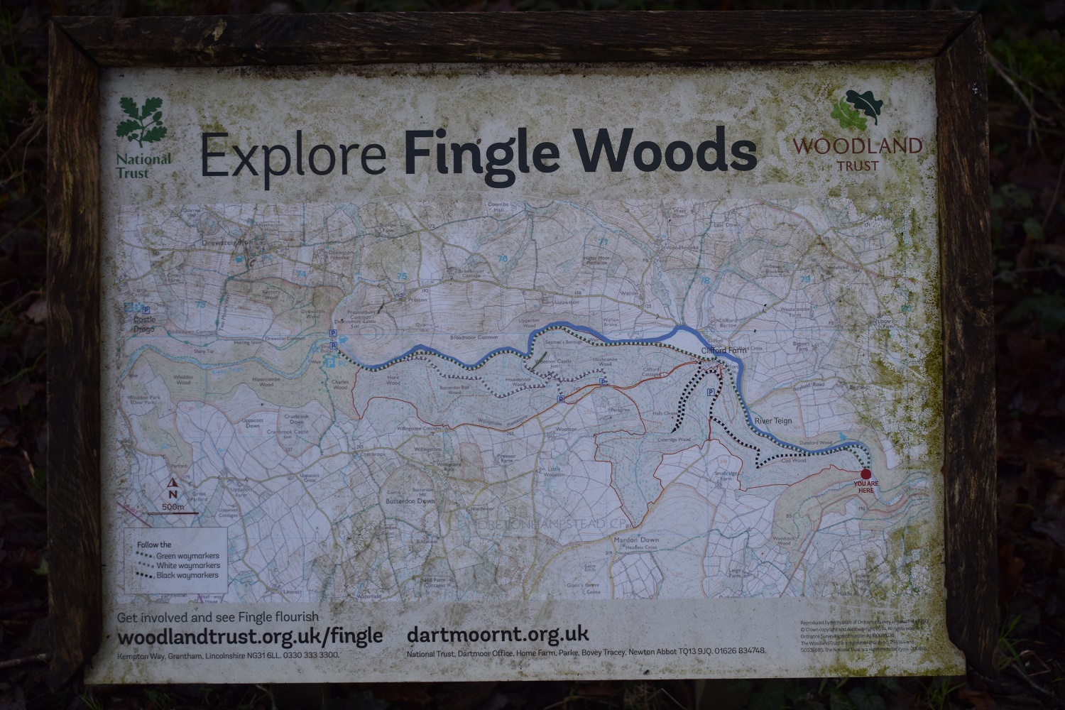
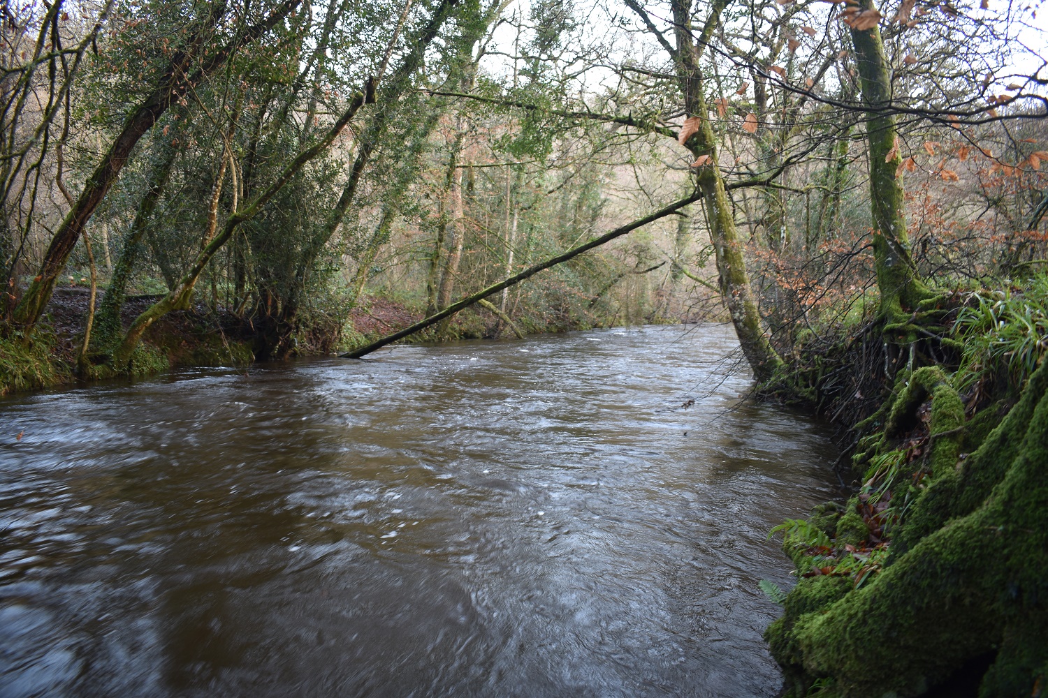
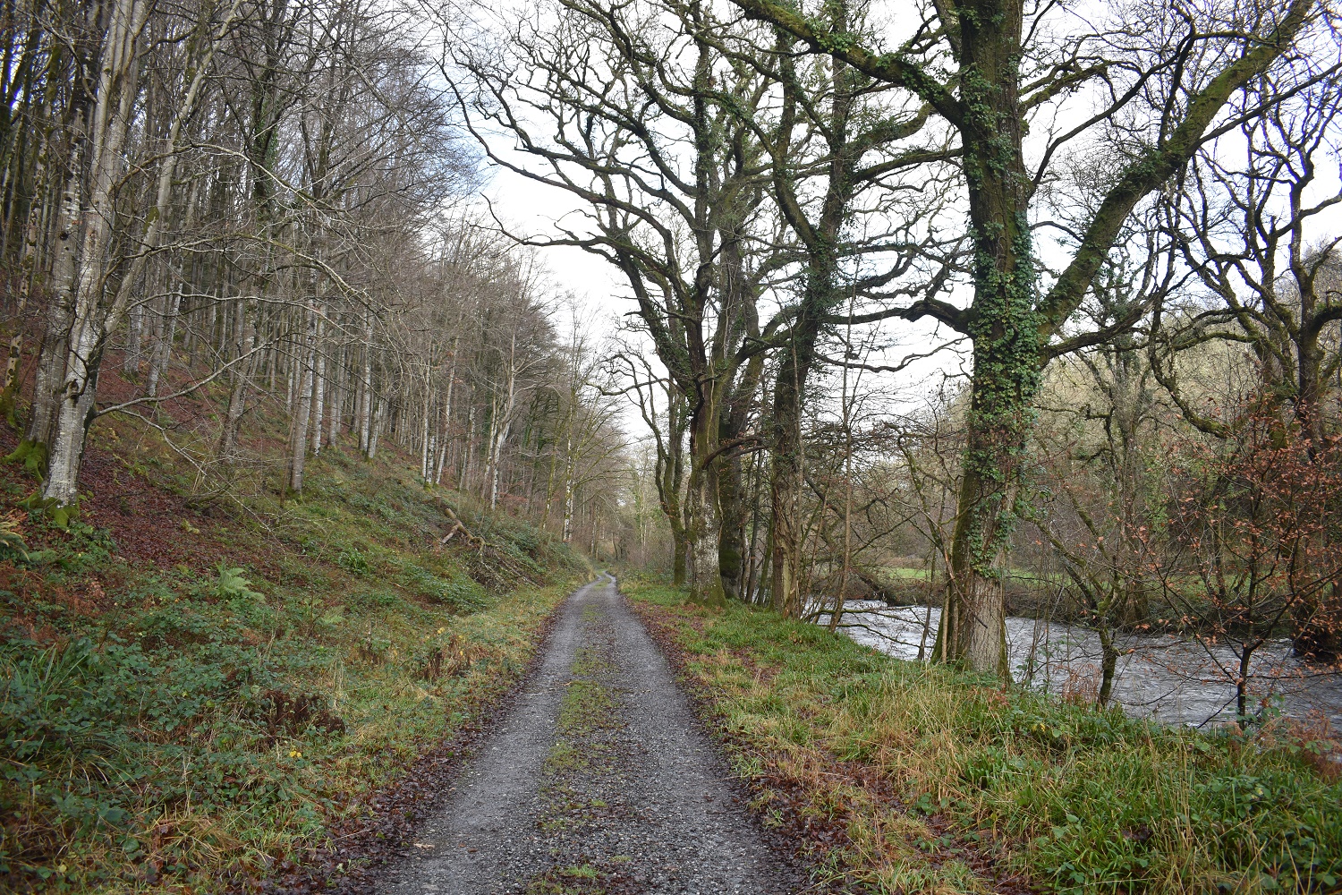
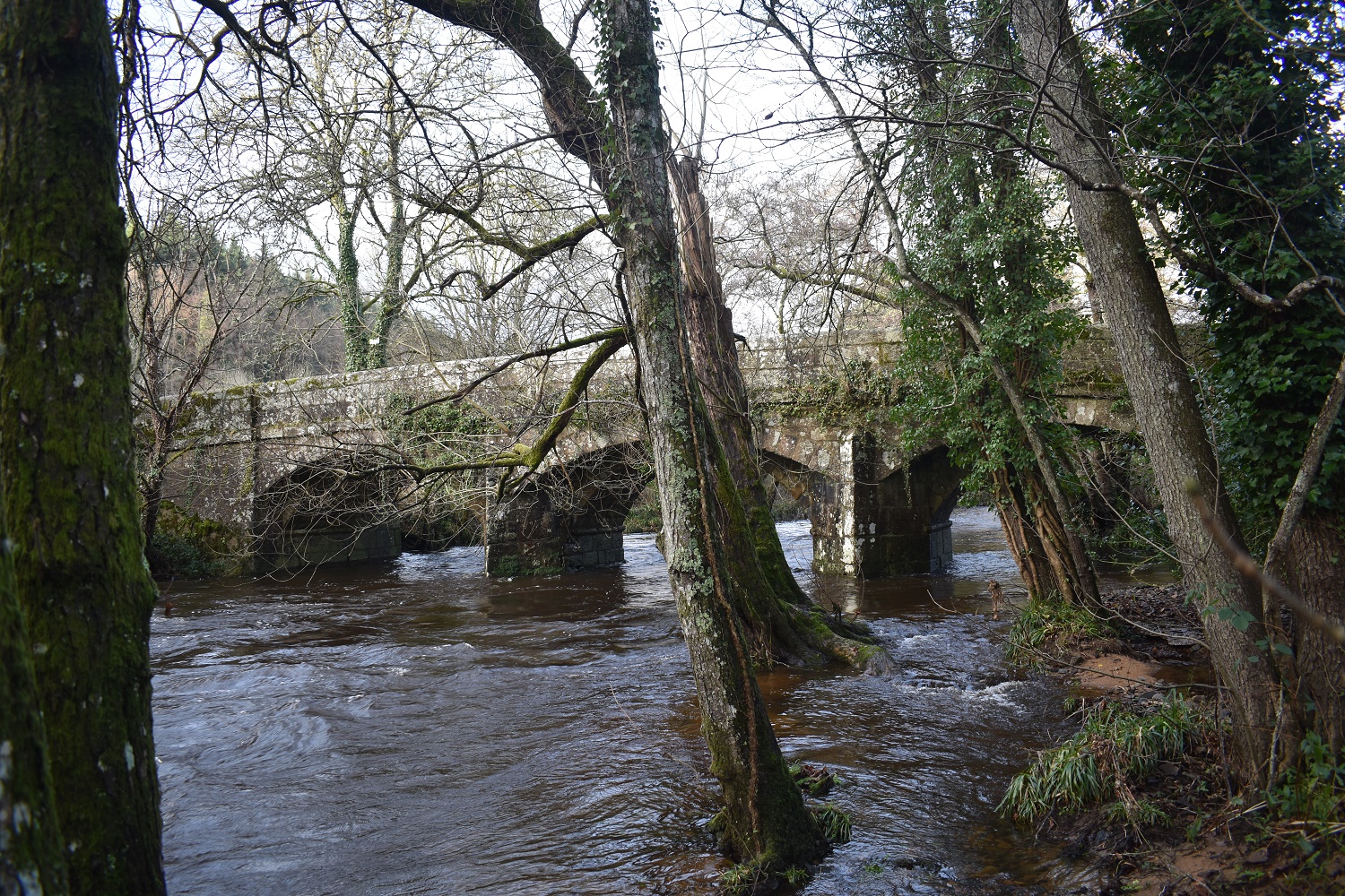
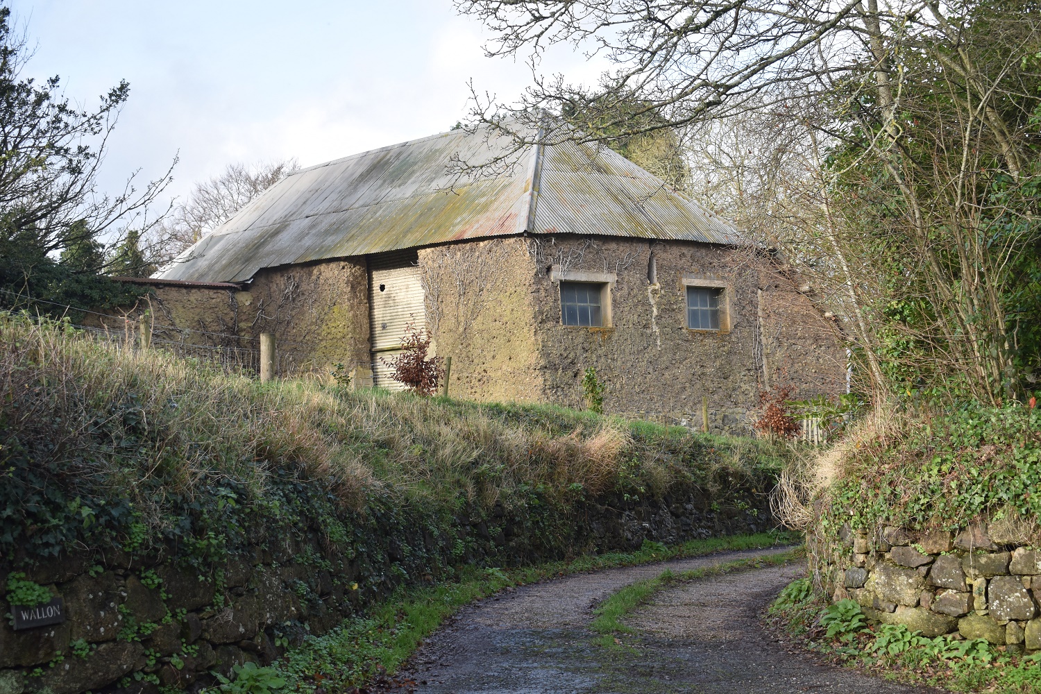
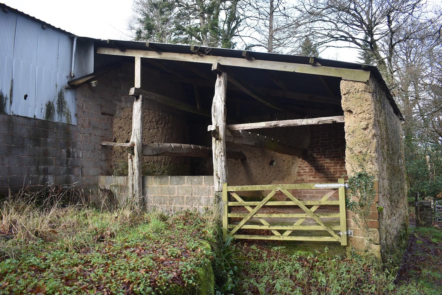
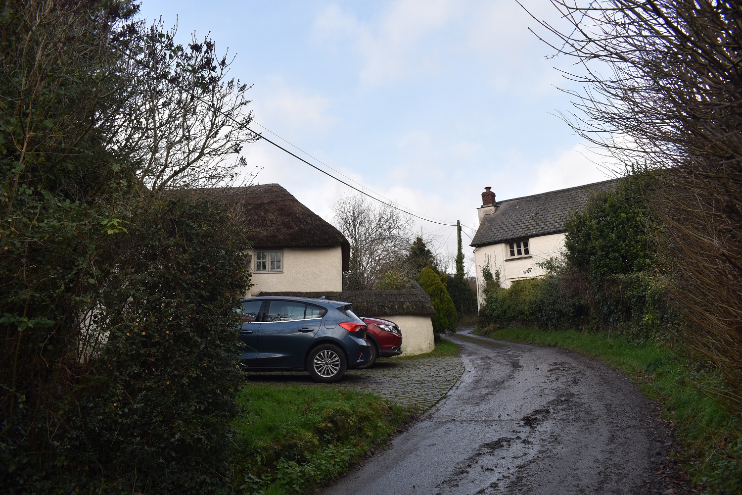
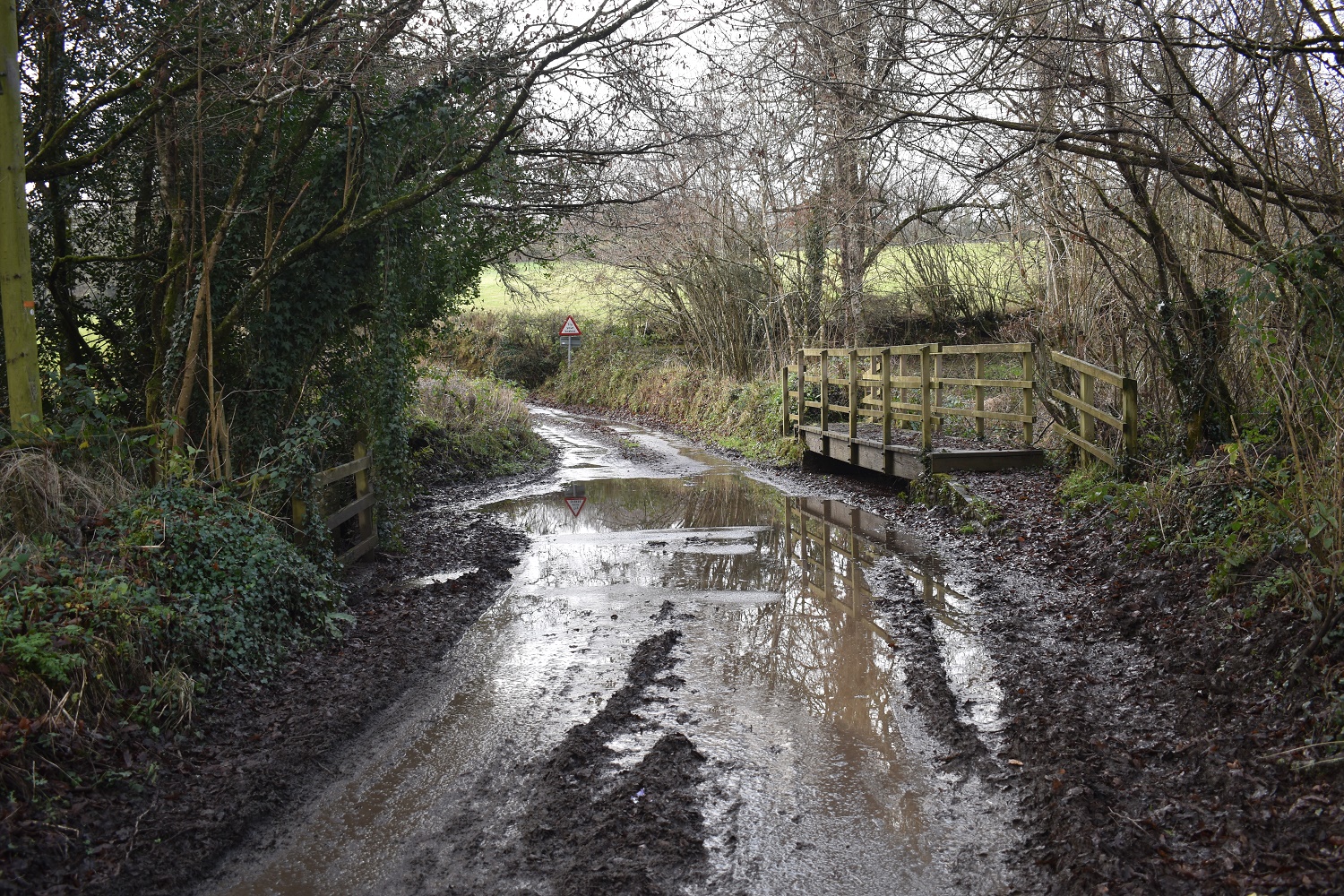
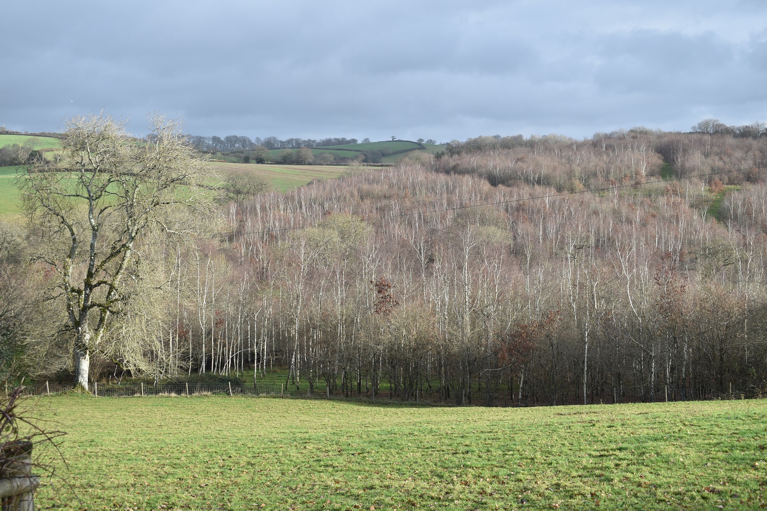
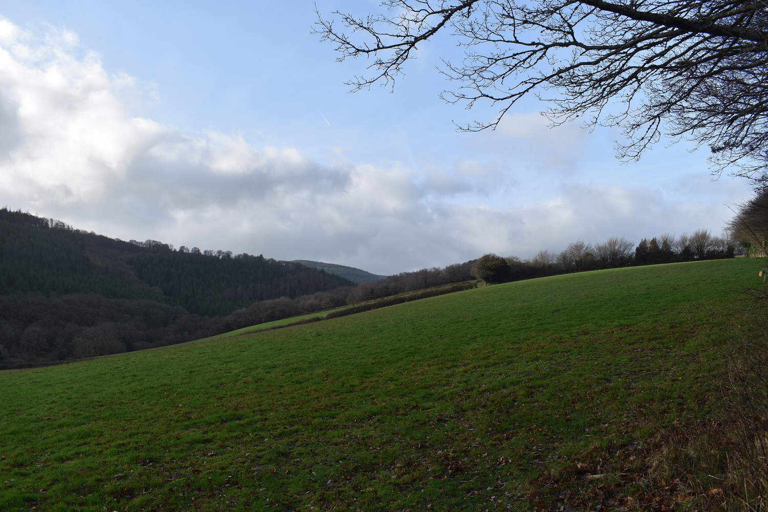
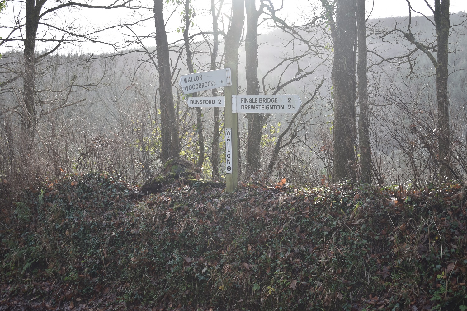
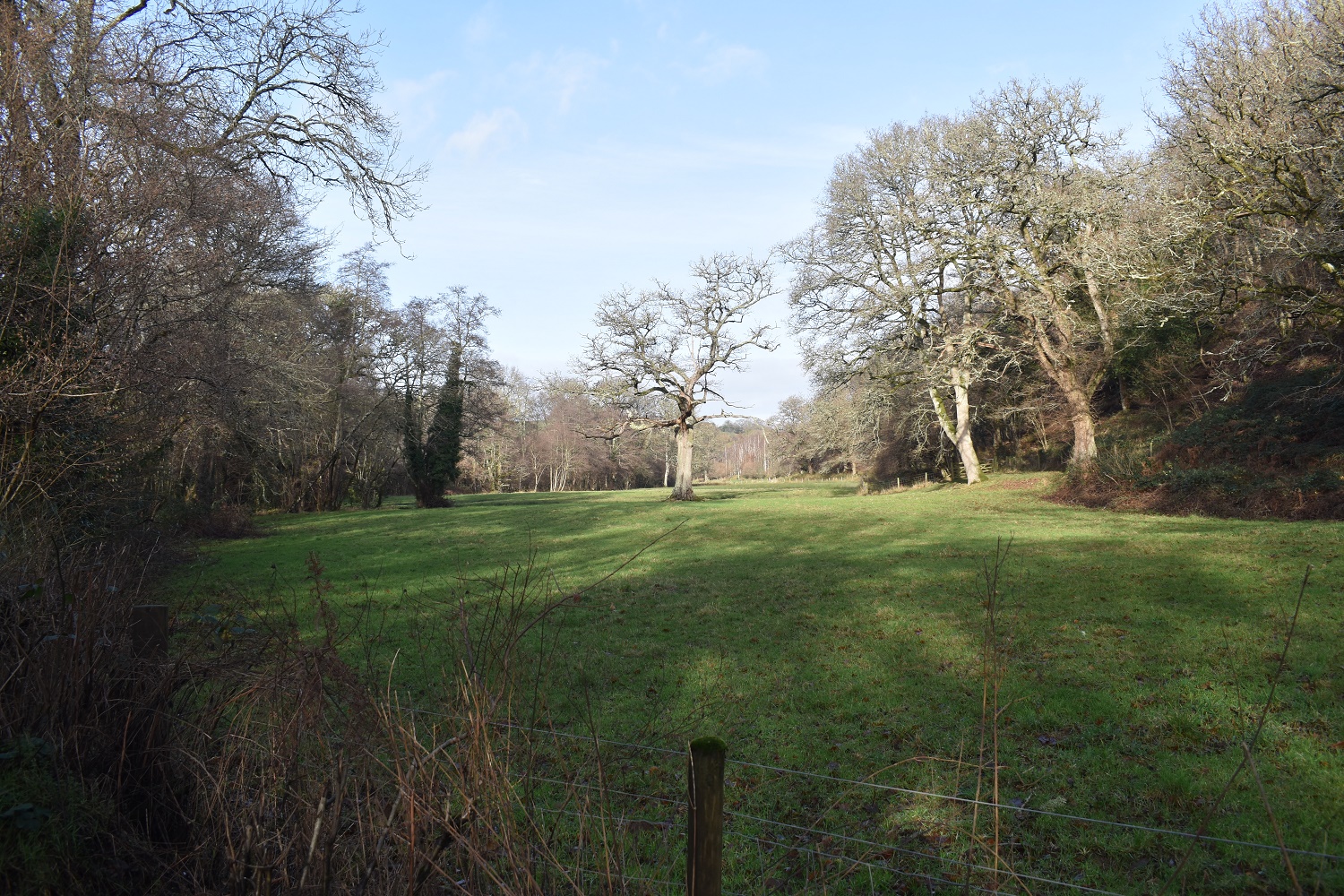
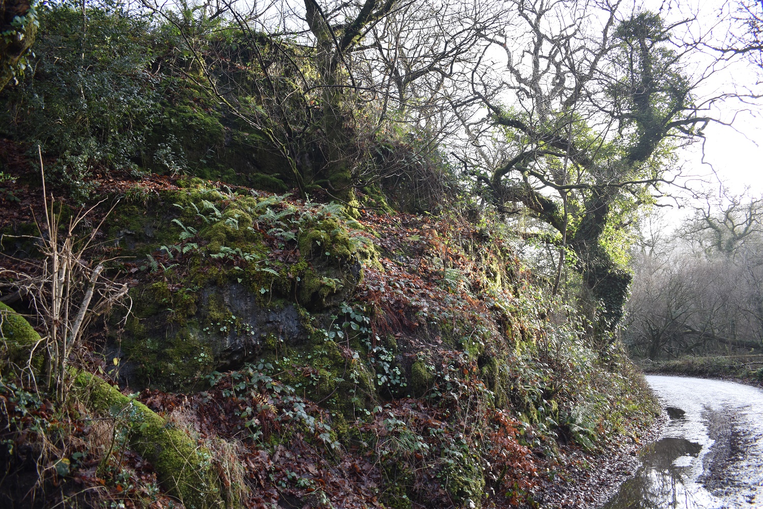
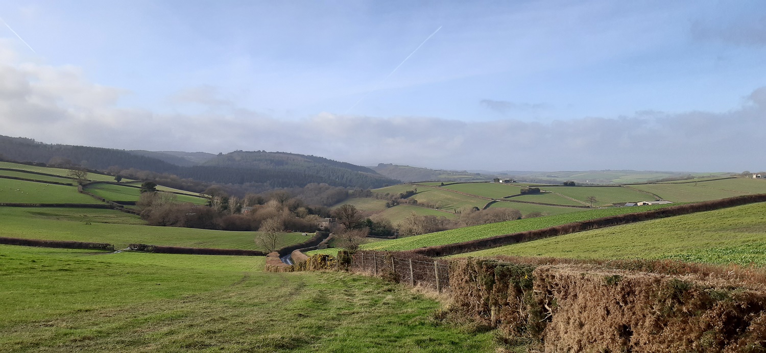
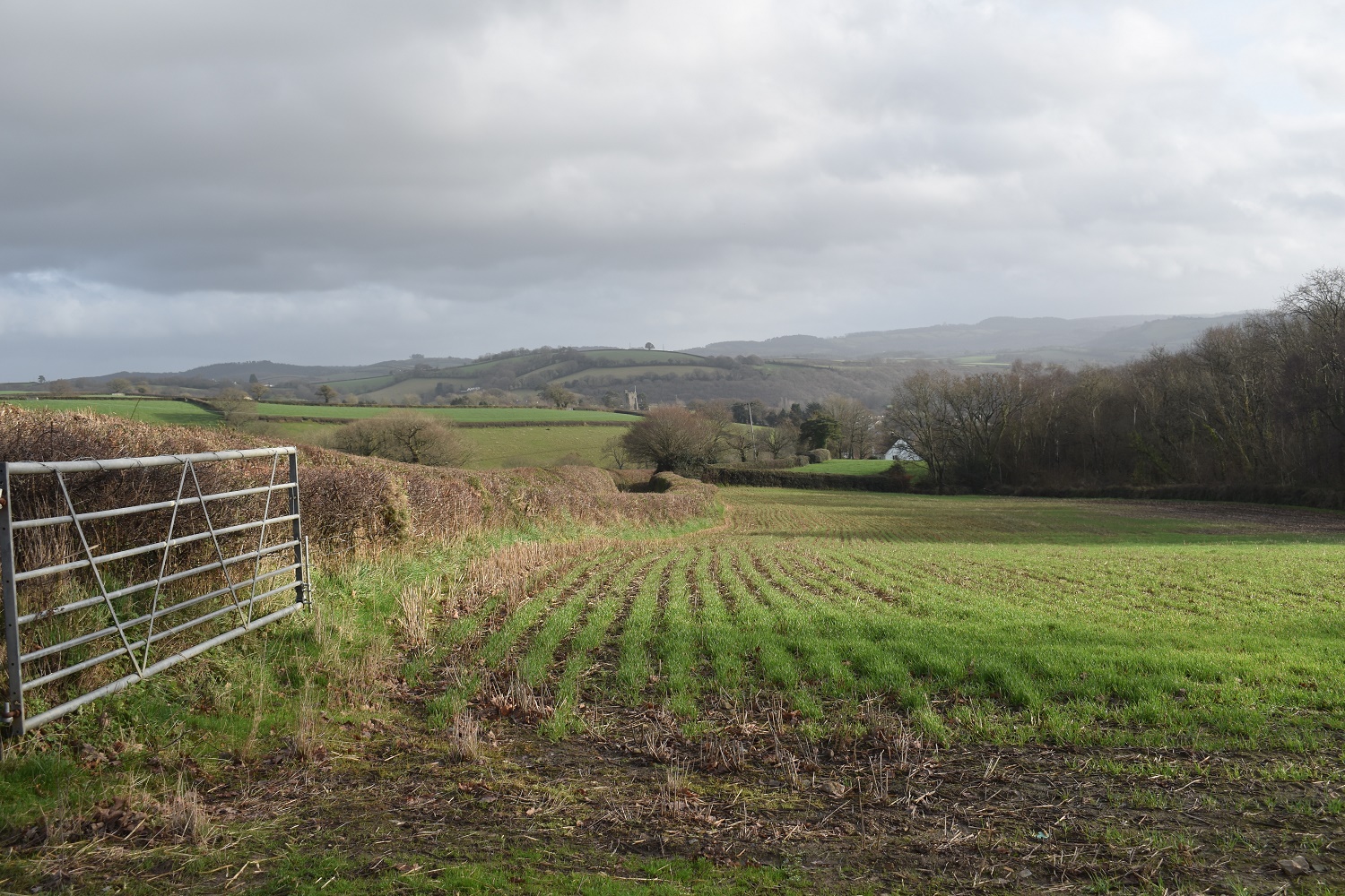
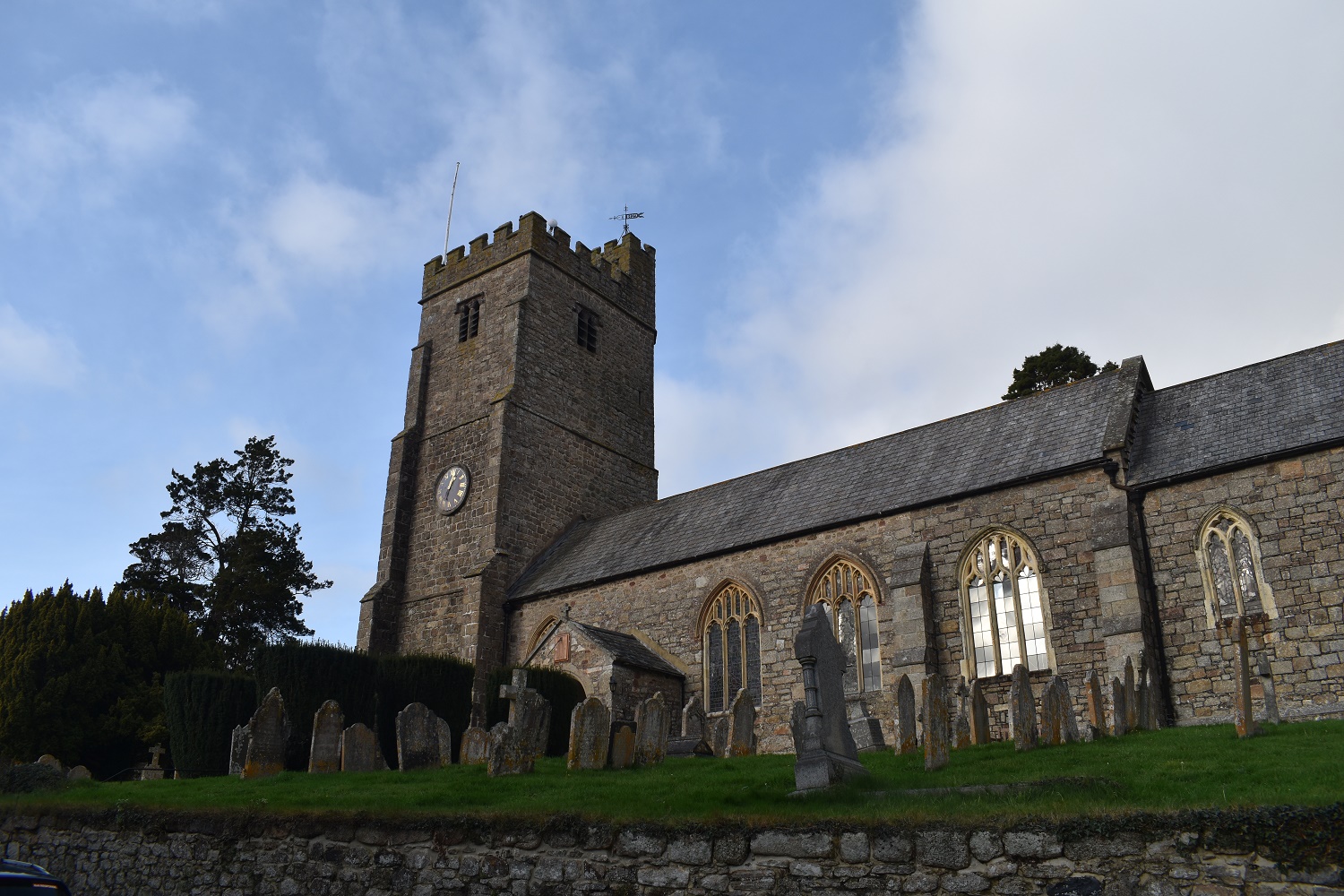
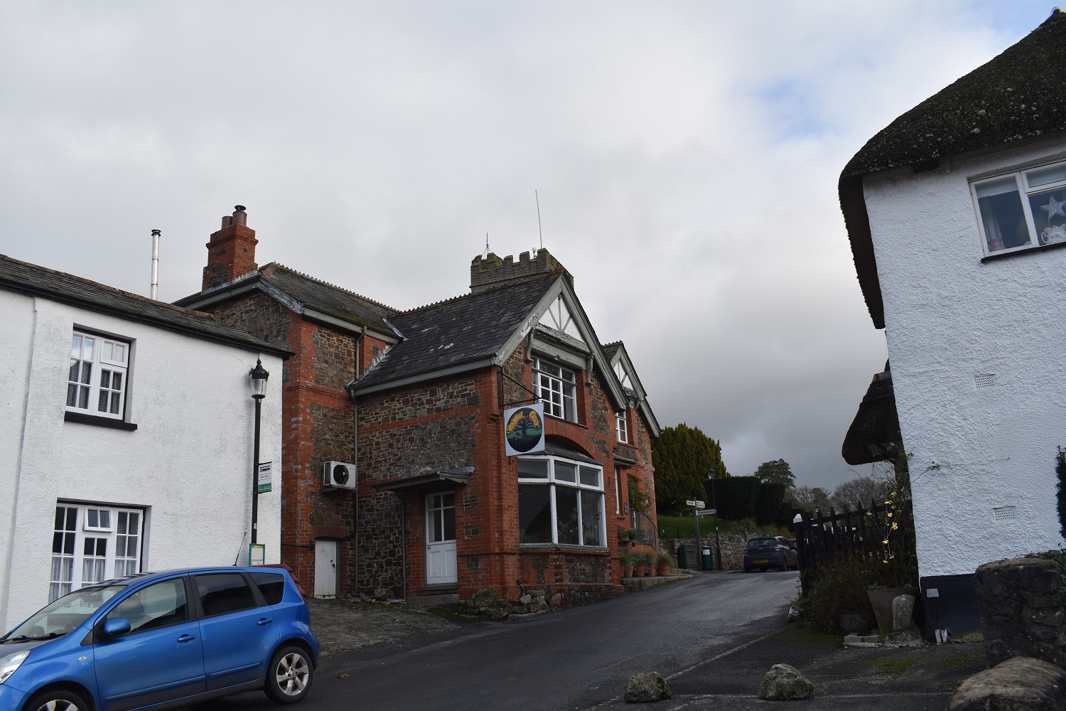
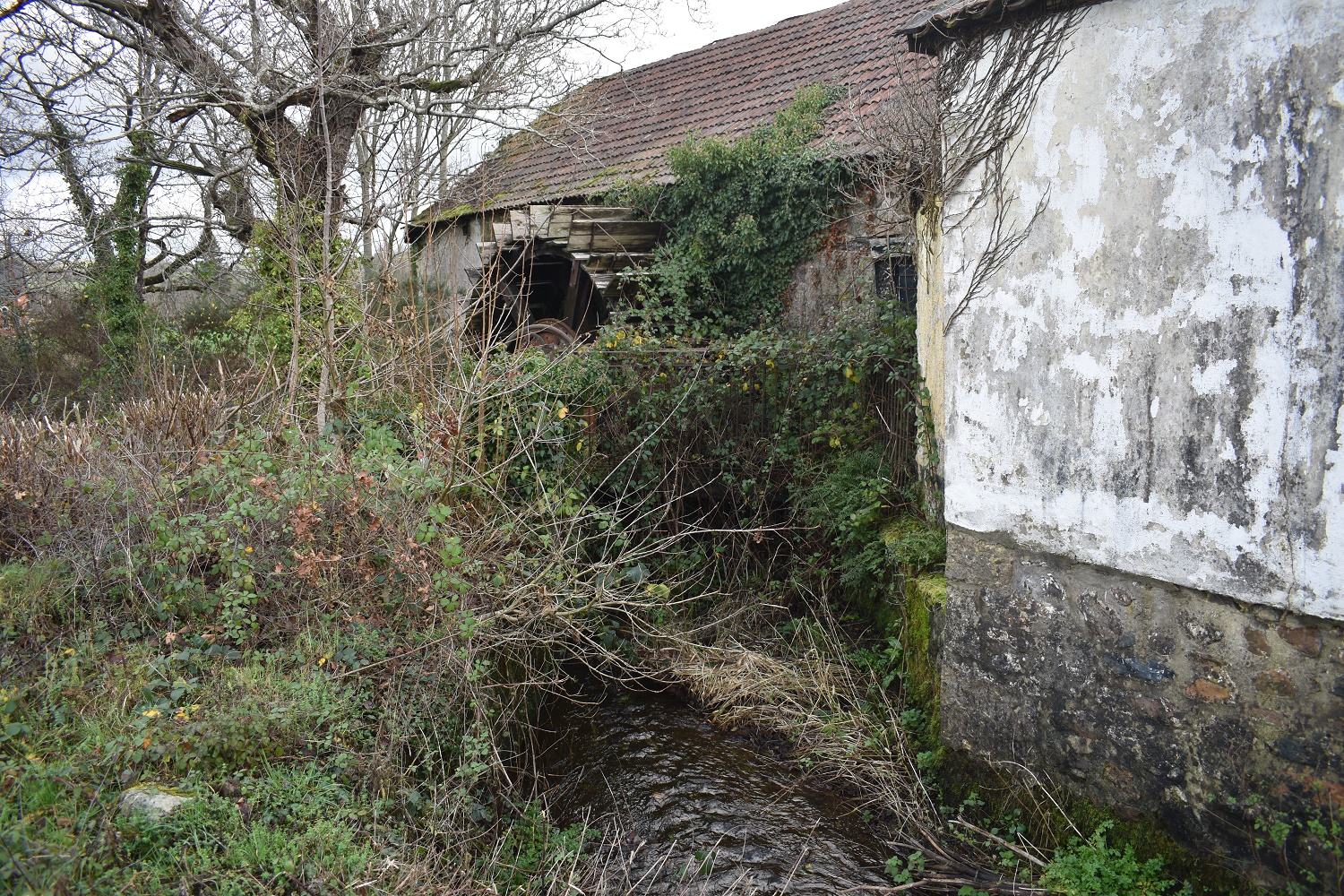
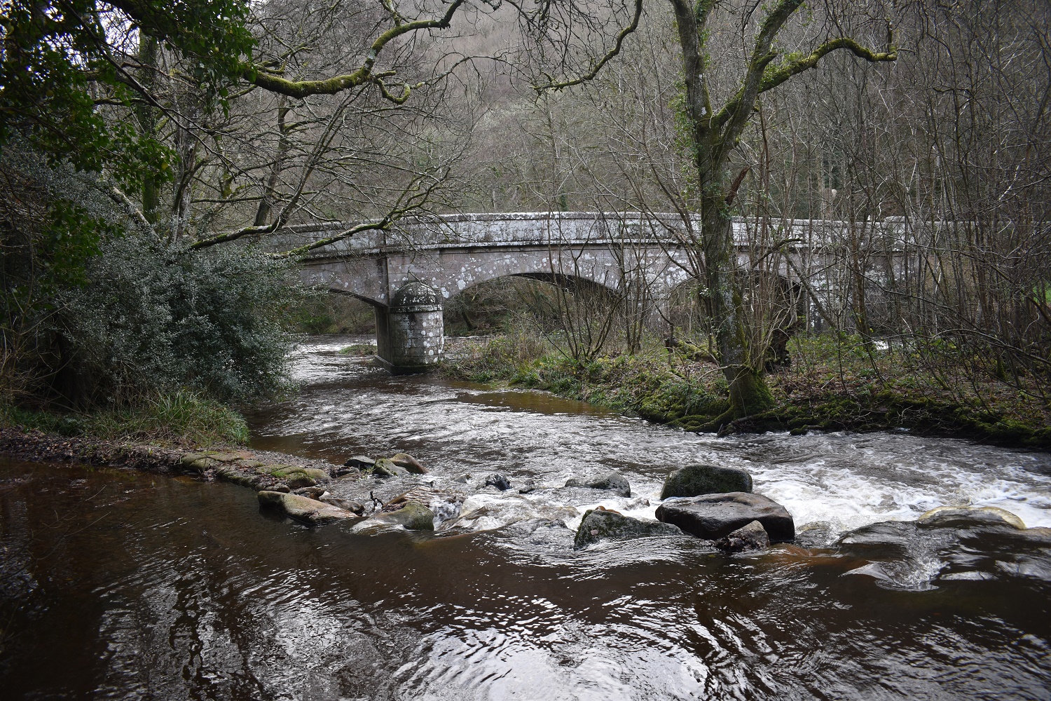
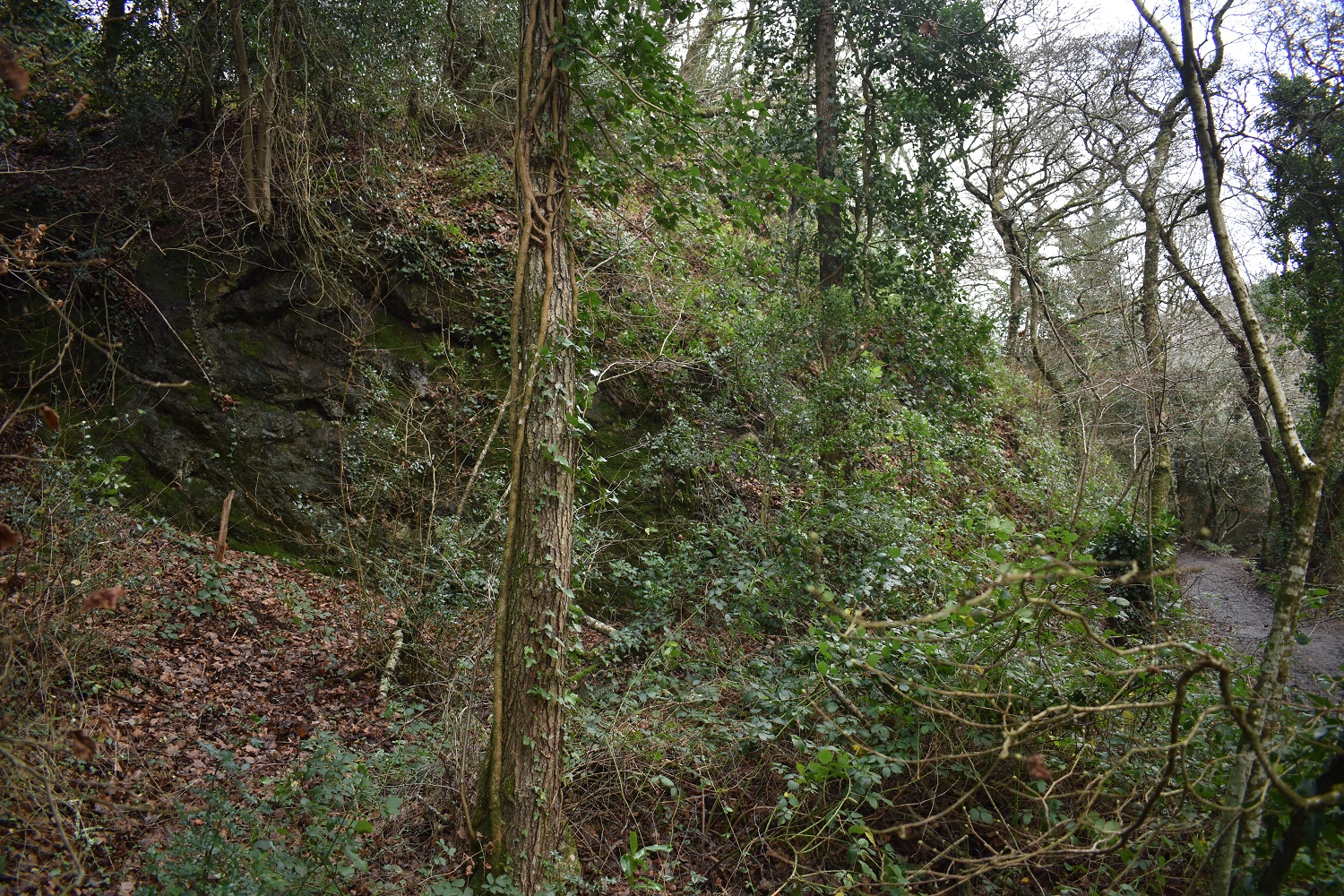
On the drive up to Steps Bridge I stopped off to look at Weirsmeet (a Dartmoor 365 square). This walk would pick off 5 others Dartmoor 365 squares and this on was a bonus 6th square. Its not an easy one to get to as there is a busy B road to negotiate, plus nowhere to park nearby. Once at the bank this is as good as it gets for a photo as there is private land all around it and a steep bank down. Its a large double weir on the River Teign and the nearby brook which joins here as wellI parked up at Steps Bridge and got out, booted I set off looking for the path down to the River Teign (marked by a dashed black line). As with previous black dashed lines paths (see walk at Bag Tor ) this path was closed. I took a look down the path and could see no reason for the closure, I even walked a hundred yards down, again no reason to close it. Forlornly I walked back to the car park and crossed the road to pick up the bridleway, which the sign said to follow. If you look at the map above, the bridleway leads to the main road, and then crosses it and into St Thomas Cleave, which is the photo above. I was a bit miffed walking that way so took no photos before reaching this point. I’d come down the left hand side here, to this view back along the hidden cleave, another Dartmoor 365 spot.That gate at the back is the way back to the blocked off path from the car park. Again I vaulted the gate and walked a distance up the path, no fallen trees blocking or a worn away path, again a grumpy landowner stopping access it would seem. The Permissive Bridleway signs on the post give the new routeSt Thomas CleaveThe map shows the green dotted line following the river to Clifford Bridge, that’s my route from the You Are Here red dot. If you zoom in you will see the bridlepath down to the red dot from the road aboveDown at the River Teign, it was travelling very quickly hereThe bridlepath handrails the river towards Clifford BridgeClifford BridgeThe white house over there is near to Clifford Bridge I followed a lane towards Wallon Cross and grabbed this photo back along the valleyCob barns of WallonOld wooden beams holding the barns togetherWoodbrooke another D365 square, not much here though, just these couple of houses. this was an out and backMuddy lanes as I head back to Wallon CrossA sea of silver birchLooking west along the Teign Valley towards Fingle BridgeWallon CrossI quite liked this tree, smaller than its contemporaries but standing out alone and throwing some fine shapesThis has been called Commons Crags, I’d walked past Clifford Crags before hitting Clifford Bridge earlier, but its a scruffy set of overgrown rocks, this one by the road was easier to get a photoThis photo shows how decent the weather was on this side of the moor, driving back to Plymouth I hit dreary rain again, I was glad of my decision. This lane leads up to Boyland Farm and on to Dunsford. A lovely sceneLooking down to Dunsford, the church can be seen sticking up.Dunsford churchThe tree on the right shows when this walk was done. It was New Years EveThe Royal Oak in DunsfordA short walk across fields took me to the B3212, crossing that I reached the Dunsford Mill Stepping stones. Not to be crossed today, which is a shame as there is a nice path on the other side back to Steps BridgeThe mill wheel and the leat belowBack now at Steps Bridge, the leat mentioned in the photo above is heading away on the leftSteps Bridge Rocks, as named by the Tors of Dartmoor team, again its a scruffy looking set of rocks covered in a lot of greeneryOne last look at Steps Bridge and the River Teign at the end of my 2021 walking. It was around half past one at this point and plenty time to get back and enjoy the New Year celebrations
Hello – I had the same problem as you just a few days before with the path from Steps Bridge car park shown as a permissive path on up to date OS map. It ended up being quite a lot of extra walking as I was returning to Steps Bridge – my daughter who was with me was remarkably forgiving about it as she could also see that it looked fine on the map. See account on https://trekkingadventuresbackpacking.travel.blog/2021/12/30/tor-bagging-above-a-legal-200/
As you say there appears to be no reason for that path to be closed apart from the whim of the landowner
I like your route planning on your walk, I think like you I’m not a fan of walking on the B3212, too many sharp bends and quick cars to be safe on that road, so it made sense to descend to the path by the River Teign for you. No idea how long its been closed like that, and i had a wander from both ends to see if there had been any collapsing of the path, but could see nothing, has to be the landowner
The river looks very lively in your post. I have suffered from the same thing as you. Covid visited us too. I was relieved to get out and about after 7 days. X
Glad you are able to go back to your hikes now.
I managed to escape the Covid but my partner didn’t and was bad for a good week during our Christmas/New Year holiday.
We did visit Finger Bridge around 4 years ago. We really like that area.
Glad you have reminded me with your post this short holiday we had there.
Fingle bridge is a nice spot by the river with a decent pub, all the walks along the river whether heading east or west are very good and I can imagine its a nice spot for a holiday
Glad the dreaded “C” has been and gone for you with no major effects. So frustrating to see paths closed, blocked or poorly maintained. As this one was a permissive path I guess there is nothing you can do. Maybe fishermen want to keep the riverside to themselves and as they pay, money talks?
It may well be fishing with the path running alongside the Teign for about 400-500 metres. I was glad to get the virus out the way, shame I’d had the booster 4 days before, which is a bit of a waste now I have natural immunity. Hopefully vaccinations will go back to a more normal once a year in the autumn and we can keep moving towards a normal lifestyle


Glad you have recovered.
LikeLiked by 1 person
Hello – I had the same problem as you just a few days before with the path from Steps Bridge car park shown as a permissive path on up to date OS map. It ended up being quite a lot of extra walking as I was returning to Steps Bridge – my daughter who was with me was remarkably forgiving about it as she could also see that it looked fine on the map. See account on https://trekkingadventuresbackpacking.travel.blog/2021/12/30/tor-bagging-above-a-legal-200/
As you say there appears to be no reason for that path to be closed apart from the whim of the landowner
LikeLiked by 1 person
I like your route planning on your walk, I think like you I’m not a fan of walking on the B3212, too many sharp bends and quick cars to be safe on that road, so it made sense to descend to the path by the River Teign for you. No idea how long its been closed like that, and i had a wander from both ends to see if there had been any collapsing of the path, but could see nothing, has to be the landowner
LikeLike
The river looks very lively in your post. I have suffered from the same thing as you. Covid visited us too. I was relieved to get out and about after 7 days. X
LikeLiked by 1 person
Hope your version of Covid was as mild as mine, I felt more frustrated at being cooped up for sure, and you’re right it was a relief to get out again
LikeLiked by 1 person
Yeh it was pretty mild, was very fortunate. Maybe the fact that we like a bit of country walking has contributed to that, you never know. 🙂
LikeLiked by 1 person
Glad you are able to go back to your hikes now.
I managed to escape the Covid but my partner didn’t and was bad for a good week during our Christmas/New Year holiday.
We did visit Finger Bridge around 4 years ago. We really like that area.
Glad you have reminded me with your post this short holiday we had there.
LikeLiked by 1 person
Fingle bridge is a nice spot by the river with a decent pub, all the walks along the river whether heading east or west are very good and I can imagine its a nice spot for a holiday
LikeLike
Glad the dreaded “C” has been and gone for you with no major effects. So frustrating to see paths closed, blocked or poorly maintained. As this one was a permissive path I guess there is nothing you can do. Maybe fishermen want to keep the riverside to themselves and as they pay, money talks?
LikeLiked by 1 person
It may well be fishing with the path running alongside the Teign for about 400-500 metres. I was glad to get the virus out the way, shame I’d had the booster 4 days before, which is a bit of a waste now I have natural immunity. Hopefully vaccinations will go back to a more normal once a year in the autumn and we can keep moving towards a normal lifestyle
LikeLike
I sincerely hope so!
LikeLike