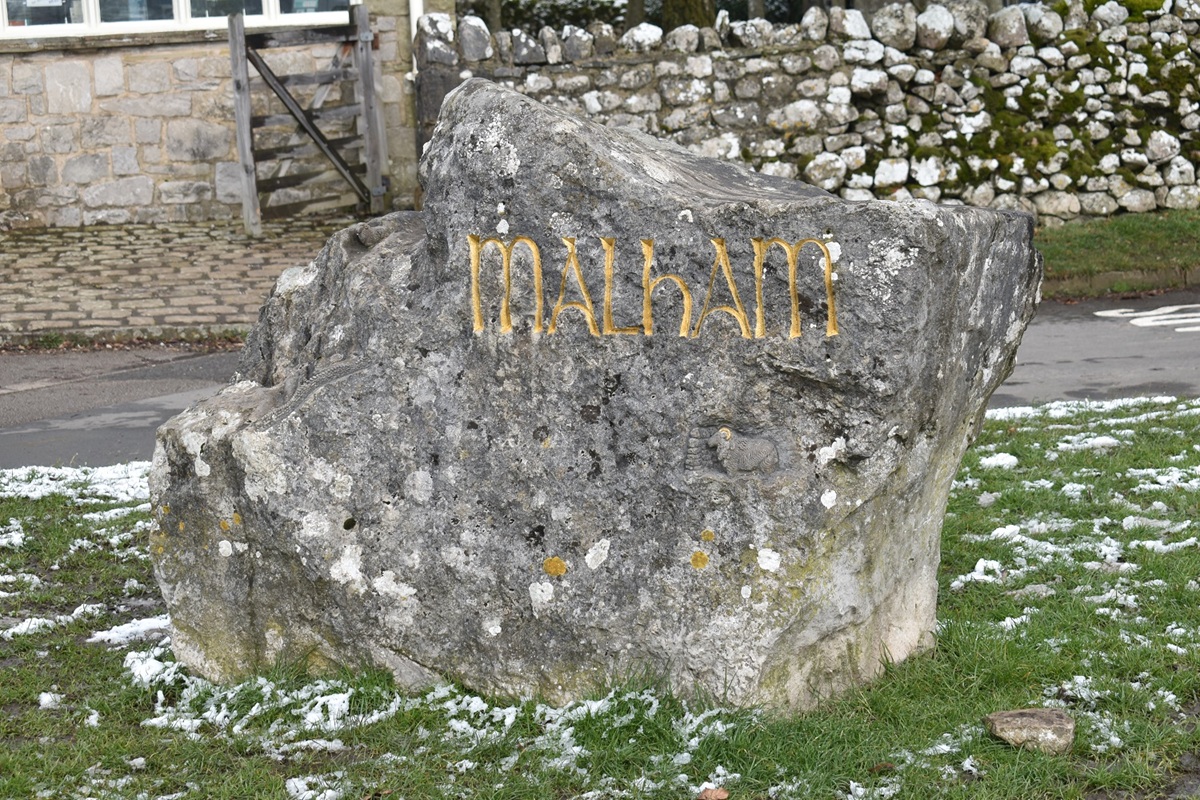
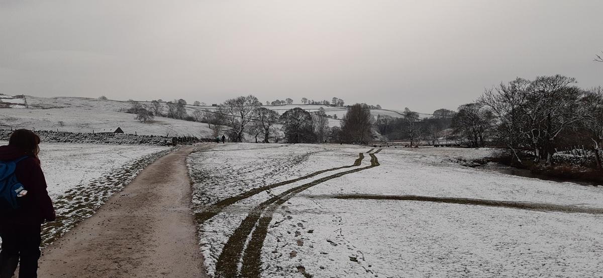
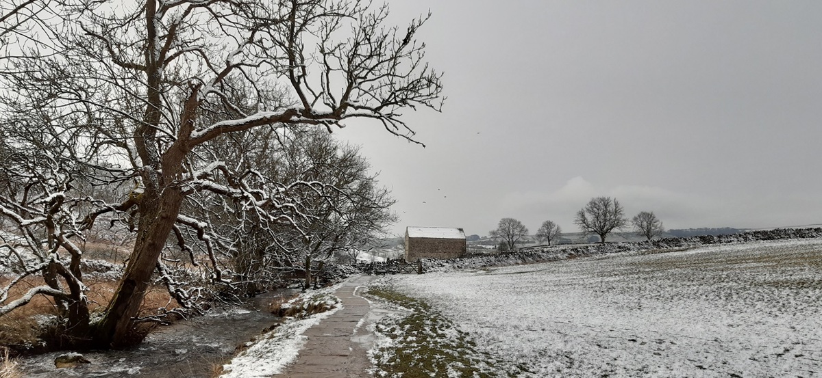
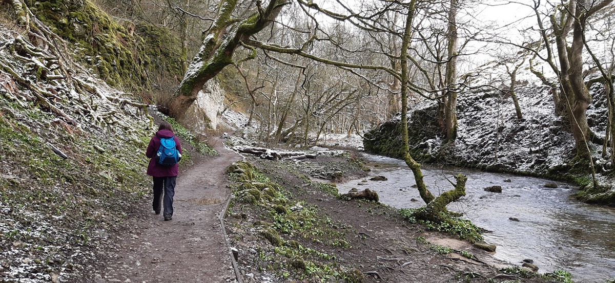
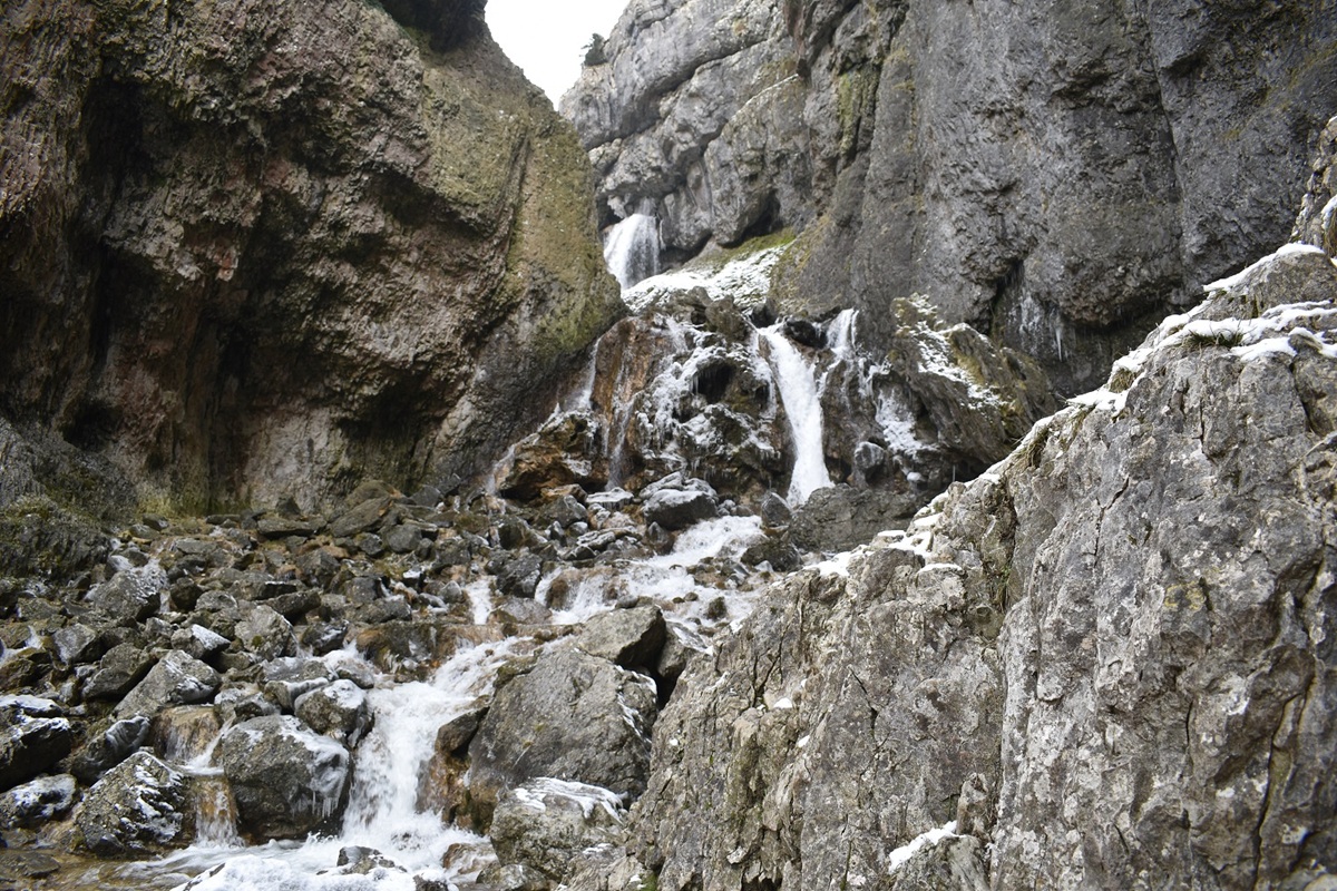
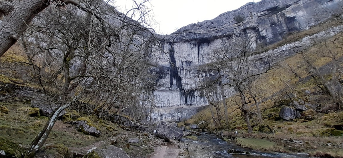
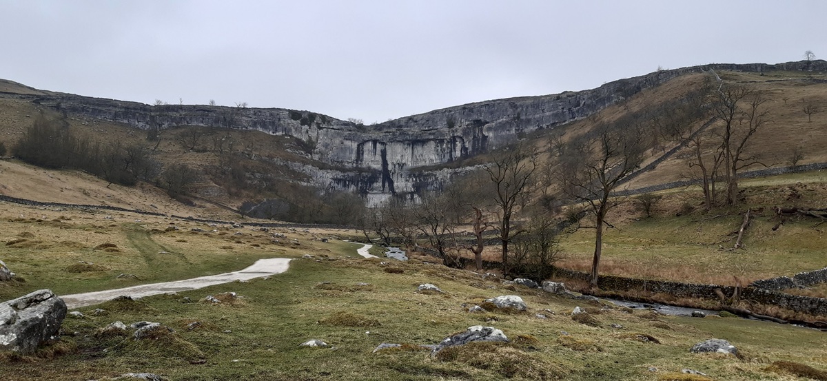
Now any first trip to the Yorkshire Dales wouldn’t be complete without a trip to see Malham Cove. I remember this walk from a TV programme called Britain’s Best walks, and I think it was at number two. Ade Edmondson (The Young Ones and Bottom fame) walked this route on the show, and I particularly recall him entering Gordale Scar. Now I’m pretty sure he was walking it in the summer months and the water coming down Gordale Scar was a little less than I saw, however it looked a good route. I was a bit apprehensive of the climb up the Scar waterfall and that only intensified when we drove in. To say there had been a bit of snow would be about right and it was cold, very cold. Still we set off from Malham towards Janet’s Foss and had a hope that maybe we could at least have a look. As it was we changed our minds and walked the road around to Lee Gate and up to the Malham Roman Camp and on to Malham Tarn. The tarn wasn’t the easiest piece of water to take a photo of, so we headed back down towards Dry Valley to see where all the water went when it comes out of the tarn. The truth is, it disappears underground into limestone and out at Malham Cove. This part of the walk was superb, Dry Valley pops you out high on a cliff edge before depositing you at the top of Malham Cove on the limestone pavement. We had a good look around having walked past the signs for the Samaritans, before following the muddy path down to the bottom to see where the water exits from the sink holes. All that was left was an easy walk out to Malham and a fine pint in the pub.
Start – Malham
Route – Janet Foss – Gordale Scar – Lee Gate – Malham Roman Camp – Street Gate – Malham Tarn – Water Sinks – Dry Valley – Malham Lings – Malham Cove – Malham
Distance – 9 miles Start time – 11.20am Time taken – 5hrs 10mins Highest Point – Roman Camp 400 metres
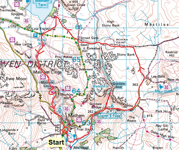
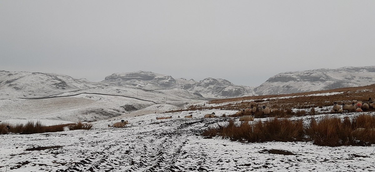
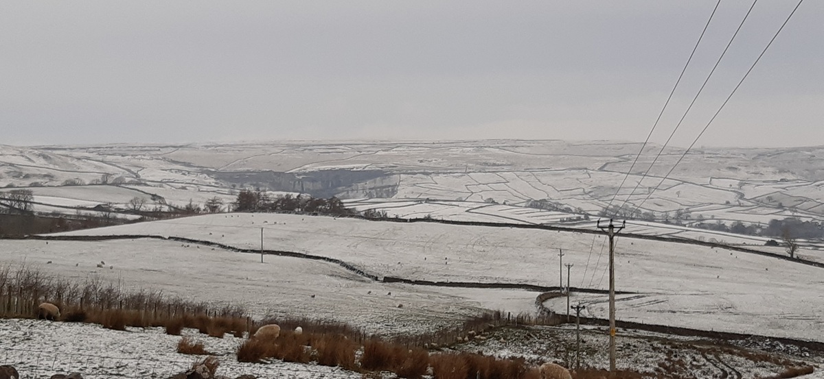
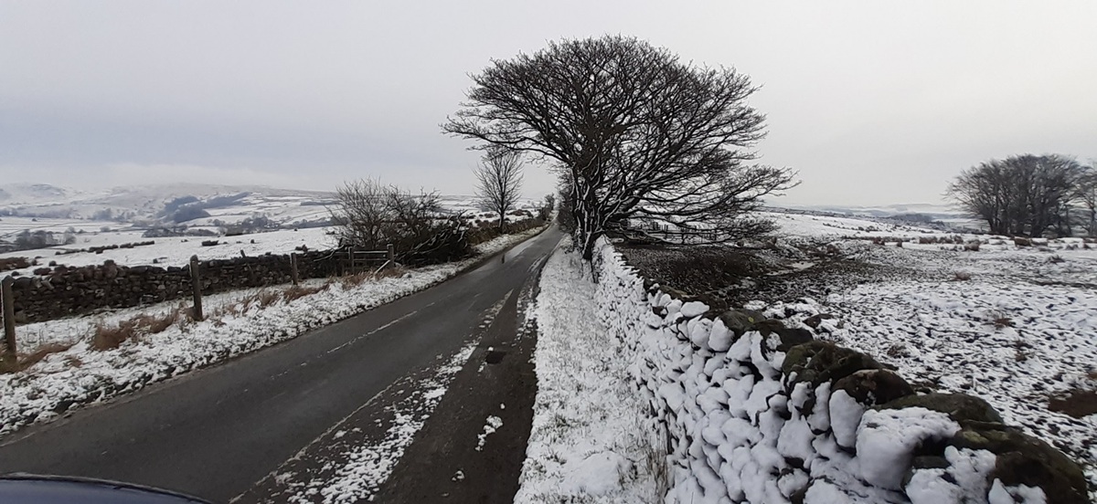
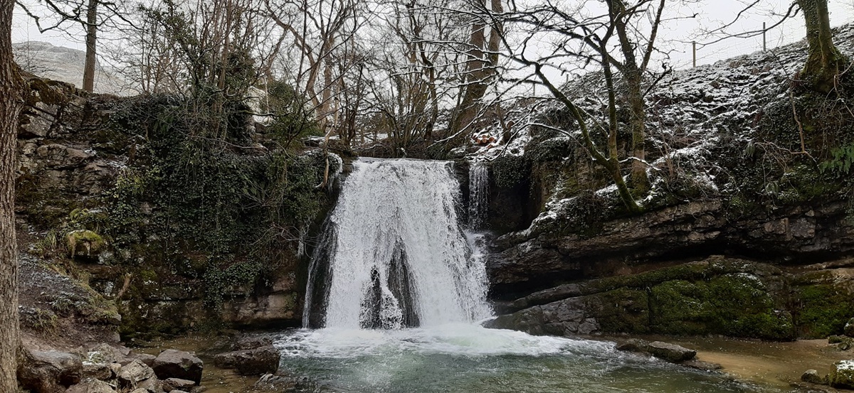
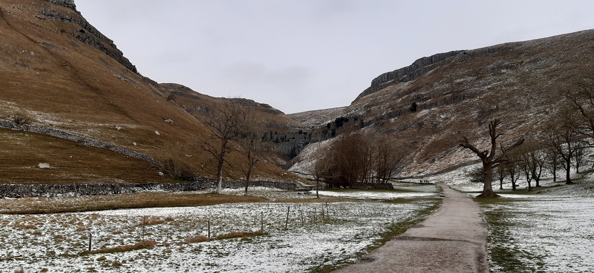
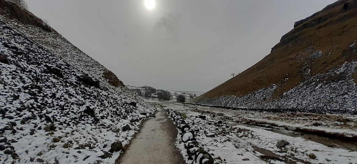
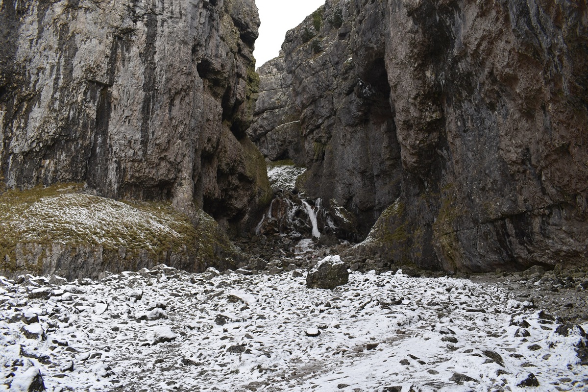
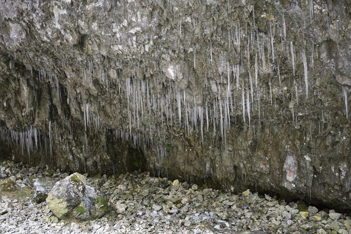
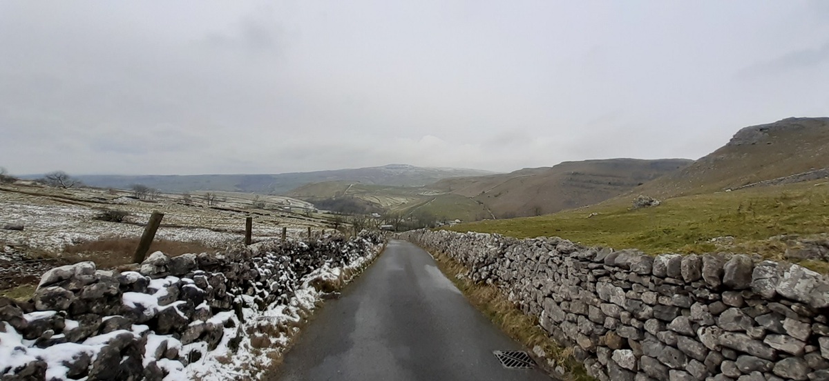
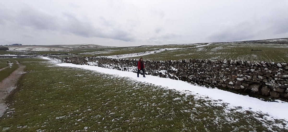
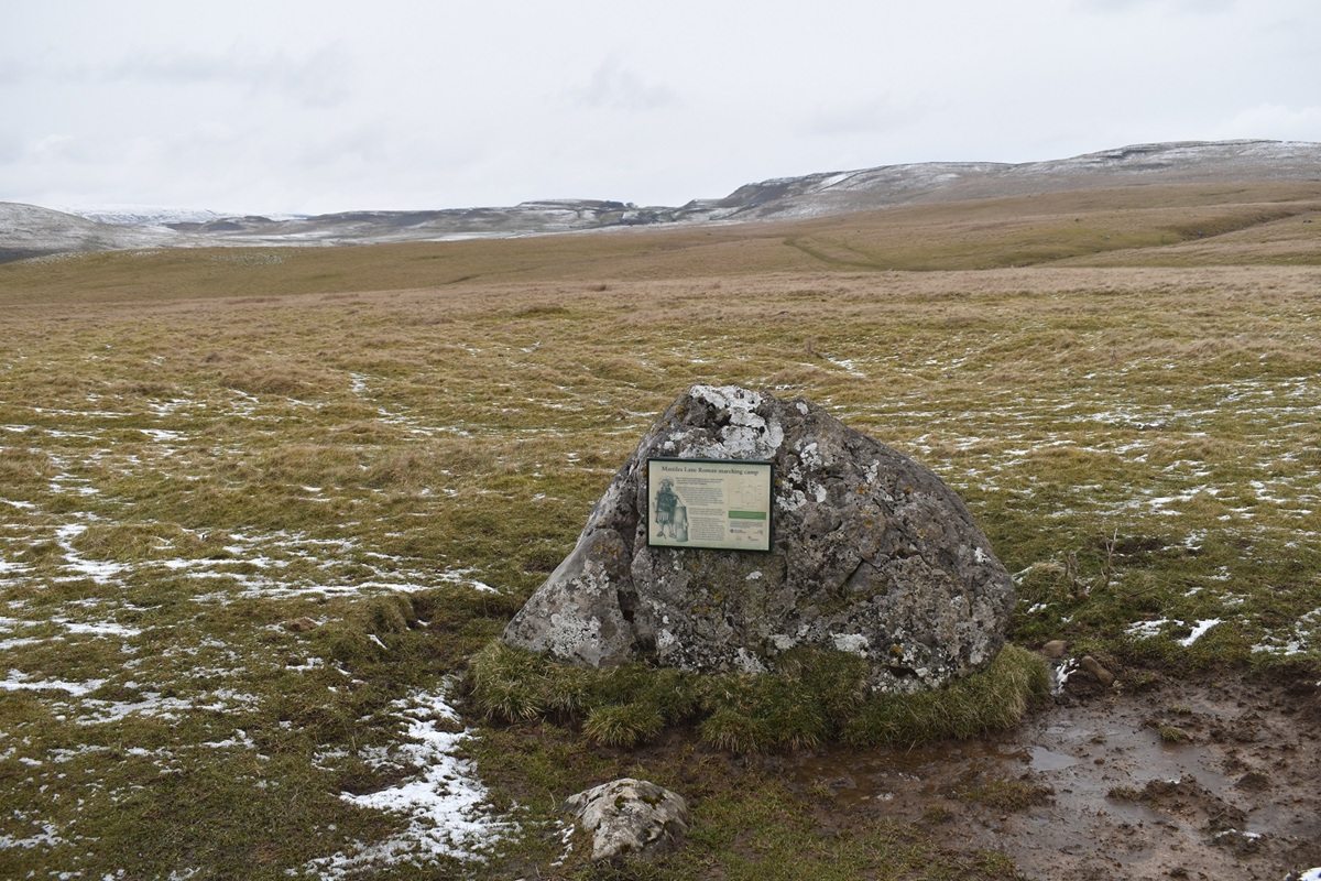
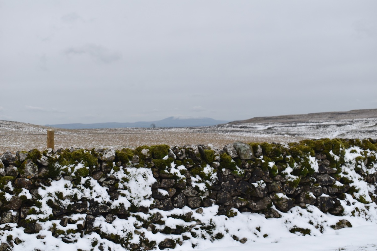
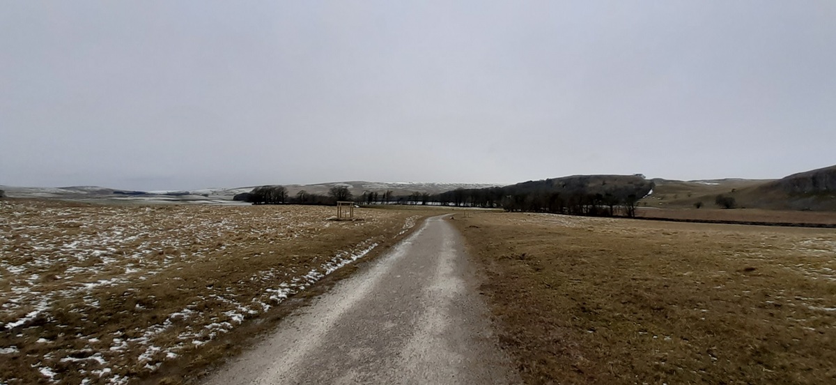
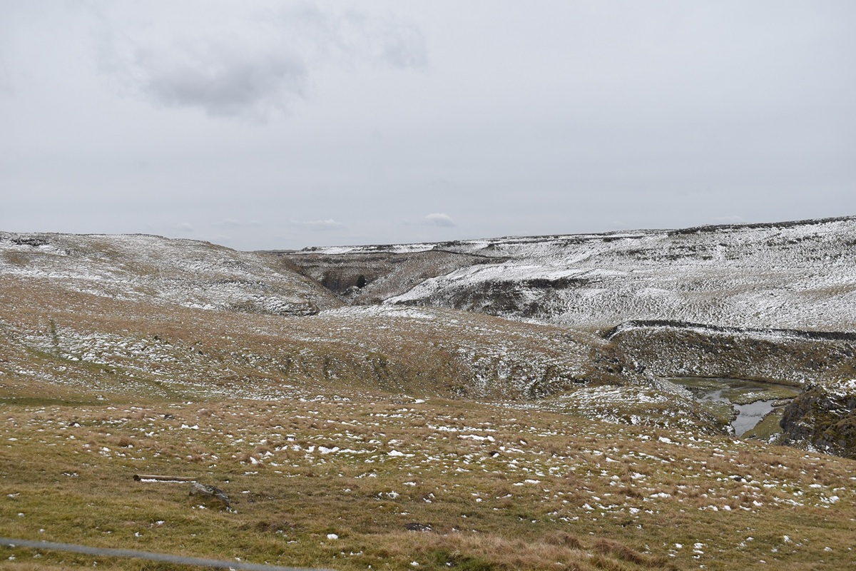
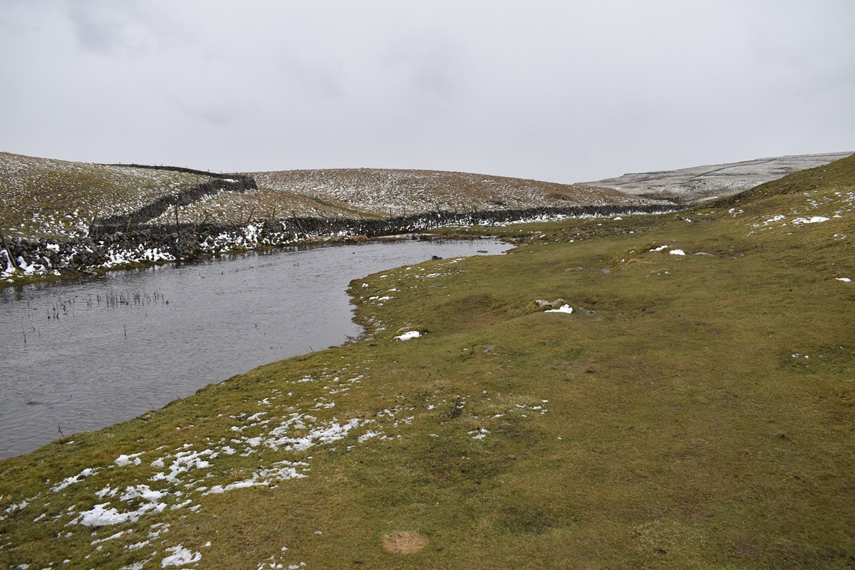
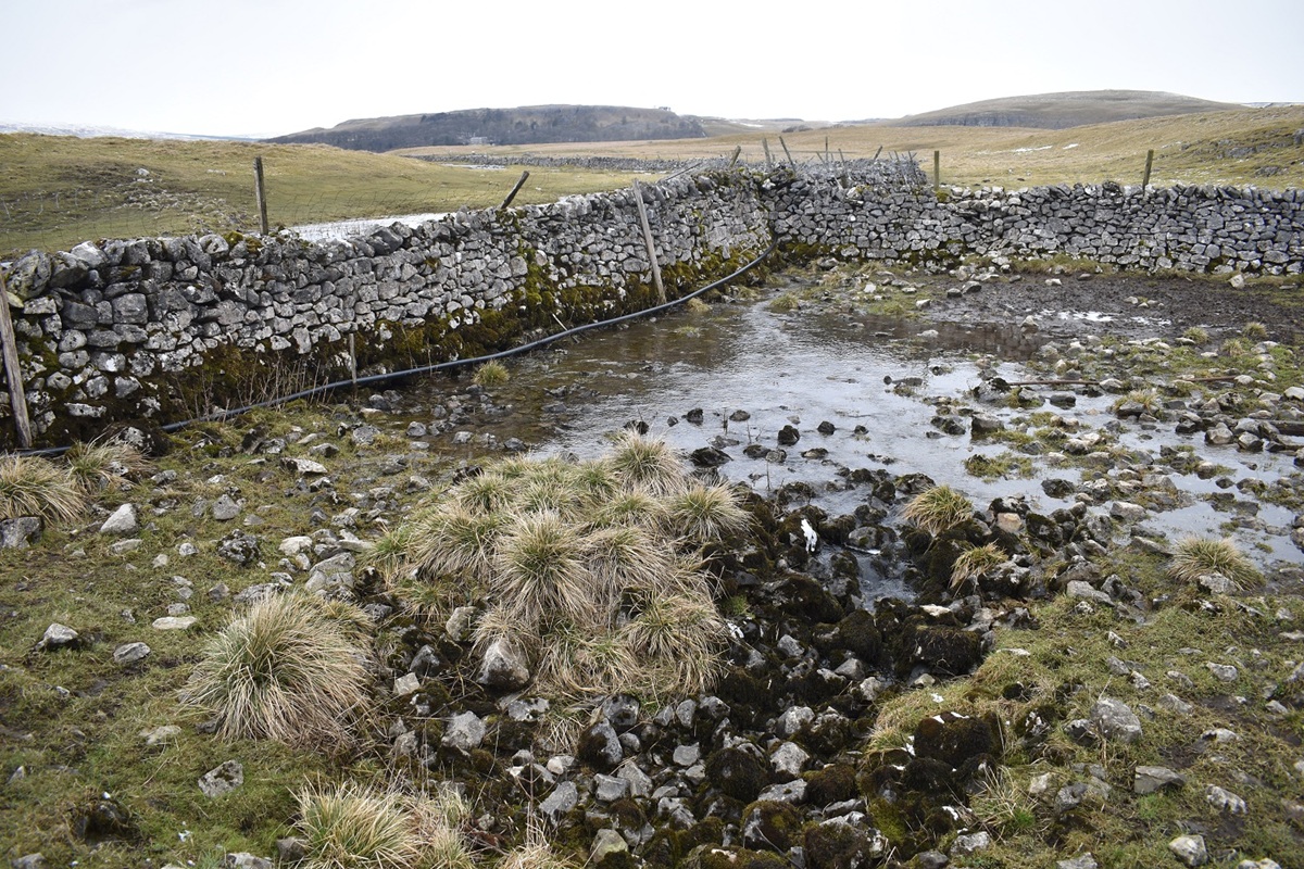
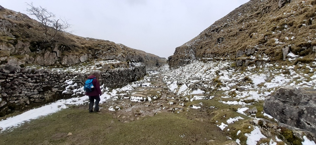
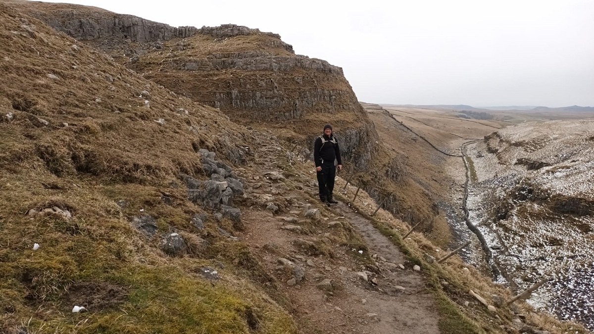
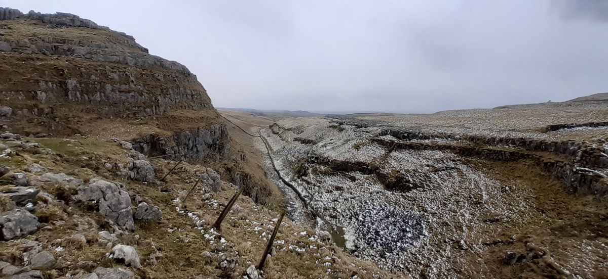
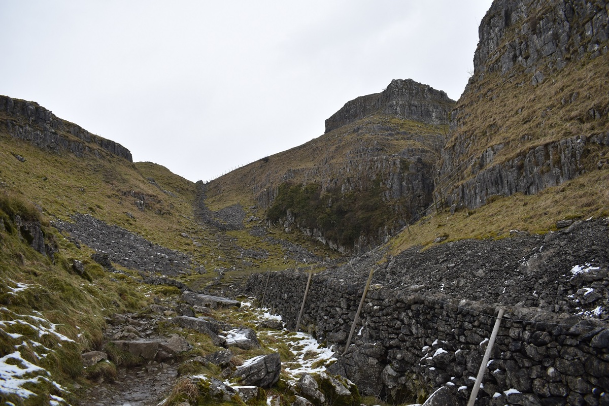
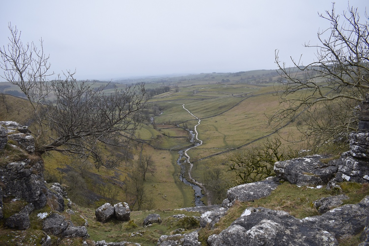
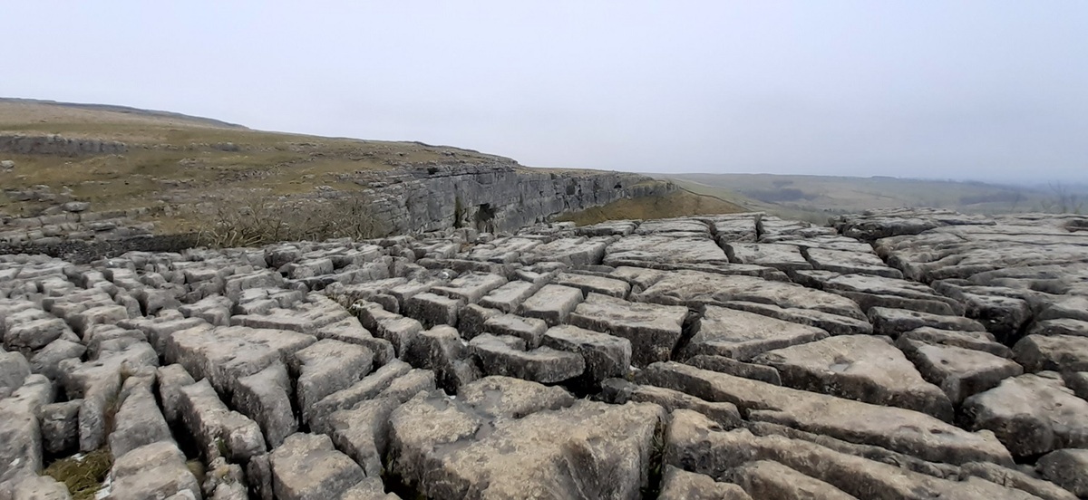
This photo is from our drive across to Malham, we were due to stay in Gargrave for two nights and had left the Blackpool area that morning, the road I’m on would look completely different the next day when we walked towards those hills, Attiremire Scar is among many over there. The only problem was we didn’t realise I’d taken a photo of this already and when we walked here the following day and we didn’t recognise the road at all. That walk is to come, for now it looks completely bleakThat’s our first look at Malham CoveAnd the road itself, it was in a decent condition considering it was very quiet up here. The temperatures were rising today so this was pretty much the last we would see of the proper snow, everything was white up here, walls, trees, all except the road, thankfully.Into Malham now and on with the walkStarting out across fields to join the Janet’s Foss pathA babbling Gordale Beck threads its way through the whitenessInto the woodland which holds Janet’s FossJanet’s Foss, naturally that is Gordale Beck coming over the top of itPopping out the top of Janet’s Foss, crossing the road and passing the refreshment van we started out towards Gordale ScarLooking back out as we entered a very cold valleyAs we started to round the corner the path became an ice rink and we skated to the rockier section to gain some grip, all thoughts of ascending this way disappeared. Far too icy and too much water coming over the waterfall. But what a sight this is, Gordale ScarThe ice was starting to melt despite it being very cold in here, I saw one of these drop so stepped back away from the cliff face.I managed to get to here but no further, the rocks were far too slippy, and the Wainwright route up the waterfall which zigzags up the middle (left of the main waterfall) looked way too icy. Not for us this time. We retraced our steps to the road and headed uphill.Heading up the road now, snow continues to melt. The entrance to Gordale Scar is on the right down there. Kirkby Fell is back middleLeaving Lee Gate and heading for the Malham Roman Camp, Linda wants more of the snow so insists on walking alongside the wall where there is plenty!Malham Roman Camp, used as a temporary marching camp to prevent a rebellion from the Brigantean Warriors in the area. The camp would have had a low ish banked up wall with a ditch around.After a bit of working out which way we were looking we think this is Pendle Hill in the distance, looking across the top of the area holding Dry ValleyApproaching Malham Tarn, with the trees around it, it wasn’t the easiest to get a decent picture of it. I reckon climbing one of the nearby hills would maybe give a better view, Great Close Scar is probably the best optionThis the top end of Gordale Scar, we should have walked up and out of that and across the limestone pavement to the rightAfter leaving Malham Tarn we walked towards an intriguing area marked on the maps as Water Sinks. The water is the outflow from Malham Tarn and seems to head over there under that wallAnd just like that its gone, there is one sink hole over there under the wall and this one here. You can hear the water falling inside what must be a caveWith no water heading this way this is now called Dry Valley. The valley is narrow, slippy when wet with the limestone rocks and caves in the walls of rock on the left as you go down.And then you pop out on to this amazing ledge in an area called Malham Lings, areas of limestone pavement all around and Watlowes Dry Valley running away towards the top of Malham Cove. A rare shot with myself in it.Amazing view without yours truly spoiling itStunning limestone scenery as we walk out of the dry valleyWe’d passed a few signs for the Samaritans so we knew it was coming, the view off the top of Malham Cove, the ground was very slippery all around here, thick mud, greasy rock so this was as near as I got safely.Limestone pavement above Malham CoveWe’d dropped down a muddy slippery path to the bottom. The water sinks had brought the beck here to pop out at the bottom of the cliff face. Above us a curved wall of limestone, Malham Cove.One last look back at Malham Cove as the drizzle started to fall a bit
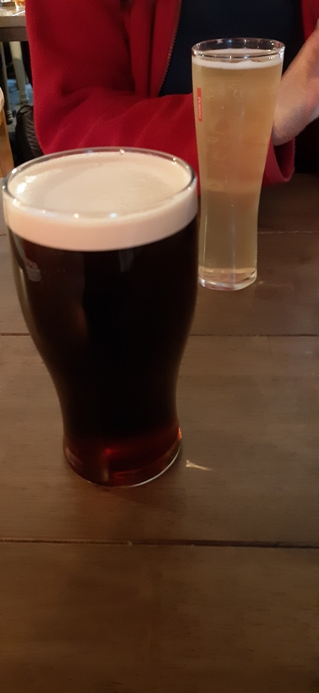
Well deserved pint of Old Peculier for me
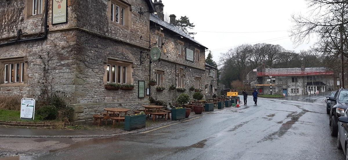
The Buck Inn at Malham, lovely pub. But we were staying 6 miles south in Gargrave, so a short drive had us all settled in our room after a warm shower. A must walk for anyone staying in the area, do your research on Gordale Scar if you fancy having a go at the climb, for me if Wainwright can do it then most can.
Janet’s Foss was really nice, I was looking for a walk with a waterfall and this one fitted in nicely. Might look to do Ingleton Falls on another visit up there
I am surprised that I haven’t been before, some lovely walking areas, I’ll definitely be back might even look at Gordale Scar again to see if I can get up
I’ve never been to Malham. It was a regular field trip for Olevel Geography from my secondary school, but I dropped the subject. The nearest I’ve been was last year on a long loop from Settle when we had a break there in March.
Your post confirms I needto add it to my list!
Its a honey pot area for sure so a dry day midweek would be a recommendation, unless you fancy a very cold day like us, even then the parking was along the road
Ticking off all the classics. Some great memories of this walk and happy times in Malham village including an epic footy match on the village green after a few too many lunchtime beers! Different times!
Making up for lost time of these walks, not coming here for so long had meant I was ready to see what all the fuss was about. It’ll be the same if I ever get to the peak district


We did this walk but during spring months. It is nice to see it with the snow.
LikeLiked by 1 person
Such a lovely area to walk in
LikeLiked by 1 person
I feel really cold looking at your photos.Brrrrrrrrr. Janet’s Foss looks lovely though.
LikeLiked by 1 person
Janet’s Foss was really nice, I was looking for a walk with a waterfall and this one fitted in nicely. Might look to do Ingleton Falls on another visit up there
LikeLiked by 1 person
A good walk that. Visited this area loads of times as a kid / teenager and have done since as well. Never done the scramble in Gordale though.
LikeLiked by 1 person
I am surprised that I haven’t been before, some lovely walking areas, I’ll definitely be back might even look at Gordale Scar again to see if I can get up
LikeLike
I’ve never been to Malham. It was a regular field trip for Olevel Geography from my secondary school, but I dropped the subject. The nearest I’ve been was last year on a long loop from Settle when we had a break there in March.
Your post confirms I needto add it to my list!
LikeLiked by 1 person
Its a honey pot area for sure so a dry day midweek would be a recommendation, unless you fancy a very cold day like us, even then the parking was along the road
LikeLiked by 1 person
Ticking off all the classics. Some great memories of this walk and happy times in Malham village including an epic footy match on the village green after a few too many lunchtime beers! Different times!
LikeLiked by 1 person
Making up for lost time of these walks, not coming here for so long had meant I was ready to see what all the fuss was about. It’ll be the same if I ever get to the peak district
LikeLiked by 1 person