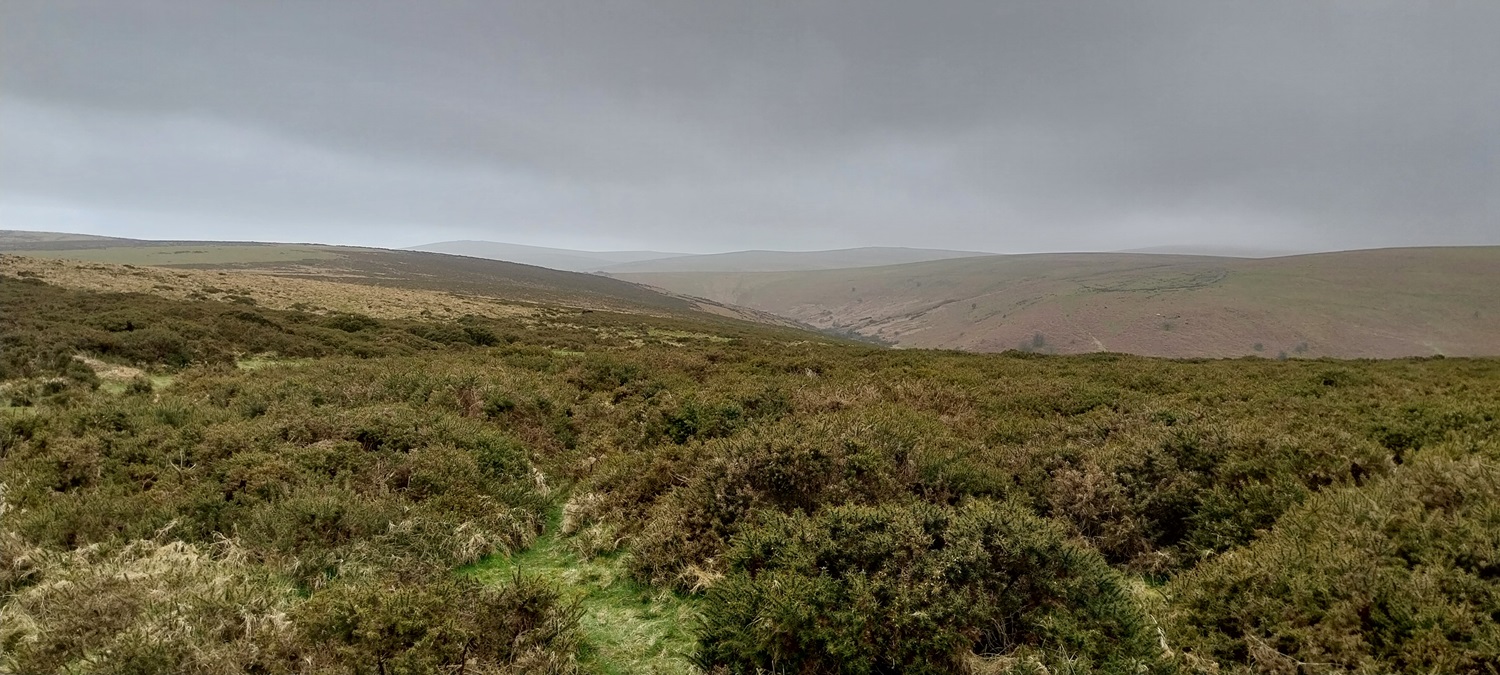
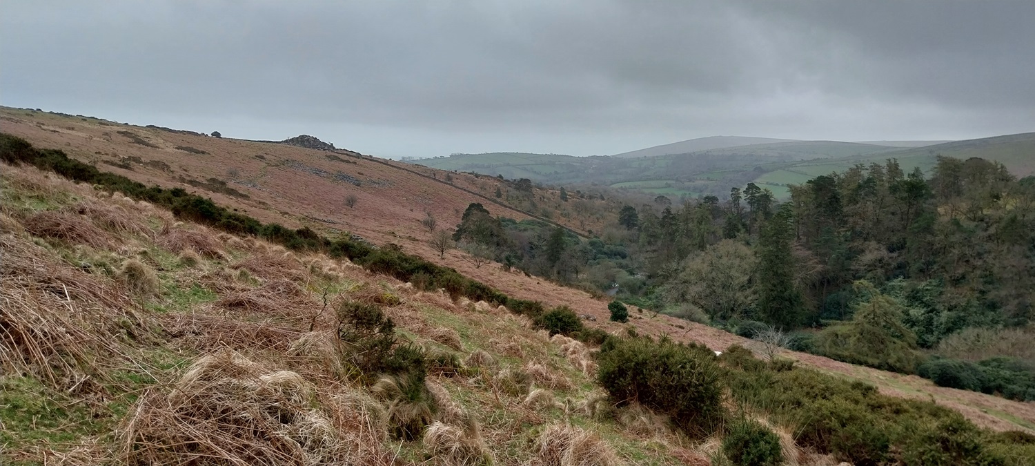
A walk of a much shorter distance than normal for us, but this was due to the strong winds still in evidence from a storm, whose name escapes me now. I also wanted us to stay pretty low, so we decided on an area which I had last visited in 2021 (when ridiculous comments about short drive had to be made!!). We made a nice out and back route towards Avon Dam which would fit the bill nicely and would be walk number 51 of my second round of Dartmoor 365 squares, with S13, T14 and U14 on this walk. We turned up at Shipley Bridge with the winds howling above us, assuming that the place would be busyish as it normally is, only to find the VW campervan convention in full swing and zero parking to be found. We had a think and drove over Shipley Bridge to the eastern side and beyond the ford and cattle grid. Just on the side of the road was a challenging bit of verge bank parking, not blocking any gates, so I went for it, luckily I have a diddy car and got it up the bank and in. Off we went along the tarmac path towards Avon Dam, before hanging left and walking uphill to get level with Black Tor, and then heading across the grass to this tor. From here we could see most of the rest of the walk laid out in front of us. We dropped steeply back to the tarmac path and joined the family groups heading to Avon Dam. Once there we headed up to Grippers Hill looking for shelter to have a sandwich, unfortunately this was only partly successful and most of my crisps are probably still spread widely across that part of the moor. We turned here back into the teeth of the wind, reaching Shipley Tor, after what seems to be a much longer distance than it looks on the map. With the rivers running high we couldn’t cross the Avon at the cascades just down from Shipley Tor, so we returned to the bridge at Woolholes (below Black Tor) and the tarmac path back to Shipley Bridge. All in all a good walk considering the weather, and the right one for the day. Now though we need to start stretching out the distances over the next few weeks, as we have the Lake District in mid May!
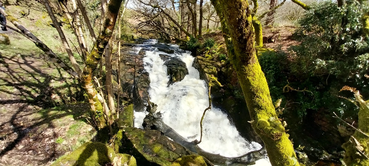
We had parked to my left here, there is also a farmers gate left here through the wall, I was back from that up a bank. It just about worked for us. Linda is off already heading to Shipley BridgeShipley Bridge and the full car park beyond, you can’t see the 20 or so VW campers all parked up swamping most of the spots available.Plenty of water in the River Avon after 5 months of solid rain, only during April have we now had back to back dry days for the first time since October 7thAfter the last photo we turned left at the Hunters Stone and uphill. This lane leads to the Avon Water Treatment Works, looking back we see Shipley Tor across the valley, we will be there later.Pastoral land around South Brent. We had turned hard right to head for Black Tor at this point, leaving the tarmac lane.Black Tor (Shipley Bridge)And from Black Tor, the valley holding the River Avon, Grippers Hill back middle with Avon Dam around the corner behind that hill (Zeal Plains) on the leftAll smiles for Linda at Black TorThe bridge at Woolholes, we’d dropped down the hill behind from Black TorAvon Dam, plenty of water coming over the topClimbing away from the Dam, towards Grippers Hill, we stopped around here and tried to get hunkered in behind gorse, failing miserably we encountered our crisps flying to our right here. The keen eyed will also notice the water spraying back up at the top of the dam.Climbing to the top of Grippers Hill, Avon Reservoir below and the centre of the south moor beyond. This area includes Redlake, Huntingdon Warren and Ryders Hill back rightHeading for Shipley Tor over on the left (not in sight yet). The River Avon in the valley on the right which was our outbound route.Boundary marker as we headed across towards Dockwell Ridge. The Avon Dam can be seen in the distanceShipley Tor just below us, Ugborough Beacon in the distance. The road down on the right was our route up towards Black TorBy Shipley Tor looking to Black Tor on the hill to the left. We would head down there into those trees nextShipley Tor, back middle just in cloud is Three BarrowsShipley Tor up to the left as we drop down to the bridge at Woolholes.Brentmoor House, its been a farmstead, a mansion, hunting lodge, a WW2 shelter for deaf children, a youth hostel and then the water company decided to close it down and allowed the Marines to use it as target practice.This is normally an area of cascades on the River Avon, in the summer it is possible to walk (with a bit of a jump) across the river. You can see a slight gap in the bushes above the white water, that’s the path down from Shipley TorAnd to finish we have the Hunters Stone, a small inscribed rock of the Masters of the Dartmoor Foxhounds, it was placed here in the late 1800s, and William Crossing reports 4 names on the rock, Treby, Carew, Trelawny and Bulteel. All that was left from here was the short walk past an emptying car park and the coffee van at the end of a nice little bimble.
I recall being about ten years old and sitting on Black Tor looking northwards into the heart of the Moor, on a still summer’s day, without anyone else in sight, and thinking how I must explore those hills.
Wet feet is never fun, I’ve only done it a couple of times, when near the end of a walk and have ploughed through a stream to get back quicker. And a fair few times when I’ve gone deep in boggy ground and had to cut short a walk
Just wanted to add a little warning to anyone attempting Shipley Tor – do not go when the bracken is up! Did a very long challenging 21 mile trek from Shipley Bridge up to Duck’s Pool Fox Tor, Cator’s Beam and then round via the Avon Reservoir. After 19 miles, the chest high bracken for a nearly a mile either side of Shipley Tor was horrendous – terrain looked nothing like your pics!
That’s fair Robin, I can imagine the longer grass coming over Cater’s Beam/Nakers Hill/Green Hill wasn’t much fun either. At least it was drier than normal though on the positive side


Stunning photos. Great blog. Thank you for sharing
LikeLiked by 1 person
Thank you Joe, keep the walkies coming at your end as well 😁
LikeLiked by 1 person
I recall being about ten years old and sitting on Black Tor looking northwards into the heart of the Moor, on a still summer’s day, without anyone else in sight, and thinking how I must explore those hills.
LikeLiked by 1 person
I can imagine its a lot busier now John
LikeLiked by 1 person
I suspect so.
LikeLike
Do people still do Dartmoor letterboxing?
LikeLiked by 1 person
Absolutely, the two famous ones at Cranmere Pool and Ducks Pool are very much in play still.
LikeLike
Some moody skies in those photos.
LikeLiked by 1 person
Yes the clouds looked very threatening throughout, luckily it was just the strong wind we had to contend with
LikeLike
I appreciated the breath of fresh air and not getting my feet wet!
LikeLiked by 1 person
Wet feet is never fun, I’ve only done it a couple of times, when near the end of a walk and have ploughed through a stream to get back quicker. And a fair few times when I’ve gone deep in boggy ground and had to cut short a walk
LikeLiked by 1 person
As you say, nice little bimble – looks windy though. Never a good thing losing crisps!
LikeLiked by 1 person
They were Mccoys as well, fancy crisps!!
LikeLike
And substantial as well – some wind to blow them away! 🤣
LikeLike
Just wanted to add a little warning to anyone attempting Shipley Tor – do not go when the bracken is up! Did a very long challenging 21 mile trek from Shipley Bridge up to Duck’s Pool Fox Tor, Cator’s Beam and then round via the Avon Reservoir. After 19 miles, the chest high bracken for a nearly a mile either side of Shipley Tor was horrendous – terrain looked nothing like your pics!
LikeLiked by 1 person
That’s fair Robin, I can imagine the longer grass coming over Cater’s Beam/Nakers Hill/Green Hill wasn’t much fun either. At least it was drier than normal though on the positive side
LikeLike