This walk is a classic Lakeland walk, and now I’ve done it I can see why. This specific walk though isn’t the full Coledale Round, that one can include another 3 or 4 fells if you want it to. However I’ve already done Outerside, Barrow, Grasmoor and Wandope, with Hopegill Head pencilled in for a walk alongside Whiteside and the classic ridge between the two. This then is a mini Coledale Round, with only 5 fells on it, its still fairly challenging and the views are pretty much the same. I started out from Braithwaite heading for Causey Pike, once on the top, the views to the east open up and the walk takes on a new aspect. The walk along the ridge between Causey Pike and Sail is a good one. Now I know there have been some strong arguments about the path up to Sail, and I’ve been one shouting about the scar on the landscape, however when standing on Scar Crags cast your eye to the right to the path down from Coledale Hause, there’s no raised voices about that path, which stands out as much as the Sail one. There’s no doubt for me that the zigzag Sail path is now starting to blend in a bit more and will only get better. The walk from Sail gets better as you get round, with the section over Hobcarton Crags a real highlight. For me doing the walk this way around is a good way and one I would repeat.
| Start – Braithwaite village |
| Route – High Coledale – Barrow Door – High Moss – Causey Pike – Scar Crags – Sail – Crag Hill – Coledale Hause – Hobcarton Crags – Grisedale Pike – Sleet How – Kinn – Braithwaite village |
| Distance – 9.5 miles Start time – 9.40am Time taken – 6 hrs 45mins Highest Point – Crag Hill 839metres |
| Weather – Grey skies then the cloud dropped a bit, before it cleared with blue skies to finish |
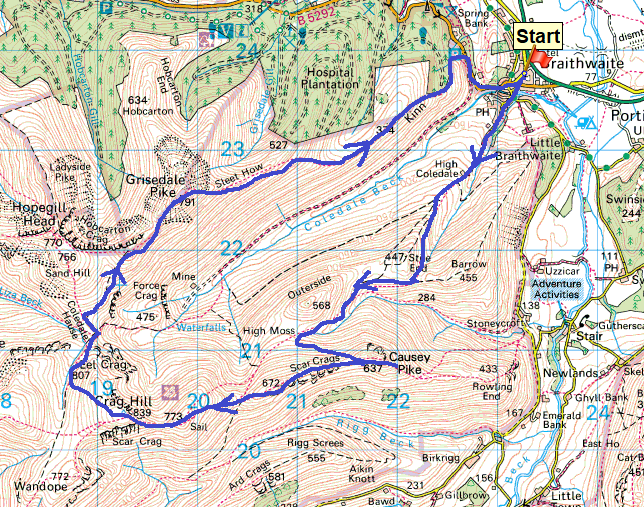
© Crown copyright 2017 Ordnance Survey FL 2017 SF
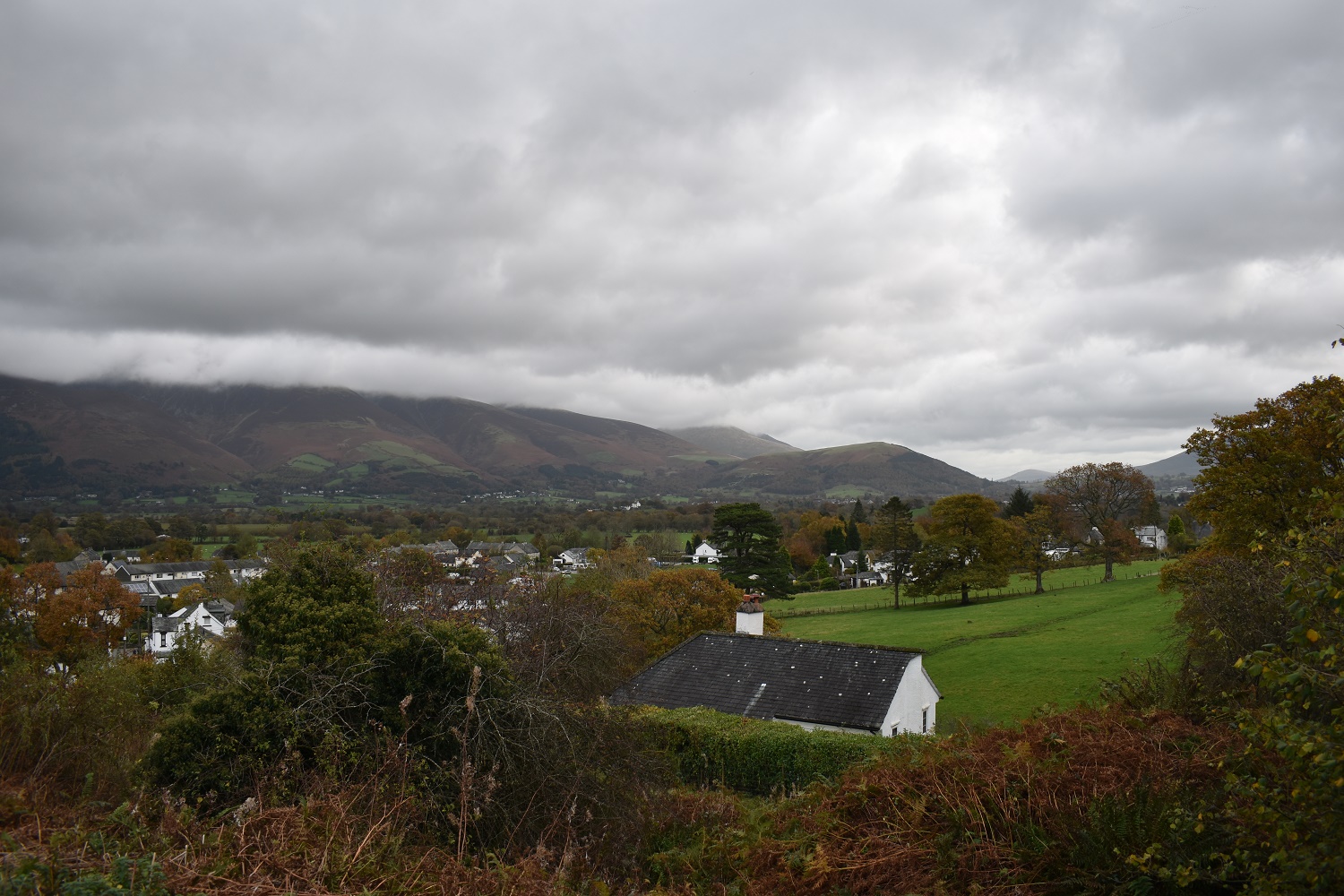
Starting out from Braithwaite with a low cloud band stretched across the Skiddaw fells, Latrigg though is clear

Skiddaw, or what you can see of it!!

Almost at Barrow Door at this point, with a glimpse of Bassenthwaite Lake and a slight clearing of the low cloud
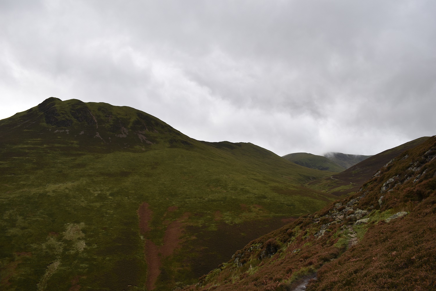
Causey Pike from Barrow Door, stretching out is the ridge I will walk with Crag Hill hanging on to a bit of cloud
Stonycroft Gill down to my right with Catbells in the middle distance. From this angle you get an idea of the tough climb to the summit on that fell
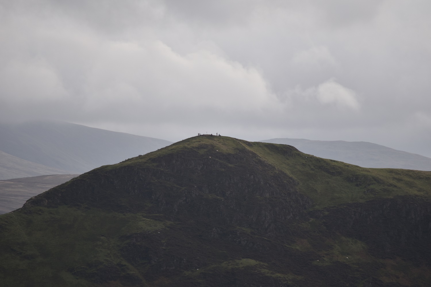
A bit of zoom picks out a few people on the summit of Catbells
Skiddaw still in cloud at the back with the slopes of Outerside on my left running down to Stile End (not a Wainwright) and Barrow

Outerside summit on the right of photo with Grisedale Pike, my last fell on this walk, across the valley
A wowser view from Causey Pike. This is probably the first time, on my round of Wainwrights, where I have thought that this fell would have been a good last one to do. The views here are brilliant

Looking to Lake Bassenthwaite, with the Kinn ridge all in light brown behind the Stile End and Barrow fells

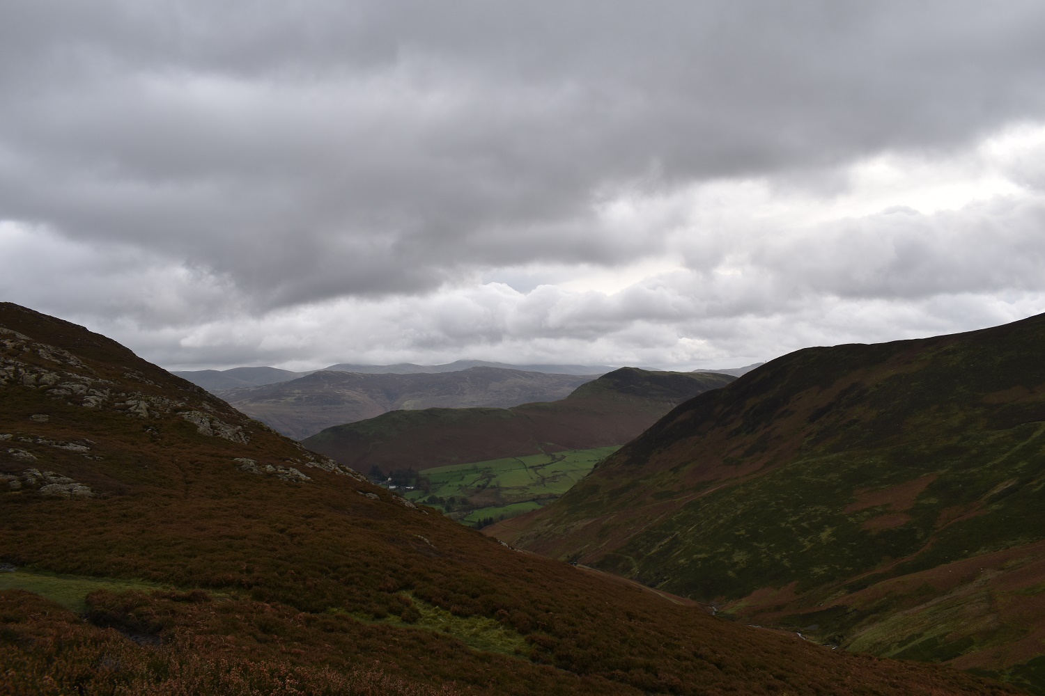
Looking down to the Newlands Valley with Maiden Moor, High Spy, Dale Head and Hindscarth forming the backdrop
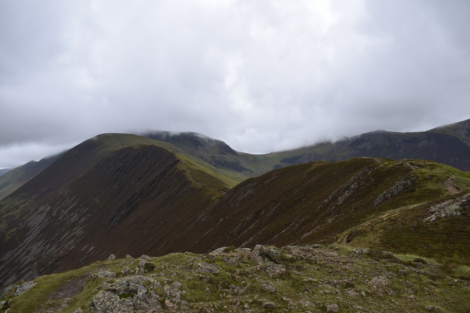
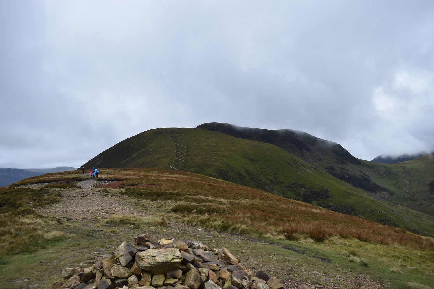
My ridge to come, Scar Crags and then Sail before hitting Crag Hill which is in cloud at this point. Coledale Hause is the dip to the right of Crag Hill

Looking back as I near Scar Crags to Causey Pike

On reaching Scar Crags you get a view to the Glaramara ridge and the pointy Pike O’Stickle
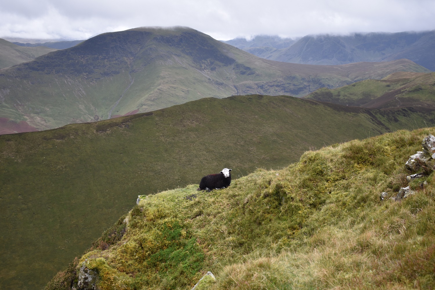
A daredevil herdy!!!
Scar Crags summit, with Sail and Crag Hill clear from the cloud

Scar Crags summit again, this time looking to Lake Bassenthwaite
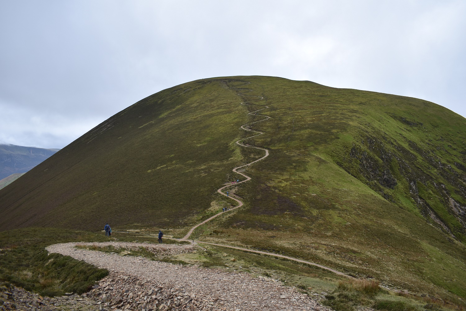
Its definitely blending in for me. It has taken a while to get to this point though (10 years maybe??). It is however a good route up, which when walking it you will not admit. I ended up walking from bend to bend and stopping, cursing all the way up!!
Looking back down the wiggles!! The cloud looks to be lifting with fells like Clough Head now visible in the distance
I spoke too soon, cloud drops on Crag Hill as I reach Sail summit
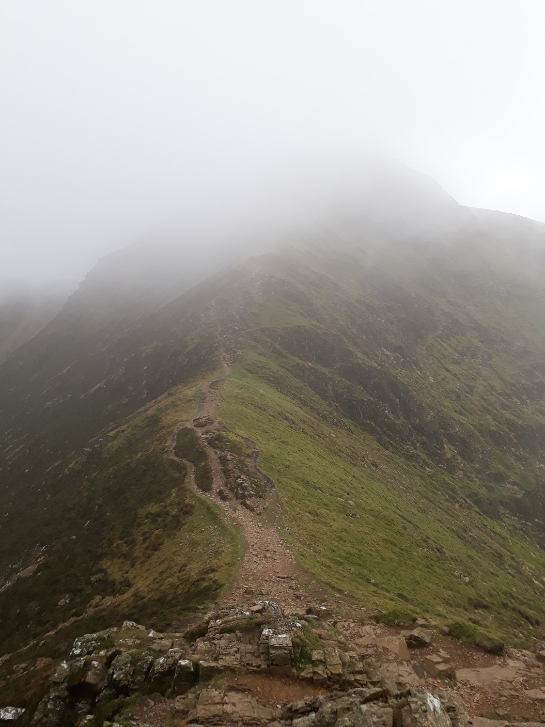
The route up Crag Hill, to be honest I was glad the clag had dropped to hide the ascent, less daunting that way!!

The cloud is playing with me now, Crag Hill clears and Addycombe Hole to the left is visible, with Wandope just hanging on to some cloud

Its down again as I head up to Crag Hill, however there are glimpses into Coledale, with Force Crag Mines bottom left

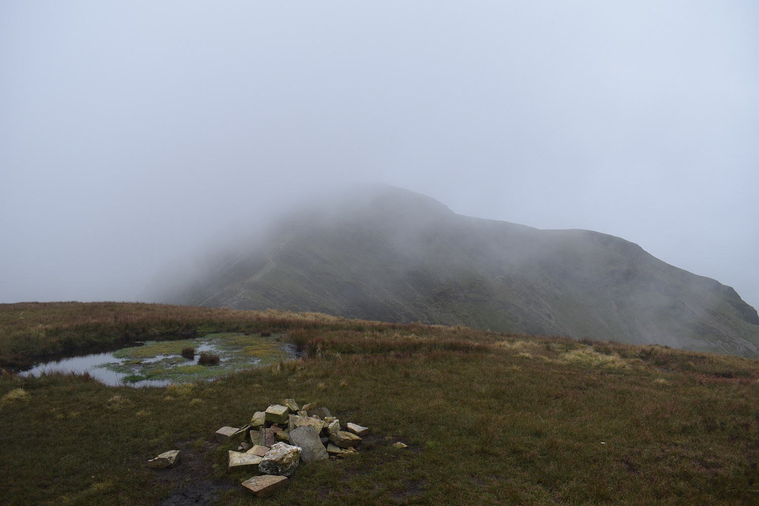
Crag Hill summit (or Eel Crags). Either way the cloud is down

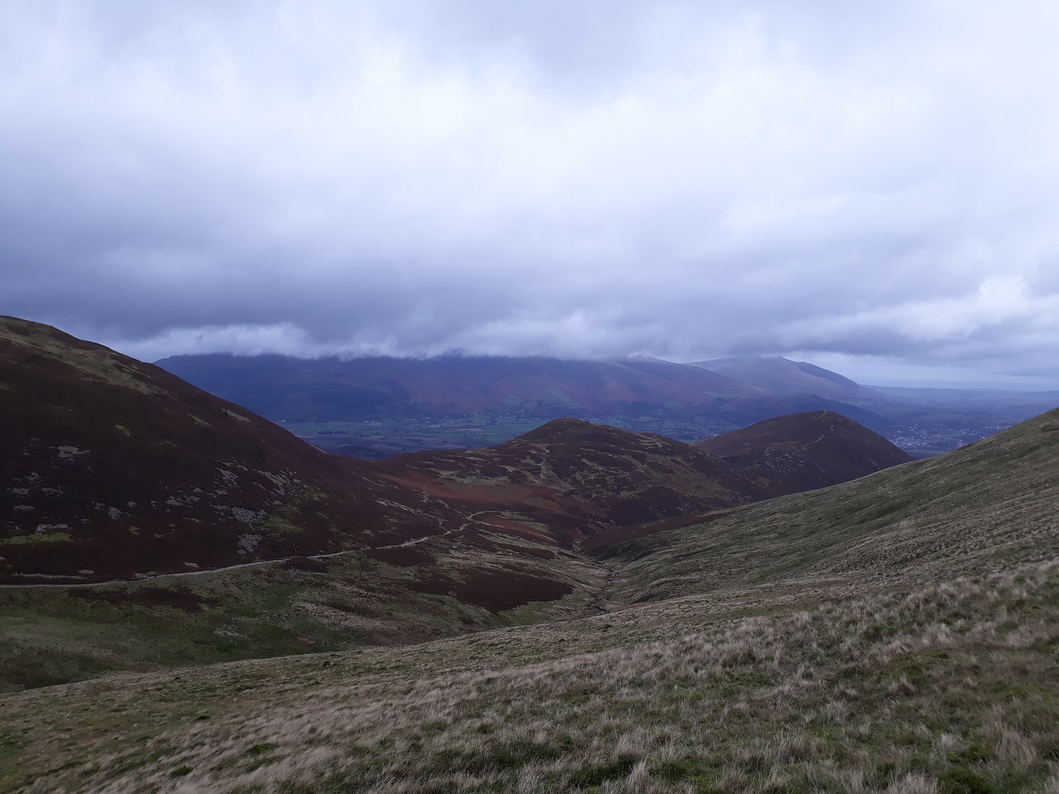
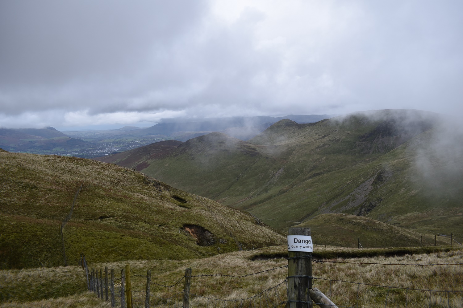
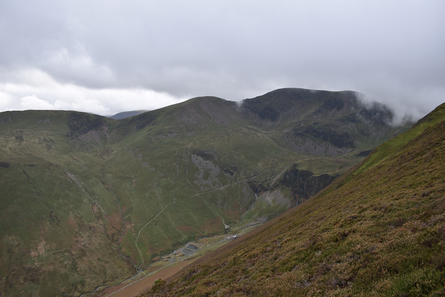
I walked for a frustrating 45 minutes in cloud, however as I heading up from Coledale Hause towards Horcarton Crags the cloud lifted a bit. Here I look back to Coledale Hause and the formidable Eel Crags
This is the part fenced off above Force Crag Mines, looking across to my outward section

Blue skies appear as I hit Hobcarton Crags, with my path to Grisedale Pike obvious ahead

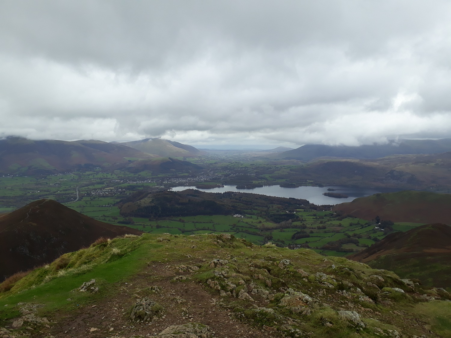
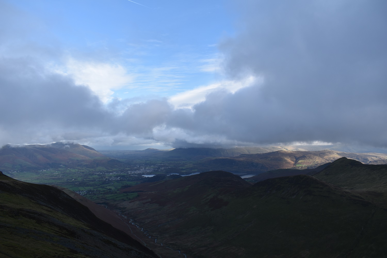
The sunshine is breaking through all around now, with Derwent Water and Keswick benefitting
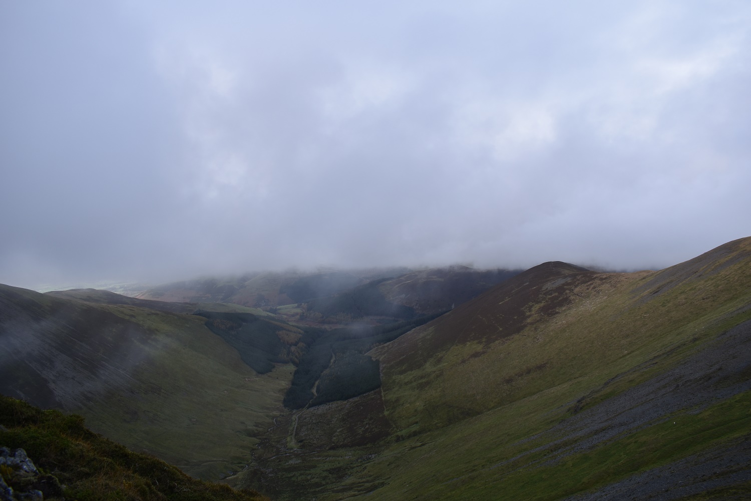
Swindale from Hobcarton Crags
Now we are talking. Some great views as I head up to Grisedale Pike. Causey Pike is far right of photo
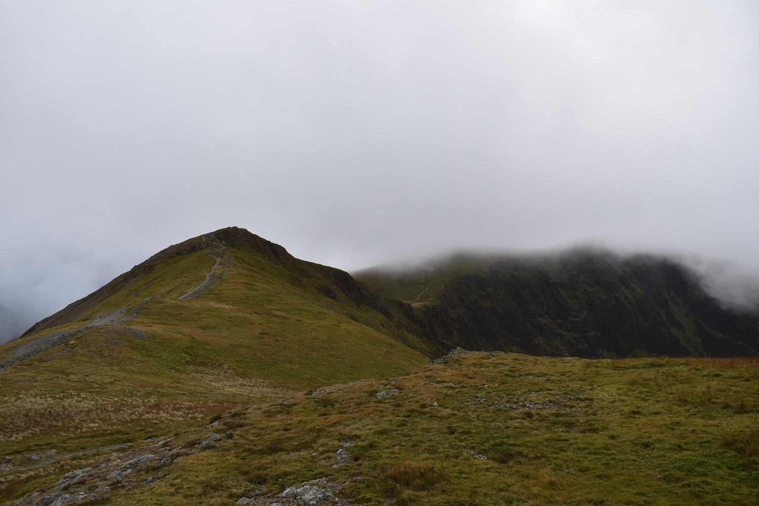
Looking back to Hobcarton Crags with Hopegill Head still in cloud to the right

I hit Grisedale Pike summit as the cloud swirls around. This is number 121 on my Wainwright round
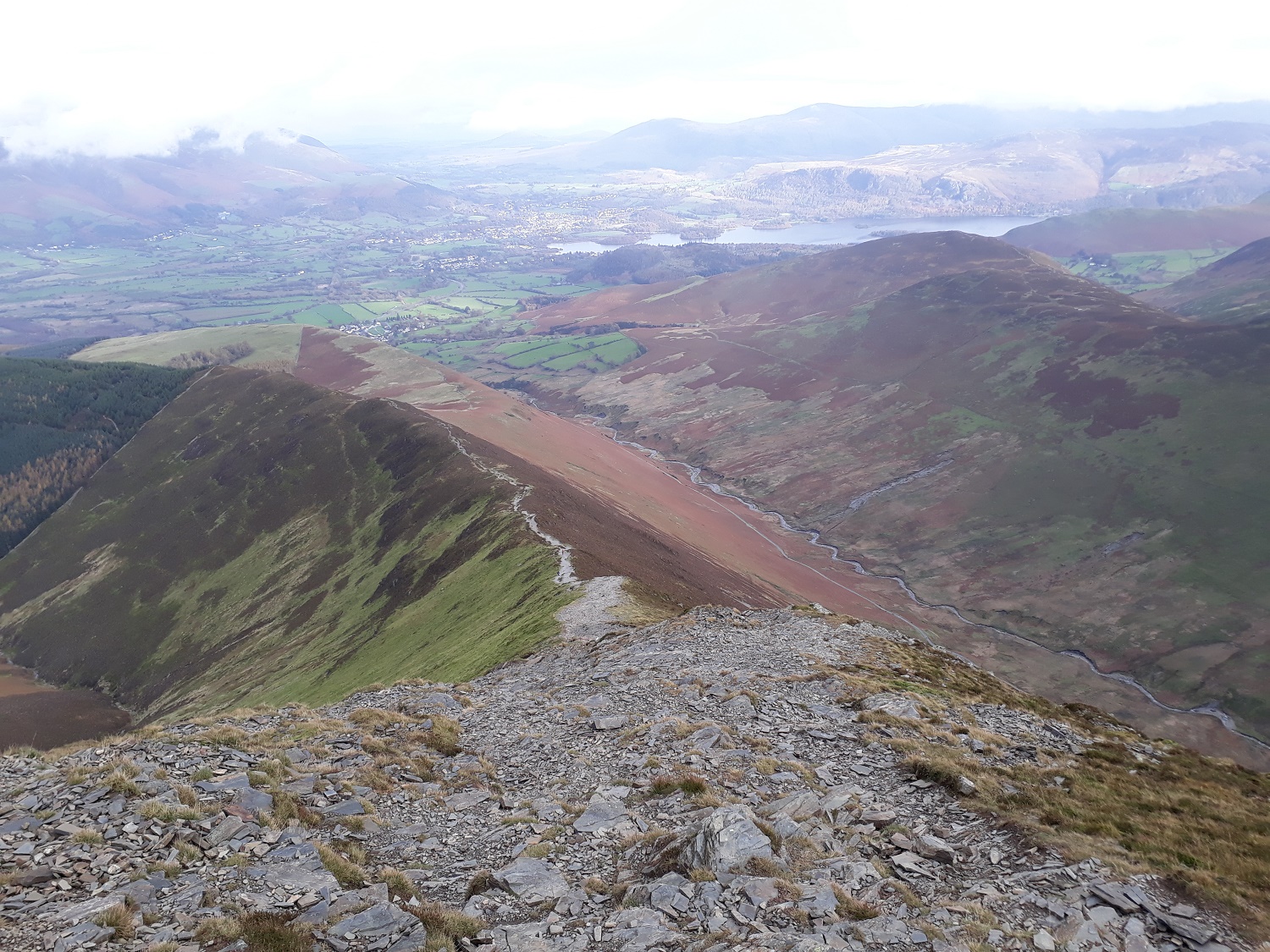
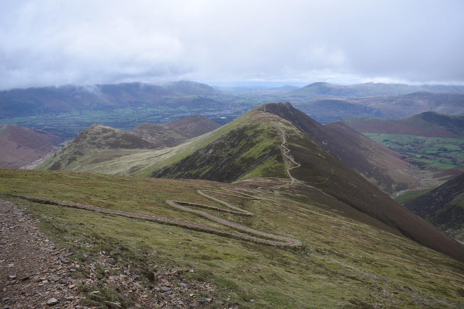
My word, now that’s a descent. Awesome view as I head down from Grisedale Pike. This for me is the reasons for doing the round in this direction
Fells on my outward section, Scar Crags left, then Sail and then up to Crag Hill

The ridge up to Grisedale Pike

Crag Hill clears again at the head of Coledale
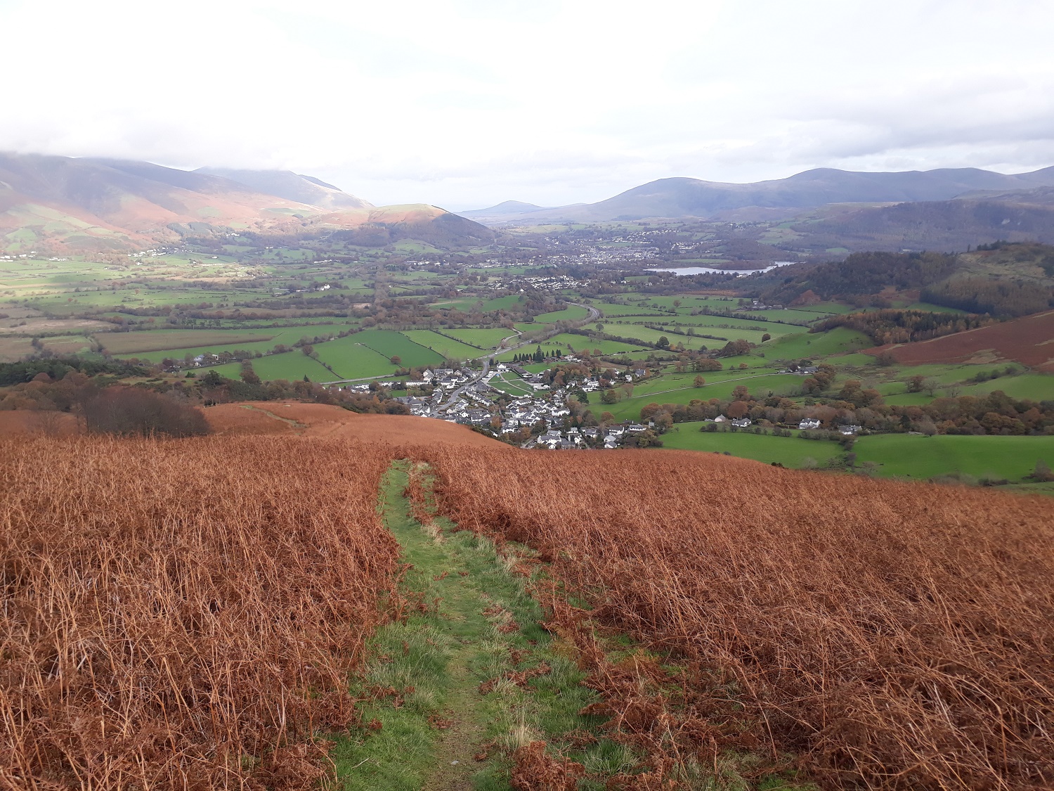
Braithwaite below and the fields stretching out to Keswick and beyond

As this was Thursday, its flying day. And these guys didn’t disappoint as they whipped up Thirlmere and banked over Keswick before I caught them over Bassenthwaite. On their second loop they ended up about 300 metres directly above me, which left me on my arse, giggling!!

Final shot over Braithwaite at the end of a great walk, Clough Head and the Dodds in the distance are now in the sunshine


Outstanding views on this walk a bit airy for my taste though 🙂 🙂 I could wish you a blue sky next time!!
LikeLiked by 1 person
There are some steep drops on either sides of some of the paths. Nothing too dangerous or scary though. Its a brilliant walk
LikeLiked by 1 person
Thanks a lot for your advice!! It can be incredibly hard to judge terrain if you are not familiar with the geology. Norway was unknown to me once, and I had not imagined that the stone blocks could be the size of two to three storey houses 🙂
LikeLiked by 1 person
Beautiful views, Looks like a great route. Always frustrating when the cloud sets in at the summit though!
LikeLiked by 1 person
The Crag Hill summit was teasing me all day, would it, won’t it be clear!! Unfortunately it closed in as I got near to the top, and then kept clearing with fleeting glimpses of the views
LikeLiked by 1 person
Nice post. How was the ascent up Crag Hill? I haven’t done that yet as I ran out of steam on Sail. I have it as an annoying outlier as I’ve done most of the rest (though not Wandope or Grasmoor)
LikeLike
If you come at Crag Hill from Wandope its an easy ascent, the back side of crag hill is mainly a grassy slope with a couple of paths to the top. The zigzag ascent up Sail was far harder than the one up Crag Hill, the Crag Hill one was rocky but the path threads you through any tricky bits
LikeLike
I love the NW fells, so much variety and so many summits! Grisedale Pike is a cracker but you’re right, it’s a real lung buster if you do it from Braithwaite.
LikeLiked by 1 person
I’ve just realised that I’ve only 2 left of the north western fells. White side and Hopegill Head. Stayed too many times in Braithwaite and Keswick it seems!!!
LikeLiked by 1 person