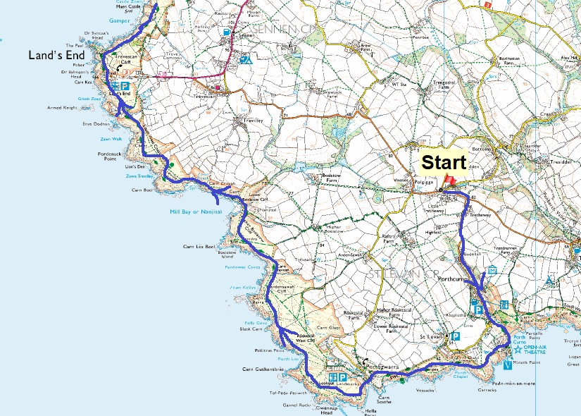
Back in the depths of winter we were holiday planning for 2023, we’d booked a week in the Lakes for early May, which we booked whilst we sat in the Lakes on our previous holiday in November. We then decided that we needed a week in March split between Lancashire (visiting family) and the Yorkshire Dales (walking). We then had a wedding to go to (still to come) plus my mum and dad’s golden wedding anniversary in August 2023, so we then booked a week in Snowdonia around those occasions. Looking at all that we had a gap in late June/early July and nothing related to the coastal path in the years’ outings. Now up to this point, a day outing to walk the South West Coastal Path has been possible, however I am at the stage where the drive is over an hour now, one way, and I need to consider other options to bag multiple day walks in one visit. So we looked at the map and immediately went for the Land’s End area, but how would we tackle it? There was Penzance, Newlyn, Mousehole, Porthcurno, Land’s End itself, Sennen Cove, Cape Cornwall and Botallack plus many more highlights around to St Ives depending on how many days you spend here. We went for 3 days walking and 2 nights, and then started looking for some accommodation for the 2 nights. We wanted to head out from Penzance, leaving the car there and working out that Porthcurno and St Just may be good spots to stay in, with a daily distance around 10-12 miles. St Just was easy to find something to stay in, at the time we wanted, but not Porthcurno, even when we reversed the route, changed the dates or altered our walk. We’d already worked out that a bus would be needed to get us to Penzance from the north coast and that seemed to mean Pendeen would be the cut off as any further around to the east meant a bus to St Ives. So we hatched a plan to park near to Porthcurno and start from there, walking first to St Just and sleep, then carry on around to Pendeen before a bus to Penzance and walk the seafront to another accommodation on the edge of Newlyn. Then walk back to Porthcurno and the car, it was a bit of a cobbled plan but it worked for us. It means that when posting these walks they will be split into four on this website to help distinguish the different areas.
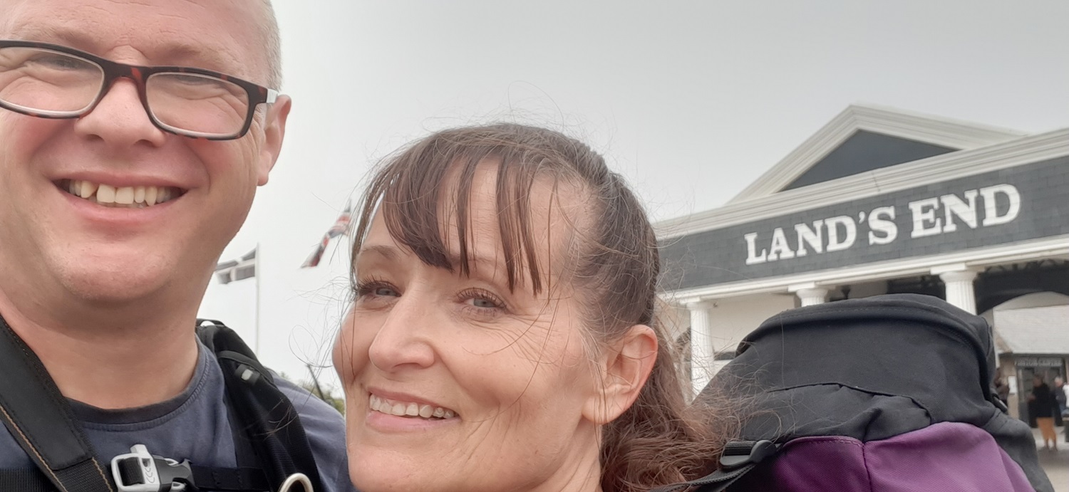
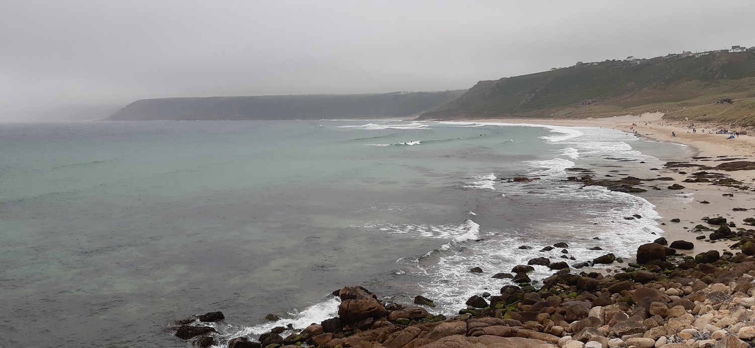
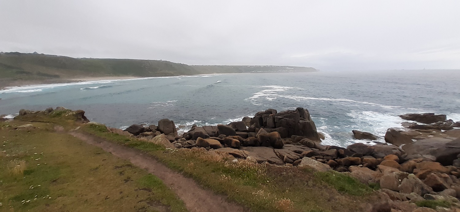
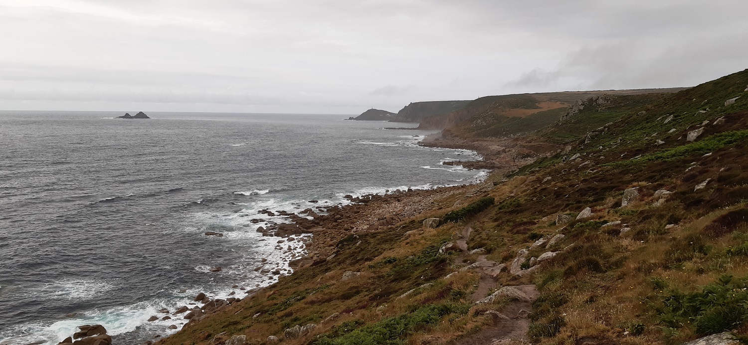
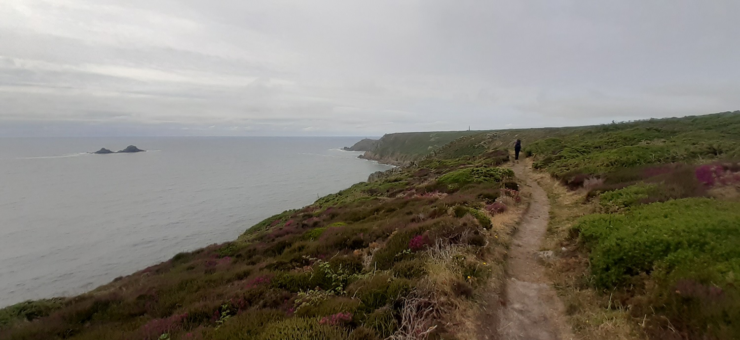
So enough about how we planned the walks, and onwards with this walk. We’d set out from Plymouth at 7am and planned on starting to walk around 9am, however we hadn’t factored in the roadworks on the A30 after the Truro turnoff at Carland Cross, we lost around an hour in traffic on a Wednesday morning! We arrived at Little Trethewey, and a little car park by a memorial and bottle bank at 9.45am and hastily hoisted our rucksacks and headed off down the lane towards Porthcurno. The walk to St Just is stunning, we had overcast weather for the day, but the coastline is studded with rocky outcrops, or tors in theory as the whole of this part from Penzance across to St Ives and out to Land’s End is granite, the same as Dartmoor. It shows in the towering stacks which are everywhere, just everywhere. You couldn’t possibly name every one of them, as is done on Dartmoor as there are just hundreds. It is truly a gorgeous landscape, and in sunshine it must be magical. We loved every step, that is until Land’s End itself, my GPS marked it as a “Theme park”, and I can’t argue with that. We took a photo and scooted on towards Sennan Cove. The only blemish on the walk was the drizzle at Sennen Cove, which is said to be a stunning place, it looks nice but isn’t the most beautiful beach in England by a long way. So we carried on towards Cape Cornwall and our bed in St Just, as we rested there the cloud cleared to unveil the Isles of Scilly and a lovely sunset. It was a fantastic day of walking and one that will live long in our memories with so many highlights.
Start – Little Trethewey
Route – Porthcurno – South West Coastal Path – Minack Theatre – Porthgwarra – Gwennap Head – Porth Loe – Nanjizal – Trevilley Cliff – Land’s End – Sennen Cove – Trevedra Cliff – Aire Point – Hermon Hill – Bosorne – St Just
Distance – 12.5 miles Start time – 9.50am Time taken – 8hrs Highest Point – St Just 120metres
Weather – Cloudy, warm, drizzle at Sennon Cove, sunshine and sunset in St Just
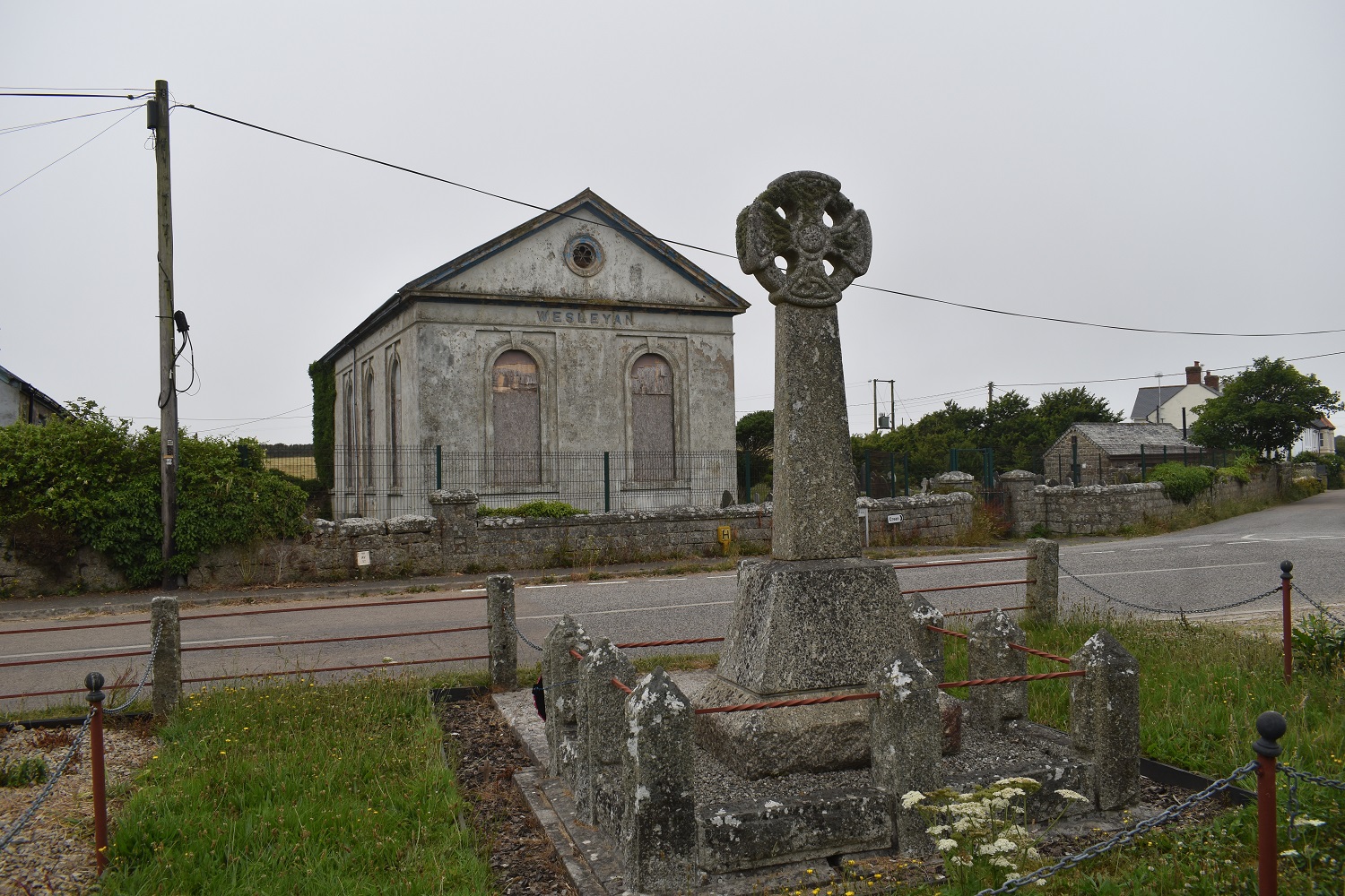
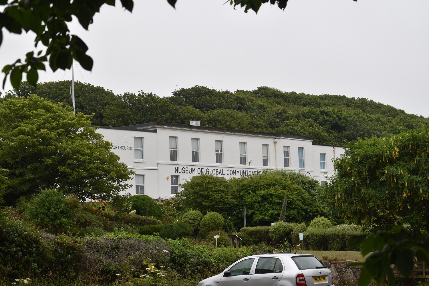
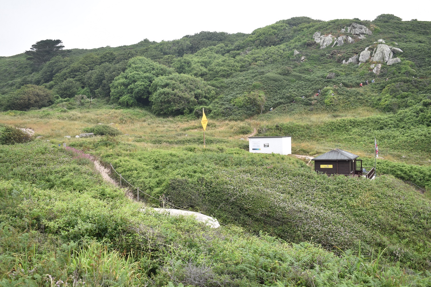
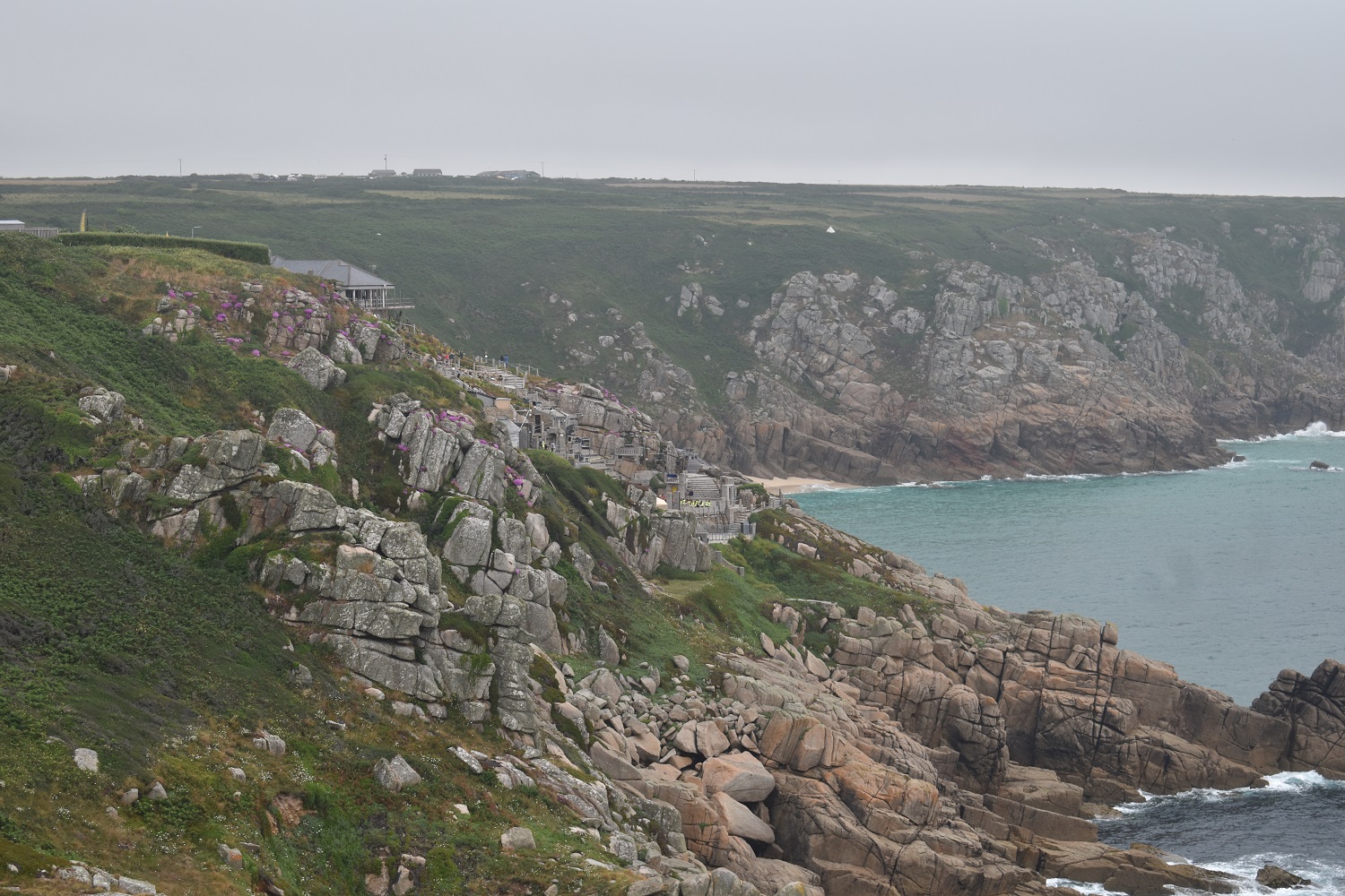
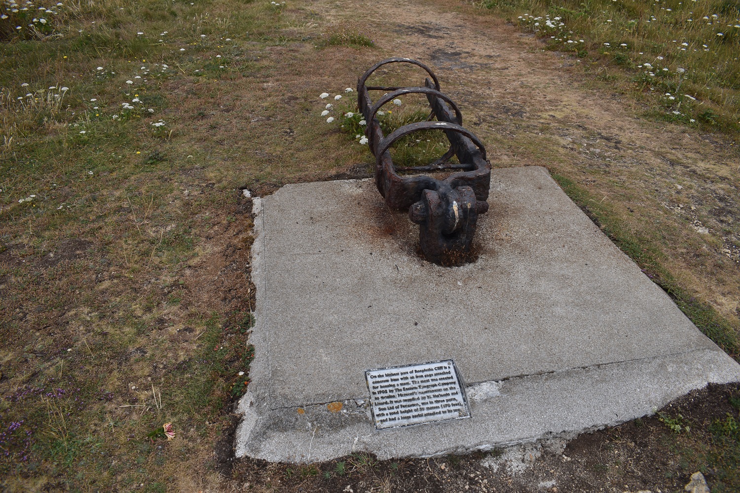
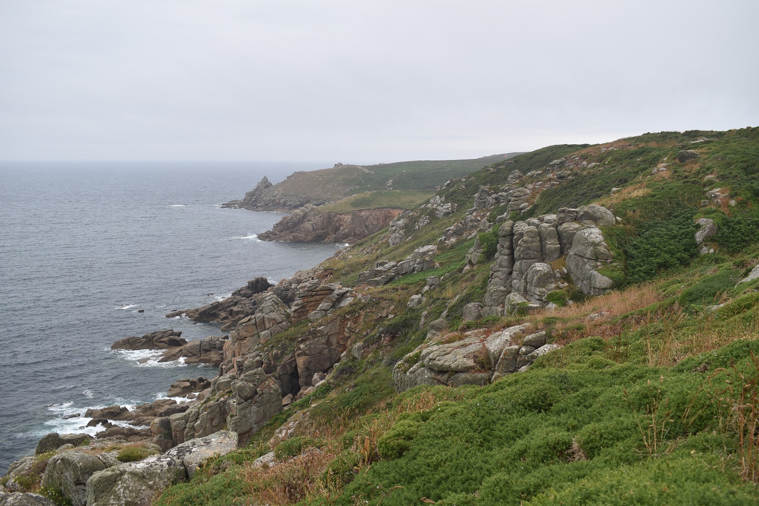
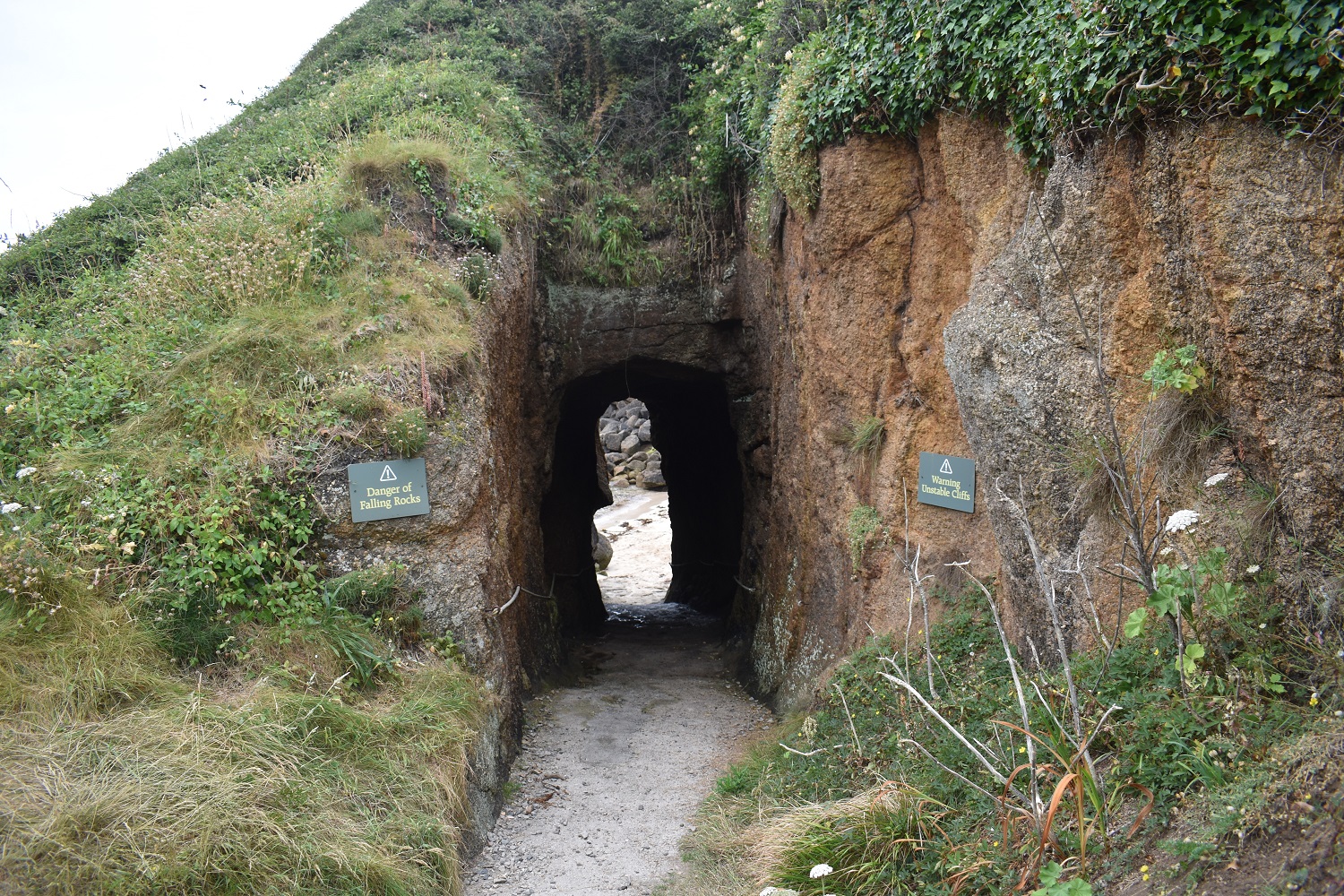
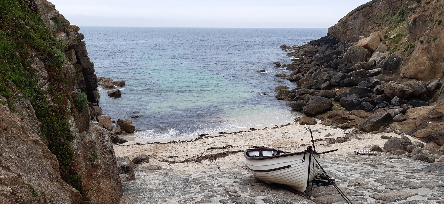
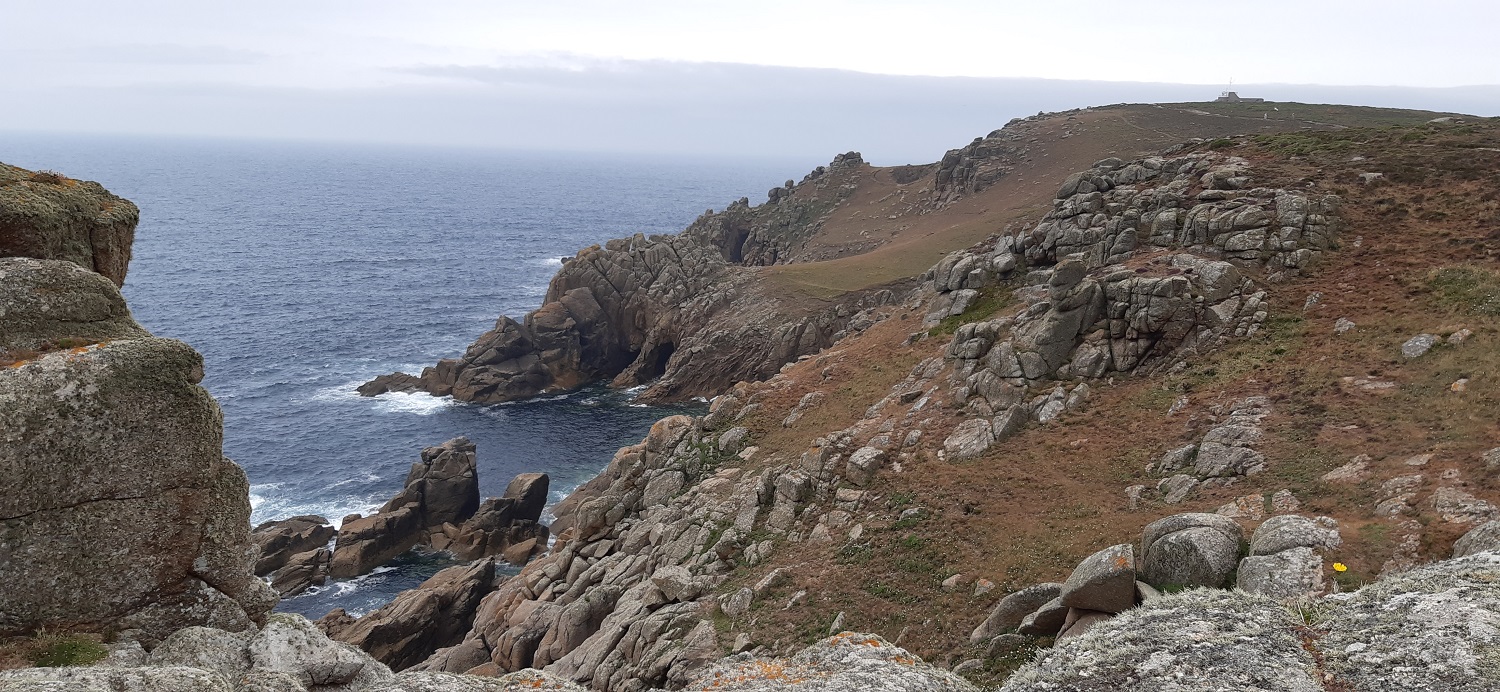
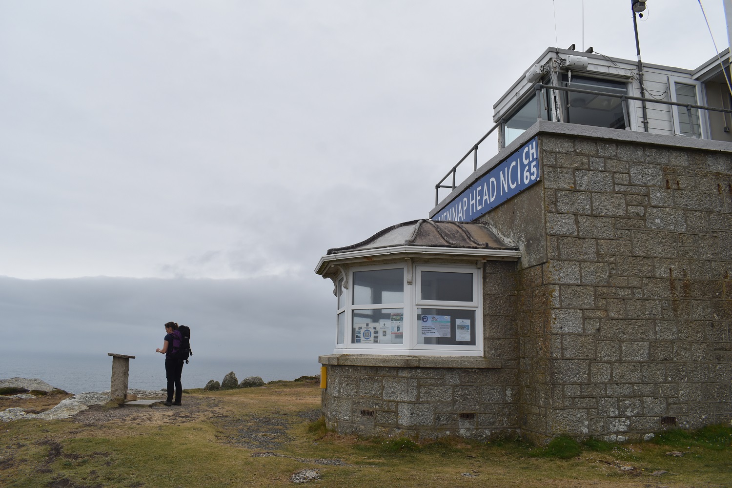
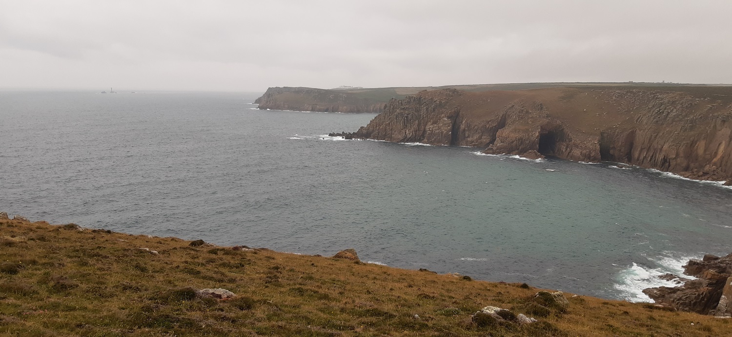
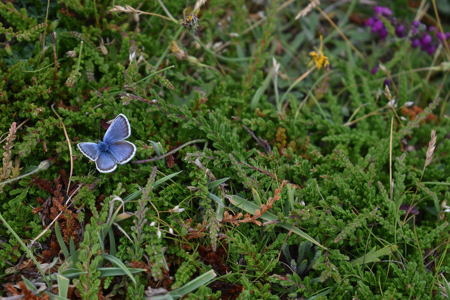
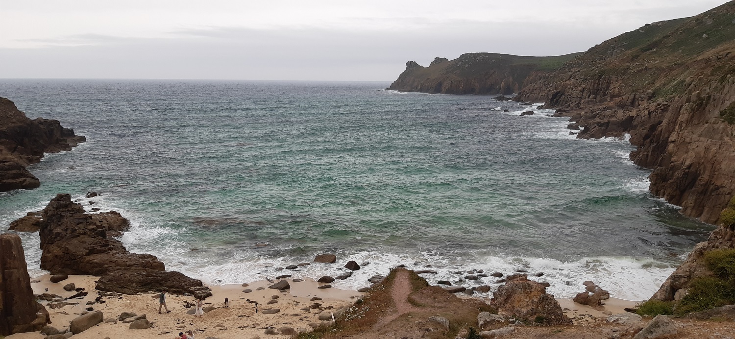
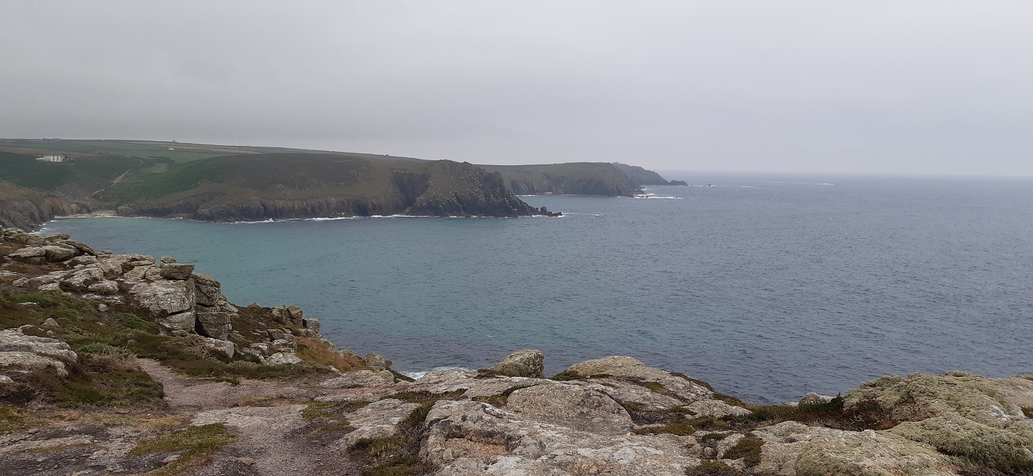
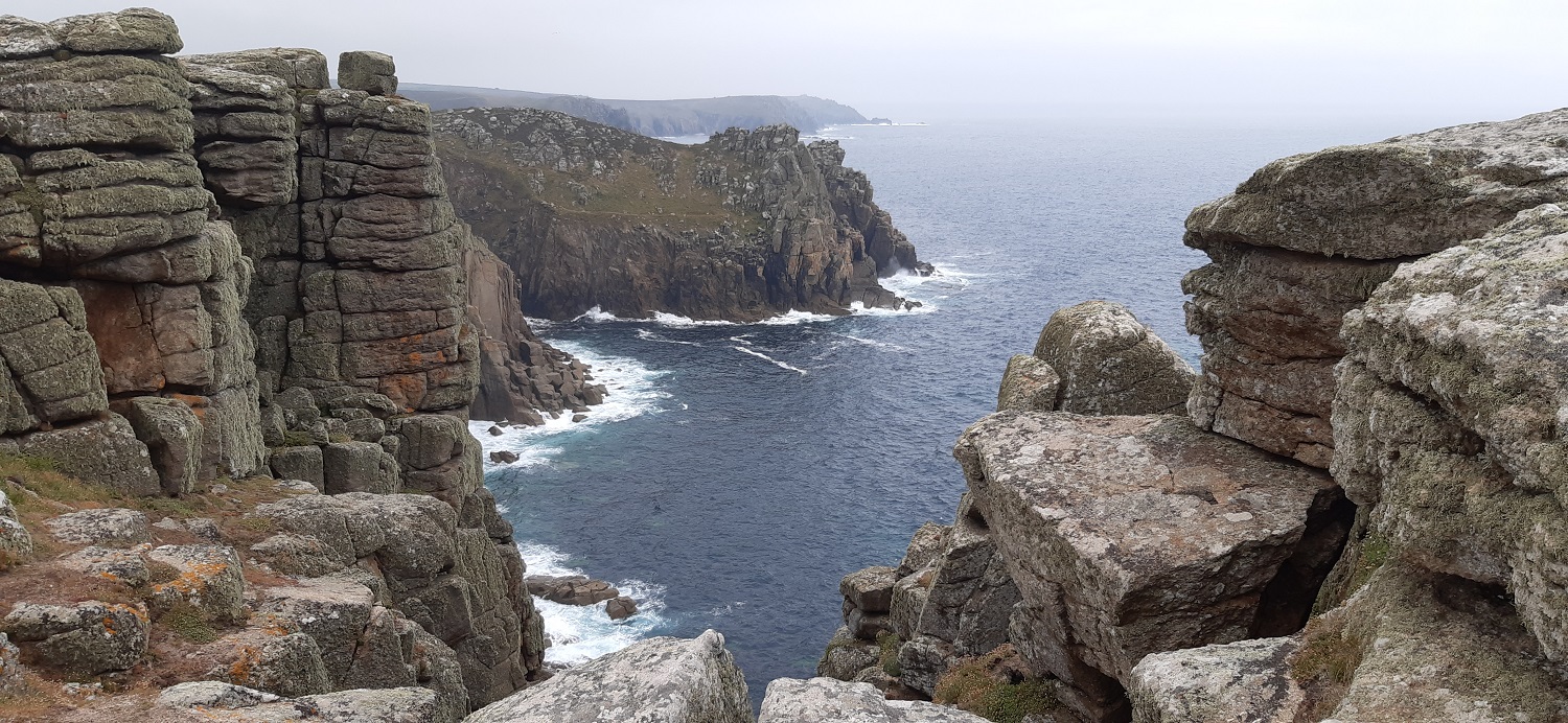
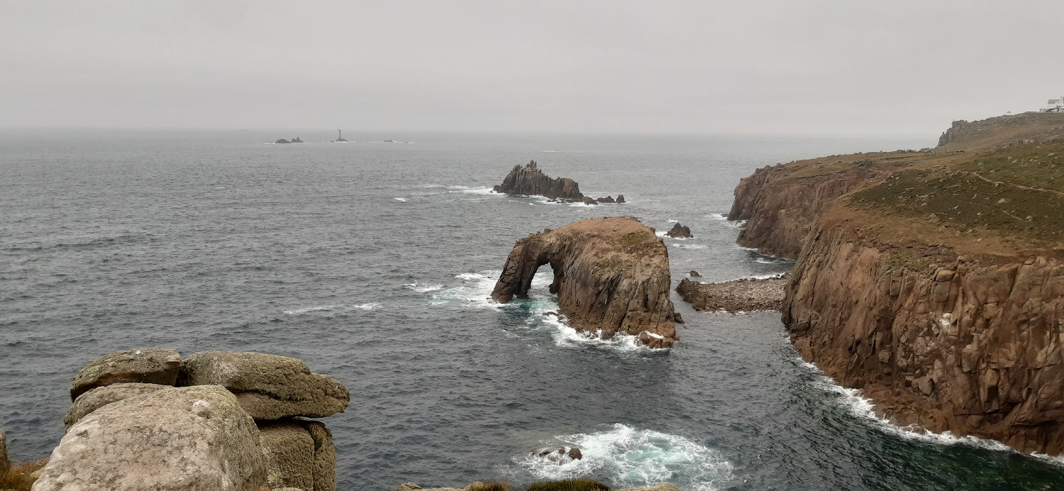
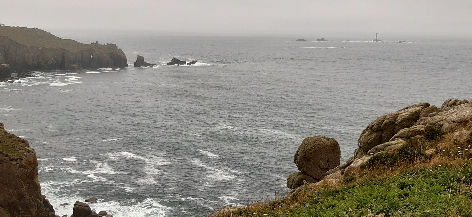
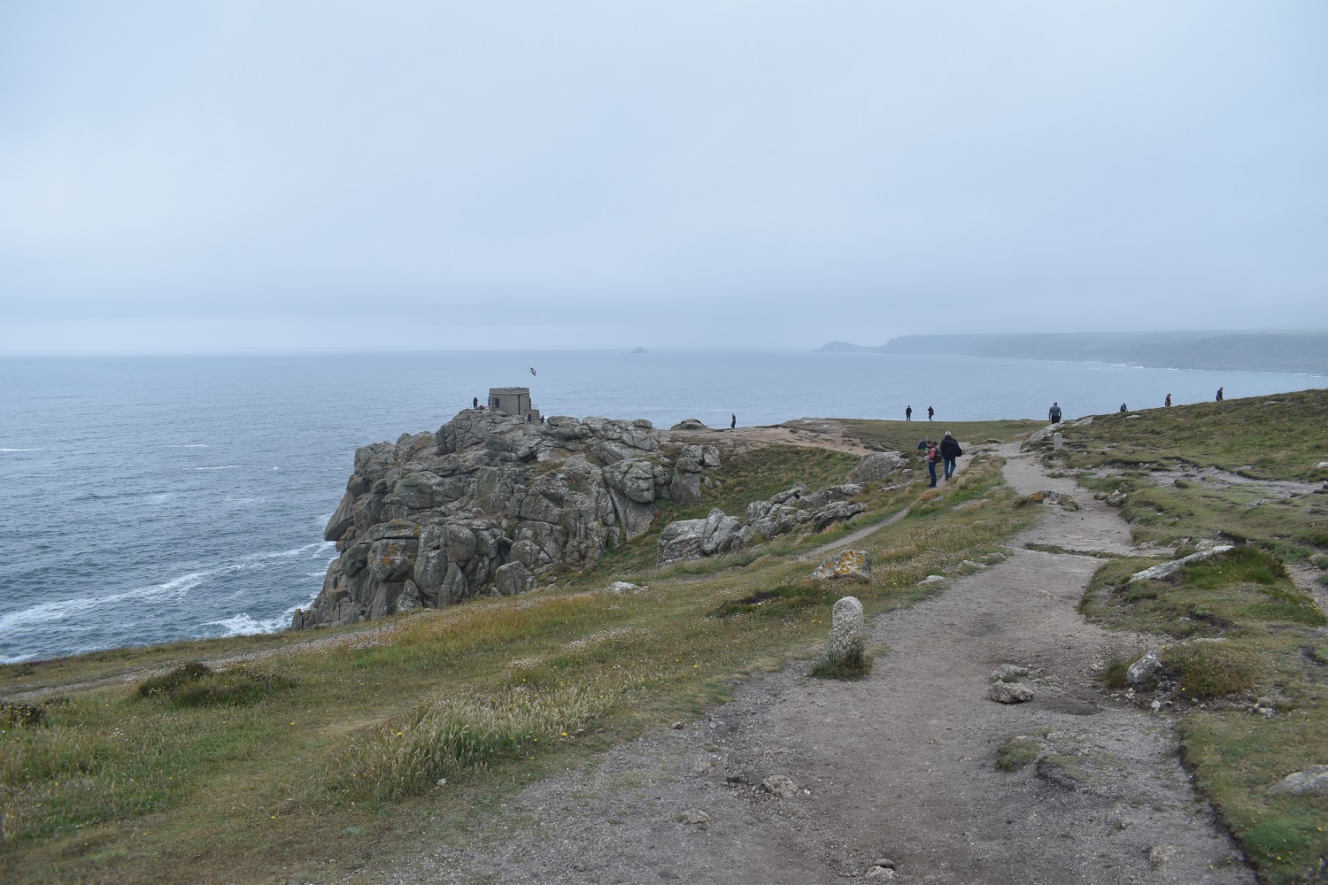
Little Trethewey and the memorial, there’s a little car park here, enough for 5 or 6 cars and we got in ok. We have about a mile to the beach at Porthcurno from here, but all the car parks in the area don’t allow over night stays meaning we couldn’t park in them Porthcurno is famous for this, the world’s largest telegraph communciations centre, PK Porthcurno. The Eastern Telegraph Company was based here in 1870, sending and receiving messages from India, France, Gibraltar, Newfoundland and the rest of the British Empire. During the war 70% of communications came to Britain through this hub, so they moved the equipment into tunnels in the granite to protect it. Now its a museum showing the Cable and Wireless company history.Porthcurno beach is where the cables reach land for the telecoms company, I believe there were around 70 in total when it was in use.The white hut is where it all starts and the cables are landed. On reaching Porthcurno beach we hit the steep steps up to the Minack Theatre car park, still getting used to the weight in our packs we struggled a bit at first, but after a mile or so we’d got used to the extra loads.There is no way to see the Minack Theatre from the car park as they obviously want you to visit it, however if you head around the coastal path to the next headland you can look back across at it, built by Rowena Cade and her gardener Billy Rawlings in the 1930s to allow her to put on plays for the local areaAs the sign says, this was the site of a large mast station, it was built mainly to spy on Guglielmo Marconi by the PK Porthcurno cable company, who was successfully sending messages ‘wirelessly’ across the Atlantic from the nearby Lizard Point. A British wireless expert used the mast to intercept Marconi’s messages and insert rude messages into them, to show that wireless technology wasn’t secure and protect the cable technology’s future.Now starting out on the path towards Gwennap Head, tors of granite sticking up along the routeA little arch to……….Porthgwarra beach, we had a coffee here and a bit of sunshine came out to warm us up nicelyThe coastguard station on Gwennap Head can be seen on the back right, we are on Hella Point in amongst the granite outcropsOn Gwennap Head now, the next drop down will take us to Porth Loe and the headland at the back is Trevilley Cliff. The weather is a bit overcast but the scenery is stunningLinda with her pack by the coastguard stationGranite stacks everywhere, caves arch through the cliffs, overhanging rocks, weathered rock piles which look the same as they do on DartmoorSome of the mentioned caves over there with golden sand inside, Trevilley Cliffs are at the back, we are heading down to the right here to Porth LoeSilver studded blue, very similar to the Common Blue but it has a grey patch across the top of the bottom wing, which is missing on the Common BluePorth Loe now and an example of those Instagram posters, bottom left. The girl is wearing a white floaty dress, and the lad has shorts and a shirt and jacket on top. Their tripod and camera are pointed left here as there is an arch with a view right through the the sea the other side. They were both posing on top of the rocky outcrop on the left all looking windsweptThis part of the path around Folly Cove was nicely perched over a drop down to the sea, with more rocky granite tors sticking up to clamber overUp on Carn Barra and looking back to Gwennap HeadPendower CovesWe reached Trevilley Cliffs and decided that this plunging view would be a good spot for lunch, granite stacks all around. that’s Carn Les Boel over there with Gwennap Head at the backVery happy with our efforts so farThe white building over there is the ‘Theme park’ at Land’s End. The three sets of islands are Longships at the back left, then Armed Knight in the middle and Enys Dodnan nearestFrom further round as we head for Land’s End, the arch on Enys Dodnan can be seen now with Armed Knight behind and Longships away to the leftA bit of zoom on Longships shows the vital lighthouse on this dangerous rocky outcrop just off Land’s EndA quick photo here and then off. It always surprises me that this place is so famous being that its not the most southerly (Lizard Point) nor the most westerly (Ardnamurchan Peninsular) in Great Britain. The scenery is still stunning though
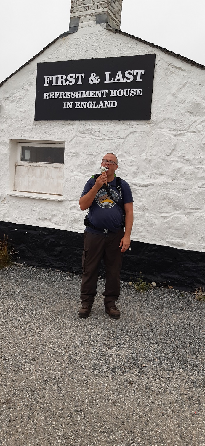
I also had an ice cream from here
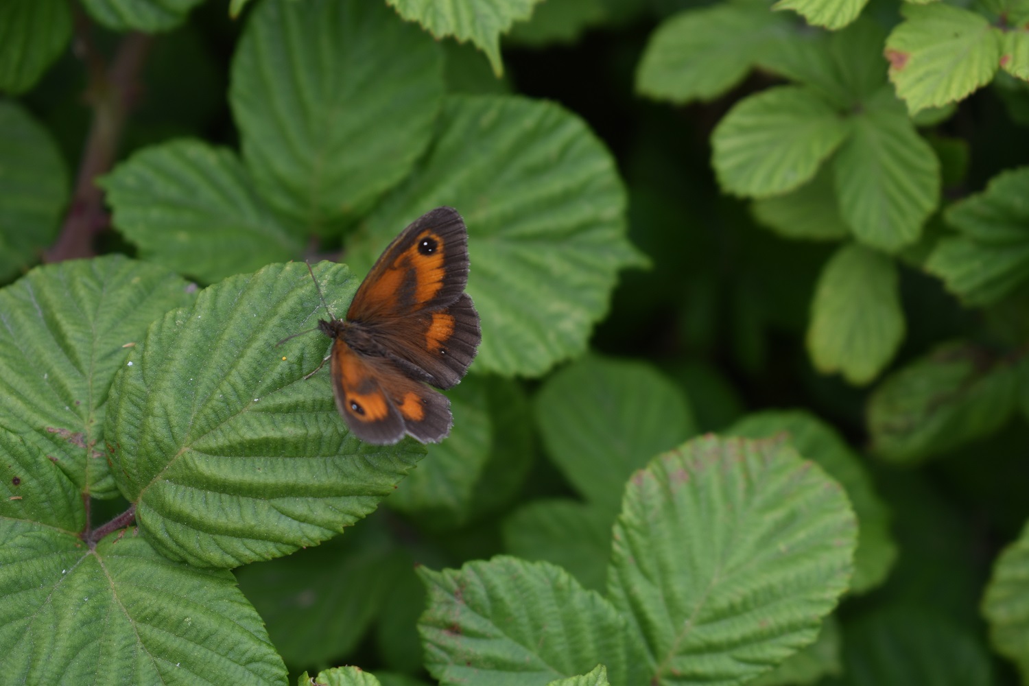
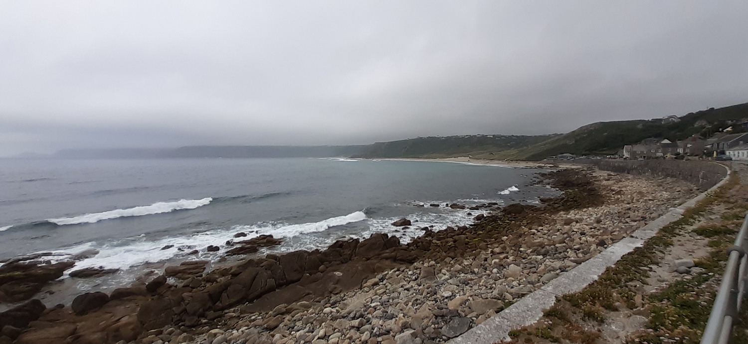
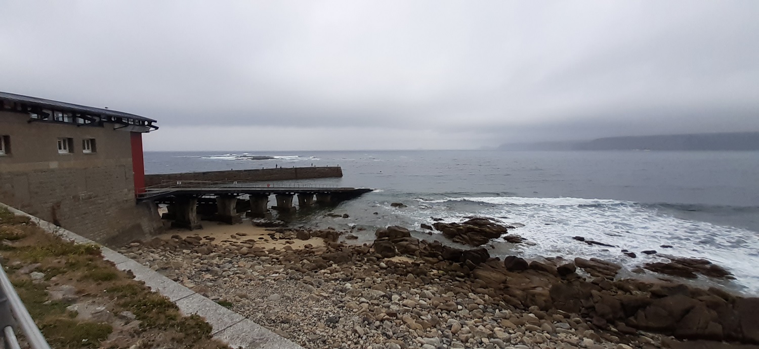
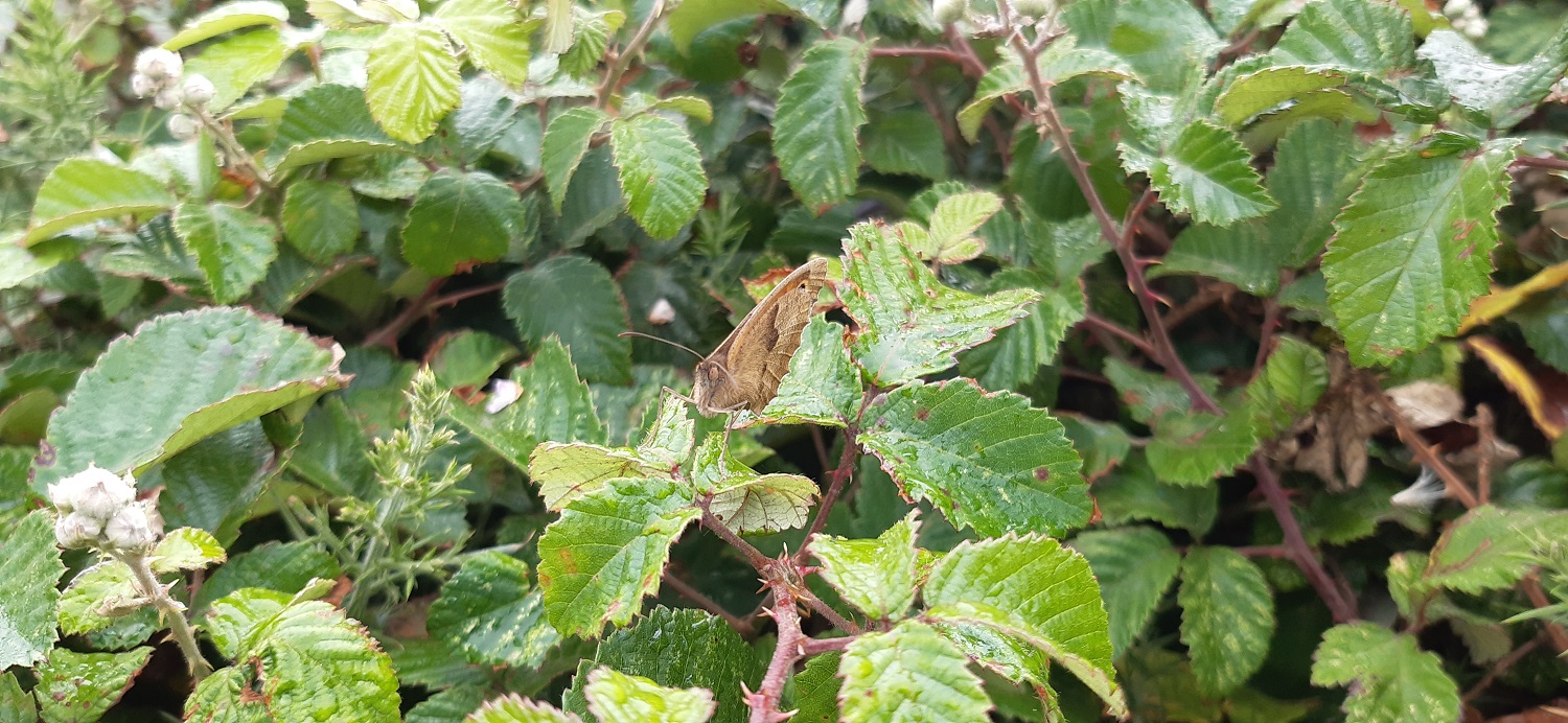
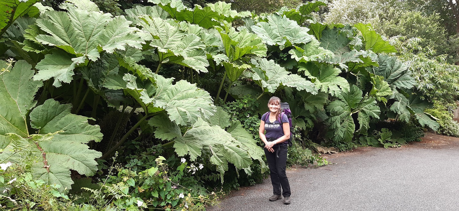
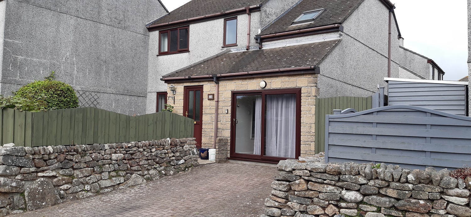
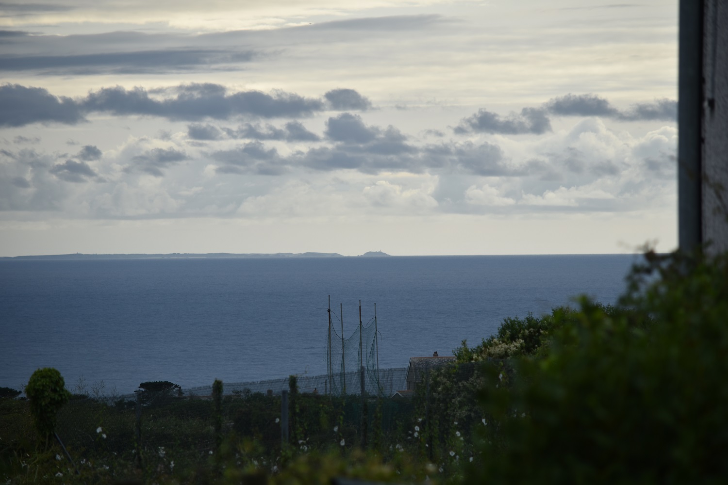
A Gatekeeper butterflyLongships with Land’s End to the left, the point sticking out is actually called Dr Syntax’s Head after a fictional character created in a 1809 book by William CombeRMS Mulheim, which ran aground in 2003 carrying scrap car plastic, The story goes that the chief officer of RMS Mülheim on watch, had caught his trousers in the lever of his chair, fallen over and passed out. The ship ran into rocks and the crew were airlifted to safety.Pedn Men Du coastguard lookout, now owned by the National Trust. Sennen Cove is beyond along with Cape Cornwall.Sennen Cove from the lookout stationThe cloud was lowering as we reached Sennen Cove, there was a house for sale to our right here, 3 bed semi detached, 1.275 million! Not for locals to buy obviously.Lifeboat station at Sennen Cove, the islands beyond are The Tribbens. That’s Cape Cornwall across the bay which is slowly disappearing from view.The next section of the path involves walking the soft sand across the beach and dunes, particualrly tough on the legs at mile ten in the walkDrizzle and a disappearing Sennen Cove beach, still people were surfing and swimmingThe rain clears and we look back across Sennen Cove, the beach to the left looked like a lovely quiet spot for a swim, Gwynver Beach is its name.Aire Point, we’d noticed that after rounding Land’s End that the rocky granite stacks had been left behind but Aire Point saw a return of themI remember the stack on the left causing a bit of trouble on tiring legs, but the views across Whitesand Bay to Longships and Land’s End help make up for the awkward scramble.Cape Cornwall ahead with The Brisons to the left, we will be walking to level with them before turning in right to St JustA Meadow Brown in amongst the greenery. The sun was out again now and as we climbed up one final cliff we had a rest and dried out a bit after the earlier drizzle.Above Gribba Cliffs and the last section before we hang a rightI never know what these plants are but they are always seen in ornamental type gardens, Linda showing how big these ones were in Bosorne.All the way to St Just to see a LlamaOur little place for the night, we had what would have been the garage for this property and entered through the patio door. It was perfect for what we needed, which was just a place to sleep. We headed into St Just for some fish and chips and a few beers to bring backThe owner of the property messaged to let us know the Isles of Scilly were in view from the front of the house, and here they are, a bit of zoom picks them out 30 miles awaySunset Land’s End style at the end of day one of this 3 day walk. Tomorrow’s weather was set to be warm and sunny as we head around Cape Cornwall.
I’ve only been to Cornwall once – it’s such a trail down there (I marvel how you keep driving up north and back again several times a year!) I recognise several places you walked through, though. Walking a coastal path sounds easy but having done some stretches of the Cleveland Way and the South Coast Path near Lyme, know that it’s hard work – but enjoyable
Coastal walking can be very hard on the legs, the climbs can be a hundred metres each time, but you can have 3 or 4 in on walk plus a lot of little ones. And unlike climbing a mountain they are scattered throughout the walk and no downhill section to finish with
I’ve visited several of these spots but never actually walked the coastline. Considering it’s some of the best, that a massive oversight. Spent many happy times at Sennen Cove and I confirm it’s stunning on a sunny day. St Just we used to visit, grab some pasties then drive down to Cape Cornwall to eat them. Happy times
We loved St Just, probably going to be a revisit there for sure, so much good coastline around this part and its fairly easy to walk as well, not so much of the steep up and downs you get on other sections
Never seen a Silver-studded Blue, how lovely. And the scenery is superb of course. It’s never occurred to me that this is a different example of the geology seen on Dartmoor.
I assume that Land’s End, like John O’Groats, is more a victory for marketing than anything else.
Do you take notes, or can you identify the views in your photos from memory? Pretty impressive either way – I’m sure that I would struggle. Well, actually, I do struggle.


Such a great part of Cornwall, and again a good read.
LikeLiked by 1 person
I loved that the whole area has so much granite and the outcrops thrust up from the cliffs providing such a lovely landscape
LikeLiked by 1 person
Coming from Plymouth and strong ties with Dartmoor. You are so right the rising granite brings me “home” too.
LikeLiked by 1 person
Beautiful. Seems like great route planning
LikeLiked by 1 person
The route planning worked well for us, I’ll have to split it into 4 walks for posting on the blog but that’s no hardship
LikeLike
I think we’ve all done that 😉
LikeLiked by 1 person
Love that coastline, despite the ‘theme park’ of Lands end, which is only a small part of it.
LikeLiked by 1 person
Its a bit of a shame really, but I loved the part from Porthcurno to Lands End, just a stunning part of the world
LikeLiked by 1 person
It certainly is
LikeLiked by 1 person
Looks like a fab walk. And you certainly saw a variety of butterflies. 🙂
LikeLiked by 1 person
Another coastal walk a few weeks later was even better for butterflies, saw hundreds and hundreds of them around Start Point
LikeLiked by 1 person
Fantastic 😊
LikeLiked by 1 person
I’ve only been to Cornwall once – it’s such a trail down there (I marvel how you keep driving up north and back again several times a year!) I recognise several places you walked through, though. Walking a coastal path sounds easy but having done some stretches of the Cleveland Way and the South Coast Path near Lyme, know that it’s hard work – but enjoyable
LikeLiked by 1 person
Coastal walking can be very hard on the legs, the climbs can be a hundred metres each time, but you can have 3 or 4 in on walk plus a lot of little ones. And unlike climbing a mountain they are scattered throughout the walk and no downhill section to finish with
LikeLike
I’ve visited several of these spots but never actually walked the coastline. Considering it’s some of the best, that a massive oversight. Spent many happy times at Sennen Cove and I confirm it’s stunning on a sunny day. St Just we used to visit, grab some pasties then drive down to Cape Cornwall to eat them. Happy times
LikeLiked by 1 person
We loved St Just, probably going to be a revisit there for sure, so much good coastline around this part and its fairly easy to walk as well, not so much of the steep up and downs you get on other sections
LikeLiked by 1 person
Never seen a Silver-studded Blue, how lovely. And the scenery is superb of course. It’s never occurred to me that this is a different example of the geology seen on Dartmoor.
I assume that Land’s End, like John O’Groats, is more a victory for marketing than anything else.
Do you take notes, or can you identify the views in your photos from memory? Pretty impressive either way – I’m sure that I would struggle. Well, actually, I do struggle.
LikeLiked by 1 person
I tend to just make mental notes as I’m going around, I have my GPS with me so I’m almost narrating as we walk saying what we are looking at
LikeLiked by 1 person
You must have a better memory than me. Or just don’t work 6 months behind?
LikeLiked by 1 person
To be fair I am about 5 or 6 weeks behind
LikeLiked by 1 person
And I’m less than 6 months, which is good for me. Maybe I’ll catch you up?
LikeLike
I think your massive leaved plant is a Gunnera.
LikeLiked by 1 person
I would say you’re right, huge things
LikeLiked by 1 person