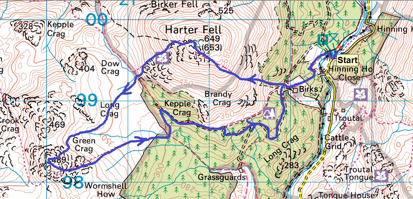
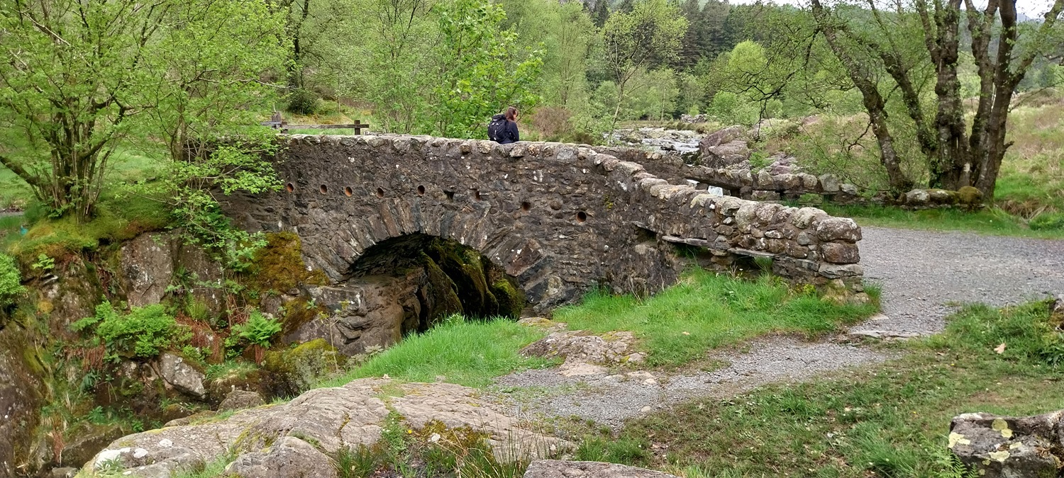
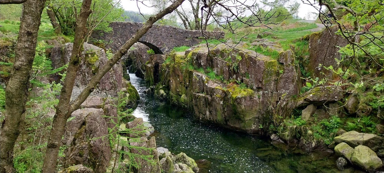
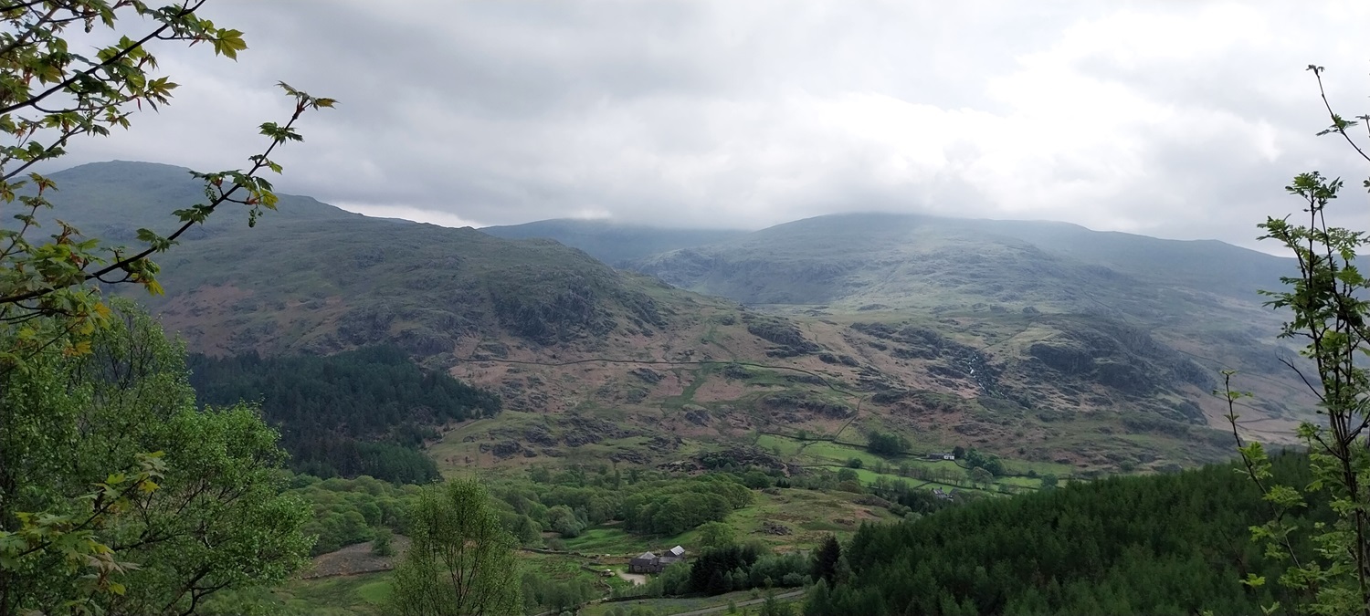
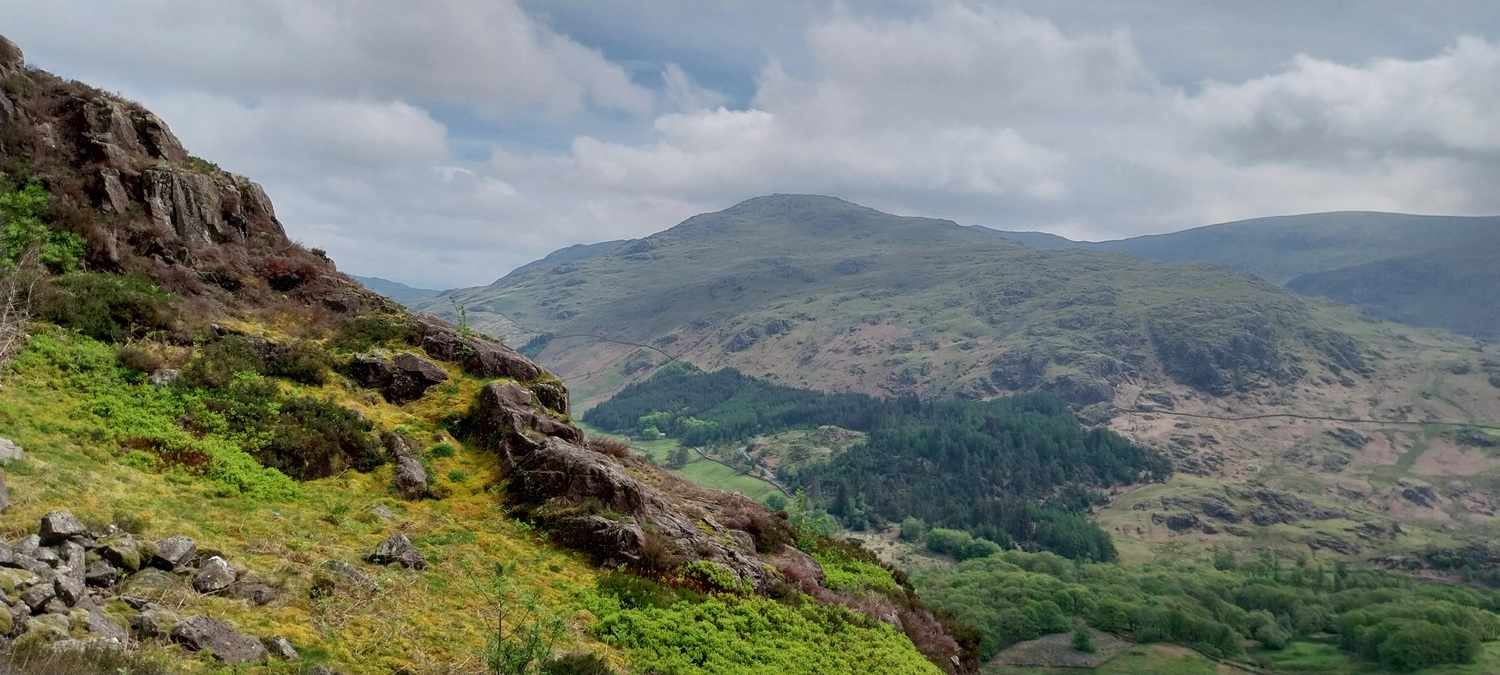
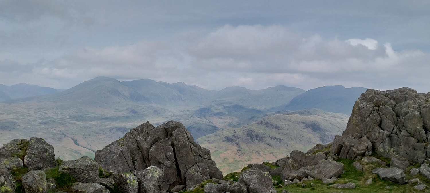
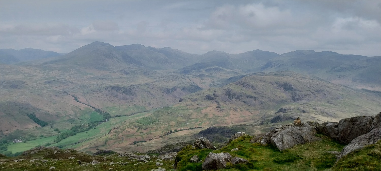
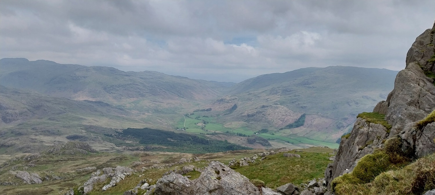
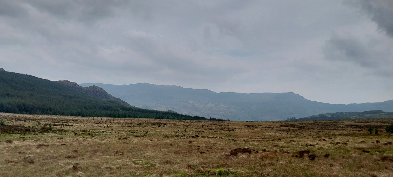
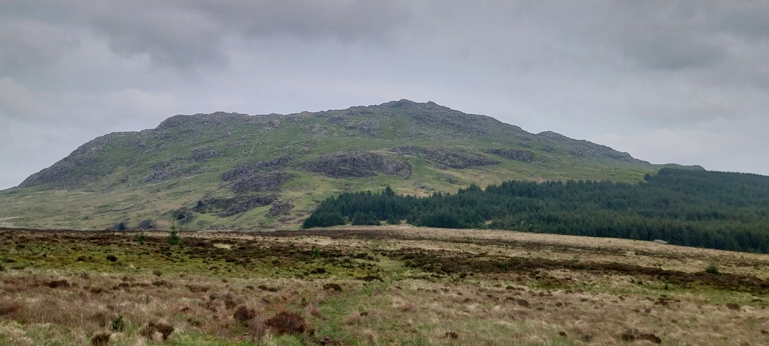
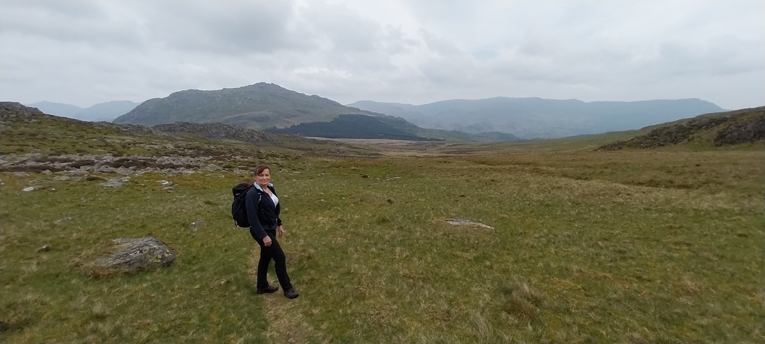
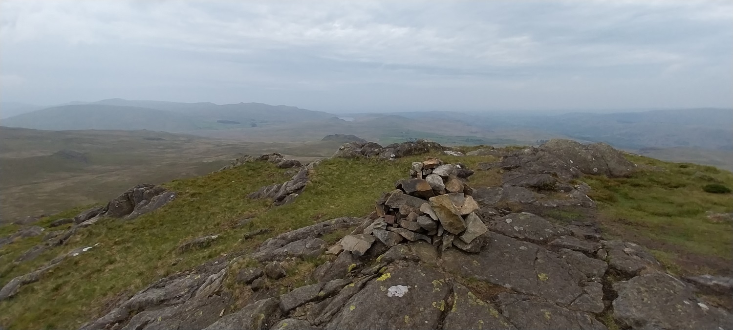
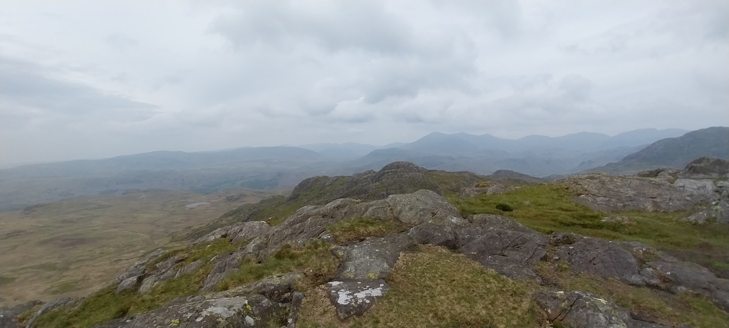
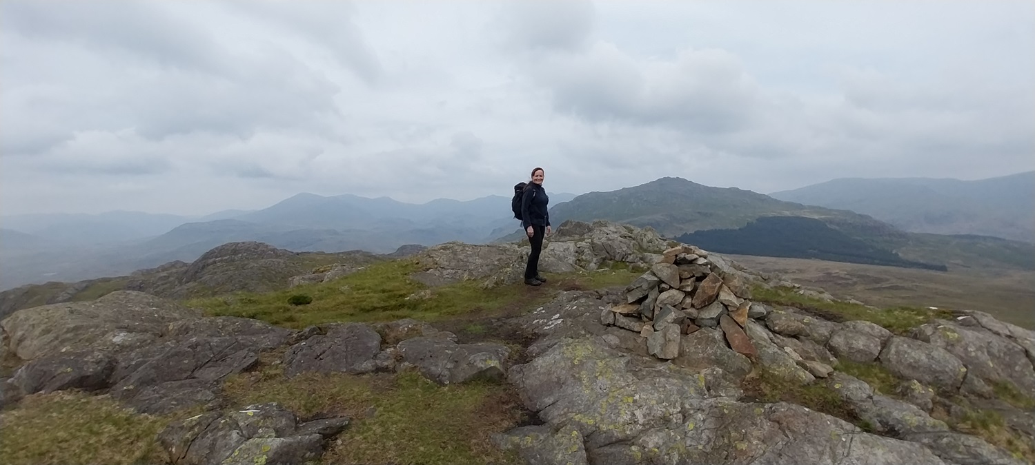
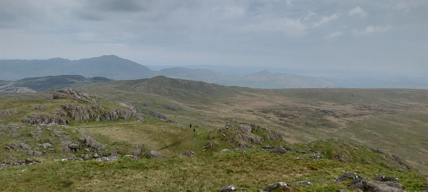
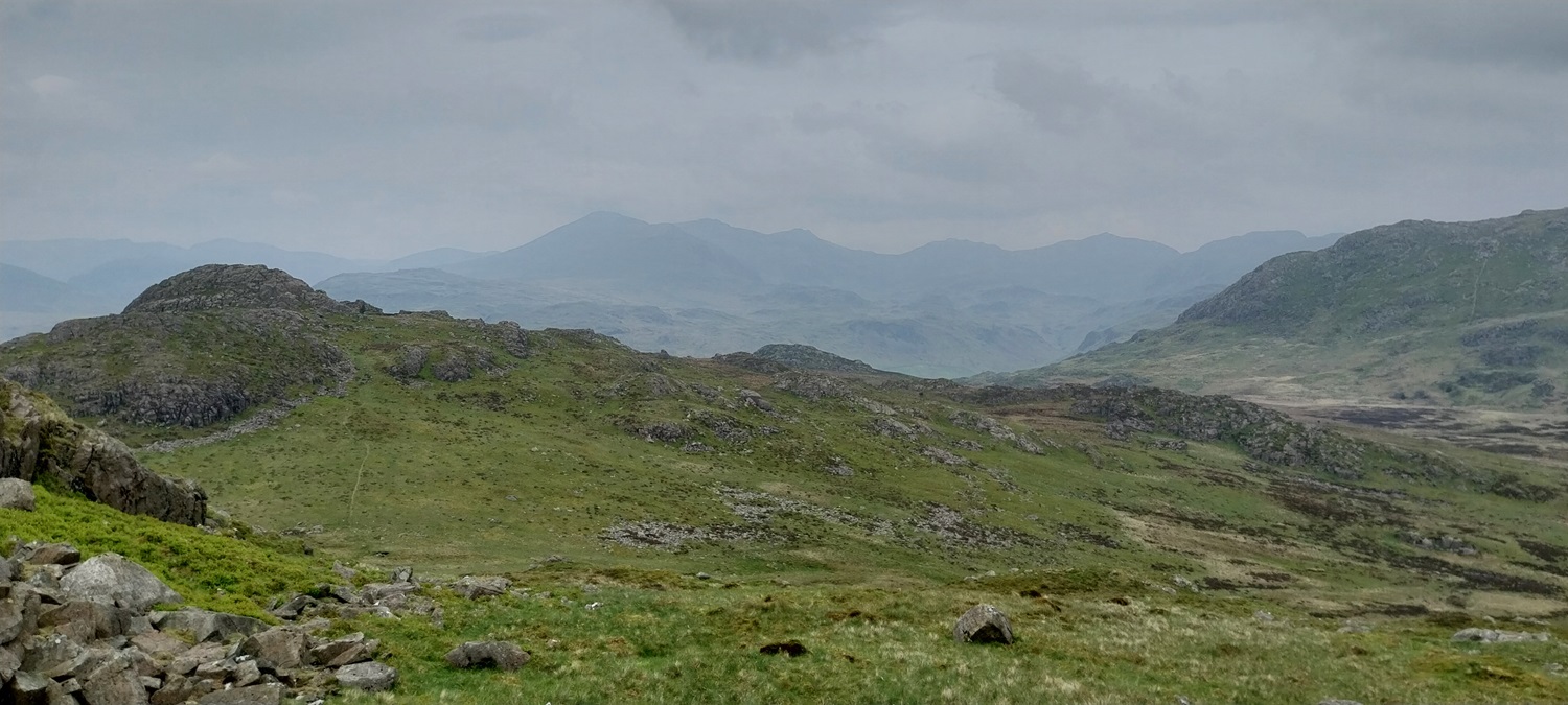
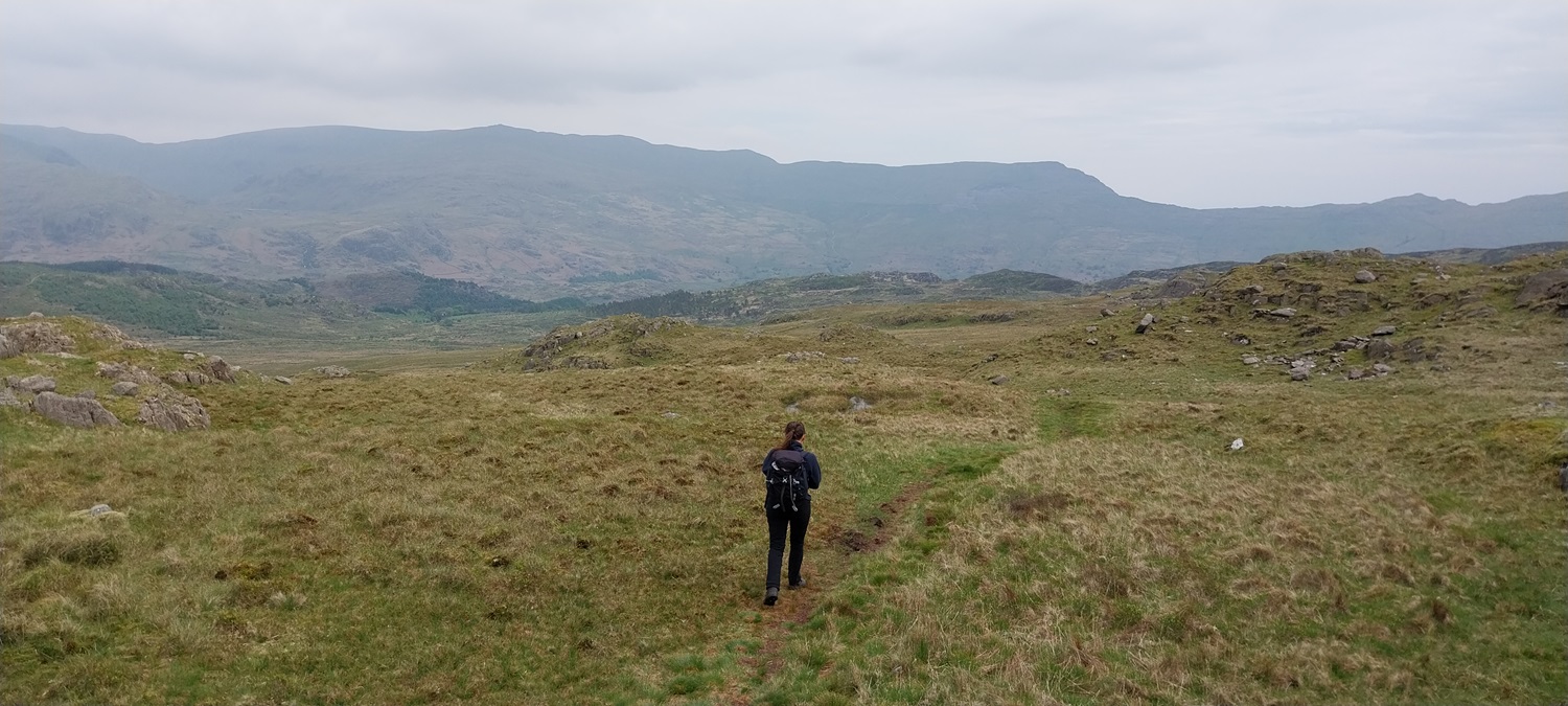
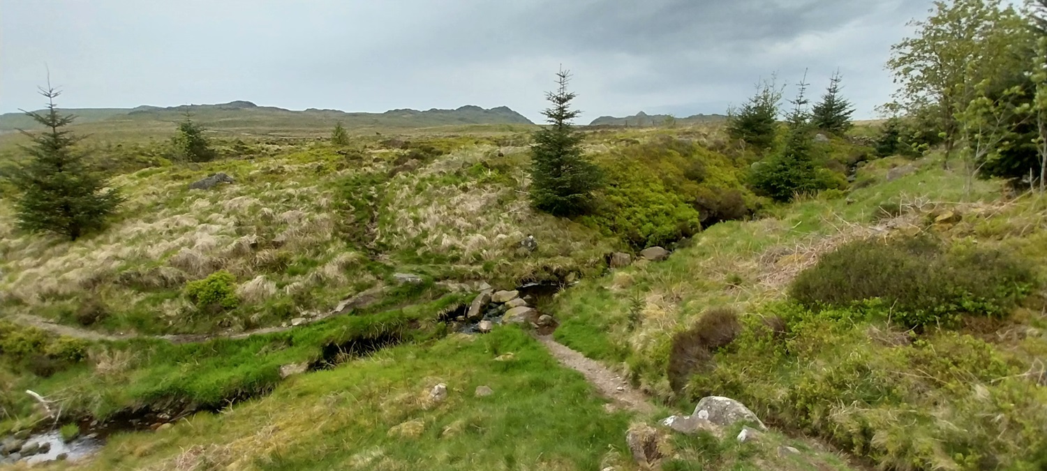
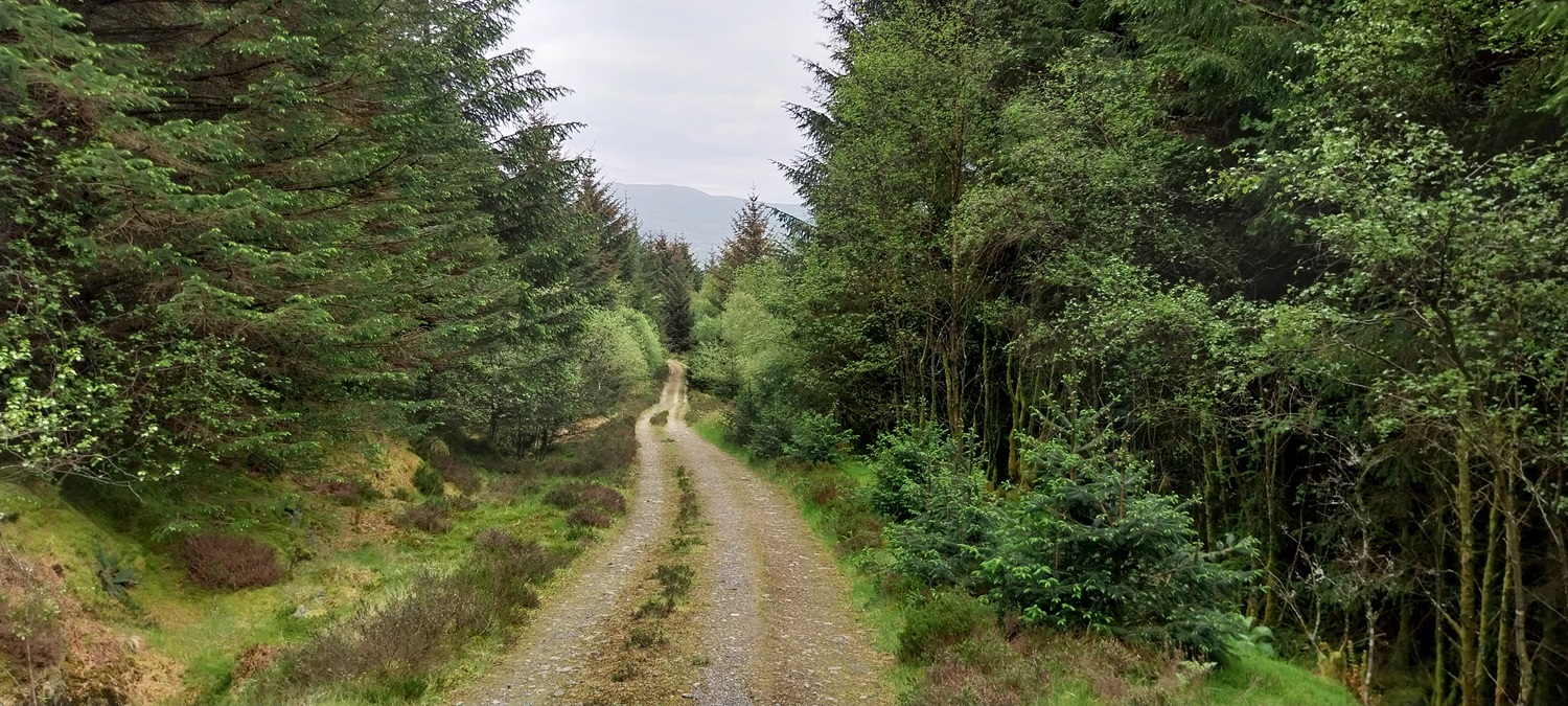
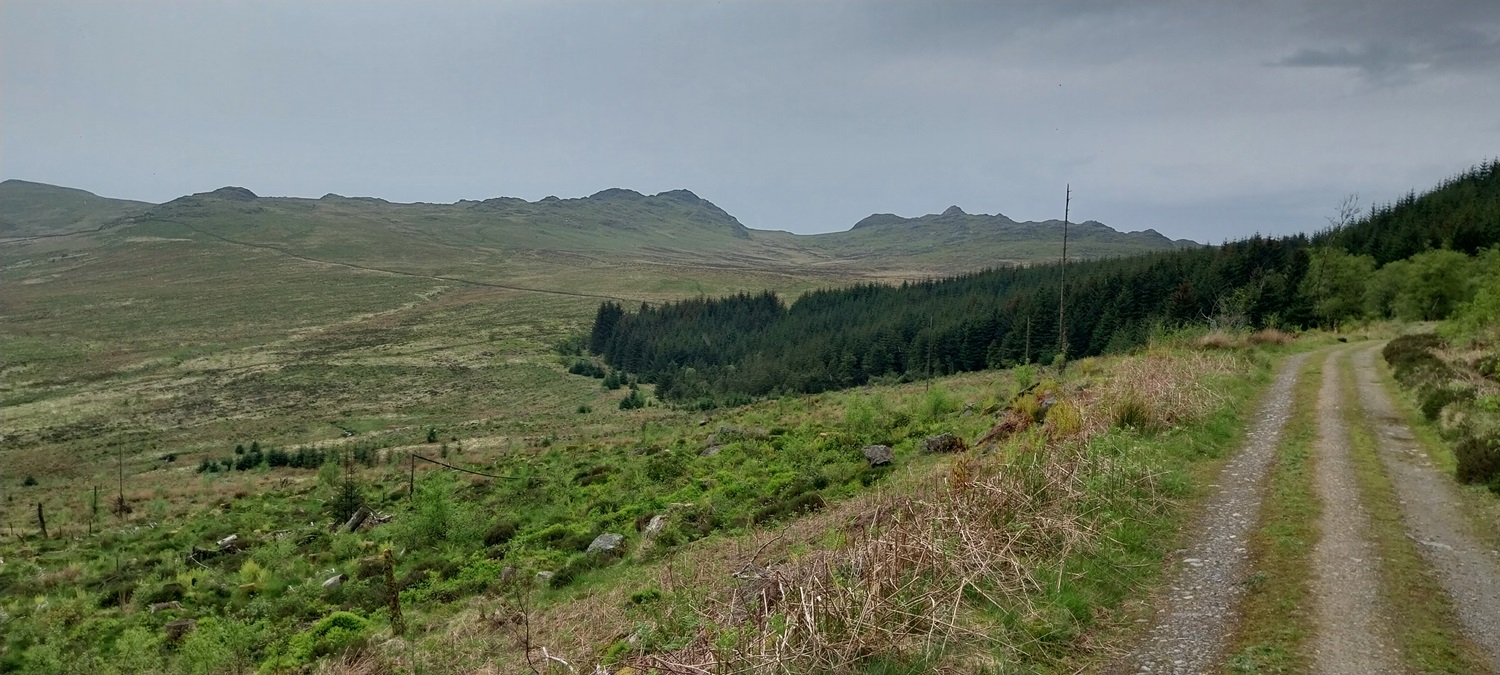
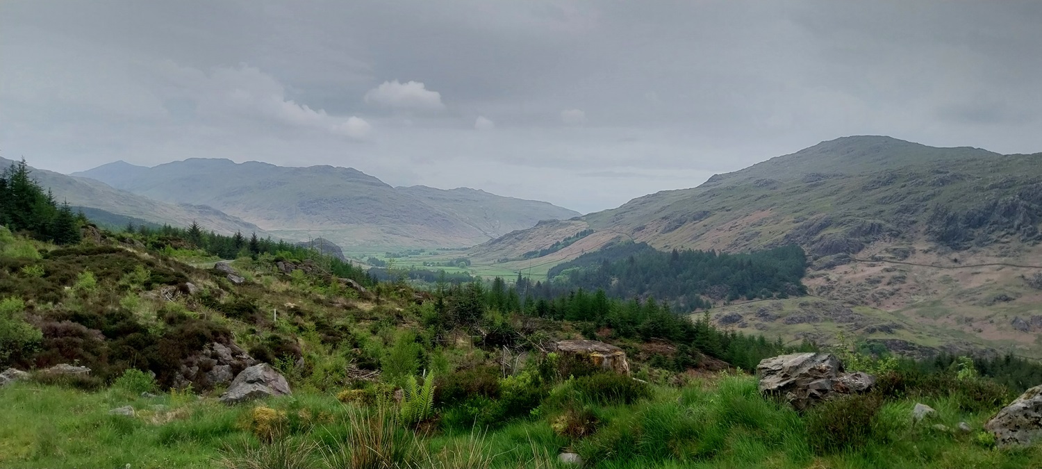
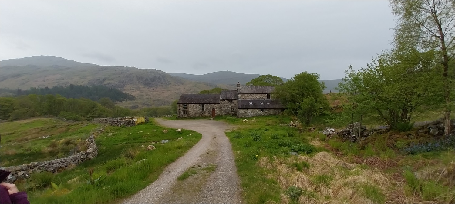
So with ticking off Catstycam and Birkhouse Moor, I’d completed Wainwrights 204 and 205. Now for numbers 206 and 207. This started with a drive over Wrynose Pass, not so bad in drying weather and along the valley to Cockley Beck, before a left turn to Birks Bridge. The car park was fairly empty as we arrived at 10.15am, booting up and heading down the road to take a look at the bridge first, before joining the path through the trees to Birks farm itself. At this point the track changes from a fairly wide, occasionally muddy, woodland track. To steeply narrow, uphill, loose, scrambly path. All the way up to Maiden Castle was a challenging route, once there however the path opens up, sweeping to the summit. There is a nice trig point amongst a rocky outcrop, plus plenty of other outcrops, one higher than the trig. Its a great summit and gives some superb views into Eskdale, to the Scafells, then the other way to the Coniston Fells and round towards Morecambe Bay. We set off downhill towards the south west side of Harter Fell, on the route to Green Crag, as we got 3/4s of the way down we stopped for lunch. From here we were able to watch two couples head off across the boggy section towards Green Crag, both of which who made early errors and hit some very boggy ground. When we headed out we went via their corrected route and crossed the boggy bit easily, in fact like most of the Lakes it isn’t as bad as Dartmoor. We reached the final ramp up to Green Crag quickly, but the views from there had worsened, as the cloud dropped further and the haze thickened. We left quickly, knowing the rain was on its way, arriving below Kepple Crag not long after, taking the tracks through the forest back to Birks. All that was left was to repeat our outward route to the car park, where we met one man who was returning back to Birks Bridge for a swim! We had caught a little drizzle as we walked back to Birks, and the wet stuff fell harder as the evening progressed, leaving Tuesday as a wash out. But this was another two in the bag and just 7 left.
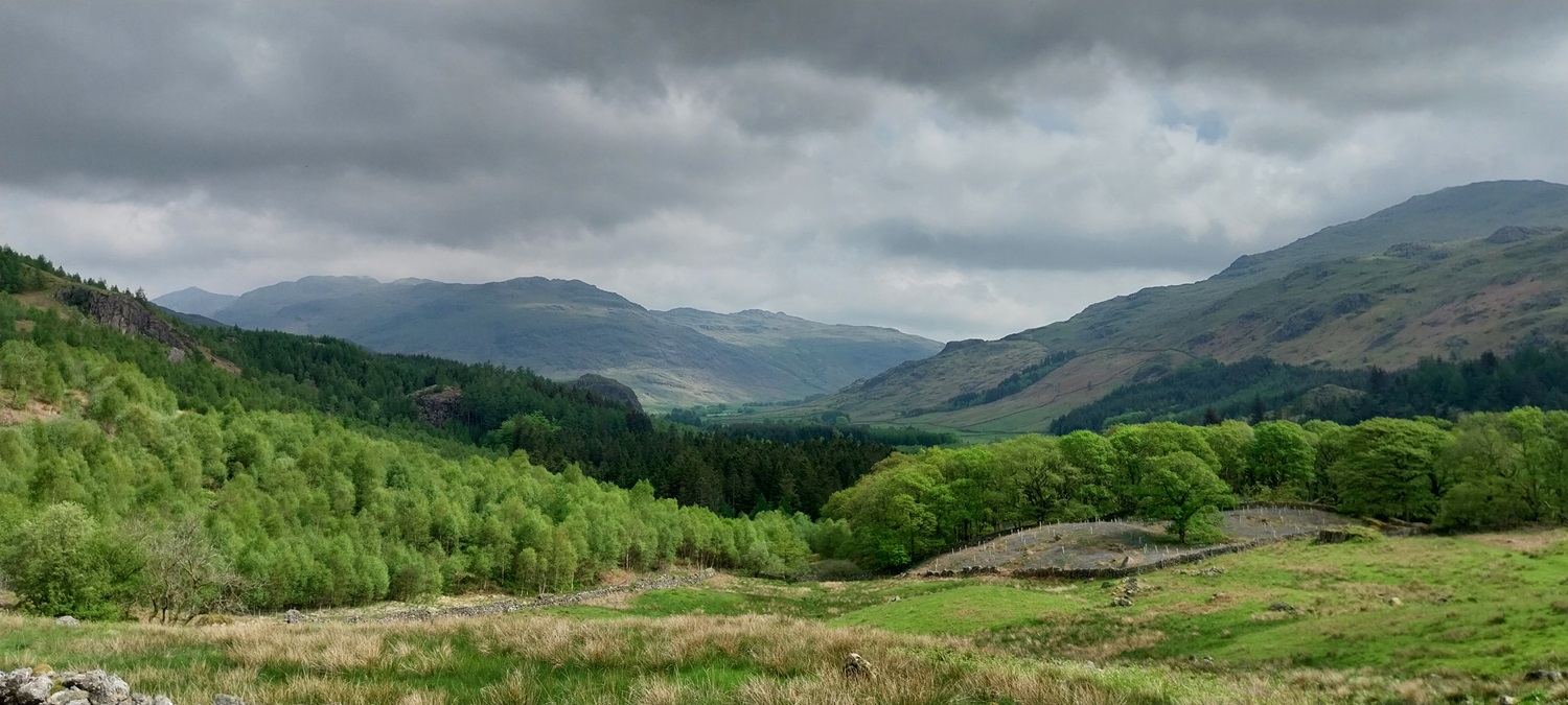
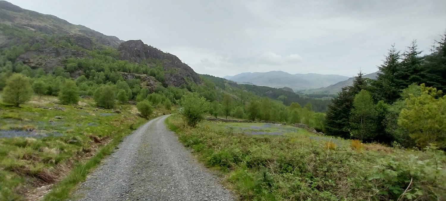
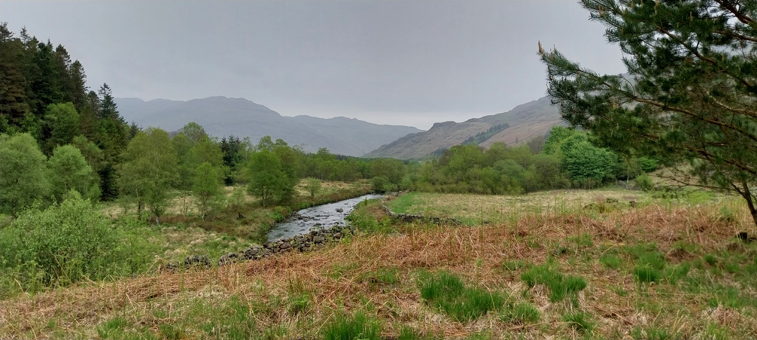
Linda at Birks Bridge, looking down to the deep waterThis is a favourite swimming spot in the summer monthsAs we walked to Birks farm we found pockets of bluebells, both in the trees and out in the open, like these. Harter Fell behindGrey Friar up on the right and Little Stand straight ahead, behind Little Stand are the Crinkle Crags, which run up to pointy Bowfell, back left.As we climb steeply up through the trees, views open up to the Coniston Fells, with the tops in the cloud. Grey Friar is just clear to the left thoughBit of sun peeping through, brightening the skies over Grey Friar. We would be there on our next walk.Looking to the Duddon Valley. Caw is the larger fell in the centre, and the pointy one I think is Great StickleWe stopped for a brew at Maiden Castle and took in the views again to the Coniston Fells, it had been hard work to get to this point, but from here on the route was less steep.Yours truly on Harter Fell, 206 done.A hazy view into Eskdale and the ScafellsLinda on Harter Fell, the rocks to the left are the high point.We’d walked behind the rocks of the high point to take in a better view to the Scafells. Scafell left, then Scafell Pike and Great End. Esk Pike is next and then the pointy Bowfell and the Crinkle Crags to the right. Before all that is Eskdale and Hard Knott fell.Wrynose valley from the same placeDescending now and Green Crag in view Lunch stop spot, Green Crag is beyond the boggy ground, the high point of Green Crag is middle left, the wetter parts are in the right half of the photo. Crook Crag is the knobbly fell to the right of Green Crag. The basic rule is head over the stile by the trees, and head left towards the dark brown heather sections, if you look closely you will see a darker line of a path heading diagonally right to left in the direction of Green Crag. To get there you will cross some boggy bits, but far better than those areas on the right half of this photo.About half way across the ground becomes firmer and the path starts to contour up and round to the right a bit to line up with Green Crag and then the col between Green Crag and Crook CragLooking back to Harter FellPeek a booAt the col, Crook Crag on the left here, Green Crag is up to the right. Linda in front of Harter FellGreen Crag summit and a claggy view, the rain that was forecasted for around 3pm appears to be gathering, its 2pm here so we need to get a wiggle on to miss it.The Scafells are almost hidden by the hazy conditionsLinda with Harter Fell again behind her, the Scafell to her leftHappy summit selfieCaw is the big fell at the back, the pointy fell beyond those people is White HowAs we leave Green Crag I take one last look across to Crook Crag and the Scafells at the backLeaving Green Crag, we picked up a good path that headed gently down left in the direction of Kepple CragKepple Crag just to the right of the treesAs we get to the forest we cross a stile and stream, we follow the path uphill through the trees to reach the forest tracks, which will take us back to BirksOn the forest tracks nowThe forest tracks continue out of the forest, before deforestation of the non native trees, this part would have been in it. Now we get good views to Green Crag again.Rounding Kepple Crag you get the views to Grey Friar and Little Stand againI think that is Brandy Crag on the left as we near Birks farm againBirks farm, I’d omitted to take a photo of it on the way outAnd back at Birks Bridge. This was a good walk and one that will get better as the ground dries. However its not impassable in the winter by any means. Just got to have a bit about you and pick the firmer ground. Two more down and a rest day around Ambleside, in the rain was next up for us, we stayed dry with a trip to Wray Castle and then in a pub in Ambleside! Next walk for us was Grey Friar
The path after Birks farm becomes a bit knarly with tree roots and muddy after lots of rain, its a steep way up for sure, but I would come down the south western path and then around the base back to the start


Nice report. I’ve still got Harter Fell to do, and want to do it from Birks Bridge so I can have a swim there afterwards. Not many left now!
LikeLiked by 1 person
The path after Birks farm becomes a bit knarly with tree roots and muddy after lots of rain, its a steep way up for sure, but I would come down the south western path and then around the base back to the start
LikeLike
Nice up there.
LikeLiked by 2 people
Lovely!
LikeLiked by 1 person