Back on the coastal path trail and a walk I wasn’t expecting too much from. Look at the best days on the coastal path and this area won’t feature, but don’t be too quick to dismiss it, its a good walk along here. That said the walk back can be a bit scruffy to start, alongside the A379 but once you leave that and start climbing to Great Hill it improves. The town of Shaldon is decent as well, on the other side of the estuary from Teignmouth, it’s quieter, still there are a few pubs which would deserve a visit and the river looks lovely from this side with a more traditional feel. Completing this walk means that I have 3 parts, or day walks, to do and that will mean I will have completed a section of the coastal path from Lyme Regis to Whitsand Bay. Whether I get these 3 done over the next few months is unlikely, as I want to leave nearer driving options open for the future. But doing these would mean the South Devon section is complete which leaves me with a quandary as this would be a great achievement. This walk gives some stupendous views and on a day like today you can’t fail to be impressed by the area.
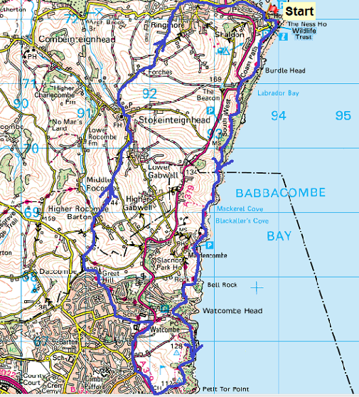
Start – Shaldon car park
Route –South West Coastal Path – Labrador Bay – Mackerel Cove – Maidencombe – Watcombe – Petit Tor Point – Torquay Golf Club – A379 – Watcombe – Great Hill – Higher Rocombe Barton – Stokeinteignhead – Forches – Ringmore – Shaldon
Distance – 10.5 miles Start time – 10am Time taken – 6hrs Highest Point – Great Hill 180 metres
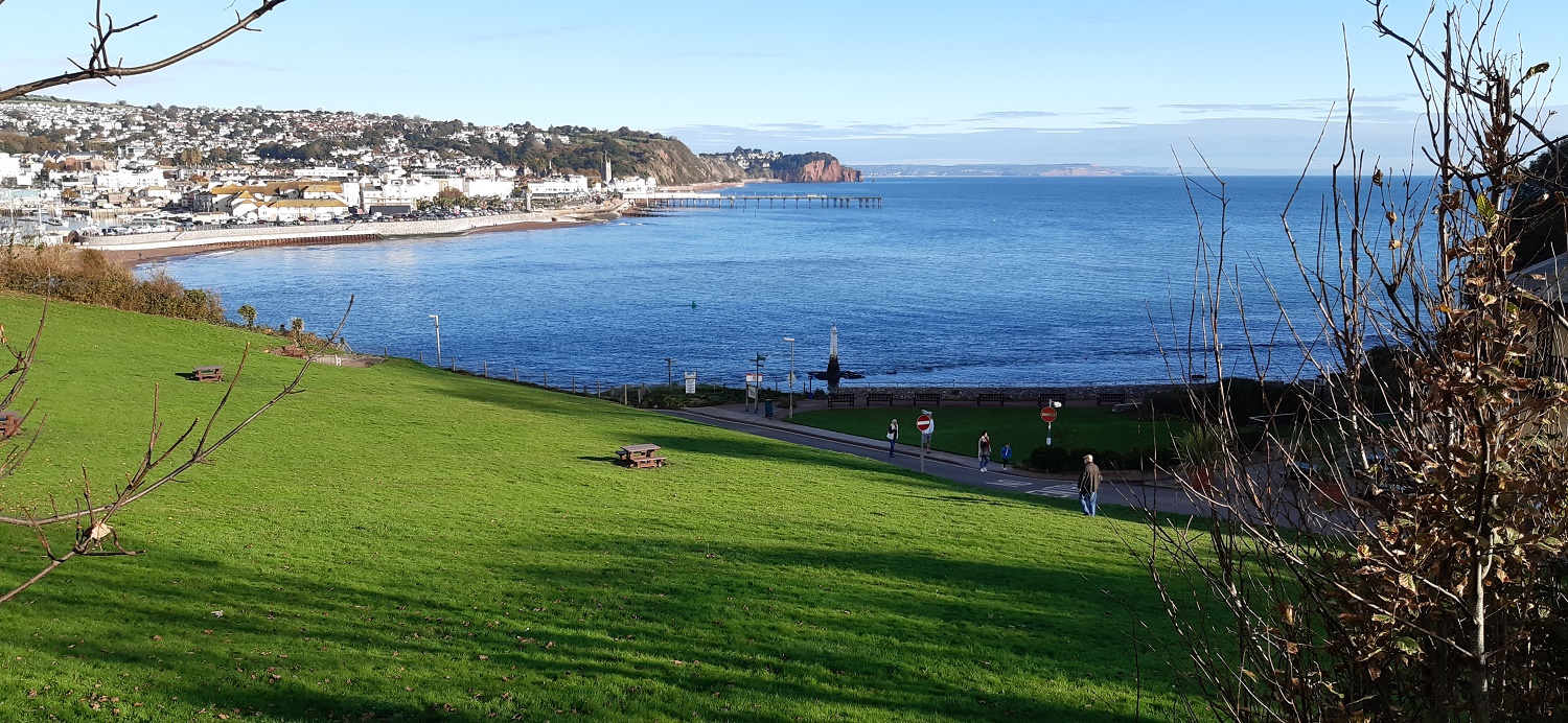
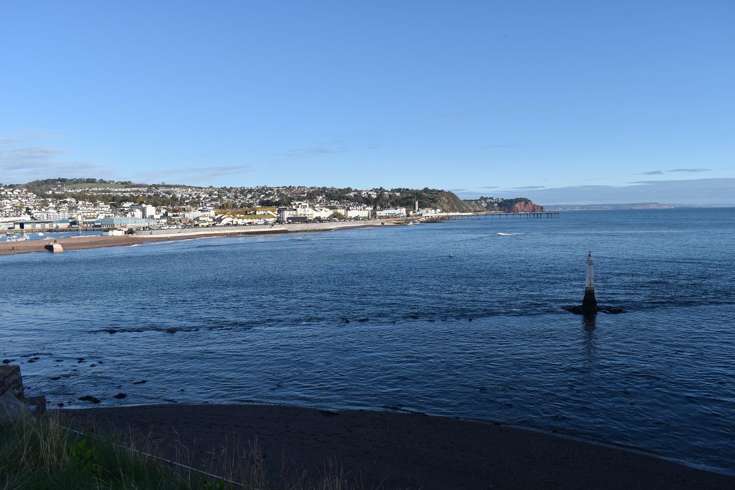
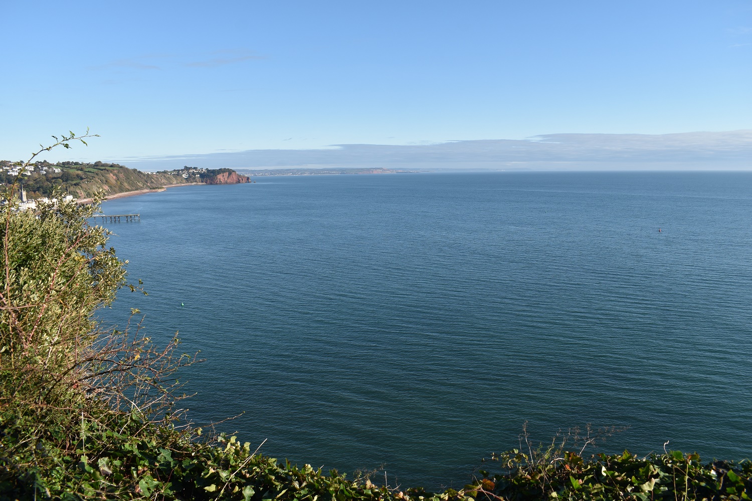
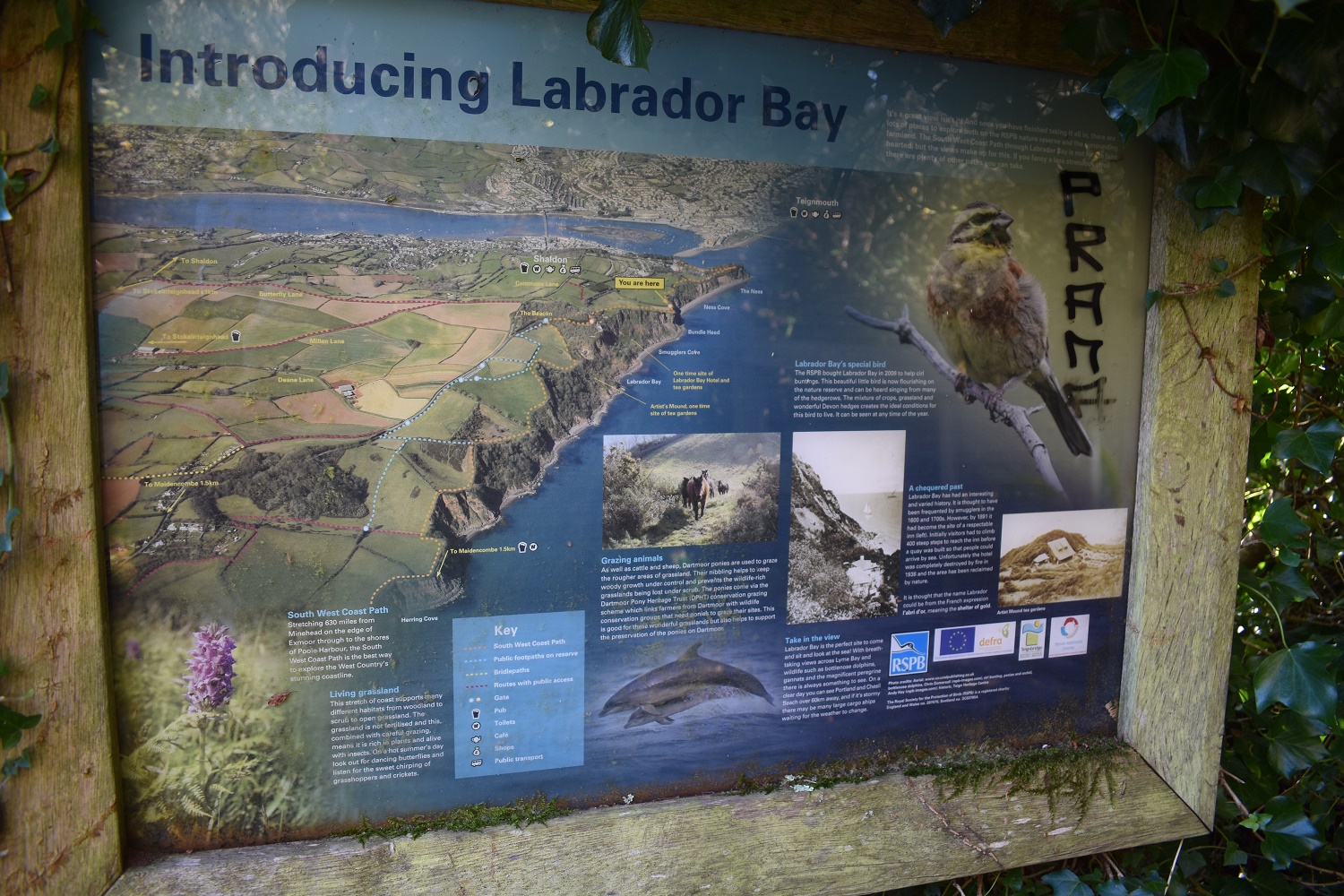
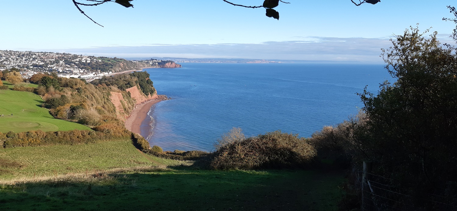
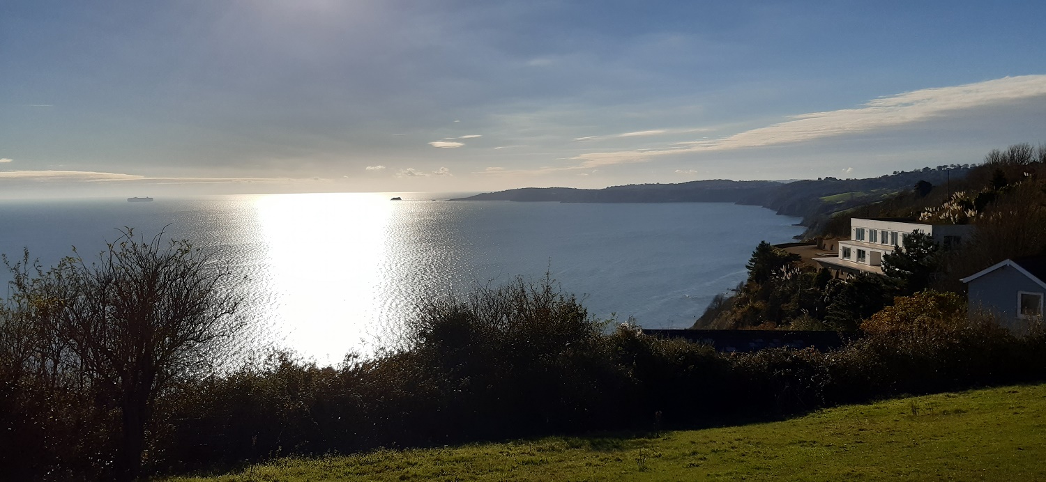
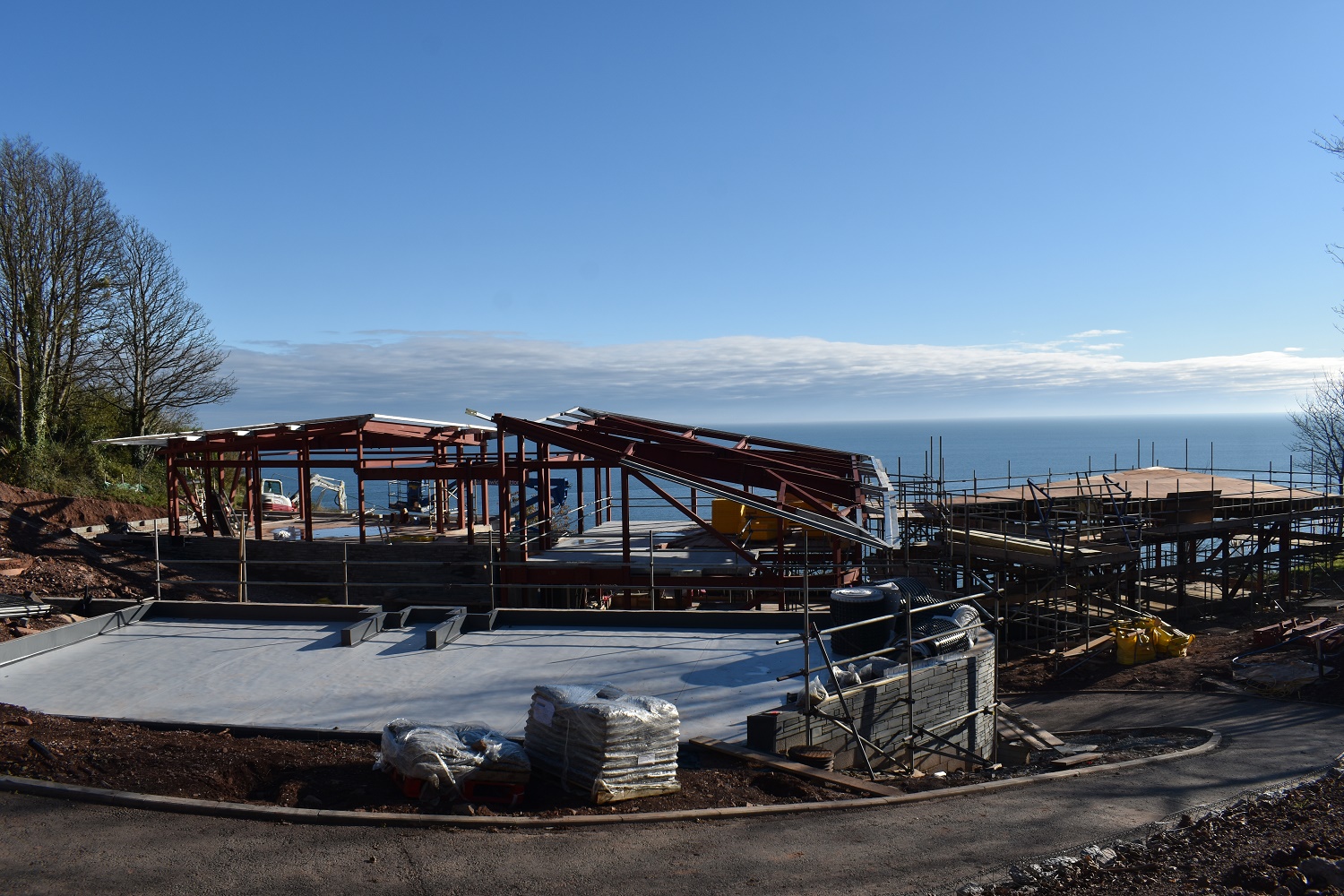
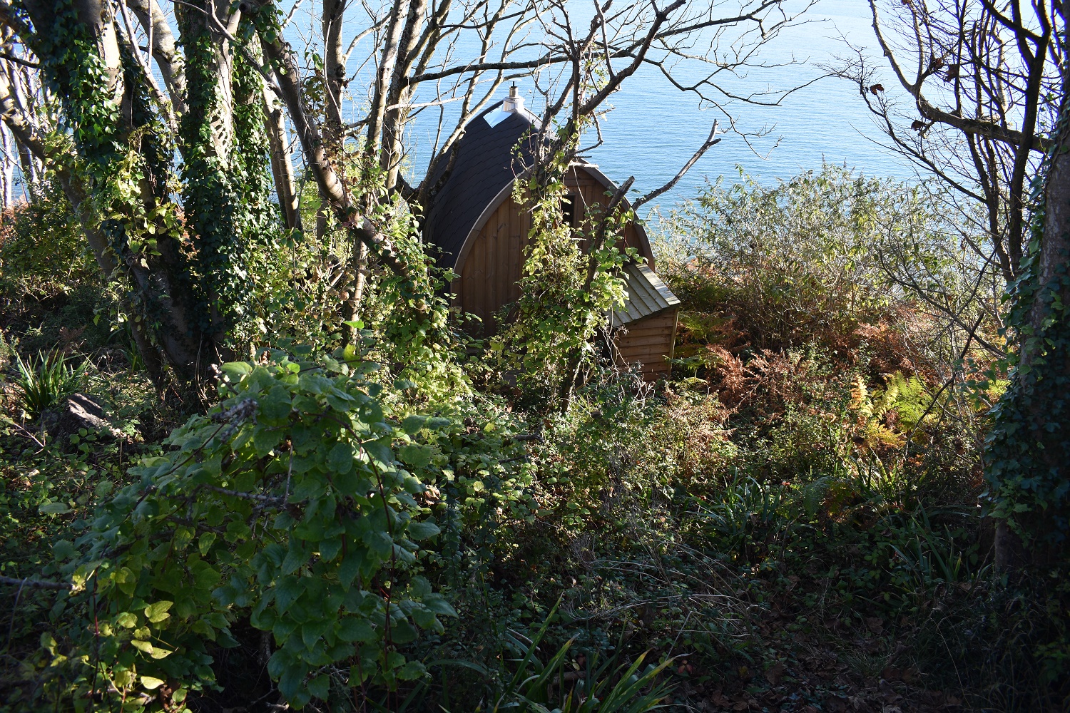
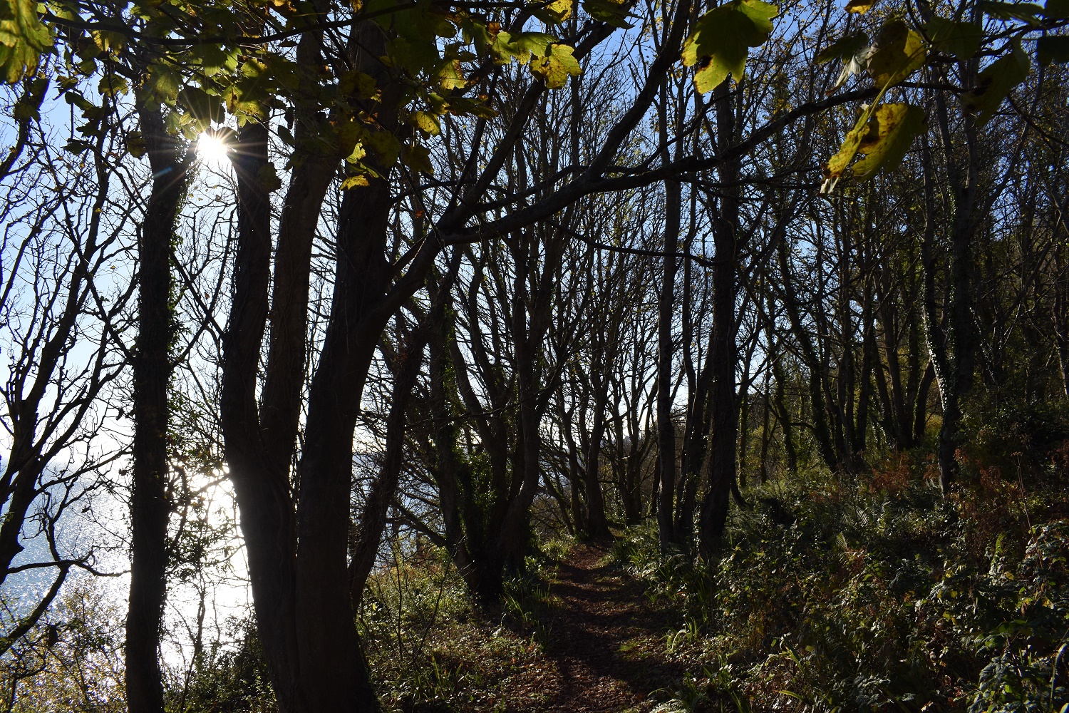
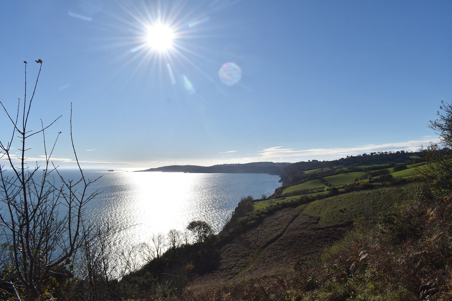
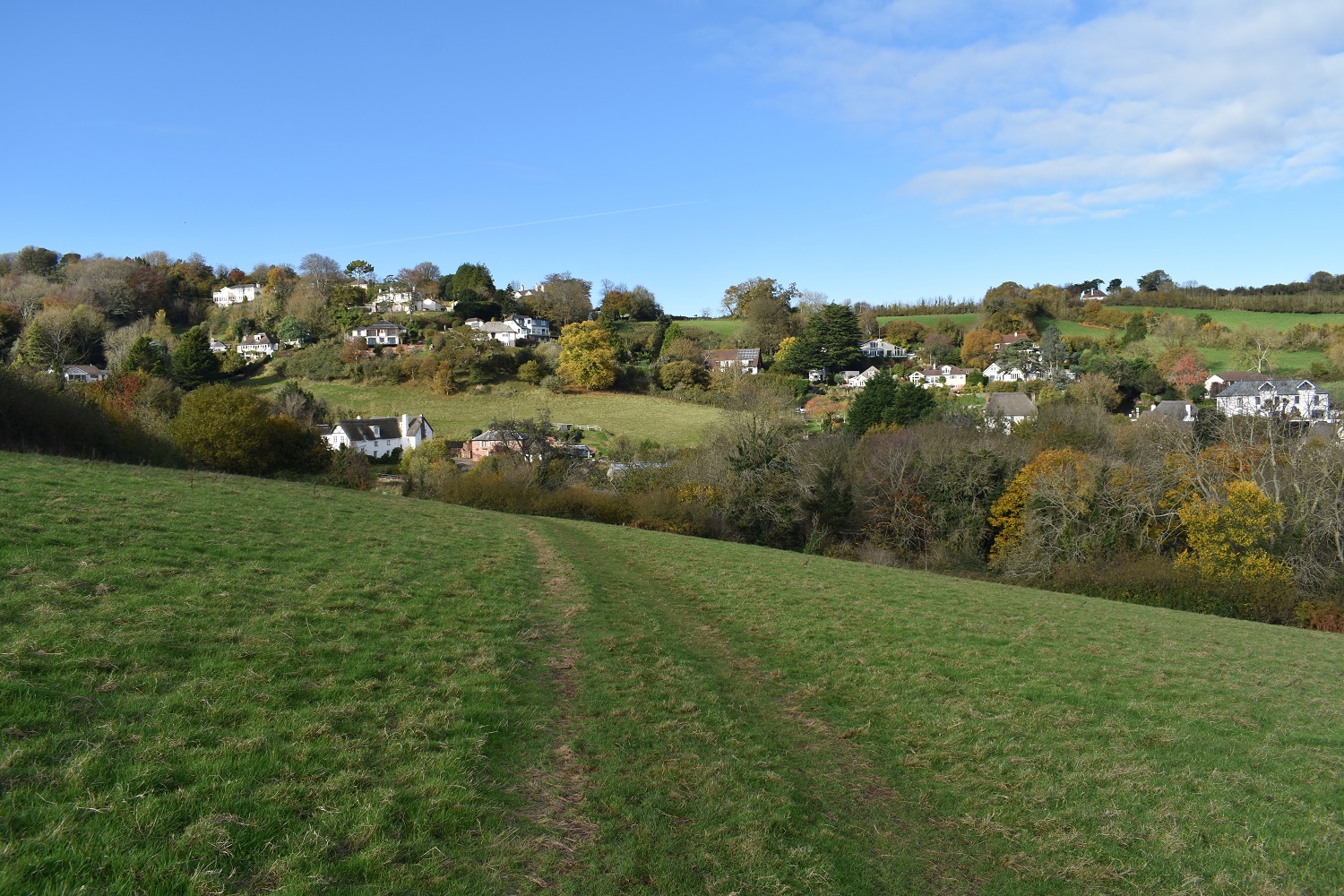
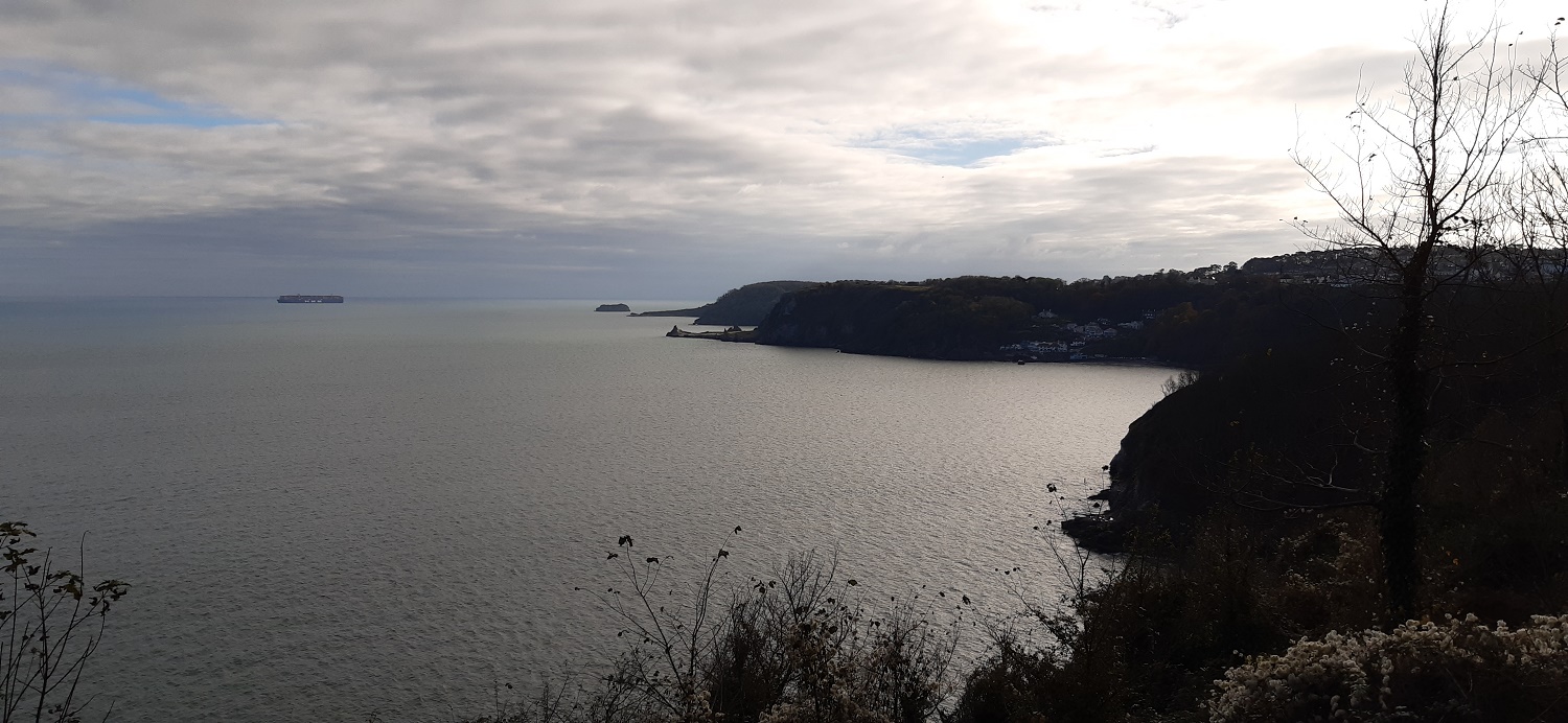
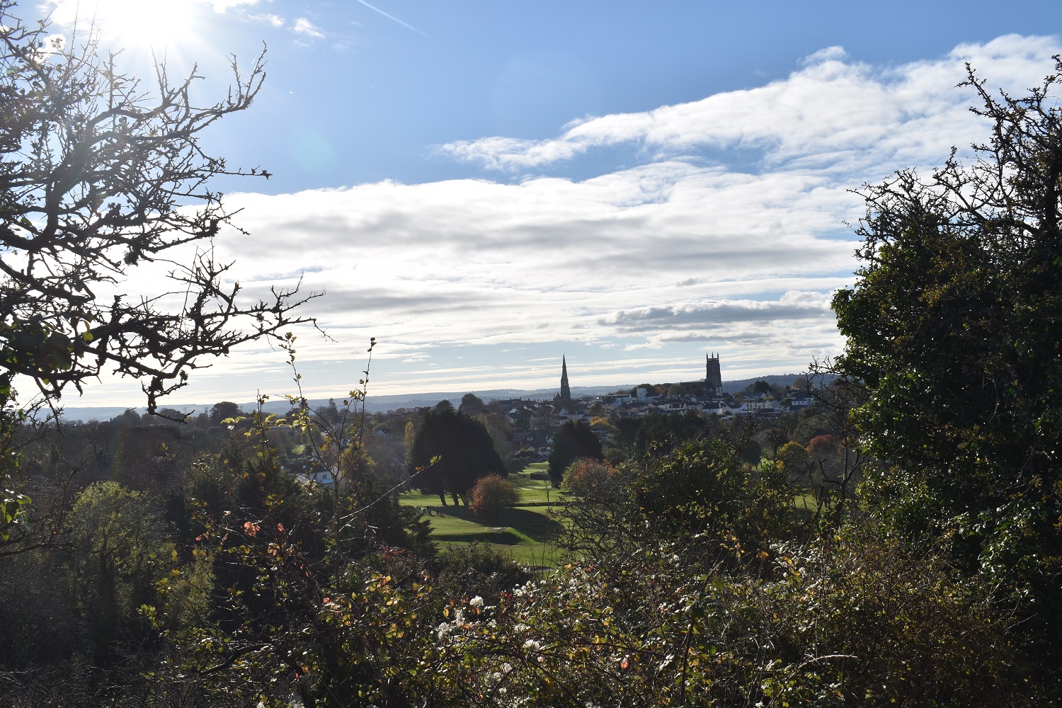
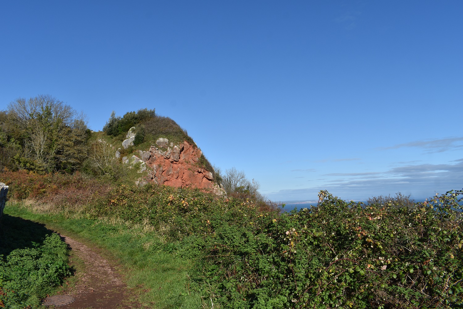
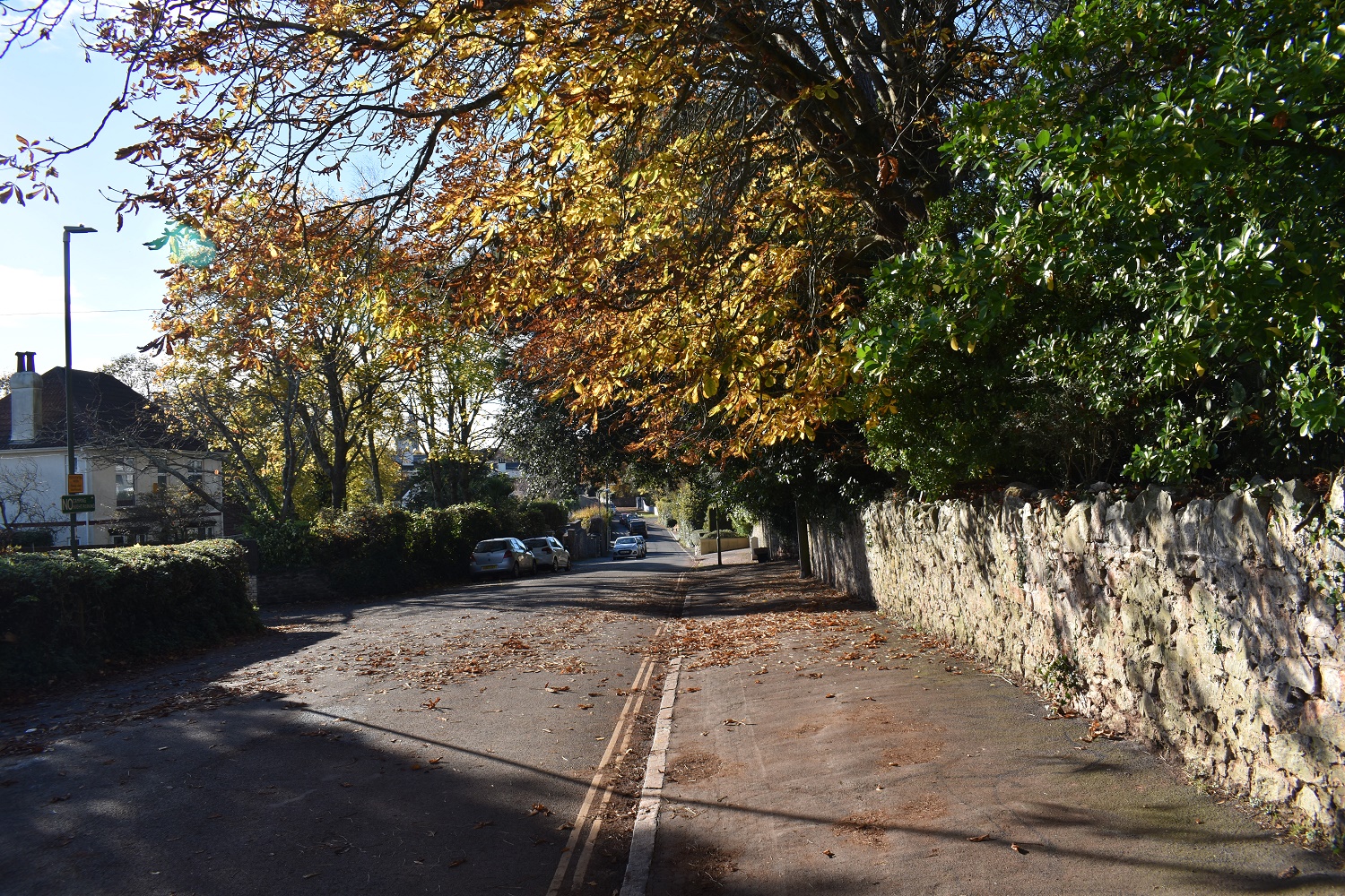
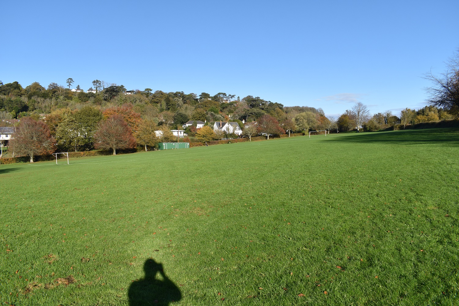
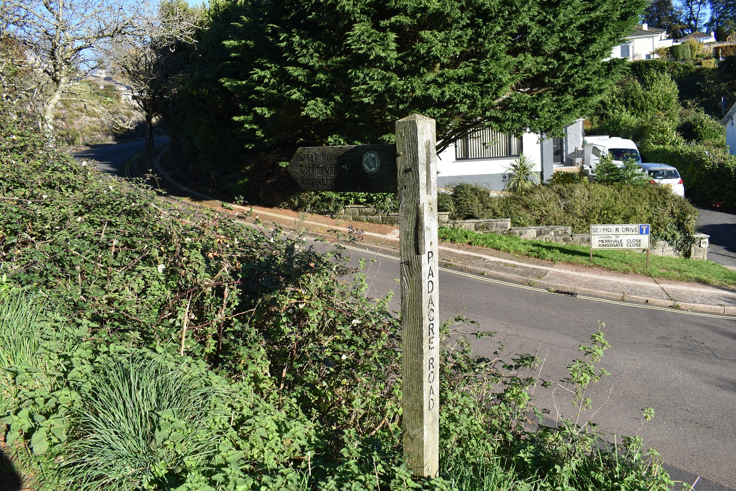
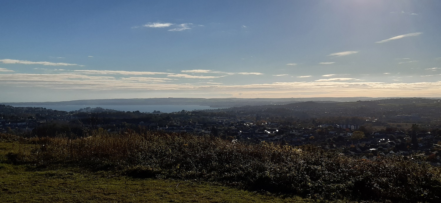
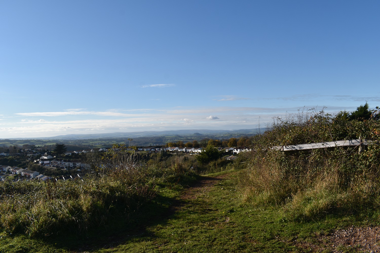
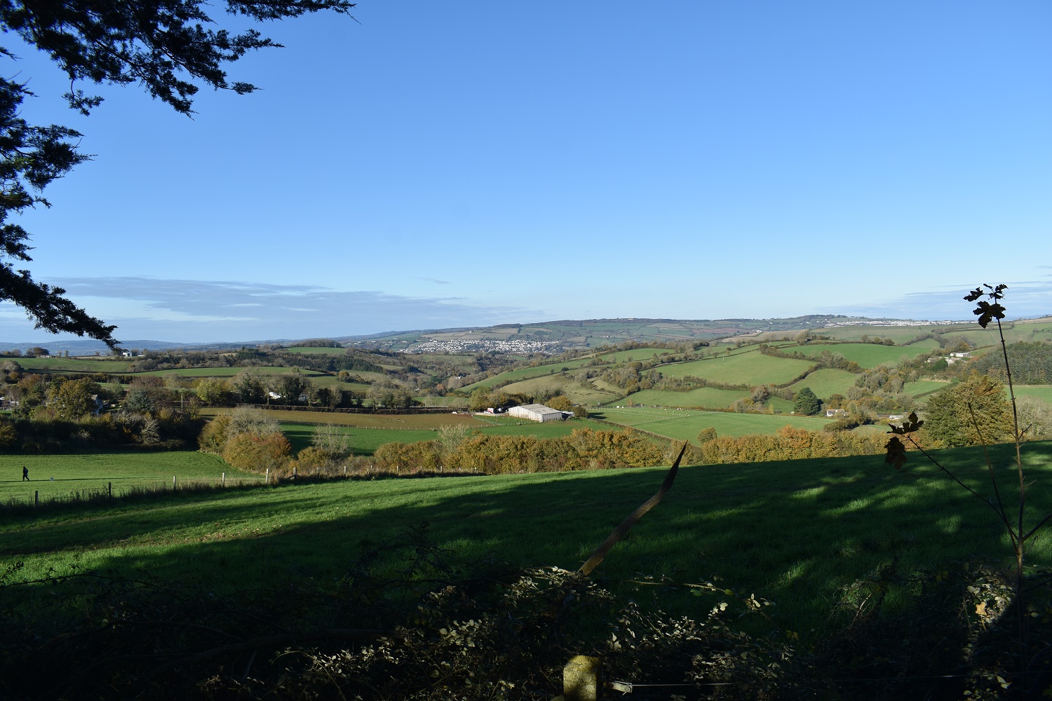
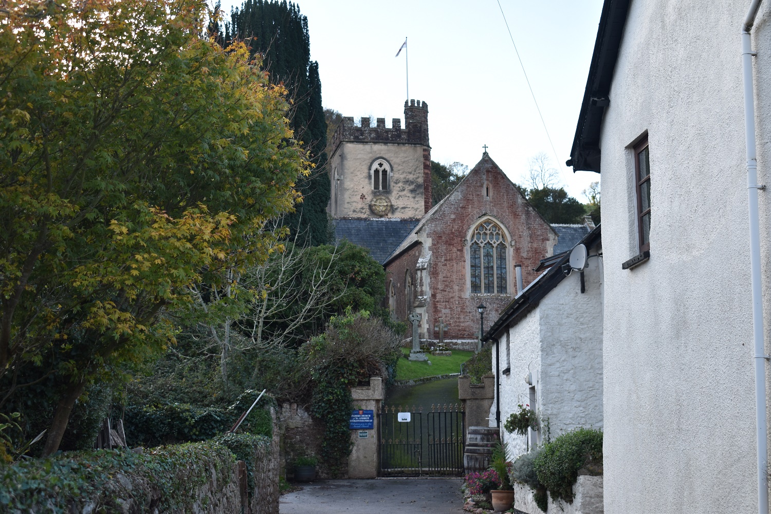
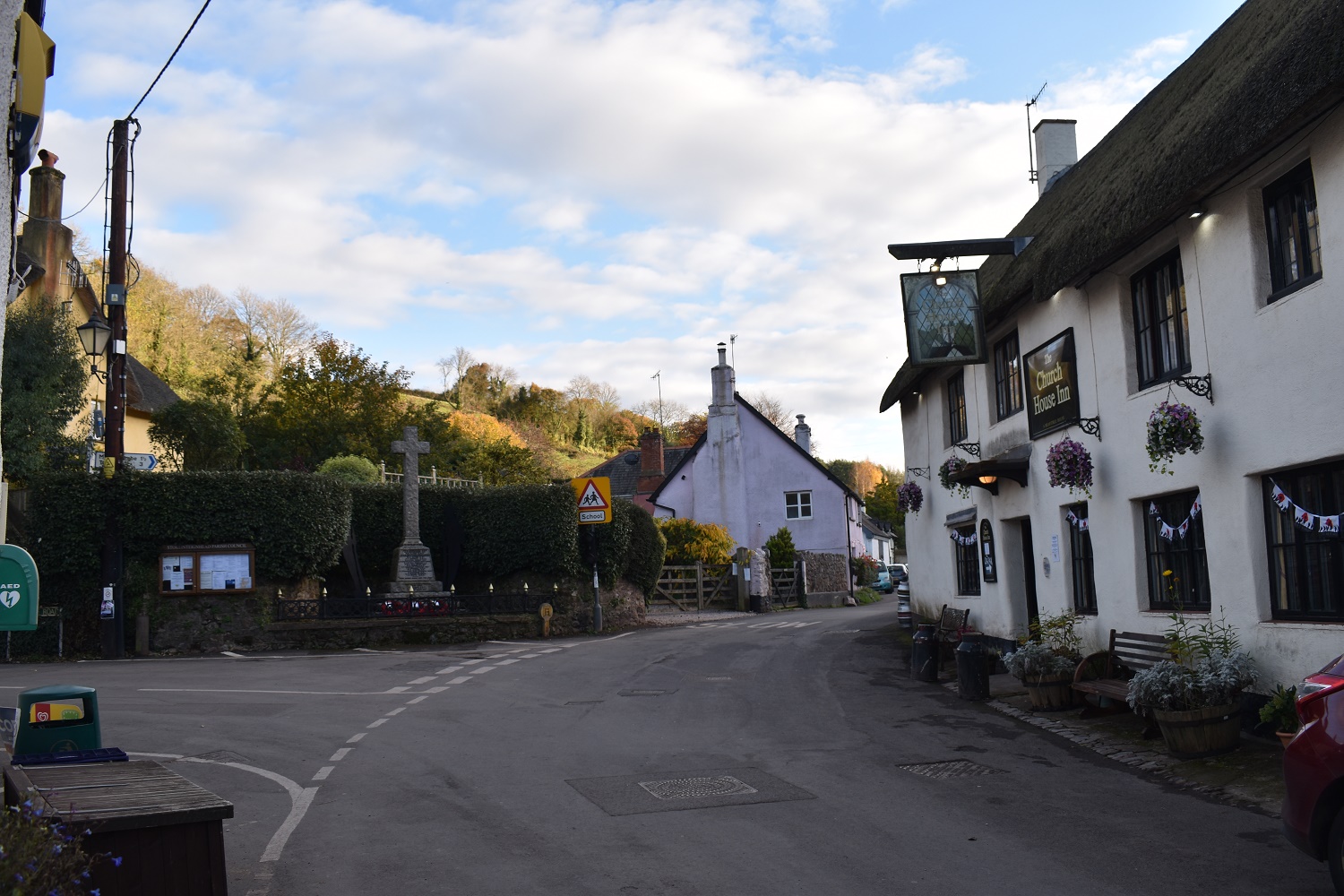
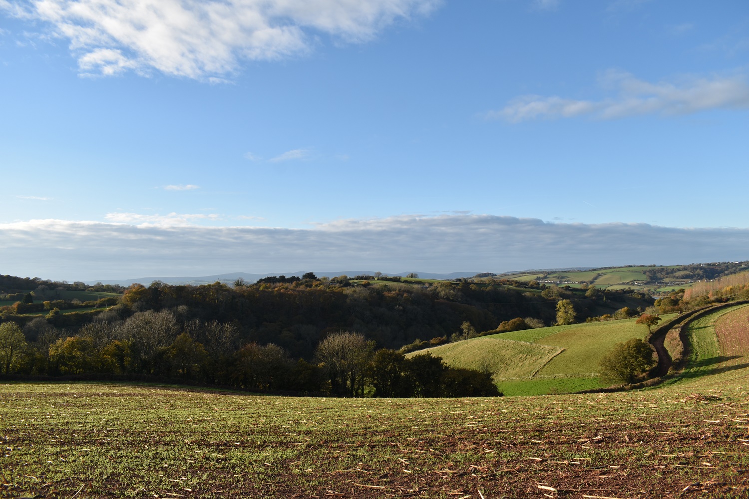
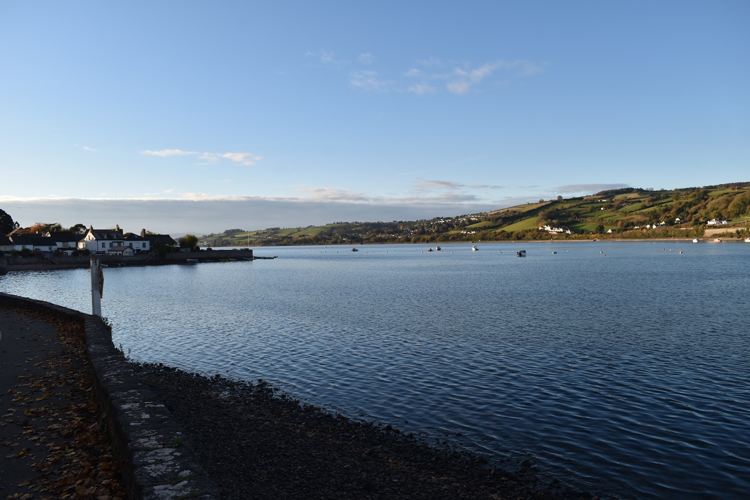
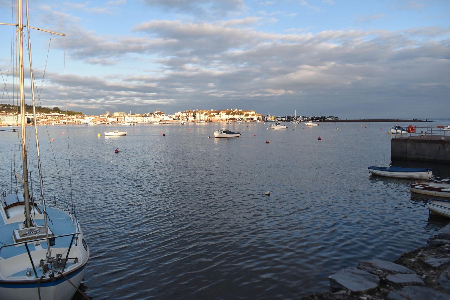
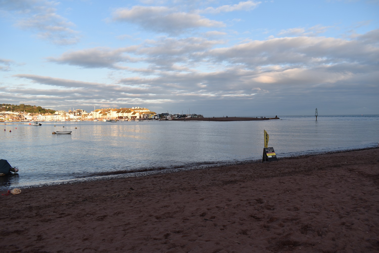
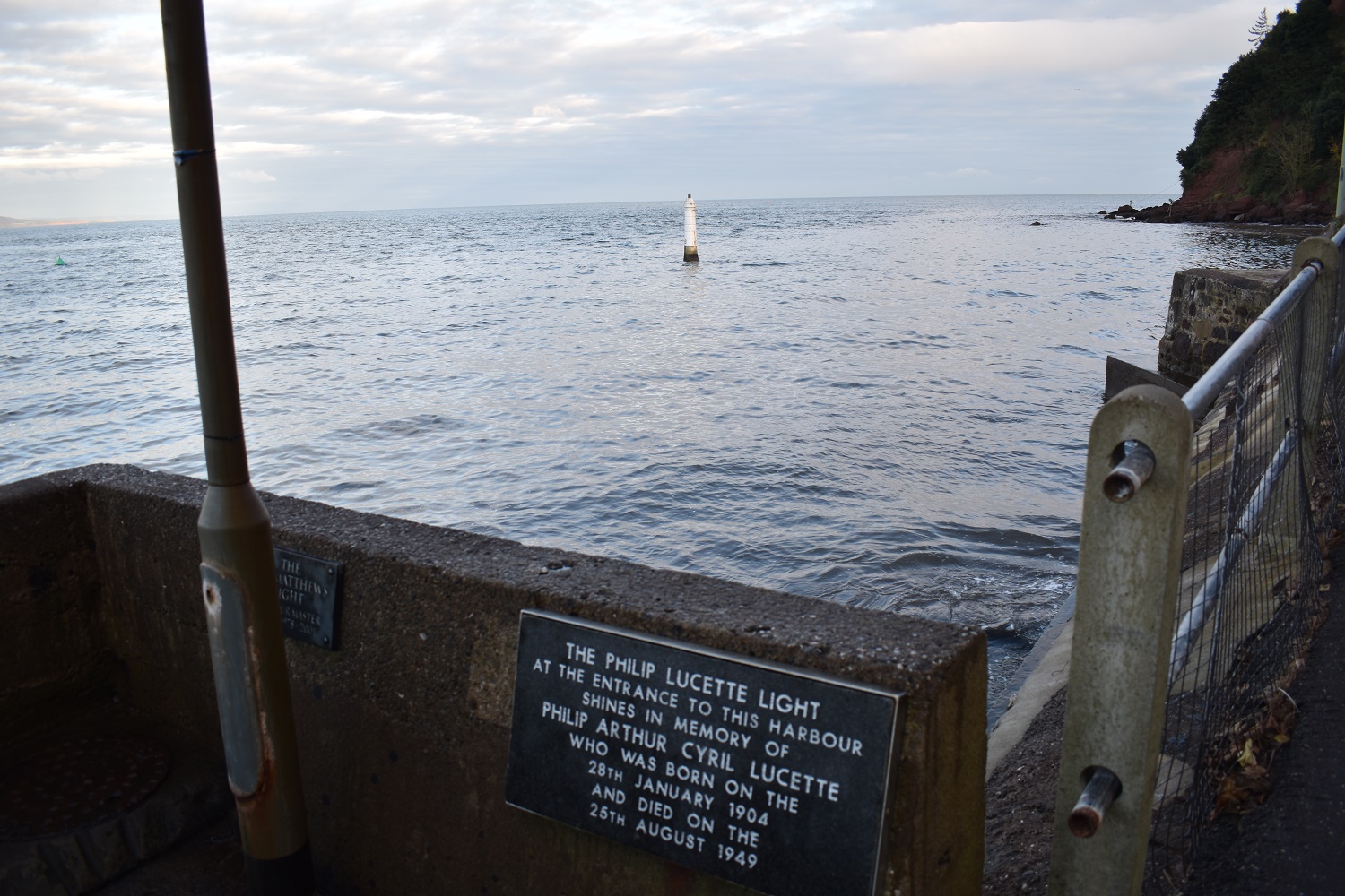
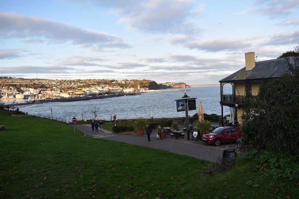
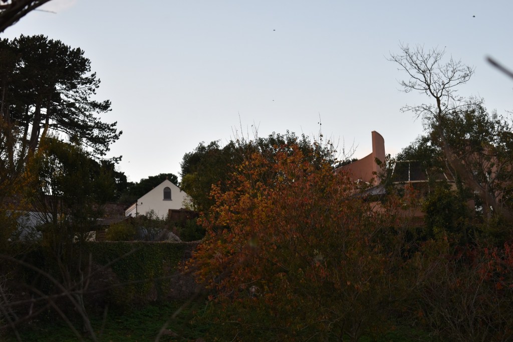
The car park on this side is a good one, a pound for the day on a Sunday (similar to my walk from Buckfastleigh to Pupers Hill recently) so that was a good start, there’s a pub/hotel down there on the right which is always worth keeping in mind. Finally the view from here isn’t too shabby across to Teignmouth and its pier.Down to Shaldon beach and the entrance/exit of the River Teign. The red cliffs in the distance are near to Dawlish and those familiar with the train journey to the south west will pass through those on the best train track section in this country.Climbing up now on to the cliffs to head towards Labrador BayThe info board, those who like birds will be interested in the many sightings of the cirl bunting here. I saw one so it can’t be that difficult to see themLabrador Bay as I climb further, the pitch and putt was popular this morning on the left of photo.The rock off the headland is the Ore Stone and one of those huge container ships is anchored to my leftA Grand Design perhaps. In a fine location for sure but if its another second home them I’m not interested and I hope it slides into the seaI’d prefer this to be honestWoodland walking on the cliff edge, the sun was glorious walking through hereBabbacombe Bay, looking across to Hope’s Nose and the Ore Stone, this walk will take me about 2/3rds of the way to the point before I turn inlandRed sandy cliffs all the way along hereThe village of Maidencombe, its tightly packed with steep roads on all sides, it has a pub, but it was too early for that, plus the parking for the pub was at a charge!!?I’m on the John Musgrove trail here rather than the coastal path as I took the wrong exit out of the car park in Maidencombe, not to worry as I rejoin it in those bushes right of centreI think that’s Babbacombe village down there as I round the corner and head for Watcombe woods and then the golf courseThe golf course is in front of me and parts can be seen here, beyond is St Mary Church, Babbacombe and on to TorquayI stopped at this point and headed inland along a road, I’m at Petit Tor Point which is to my right here, although the lump ahead of me is more prominent from the coastal path, it has a trig point on it if you are in doubt of your location.This is Petitor Road decked in autumn colours, at the far end is the golf club entrance and the A379I didn’t bother with photos along the A379 however I turned off at the secondary school and came to this field, I’m heading next left of this photo but I had to take a shot of one of the most sloped pitches I’ve ever seen. I estimated that the goal on the left is at least 3 posts lower than the right hand one, which puts it 8-10 metres lower. God help the team playing uphill and it surely means a game of two halves is in play here.Now I lost the John Musgrave path at the schools below as there were 3 next to each other and I had a nightmare wondering what the pickup times were like at 3pm with 2 primaries and a secondary all piling out around the same time. But I stuck to Padacre Road which brought me back on track and to the foot of the climb to Great HillThe view from Great Hill to TorbayAnd northwest ish towards the southern edge of DartmoorKingsteignton in the distance as I come out of the back of Great Hill and start to drop down to High Rocombe Barton along the John Musgrave trail.The church in StokeinteignheadAnd the pub, a half decent village this one and the food smelt good coming from the kitchen but I had my eye on the bar at the end of the walkThe Dartmoor hills in the distance and tors such as Haytor stood out even from this distanceNearing Forches now as the sun lowers a bit, it was about 3pm now and a road walk all the way to the estuary.I passed through the village of Ringmore and then down to the estuary, looking inland hereAnd then across to Teignmouth in the sunThe flag marks the point at where you would catch the ferry across to carry on your journey towards Poole if you were walking that wayThe tide is in now and the rocks below the harbour light are now covered unlike the start of this walkThe Ness, my refreshment stop and the end of the walk. I sat on one of those outdoor tables and enjoyed the view at the end of a fine walk in great weather.Before I headed home I noticed a curved building next to the car park and recognised the building from the Grand Designs programme. I remembered the white house behind had been a large family home and when they all left the old lady decided to build in the garden and sell the Georgian home she had lived in. I seem to remember the glass roof inside that spiral caused some tricky technical building works.
Great walk. You’re right, looking at the map it doesn’t look like the most thrilling section but plenty of grand views to be had. I really must plan more walks that involve a nice pub and a pint!
A pub at the end is the aim obviously, but I’ve been on a few walks now were pubs in the middle seems to be the better ones. These coastal walks are certainly passing plenty of hostelries but also my half Dartmoor half lanes walk have also thrown in a few as well. Bonus


Great walk. You’re right, looking at the map it doesn’t look like the most thrilling section but plenty of grand views to be had. I really must plan more walks that involve a nice pub and a pint!
LikeLiked by 1 person
A pub at the end is the aim obviously, but I’ve been on a few walks now were pubs in the middle seems to be the better ones. These coastal walks are certainly passing plenty of hostelries but also my half Dartmoor half lanes walk have also thrown in a few as well. Bonus
LikeLiked by 1 person