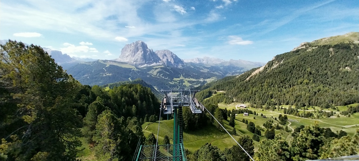
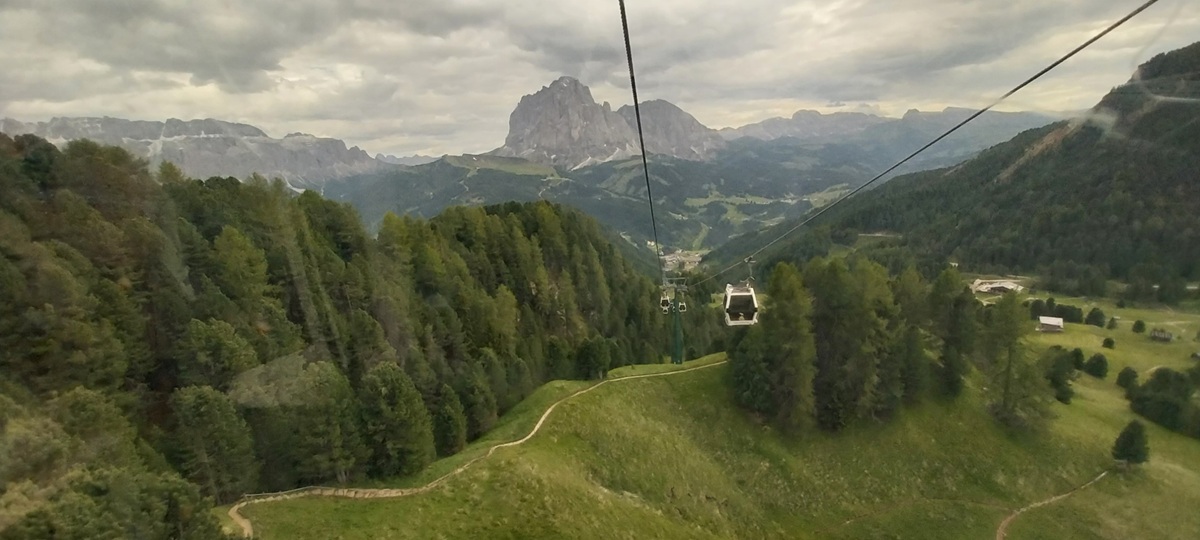
This would be Day 8 of our holiday and looking at the weather a great one for heading up high. I’d prebooked a cable car to Col Raiser before heading to Italy, but the booking on this cable car was for one use across the whole summer period, so we could choose the best day. As it was I was keen to just go up on a day were the sun shone and cloud was free from the tops, and we certainly picked a good day. If you read up on any mountain walking across the Alps and Dolomites, the rule is the same, go early and avoid any storms in the afternoons. As it was the cloud did build but no rain or hail fell, I’m putting that down to being early in the summer season and maybe June is a good month for that. June tends to be when the bus routes open, so do the refugios and the cable cars run more frequently. Winter is the real busy time here, with skiing and snowboarding ruling the slopes, but walking in the summer is popular, particularly with the daytrippers and those instagram folk, who are interested in ‘that’ photo. These routes and places are popular, especially in July and August. So June and September tend to be on the edges, places are opening and if you get lucky and the weather is clear, the buses will run and refreshments will be everywhere on the mountains. Enough of the “Wish you were here” holiday sales pitch and on with the walk. We woke to clear blue skies and headed out early, walking the cable car station near Santa Cristina and headed up the cable car to Col Raiser. Wildflower meadows abounded, small houses and huts dotted the lush green hills, paths snaked their way across the slopes, all headed for a destination where views left you spellbound. We headed off, the main routes were marked and labelled, we had an idea where we needed to get to first and picked paths which went roughly that way, all the time necks on full swivel admiring the views. Secada, Sassolungo, Stevia and the Sella range all grabbing attention. We arrived at a col around 2100metres, below the rise of Pic sitting around 2300 metres, we could have climbed that but we turned right and headed upwards to Seceda, all the way getting more excited for a view we’d seen on photos. Seceda sits around 2500 metres, with Col Raiser just above 1900 metres, so you have a bit of a walk and ascent still to get up. Its a far better route than heading up on the cable car from Ortisei to the summit, which has the same sense of achievement as the Snowdon railway (there is a lot of talk of that currently, obviously I’m with the hikers and fell runners who are pushing to the summit past those queueing to touch the top and move on, rather than getting off the railway to take their instagram photos at the summit).
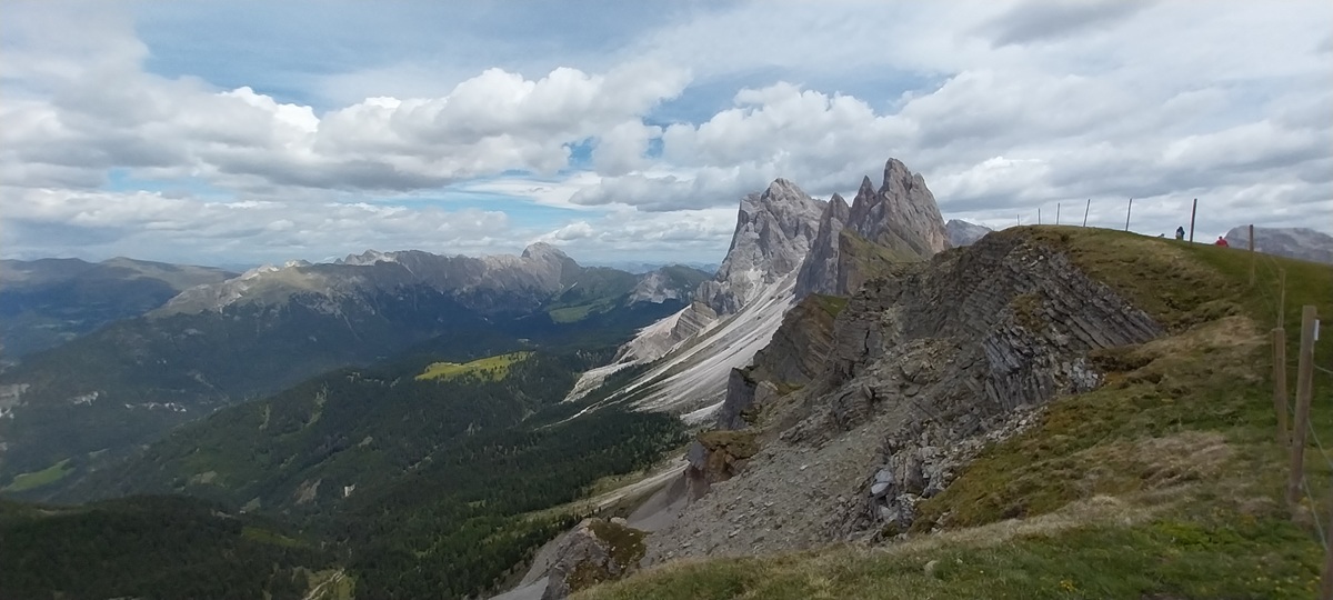
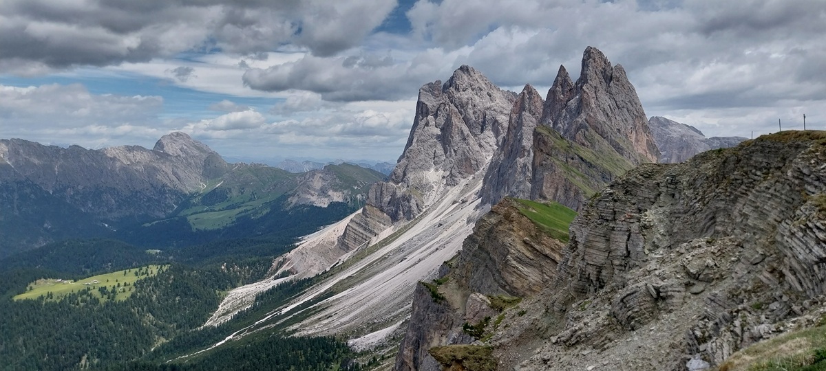
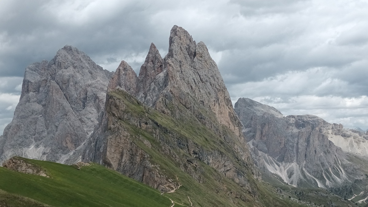
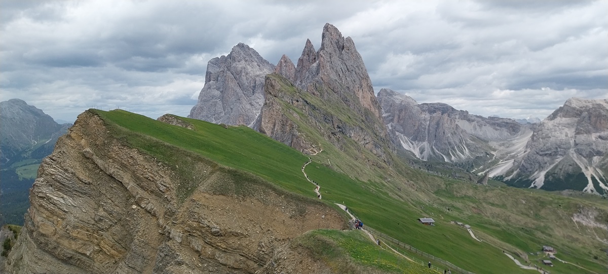
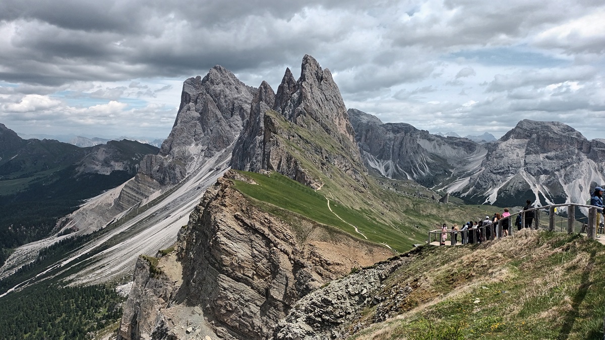
Anyhoo I digress, you soon arrive at the top and look along the ridgeline, its as amazing as you could only hope, you stand mouth open looking at Furchetta, Grande Fermeda and Sass Rigais, as they criss cross each other forming the ridge from your viewpoint. To the north is the Austrian Alps, south Sassolungo and to the right of the ridgeline are the meadows of the Puez Odle rising to Stevia and the Piz de Puez, behind you the Italian Alps, the views are 360 and dialled up to 11. The whole place is as a result of Africa and Europe smashing into each other and the limestone seabed being catapulted into the sky, full of coral reefs, yes its half the size of Mont Blanc, but it looks twice as good here. The name Dolomites comes from the 1800s and a French gentleman called Deodat de Gratet de Dolomieu, who named the rock which is everywhere, and the place is magic. Go up above 2500 metres and you get a moonscape of rocks, dusty trails linking the massifs, whilst the lush green wildflower meadows nestle below. Far too quickly we needed to head off, but not before walking the ridgeline, ahead of us we heard arguing, the result of a hut being erected by farmers, charging 5euros to walk the ridgeline. Previously you could walk across the grass and stand high above the 1000metre drops to the valleys, not now, ropes make you stay on path and the 5 euros seems silly to walk a path with no better views than you have before the hut. We dropped down to a lower path instead and then walked up further along to reach a col viewpoint. It was ok, but not really worth the effort, so we rejoined the lower path heading for Pieralongia and then the descent to Col Raiser again. We were tiring but made it to the Odles hut for refreshments, we could have stopped at 4 or 5 other refugio huts on the way but I feel the drinks are best at the end, so we did. I was a little emotional at this hut, having walked the walk I’d seen for 25 years, despite being thousands of miles from home, in a completely new place, I rarely got the map out, I’d looked at this place so often over the years and knew it like the back of my hand. We headed back down on the cable car and walked out heading for the apartment, turning to my right I saw a bus stop with people waiting. A quick search had a bus arriving in 5 minutes, heading for our apartment. Even better, by staying in accommodation in the area, it gave us free bus transport through the valleys, a scan of the QR code had us onboard and away. A fantastic end to a walk I can’t categorise, it was that good.
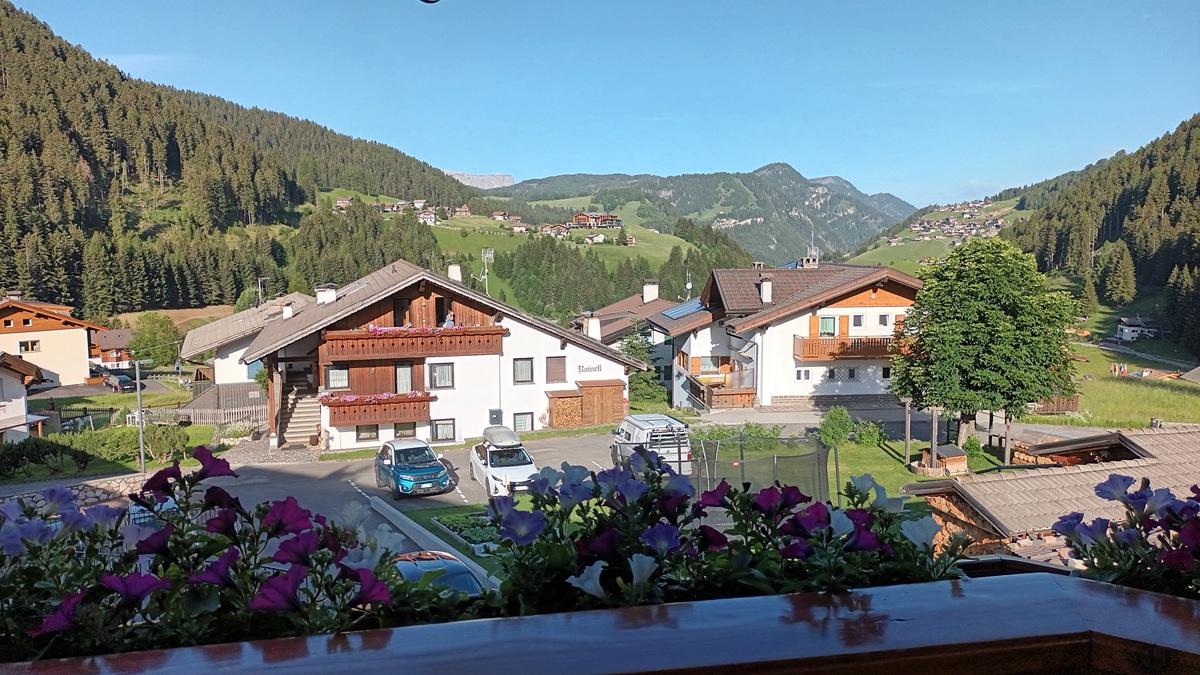
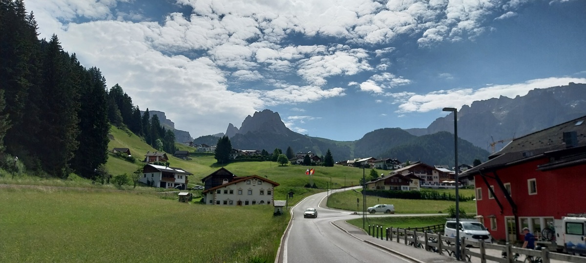
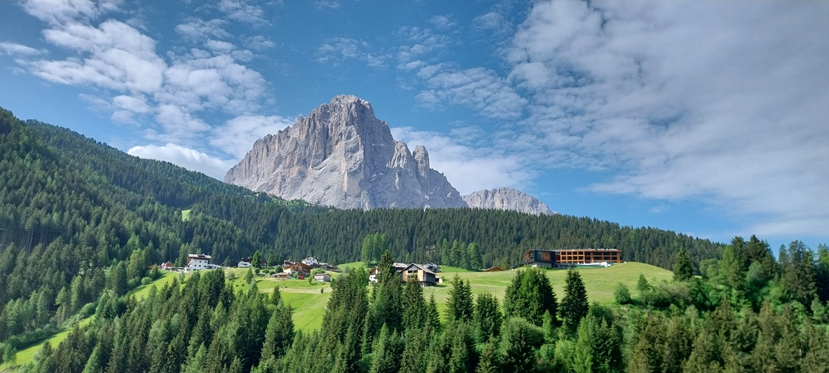
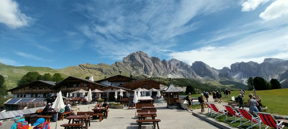
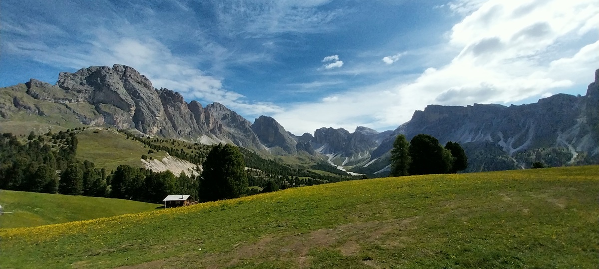
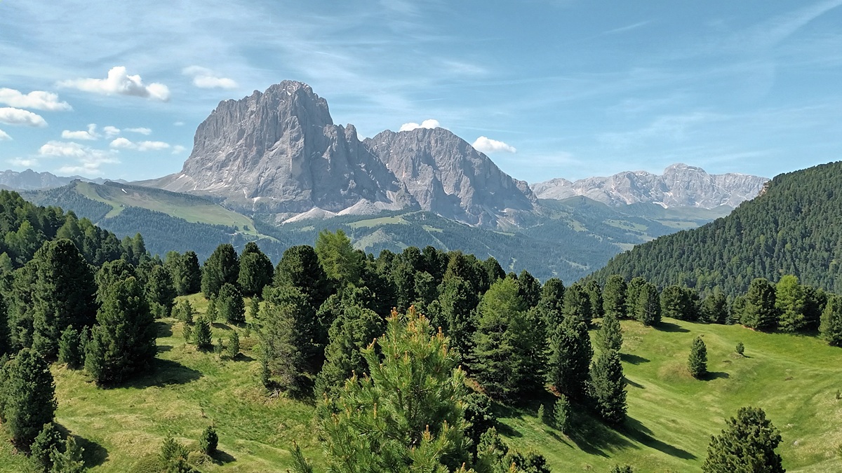
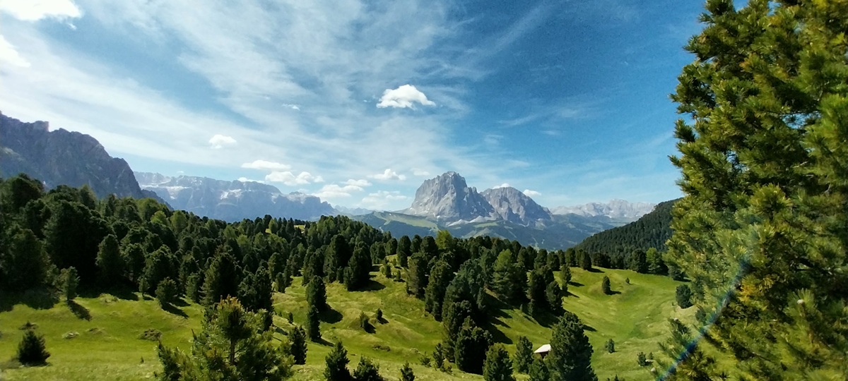
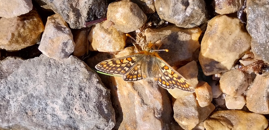
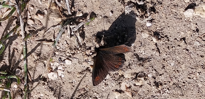
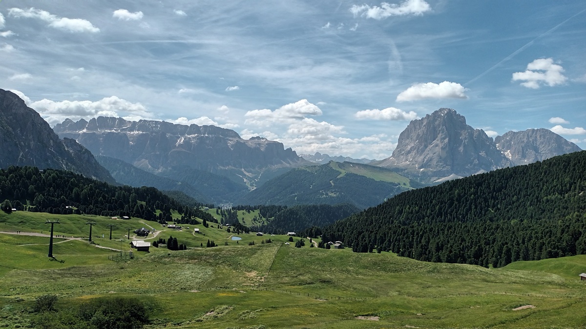
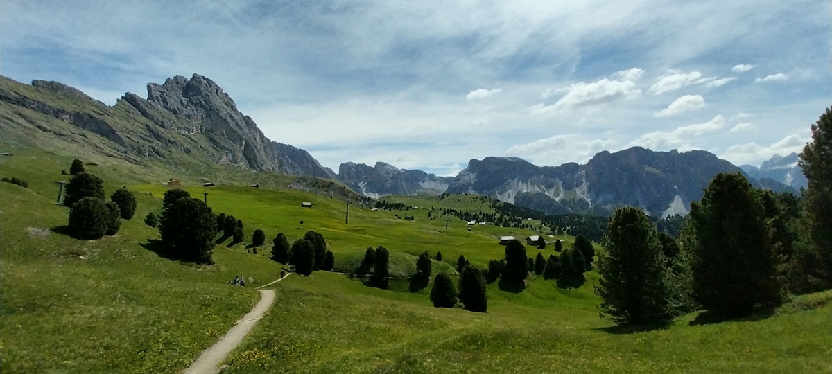
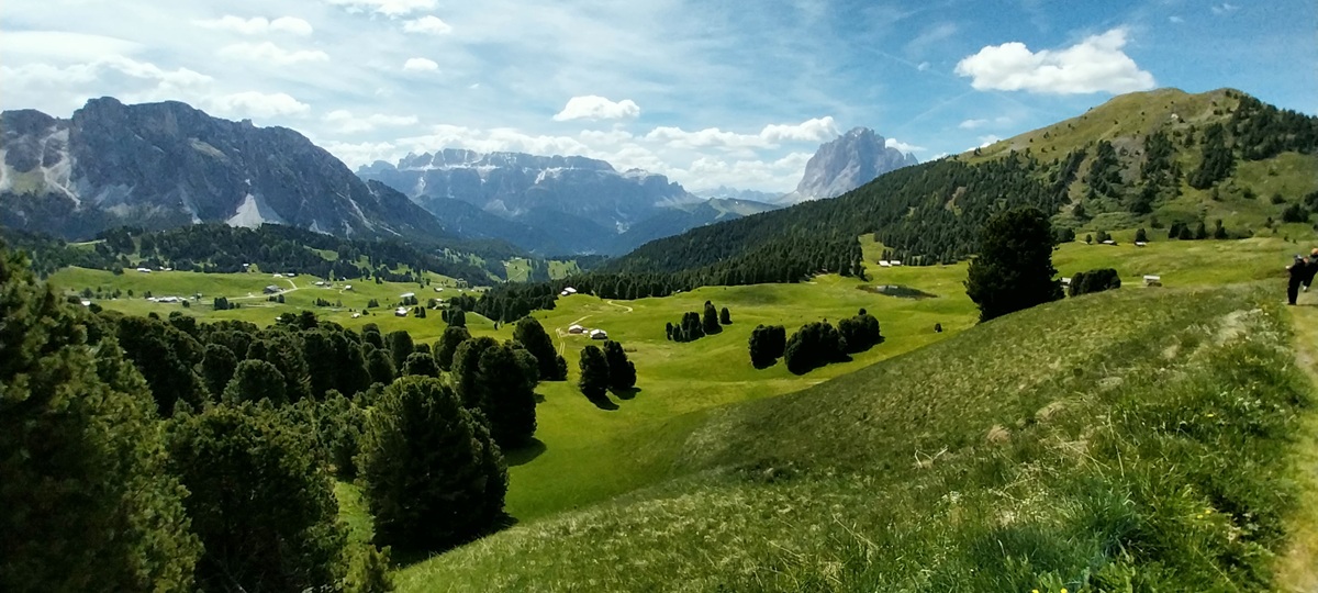
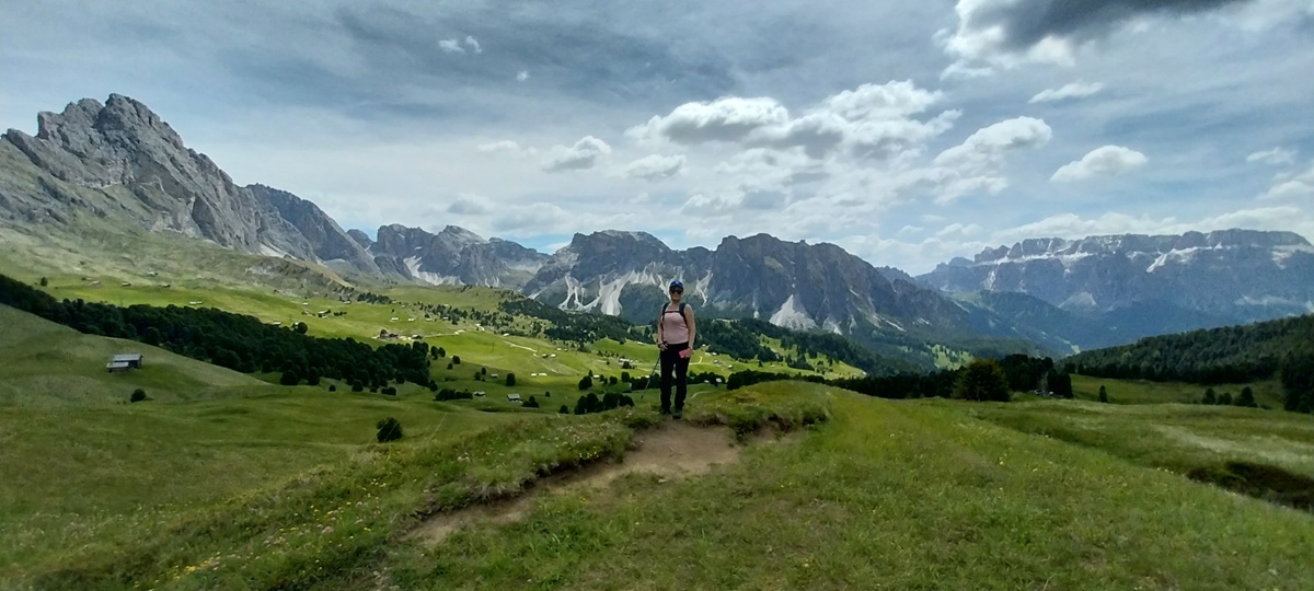
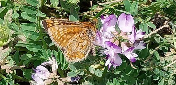
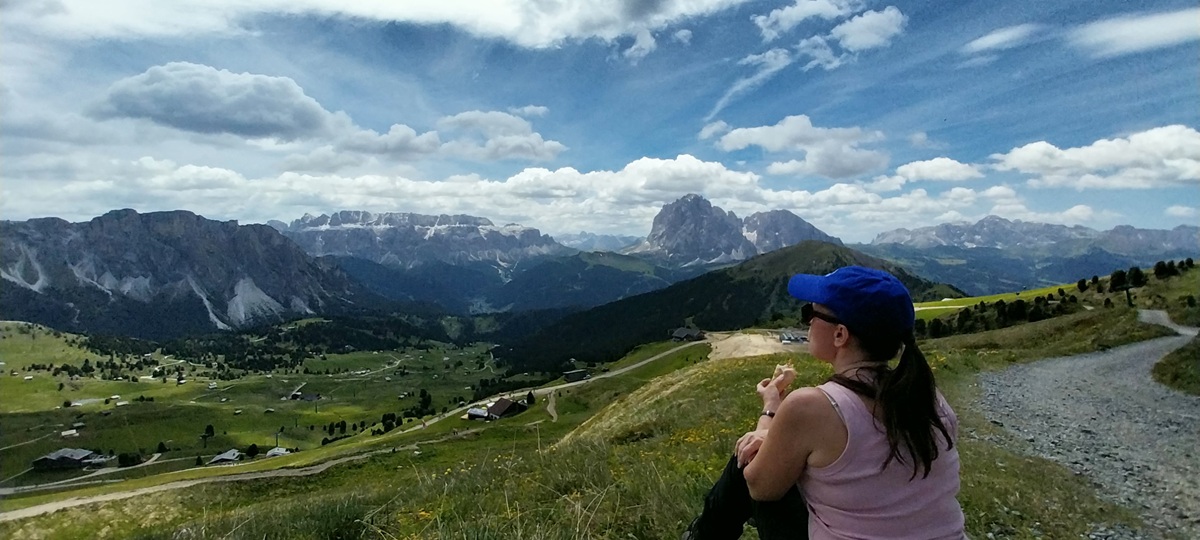
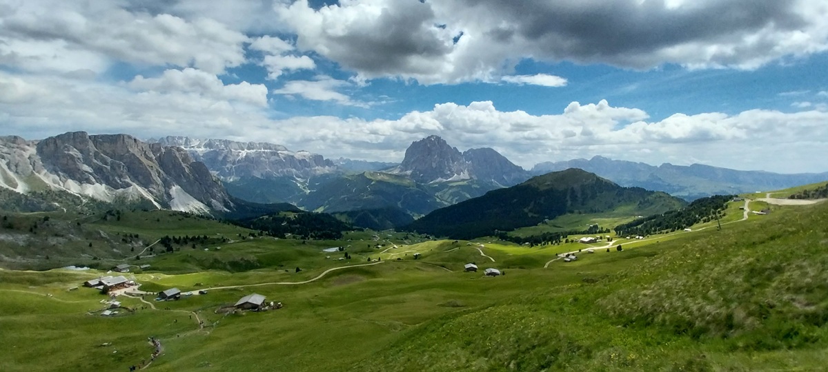
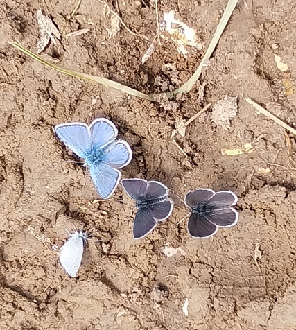
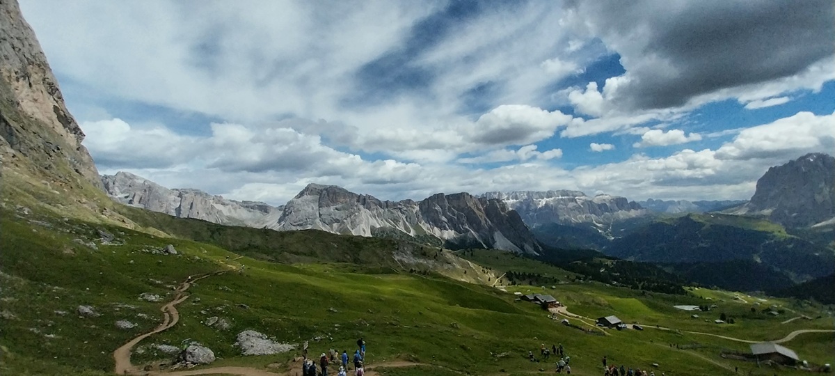
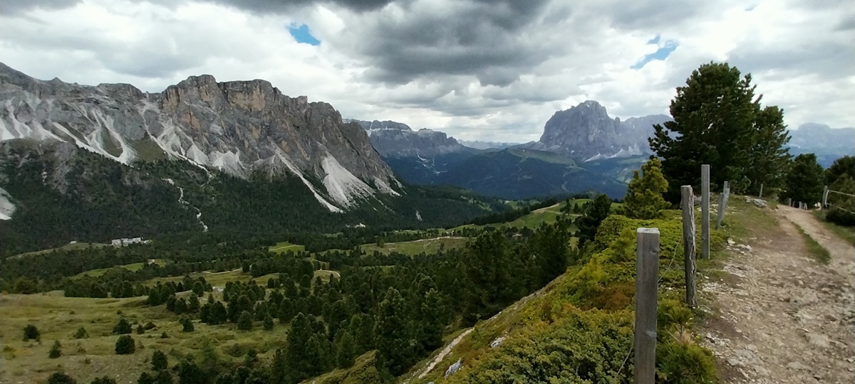
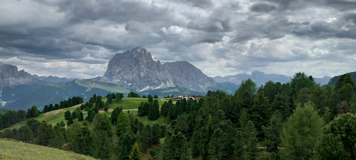
We woke early to clear blue skies, we would get ready, boot up and start out from the apartment, heading along the road towards that village on the hill on the right. We would turn up right into the pines before getting there to reach the cable car stationPizes da Cier is straight ahead and the Sella range to the right as we near the outskirts of Santa CristinaSassolungo would be in view for 90% of today and it was looking magnificent in the early sunshineSassolungo again, looking like its other worldly. Here we are nearing the Col Raiser Almhotel, having risen over pine woodlands and meadowsCol Raiser Almhotel and our first look at Seceda ridgeline and the main mountain range of Odle Giesler, on the right of the photo there is a girl in a burgundy top, walking out into the middle of the meadow to twirl around like Sound of Music whilst her boyfriend lay in the flowers videoing her. We hoped that would be the last time we saw that and the ignorance not to walk on the meadows as the signs said.Looking into the Odle Geisler range, Sas Rigais is the highest point at 3025 metres on the left, round to the right is Piz Duleda at 2909. In the centre in what looks like a dip, is the Cresta Da Lungiaru, its actually sitting around 2600 metres and it connects Mont de Stevia just out of photo on the right to Odle GieslerWe started out on the main path 4A followed by number 2 to set us off from Col Raiser, but we soon left that busy path, heading for Cuca, a col between Pic and Seceda. This would give us a quieter route and chance to take in the meadows and the paths that meandered through pines and around small lakesSassolungo still in view though, looking absolutely massive from here at 3181metres, with Sassopiatto sticking out to the right at a measly 2964. Its famous for the coffin cable cars to get you to the refugio in the col near the summit (have a search on the internet for them!!). The mountain range to the right of Sassolungo in the distance is Catinaccio D’Antermoia, which is just over 3000 metresJust stunning up hereThe paths had some small streams crossing them as we walked, butterflies gathered to drink all around them, hundreds and hundreds of them. We had a coffee and I took some photos, and first is a Marsh Fritillary
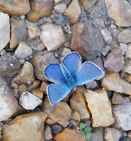
Common blue
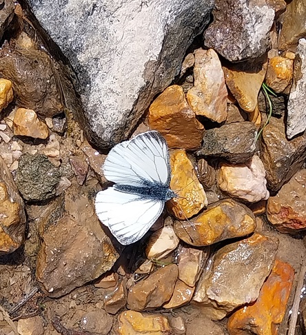
A male Green Veined White
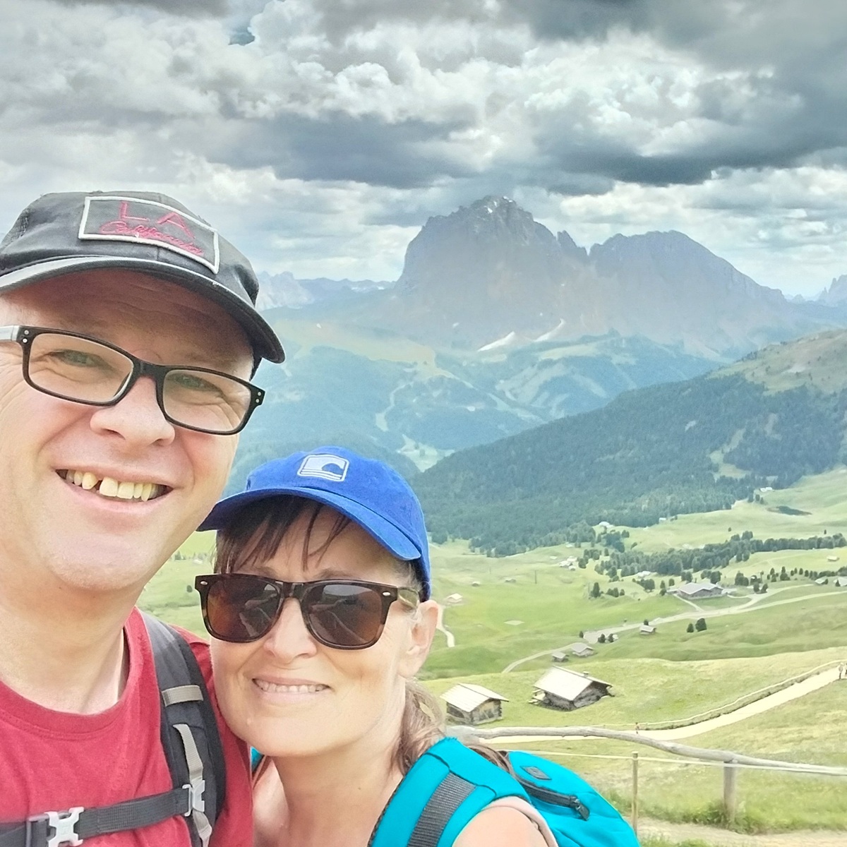
Woodland RingletOnwards with the walk, a stunning place as we walked past Lech SantWe’d pretty much walked across the centre of this photo, contouring across the hillside to reach Cuca at around 2160metres, so only a 200 metre climb from Col Raiser. However next we needed to go left and upwards to SecedaThat’s Pic on the right, its got a fab viewpoint down to Ortesei, Santa Cristina and the whole Val GardenaLinda and the Odle Geisler up to the left, Stevia above her and Sella to the right
Marsh Fritillary
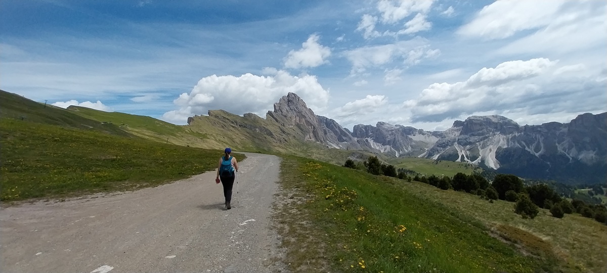
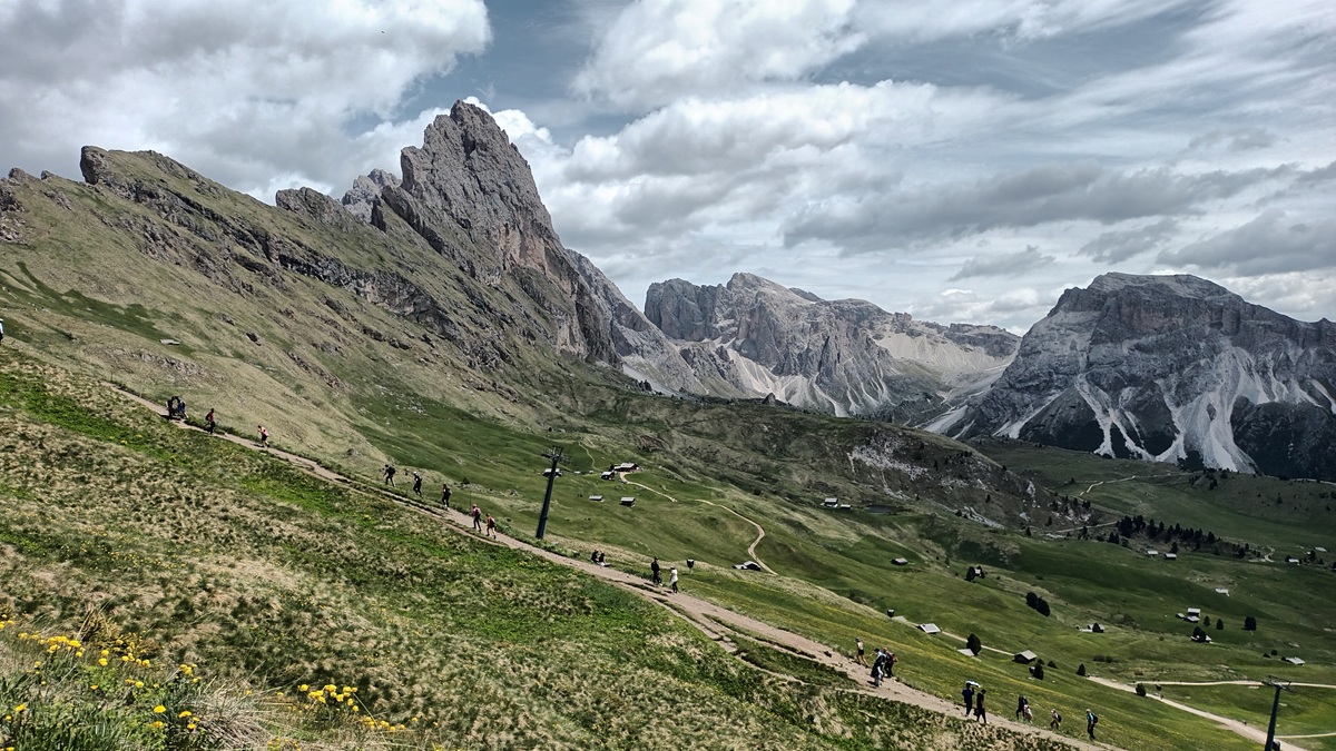
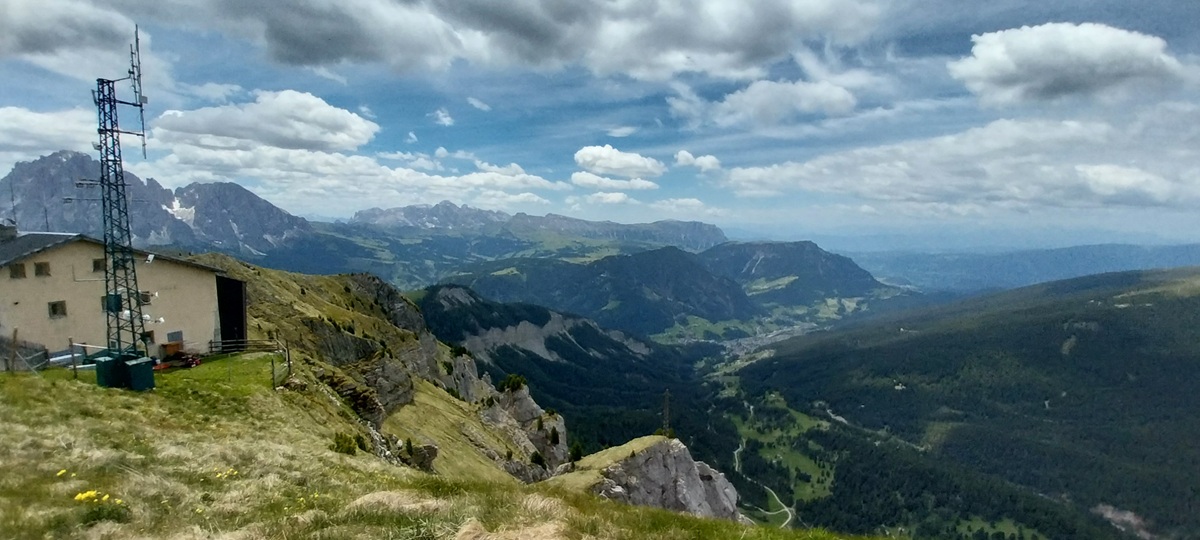
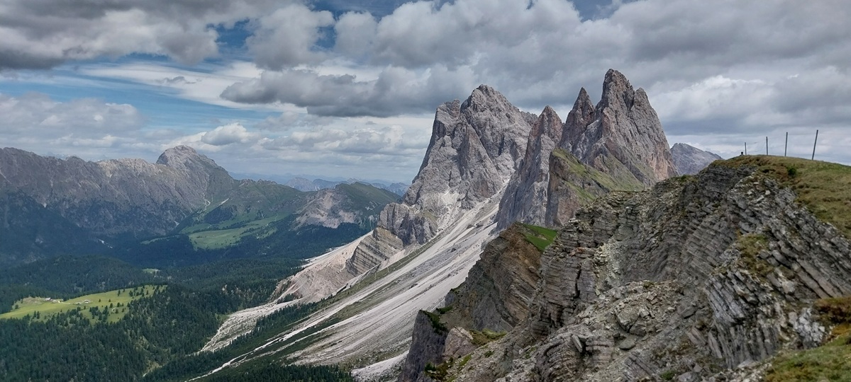
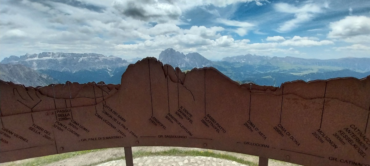
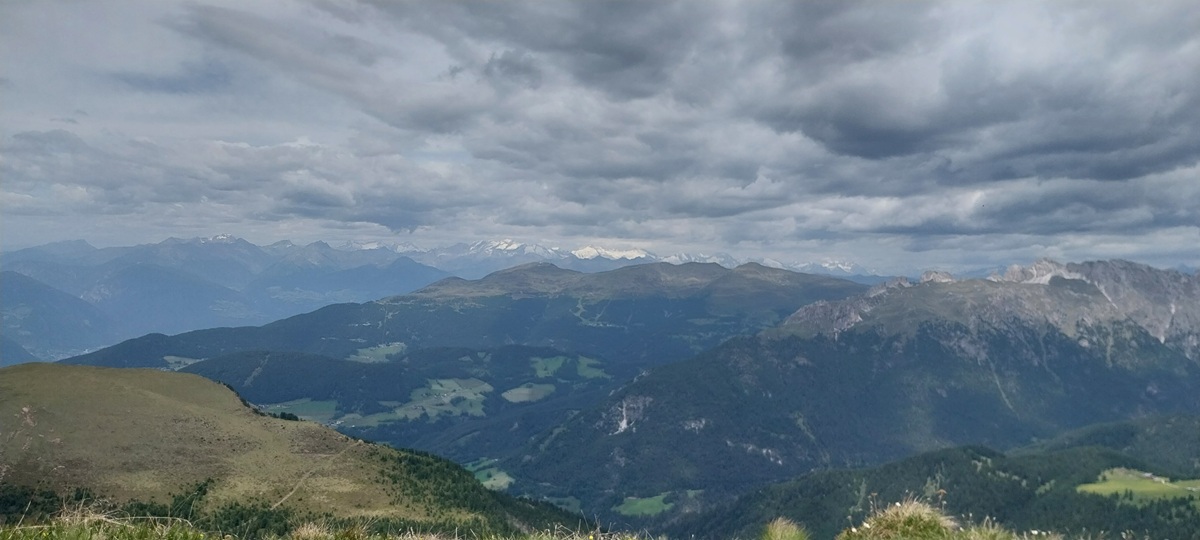
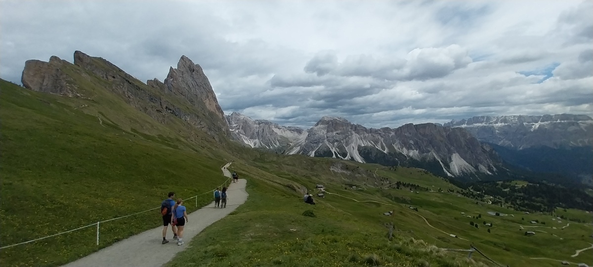
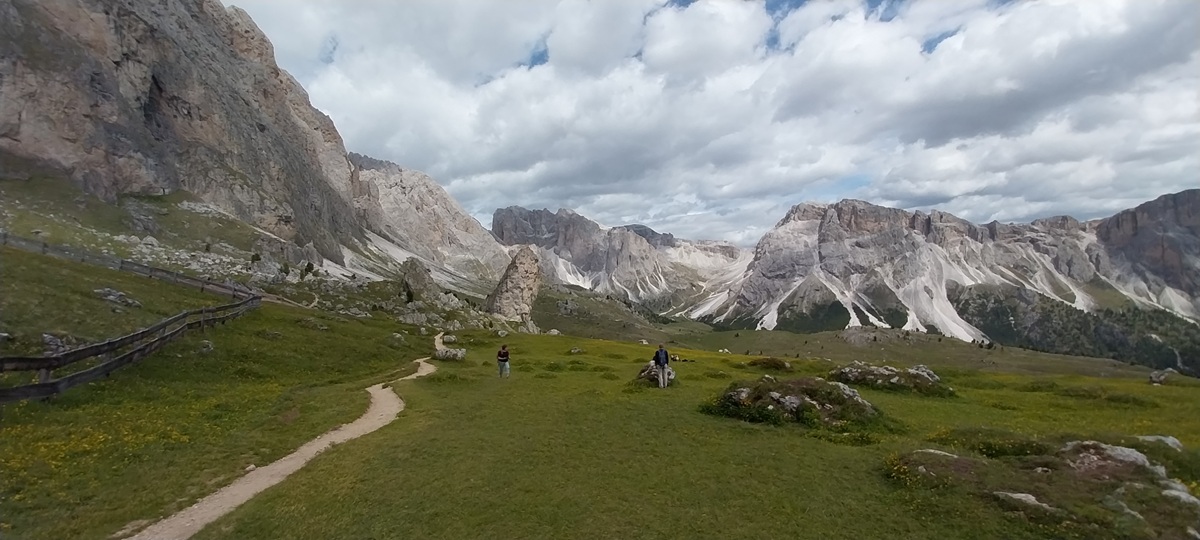
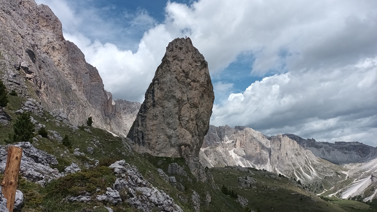
Looking back to Pic as we climbed from the col at Cuca below. We’d stood by the hut you can see down there and watched three guys in just speedos and boots walking up towards us, I bet they were American, Linda prayed they weren’t English, they turned out to be Spanish and had climbed up from Ortesei below, so they were 2/3rds of the way to Seceda now The path eases a little and zigzags up the hillside, views everywhere as the profile of the ridgeline starts to take shapeBefore we rejoined the busy path up, we stopped for lunch with one hell of a view. Col Raiser is down on the left edge of the photo on that grassy hillThe busy path can be seen below and the razor like ridgeline is above. Piz Duleda over to the right peeking up at the backThe cable car station to Ortesei on the left and Ortesei itself can be seen in the valley below. The cable car from Ortesei was around 50euros each return when we came here, the Col Raiser one was 36euros. Hence our choice of route and walk.Odle Geisler ridgeline from Seceda, 1000metres of drop to the left and one of the most stunning things I’ve seen. The two high points along the ridge are Gran Fermeda and Sas Rigais behind. Below left is the Villnoss valley Back left is Sass di PutiaWider photoA stunning place with the Fermeda towers in front and Sas Rigais behind. It was around this point that Linda photobombed a duo doing Instagram poses for their tripod camera. One of them laughed, one not so much 🤣At the summit was this clever ridge profile, made of metal and naming every summit you could see, from Sassolungo to the south and the Austrian Alps to the north. I really should have taken a video of the whole thing.And this is the snow topped Austrain Alps in the distance and the area around Grossglockner at 3798, Austria’s highest point. Nearer is the Plose rangeThe peaks are all named with Gran Fermeda the high one on the right, just left and behind that is Gran Odla with Pitla Fermeda further left and infront. Sas Rigais is furthest back leftAcross the meadows to the peaks. You can see a small hut on the path down to the right, people were arguing with a farmer about not paying to walk any further, lower down you can see another path that you can then ascend and miss out the pay hut. Previously you would be able to walk over the grass to the edge, but now its all roped off and you need to pay 5euros each and stick to the path. We ignored all the grumpiness and descended and walked the lower path and then ascended further along. You reach a col where you can gaze downwards at the drop, but no views up to the peaks from there. For me the better views are here and back at SecedaEnjoying the lower path on our way to Pieralongia and the huge rock formations there
Very happy walkers
It never fails to make you stop and stare at it. Stevia on the left might be a target for a return visit.
A common blue (the blue one) and two Small blues (the darker ones)
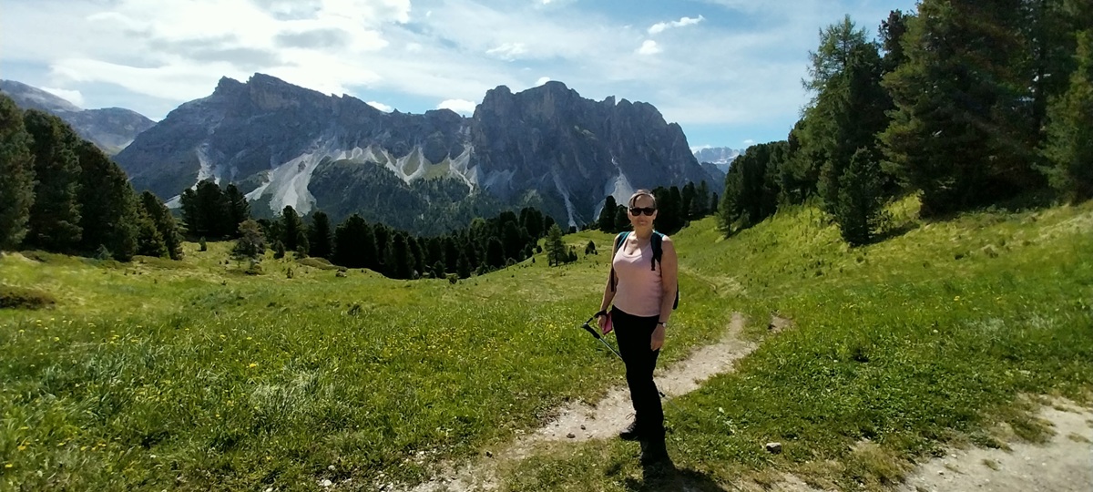
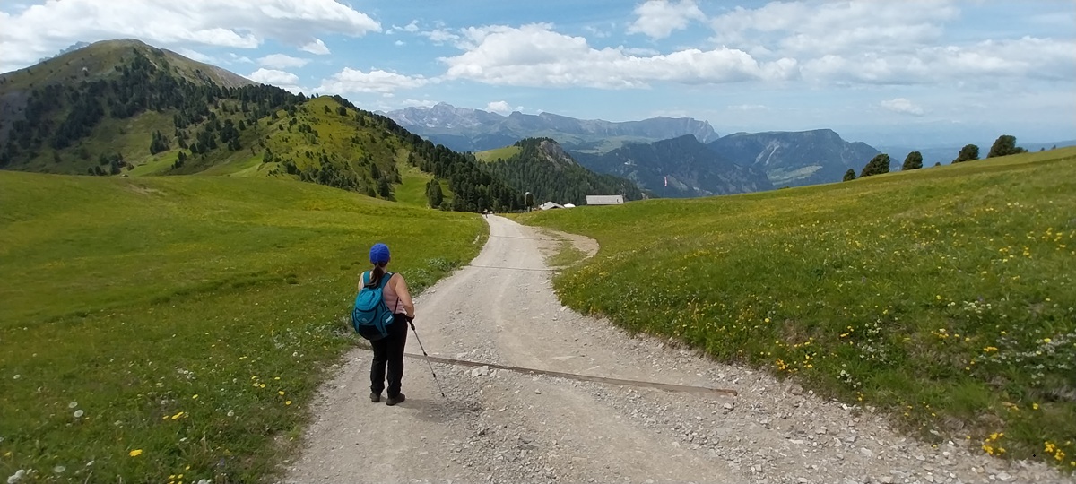
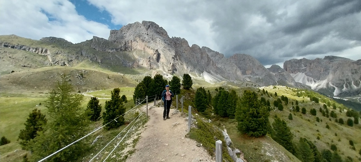
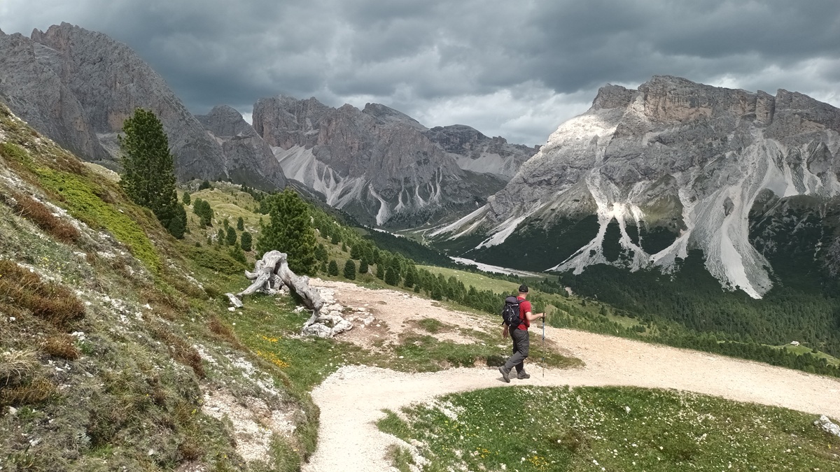
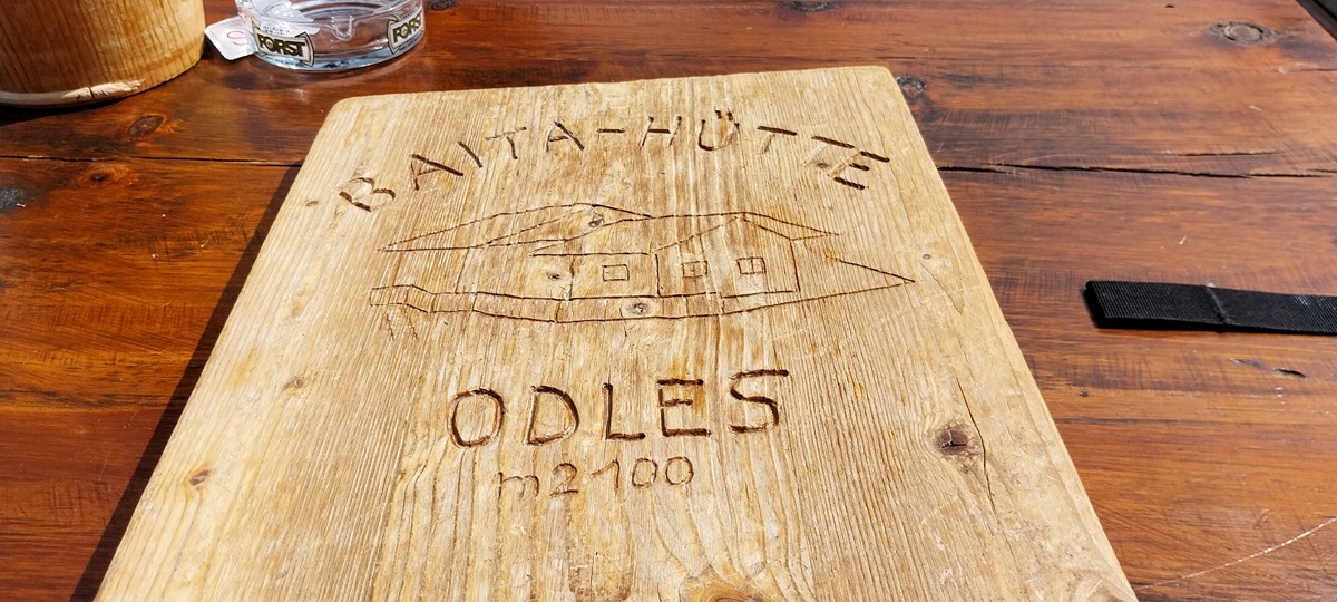
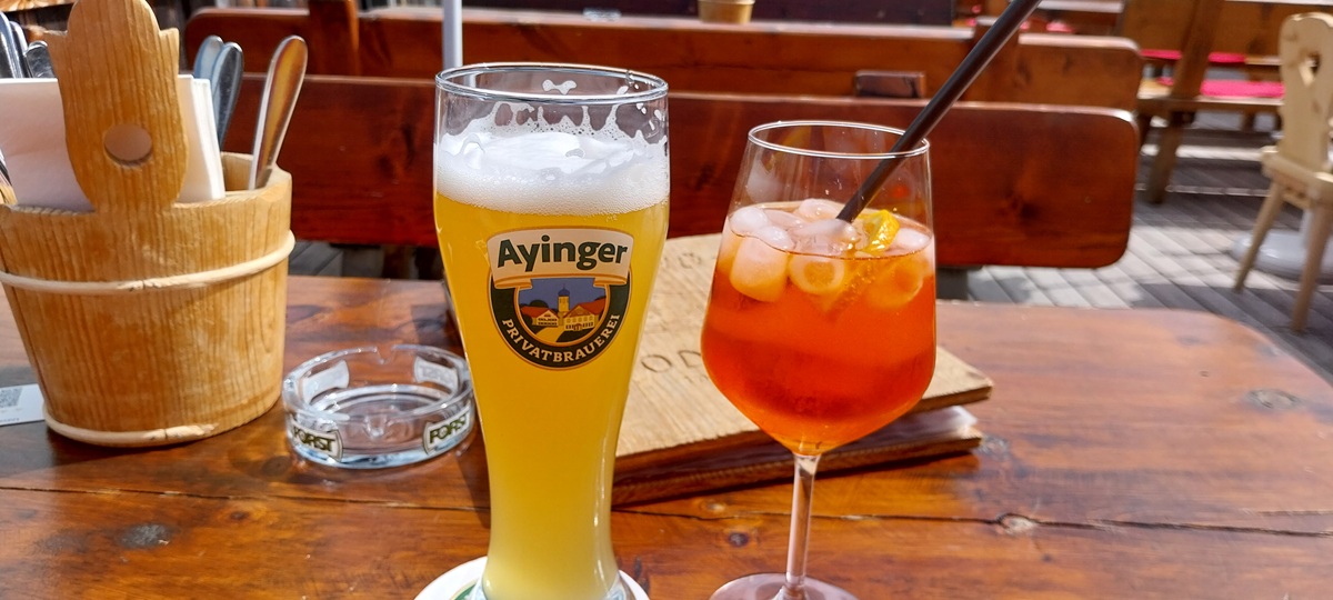
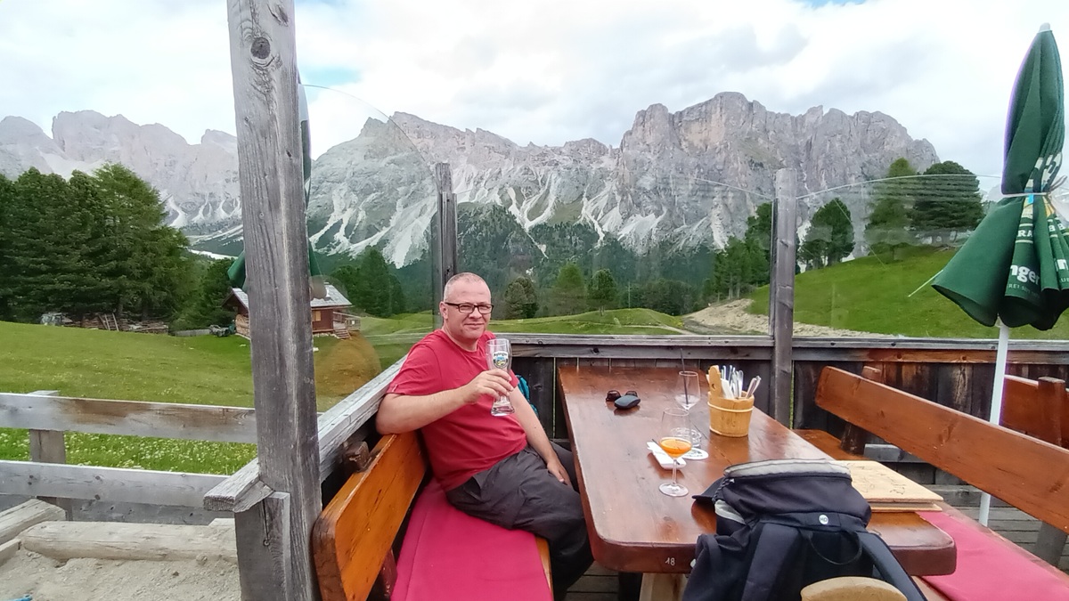
Walking towards Pieralongia with Stevia straight aheadThe rocky uprights of Pieralongia ahead as we traverse under Odle GeislerSomeone on top of Pieralongia, a huge upright rock. The refugio here looked very inviting, but we carried onThe path twisted and turned and headed out on to this high spur of ground with drops either side, Stevia is over there on the left and the valley is called Ncisles, with Refugio Firenzi down thereLinda on the spur and the Odle Geisler range, Sas Rigais and Furcheta behindThe twisting path, I’m looking at those dark clouds over there behind Furcheta to make sure there’s no lightning coming our wayIt would be wrong not to finish the walk with a picture of Sassolungo, still dominating the landscapeThis hut sat behind the Col Raiser Almhotel and was perfect for refreshmentsRefreshmentsEmpty glasses, you’ll notice a third glass which may have been mine also!! Steve with Stevia behind himDown the cable car, if you want to walk the path meanders through the pines to the car parks and cable car station at the bottom. We lucked in with a bus turning up at the bottom, it was the first day it has run during the summer period and took us back in Selva, perfect.One final look at Odle Geisler, just an astonishing place
Absolutely amazing, Steve! Sad that such a place becomes commercial. Was the fee to help protect the environment or just to feed someone’s greed? Glad you chose not to xx
Difficult to say, I can imagine the place was getting overrun and people were allegedly ignoring the roped off sections and just going where they wanted. We saw a bit of it when we were there. So I’d say it has an element of environmental or to protect pastures but they’ve picked the most popular route to put it on only. So it feels like its commercial gain as well. The authorities are doing work on cars and charging and restricting access for cars at certain times so I feel that is the better way to sort this issue
What incredible views. Those shots of Sassolungo from a distance draped in the beautiful light are breathtaking. To do a walk you’d wanted to do for 25 years is really special 🙂
Great pictures Steve, the views in the Alps are something else aren’t they! And I know that feeling very well when you’ve looked at something in a book for decades and finally get to see it, a great achievement! And you’ve given me an idea, I’m going to stand at the bottom of those steps on Yr Wydffa and charge a fiver for people to pass me! I’m with on the stupidity of queuing, they should remove that whole step thing, put a tourist trig/banner/statue or whatever outside the cafe with ‘I’ve climbed snowdon!’ on it and let the hillwalkers wander up to the highest point in peace
I get that the signs and ropes are reasonably new, asking people not to walk on the meadows and flowers, and they will have seen hundreds of people on insta twirling around and they want to do the same. But the signs are there now for a purpose and they were very obviousl
Beautiful post and photos. It’s been a long time since I’ve been to the Dolomites, but I still remember the beauty of Sassolungo and the Odle Geisler range, and how much I was in awe of their dramatic vertical rock walls and unique alpine culture. It’s a place I’d like to go back to one day. Thanks for sharing, and have a good day 🙂 Aiva xx
Its one of the best places for walking, you can be as easy or hard as you want. Plenty of via ferrata type walks or just easy strolls around meadows with a refugio at every corner
Absolutely magnificent! What an extraordinary set of rock towers. Reminds we of the sheer awe I felt when I first caught sight of the Brenta Dolomites. Just so much rock!
Its a very special spot, yes its very busy around that ridgeline, but there are ways up and down which have only a few people on them and going in June seems to be a good option to miss the worst crowds
Fantastic scenery, Steve. When I worked for Pilks (a long, long time ago) I used to visit a dolomite quarry they owned near Doncaster. Not exactly like tis though! 😂 (You’re comment on Wish you were here brought back memories of Judith Chalmers)


Absolutely amazing, Steve! Sad that such a place becomes commercial. Was the fee to help protect the environment or just to feed someone’s greed? Glad you chose not to xx
LikeLiked by 1 person
Difficult to say, I can imagine the place was getting overrun and people were allegedly ignoring the roped off sections and just going where they wanted. We saw a bit of it when we were there. So I’d say it has an element of environmental or to protect pastures but they’ve picked the most popular route to put it on only. So it feels like its commercial gain as well. The authorities are doing work on cars and charging and restricting access for cars at certain times so I feel that is the better way to sort this issue
LikeLiked by 1 person
What incredible views. Those shots of Sassolungo from a distance draped in the beautiful light are breathtaking. To do a walk you’d wanted to do for 25 years is really special 🙂
LikeLiked by 1 person
We’ve booked for next year as well 😊
LikeLiked by 1 person
That’s amazing! 😊
LikeLiked by 1 person
Terrific.
LikeLiked by 1 person
Great pictures Steve, the views in the Alps are something else aren’t they! And I know that feeling very well when you’ve looked at something in a book for decades and finally get to see it, a great achievement! And you’ve given me an idea, I’m going to stand at the bottom of those steps on Yr Wydffa and charge a fiver for people to pass me! I’m with on the stupidity of queuing, they should remove that whole step thing, put a tourist trig/banner/statue or whatever outside the cafe with ‘I’ve climbed snowdon!’ on it and let the hillwalkers wander up to the highest point in peace
LikeLiked by 1 person
Absolutely Jim, Linda was saying the same thing earlier about having a separate summit for the train trippers
LikeLiked by 1 person
When I walked the Cambrian Way, I didn’t even bother to try to ascend the steps. Your walk in the Dolomites looks fabulous!!
LikeLiked by 1 person
Glorious views from every direction! Love them!
Christie
LikeLiked by 1 person
Wow! Just absolutely amazing scenery.
LikeLiked by 1 person
Beautiful place. It is a shame about this instagram influencers who are not respecting anything.
LikeLiked by 1 person
I get that the signs and ropes are reasonably new, asking people not to walk on the meadows and flowers, and they will have seen hundreds of people on insta twirling around and they want to do the same. But the signs are there now for a purpose and they were very obviousl
LikeLiked by 1 person
Pingback: Jo’s Monday walk : Bingley 5 Rise locks | Still Restlessjo
Beautiful post and photos. It’s been a long time since I’ve been to the Dolomites, but I still remember the beauty of Sassolungo and the Odle Geisler range, and how much I was in awe of their dramatic vertical rock walls and unique alpine culture. It’s a place I’d like to go back to one day. Thanks for sharing, and have a good day 🙂 Aiva xx
LikeLiked by 1 person
Looks brilliant – superb photos!
LikeLiked by 1 person
Its one of the best places for walking, you can be as easy or hard as you want. Plenty of via ferrata type walks or just easy strolls around meadows with a refugio at every corner
LikeLike
Absolutely magnificent! What an extraordinary set of rock towers. Reminds we of the sheer awe I felt when I first caught sight of the Brenta Dolomites. Just so much rock!
LikeLiked by 1 person
Its a very special spot, yes its very busy around that ridgeline, but there are ways up and down which have only a few people on them and going in June seems to be a good option to miss the worst crowds
LikeLiked by 1 person
Fantastic scenery, Steve. When I worked for Pilks (a long, long time ago) I used to visit a dolomite quarry they owned near Doncaster. Not exactly like tis though! 😂 (You’re comment on Wish you were here brought back memories of Judith Chalmers)
LikeLiked by 1 person
We’ve just been over the Peak District (Worksop) and lots of the rock over that side was dolomitic, strange seeing it there
LikeLiked by 1 person
I’ve seen your pictures on Instagram Steve. Looks like you’ve had some good classic walks and had decent weather too.
LikeLiked by 1 person
The weather was very good, especially in the day. Looking forward to going back next year
LikeLike