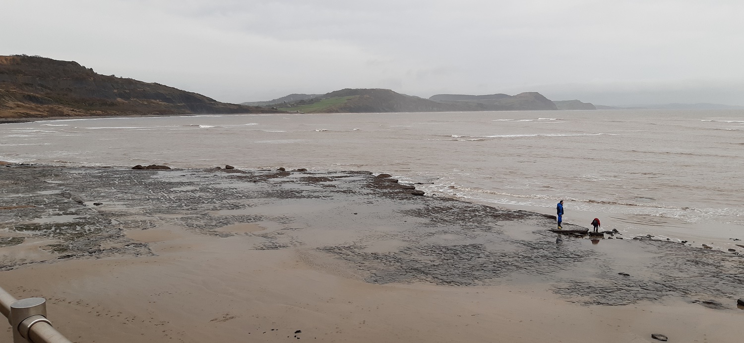
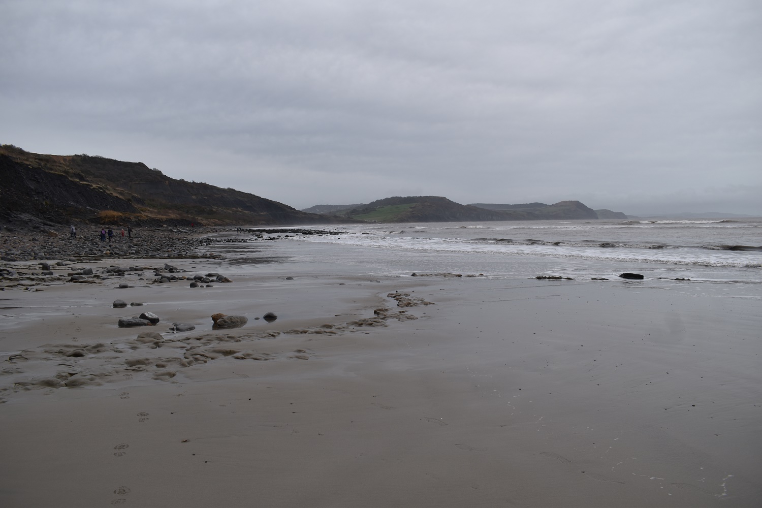
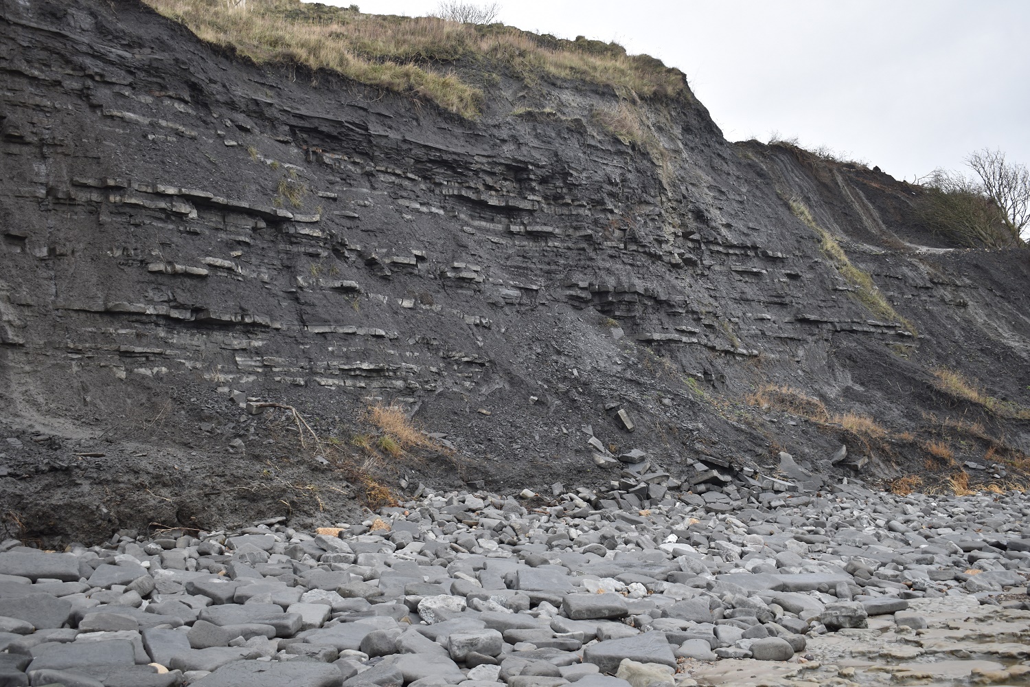
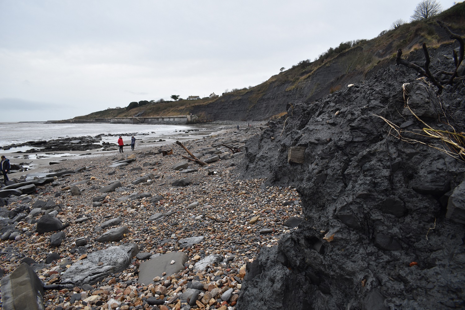
First walk of the new year and choices on where to go. Dartmoor, coast, east, west, north. In the end it was the weather that made my mind up, a few days earlier I had walked on the north eastern side of Dartmoor and the weather had altered from the gloomy drizzle to the west and south of Dartmoor, to become a nice sunny day. The plan was similar, head east, this time to the coast. It meant an early start to drive there but it meant I was up and walking before 9.30am which was good. I’d also looked at the tide times and I’d looked at the routes out of Lyme Regis, deciding that the daft coastal path diversions inland weren’t going to be my only route between Lyme Regis and Charmouth. I’d read about walks along the beach and below The Spittles, the crumpled soft cliffs that were home of landslides and fossils and thought that could be an option. Low tide was around 11am, so setting out when I did was perfect and I had plenty of space and options to pick a route across the long beach. The obvious warning here is to watch the time and know when its coming in, the ledges here are flat and can mean the tide can come in very quickly and its over a mile in total to walk it. At the far end of the beach I’d made good time and decided to ascend Stonebarrow Hill in order to scope out a car park for my next walk in this area and make the next part a little easier. Walking back I took the diverted inland route which when you measure it is around a kilometre from the sea, and too far away. There are other options when looking at a map, with the pink dotted paths running across Timber Hill just above The Spittles, surely these could be used. Still if you are walking the coastal path, pick the right time and walk the beach instead, its glorious even on a drab weather day like mine.
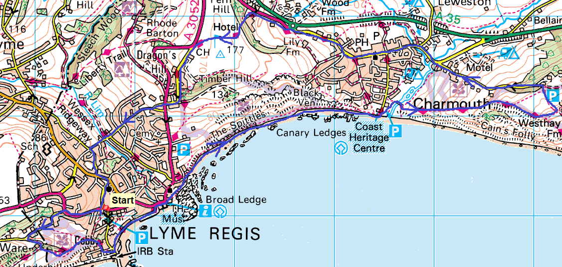
Start – Lyme Regis Holmbush car park
Route – Ware – South West Coastal Path – The Cobb – Lyme Regis seafront – Lyme Regis beach – Charmouth – Stonebarrow Hill – Charmouth – Fern Hill – Lyme Regis Golf Course – Lyme Regis – Holmbush car park
Distance – 9 miles Start time – 9.15am Time taken – 4hrs 30mins Highest Point – Fern Hill 177m
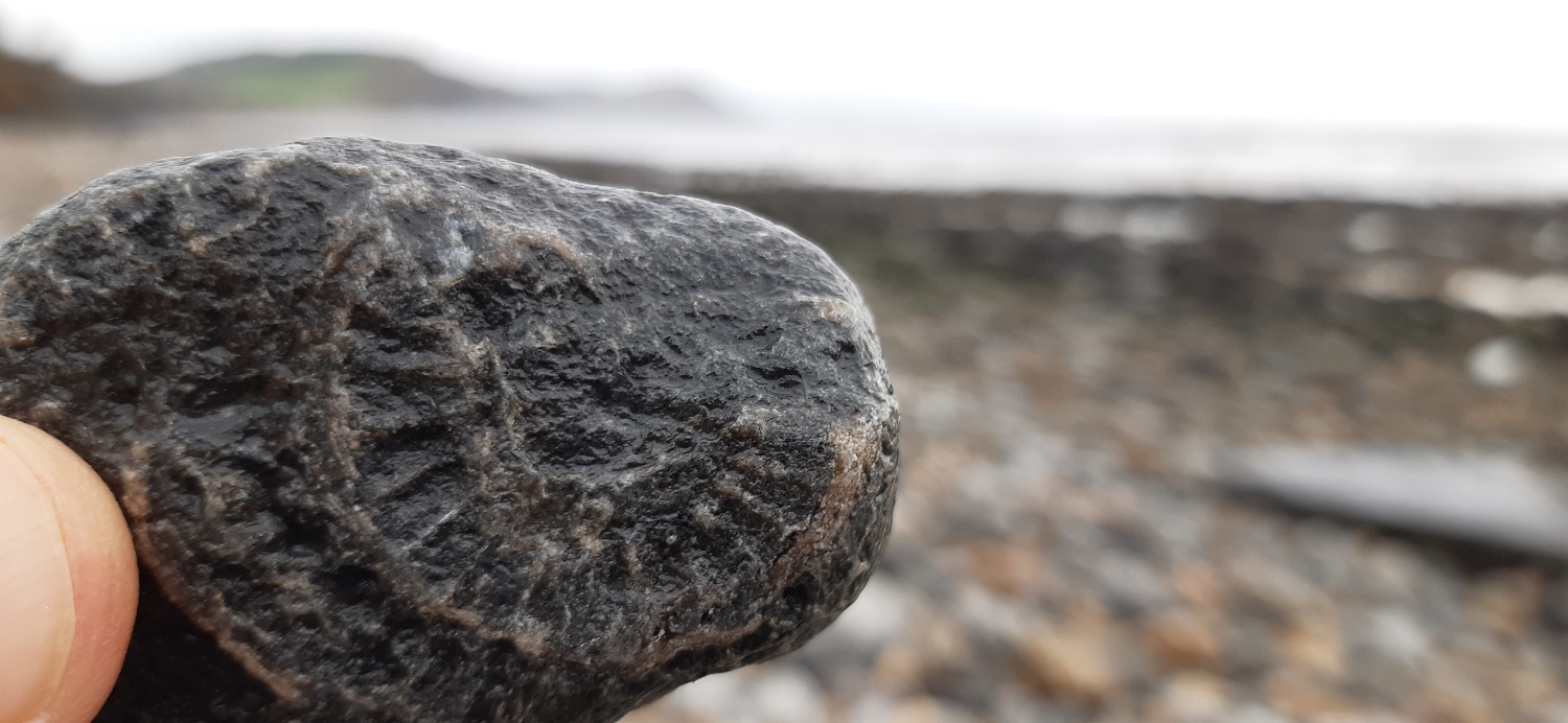
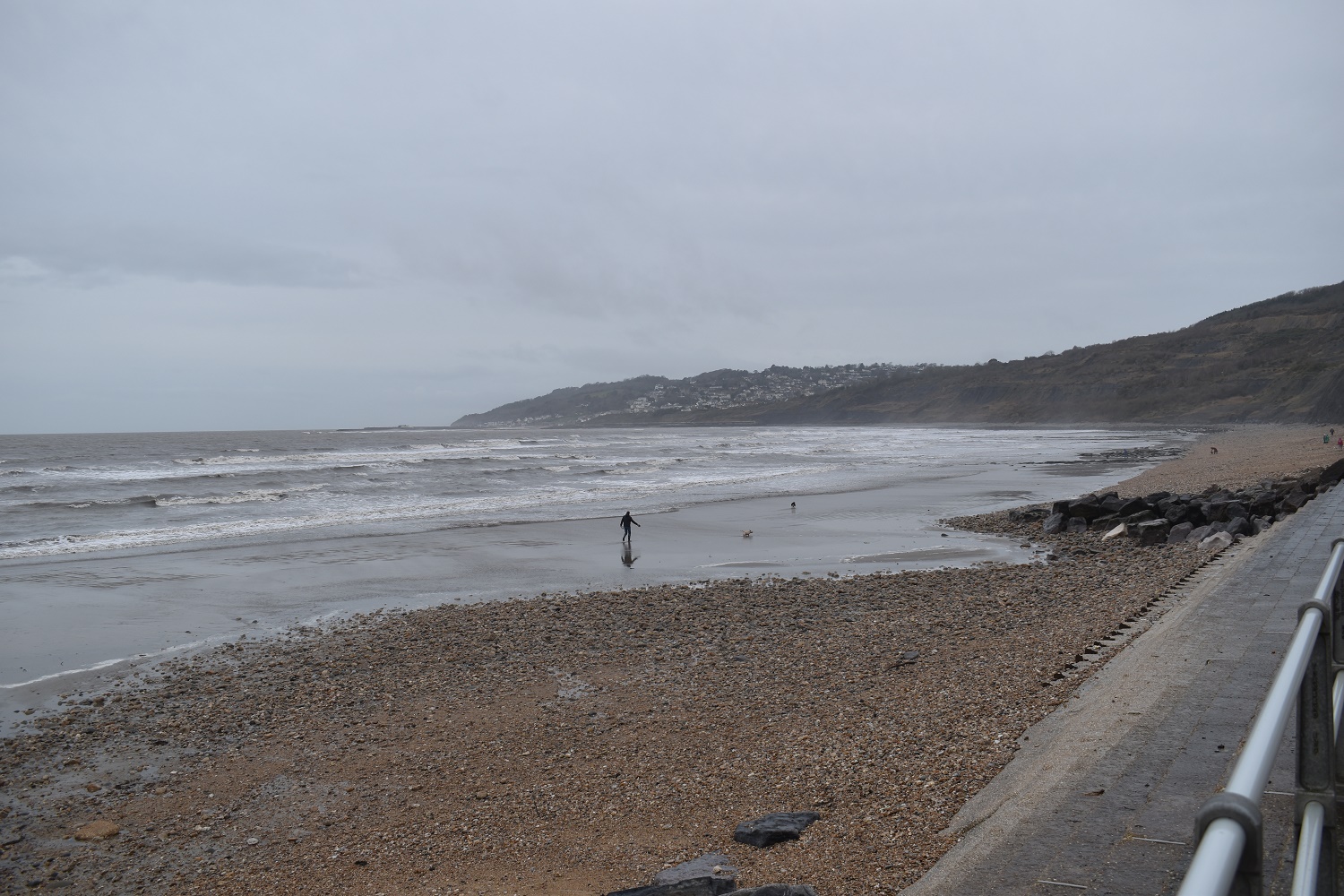
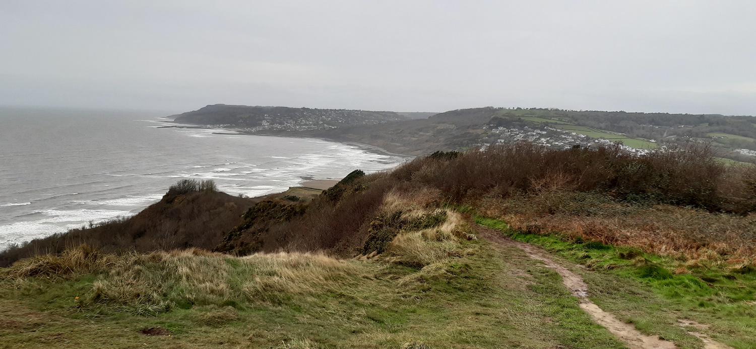
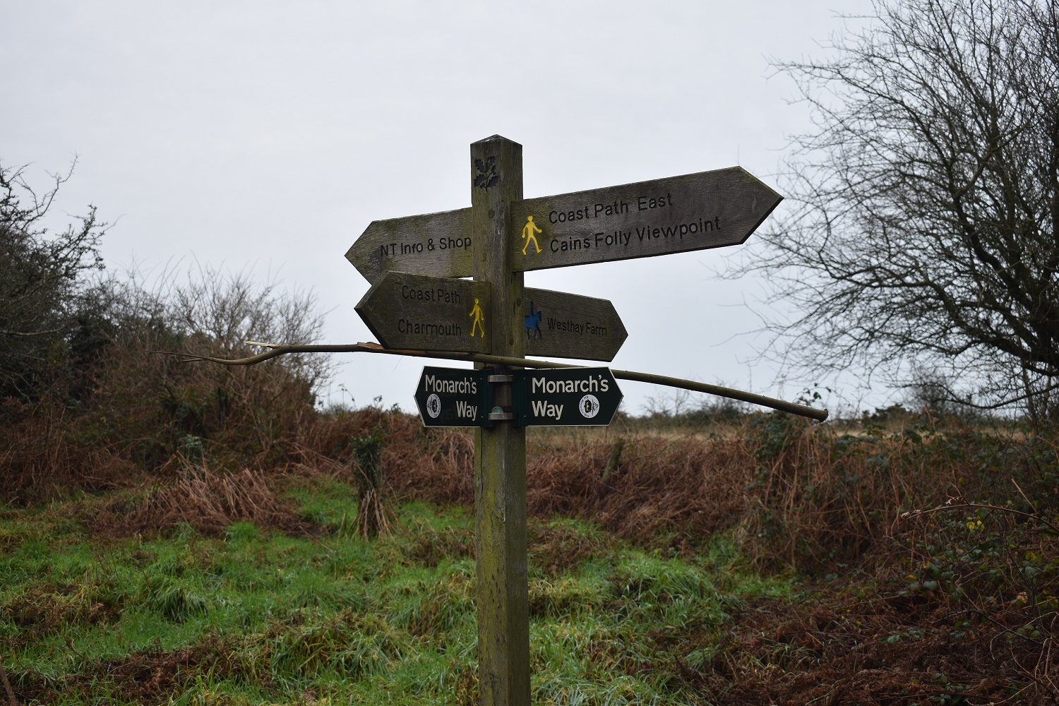
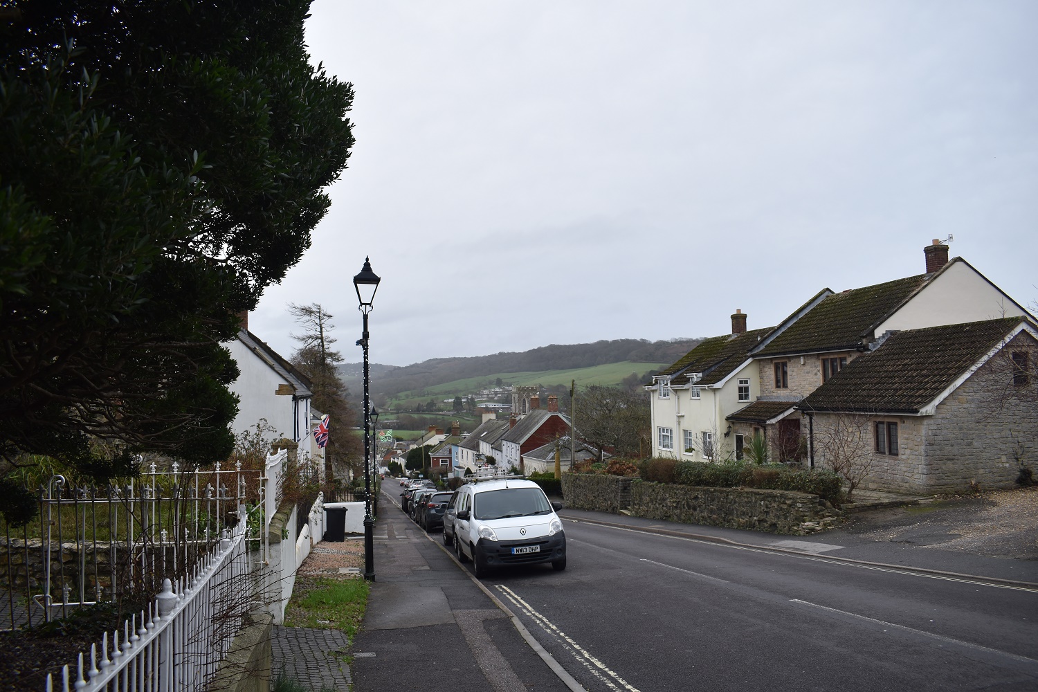
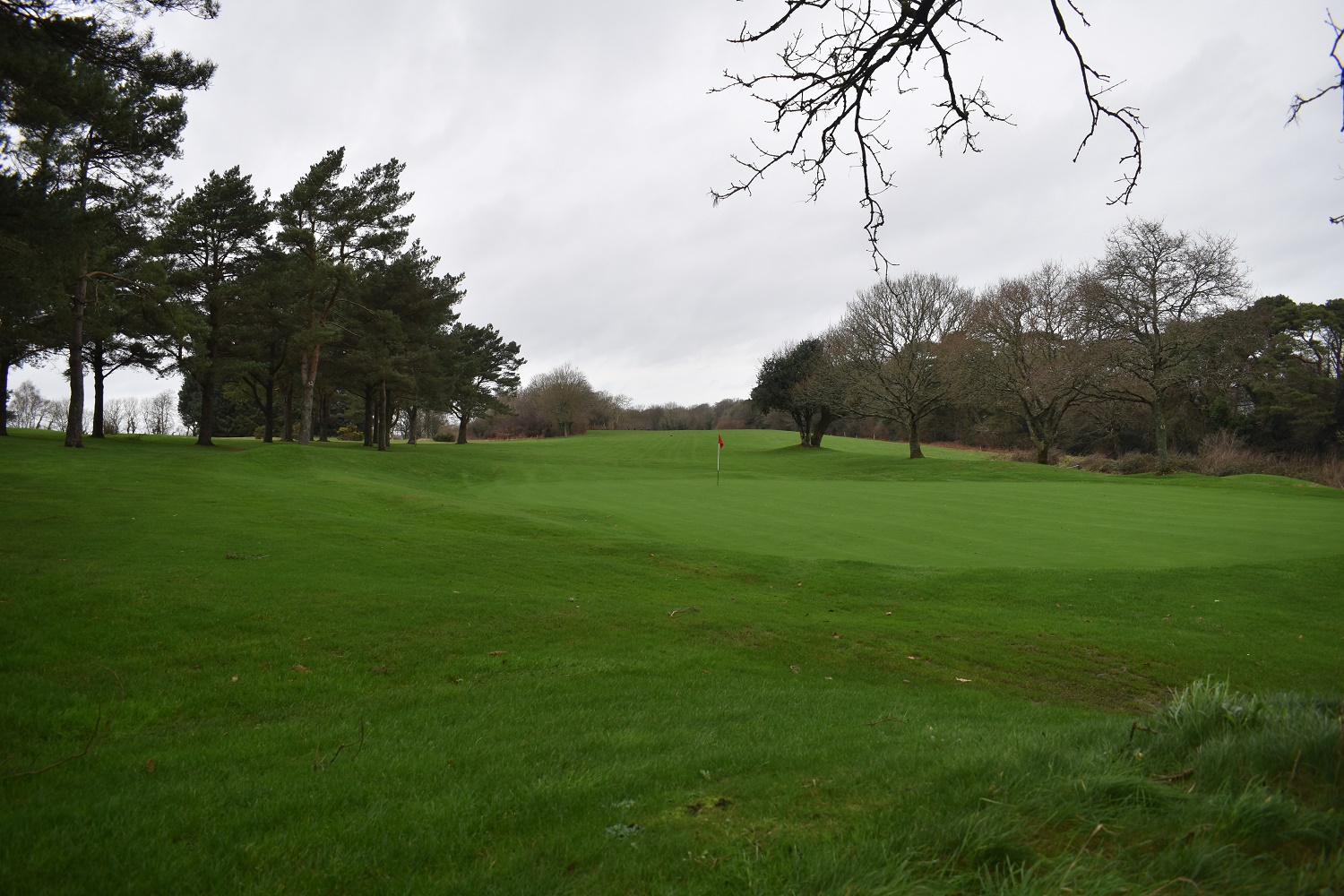
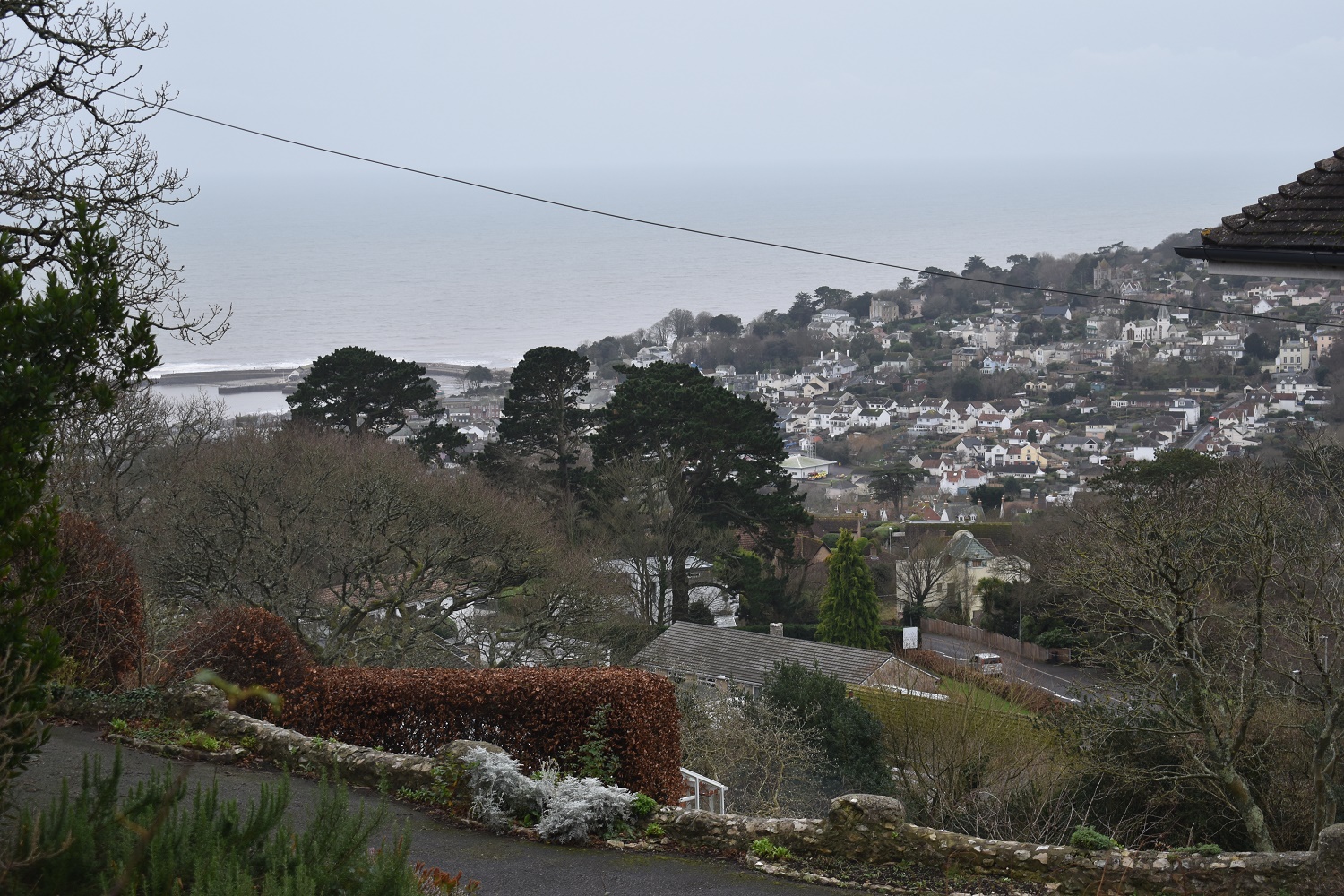
I started out by heading uphill away from the sea, heading out of Holmbush car park I turned left to pick up a loop that linked to my last walk in this area (here)Loved this houseRight I’m stood in Devon here, having crossed the border from Dorset where I started, this is the point I last left the coastal path to head up to very busy A3052 to start walking back towards SeatonThe path down towards The Cobb (can just be seen behind the trees) was very slippery however the views across Lyme Bay were worth stopping for. The hills in the distance from the left are Stonebarrow Hill, Golden Cap and Doghouse HillThe Cobb is behind me as I stand on the pebbled beach next to it and look across to Seven Rock PointThat’s The Cobb sticking out there, I’d walked the seafront promenade past shops and cafe’s to this point, picking up a coffee from a nice cafe on the frontNow this is Broad ledge, a stone slab that is constantly under attack from the sea, I’m standing on the seawall path which leads off to my left and the down some steps at the far end to the beach. Again in the distance are Stonebarrow, Golden Cap and Doghouse HillOn the beach now, on the left is The Spittles a rising mass of soft cliff, clay, fossils and Blue Lias and then Black Ven the second part of the cliff again full of fossils. My route would be part on the rocks and part on the sand as the water retreated, it was about half ten at this point, about an hour from low tide.The lower parts of the Spittles, the horizontal rock must be the Blue Lias. I’m not a rock expert but I can see why people love this place, its fascinatingOn the right is the landslides that drop down the cliffs, the black is soft and full of debris like trees, branches and metal. the beach had an old boiler on it, with pipes and bars sticking up out of the black clay. It was a surreal place. There were people who had brought bags with rock hammers in and small spades to dig for stuff, like an amateur excavation.It was lovely walking across this beach, there was a hub of activity in places around the landslides and people digging holes for stuff and then sections were you felt alone, the weather helped as only the hardy were out across here.I decided to have a look myself, and flipped over half a dozen little stones and bingo. Not a great specimen admittedly but that’ll do me after 2 minutes looking. An ammonite fossil from the Jurassic coast.Looking out to sea and a watery sunshine dribbled through the clouds and cast a nice light on the sea as I crossed the Canary LedgesAt the far end of the beach, Charmouth is behind me alongside beachside cafe’s and shops (there’s a car park here as well). You can see here how important low tide is to walk across here, you’ll be walking amid some large rocks otherwise at timesI had my first break here, overlooking Charmouth beach and across to Lyme Regis. Looking at the view you can see two people stood in the sea on the left. They were carrying measuring sticks, with a marked theodolite by the building by the car park. There are 3 people just to the left of the river as it enters the sea, they had already walked from right to left through the river. These were a group who were measuring the height on the land against the sea.Charmouth right, Lyme Regis in the distance across the bay as I climb Stonebarrow HillTop of Stonebarrow Hill looking back down to my route so far.And the other way, Cains Folly is belowOne last look back, I was enjoying this viewI dropped down a hundred metres or so and picked a path off to the left towards the car park. I will be back to this view to walk the route to Golden Cap which is ahead.Plenty of signs at the Stonebarrow Hill car parkWalking through Charmouth, I was climbing from this point (that’s Stonebarrow Hill back right)The inland diversion route of the coastal path at this point is rubbish, it follows a road for a long way and then this section across the golf course. Now I like a golf course but this path is pointless considering the options lower down and nearer to the sea.I’m now on a road. I’ve left the golf course and I’m now heading south in the direction of the sea. I need to get off to the right in this photo. But that’s irrelevant if I’m walking the coastal path as I’m a fair distance from the coast hereTwo signs of note here, the wooden one at the back is the coastal path one telling you to go uphill and to the left, heading up hill for at least 500 or so metres before turning right to walk east through the golf course as I did, level with the sea. Or you can go straight on as this path does into the distance. There is another path that hand rails this path about 50 metres to the left of this one. After this photo I left the coastal path and walked the roads and lanes back to my car. At this point I was left in no doubt that if you are walking the SWCP that you do this short section at low tide along the beach between Charmouth and Lyme Regis and don’t waste your time heading inland through these crap paths.
The coast path diversion across the golf course is clearly longstanding as it was in place in 2010 when I walked the entire SWCP. I agree that there seem to be much better alternatives if it’s necessary to do that stretch when the tide is in and seems odd that it hasn’t been re-routed. At that time the path up Stonebarrow Hill was also closed off and I hadn’t realised until I walked all the way down to the seafront at Charmouth…. Your route is a brilliant circular walk.
I didn’t like coming so far away from the coast of that part of the coastal path and it just seems strange that if the diversion has been in place that long, why are they still marking paths nearer the sea on the OS maps. Anyway I loved the stretch of beach and would highly recommend a walk across it at low tide
I lived the 1970s in Charmouth. Some cool visual reminders here: Black Venn, Cliff House, The Cobb out west and, of course, always in the distance, Golden Cap in the east.
x
Never been to the Jurassic Coast or Lyme Regis so good to see it virtually. I’ve just checked my version of the OS maps app and the rights of way near the sea aren’t there any more. Clearly someone has decided to discourage walking through that area for some reason. Not exactly a coast path there is it!
It was a fair distance inland, and the road walking wasn’t very walker friendly as it was a main road in and out of Charmouth. Luckily the beach route saves that section of the coast, so its a case of picking a day/time where the tide is out


Lovely coastal walk. I love the house in your second photo. The roof is amazing.
LikeLiked by 1 person
I thought the roof was fantastic, you don’t see many as elaborate as that
LikeLike
The coast path diversion across the golf course is clearly longstanding as it was in place in 2010 when I walked the entire SWCP. I agree that there seem to be much better alternatives if it’s necessary to do that stretch when the tide is in and seems odd that it hasn’t been re-routed. At that time the path up Stonebarrow Hill was also closed off and I hadn’t realised until I walked all the way down to the seafront at Charmouth…. Your route is a brilliant circular walk.
LikeLiked by 1 person
I didn’t like coming so far away from the coast of that part of the coastal path and it just seems strange that if the diversion has been in place that long, why are they still marking paths nearer the sea on the OS maps. Anyway I loved the stretch of beach and would highly recommend a walk across it at low tide
LikeLike
I lived the 1970s in Charmouth. Some cool visual reminders here: Black Venn, Cliff House, The Cobb out west and, of course, always in the distance, Golden Cap in the east.
x
LikeLiked by 1 person
Glad you enjoyed the visual reminders. Hopefully it won’t be too long before I can get back to do the next stretch over Golden Cap
LikeLiked by 1 person
Never been to the Jurassic Coast or Lyme Regis so good to see it virtually. I’ve just checked my version of the OS maps app and the rights of way near the sea aren’t there any more. Clearly someone has decided to discourage walking through that area for some reason. Not exactly a coast path there is it!
LikeLiked by 1 person
It was a fair distance inland, and the road walking wasn’t very walker friendly as it was a main road in and out of Charmouth. Luckily the beach route saves that section of the coast, so its a case of picking a day/time where the tide is out
LikeLiked by 1 person