A walk to hopefully change the fortunes a bit with the weather, as a rule east is better than west for the weather and the same goes for coastal rather than moorland. So I went east and coastal hoping to double up the luck. The forecast itself was very positive with sunny spells forecast all day and a 30% chance of a shower at 1pm, the 30% means 100% really! I’m pushing the distance I travel further and further east now as I’ve completed lots of the South Devon coastal path now and the few areas I have left around Torquay will be left for winter walks when the days are short. I started out from Seaton knowing this is a long walk due to to the landslips of Dowlands, there are very few paths along this section which take you back inland to allow a return, so I knew I’d need to get to Ware probably before turning. This was perfect as going any further would mean leaving Devon and I was out without my passport (vaccine or otherwise!). The walk was very good, with the only bad section being the road walking along the A3052, I got lucky with walking in some of the farmers fields at the side of this road, as the cars are doing 50mph along this road and there aren’t many verges to hide on. Luckily I made quick progress on the road sections I had to walk and was soon at Charton Cross and picked up a cracking bridleway and unused minor road from Charton all the way back to Axe Cliff golf course. The coastal path section is fascinating as to how the cliff has slumped like it has (similar to the cliffs after Branscombe Mouth here) and there are plenty of boards along this part of the path explaining when it happened. The woodland and scrub along here is very dense and there are few chances to get a glimpse of the sea along this 5 mile section, however there are a few and they are superb when you get to them. Doing this section of the walk I found that there are ways out of the route should you need to, there is a path up to the Rousdon estate which you could use (there is a sign at the Rousdon estate end which says it is a private path now) and there are paths up to the A3052 at Pinhay. Altogether this is a great section of the path, different from the rest as I push on to Dorset. My next visit around here will indeed be in a different county as I will be starting on the edge of Lyme Regis.
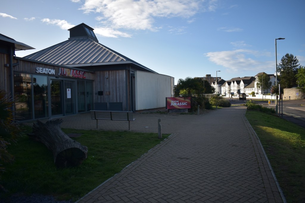
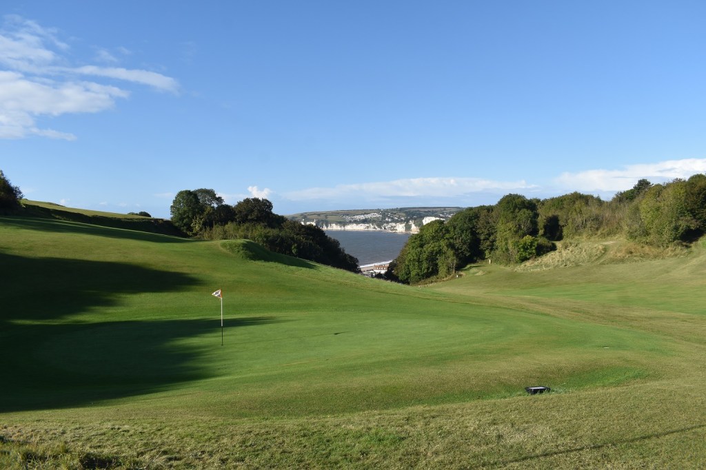
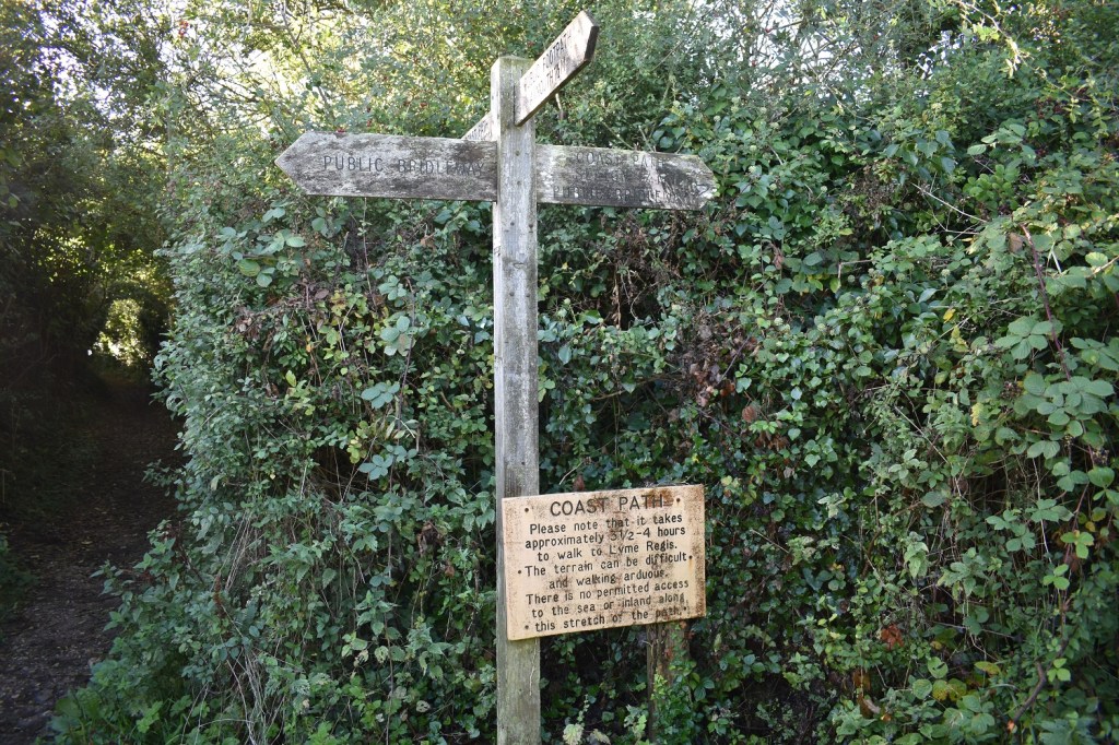
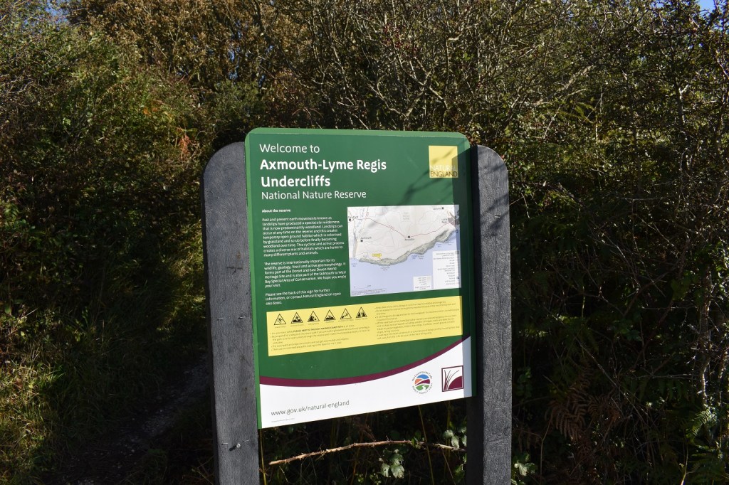
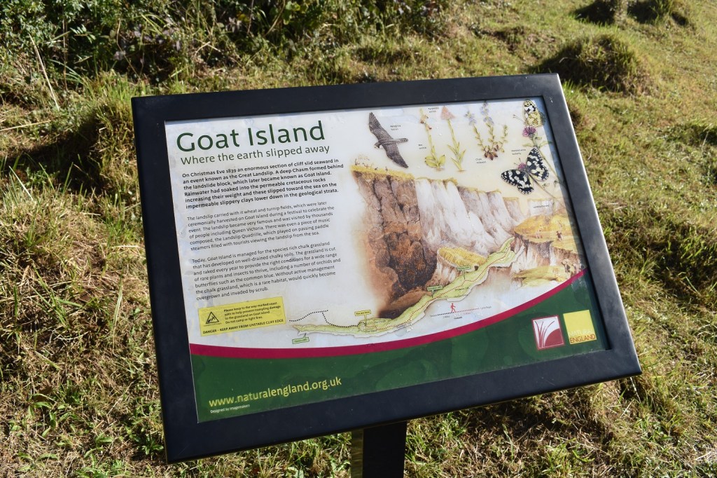
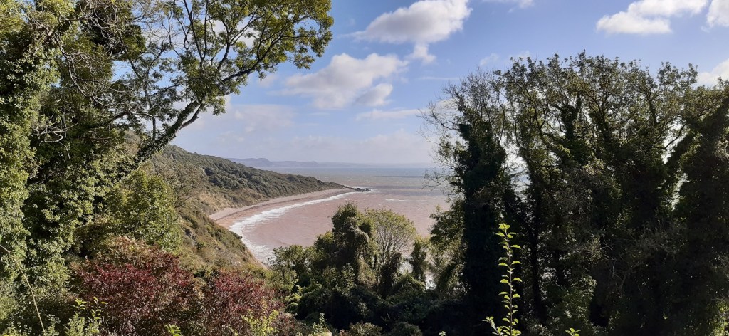
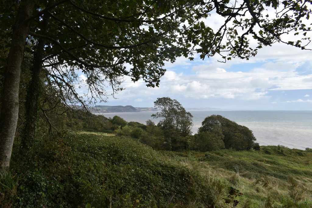
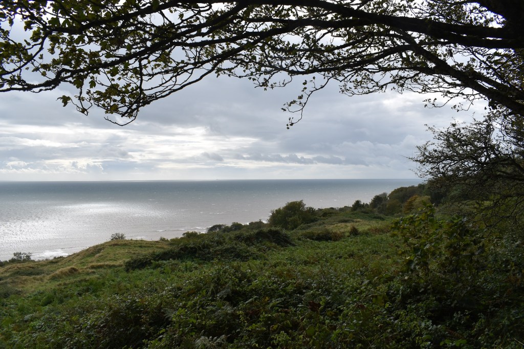
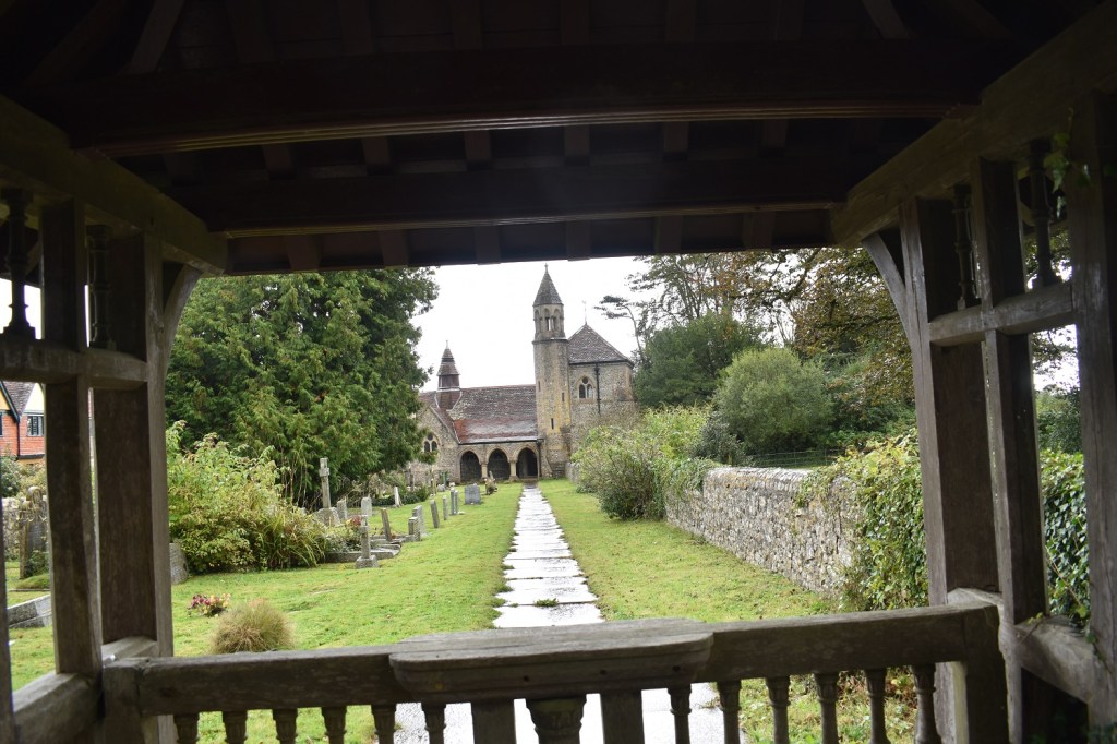
The museum place on the left says it all about this area, Jurassic everywhere, the walks, the cliffs, fossil beaches. Everything. I’d parked in the long stay car park but too be honest I could have done a bit more digging and parked for free just the other side of the bridge over the River Axe. Which would have meant an out and back to start the walk along the Seaton Esplanade but that would have been fine.Back at the Esplanade, a couple of months ago I turned at this point to head back to Branscombe after a fine walk (link in the text at the start of this post), today in the morning sunshine, the white cliffs by Beer looked fantasticThere was a stiff breeze blowing it from the west whipping the spray up the beach at the far end. Haven Cliff at the far end is my targetAxemouth Harbour, where the River Axe enters the seaA lovely view up along the Axe (it won’t look like that when I get back)A view back down to Seaton beach and the white cliffs beyond from Axe Cliff Golf Course (think this is the 17th green)The coastal path takes you through the golf course and a short distance up to this point where I will turn right and head down that path on the left. The sign at the bottom suggests a 3 to 4 hour walk to Lyme Regis, which is a bit generous, I took this photo at 10.10am and I was stood here again at 2.30pm having been there and back. The point about there being no paths inland isn’t quite true either.Stood on Haven Cliff now looking at some fantastic viewsThe path starts to drop now down into the woodland and get into the parts of the cliffs that slid downwards towards the sea. I’m guessing previously the old coastal smugglers path would have stayed up on top of the cliffsOne last look back before I head into the trees, bare in mind that once in the trees (about 5 miles ish) there are only a few spots were you get a glimpse of the seaThe Nature Reserve of Dowlands Cliffs and LandslipsThe first break in the trees is quick to come, Goat Island was a section of land left almost marooned by the landslip, an island where everything around it had fallen away.Part of Goat Island looking to sea, the area behind me was lower than where I was stood but was full with trees, scrub and bracken so I couldn’t see how far down it wentAfter another mile or so you get this break in the trees out of nowhere. The view was superb today down to Humble Point and the beach this side of it. In the distance is the coastline heading towards Chesil Beach
This chimney is part of the Rousdon Cliffs freshwater pumping station, there were a number of ruined buildings/houses around here, and the path to my right here lead up to the Rousdon Estate. They say it is no longer a permitted path up that way, however in an emergency I would certainly use it as there is a public bridleway at the top of the path.
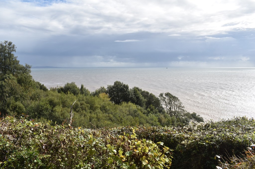
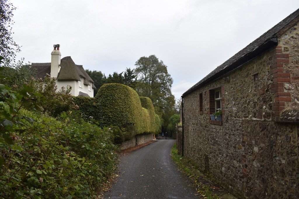
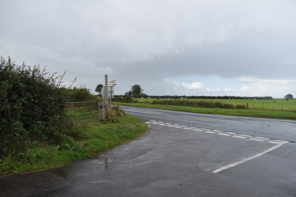
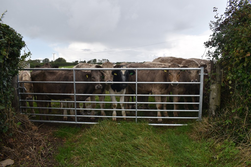
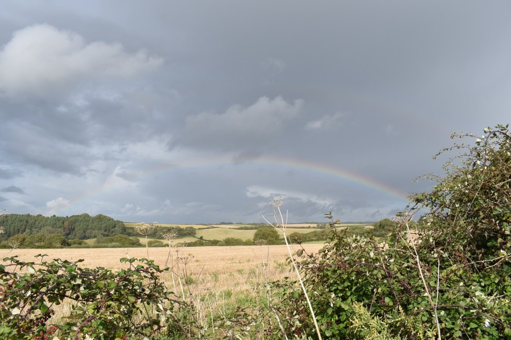
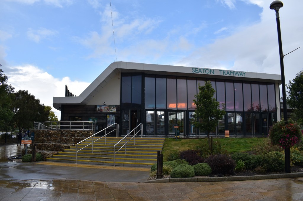
Lots of the path looked like this, other parts had plenty of tree roots across it and it was far narrower, with lots of steps going up and down along its length. I’ve left Rousdon Cliffs now and having seen only 2 people since the golf course (2.5miles ago) I saw about 20 more people in the next 2.5miles, clearly its more popular this side of Rousdon, maybe people are using the path as a loop or maybe its the Pinhay loops later on which bring people this side of the LandslipsArriving at the point were the paths to Pinhay split off there’s this grassy ledge which give more great views. Having been in the trees for another mile or so I’d noticed some black clouds passing over me, at this point I could see they were out to sea currently but dropping rain over there in the Chesil Beach areaAnother 500 metres or so on I stopped for a coffee, I’d had one stop at Rousdon Cliffs, this one however gave a view towards Golden Cap (the high point over there and a Julia Bradbury walk in one of her TV series, might be Walk with a View). It was also here that it started to spit with rain.Just sea looking this way and the odd ship sailing past out of the Channel. I was nearing the point where I would turn back towards Seaton trying not to stray into Dorset!I’d left the coastal path now and was heading inland a little into the hamlet of Ware. I’m standing in Devon, the couple down there are about to step into DorsetField walking to get off the A3052, the cars were hurtling along and the verges weren’t readily available all the time for me to walk on. The fields along here have no gates on them so I could walk from opening to opening in the field avoiding as much of the road as possible. I’m looking inland here over Horseman’s Hill, the rain was on and off along hereChorton Cross was my turn off point and a break from the traffic. I’m standing under an oak tree here to get a break from the rainMooI walked through Chorton, still rainingNow I hadn’t expected to see this, a gatehouse to an estate. The Bridleway goes straight through and along the track the other side. This is the Rousdon Estate and the path up from Rousdon Cliff comes in from the left just after the gatehouse, with signs saying access is now private, apparently.For me I was heading straight on anyway along this brilliant straight path which helped me gobble up the return milesThe main house, not bad eh?!The church, St Pancras, in the estate. Haven’t a clue why I’ve taken it wonkyThe gatehouse at the other endI’m now in the hamlet of Dowlands looking northwest ish. Some black clouds in the distance and some on the left here coming my wayThe lane I was on was quiet and had no people or cars on it whilst I was there it was a lovely way back following straight on from the fine walking through the estateProbably should have seen more rainbows today given the amount of heavy showers that passed over me and around meBack at the golf course again, all that is left is to walk down the hill, cross the bridge over the Axe and head into SeatonIt was raining hard at this point and the glorious sunshine form earlier has gone (not what was forecast), still the Axe looks lovely with the tide mostly inThe electric tramway at Seaton, glad to see it was open. The tramway heads up to Colyton some 2.5 miles away pubs are available at some of the stops and in the villages, but I had to head home! A fine walk and something different from the rest of the coastal path (apart from the short section after leaving Branscombe Mouth), well worth seeing.
Interesting that them path doesn’t run close to the edge and only affords occasional views of the sea. Interesting in a way but I think I’d prefer the more open stretches
Its a little odd, there are sections were you think they take the path nearer but instead swing it inland away from it. Even the areas where the ground falls down to a gorge or beach, they route the path more inland to ease the descent and reascent which is a first for the coastal path!


Grand pictures. I’ve had some sweltering days on the Undercliff.
LikeLiked by 1 person
I can imagine walking in there in the summer heat would be difficult, not a lot of breeze or openings to get any air in. Fascinating place though
LikeLiked by 1 person
It is, though I also like that landslip west of Beer perhaps more.
LikeLiked by 1 person
Some lovely stacks of rocks on that landslip between Beer and Branscombe Mouth
LikeLiked by 1 person
Interesting that them path doesn’t run close to the edge and only affords occasional views of the sea. Interesting in a way but I think I’d prefer the more open stretches
LikeLiked by 1 person
Its a little odd, there are sections were you think they take the path nearer but instead swing it inland away from it. Even the areas where the ground falls down to a gorge or beach, they route the path more inland to ease the descent and reascent which is a first for the coastal path!
LikeLiked by 1 person