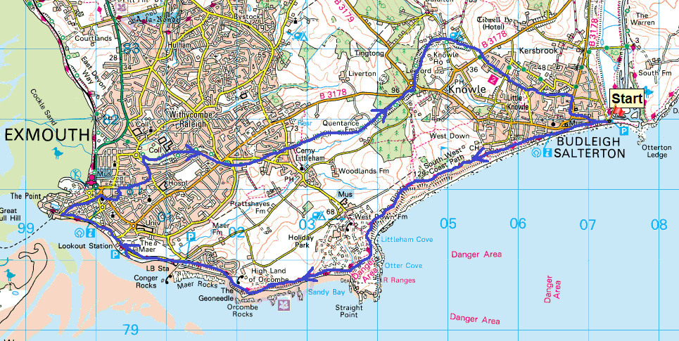
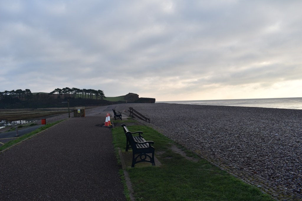
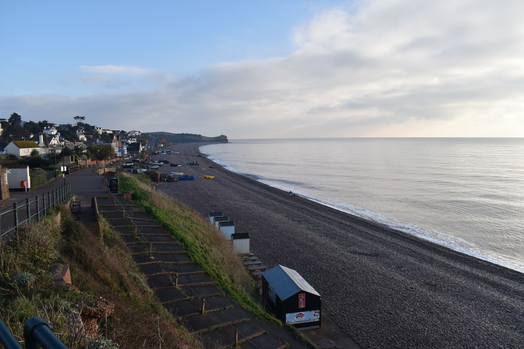
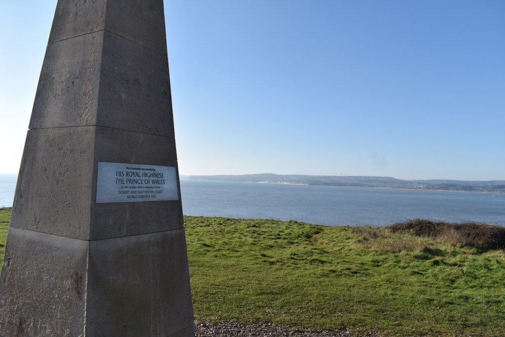
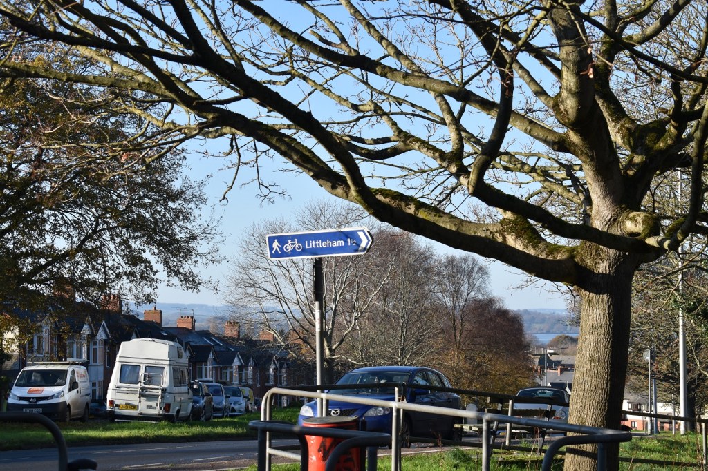
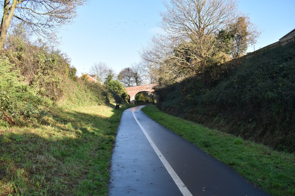
Another double weekend walk after the previous one at the start of November. I was still in a fine mood, having managed to get out for a pub lunch alongside a fine walk with the boys around Burrator reservoir, the day before. And to improve things further the weather was set for a cracking day. It started chilly but the sky was blue and the sun shone. I was back on the Jurassic Coast, in fact the most westerly section of it. There is a monument to tell you this fact, it is called the Geoneedle. This westerly section of the Jurassic Coast is said to be the oldest, as in the rocks are the oldest, and despite the name ‘Jurassic Coast’ the rocks are Triassic from 250 million years ago. This walk is a cracker, the coastal section is really good, coming out of Budleigh you are faced with a long (very long) gently uphill section, it just keeps on going uphill, around every corner. Eventually to your right is the golf course, East Devon golf course, at that point you are reaching the top. Then bam, the ground drops again and you head down to the huge holiday park at West Down and the military firing range, linked to the Lympstone Commandos. You then head past Sandy Bay and on to Exmouth. In Exmouth you have a choice, stop for some food and refreshments before heading through the town to join the Budleigh to Exmouth cycle path, which starts near to the college, just north of the hospital. This path takes you back to Budleigh along the old railway track (before the railway cuts by Beecham). Once you get past Littleham this path is easy to walk and fantastic, winding through green countryside before descending to Budleigh Salterton. This is a good one and worth a visit when Exmouth is open.
Start – Budleigh Car park, the one by River Otter estuary
Route –South West Coastal Path – West Down – The Floors – West Down Holiday Park – Sandy Bay – The High Land of Orcombe – The Geoneedle – Maer Rocks – Exmouth – Exmouth to Budleigh Cycle Path – Littleham Budleigh Salterton
Distance – 12 miles Start time – 9.50am Time taken – 5hrs 10mins Highest Point – West Down 129 metres
Weather – Glorious sunshine, haze, dry, cold to start
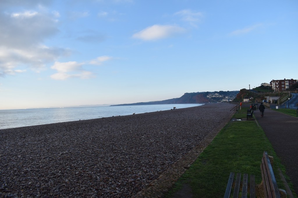
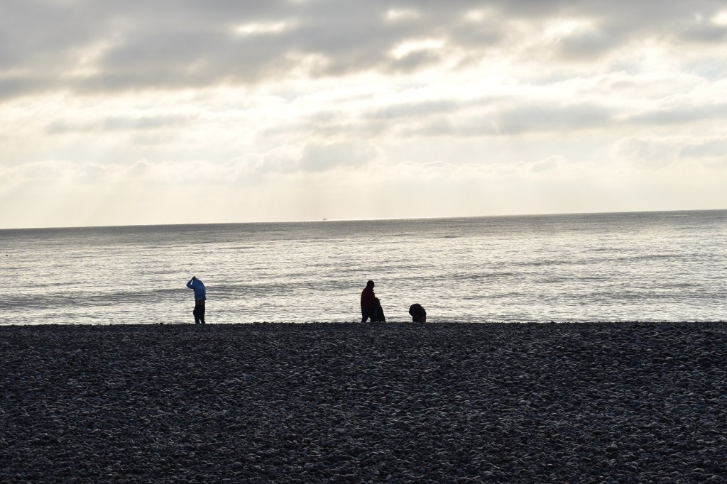
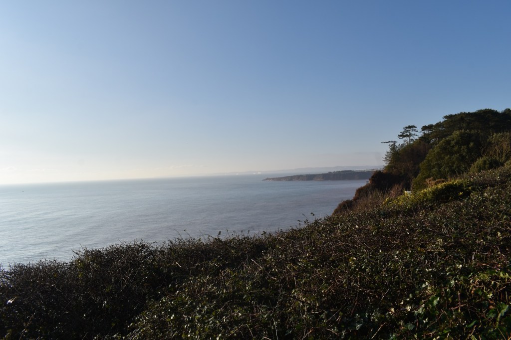
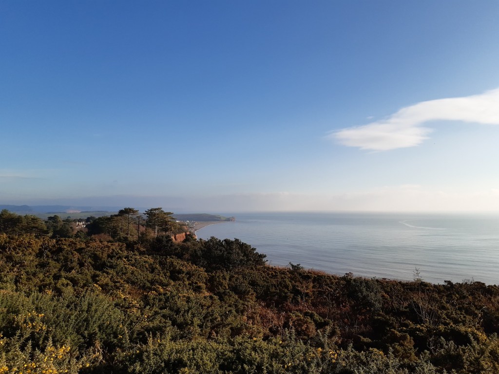
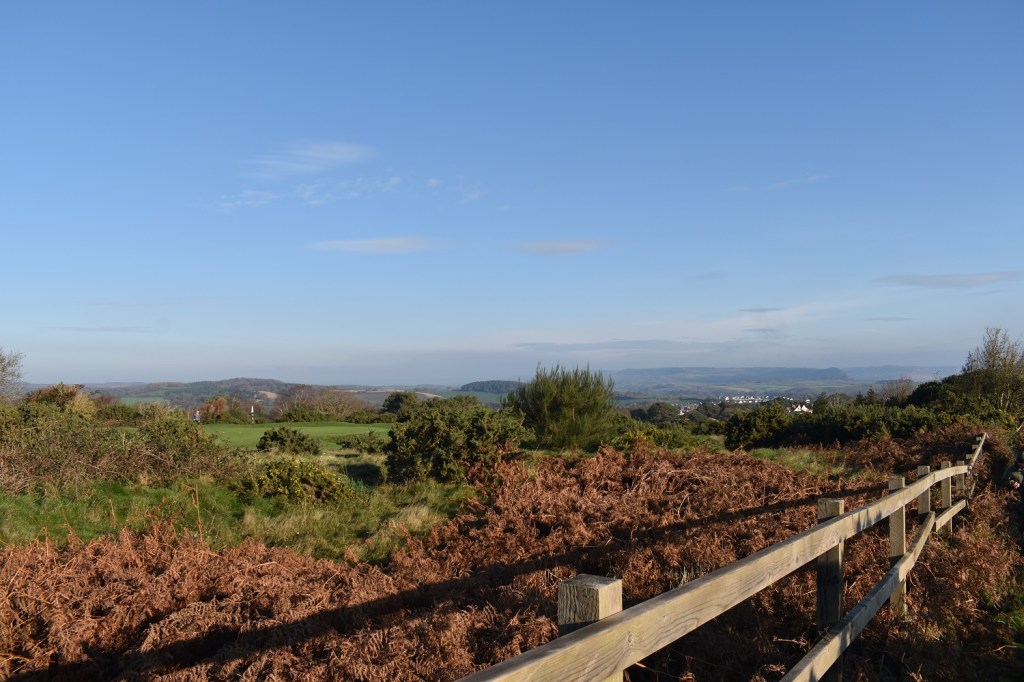
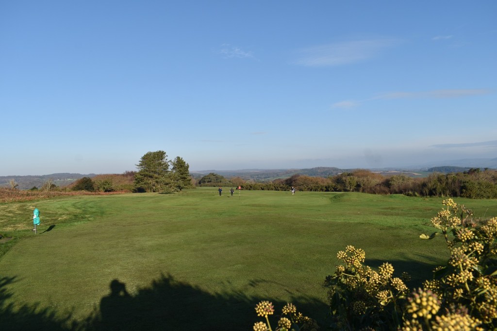
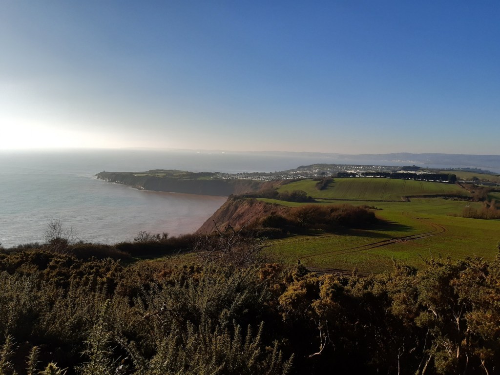
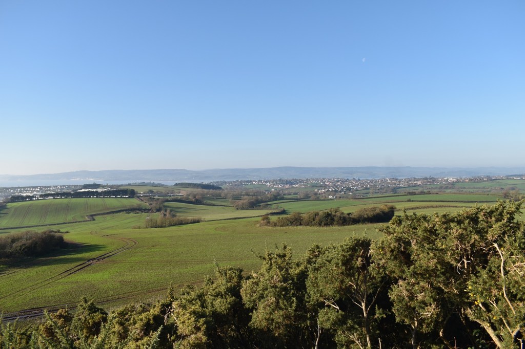
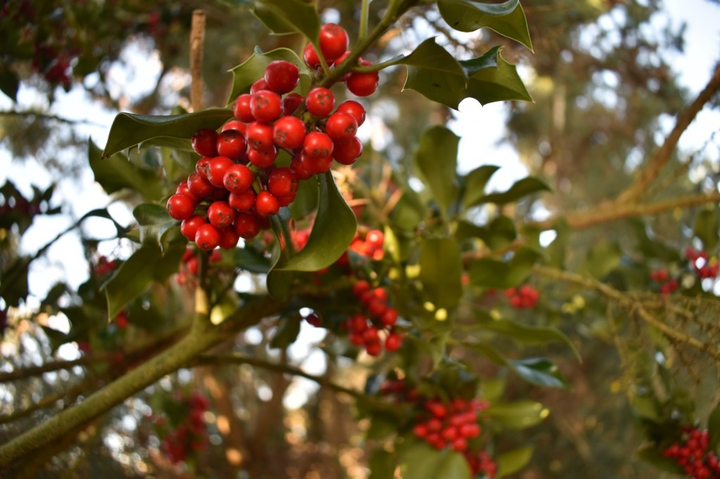
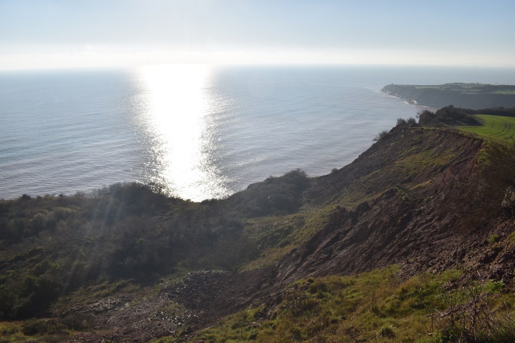
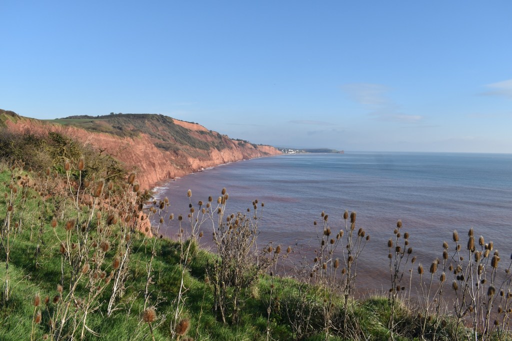
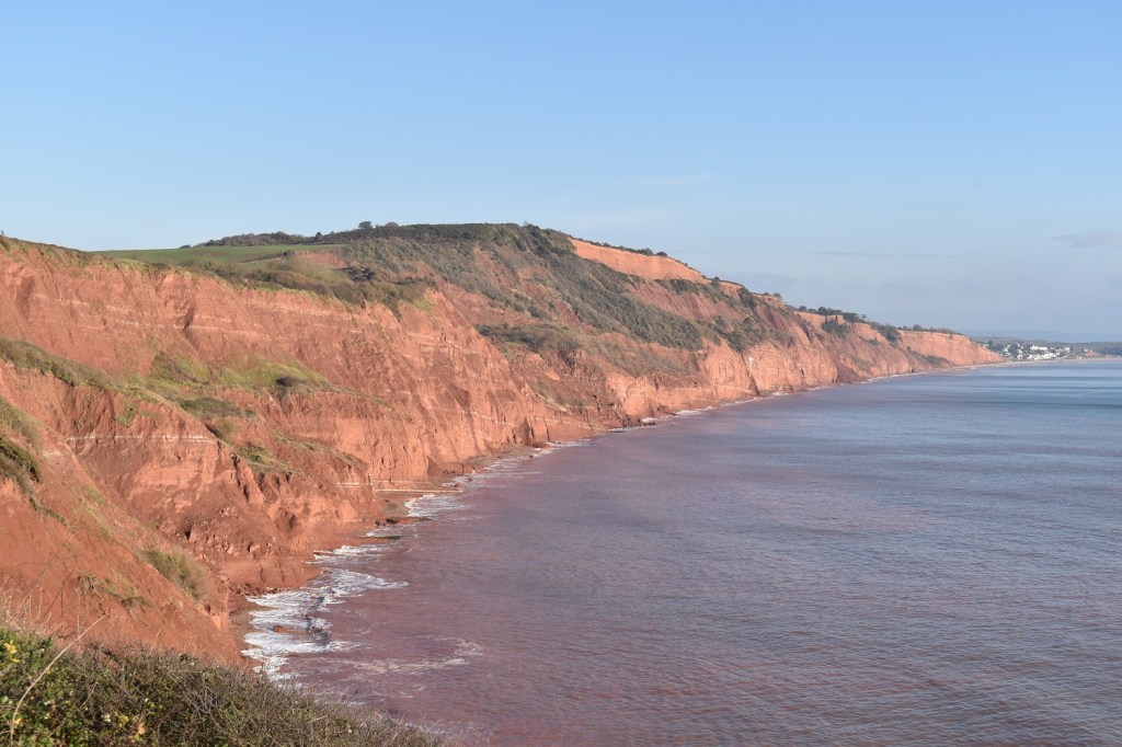
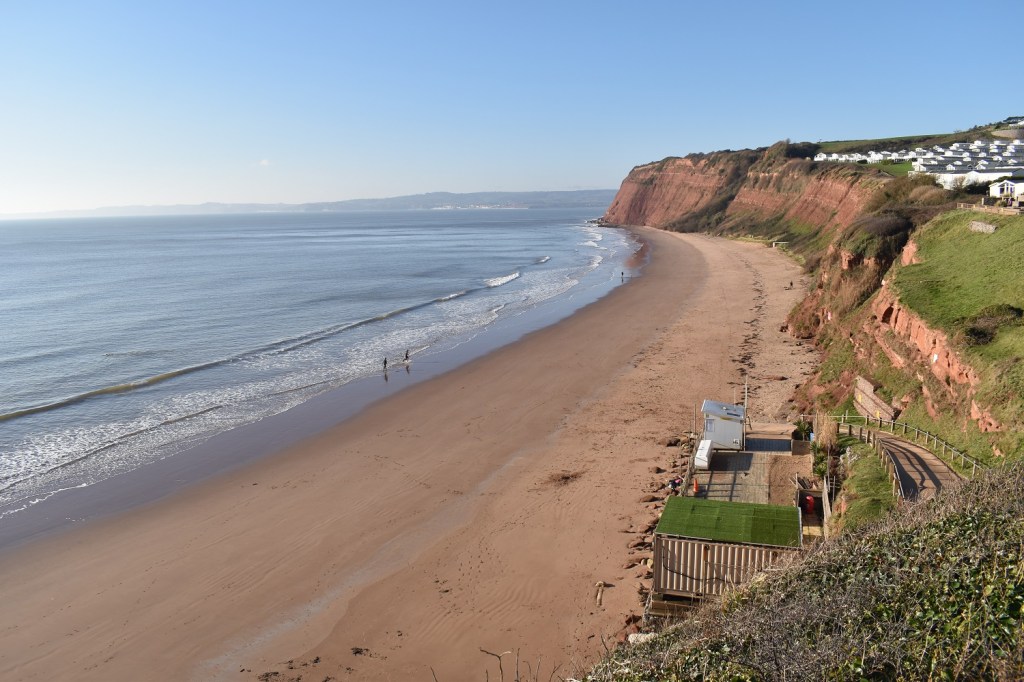
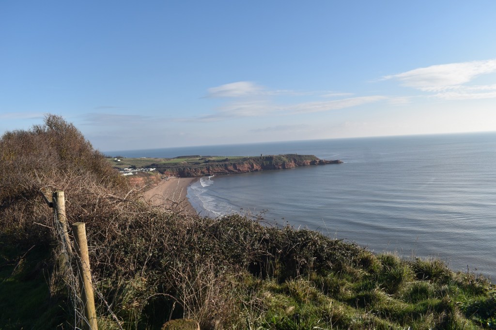
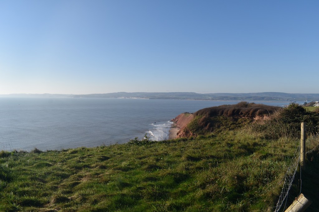
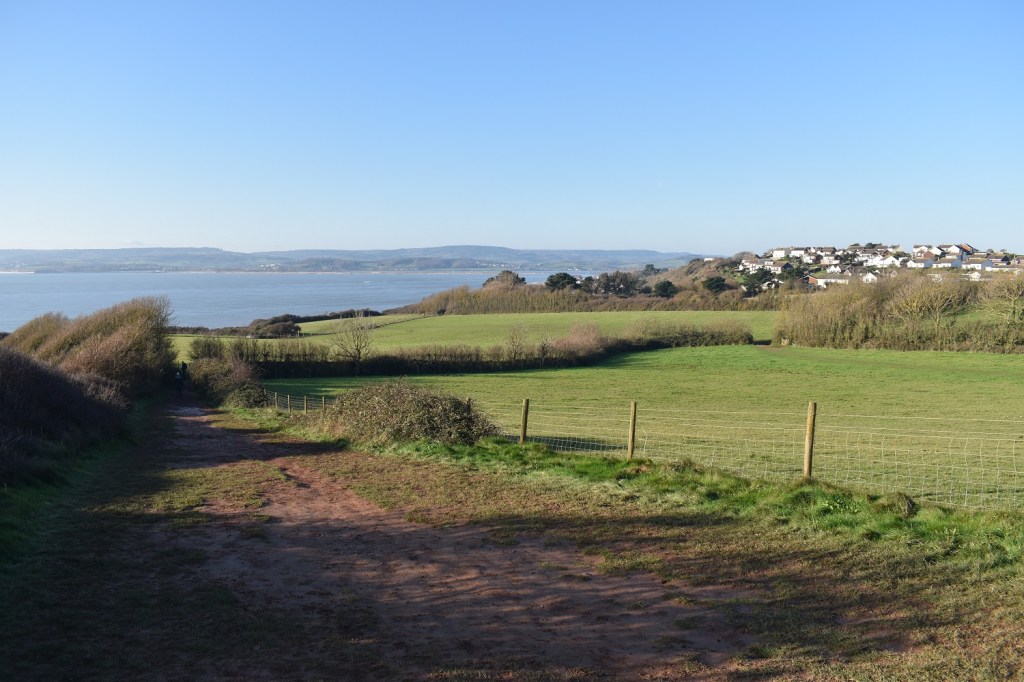
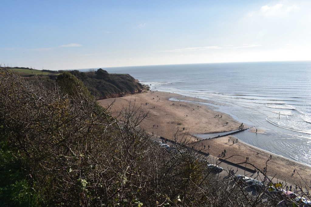
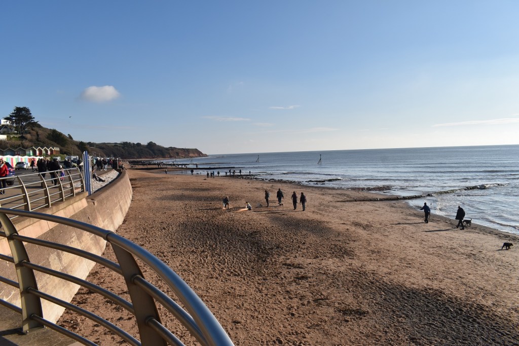
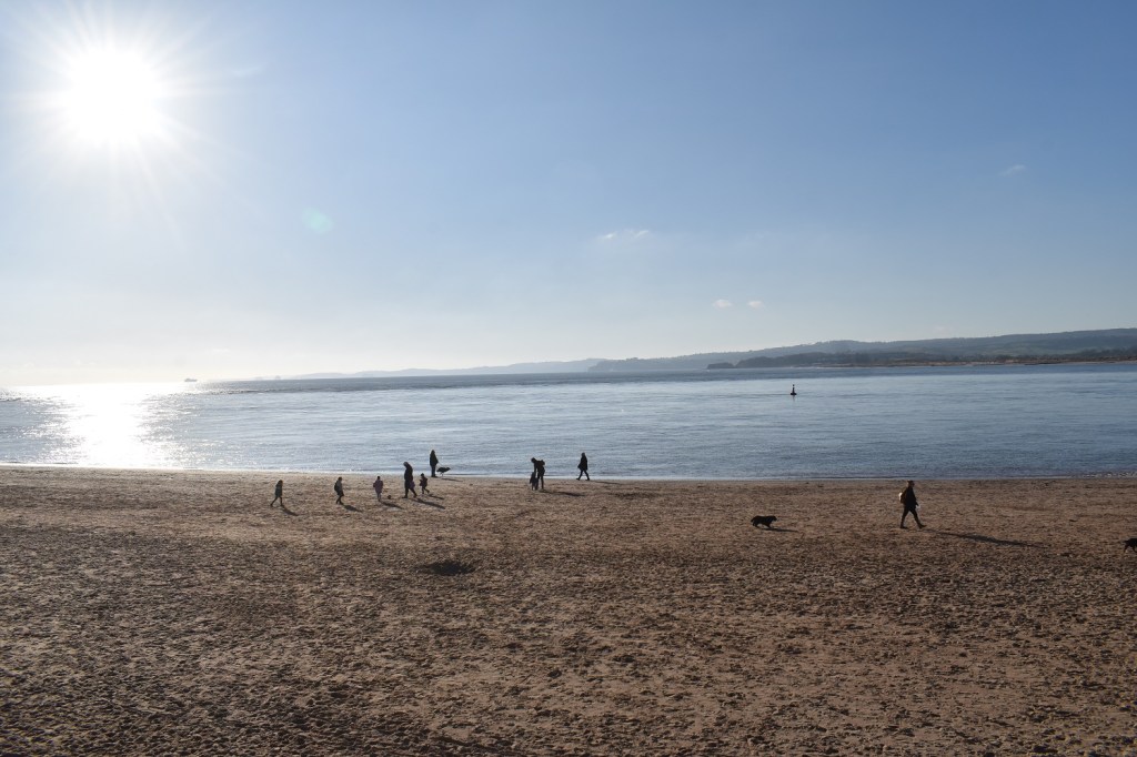
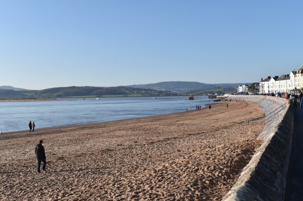
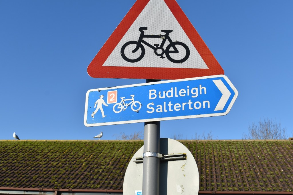
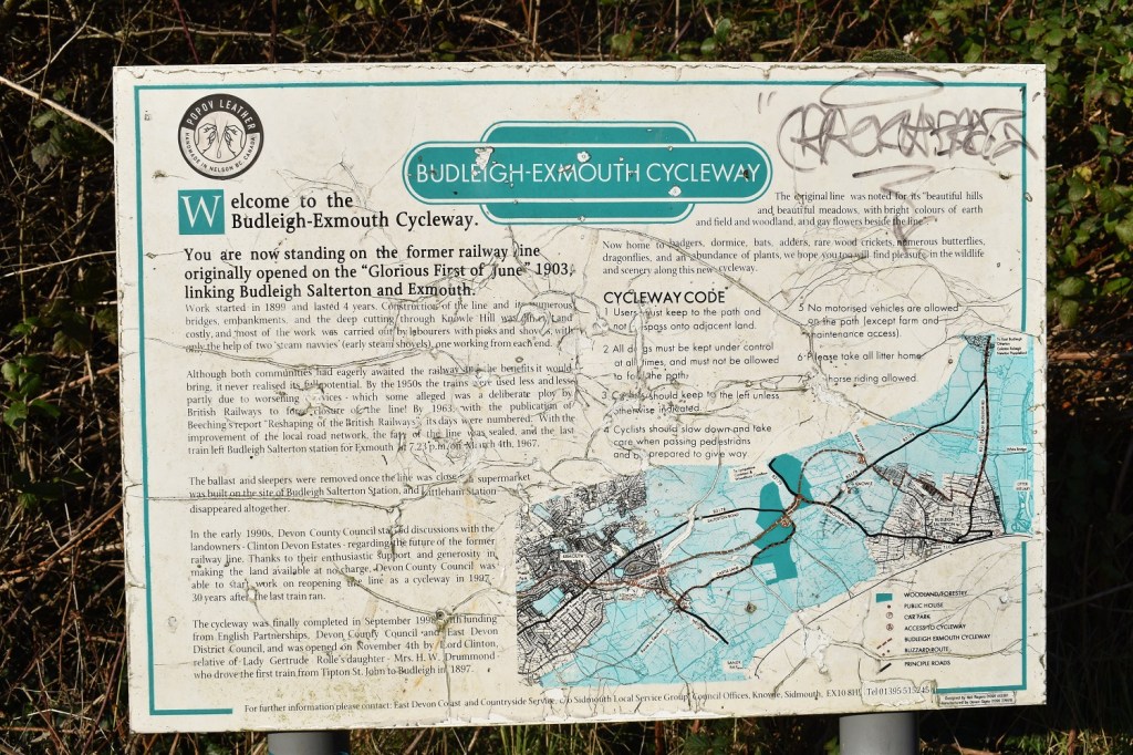
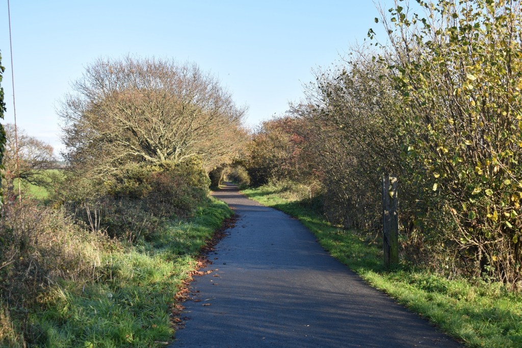
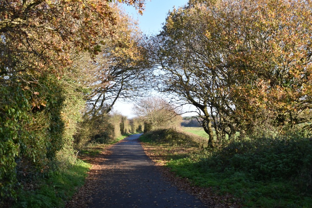
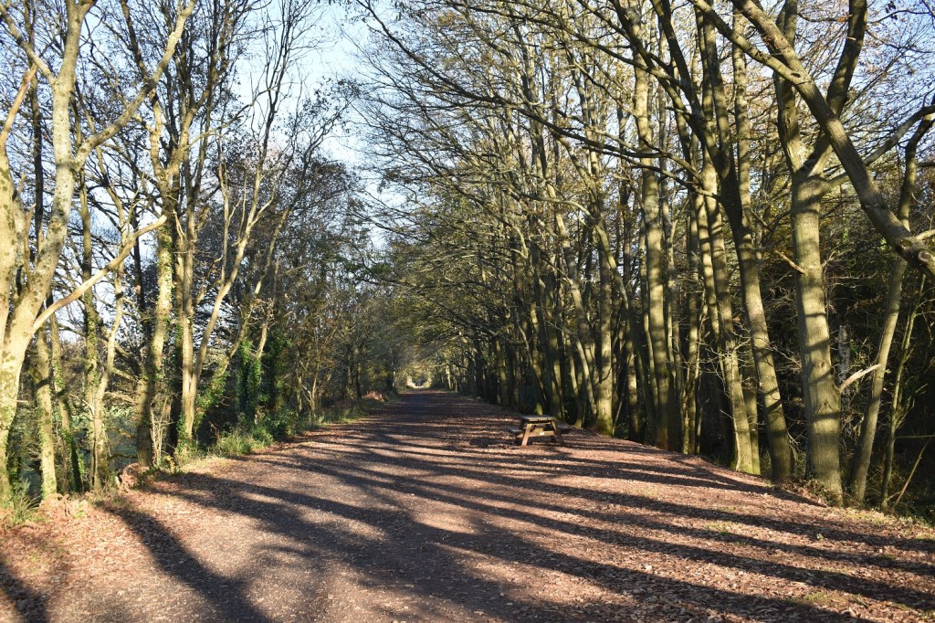
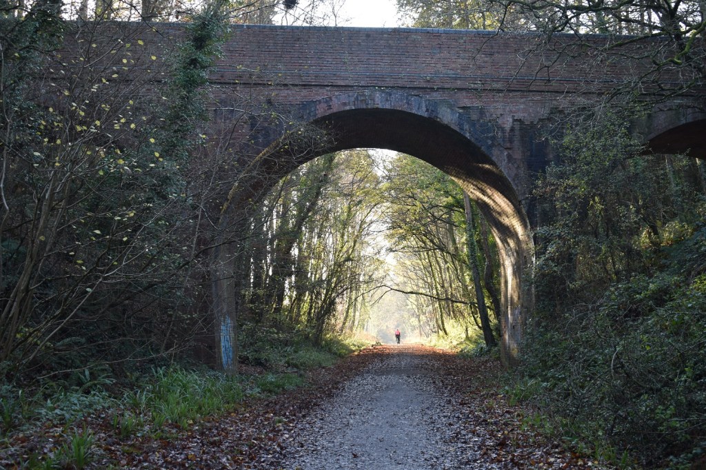
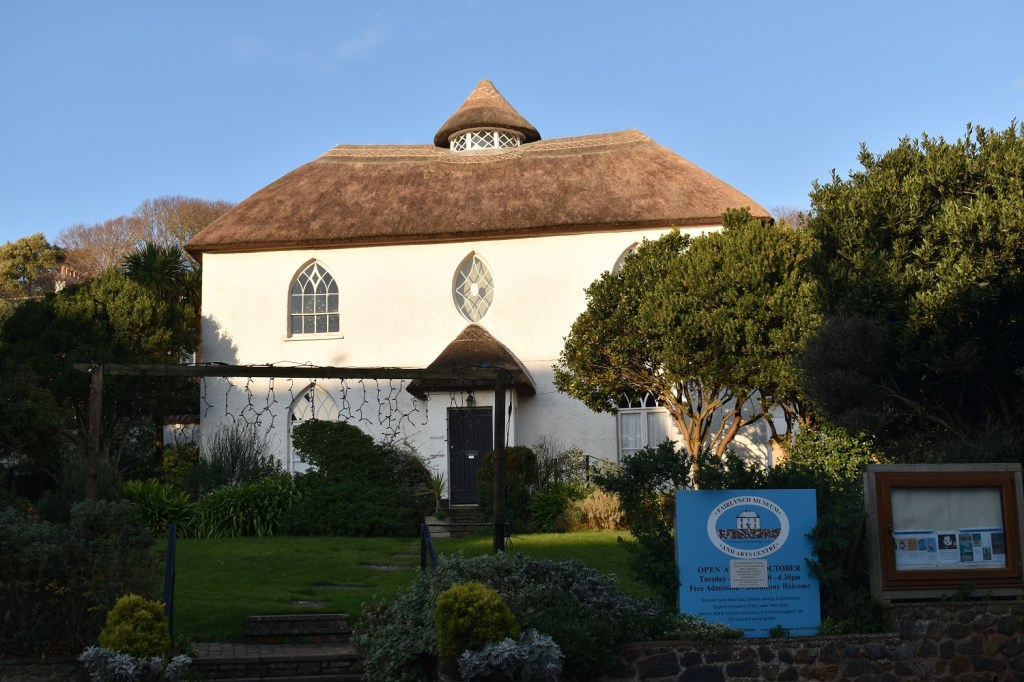
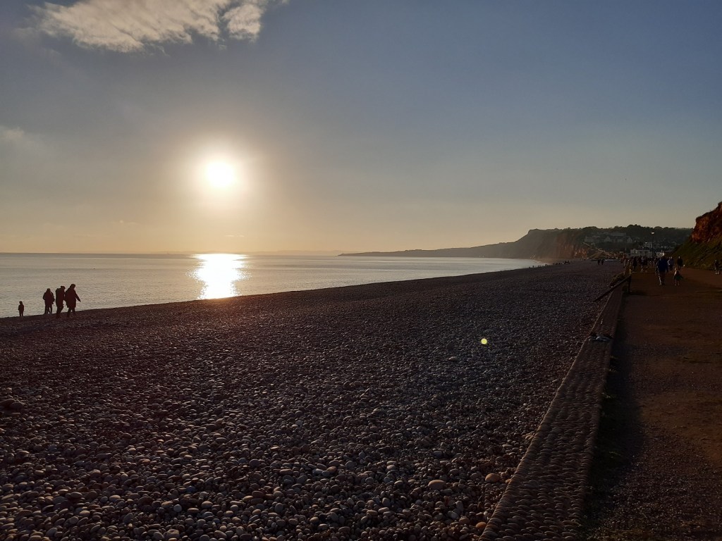
Starting out at Budleigh Salterton, the car park is just to the left here and the headland over there is the start of the section which leads off to Sidmouth, I walked that way back in August hereThat’s the way I’m going, its a long gentle uphill walk to the pointMorning swim for someStarting the climb out of Budleigh SaltertonStraight Point as I keep climbingLooking back towards Budleigh, lots of gorse and hawthorn along this path which can restrict the views, but occasionally you will get a view through it all which is very specialEast Devon golf course appears . the town on the right is Budleigh Salterton, just up and right of that is High Peak, which I walked back in the summerNow I’ve only played golf here once and it was as part of the Devon boys team, back when I could swing a club decently and before I went to Uni, which put paid to me being the next Nick Faldo. Its a great golf course for those that play regularly.I turn left after the last photo to see this, a view down to Straight Point and the holiday park. the coast beyond the Exe estuary is that of Dawlish, Teignmouth and down through Torbay. Its not just out to sea where there are good views. Exmouth from the top of West DownLots and lots of holly today, the red berries standing outLots of landslides here, right beside the coastal path, the farmers field next to this must be getting eaten away, year after yearThe farmers field to ExmouthThe sandstone cliffs of Littleham CoveYou can see the lines of rocks in the Sandstone, running down to the sea, which is eating away at the baseSandy Bay and the holiday park to the rightLooking back to Sandy Bay, Straight Point is across the bay which is home to the rifle ranges of the armyOrcombe Point and the Exe estuary beyondThe path after Sandy Bay was very muddy and slippery, lots of people here walking out from Exmouth, and turning back due to the path conditionsThe Geoneedle. Each section of the needle is a different type of stone from different parts of the Jurassic Coast. Opened by Prince Charles. The sandy beach across the bay is DawlishPart of Maer Rocks, a tougher rock sandstone, compared to the muddy sandstone of the cliffsExmouth beach, which is huge and runs around to my right hereI’ve walked 10 minutes here to look back along the beachAnd there is still all this to goA great beach here at Exmouth. Across the Exe estuary is Dawlish Warren, home to another golf course and a wildlife havenYou can see a ferry just leaving the docks there which is the end of the coastal path, that ferry takes you across the estuary to Starcross. I walked to that point and then headed into ExmouthAfter passing lots of shops and places to eat (which were shut) I reached this point. This is grid point SY006814, here is a great point to join the cycle way between Exmouth and BudleighThis is what is looks like for the first mile or soYou will cross major roads, but keep an eye out from the number 2 cycle way to BudleighAnd the info sign about the cyclewayAs you can see its easy walking (and cycling) and through some lovely countrysideLovelyTree tunnel and a bench for a snackThis is the old railway that you are walking along (the sign explains its heritage). So you will pass through a number of bridges which carry roads over the old railwayInto Budleigh Salterton now and one of the best looking museum buildings in this country. BeautifulAnd back to the beach and a setting sun, just glorious here today, a real treat to walk in such good conditions and around some fascinating landscapes


Used to lead lots of walks around there. Good bit of coast.
LikeLiked by 1 person
Its a lovely section, I was a bit surprised at how nice it was really
LikeLiked by 1 person
Love the colour contrasts here. Green fields, blue sky and those deep red cliffs. Fantastic walk.
LikeLike