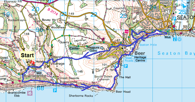
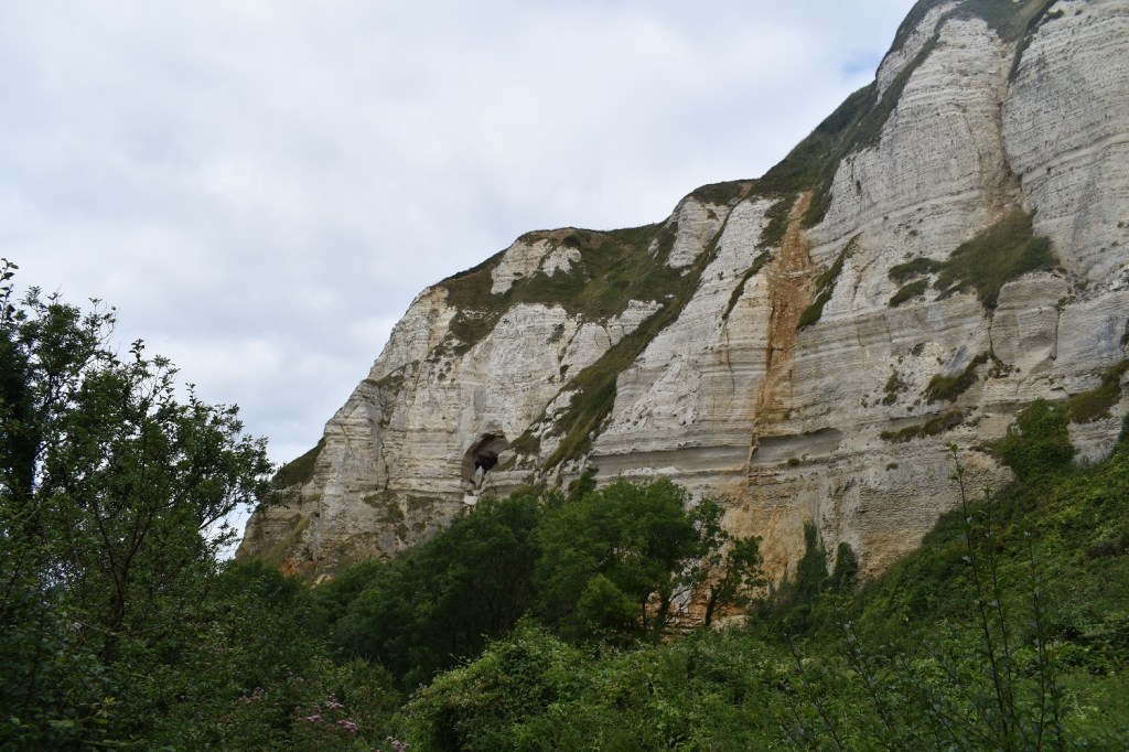
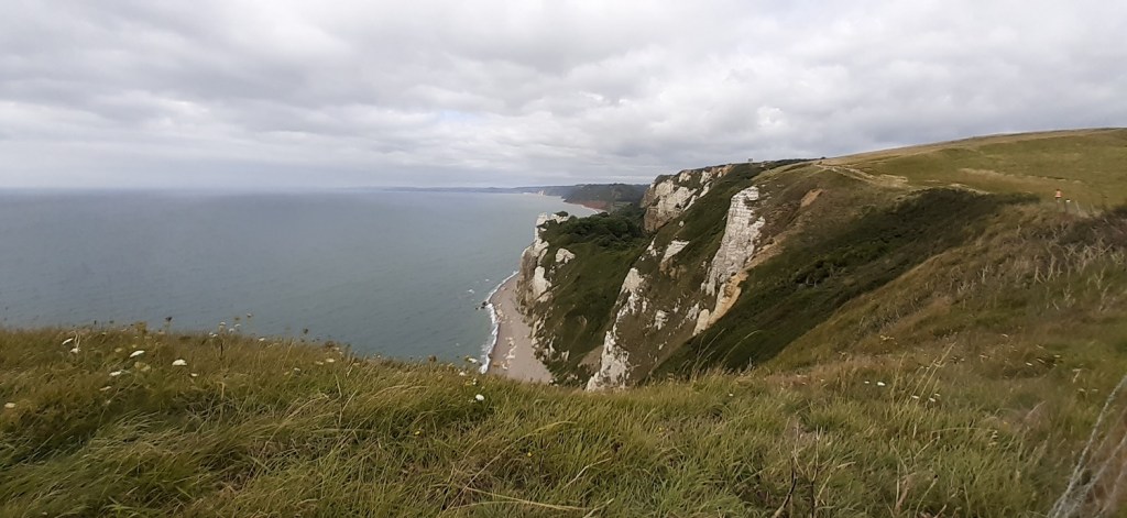
Back to the coastal path this week and choices of where to go. The south west coastal path is vast, and it can take a good 90 minutes or more to get to its furthest points to walk. Naturally I’ve picked off lots of the nearby spots and some of the good spots, but recently I’ve tried to branch out further whilst still leaving some near spots should I need to walk in winter nearer to home and not drive as far. This walk pushes my south eastern edge of walking (the south Devon and then Dorset coast) further east, as I head towards Lyme Regis and Bridport. I’m finding now that I have at least an hour and 15 minutes drive to most of the places to walk, whether that be north Cornwall (Boscastle area), South East (Seaton area) or west to the Roseland Peninsula. Early starts are key in order to get there and get walking. This time I went east to a place I’d finished my coastal path section in before heading back to Sidmouth, this was Branscombe Church. The plan was to head to Seaton, about 8 miles ish all around, and it provides another surprise on the coastal path, which is rarely known about, unless you do a bit of digging. Hooken Landslip happened over night one day in 1790, the 15 million tons of cliff slid down hill and revealed some fine stacks of rock, both left on top of the cliff and down below. Walking through this is like no other I’ve seen on the coastal path, it feels a bit Jurassic World, Heavily wooded and the towering cliffs above show all their lines and years of history. Its a great walk with plenty of places to stop and refresh and with a village called Beer, its worth a stop.
Start – Branscombe
Route – Branscombe Church – South West Coastal Path – West Cliff – Branscombe Mouth – Hooken Landslip – Beer Head – Beer – Seaton Hole – Seaton – Seaton Hole – Vicarage – Branscombe
Distance – 8.5 miles Start time – 9.20am Time taken – 4hrs 40mins Highest Point – West Cliff 105metres
Weather – Mainly cloudy, some sun and a teensy bit of drizzle at the end
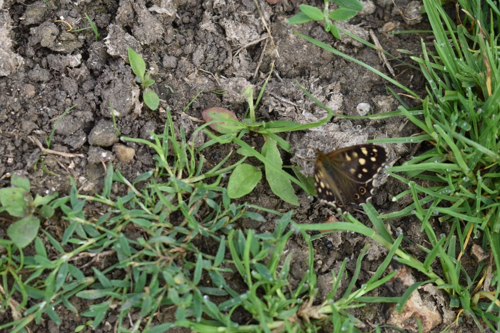
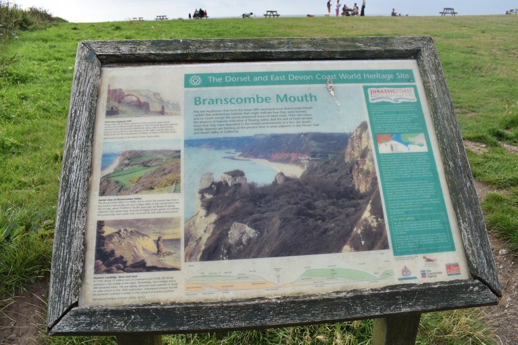
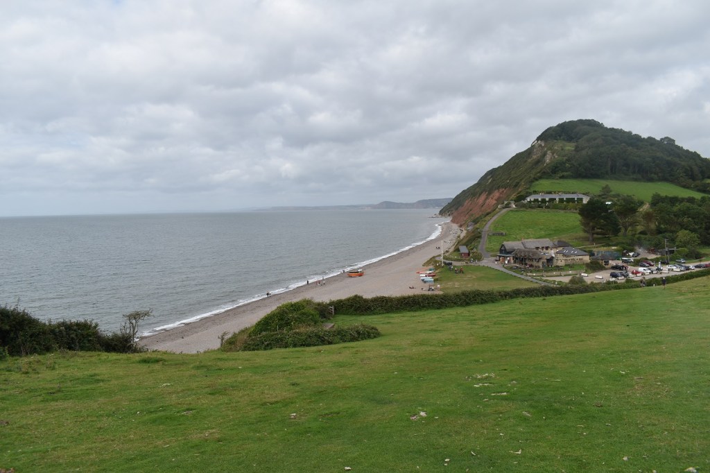
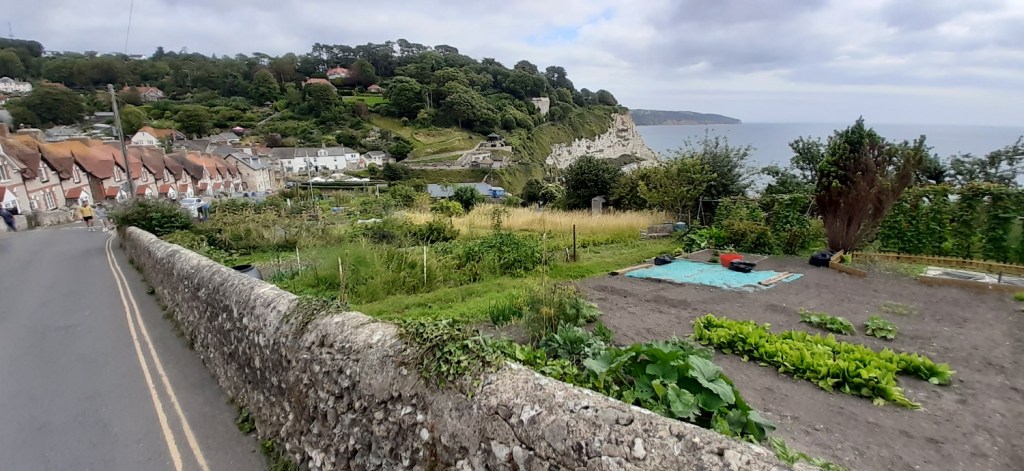
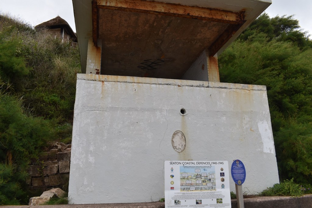
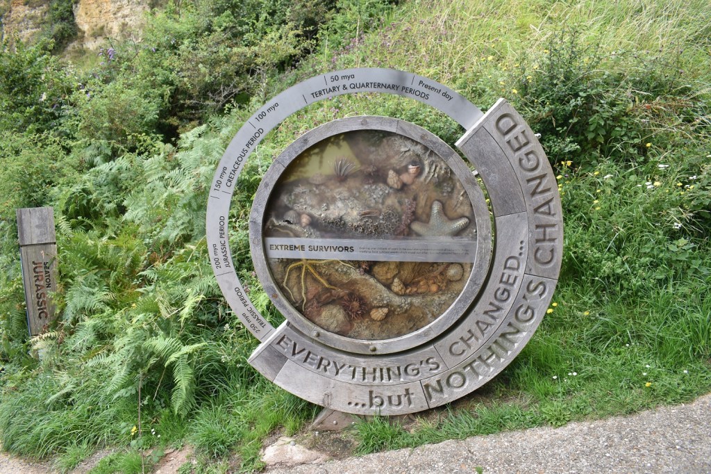
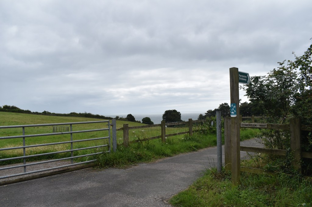
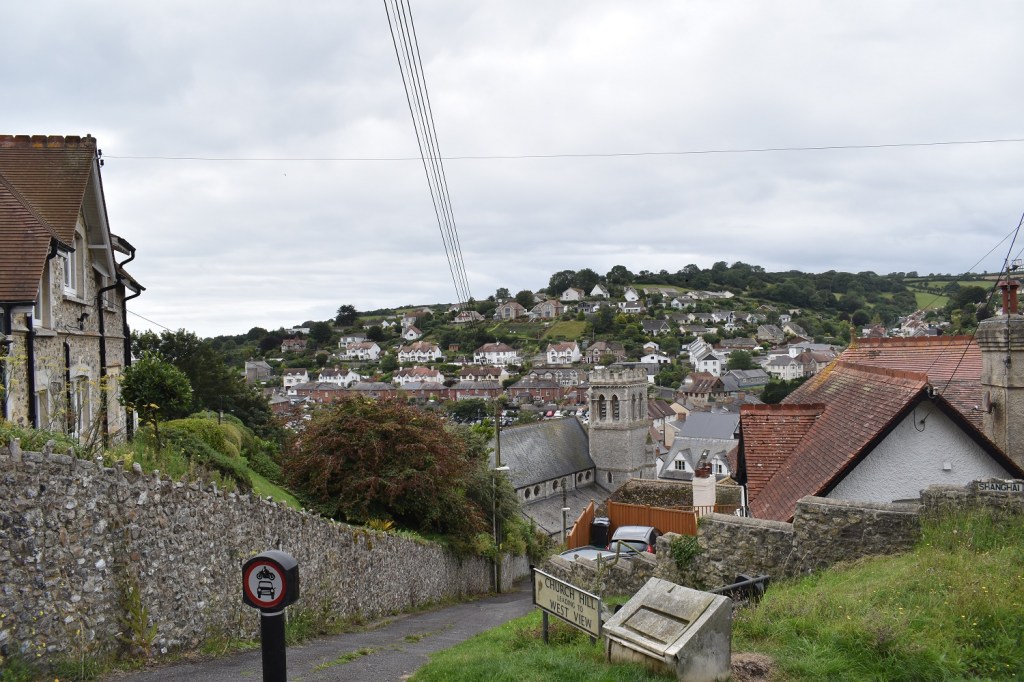
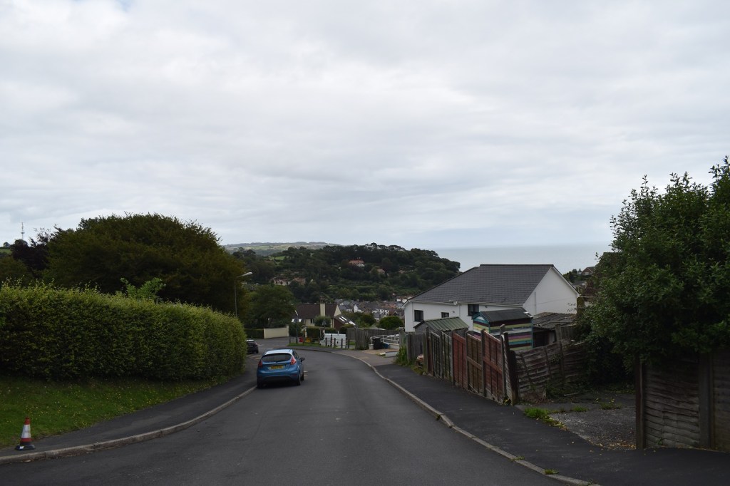
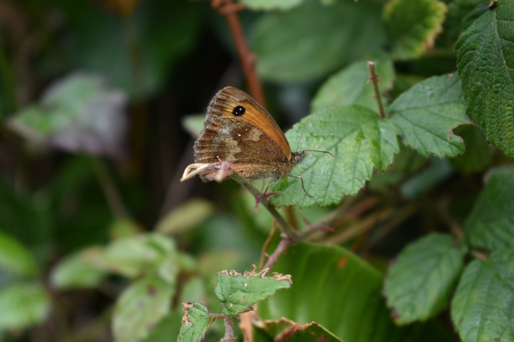
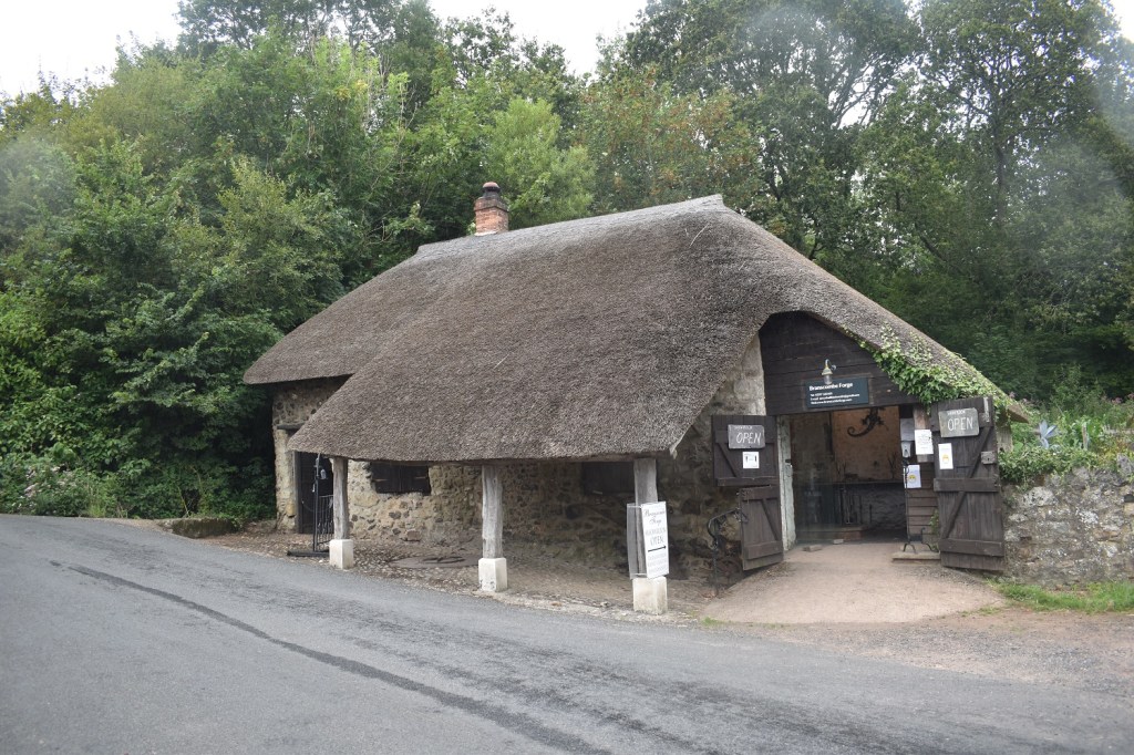
I’d parked down the road, behind me here, in the National Trust car park. The walk starts here at Branscombe Church as I’m heading left and up, and up into the trees to the coastal path on the cliffAt this point I kind of regretted not carrying on the last time I was here, and finished down in Branscombe Mouth, the climb up from the church is tough on legs not yet warmed up. However I’m on West Cliff and heading downhill to Branscombe MouthThat’s part of Branscombe village down there. There’s a tea shop/village hall and pub down thereThere was a bit of a side path of 5 metres from the coastal path which brought me to this view, don’t look down as it is vertiginous, but that’s Branscombe beach/mouth along there. The weather had its moody hat on today, some sun passed through as did cloudy bits but never settling on one typeBeach huts and Branscombe Mouth, the coastal path is obvious to start with as it heads across the field on the opposite side, but it doesn’t climb up the cliff any further, instead it heads into the green area, Hooken Landslip, below the cliff faceA speckled wood joined me as I had a morning coffee at Branscombe MouthThe board here tells you about the landslip and mill in the area here. I was fascinated to here about a mine/quarry entrance in the cliff face, time to go and see if I could see it.Climbing the field and looking back at West Cliff and Branscombe Mouth. The area in the distance sticking out is around Budleigh Salterton and Otterton LedgeThere is a caravan park below the cliffs, I head through that firstThe cliffs above, lovely layers of rock and white chalkHere is the quarry entrance, or adit which was exposed during the landslip. This is part of the Beer quarry, famous for Beer limestone which has made some of the most famous buildings in this country and beyond, including St Pauls, Westminster Abbey, Rochester cathedral, Exeter cathedral, London Bridge, Christ Church in St Louis, Missouri and a little known Windsor Castle. It ran for around 2000 years and finished in the 1920s. Now it is home to countless bats, most endangered. An absolute treat to see this on the coastal path and you can visit and tour the caves, just search for Beer Quarry Caves (no I’m not promoting)The pinnacles on my left here were uncovered as part of the landslide and erosion afterwards. The chalk cliffs stand out hereClimbing up to Beer Head and looking back along Hooken Landslip towards Budleigh Salterton in the distanceBeer Head and Seaton is ahead. Culverhole Point sticking out beyond SeatonDropping into Beer now, most of the village is to my left and up the hill (I’ll be there later) however down here all attention is seawardBeer and its beachOver the top of the next rise and I’m closing in on Seaton now, however the red cliffs down there hold a little beach, Seaton Hole, and access to Seaton along the shoreHowever at high tide it advises not to head that way ( I arrived 20 minutes before high tide) so I headed up the hill a short distance to join the alternative road (the original road, nearer to the coastal path, is closed apparently to everything, although I didn’t check to see if I could walk)A road walk, along the alternative path, into Seaton brought me to about halfway along the seafront, which was perfect for my efforts today. I turned here to head back to Branscombe, however I noticed plenty of people walking what looked to be the section to Seaton HoleLooking the other way towards Haven Cliff, next time I’m here I will head that way. I sat in front of the white block of flats down there and had a bit of lunch, to my left here there was a minivan selling wine out the back of it. Possibly a bit early for a burgundy for me!!I headed back along the seafront to see how far I could walk towards Seaton Hole before it cut me off. Along here are many points which refer to WW2 and our coastal defences. This was a search light stationThe beach to Seaton Hole was absolutely fine to cross at high tide, I can only assume those with health and safety hats on are talking about high winds, waves and higher tides when telling us to not walk the beach at high tideThe Jurassic coast, summed up in 50 million year periods, up the path from here takes you to the cafe at Seaton Hole which has the sign warning of the no possible crossing at high tide. I say use common sense, if that still exists in societyI headed inland at Seaton Hole and picked up the Cowerslea Way into Beer villageHere is Beer, or the inland part of it, the beach is down to the left herePeco or Pecorama pleasure gardens, all shut up which was a bit worrying for it. Home to a miniature train track and other things. the primary school next door must miss the activities hereThe miniature railwayLooking back down to Beer and the beach areaI’d joined a lane behind the miniature village which would take me basically to Vicarage and Branscombe. this field was full of purple flowers, which never show up as well on a photoMeadow Browns everywhere along the laneFields and fieldsAnd into Branscombe and the church in the distance, I’d already passed the pub and was heading to the village hall cafe, by the mill, for a cold drinkThis is the National Trust forge, the car park is to my right as is the cafe/hall. A bit of drizzle on the lens heralds a brief shower. I sat in the car and drank my tea and ate a biscuit or 3 before heading home. A fine walk this one with lots of places which are so unknown to see. I need to keep pushing east to see more of this landscape, can’t wait to be back
The section here and a bit further along towards Lyme Regis has all suffered from a kind of cliff slump, making for some fantastic walking. I haven’t done the next section of it yet (between Seaton and Lyme Regis) but I reckon it could be a gem. If you ever need a guide down this way, let me know.


One of our favourite bits of the coast.
LikeLiked by 1 person
I love it that there is a place called 🍺 Beer. That’s wonderful 😊 If there was a place called Cider , I would be happier as that’s my tipple. 🙂
LikeLiked by 1 person
Being in Devon I reckon they probably sell an awful lot of cider in Beer!!
LikeLike
What a cracking bit of coast that is! So much coastline to see and I’ve never really explored the southern side
LikeLiked by 1 person
The section here and a bit further along towards Lyme Regis has all suffered from a kind of cliff slump, making for some fantastic walking. I haven’t done the next section of it yet (between Seaton and Lyme Regis) but I reckon it could be a gem. If you ever need a guide down this way, let me know.
LikeLiked by 1 person