2nd walk in 3 days and if I’m honest my legs were still aching from the previous days’ hike over Dartmoor. Once I got going though the aching went away as I made my way along the coastal path towards Branscombe. The day had started well, I was up early and parking in Sidmouth at 9.10, the better news was that as I came down past the cricket club/croquet lawn, I spotted a parking space roadside, a quick check of the sign confirmed that any parking restrictions were only Mon to Sat. Yippee, free parking, opposed to the long stay parking at Chit Rocks, which was my planned destination. Sidmouth is a regency town and the esplanade along the front is full of nice hotels, places to eat and drink and a great view out to sea. At the far end, after the lifeboat station, some work to replace the bridge has been on going, so the footpath heads inland past a road ford to the old toll house before heading back coastward and little further along. The 3 or 4 miles towards Branscombe is a series of lung busting climbs and drops down to sea level, before a section stays high along Weston Cliff and past the Berry Camp. I had wanted to get to Branscombe but I figured it was just a bit too far in the time I had, so dropped to Branscombe Church and looped back along the lanes to Sidmouth. The highlight was the Donkey Santuary, the lanes and paths run through and around this place giving you a great look at hundreds of donkeys in dozens of fields. The place isn’t open at the moment but they are very cute and worth a look if you’re in the area. Another great walk along the coastal path with some stunning cliff views down to the sea.
| Start – Sidmouth |
| Route – South West Coast Path – Salcombe Hill – Salcombe Mouth – Dunscombe Cliff – Weston Mouth – Weston Cliff – Berry Camp – Branscombe Church – Street – Weston – Sidmouth Donkey Sanctuary – Salcombe Regis – Salcombe Hill – Sidmouth |
| Distance – 11 miles Start time – 9.15am Time taken – 6hrs 30 mins Highest Point – Weston 166metres |
| Weather – Sunshine and breezy, cool to start but warmer as the day went on |

© Crown copyright 2020 Ordnance Survey FL 2020 SF
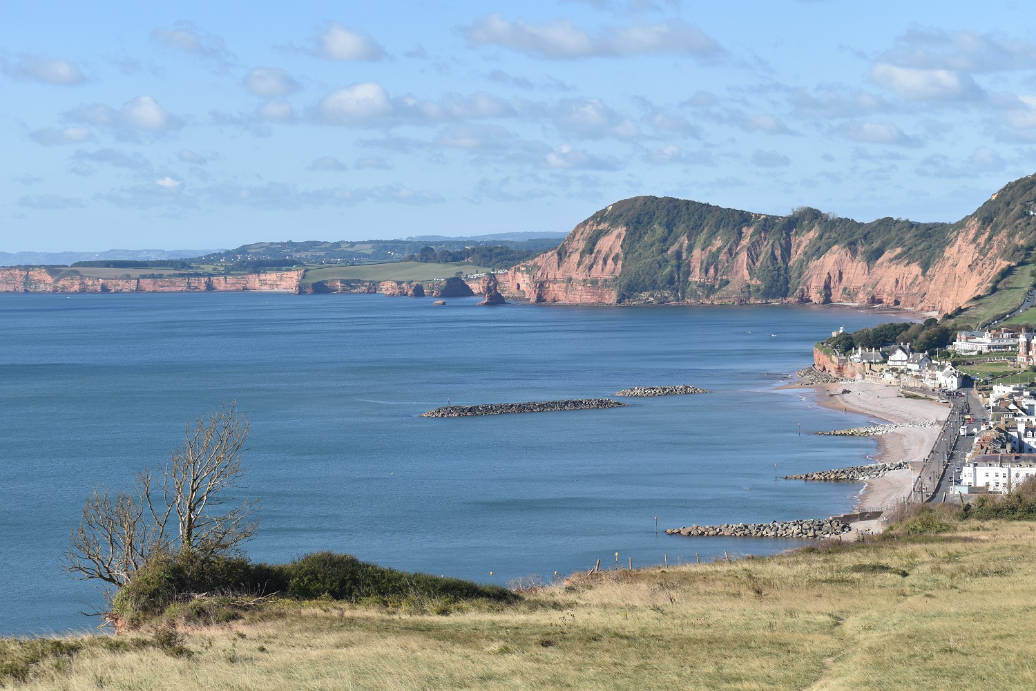
A walk to Chit Rocks from my impromptu parking spot to match up with my last walk here, allowing me to start were I finished last time (here)

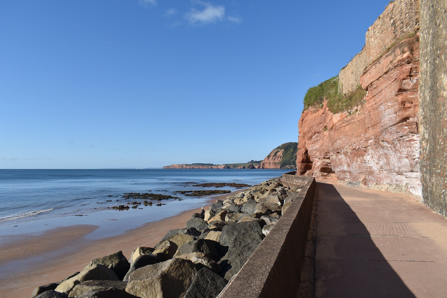
Sidmouth sea front, more of the Jurassic coast beyond Sidmouth. And more of it falling down, as recent as last week another section came down, closing the East Beach completely
You can see the two sections that have fallen recently on East beach, one last week and the other a month or two ago. The path now misses the nearly opened new bridge and heads inland a little way
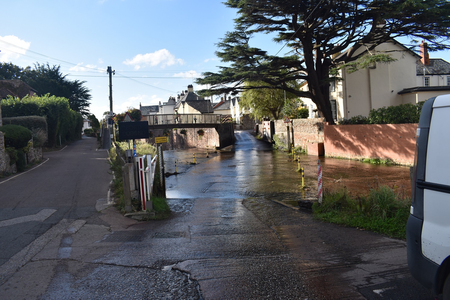
Through this road ford, it was well used
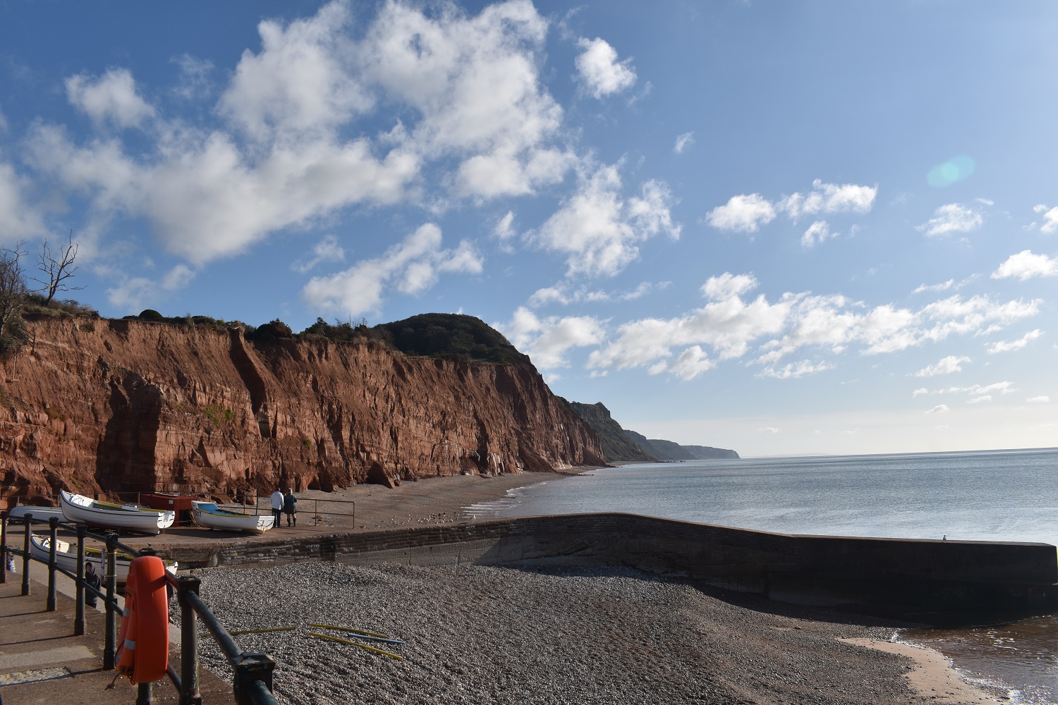
Groynes sit just off the beach protecting Sidmouth sea front with the Jurassic coast stretching towards Budleigh Salterton beyond. You can see the sea stacks at Ladram Bay by the big hill over there

Yep its a long way down, the coastal path still runs close to the edge here

Making it up on to Salcombe Hill it was obvious that there was a lot of people who liked an early walk in Sidmouth. In fact the numbers never dwindled, every 200 metres or so there was a pair, 3 or 4 groups coming my way. All the way to Branscombe Church. I was glad of the peace and quiet of the lanes on the way back. The lack of solo walking was the only downside to this walk

Huff and puff, there’s a fair bit of up and down on this walk

Salcombe Mouth is down there, although not in sight due to the greenery
There it is, Salcombe Mouth and Dunscombe Cliff is the next up
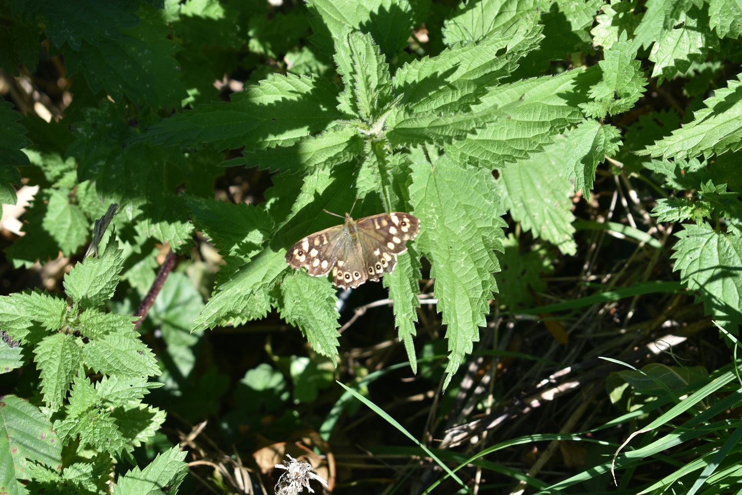
Lovely Speckled Wood on some nettles

What looks like some chalky cliffs mixed in with the sandstone on Dunscombe Cliffs. The first point beyond the cliffs is Danger Point, beyond that is Berry Head around Brixham/Torbay area

This section down there is called Hook Ebb, there’s a bench here so I took a break and a coffee and some biscuits. Lucky the next climb doesn’t start from the sea level before rising up again

Common Blue on a thistle. Only the second one of these that I have caught

Out to sea and into the sun. and I must have been drunk as I didn’t get the horizon level!!
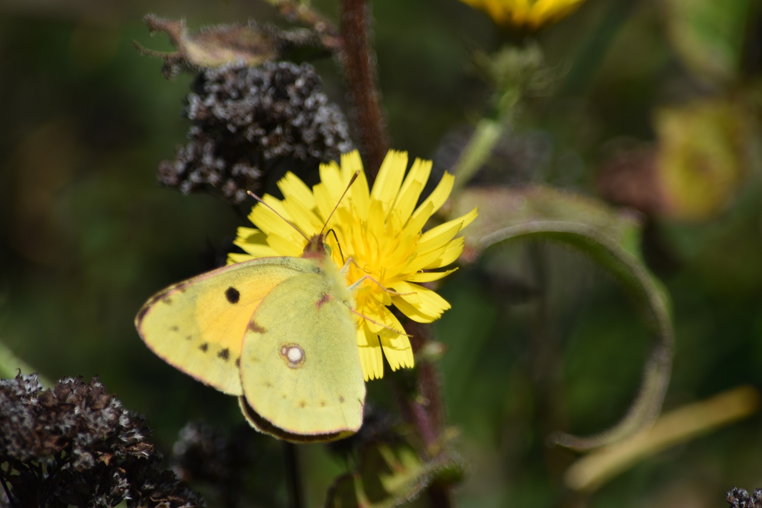
Now then, this one is a new one for me. A Clouded Yellow on Dunscombe Cliff, they migrate sometimes across to the southern counties of England and there were 3 or 4 of these spiralling around with each other. Took me a while to get a photo, but I wasn’t moving until I got it so had a second break for coffee whilst I snapped away

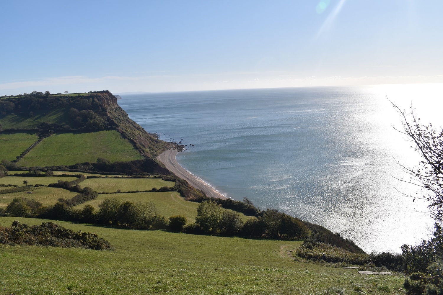
Looking down to Weston Mouth, and this one requires a drop all the way to the beach before a climb up again to Weston Cliff at 162 metres
Weston Mouth was a location for some serious high quality farming, the south facing slopes kept away the frosts and allowed for a micro climate to develop. Meaning early potatoes, Branscombe potatoes could be harvested and sold locally and on to London
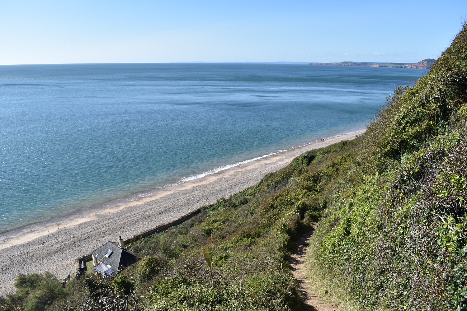
I spent a good while trying to work out how far this person had to walk from their car to get to this spot. There is a sort of track coming down from Dunscombe so maybe there,. But its at least 500 metres, however what an idyllic spot for a house, and the owner was in

A Large White butterfly, plenty of these around today
Climbing away from Weston Mouth, the good news is there are lots of benches all along this route, meaning a rest is not far away

Up on the right, about the 50th group to have past me on this walk as I take one last look to the west along the Jurassic coast

Can you see the little piggies living piggy lives

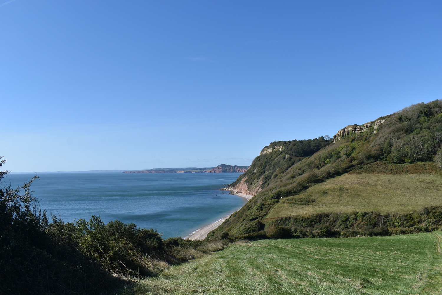
Approaching Berry Camp, I’m guessing that the chalky looking cliffs helped with the workings here

You might need a bit of zoom here (no not the new application which helps with face to face telephone calls, but the ability to look closer at something). Across the bay you can see the outline of Portland Bill
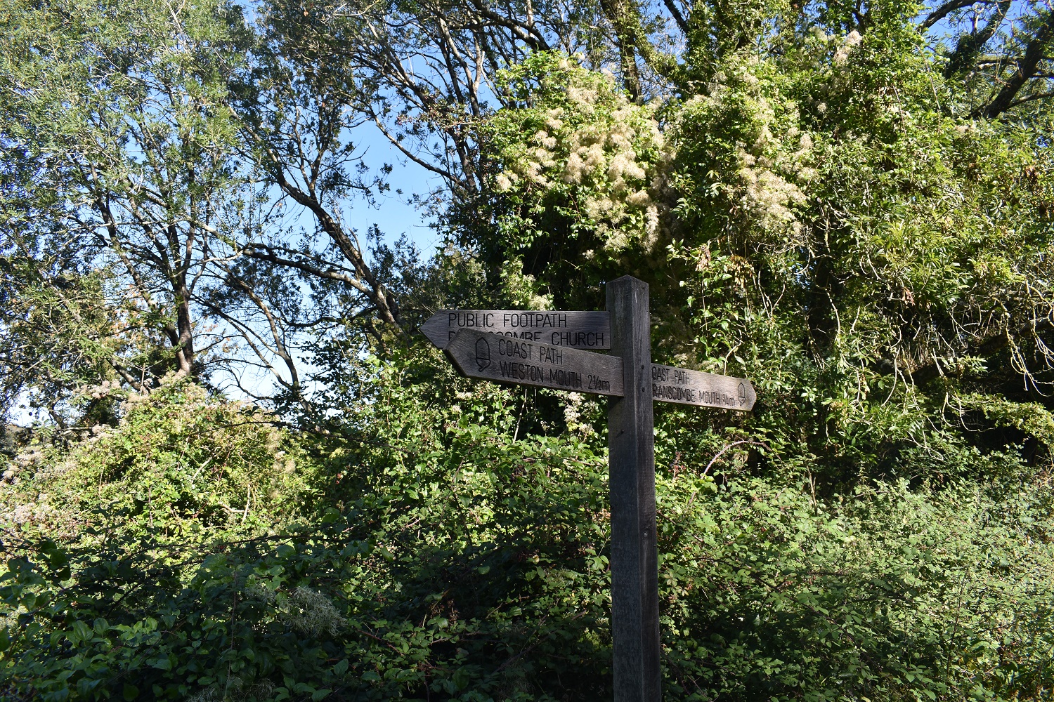
I’d dropped away from the coast here, following the coast path to this point. To my right was Branscombe however I’d walked far enough and had enough time to make my way back to Sidmouth. I therefore headed down to the church

Branscombe Church, St Winifred’s and dates back to 995AD. It definitely has a look of a Saxon/Norman church with the castle like turret

I was aware of the steepness of the lane out of Street to this point and there was no need to rub it in
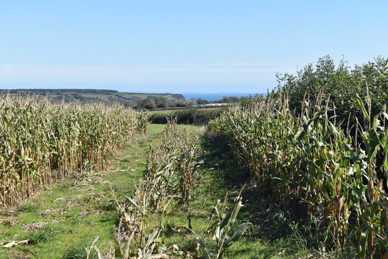
Through the sweetcorn and back to the coast at Branscombe
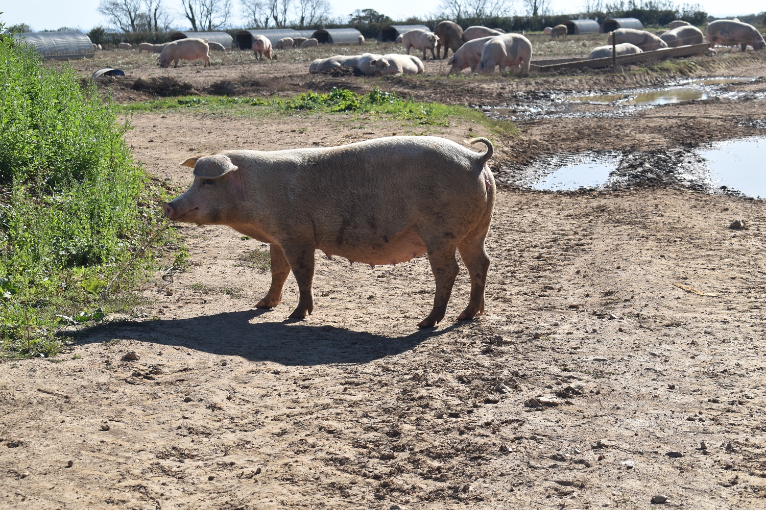
The lanes brought me back to the other side of the pig farm near Weston. The smell reminded me of the pig farm near my nan’s in St Helens. Billy Fletchers pigs was a regular smell when playing in their garden

A Comma on some blackberries, probably my favourite looking butterfly as it looks like it has been in a bit of a fight and some can look a bit scrappy.

I arrived at the donkey sanctuary having seen dozens of boards saying it was closed. The good part however is there are plenty of footpaths that pass through the many fields of this place.

Hundreds of these guys and gals in the many fields
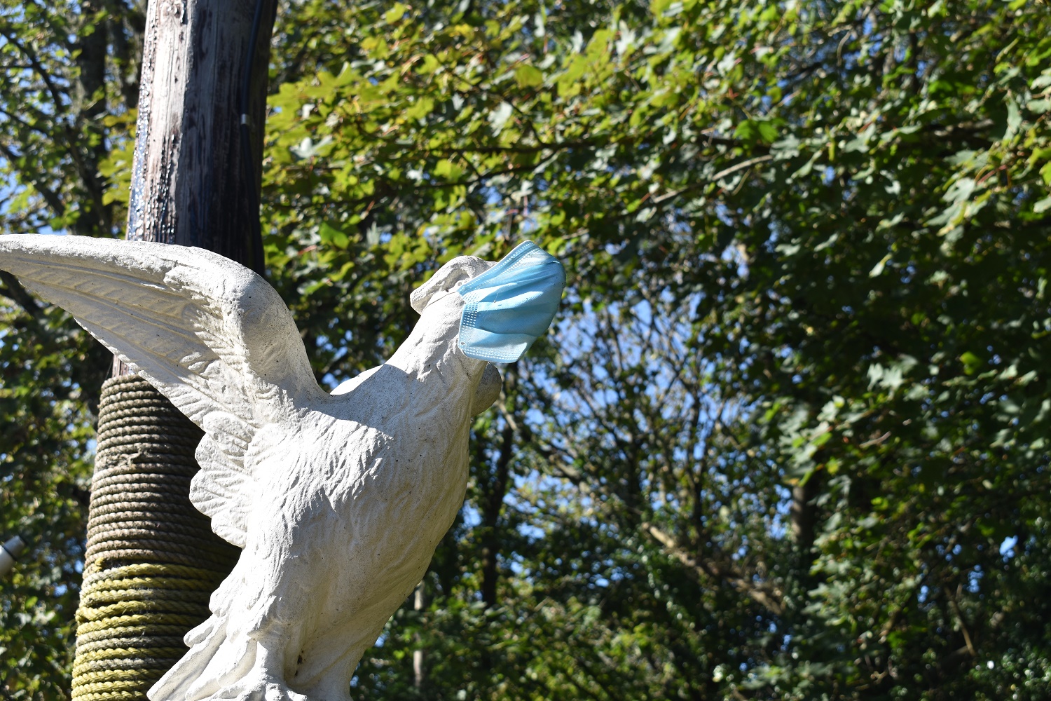
Can’t be too safe, even the garden ornaments need protection from the virus, but only after 10pm and in groups of more than 6, but not work, school, pubs, restaurants, shops and hunting parties. They are all ok, the virus knows that
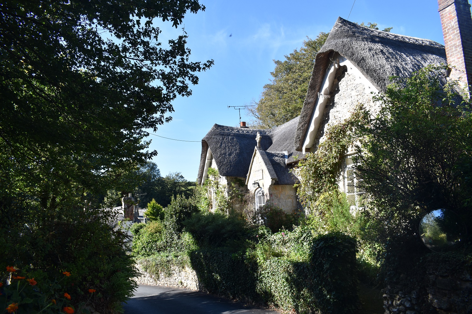
Thatched cottages in Salcombe Regis, to be honest the whole of East Devon has countless examples of this type of house

Salcombe Regis church, St Mary and St Peter. Another Norman church with additions from 13th and 14th century

In the dip is Salcombe Mouth as I leave Salcombe Regis

As I descended Salcombe Hill down into Sidmouth this is the observatory. Under normal times this place is open for star gazing, which sounds fantastic

Another Speckled Wood in the sunshine

Arriving in Sidmouth, I took a similar route back past the Old Toll House and road ford to the Esplanade. Grabbed an ice cream from a local shop and walked to the car. A fine walk, could have done without so many people along the cliffs but the walk back was great along the quiet lanes


One of our favourites,.
LikeLiked by 1 person
Would love this walk . The donkeys and pigs are a bonus. 🙂
LikeLiked by 1 person
The Jurassic Coast is lovely, such a lovely area for walks, beaches and some nice towns and villages to visit
LikeLiked by 1 person
It’s very bad form of you to keep posting these glorious walks long the South coast and giving yet more places I need to go and visit! 😀
Stunning walk and I love the arrow straight lines of the beaches. I should really get down that way. Love the now regular dig at our ridiculous COVID rules in the posts
LikeLiked by 1 person
I’m doing my part for tourism South West!! I really should get a commission
LikeLiked by 1 person