I had been watching the weather most of the week and unusually as we neared the weekend it was getting a little better. It was set for a dry Saturday with some sun and the same for Sunday. I thought a walk around the high points, of the north western corner of Dartmoor, would be a good idea. As I drove through Tavistock, with rain pouring down on the windscreen, I wanted to strangle the weatherman. I ploughed on and found the weather and cloud had lifted when I pulled in to the Sourton village hall car park area. I set off in cloud and assumed it would get better, well it did, eventually. Between that though, the cloud dropped, as did the rain. My route, apart from one diversion into Tiger Marsh, was fairly conventional, following a good track all the way to Kitty Tor and then a grassy path back to Corn Tor and then Sourton Tor. Easy peasy. Now Stenga Tor was on my list and I’m a bit a masochist sometimes. This area is boggy and I must have found all of the marshiest, boggiest parts. The worst of it is west and north of the tor, although south and east is still pretty soggy. The sun at the end meant that I finished on a high and the views again from Sourton Tor are always a joy. Now to find the waterproofing stuff for my boots!
Starting in Sourton, this is Sourton Green Cross with the Highwayman Pub, Britain’s most unusual pub behind!!
Sourton Church
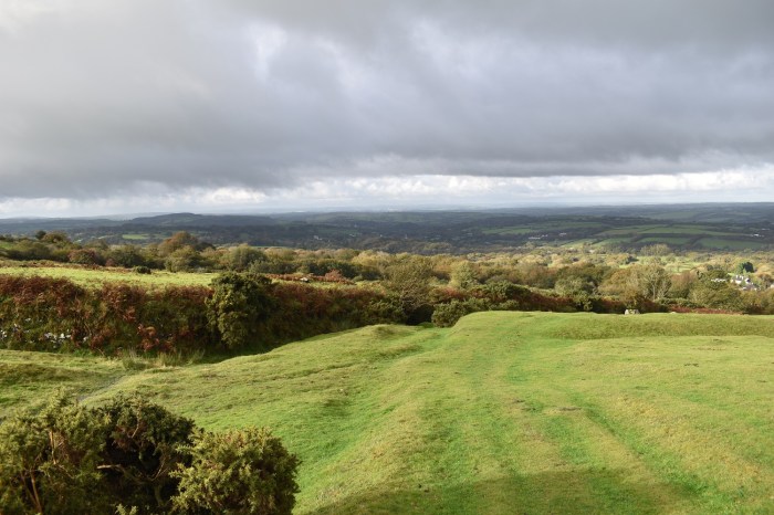
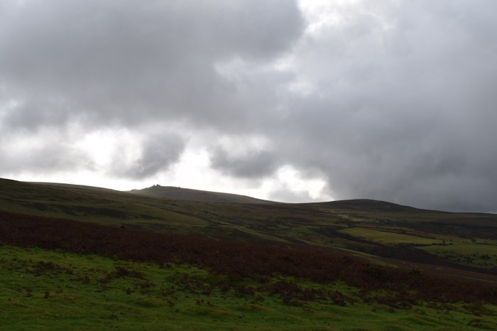
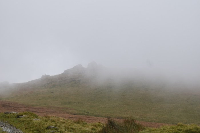
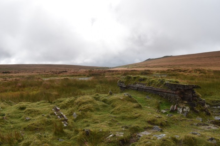
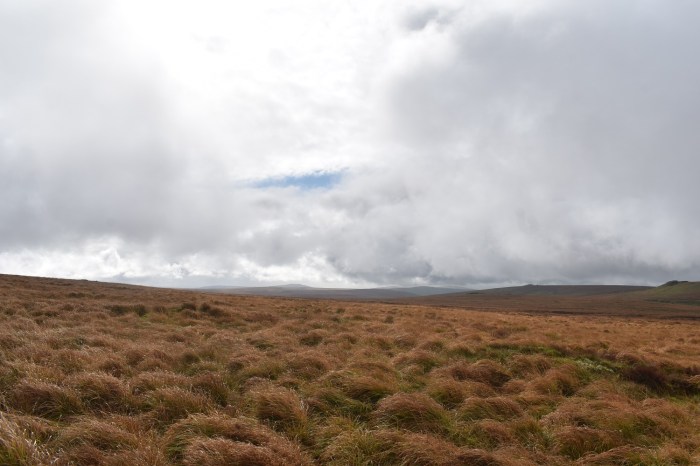
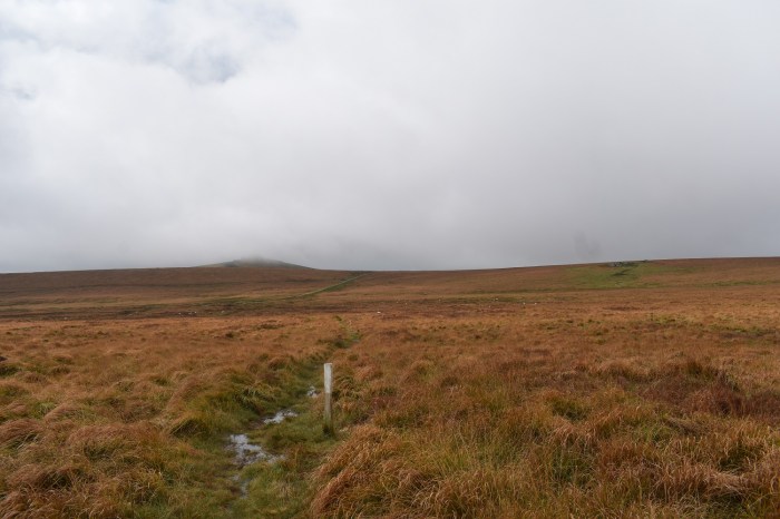
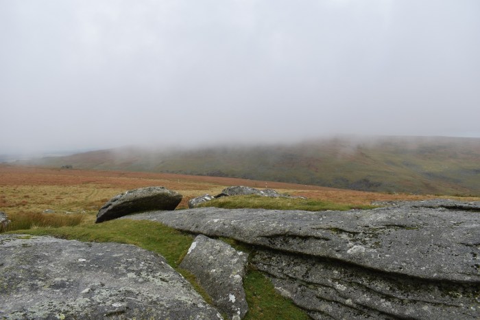
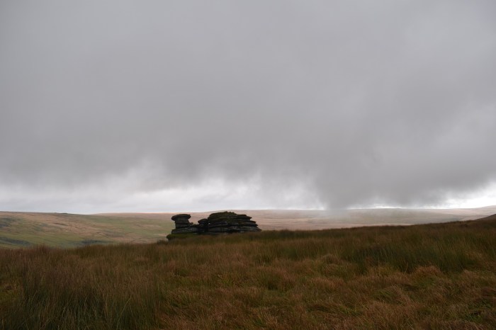
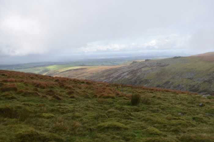
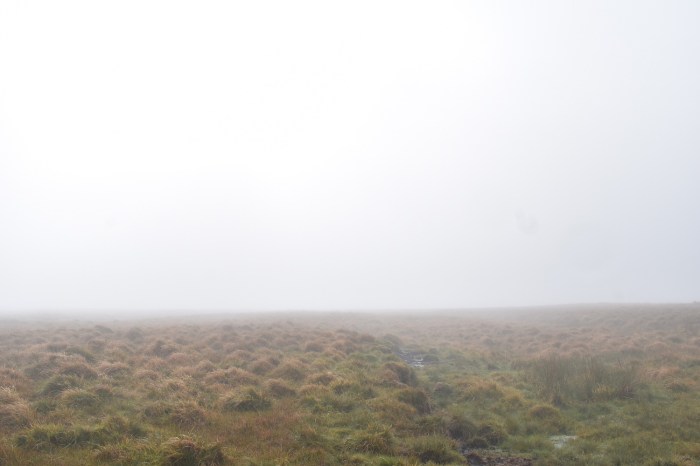
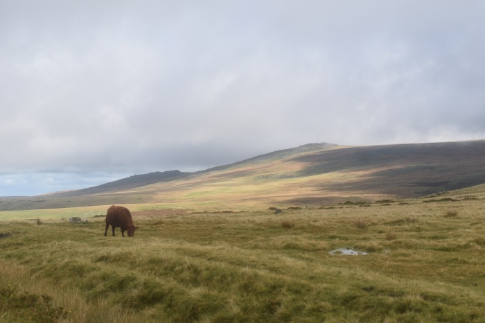
Crossing the Granite Way cycle route and on to the open moor, turning to look back at Sourton ChurchSunshine breaks through as I look south west over the Lydford Valley towards Bodmin MoorEast Tor is above me, I head right here and around the back of East Tor on a clear track heading uphillThe cloud level appears to be dropping as I look south towards Gibbet Hill furthest left and Brent Tor in the centreHmmm, this is the culprit. Normally looking this way, you would be able to see the fields as far as north Devon, but there is a clear wall of rain heading my wayThe Lake viaduct below me as a shower of rain passes behind thatIt looks brighter to the south behind Great Links Tor, however I was soon to be swallowed upThis valley runs down towards the Lake viaduct, which you can see down there. The path loops up and around the valley and links on to the Rattlebrook railway, I think this might be my last view for a whileAs I stepped on to the Rattlebrook railway the rain started and the cloud engulfed meLydda Bridge with Gren Tor up on the left. To the left of me is Tiger Marsh which is one of the Dartmoor 365 squares I went for a lookHmmm, I guess I expected this but I should have had a stern word with myself when I decided to walk across Tiger Marsh towards Gren TorI’m pretty much 3/4s of the way across here with just the infant River Lyd to jump, that’s if I could get through the soft boggy green stuff first, water was about ankle deep in the worst bits which left my shoes pretty wetI made it however and as I reached Gren Tor, Great Nodden came out of the cloud and some views appeared againNot far from Gren Tor is Woodcock Tor, a small outcrop which sits 10 metres below the Rattlebrook Railway track. again Great Nodden in view with the Lyd valleyWoodcock Tor looking back towards the Sourton directionGreat Links Tor swirling in and out of viewThe Rattlebrook railway path. This path is great, its easy walking and takes you into the heart of Dartmoor behind Woodcock HillThis is the ruin of the Rattlebrook peat works. Bleak House is down in that direction in the dip between the Dunna Goats on the right and Green Tor which is just hidden on the leftFurthest right is Lower Dunna Goat, then Hare Tor with Great Mis Tor centre leftThe posts help you follow the path to Kitty Tor, part of it heads over some boardwalk sections which can lead you into ponds if you are not careful. Great Links Tor is staying stubborn and refusing to lose the cloudOn Kitty Tor and at the higher rockpile with the military flagpole on itThis is the lower outcrop and has two military huts and a view down to Lints TorIn the cloud is the roof of Devon, High Willhays and Yes Tor, with Stenga Tor down there on the left, my next objectiveThe cloud looks like it is dropping a bit here, but in all honesty it was dropping and rising again quickly, however you can see to the south beyond Great Kneeset that the weather looks brighter. Hangingstone Hill is back leftThe snail shape of Stenga Tor. Now I really dislike this tor, really dislike it. I’m stood here on an island surrounded by ankle deep boggy ground. If you walk from here to the tor you will go in knee deep at some point at least once. The only way in really is from the Kitty Tor side (south) and that is best done as an in and out. However if like me you then want to head north, you need to navigate 70 metres of ankle breaking, knee twisting marsh. The waterproof on my shoes had given in a while ago and this did not help. Stupid torNow I’m on the walk above the West Okement valley, the views across to Black Tor (Okehampton) are brilliant and I can see sunshine ahead which improves my mood after the bog squelch at Stenga TorThe West Okement valley, you can see the Slipper Stones on the left and heading down into the valleyBlack a Copse woods and the Slipper Stones belowAt the point of the last photo you turn away from the valley a little (another path does continue onwards to Shelstone Tor), I’m heading for Branscombe’s Loaf. A great name however the cloud is in and underfoot is more of that horrid marshy boggy ground againBranscombe’s LoafOh hello, is that blue sky to the northI look back to Branscombe’s Loaf from the second outcrop up there to see a lone walker who had appeared like a ghost from the cloudsI worked out that the Corn Ridge, Branscombe’s Loaf and High Willhays had been in cloud the whole time, the areas around went in and out of cloud before the clag eventually cleared completely. Here I look north to sunshine and north Devon
Zooming in on Meldon reservoir with the Meldon viaduct in view beyond
I dropped away from Branscombe’s Loaf in a westerly direction and found this, Corn Tor. The fields of west Devon are in sun below
The hazy cloud came and went whilst I was here, that’s Sourton Tor down there which is my next destination. I might yet add this tor to my 500 list but that would mean dropping one. If any of the few I have left to do aren’t very good, then this one will be first up
Yes Tor is just clearing the cloud now, with West Mill Tor behind looking dark and moody
My turn for the sun now as I reach Sourton Tor, there were a few families up here which is nice to see and didn’t bother me too much as I was taking a photo or two and then moving on. This view south west from the tor, over the trig point always gives a great photo in good weather
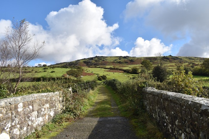
Yes Tor has gone again, but Branscombe’s Loaf is clear on the right with Corn Tor furthest right of photoThe dome of South Down to the left of Meldon reservoir as this corner of the moor clears the cloud completelyHeading down from Sourton Tor back to the village you pass this head shaped rock, I think this is the one they say looks like a witchSourton Church below and the land of west DevonBack at the bridge over the Granite Way with Sourton Tor in full sunshine above, East Tor is on the right hand side. A fine walk in weather that shouldn’t have been here, very wet boots and socks that needed ringing out. Glad I had a spare pair in the car!
I really like that area from Sourton, across to Shelstone Tor and Meldon. I like the Rattlebrook railway and the River Lyd/Great Nodden part. Its just that small section around Stenga Tor, horrid!
Looks like an epic walk. I wouldn’t like all that squelch though! Love the rock that looks like a face. And the Highway Man looks an interesting place for refreshments.
The season of wet feet is upon us! I’ve taken to waterproof socks which so far have worked really well at least where the bog doesn’t go over the height of the socks (not much use when the water flows down the inside from the top). Other than winter conditions I walk in trail shoes all the time now.


One of my favourite corners of the Moor.
LikeLiked by 1 person
I really like that area from Sourton, across to Shelstone Tor and Meldon. I like the Rattlebrook railway and the River Lyd/Great Nodden part. Its just that small section around Stenga Tor, horrid!
LikeLiked by 1 person
Look at Stenga from the top of the river SE and it looks like Brian the Snail in The Magic Roundabout.
LikeLiked by 1 person
The slimey ground around the tor suits a snail as well. I normally refer to it as Slime Tor
LikeLike
Looks like an epic walk. I wouldn’t like all that squelch though! Love the rock that looks like a face. And the Highway Man looks an interesting place for refreshments.
LikeLike
The season of wet feet is upon us! I’ve taken to waterproof socks which so far have worked really well at least where the bog doesn’t go over the height of the socks (not much use when the water flows down the inside from the top). Other than winter conditions I walk in trail shoes all the time now.
LikeLiked by 1 person
At least trail shoes would dry quicker than my boots. Took me 4 days!! The missus wasn’t happy with the wet shoe smell in the house!!
LikeLiked by 1 person