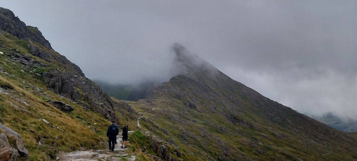
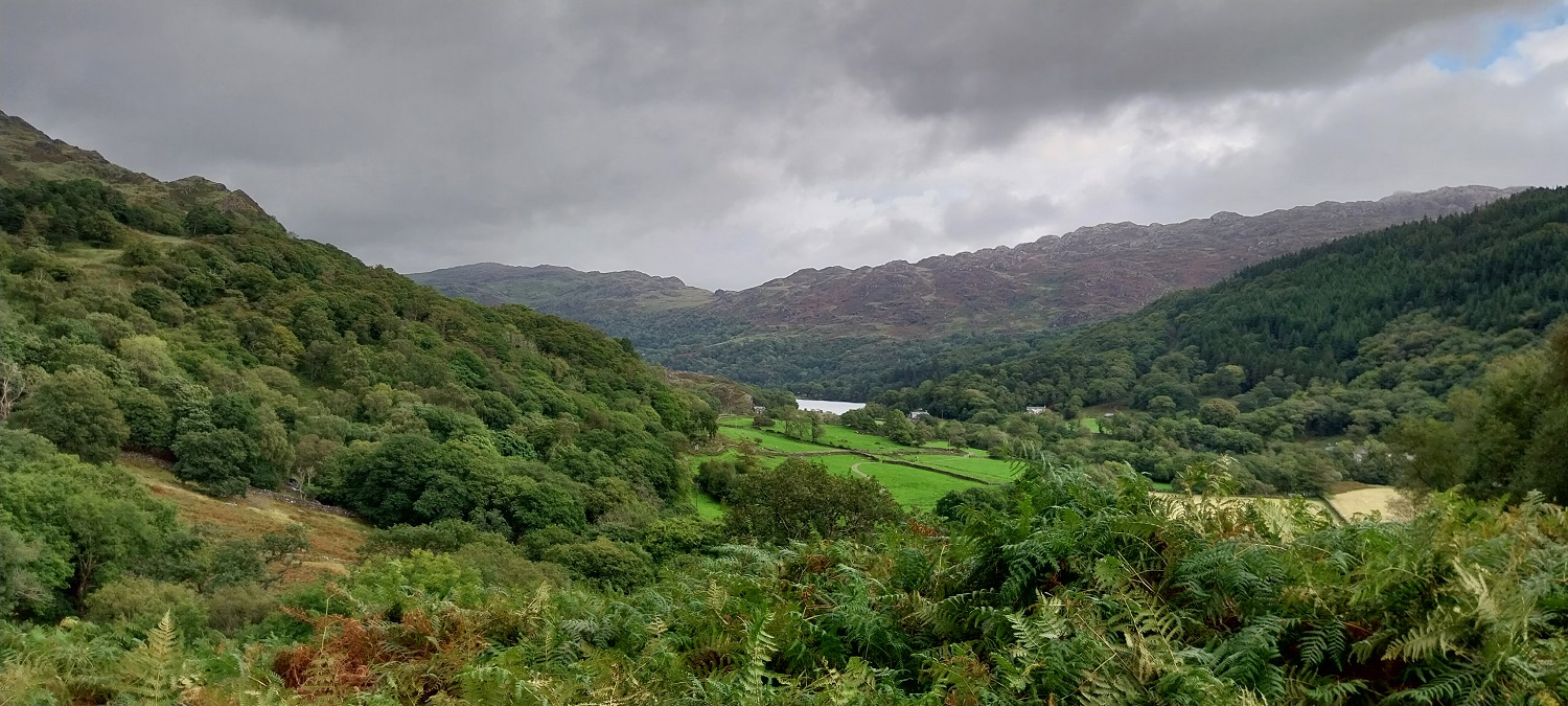
So after a couple of warm up walks of Cnicht and Moel Siabod, we’d reached the big one, Snowdon or Yr Wyddfa in Welsh. This walk would see us all break through the 1000 metre barrier and for Linda and the boys its their highest walk. After a bit of research on the best routes, plus finding parking spots, I thought that the Watkin path would give us a good walk in along a gradual path, good chances of parking and importantly nothing too exposed. Having done it, I can confirm it is indeed a great route. We were in the middle of the summer holidays, so parking could have been tough, but as with the Lakes, if you go in the week when locals are in work then you stand a better chance. Bethania has a paid car park but we parked roadside, beyond the car park, easily at 9.50am. I chose the Watkin path as Crib Goch is too exposed for us, Miners and Pyg track both start from Pen y Pass, which at £20 for 8 hours parking is horrific, if you miss that time then its £30 for 8-12 hours, eye watering stuff. Binning those routes the other option was Llanberis track, a dull plod beside the railway, not for me. Watkin kept coming up as the second best route up and with the strong winds, I also canned the Rhyd Ddu and Ranger paths due to the crossing of the Bwlch Main. If I was going again, I would pick the Watkin route, it starts gradually on a wide path, before climbing lots of steps and twists up to Bwlch Ciliau. Here it gets interesting the path angles up across the front of Clogwyn y Garnedd, and a bit of scrambling is needed to pull over some bigger outcrops, when it is wet these can be tricky especially descending, but would provide little issues in the dry. You pop out just under the summit cafe building, and all that is left is a simple walk to join the queue and touch the top. Then just drop down and find a place to enjoy your sandwiches, and listen to people arguing about queuing and which way you head up to the trig point. The weather for us prevented views from the summit, but on the way down the cloud lifted a bit and we got some stunning views of Y Lliwedd, Glaslyn, Crib Goch and Yr Aran. All in all a brilliant walk, which is something that I’ve said a lot this year, the walks of the year could be a long list.
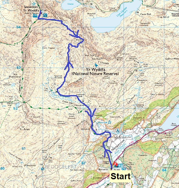
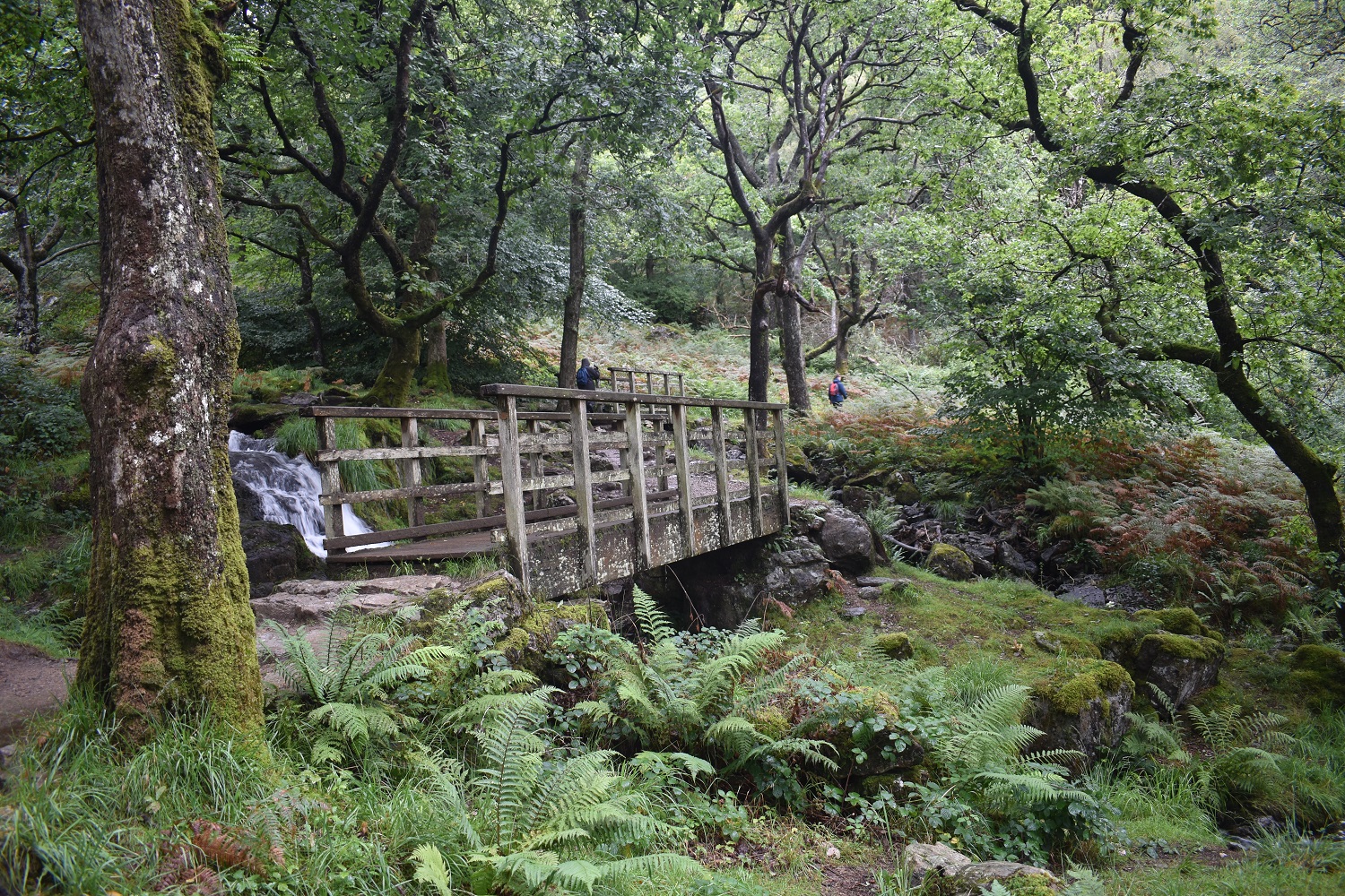
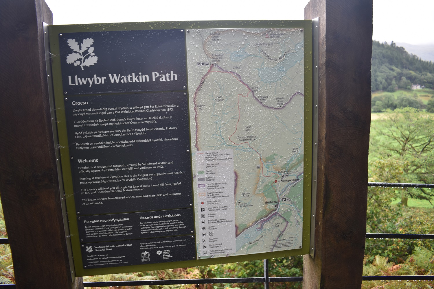
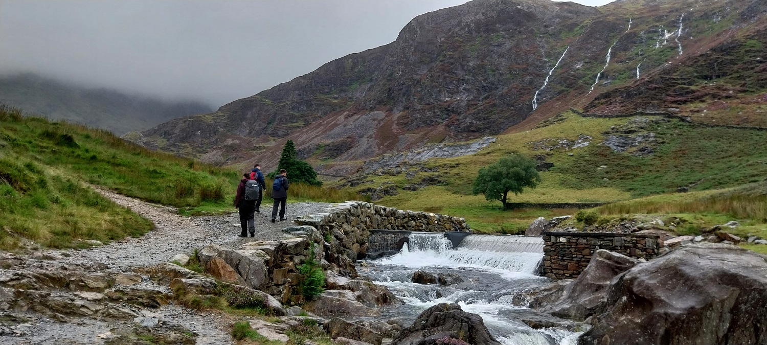
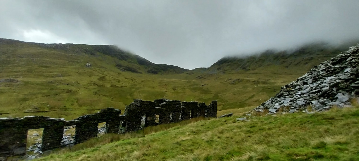
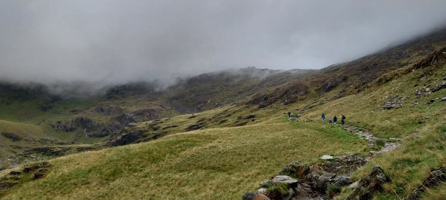
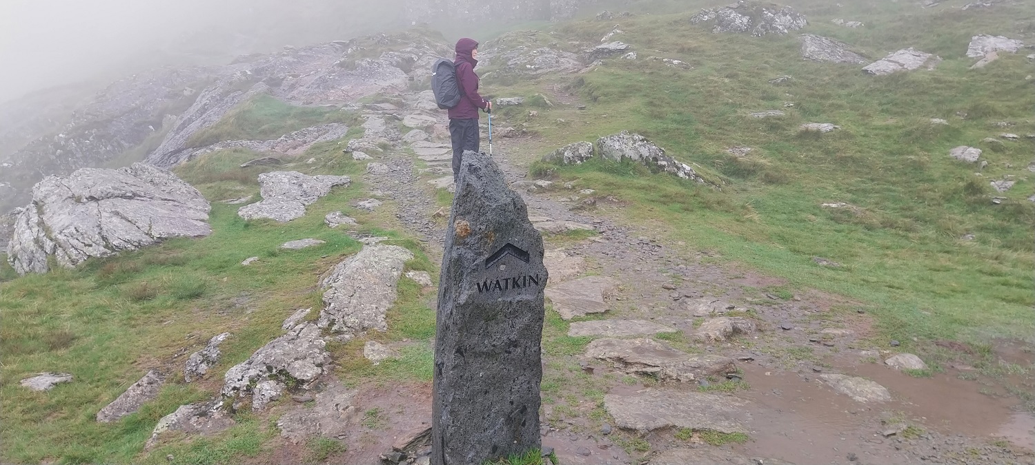
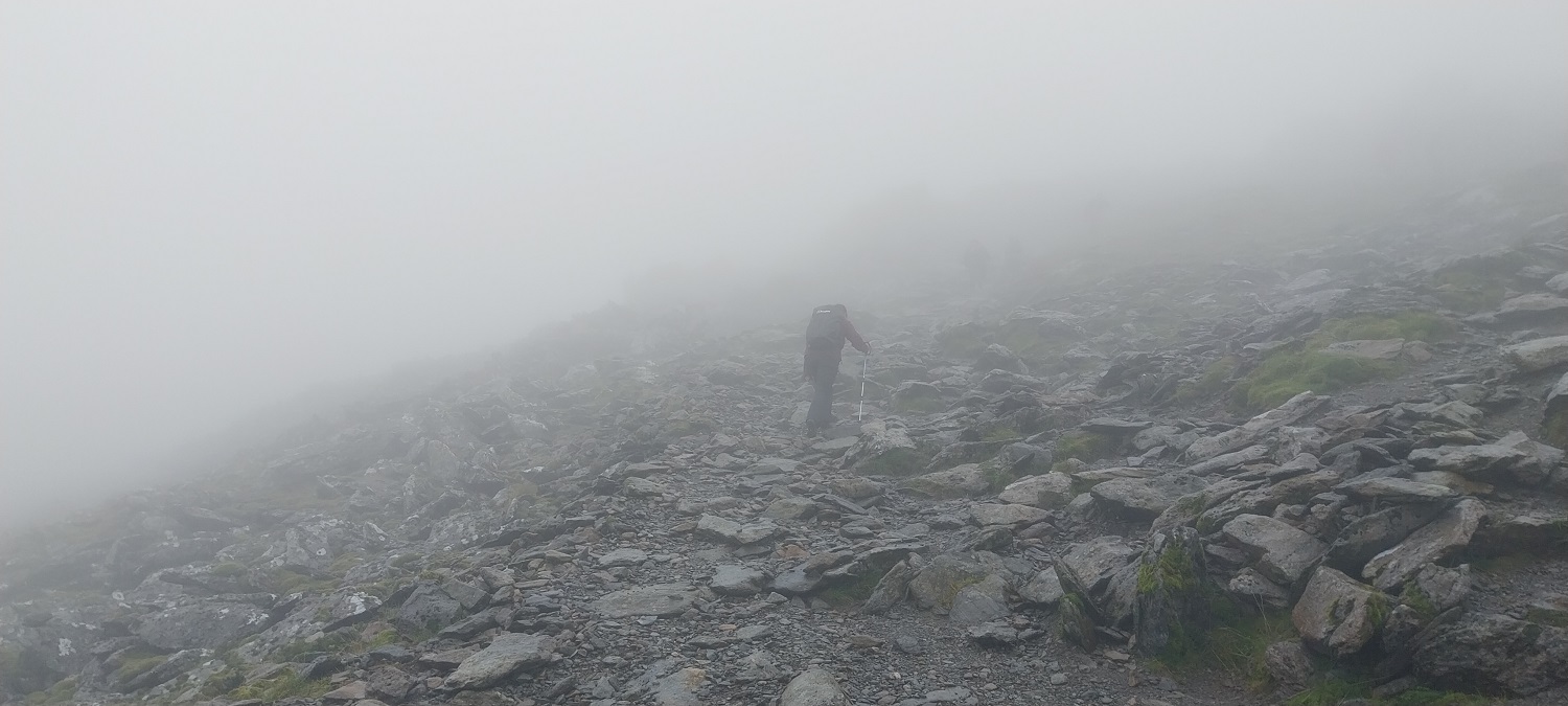
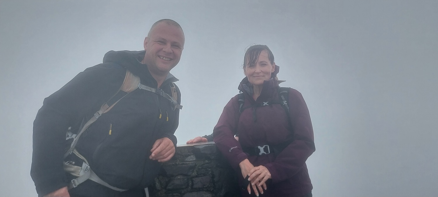
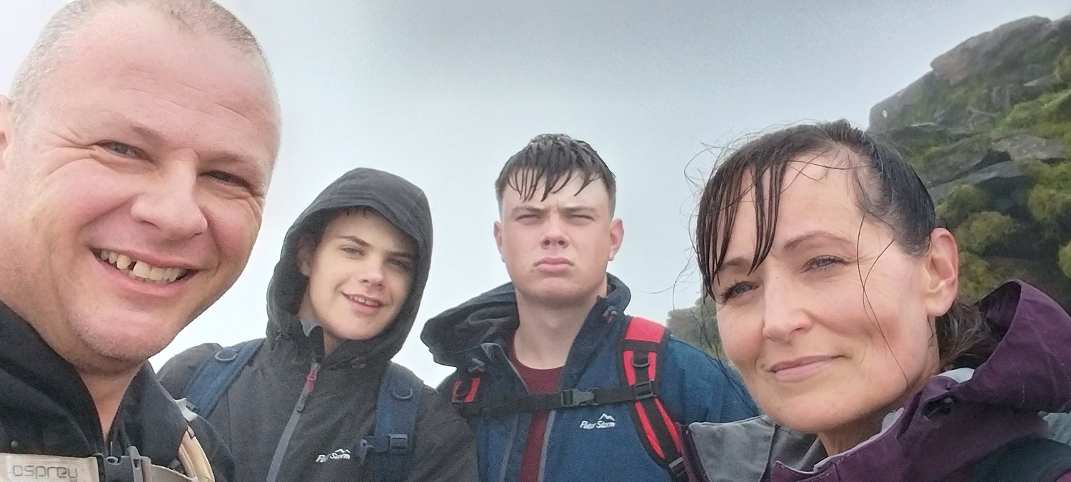
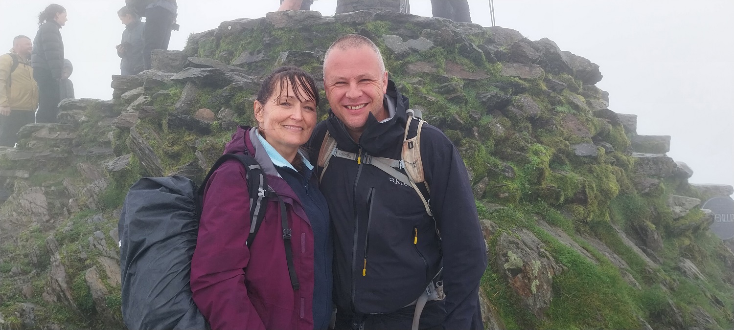
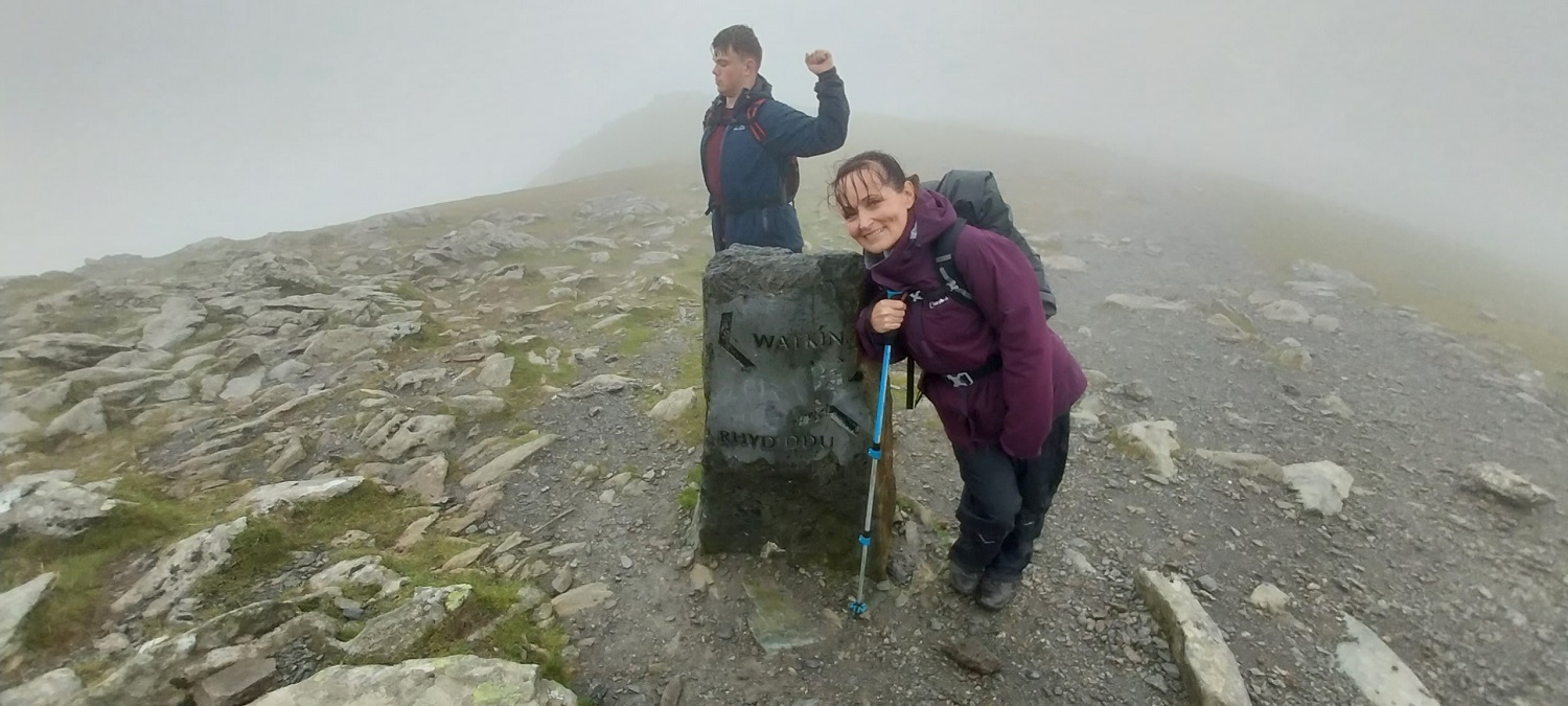
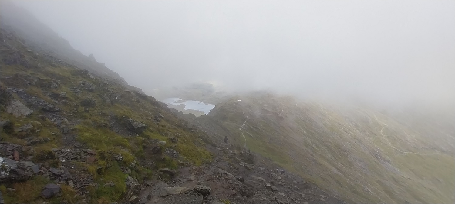
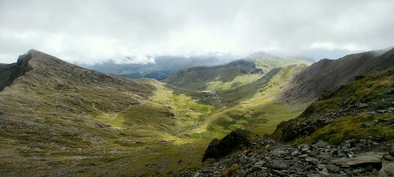
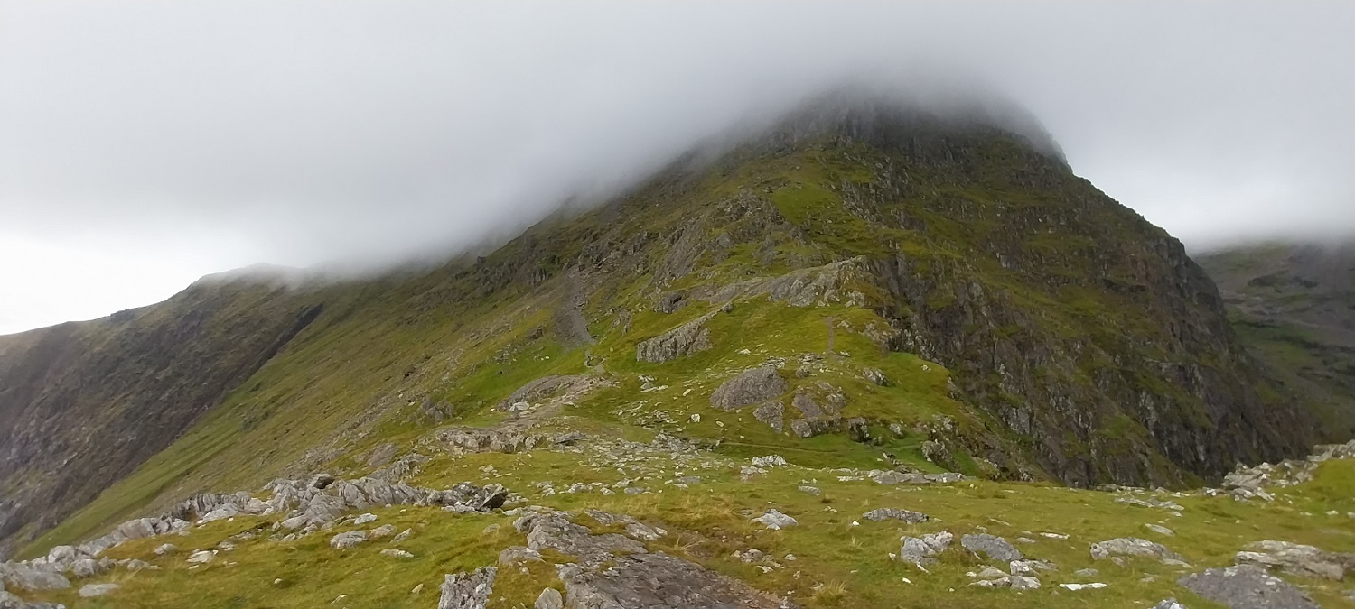
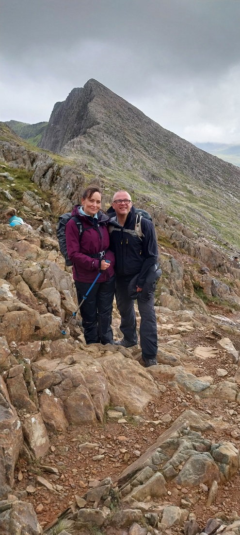
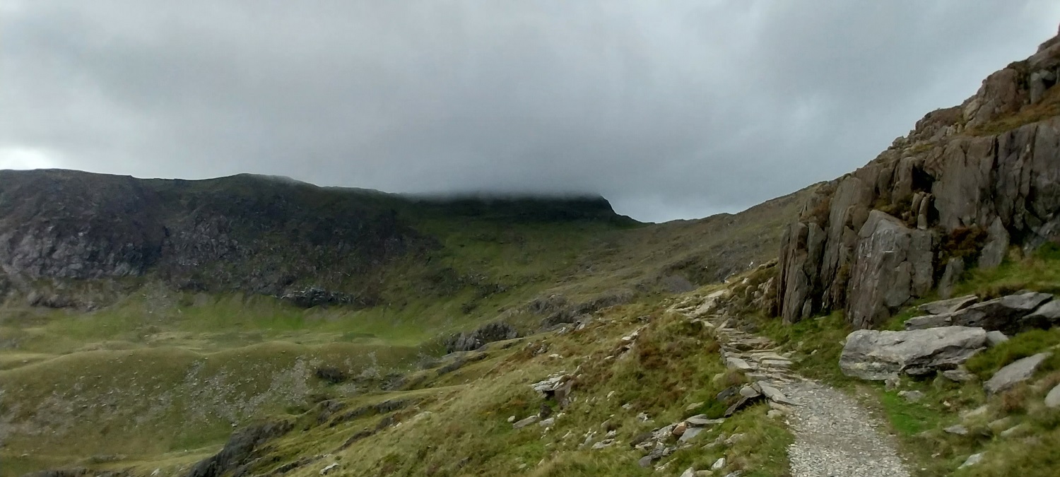
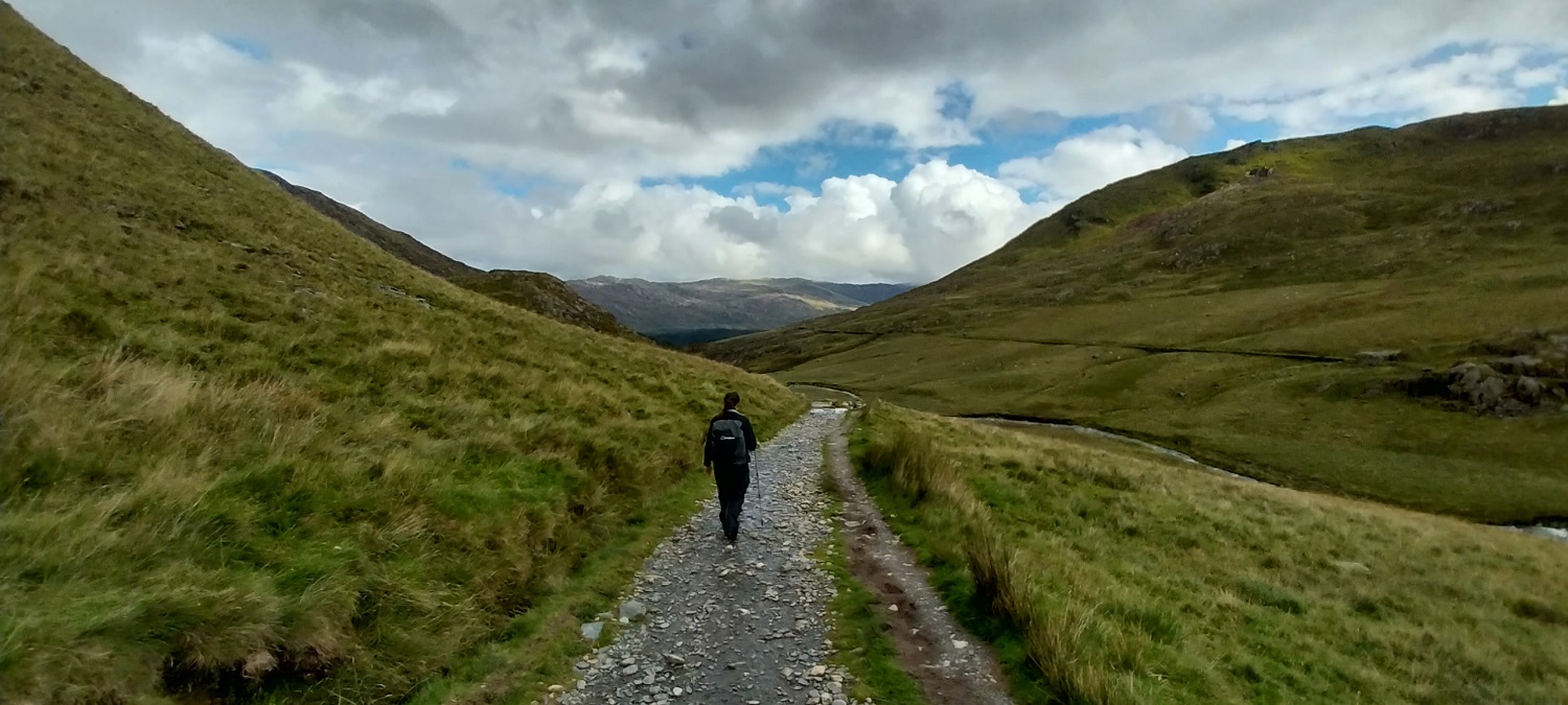
Starting out, the intrepid explorers head for the start of the Watkin path which is just on the left here. The Bethania car park is on the right on the bend. We had easily parked about 100 metres behind me on the roadside.Crossing the bridges at the start of the Watkin path, you climb through some woodland to start with before opening onto hillside in sight of the waterfallsOpened in 1892 and named after Sir Edward Watkin, a railway entrepreneur, it was the first designated footpath in Britain. Watkin extended the original donkey path to the quarries up to Snowdon summit and it was officially opened by Prime Minister William Gladstone in front of a crown of about 2000 peopleThe waterfalls, if you type Watkin path into a search engine you will find that pools/swimming spots come up first as these have become some of those abhorrent Instagram locations. The good news is after the waterfalls the number of people falls considerably.Waterfalls by the path as you climbThe weir, the lower slopes of Y Lliwedd rise up to the rightGladstone Rock, the Prime Minister stood here to open the pathThe buildings of the old slate quarries by the Watkin path, Bwlch Cwm Llan is the dip, with Yr Aran to the leftHeading up to Bwlch Ciliau, which is just below the cloudPointy Yr Aran across Cwm TregalanA moody Y Lliwedd is in and out of cloud as we climb a toughening path to Bwlch Y SaethauInto the cloud and the section of scrambling, the drizzle had been falling for the last hour making the path slippery.I’d stowed the camera for the difficult scrambles across wet rock, here we hit the final pull up to join with the Rhyd Ddu path, just below the summit. I was at the back at this point, struggling to keep up with Linda, the boys were well ahead, almost skipping to the top.Windy summit. We had been protected from the worst of the gusts on our route but now we felt the wind a bit. In the queue to get to the trig, one guy in front of us (wearing beige shorts, trainers and a thin jacket) had sat down and slithered back down the steps, saying it was too windy for him. 2 mins earlier he had been boasting on how well we’d all done to walk to the summit (he’d clearly got the train).Me and Linda at Snowdon summitTribute to Princess Gwenllian, as it says on the signSummit selfieWith arguments going on behind us about which way to come up, and how long people had been waiting (who had got the train up). A lovely photo of me and Linda. We then sat here out of the worst of the wind to have a bit of lunch. The cloud never cleared for us unfortunately but we were happy that the drizzle had stopped.
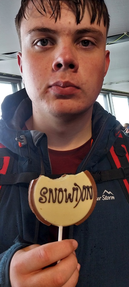
My eldest went into the shop for a chocolate lolly
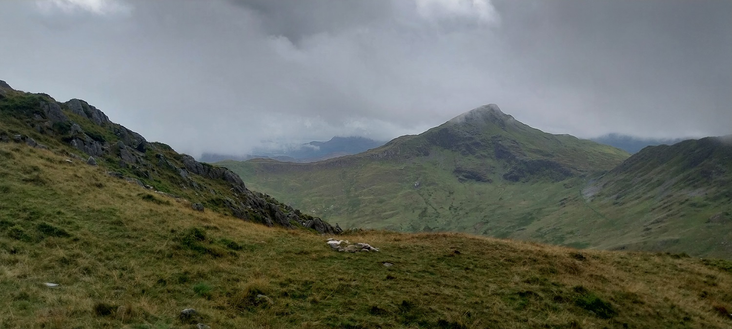
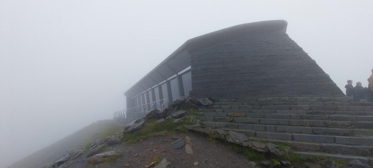
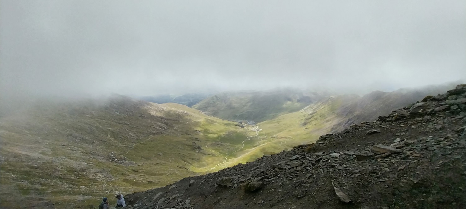
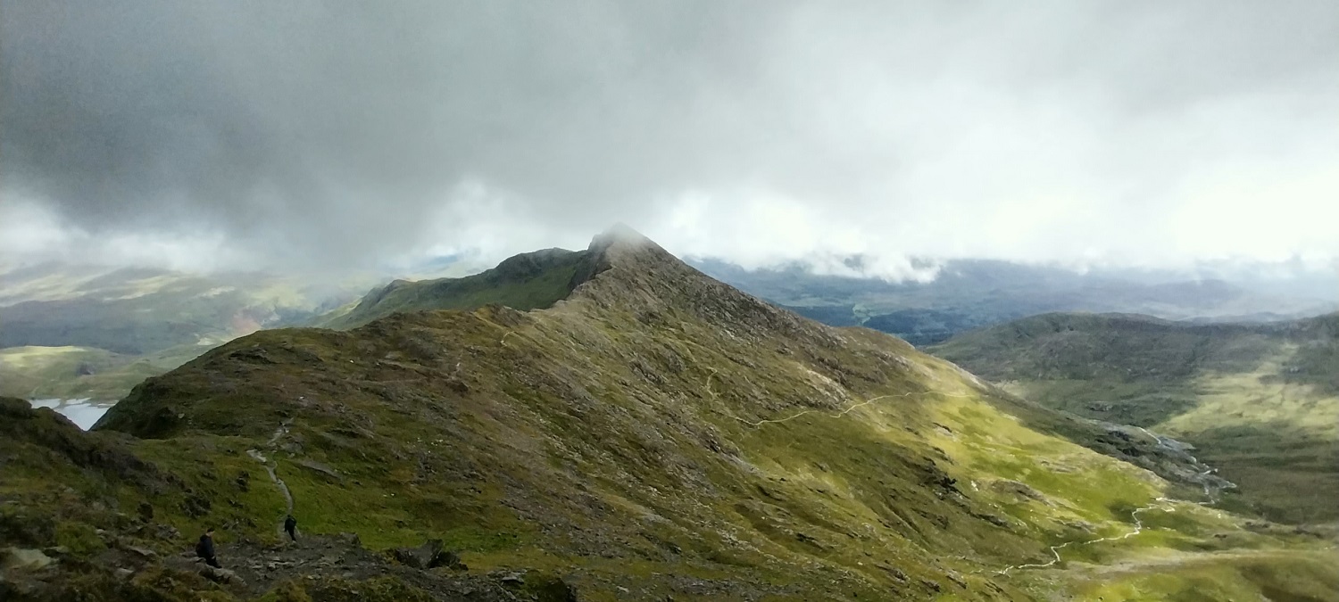
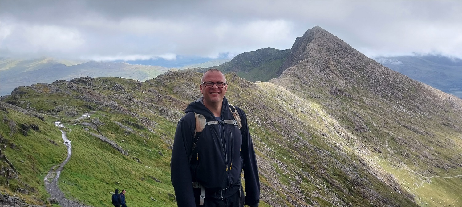
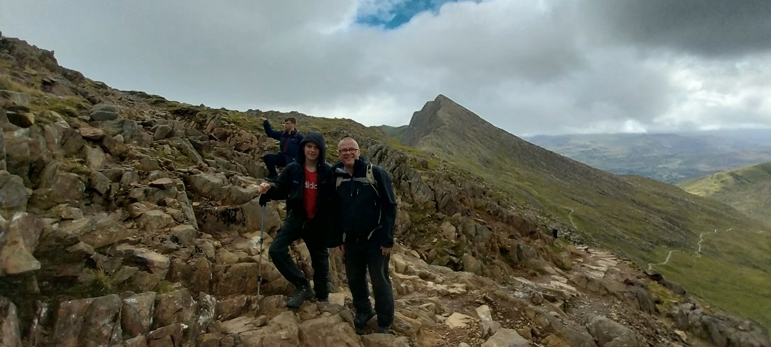
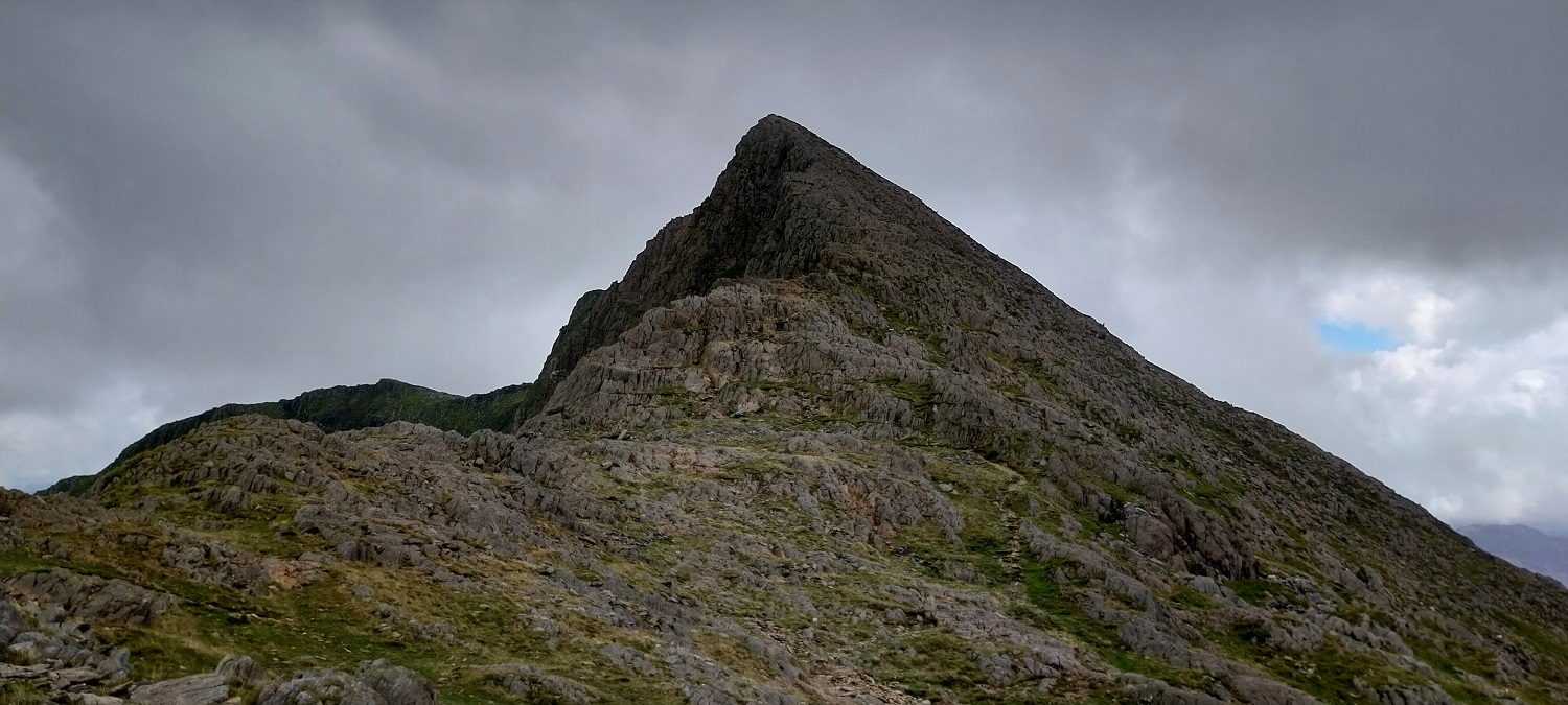
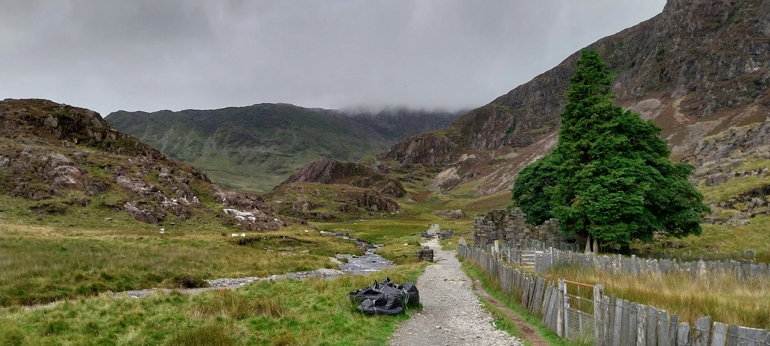
The summit cafe looks spooky in this weather, the wind was hammering from the left hereAfter a short walk back down the Watkin/Rhyd Ddu path, we hit the point where we go left and back down the Watkin, heading straight on will take you over Bwlch Main. I did look at a circular walk back that way, it would have been a mistake though as we would have missed the views as we dropped under the cloud.We have almost finished the difficult scrambling section, which is trickier on descent. A glimpse to Llyn Llydaw as well. Hitting the base of the cloud we could see sun shining in Cwm TregalanFurther down and Y Lliwedd unveils itselfCwm Tregalan with Y Lliwedd to the leftStunning views ahead to Y Lliwedd, said to be the best of the Snowdon Horseshoe mountainsYours truly ruining the view to Y LliweddBack up to Snowdon across Bwlch Y SaethauWe headed left a bit to take a look down to Glaslyn. Crib Goch is the pointy rocky mountain opposite. I was surprised how short it was, the drop off the ridge looks steep though.Me and the boys as we head to Bwlch Ciliau
Gorgeous photo with Y Lliwedd behind us
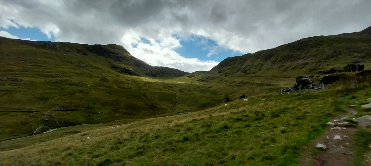
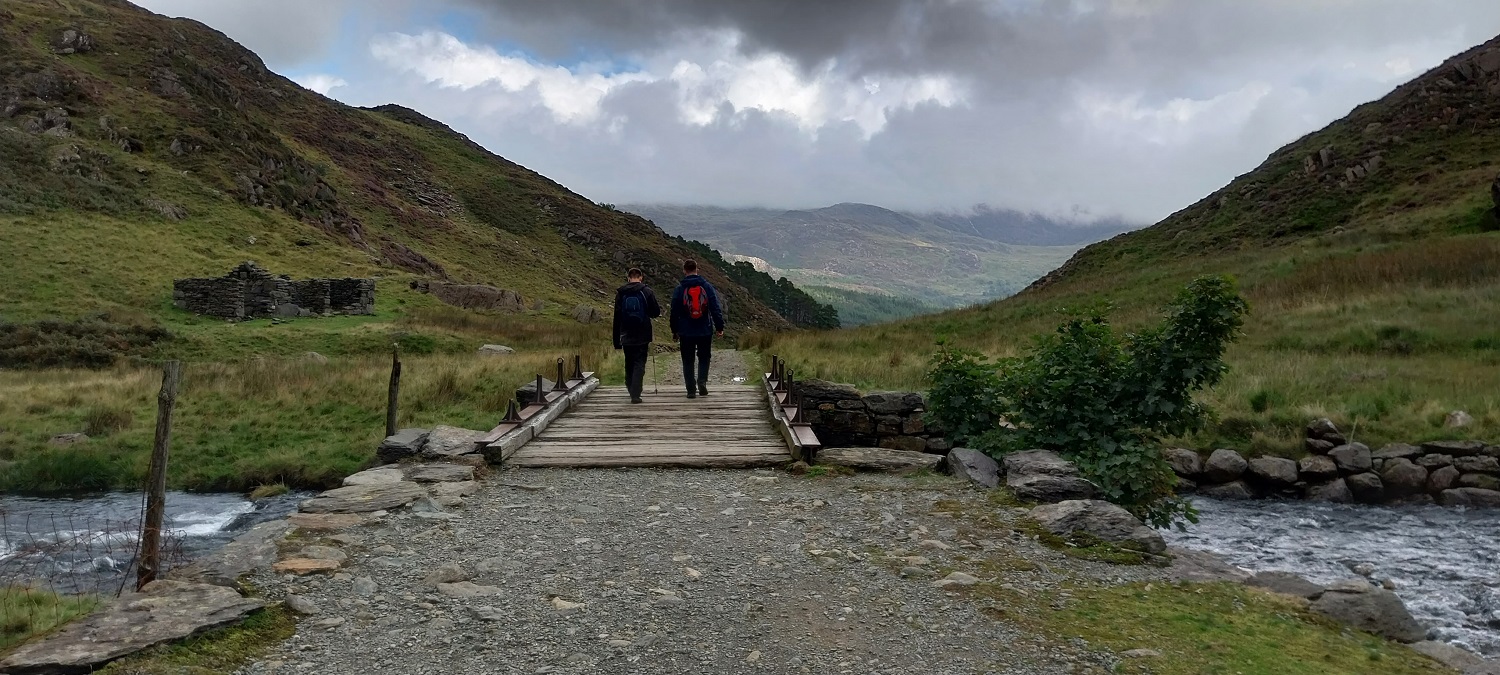
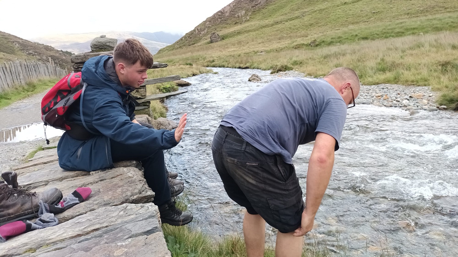
Just one more photo of this shapely mountain and its steep face. As we descended we met two people who had climbed y Lliwedd, thinking it was Snowdon, my eldest broke the bad news to themGorgeous Linda with Yr Aran behindLooking back up, Snowdon still swallowed up by the cloudAgain from the slate quarry buildings (up on the right) looking to Bwlch Cwm Llan, with Yr Aran to the left and the ridge to Allt MaenderynHeading down to Gladstone RockAfter a few weeks of managing my feet and the Plantar Fasciitis affecting them, it was at this point that I started to feel them hurt a bit, so a stop here and feet dip in the Afon Cwm Llan was needed. As I type they have been better recently, but still need stretching, ibuprofen and massage Trying to sort my feet and my eldest is caught on camera trying to push me in!! A change to the will is needed clearly.Gladstone Rock is over there as I look back. Bwlch Main is the ridge heading up into the cloudWaterfalls ahead as we near BethaniaA small section of Llyn Gwynant as we walk the final section, just a short part through the woodland and then its the car. A brilliant way up this very popular mountain, not too busy but it is the way with the most ascent. That said it is gradual for lots of it and the scramble would be a piece of cake in the dry. A must for any walker and we are glad to tick this one off.
Its a shame it’s the highest mountain in Wales (with a railway to the top!) as it a superb, complex and massive mountain with huge variety of ridges and routes that’s now over-run. I rarely stop on the top now (or avoid it altogether) as it’s so busy but the Watkin is a fine route with much less in the way of crowds. The South is also excellent and very little walked as it’s not an obvious way to the top
Great photos – they bring back all sorts of fabulous memories. I haven’t a clue how many times I’ve been up there, well over twenty, by almost every feasible route I suspect, but none of them this century, which is a bit weird. I’m shocked by those parking charges!
I’m wondering whether people staying at the YHA, assuming it’s still there, have to pay those crazy prices. It would make for a very expensive weekend away.


It’s a lovely mountain Yr Wyddfa, but these days it is overrun with people, I think the Watkin path was a good choice, shame about the cloud.
LikeLiked by 1 person
Well done for all getting up there. That’s pretty amazing. A bucket list mountain. 🙂
LikeLiked by 1 person
Definitely one to tick off, just Ben Nevis to do now of the highest ones of England, Scotland and Wales
LikeLiked by 1 person
Its a shame it’s the highest mountain in Wales (with a railway to the top!) as it a superb, complex and massive mountain with huge variety of ridges and routes that’s now over-run. I rarely stop on the top now (or avoid it altogether) as it’s so busy but the Watkin is a fine route with much less in the way of crowds. The South is also excellent and very little walked as it’s not an obvious way to the top
LikeLiked by 1 person
I looked a lot at the Rhyd Dhu or Ranger path to the summit but with the high gusty winds I decided the crossing of Bwlch Main might be a bit fraught
LikeLiked by 1 person
Great photos – they bring back all sorts of fabulous memories. I haven’t a clue how many times I’ve been up there, well over twenty, by almost every feasible route I suspect, but none of them this century, which is a bit weird. I’m shocked by those parking charges!
LikeLiked by 1 person
The parking costs were astonishing, thankfully there are still plenty of roadside spots for the Watkin Path that are free
LikeLike
I’m wondering whether people staying at the YHA, assuming it’s still there, have to pay those crazy prices. It would make for a very expensive weekend away.
LikeLiked by 1 person
They advertise it as £10 per day for parking (but varies in peak seasons) so it would suggest that the YHA also have to pay in that car park as well
LikeLike