Since I had started walking in The Lakes I had in mind a number of routes, paths and edges that have to be tried or at least looked at. The names of these places will be familiar to a lot of people, places like Striding Edge, Sharp Edge and the Corridor Route are all very well known routes to some of England’s highest peaks. However I have been just as excited by others such as Prison Band, Kilnshaw Chimney, Jacks Rake, Lords Rake, Gasgale Crags and Climbers Traverse among many others. Now Prison Band is coming up in my next walk, however this post covers another one, the lesser known East ridge to Bannerdale Crags. Now its nowhere near as hard as Sharp Edge, but look at it from a few hundred metres away and it looks far more difficult than it actually is. There is a pretty good path up through the crags and whilst it is steep, on a dry day there is very little to bother an experienced walker. I always say to understand a route up a mountain you have to smell the mountain, in other words get up close to it, because from a distance this place looks daunting when in fact it is fairly simple. It was a great walk, not too long and a good tick on my list of wainwrights and also for the boys who are into the 30s now I think (I do a proper tally after the next walk). The only downside of this walk was the rain at the end, we had been watching the band of rain coming at us as we descended off Bowscale Fell, and it was only as we reached the steep last part that it started. We had a quick stop in the church to get out of the worst of it but it didn’t dampen our spirits. This for me is the best way up Bannerdale, except no substitutes!
| Start – Mungrisdale |
| Route – Bannerdale – East ridge – Bannerdale Crags– Bowscale Fell – Underscar – Mungrisdale |
| Distance – 5.5 miles Start time – Midday Time taken – 4hrs Highest Point – Bowscale Fell 702metres |
| Weather – Cloudy but dry, then rain to finish as we walked into Mungrisdale |

© Crown copyright 2018 Ordnance Survey FL 2018 SF

All ready for the off. Its rained here but blue sky is above.

The Tongue stands proud and centre. Bannerdale Crags is left and Bowscale Fell is back right

Heading to Bannerdale Crags, The East ridge rises in front of us. At this point it looks impossible
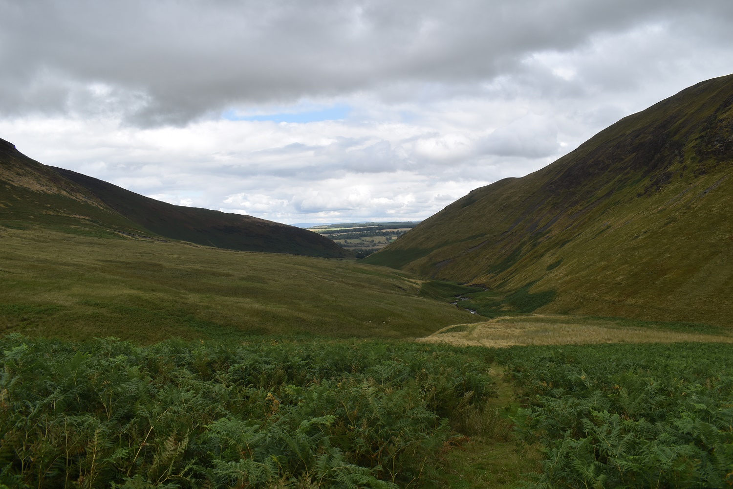
Looking back out of the valley towards Mungrisdale

Starting up the East ridge. I have to say at this point I wasn’t sure. I’d done all the research on websites but it doesn’t replace actual feet on the ground. It looks tough from here but actually it was fine

Bilberries/Whortleberries or whatever you call them. These two were piling them into their pockets, good job I brought plenty of water to wash them. They were devoured in seconds!!! The Tongue left and Souther Fell right is the backdrop

Looking down into Bannerdale and eating berries!!

Looking back down the East Ridge

After reaching the top I took this shot along the ascending ridge
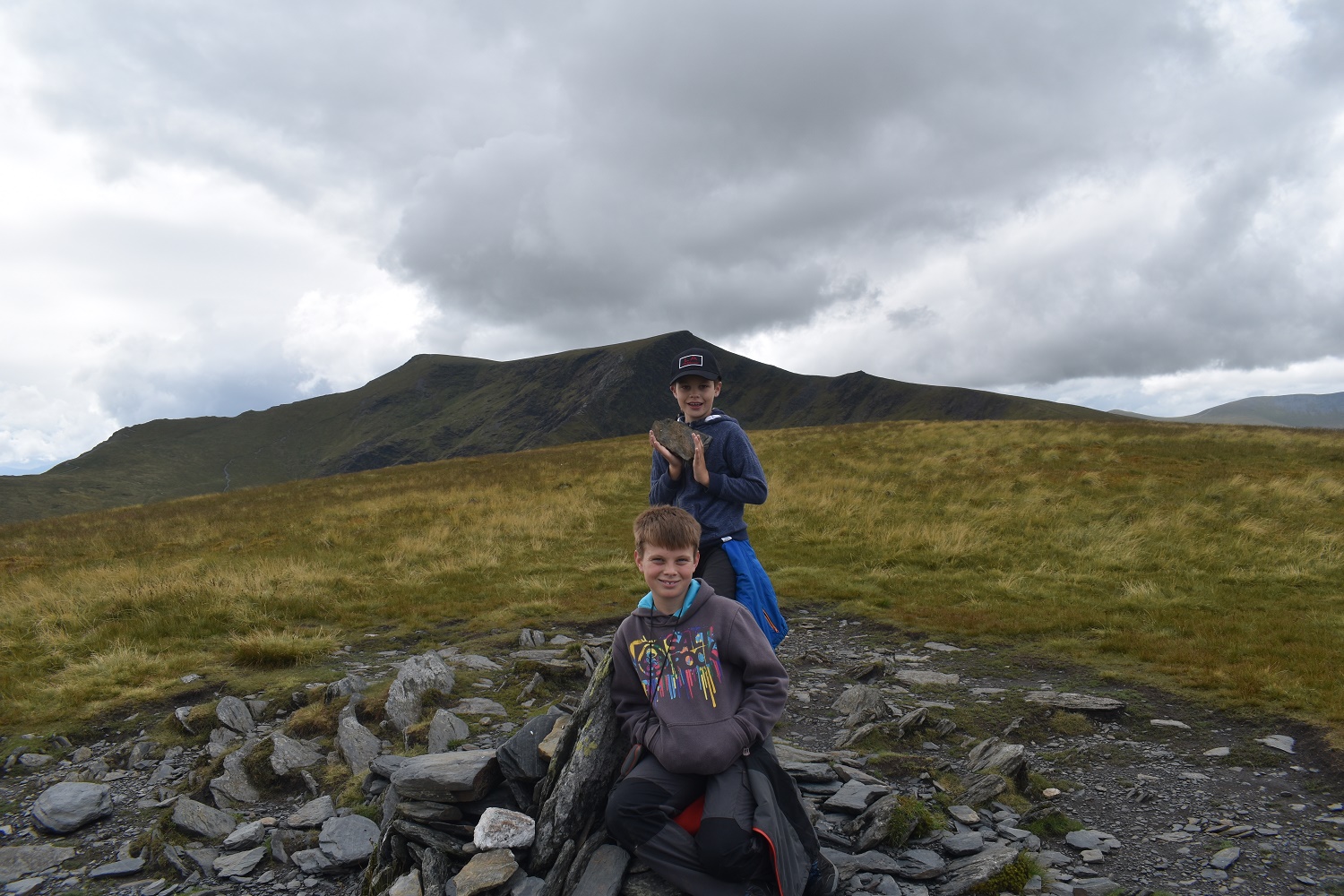
Bannerdale Crags summit with Blencathra behind
Me and my eldest. Great Mell Fell in the distance

Plenty of fells in view. Skiddaw is left then Great Calva centre, Knott to the right

Bowscale Fell is next up, with Carrock Fell behind

We had a walk over towards Blencathra first, This gave us a great view of Sharp Edge as it rises up to Atkinson Pike (the right hand point), the summit is Halls Fell on the left

Bannerdale. The Tongue on the left and Souther Fell right

Bowscale Fell summit. Blencathra is the high point behind and Bannerdale Crags is on the left

Skiddaw has its head in the clouds now

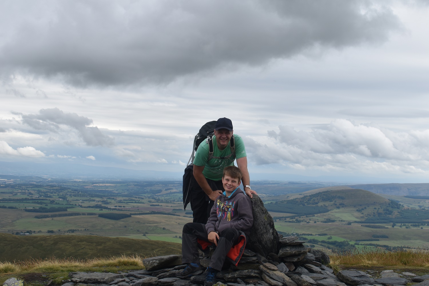
My youngest on Bowscale Fell summit

Bowscale Tarn, Carrock Fell is behind on the right

And again Carrock Fell right with High Pike peeking up to the left

As we descend we look back to Bowscale Fell up to the right with Blencathra looking dark in the centre and Bannerdale Crags below and left. At this point it was clear that the weather was threatening rain so we quickened our pace

Definitely rain behind the Mell Fells. And its coming this way

Nearly down but its about to hit us

Souther Fell is left and The Tongue right but its raining now

Solice in Mungrisdale church

As earlier in the walk a shot of the Tongue with Bannerdale left and Bowscale Fell right as we head back along the road to the car


I’ve never explored the collection of fells to the east of Blencathra and I can see that’s a serious omission. A great looking route with plenty of interest and views, great stuff!
LikeLiked by 1 person
Mungrisdale is a good starting spot and the valley of Bannerdale is a cracker. You can easily add Blencathra or Mungrisdale Common to my route but this was right for us and this route up Bannerdale Crags is a fine one
LikeLiked by 1 person
This looks a lovely walk. And you are right. The ridge does look tough from a distance.
LikeLiked by 1 person
I was a great 4 hours out in a rarely visited part of the Lakes. I was a bit worried approaching the East ridge, I was hoping that there would be no scree, especially with the boys, but it was pretty good, steep but safe underfoot in the dry and we ended up picking bilberries most of the way up as there was loads of them!
LikeLike
A new one to me. Looks like a route worth trying. (And where I grew up we called those berries whinberries. We used to oick them and my mother would make them into a pie. Delicious! 😋)
LikeLiked by 1 person
I think they are called whortleberries down here in the south west
LikeLiked by 1 person
Lots of different regional names. But, whatever they’re called they taste delicious in a pie 😋
LikeLiked by 1 person
I thought that ridge looked good and you’ve confirmed my suspicions. Next time I go that way I shall have to try it myself. I also enjoyed the descent route – shame the weather made you rush it. I didn’t get that view of Sharp Edge, it was in the cloud; I’d forgotten how steep it is! (Although I remember the last steep section – is it Foule Crag or something similar? I shall have to dig out a map.)
LikeLiked by 1 person
That’s it, Foule Crag. Proper scrambling up there. The East ridge is a great way up, probably the best to Bannerdale Crags
LikeLike