Its taken a bit to get round to writing this post, a walk to one of the great mountains in the Lakes and picking up a few other Wainwrights on the way around, with any luck. The walk is a very good one and is a change from the previous walks on this holiday (Carrock Fell/High Pike and Armboth Fell). The landscape is far more craggy and rocky, rougher, steep paths, gills, valleys and crags everywhere. The start involves parking at Seathwaite, which can be tricky. However this was a Tuesday and despite it being summer school holiday we parked fine at 9.30am on the roadside verges (being careful not to block gates or farm access). I was expecting a horror story for the parking, but its clear that during the week its not too bad really. The plan was to head straight up Sour Milk Gill to Gillercomb, up to Base Brown, then Green Gable and on to Great Gable. If time allowed we would look at Seathwaite Fell for the return and then down to Stockley Bridge. As it was it all went awry on Green Gable, where my youngest tripped badly and hit his knee on a pointy rock. It could have been a lot worse but we spent a while bandaging him up before deciding to proceed. It certainly took the edge off finally getting up this iconic mountain, but more importantly he was fine in the end. Although spending nearly 8 hours in two A&Es in Cumbria that evening/morning nearly finished us both off for the week.
Start – Seathwaite
Route – Sour Milk Gill – Gillercomb – Base Brown – Green Gable – Windy Gap – Great Gable – Styhead stretcher box – Styhead Tarn – Stockley Bridge – Seathwaite
Distance – 7 miles Start time – 9.30am Time taken – 7hrs Highest Point – Great Gable 899 metres
Weather – Some low cloud and drizzle to start, breaking clouds higher up and sun breaking through to finish
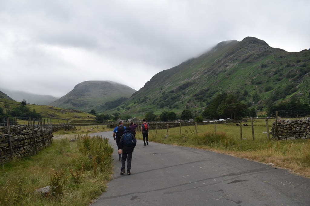
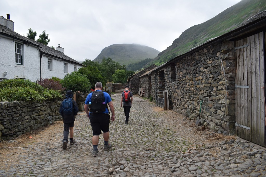
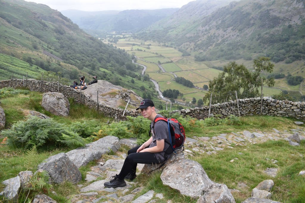
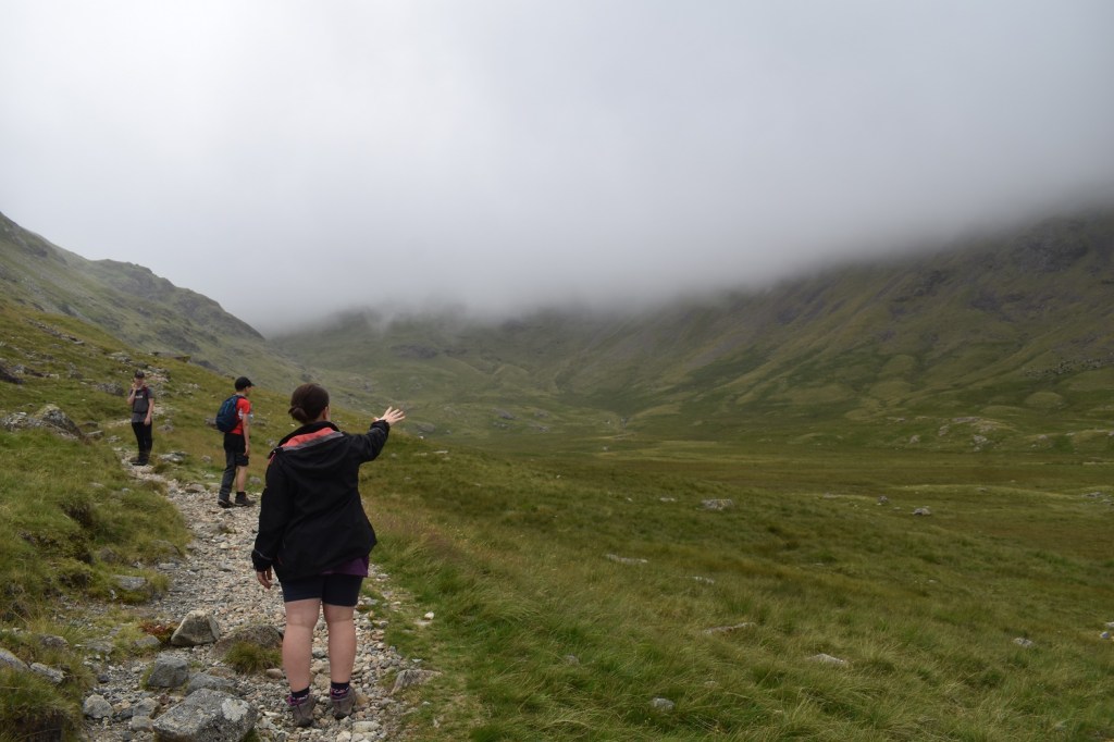
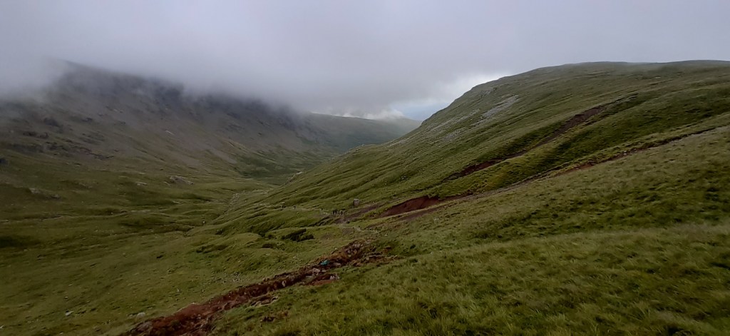
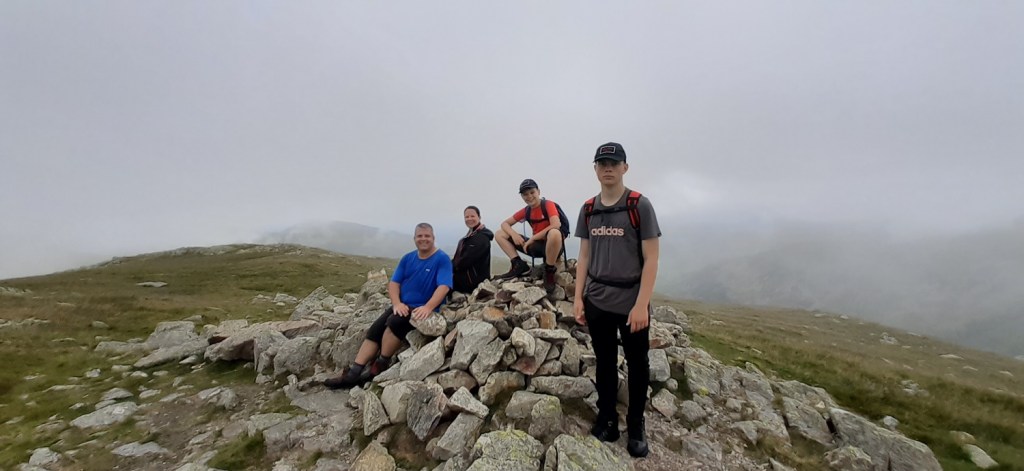
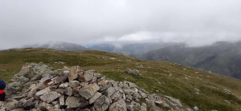
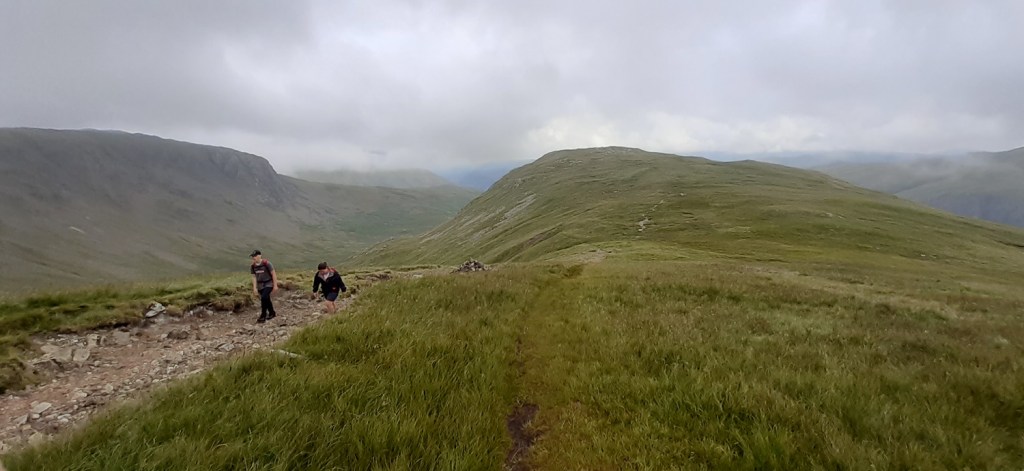
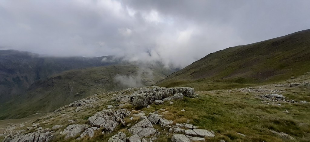
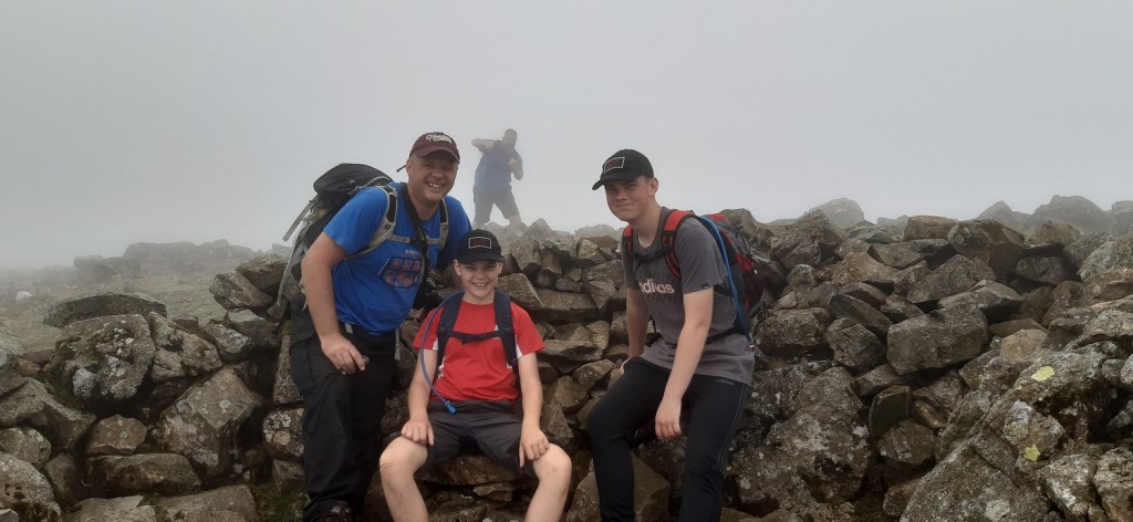
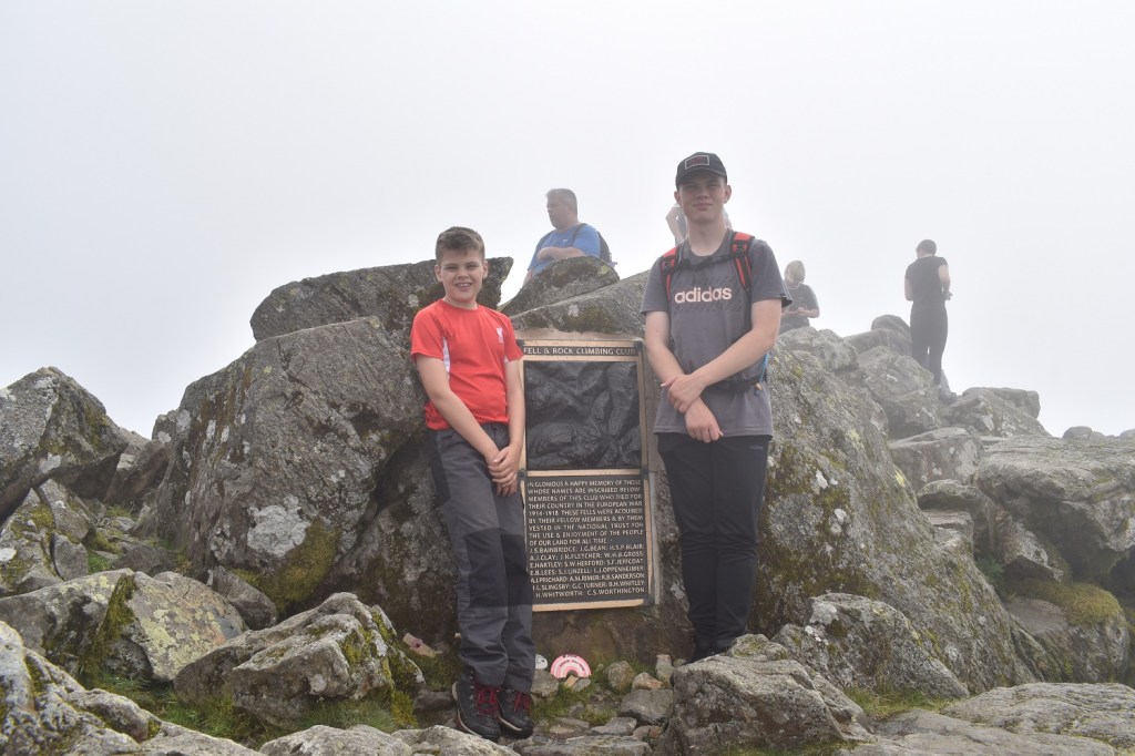
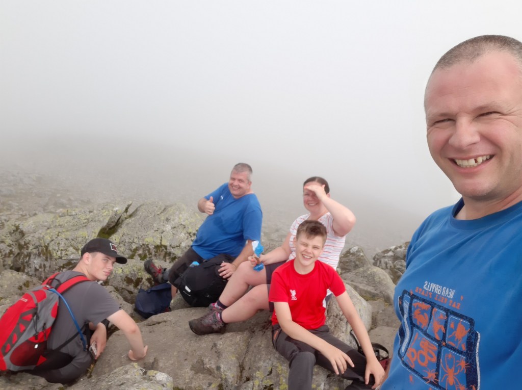
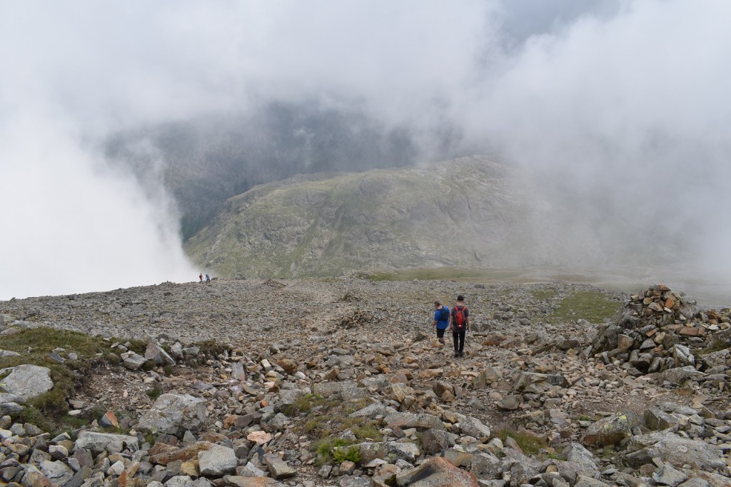
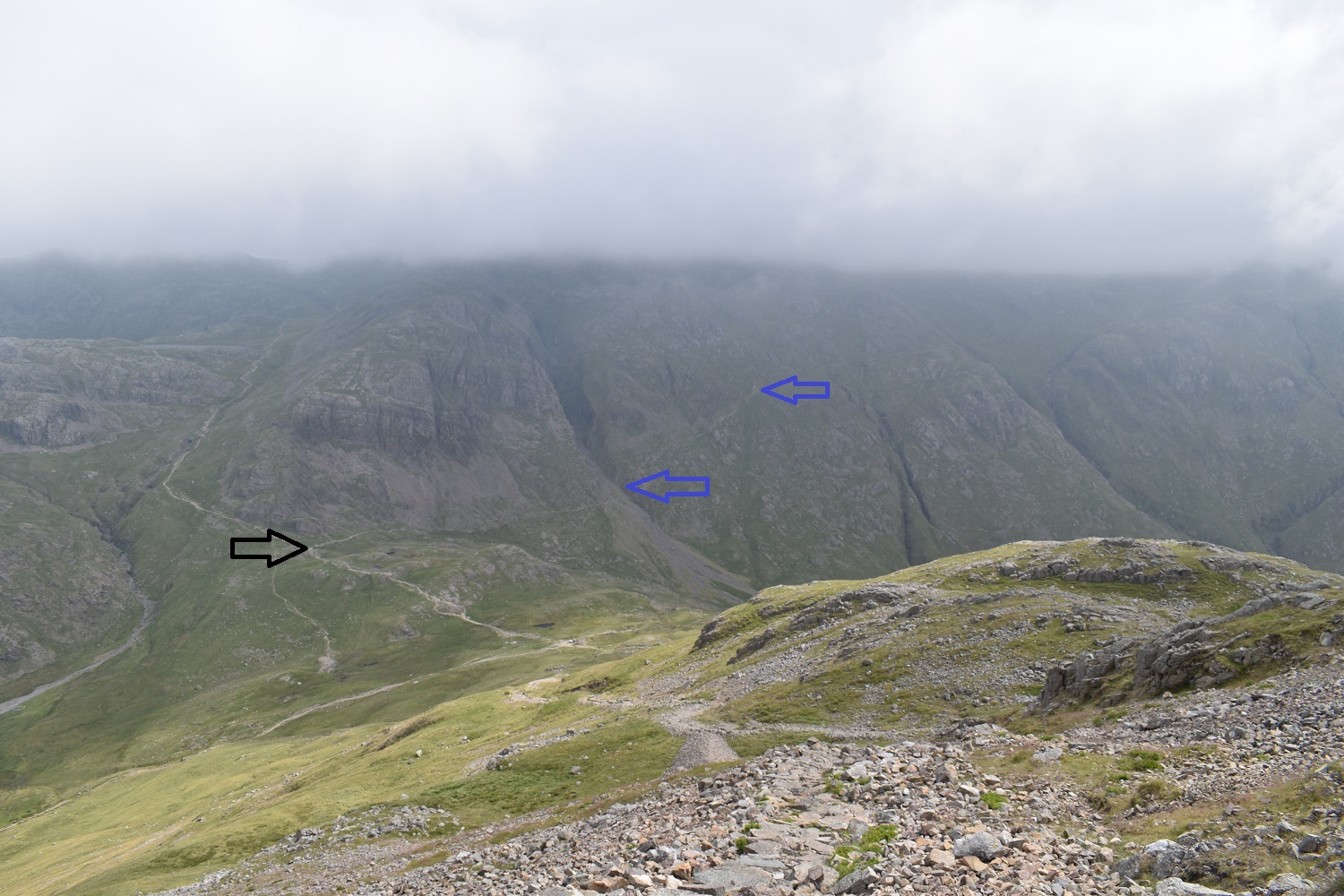
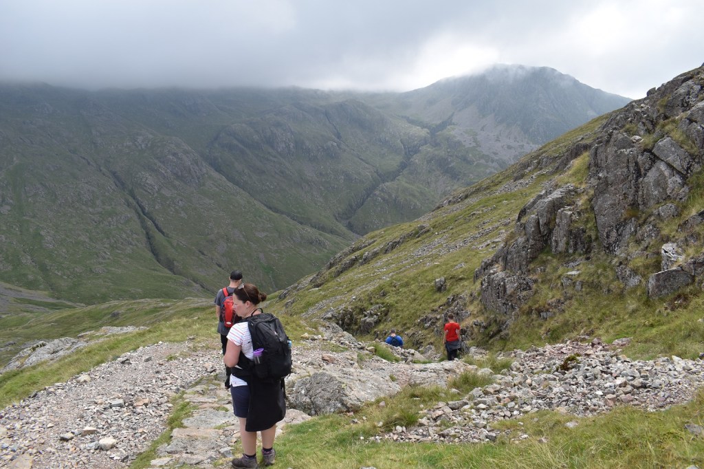
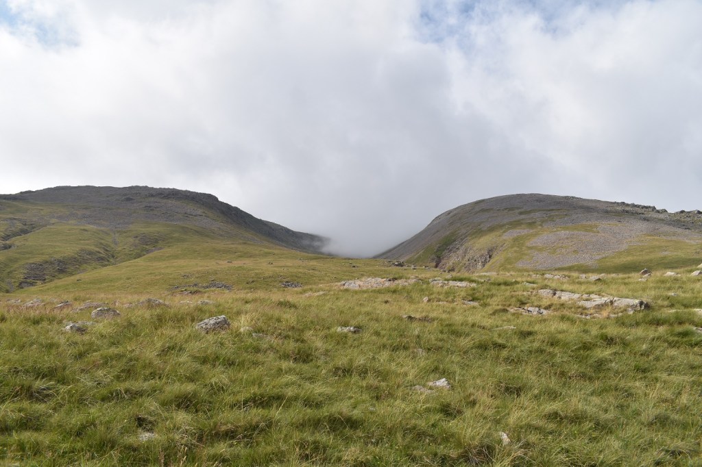
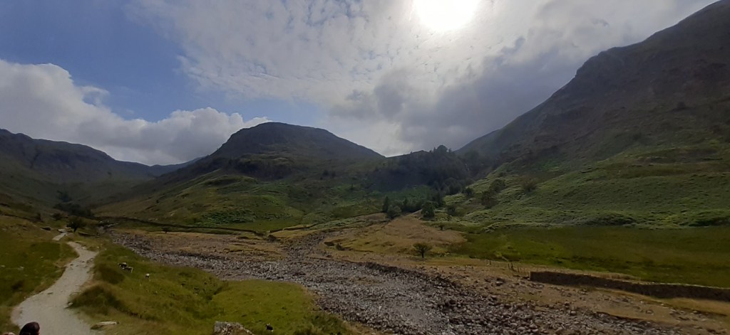
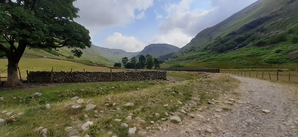
My sister and brother in law joined us on the walk. As is tradition on our Lake District visits, we always have one big walk and other family members join in. The younger cousins had been stowed with Nanny and Grandad for the day and we were off. We parked at 9.30am (about 30 metres behind were I took this photo), Seathwaite Farm can be seen above my sister’s head so we did pretty well considering the time, the fact it was summer holidays and the hysteria online about parking in the Lakes. Its not that bad, especially in the week.Seathwaite Farm, the wettest place in England, we turn right through the barn and the gate on the rightStarting the climb and looking back along the Borrowdale ValleySome decent scrambles up here, hardly any water in the gill though. A National Trust ranger I met later in the week said it had been dry for nearly 6 weeks!Borrowdale from the climb. Over on the right is the ridge up to Glaramara. The cloud is hanging on to the summits and seems to be around the 600 metre contour at the moment. Hoping that it raises a bit as is forecast for the dayMy eldest takes a break, to be honest he was the mountain goat for the week up there, always ahead of us. So it was nice to get a pic of his face rather than the back of his head 100 metres in front of me. The group over there were youngsters who were planning on a walk to Green Gable, then around Gillercomb to Brandreth and down to Buttermere to camp. I had the honour of breaking the bad news to them that they were a fair distance from Green Gable at this point (we were sat at the top of Sour Milk Gill). They followed us through Gillercomb before finding Green Gable, I hope they made it successfully from there to Buttermere.Cloud drops in the Gillercomb valley. My sister points out the farmer and his sheep. He’d driven them up Sour Milk Gill with his 4 dogs to the far side of the valley, the sheep then made for the far end in a long line.Lots of drizzle through Gillercomb, but finally we made the last pull up to the col between Green Gable and Base Brown, we headed left to the latter first. The hut ahead is the fix the fells group, doing some fine work on this pathLooking back over the fix the fells working area, along Gillercomb. The weather in the distance looks promising and sunny!Base Brown summit, wainwright 167The cloud lifted from the summit for a short time to unveil Borrowdale belowThe cloud was up and down like a yoyo as we dropped back to the col. Green Gable is ahead somewhere!Again the cloud lifts to clear Base Brown and Gillercomb leftThat’s Seathwaite Fell over there, if we are quick enough we may get that one last.Lunch stop with an in and out view to Base Brown, parts of Thornythwaite Crags appear on the right which is on the route up to GlaramaraGreen Gable summit and a photo bomb at the back by my brother in law!! Number 168 for me, the cloud is down but we are all happy. Then it all happened, we were walking across the summit, behind this photo, and my youngest tripped and landed on his knee. I saw the rock he landed on and looked down at his knee, the cut was messy, just below the knee and deep. I think shock hit him as he seemed ok at first and then looked ashen. I got my medikit out and we bandaged it pretty well. He put weight on it and he could stand ok and walk, first with a limp but a little better as he went. I supported him down to Windy Gap, which was a treacherous descent on scree. At the bottom, he wanted to carry onThe ascent of Great Gable from Windy Gap is full of little scrambles, he’s ahead of me here making his way slowly up. If I’m honest, as I didn’t know the route specifically and not knowing what we might face, I probably should have binned the walk at Windy Gap and headed down. It was a choice but he was saying he was ok and walking well without help, certainly better than I was at this point.On the ascent to Great Gable we got glimpses of Styhead Tarn below and Seathwaite Fell above thatNearing the summit, we’d taken our time from Green Gable to this point and as a result were well behind were we should be. I think at this point I just wanted to be back down and checking his knee again and not feeling guilty for bringing him up here. The bleeding had stopped with the padded bandage being put on and wasn’t visible through it. I figure touch the top and then make a steady way down.Green Gable summit breaks the cloudThe boys on Great Gable, the cloud is in, it was swirling around with the odd break but nothing in the direction of the ScafellsWe had a break on Gable and planned a steady descent. If anything at this point my youngest looked in fine fettle, might have been the paracetamol and haribo thoughThe descent was good this way, a well made path all the way to Styhead. Our spirits lifted a little coming down here, the cloud also lifted a bit, unveiling Styhead and Sprinkling Tarns, Seathwaite Fell and parts of the Corridor Route to Scafell PikeFurther downLooking towards Borrowdale on the descent, Seathwaite Fell on the right, not going there today though, not now.The last section to the Styhead stretcher box, the path up to Sprinkling Tarn heading up to the left, Great End with its head in the clouds and the gash of Skew Gill heading up to Great End in the centre of the photo. The Corridor Route can be seen heading left to right from the path to Sprinkling Tarn (black arrow), it then heads at a stupid angle diagonally up (see blue arrows). We looked at it in disbelief that we walked that path 9 years ago (fairly inexperienced at the time), a path that seems to cling to the face of a cliffMy youngest in red was pretty much leading the way down here and the path back to Stockley Bridge, I was confident knowing that he was doing ok. Lingmell appears from the clag with Piers Gill and Grains Gill looking menacing from hereGreat End almost out of the cloud and Esk Pike appears in the distance as we near the stretcher box intersectionStyhead tarn and our way back. Seathwaite Fell up to the rightThe Styhead stretcher box, Skew Gill and Great End behindOn the path passing Styhead Tarn looking up at Windy Gap in cloud. Great Gable left and Green Gable right, the tops of both are not in view from hereLooking back up at Great End to the left and Lingmell peeking up at the backFollowing the outflow from Styhead Tarn which becomes the River Derwent a bit further down, my youngest was dipping his cap in the stream to make his head cool, as the temperature roseSunshine and all happy. Probably more a bit of relief hitting now that the fall wasn’t worseBorrowdale and Seathwaite Farm in view nowBy this point my feet were killing me and I’d dropped well behind the rest, at least 5 minutes behind, my youngest waited for me down on that path to the right and we walked out to Seathwaite togetherLooking back up Grains Gill, the front of Seathwaite Fell to the rightWider shot of Seathwaite Fell, the sun is out now properly. Grains Gill left and our descent route to the right, in the trees on the right is Taylorforce waterfallBack at the farm and one last look up the valley. Mixed feelings, naturally, about this walk. The low cloud would take the edge off any walk, but you can’t not admire Great Gable, its a brutal craggy place and has faces of a different nature all around it.
The injury, 4 stitches in the end in the lower cut which was quite deep. This photo is 3 days after the walk and has healed a fair bit so you can imagine how bad it was. 4 hours spent in Penrith walk in centre, to be told at midnight that they couldn’t sort it and I’d have to go to Carlisle. We got back to the house in Grasmere at 4.15am, and it was getting light by then. Both of us were a zombie the next day. I’m just thankful he didn’t hit his head.
Base Brown is a bit of an awkward one to do on its own as it would mean an up and down of Sour Milk Gill (arse crampon needed!!). But you could do what we did and do all 3 in one walk
Sorry about the injury. We find the Lakes much quieter during the week, especially if you start early. And given that the English only have access to about 8% of their own countryside, so no wonder the national parks get crammed.
That looks a nasty one, hope he’s ok now and all healing up. He did pretty well to carry on to the summit and bag a classic mountain. I once wild camped just below the summit of Green Gable
I can imagine a wildcamp up there is pretty good, lovely views along Ennerdale (not that I saw them) and plenty of grassy spots on the Gillercomb side of the hill. His knee has healed pretty well, just a small scab left now, as I said on the post I was just glad it wasn’t worse
Its a good walk for sure, the steep bit is at the start, but once at the top of Sour Milk Gill the gradient is more steady to Base Brown and then to Green Gable. The scree descent off Green Gable wasn’t much fun though


Sorry to hear about the injury. Nasty! Looks a good walk though. Only one of these I’ve done is Green Gable years ago.
LikeLiked by 1 person
Base Brown is a bit of an awkward one to do on its own as it would mean an up and down of Sour Milk Gill (arse crampon needed!!). But you could do what we did and do all 3 in one walk
LikeLike
Sorry about the injury. We find the Lakes much quieter during the week, especially if you start early. And given that the English only have access to about 8% of their own countryside, so no wonder the national parks get crammed.
LikeLiked by 1 person
Exactly, in the week was much quieter even in this normally very busy spot
LikeLiked by 1 person
That looks a nasty one, hope he’s ok now and all healing up. He did pretty well to carry on to the summit and bag a classic mountain. I once wild camped just below the summit of Green Gable
LikeLiked by 1 person
I can imagine a wildcamp up there is pretty good, lovely views along Ennerdale (not that I saw them) and plenty of grassy spots on the Gillercomb side of the hill. His knee has healed pretty well, just a small scab left now, as I said on the post I was just glad it wasn’t worse
LikeLiked by 1 person
Sorry to hear about your lads knee. He did fab despite it though.
Looks like a good walk too
LikeLiked by 1 person
Its a good walk for sure, the steep bit is at the start, but once at the top of Sour Milk Gill the gradient is more steady to Base Brown and then to Green Gable. The scree descent off Green Gable wasn’t much fun though
LikeLike