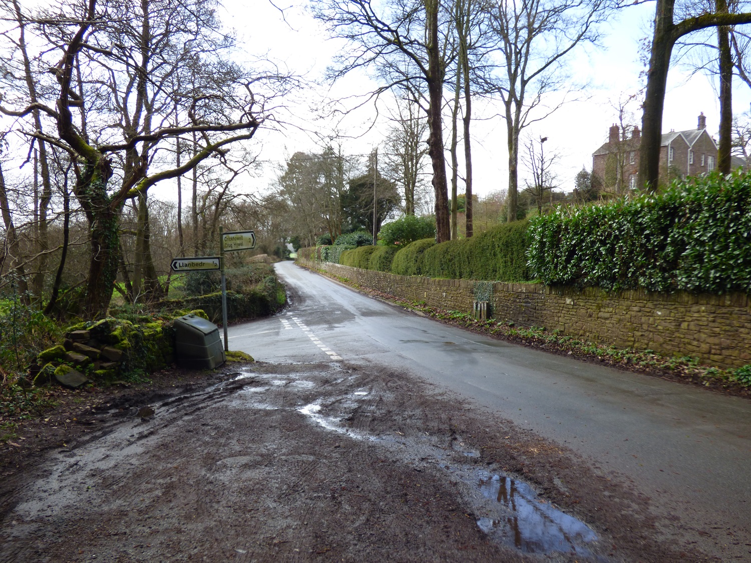
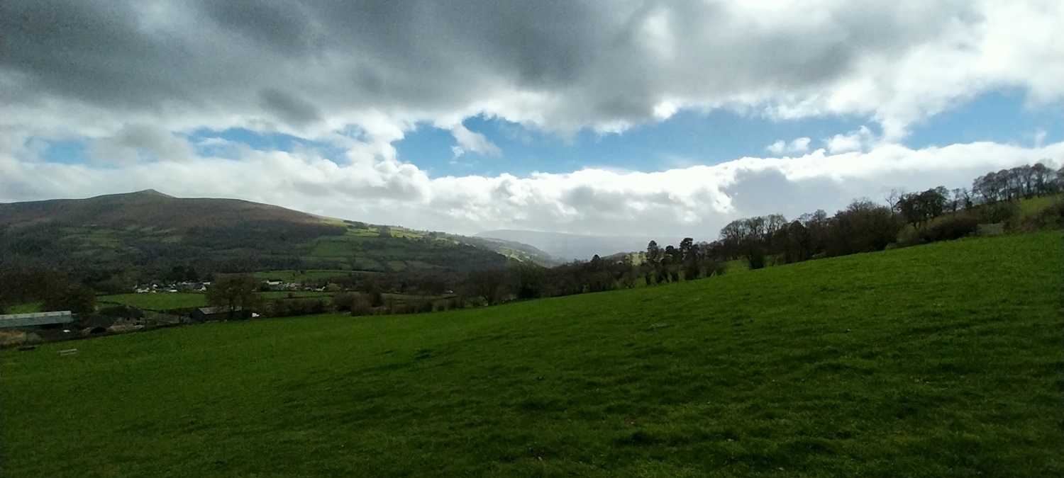
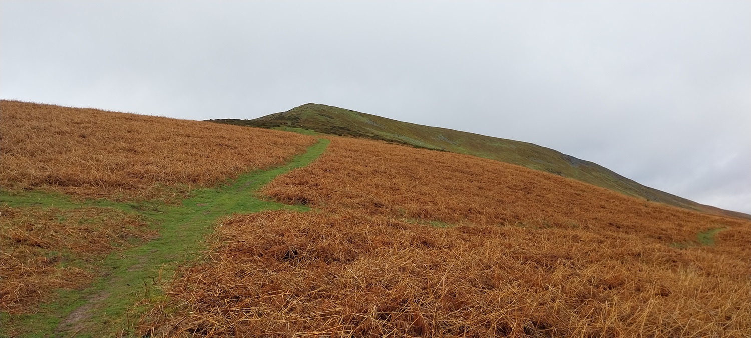
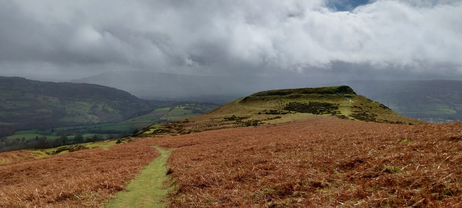
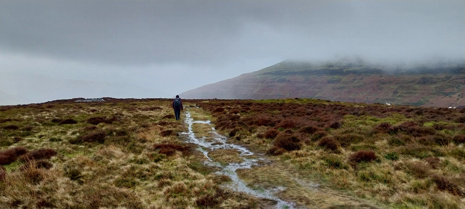
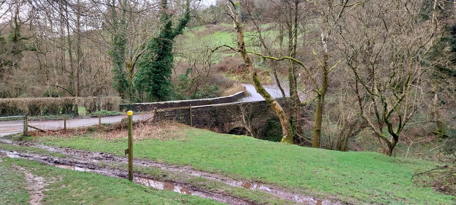
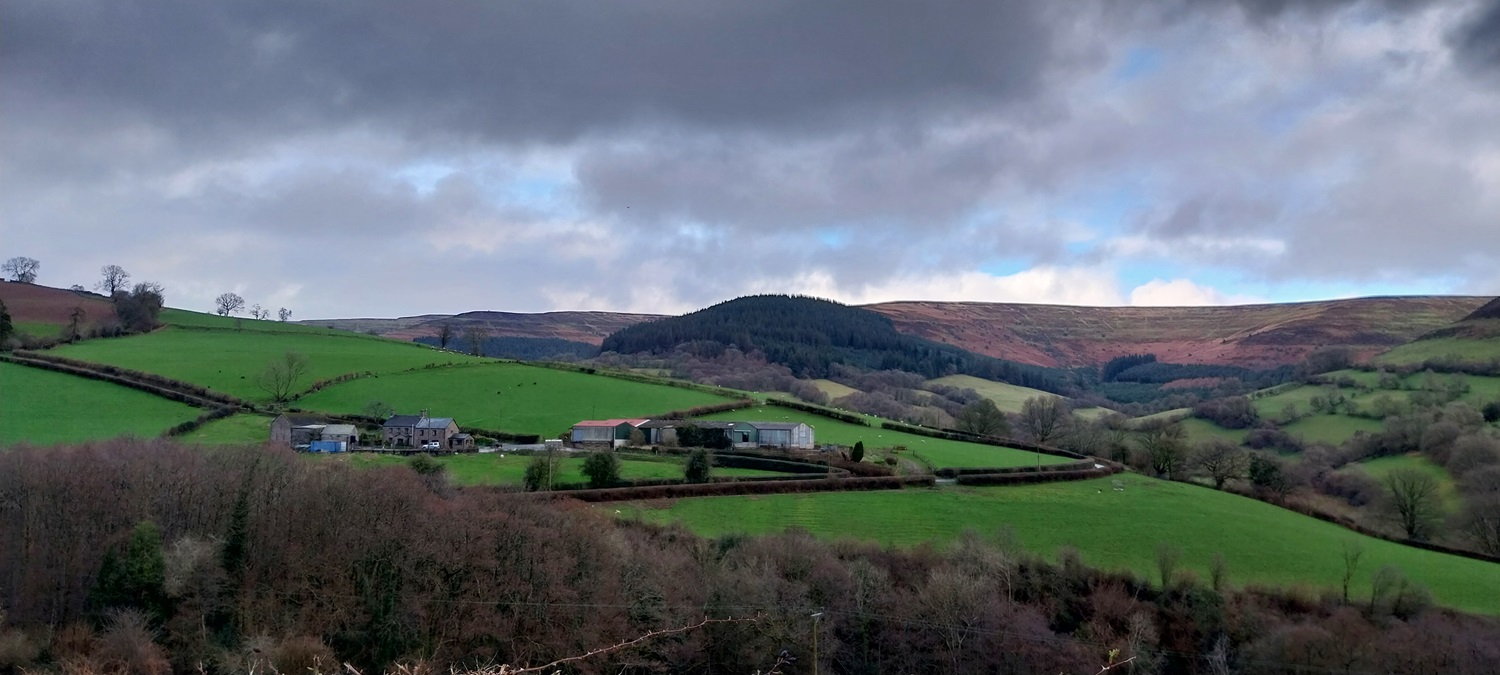
Walk number two of this visit to the Brecons (Bannau Brycheiniog), and after a day of fairly heavy and persistent rain, we stayed on the eastern side of the National Park, to avoid the worst of any showers coming in from the west. It worked pretty well and we only had one long ish batch of drizzly mizzle to contend with. For our day off, we had spent the day bimbling around a couple of record shops, including a particularly good one in Abergavenny (Music One). Our route today started from a small bit of roadside parking, not to far from the cute village of Llanbedr. We would head to this village at the end of the walk, but for now we started off along the road, before turning left and looking upwards. Ahead lay the steep concrete track which was unrelenting in its upness (yes I’m making that word up), before it eased a bit around Table Mountain, and then started upping its steepness again. As we were wondering where we would get any further energy from, the gradient eased a second time and we reached an outlier cairn. The summit was in sight, which gave us a lift and we set off for Pen Cerrig-Calch. Stunning views all around had been had so far on this walk, and the top was no exception as Pen Allt-mawr unveiled itself ahead of us. We stopped for a pasty which we’d bought earlier that morning (ironic coming from the south west of England, to eat a pasty in Wales, made in Cornwall!!), before heading off along the good path to Pen Allt-mawr. More great views of the hills to the north of Pen Allt-mawr were had on reaching its summit, before we dropped steeply off the back. As we walked along flat but sometimes slanted grassy paths, Linda slipped badly but no harm done. We headed around a curving path to Pen Twyn Glas, a pretty dull summit, where the weather closed in, drizzle started and the views vanished. We headed down a very boggy path to the quarries and it was here that the weather cleared again, leaving us with a very muddy, slimy path down to the road. All that was left was the simple walk along the lane to the car, before a drive to Llanbedr to have a look at the village.
Start – Roadside near Llanbedr
Route – Table Mountain – Pen Cerrig-Calch – Pen Allt-mawr – Pen Twyn Glas – Tal Trwynau – Old quarries – Penhoelmeirch – Llanbedr
Distance – 9.5 miles Start time – 11.45am Time taken – 5hrs 30mins Highest Point – Pen Allt-mawr 719 metres
Weather – Lots of sunny spells, cloud, drizzle as we left Pen Twyn Glas until the quarries
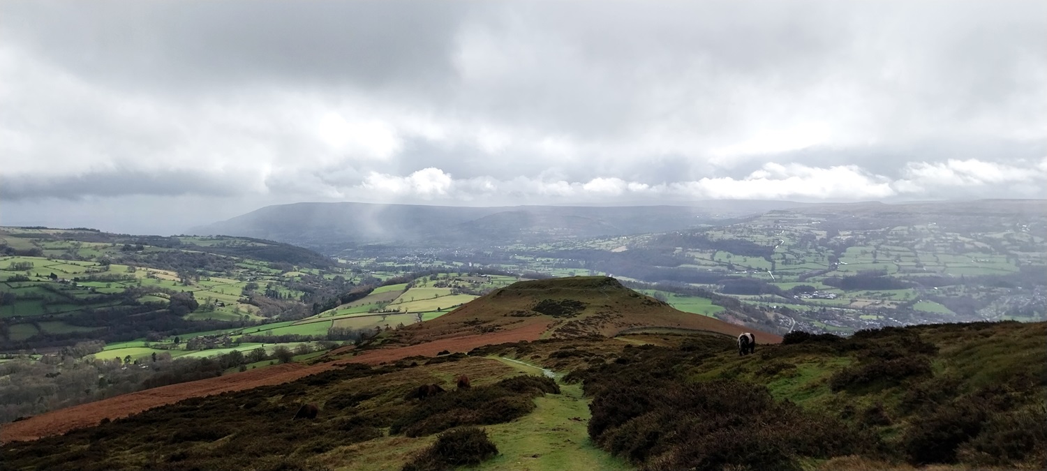
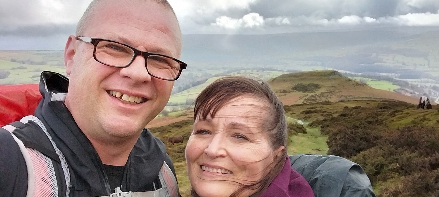
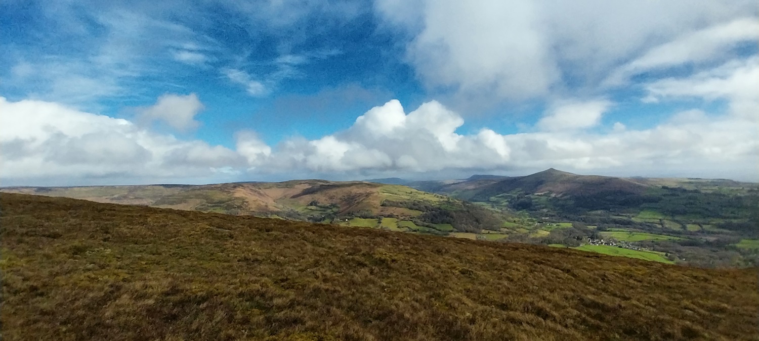
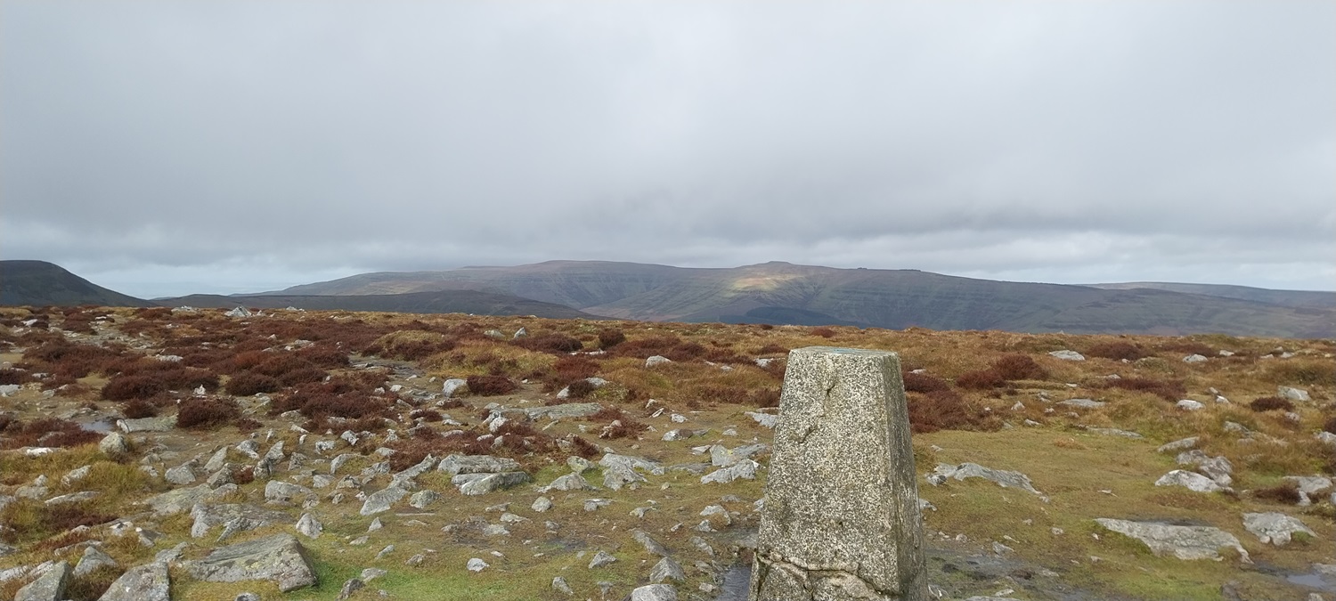
Starting spot, a small layby by a junction outside of LlanbedrSome bits of blue sky above, we saw quite a bit of that on this walk, alongside a bit of drizzle later on. For now though the Sugar Loaf looked good across the valley.Llanbedr village with the Sugar Loaf rising high behindA steep start pretty much straight out the door of the car, this track takes you up to a couple of converted barns. Linda is smiling or is it through gritted teeth at the gradient! Crug Mawr (another possible walk for today is behind)The ridge behind Crug Mawr (on the right) up to Pen Twyn Mawr to the leftLooking up to Pen Cerrig-Calch, this is a false summit in view however, as the real summit is much further behind it.Lots of clouds were being pushed through on a brisk wind from the west (our right here), now with a shower falling over the Sugar LoafBlorenge is just visible through the drizzle and mist at the back, however in the foreground is Table Mountain bathed in glorious sunshine.Crug Mawr ridge again, with a rainbow bottom rightLinda admiring the ‘Welsh Cobs’ with a stunning backdropIts a great view and as the walk is constantly upwards from the car, with no level section, you need an excuse to stop. Table Mountain framed by the Blorenge ridge behind, the valley holds the River Usk on its way to AbergavennySelfie to allow us to grab a breathThe direction of the weather and the outcrop of BryniogA wider shot of the view towards Sugar Loaf and Crug MawrThe first cairn as you start to level out a little, Sugar Loaf behind and Ysgyryd Fawr to the left behind that, where we were two days previous to this walk. It had rained heavily on the day inbetween so we’d spent a day perusing the record shops in the area, including a very good one in Abergavenny called Music OneThe trig on Pen Cerrig-Calch, the ridge behind is the one that starts to the right on Crug Mawr. Directly above the trig is the bump of Pen y Gadair Fawr, which will feature in a walk soon. To the left of that is Waun Fach the high point of the Black MountainsToday however our walk continues on to Pen Allt-mawr, the cloud is thickening a bit as we start out towards Pen Allt-mawr which is the right hand side on the hill ahead, left is the point named Pen Gloch-y-pibwr (no idea how to say that!)A newly laid path between these two keep the feet mainly dry from the peaty heather.Views down into Cwm Banw, with Pen Cerrig-Calch up to the right and the pointy Sugar Loaf in the distance in the sun.Now on Pen Allt-mawr, and I promise that Linda has not pushed over the trig point!Behind Pen Allt-mawr stands Mynydd Troed in the centre, with Mynydd Llangorse to the leftOur route heads out along the sweep, heading around to the right to a minor top of Pen Twyn Glas, and then down the ridge. At the back stands Waun Fach and the ‘easier to pick out’ bump of Pen y Gadair FawrGreat views down to the valley below and to Sugar Loaf back rightOff the back of Pen Allt-mawr now, it was here that Linda slipped as we were looking for a path back down. The one here, bottom left, ends up in a boggy area despite being marked on the map, so we instead chose to head to Pen Twyn Glas first.The cloud is dropping now as we look back at Pen Allt-mawrThe uninspiring summit of Pen Twyn Glas, cloud is very much down nowLinda ahead as the cloud lifts, and we drop near to the quarriesYours trulyThe cairn at the end of the ridge just after the quarries. Cloud still down in the distance, blocking views to the Sugar LoafThis is just a part of a very boggy slimy path as we head down to the road, good views beyond thoughDown at the road now, luckily beside the road there was plenty of running water to allow cleaning of boots and over trousers.Looking over to the the tree covered hill, which is Pen Gwyllt Meirch, or at least that area heads up to it behind, as we head down the lane looking back over farmlandDonkeySome lovely light now as the sun breaks through again, blue skies are overhead again with Disgwlyfa to the hill to the leftAs we are in Wales it makes sense to take a photo of some daffodils, luckily I got Sugar Loaf in the same picture behindAt the end we took a quick drive down to Llanbedr, the church is only open 10am to 12.30 so we missed looking inside and we didn’t go for a drink either in the Red Lion, but we would put that right the next day.
It’s a fine route that one, I’ve done it many times. On a warm sunny day the quarries at the end of the ridge is a great place for a stop. Glad you were able to enjoy some decent views. It’s one of the lesser walked routes as parking is so tricky. Pen Carrig Calch is so named as it’s the only limestone area in the Black Mountains (although there is quite an expanse of out to the west in the Black Mountain and Fforest Fawr.
I did see on the map that there were shake holes marked around the summit area and wondered why they would be there. It was a super walk, and thanks for suggesting it, particularly liked the view off the back of Pen Allt-mawr
If you’re very keen you can circuit the entire valley by tagging on the ridge we did the following day. Long day that one though when I did it years ago


Just lovely up there, Steve. Even a glimmer of blue!
LikeLiked by 1 person
Yeah we had some decent weather, it probably only rained for maybe 30 mins out of the 5 hours, so pretty good for Wales in March I’d say
LikeLiked by 1 person
It’s a fine route that one, I’ve done it many times. On a warm sunny day the quarries at the end of the ridge is a great place for a stop. Glad you were able to enjoy some decent views. It’s one of the lesser walked routes as parking is so tricky. Pen Carrig Calch is so named as it’s the only limestone area in the Black Mountains (although there is quite an expanse of out to the west in the Black Mountain and Fforest Fawr.
LikeLiked by 1 person
I did see on the map that there were shake holes marked around the summit area and wondered why they would be there. It was a super walk, and thanks for suggesting it, particularly liked the view off the back of Pen Allt-mawr
LikeLike
If you’re very keen you can circuit the entire valley by tagging on the ridge we did the following day. Long day that one though when I did it years ago
LikeLiked by 1 person
Pingback: Jo’s Monday walk : Gambelas | Still Restlessjo
Shame about the weather. The walk looks nice and I like the colours of the countryside. Great photos.
LikeLiked by 1 person
To be fair apart from a drizzly misty shower for 30 mins it did stay dry, we got clear views on the high hills which made the walk a good one
LikeLiked by 1 person
Not very sunny yet, isn’t it? Or perhaps that is unlikely to happen ever
LikeLiked by 1 person