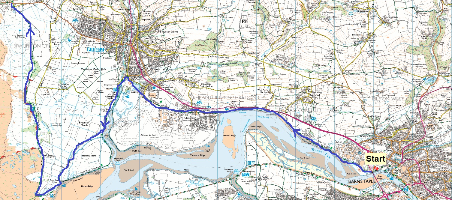
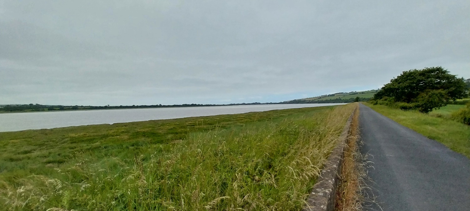
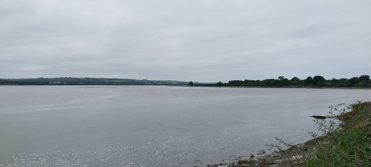
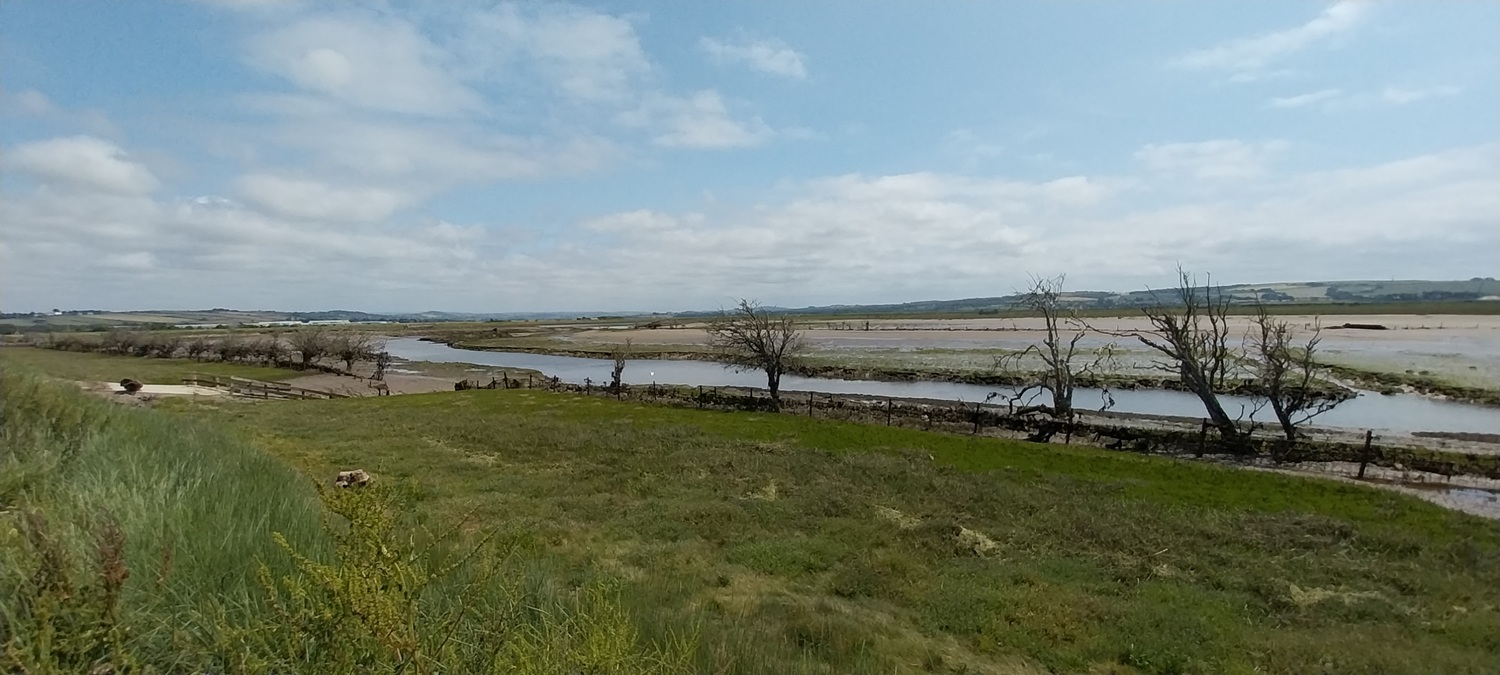
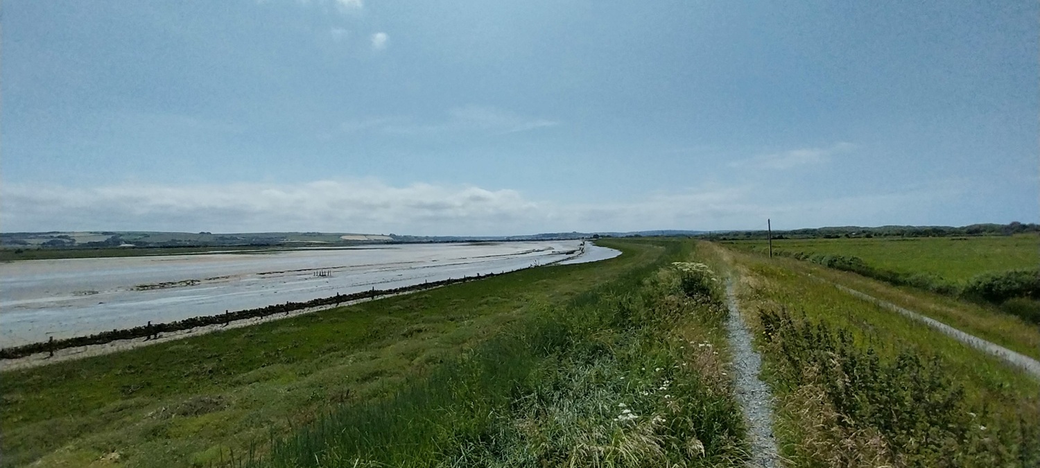
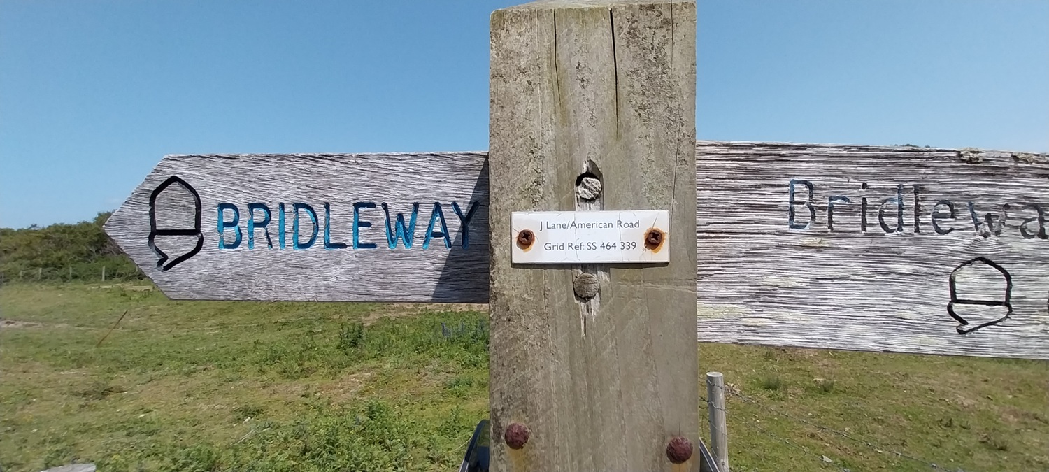
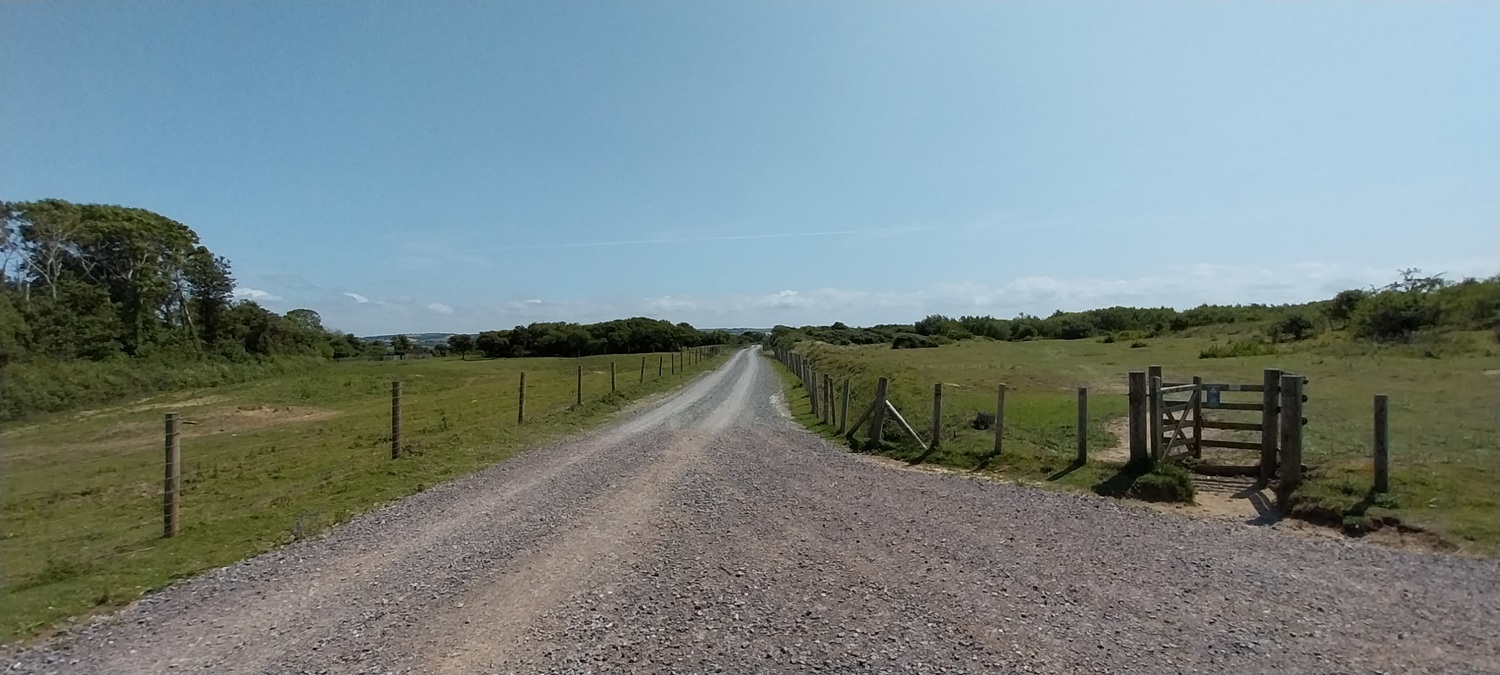
So we’d stayed overnight in Barnstaple and as a result we were able to make an early start without the need for a 90 minute drive. We started again from the Long Bridge in Barnstaple, this time on the northern side of the estuary, heading for Saunton, hopefully. The route hugs the estuary again for the first few miles, before drifting away at the Royal Marine base of Chivenor. I remember going here many years ago for an air show, back in the days when they were held at an airfield. Next we headed through Velator and its quay, before opening out to Braunton Burrows and Marsh, a vast area, seemingly reclaimed from the sea. There are dunes, ditches, banks, grassy fields and a large area where the sea is fighting back, but more than all that its an area stuffed with wildlife. I missed photos of animals and insects more than I took by at least 20 to 1, its a fascinating place. One gentleman stopped to tell us about the place and give very good directions, including telling us why the coastal path is no longer a valid path anymore and to come inland a little. Next we headed along the American Road, built as suggested by the Americans, as they practiced for the D Day landings in the dunes of Saunton Sands. Finally we walked through Saunton golf course, arguably the best course in the south west, and host to the British Amateur championship on a number of occasions. We finished on the B3231 as a bus drove passed, having tried with no signal to work out when the next bus was. We next tried to find the nearest bus stop to wait, again no signal meant we guessed the direction, choosing wrongly and walking for over 2 miles to Braunton, when in hindsight a 400 metre walk in the opposite direction, would have us at the Saunton bus stop. Still a lovely walk in lovely weather.
Start – Barnstaple
Route –South West Coastal Path – Taw Bridge – Heanton Court – Chivenor – Velator Bridge – Braunton Marsh – Crow Beach – American Road – Saunton Golf Course – St Anne’s Chapel – Walk to Braunton
Distance – 10.5 miles (plus 2.5 miles to the bus stop!) Start time – 9.45am Time taken – 6hrs Highest Point – Nothing worth talking about, again
Weather – Cloudy to start and hot sunshine to finish
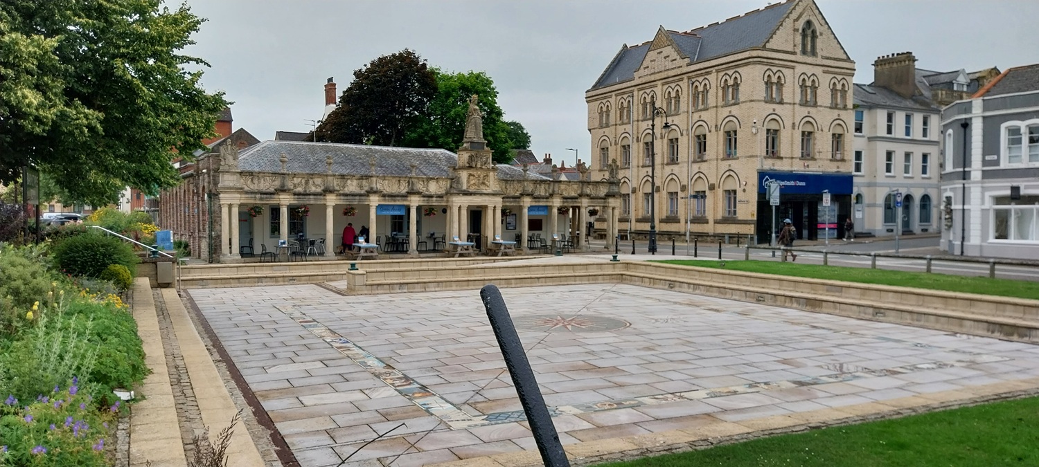
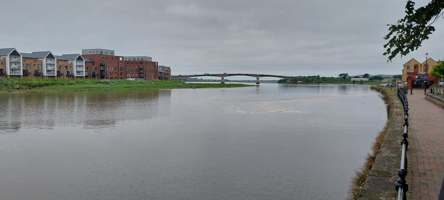
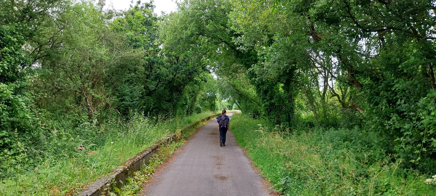
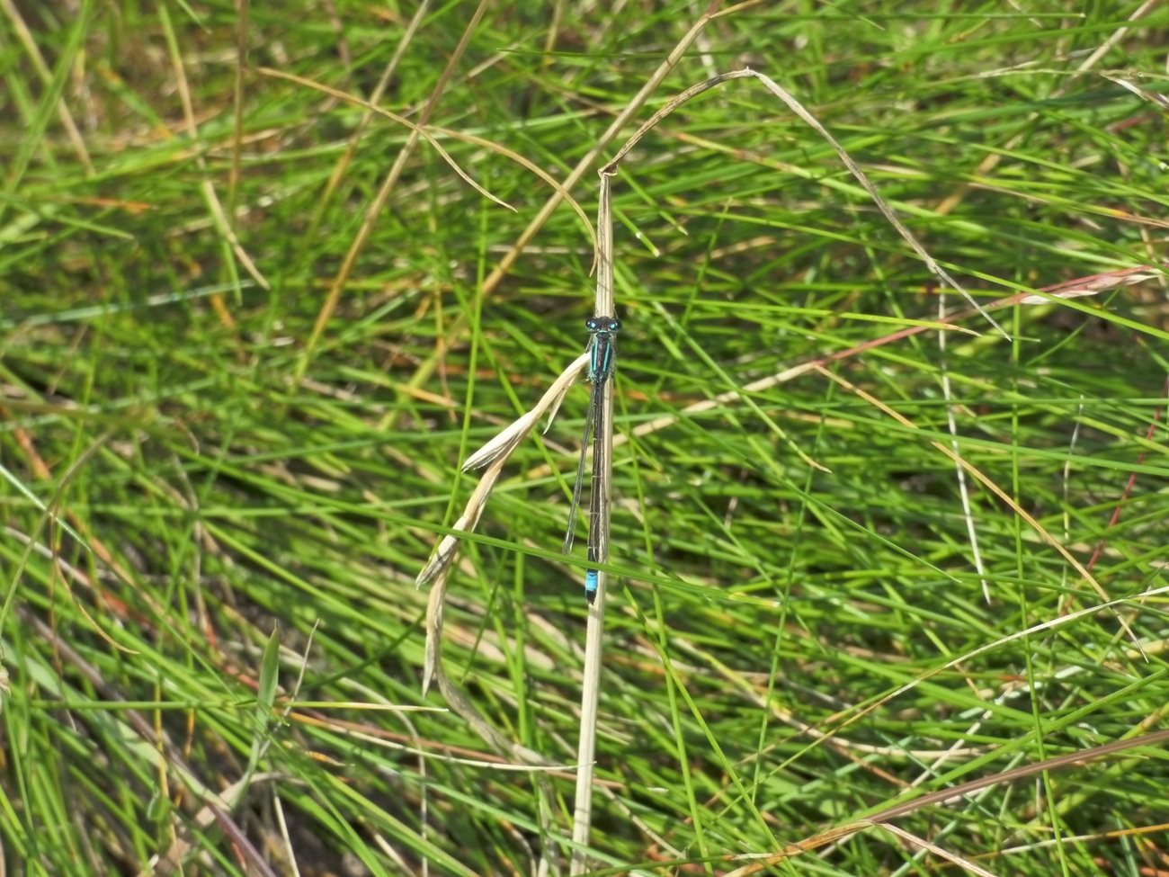
Long Bridge in Barnstaple, our start point for the second day runningWe both quite liked the look of this square, bit early for a coffee stop for us thoughTaw Bridge ahead, the River Taw obviously next to us and would be our companion for a few milesLittle Egret across the river, stalking its preyA caravan boat or boat caravan?Like the walk yesterday, we are following the old railway line which was closed in 1970River Taw estuary left and our path on the right, all flat like yesterdayLooking backSo the box here held a book for people to write the birds seen on the estuary. I opened page one to see a drawing of an unusual phallic bird!! Typical Britain. I laughed, Linda laughed, we are just kids really!!Taw estuary as we approach ChivenorFancy place to eat by the estuaryThe barracks were next, plenty of army vehicles inside, an obstacle course and a fella mowing the grassMeadow BrownThere’s the obstacle courseVelator Quay and weir. There were houses to the left here advertising views to the river. They must have x-ray binoculars installed in the house because its a distance away and behind those treesOut onto Braunton Burrows now, I didn’t have any expectations of this place, but its superb, so many butterflies and moths at the start of June. Can’t imagine what its like in July when more of them are out.That’s the stream that goes over the weir to our left here, it runs out to the River Taw. Left is the estuary side, right seems to be reclaimed land from the sea, with ditches criss-crossing the areaPeacock butterfly with wings closedIts a distance away but it looks like a heronWe are on the inner bank here, the outer bank, over there is closed due to a break in the bank, which started small but is now 30 metres or more across and the water floods in. The once grassy fields are now muddy areas, great for nature, but not for us anymoreMore of the same to the left as we walk the inner bank. We’d spoken to a lovely gentleman by this point who told us about the area, the break in the bank, which started small but the owners couldn’t afford to fix it, the coastal path which once went that way is now diverted along this path we are walking. He also warned of the shots heard in the distance as the army are practicing over there with blanksBlue Tailed DamselflyCrow House beach, part of the estuary and the Atlantic is just around the corner to the rightSix Spotted Burnet on some thistle, loads of these todayHere are the army/marines as we enter the sand dune areas, this is marked on the map as a forces area, a bit like the firing ranges on Dartmoor. We will turn right here and head along the American RoadAs it says on the small tag, the American Road. Built by the American military so they could practice around Saunton Sands for the upcoming assaults on the beaches of Normandy in 1944American Road
Cinnebar moth, a first for me
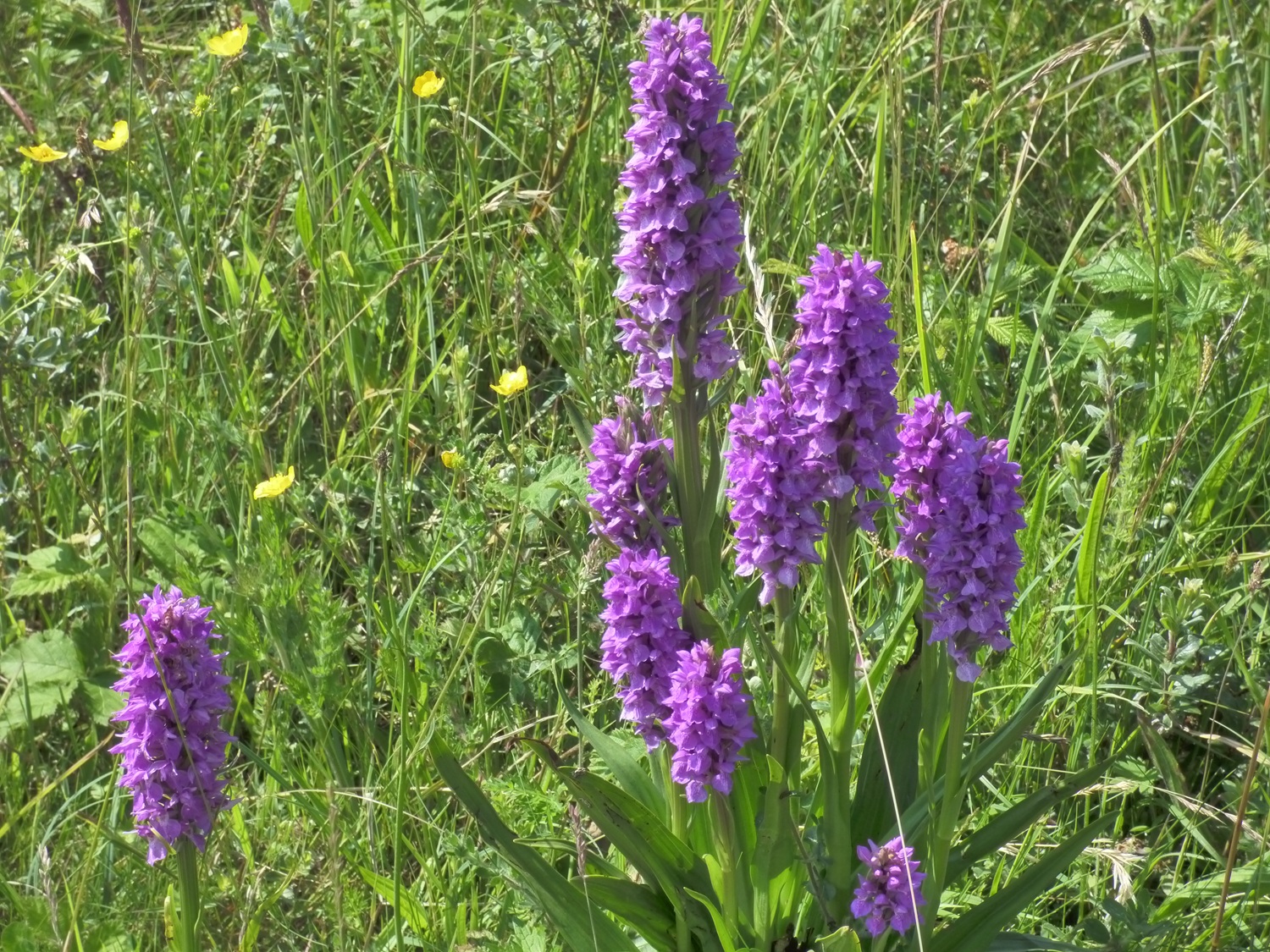
First look at Saunton golf course, never got to play here, but its said to be the best in the south westGroups of pyramid orchids all across this partStunning place, filled with sand dunes, wildflowers, butterflies and the odd golferAnd a stunning array of poppies of all types and coloursFinally we reached St Anne’s chapel, opposite the entrance to the golf course. We’d missed the bus by seconds as we reached the road, but couldn’t see the bus stop. With no signal to see the map or the bus timetable, we headed towards Barnstaple, over 2 miles later we reached a bus stop, if we’d have walked 10 mins the opposite way we’d have reached the other one, still another part ticked off, and we will be back to start from this spot and head towards Croyde beach and the surf zone!
What a shame the coastal path isn’t quite as it was. My Dad a number of years of his childhood at Heanton Court. We spent many years of our childhood in North Devon and he’d love going for a Sunday meal there on occasion and visiting the place again.
Heanton Court looked lovely, still plenty of cars in the car park when we passed later that day. The coastal path banking had been breached and the owners apparently couldn’t afford to repair it and before long the hole grew. I can’t see it ever being fixed now as its getting bigger and bigger
Looks like you captured a fair few creatures Steve, despite the ones that got away! 80 years between the American road built in preparation for war and passing by young Marines still preparing for war.
Yes that was a strange juxtaposition to have two parts of the forces effort, so many years between them. I know how important these dunes were in the preparations for WW2 and the invasion of Normandy, Its one of the largest sand dunes areas in Europe
That looks a grand walk with all the butterflies and birds. Though perhaps the bird artist was trying to explain the birds & the bees…..Also love those vibrant orchids!
I’ve had two or three more walks in the last fortnight which had us swamped with butterflies, including the Lulworth Skipper, which will give you a clue as to where we went
Don’t know that stretch of the coast. More familiar with the big surf beaches further along, especially Croyde but never walked on Saunton Sands. I always remember looking across from our holiday homes at Westward Ho to the massive white Saunton Sands Hotel.
Yes that hotel is still there, and we’ve just been to Bideford this last weekend, and we could see that hotel from Hartland Point! Our next walk around the Saunton area will take us to Croyde, massively over touristed now though is Croyde


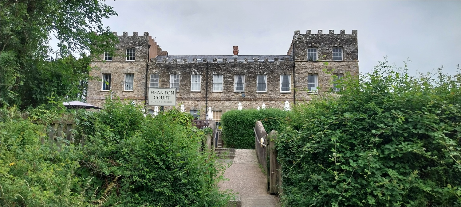


What a shame the coastal path isn’t quite as it was. My Dad a number of years of his childhood at Heanton Court. We spent many years of our childhood in North Devon and he’d love going for a Sunday meal there on occasion and visiting the place again.
LikeLiked by 1 person
Heanton Court looked lovely, still plenty of cars in the car park when we passed later that day. The coastal path banking had been breached and the owners apparently couldn’t afford to repair it and before long the hole grew. I can’t see it ever being fixed now as its getting bigger and bigger
LikeLike
Looks like you captured a fair few creatures Steve, despite the ones that got away! 80 years between the American road built in preparation for war and passing by young Marines still preparing for war.
LikeLiked by 1 person
Yes that was a strange juxtaposition to have two parts of the forces effort, so many years between them. I know how important these dunes were in the preparations for WW2 and the invasion of Normandy, Its one of the largest sand dunes areas in Europe
LikeLiked by 1 person
That looks a grand walk with all the butterflies and birds. Though perhaps the bird artist was trying to explain the birds & the bees…..Also love those vibrant orchids!
LikeLiked by 1 person
I’ve had two or three more walks in the last fortnight which had us swamped with butterflies, including the Lulworth Skipper, which will give you a clue as to where we went
LikeLiked by 1 person
Lulworth Cove?
LikeLiked by 1 person
Pretty much yes, Durdle Door and west of that. Stunning place
LikeLiked by 1 person
Don’t know that stretch of the coast. More familiar with the big surf beaches further along, especially Croyde but never walked on Saunton Sands. I always remember looking across from our holiday homes at Westward Ho to the massive white Saunton Sands Hotel.
LikeLiked by 1 person
Yes that hotel is still there, and we’ve just been to Bideford this last weekend, and we could see that hotel from Hartland Point! Our next walk around the Saunton area will take us to Croyde, massively over touristed now though is Croyde
LikeLiked by 1 person
Lovely photos of the scenery and the fauna and flaura.
LikeLiked by 1 person