First of the big walks on the Easter visit to the Lakes this year. My Wainwright map has far too many dots in the south western side, particularly around Eskdale and Wasdale. Time for a visit out that way. Now some would say that heading to Wasdale on an Easter Sunday is asking for trouble, car parks full, people everywhere, you’d be mad to go. Yet again on my visit to the Lakes I found no issue parking for a walk, in an alleged busy holiday time, in one of the busiest spots (after last summer parking at Seathwaite). This time I parked up at 9am at Overbeck car park, so hardly super early (plus there was space further down the valley as Wasdale Heads’ two car parks). Personally these extra tourists visiting the Lakes appear to not be walkers, not that I’ve seen in the 3 times I’ve been in 9 months. More people wanting to see what the fuss is about, eat out, drink in the pubs, shop and see honeypot villages.
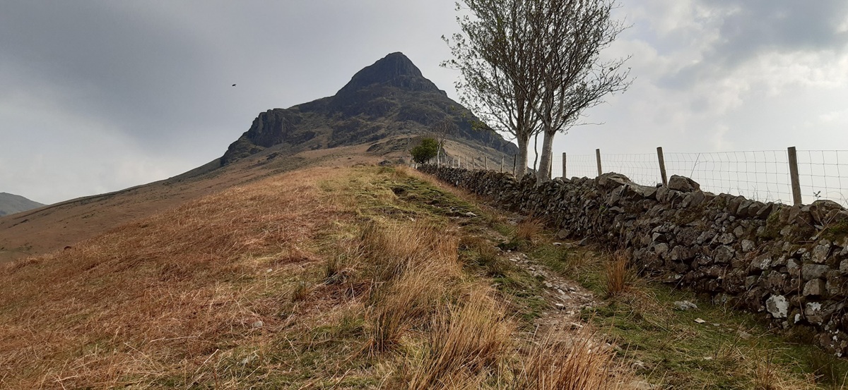
This walk starts hard from the car door, with the path straight up the nose of Yewbarrow, it looks a horrible route from the bottom but when you near you notice the path veering away from Bell Rib and through a gate taking the path between Bell Rib and Dropping Crag. I found the scramble very manageable and shorter than I thought it would be. Once above Dropping Crag you pick up an easier path (which takes you away from a second scramble or scree run), zigzagging up some grassy shelves to the ridge line. The walk to the summit is much further than you think with the odd tiny scramble on rocks but its all simple if you take your time. The descent path from the saddle was easy to find, meaning I missed Stirrup Crag, however in trying to maintain height and not drop too far below Dore Head I picked the hardest of these slanted descents over boulders and scree, it would have been easier to take the obvious straight descent to the main path below, from half way along the path towards Dore Head. From there its a tough climb up to Red Pike, but once you are there the hardest part is over. The route from Red Pike to Scoat Fell is lovely, and the narrow path to Steeple was not as hard as I expected. It made for a lovely lunch spot out of a strengthening wind. The path to Haycock was easy to follow also, however it was here that I decided that I’d bagged enough and Caw Fell would have to wait for a visit (probably from the Ennerdale side). What followed was one of the best descents I’ve had in all my Lakeland walks, the Nether Beck path down to Bowderdale was fantastic, out of the wind, the weather was warm and the beck followed my every steps, some lovely waterfalls and plunge pools near the bottom end would have been brilliant in the summer, but this time a feet soak instead finished the day off nicely. 5 Wainwrights pushes me up to 181 after this walk, starting to get closer to the end now.
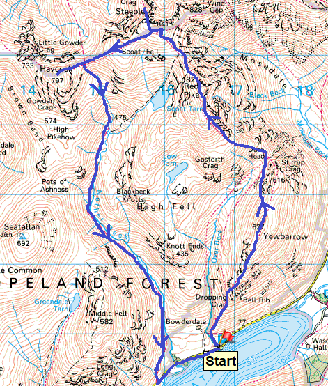
Start – Overbeck car park
Route – Bell Rib – Yewbarrow – Dore Head – Red Pike – Scoat Fell – Steeple – Haycock – Nether Beck – Bowderdale – Overbeck car park
Distance – 10 miles Start time – 9am Time taken – 7hrs Highest Point – Scoat Fell 841metres
Weather – Sunny and breezy, very hazy in the distance views
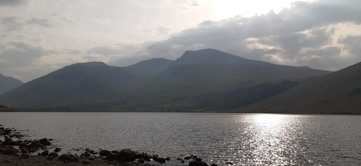
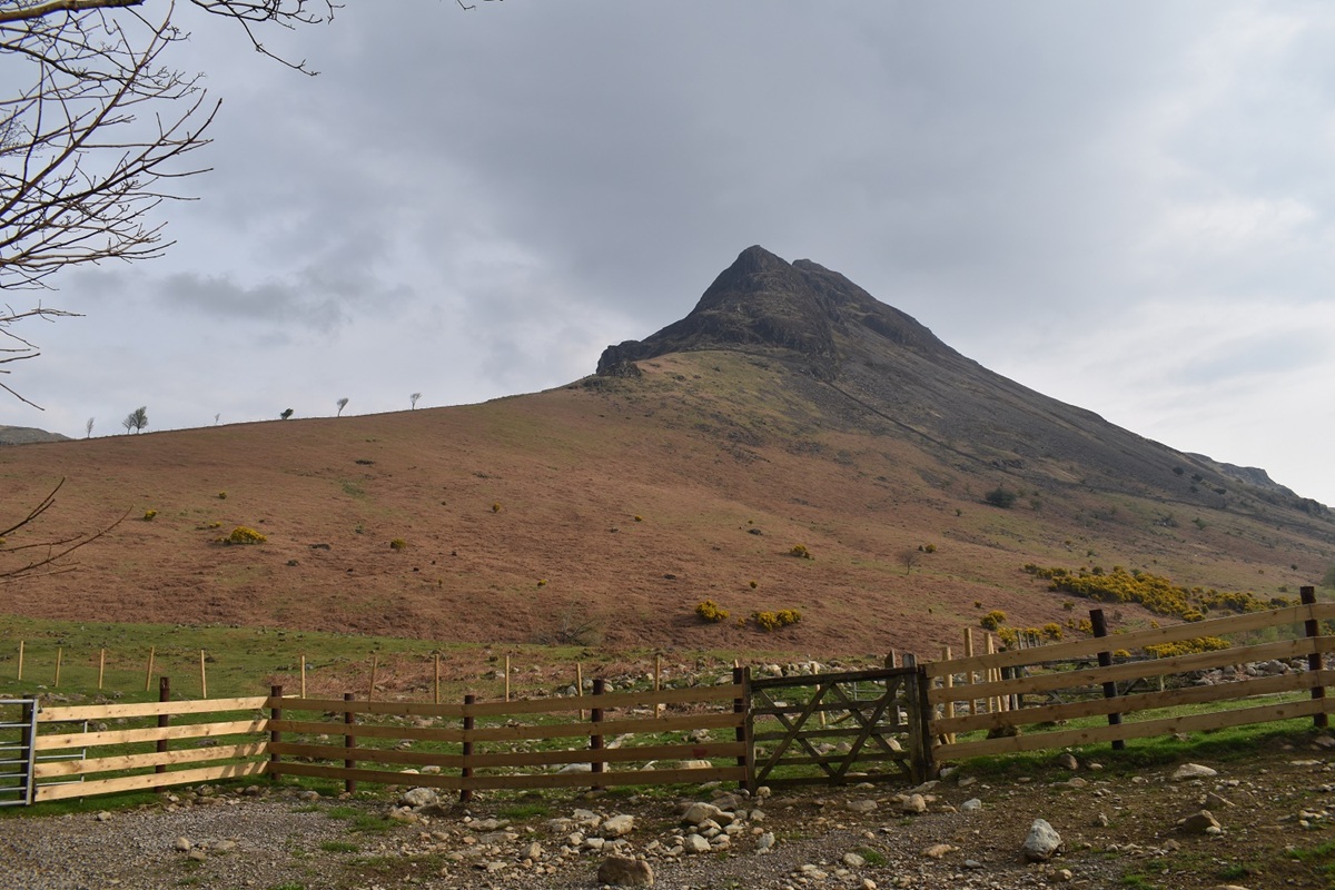
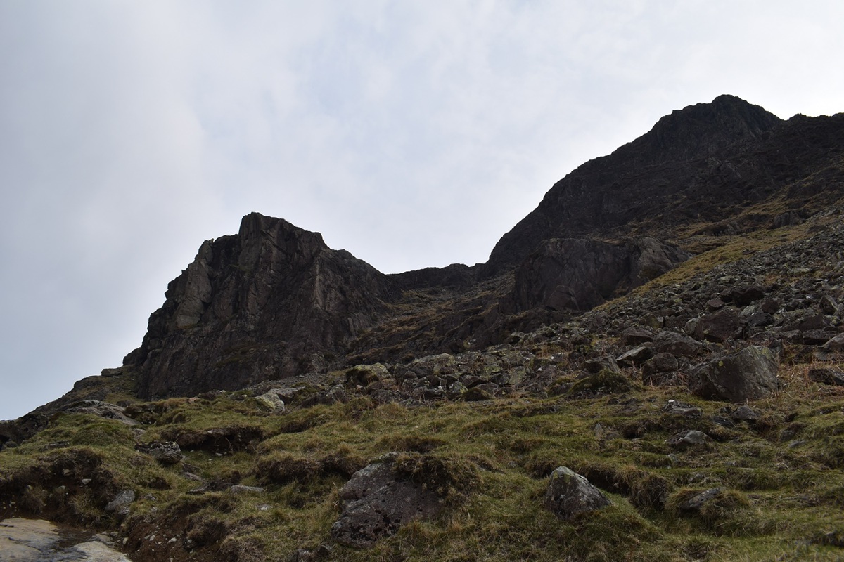
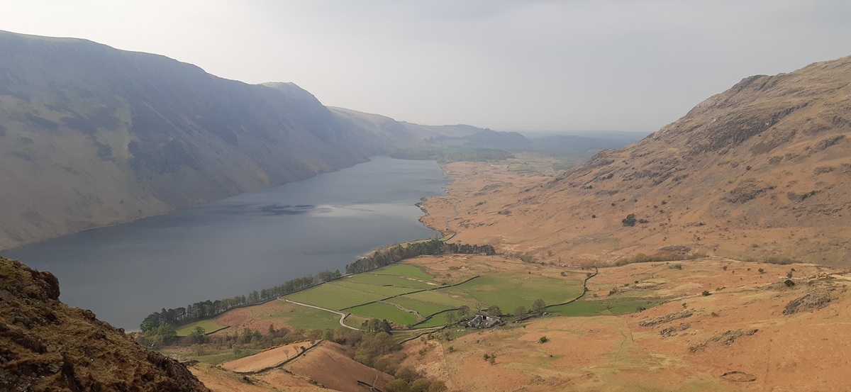
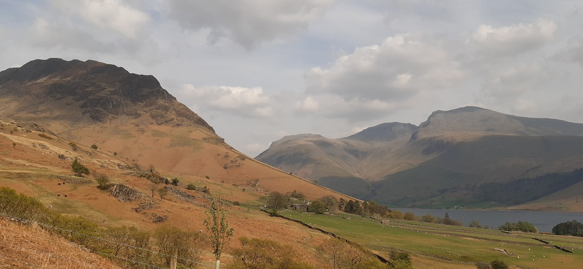
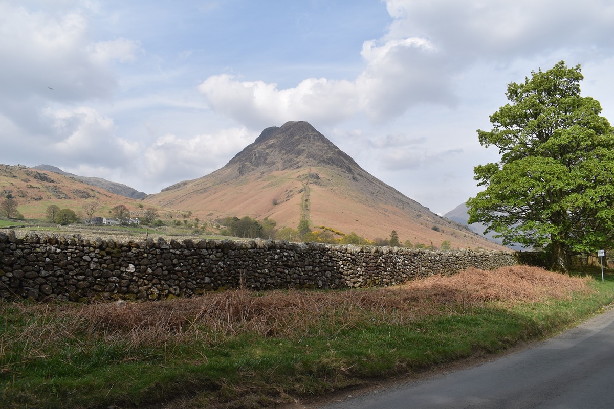
Starting out and a view across to the high point in England from the car park at Overbeck, Scafell Pike is in the middle at the back, Scafell on the right and Lingmell leftThat’s Yewbarrow, I’d read that there is a route up from front of Bell Rib! Not for me I’m taking the more standard path with a bit of a scramble but nothing too hairy or exposed.The steepness starts almost straight away, it doesn’t take long to get to the bottom of Bell Rib, about 30 mins had me picking a path to head up past Dropping CragHaving followed the path away from the wall a bit and through a gate I am faced with the above, another path heads left here and under Dropping Crag (the large rock face on the left). However I’m heading for the rocky bits to the right of Dropping Crag, again a path is followed up through. Once you are about at a level with the top of Dropping Crag you start the proper scramble section, to get to the bottom of it you will have walked a zigzag path up some rocky sections with some small scree parts, just take your time here but there is little danger in the dry.Looking back down to Wastwater, The Screes are on the left and the steep slopes up to Middle Fell to the rightMiddle Fell left, Seatallan at the back and Knott Ends on the right. Dropping Crag immediately on the right
Now this is the scramble part, you are not exposed here and I found it ok to get up with 3 and 4 points of contact lots of times
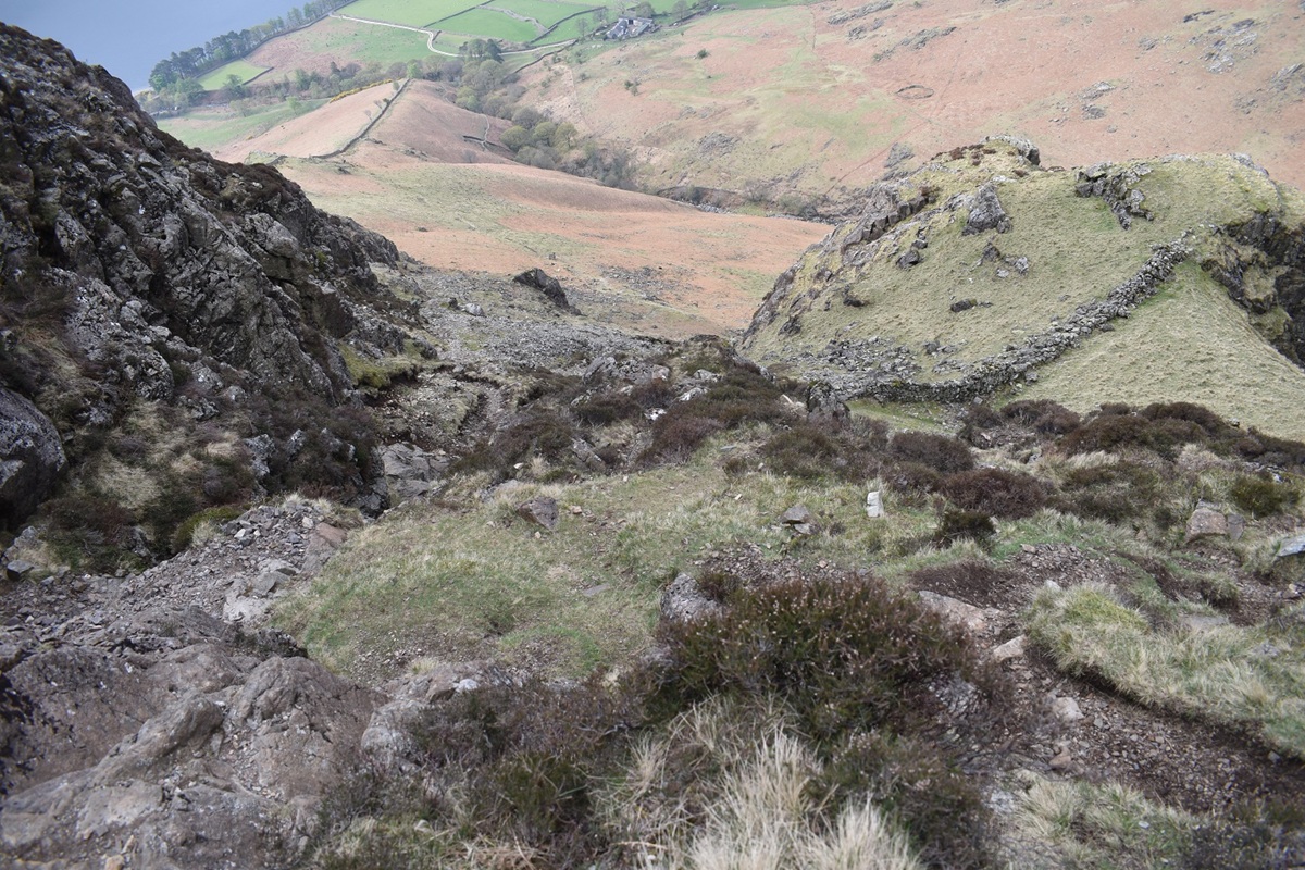
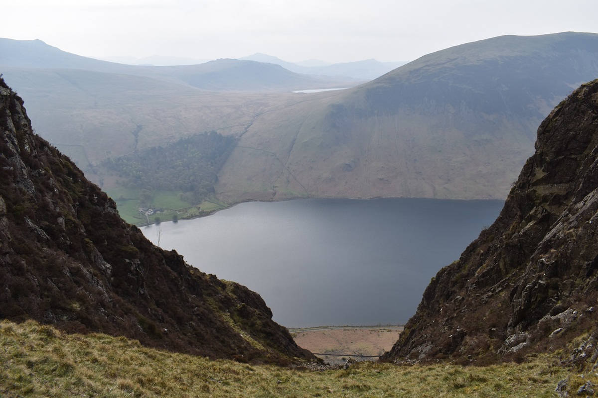
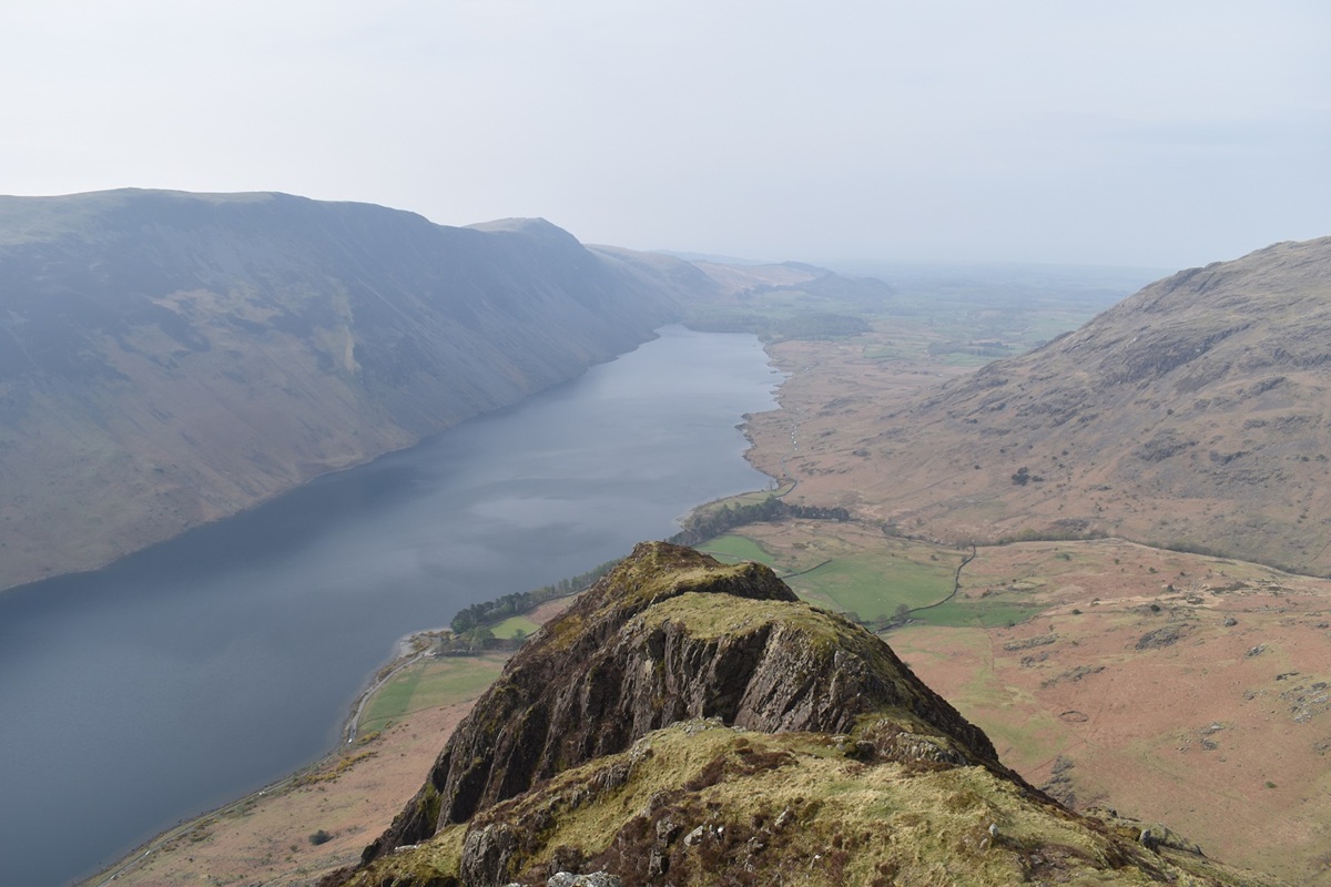
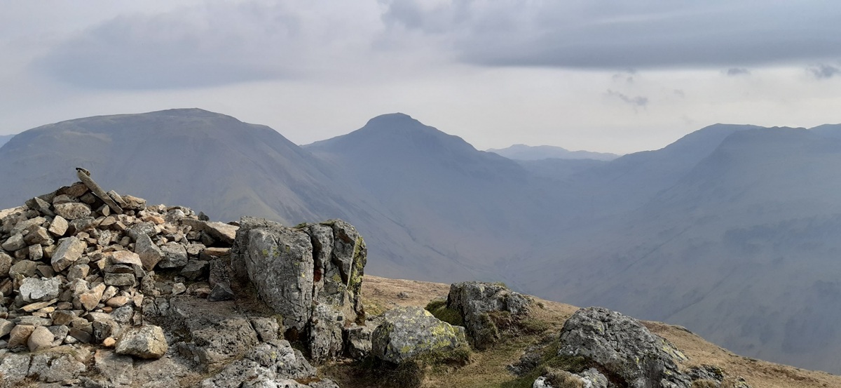
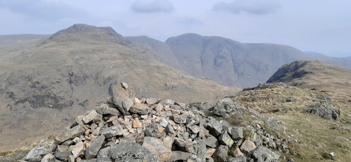
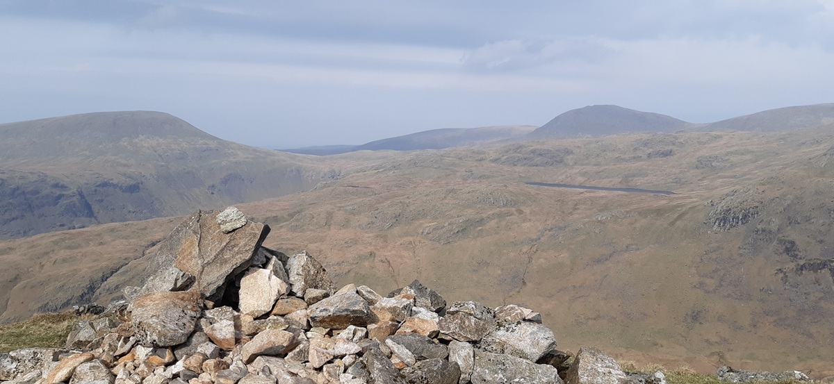
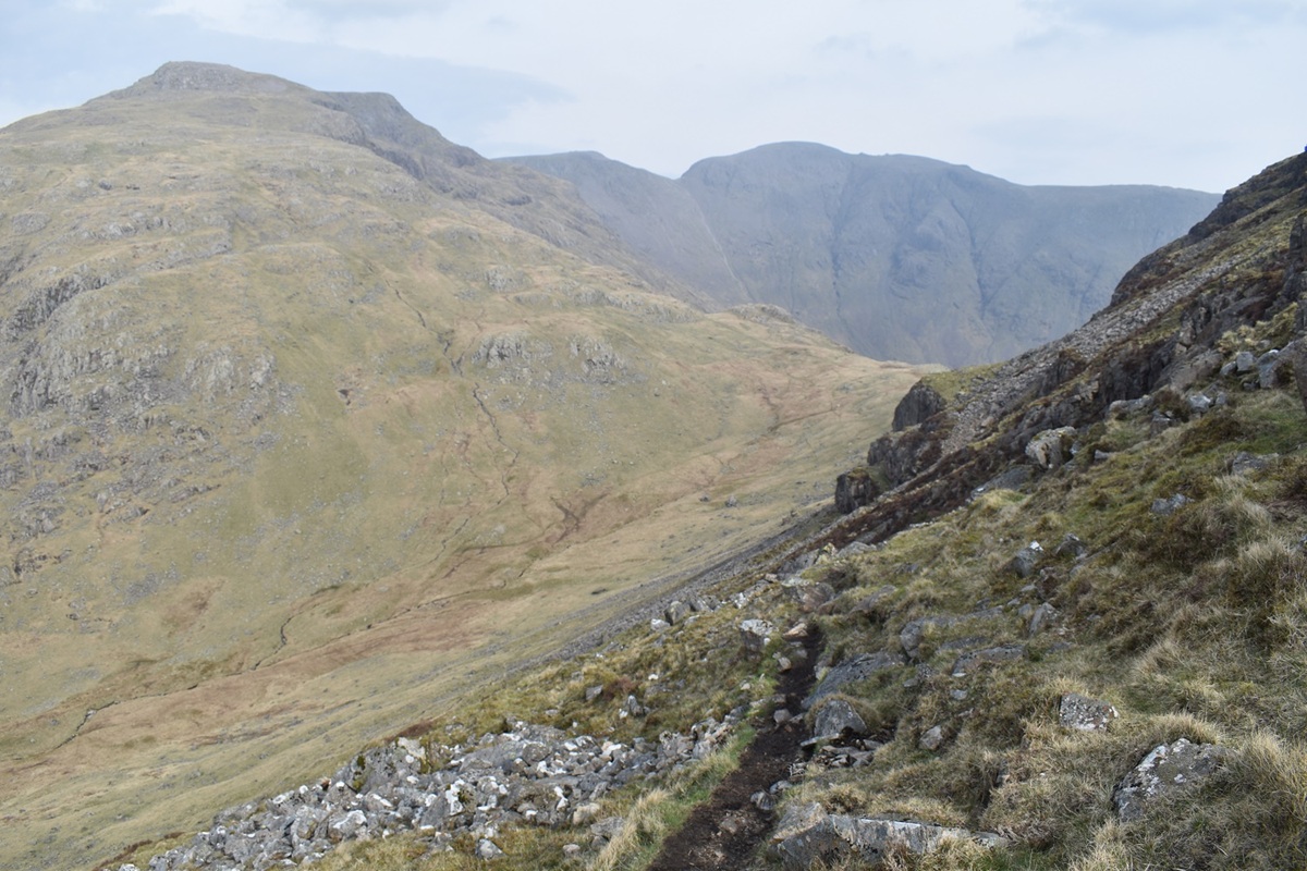
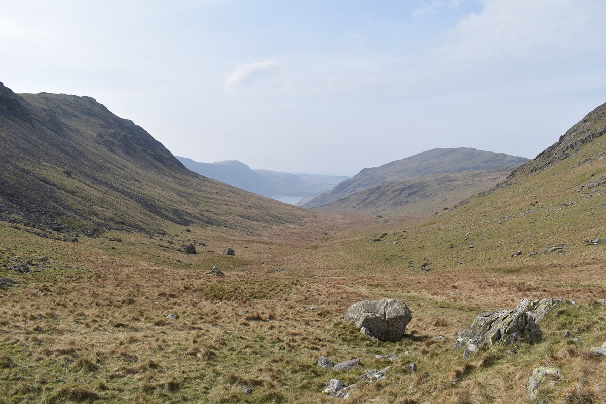
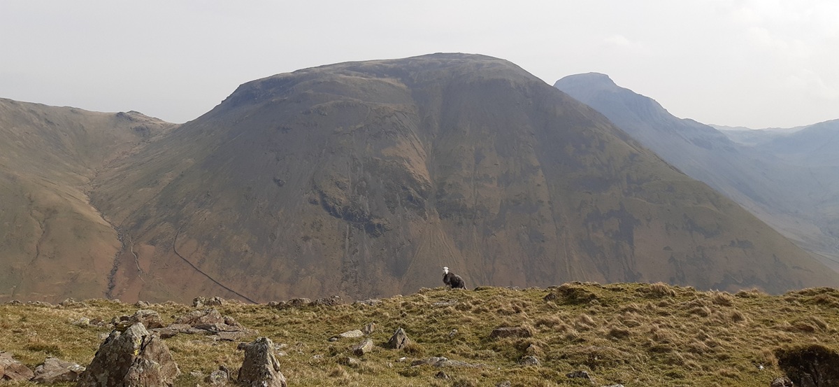
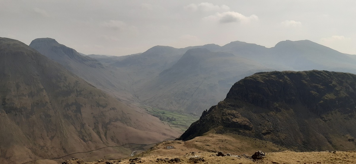
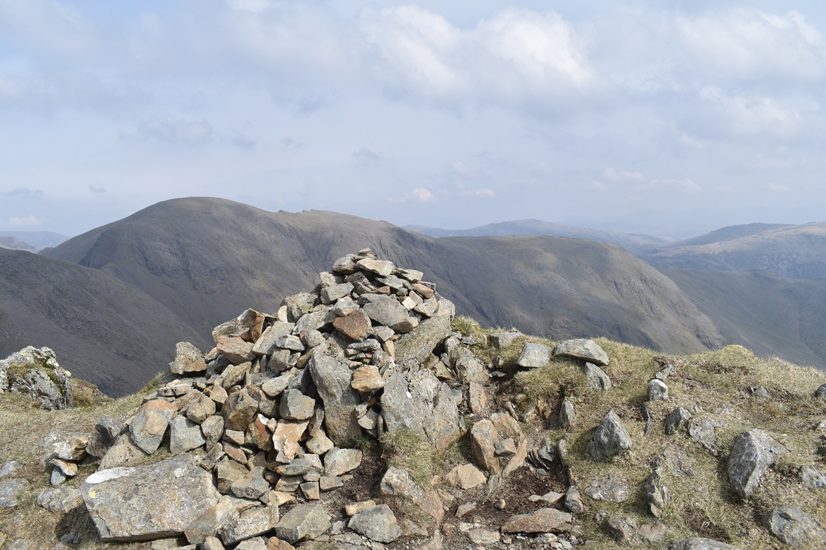
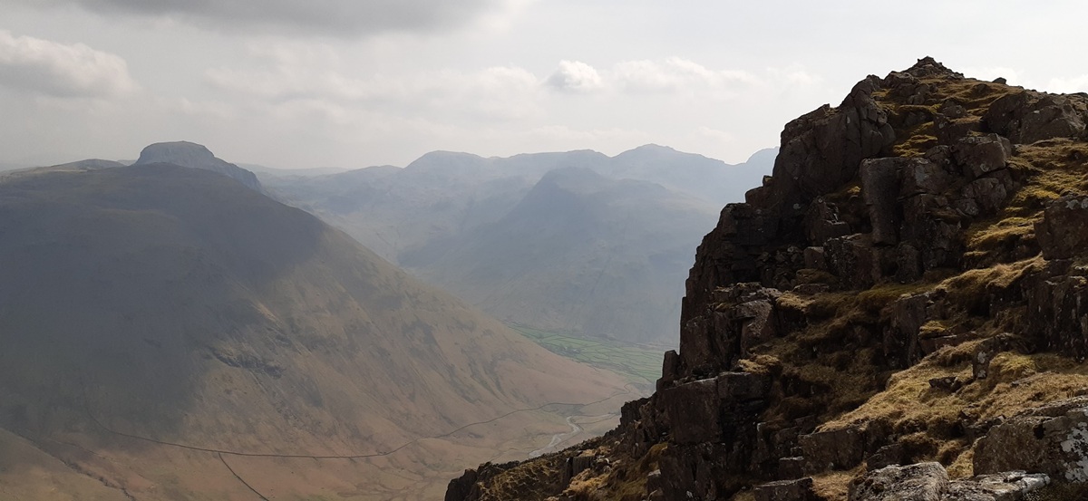
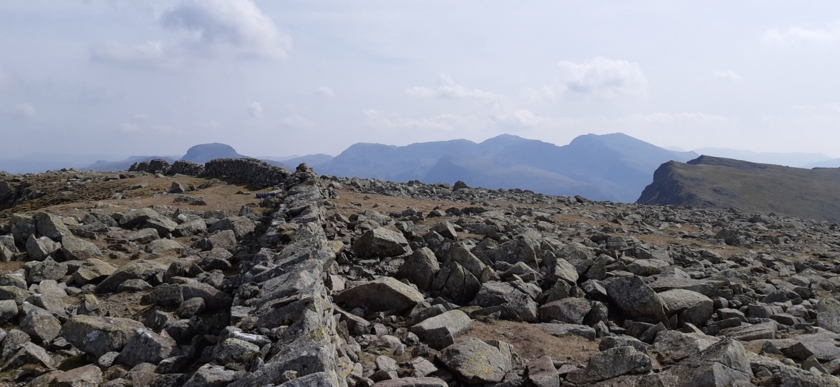
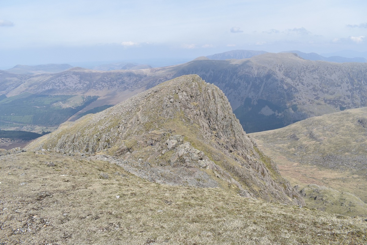
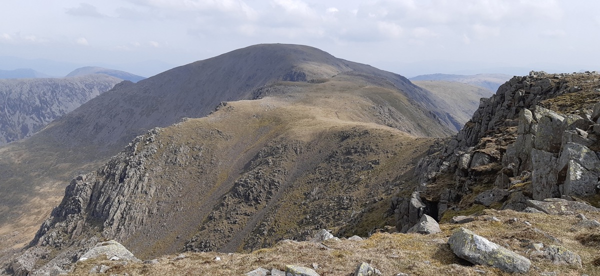
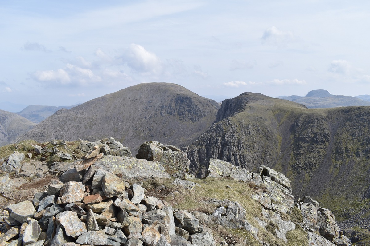
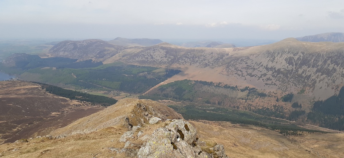
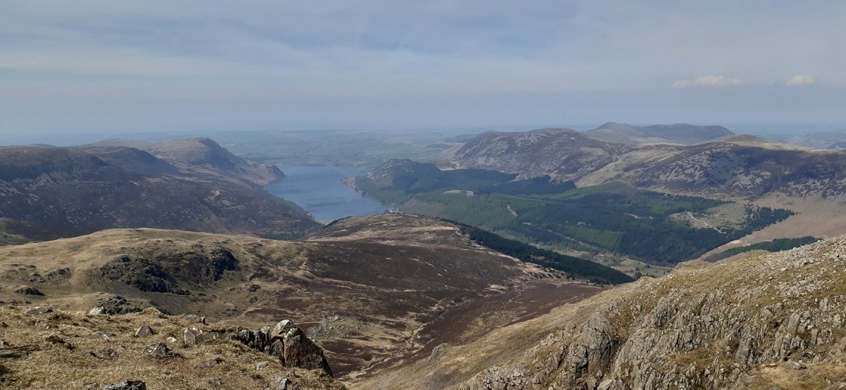
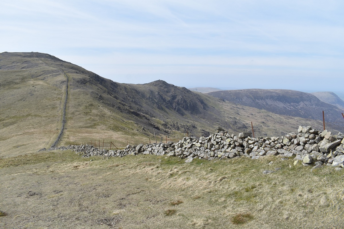
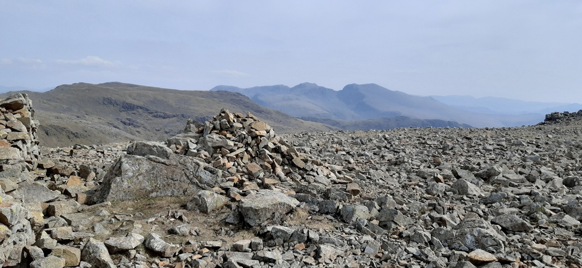
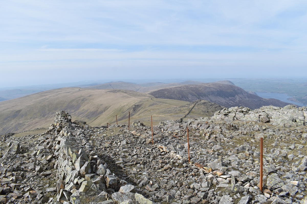
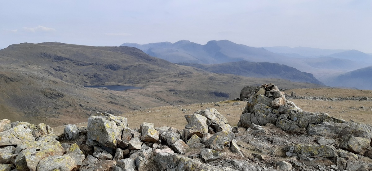
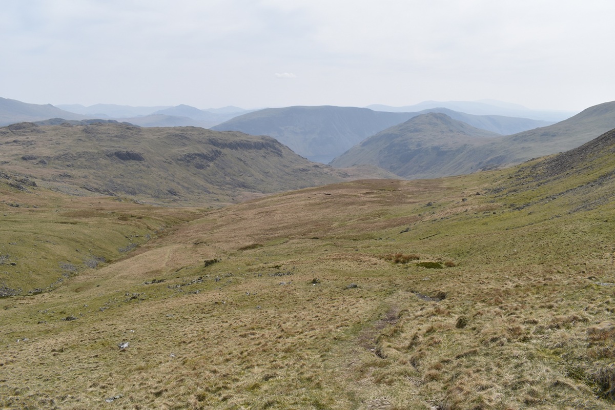
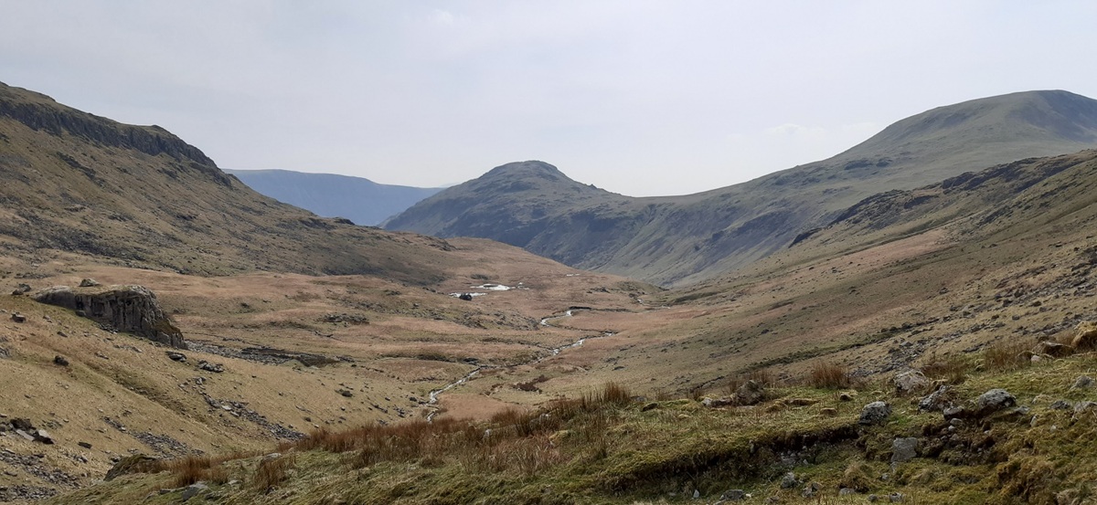
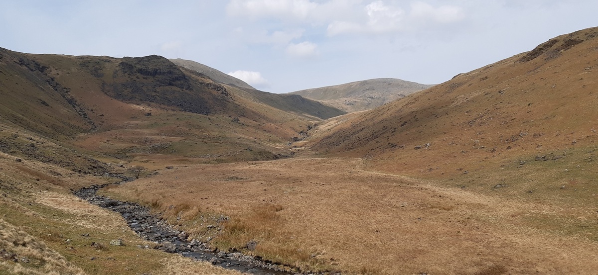
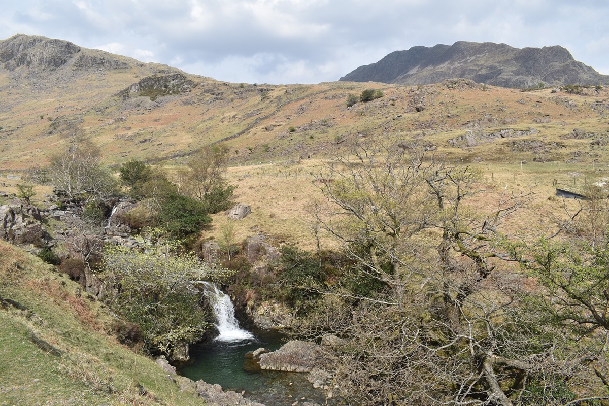
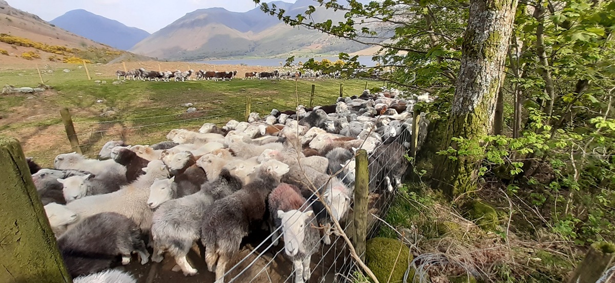
Looking back down the scramble, Dropping Crag on the right looks like a grassy bank from up here with the wall on top. As you can see I’ve found the black soil path above the scramble, from here just follow the zigzags through the heather again steeply up to Great DoorGreat Door, looking over to Burnmoor Tarn and Illgill head on the right, the end of Wastwater belowThis is a great view off the nose of Bell Rib along Wastwater. The sun was breaking through the thicker cloud here, there’s still a bit of up to go from here along the undulating ridge and the odd rocky bit to the summit, I also found the walk along here further than I expectedAt the summit, hazy distance views but the unmistakeable shape of Great Gable in the centre, Kirk Fell is on the left and Great End back rightThe end of Yewbarrow on the right (Stirrup Crag), my next route is up to Red Pike on the left, the path down from here is to the saddle on the right, towards Stirrup Crag and then you will see a path branching off to the left at a small cairn. Pillar is at the back, I was considering tackling that today instead of HaycockMy first look at Haycock, back right, with Seatallan on the left. Not sure if my photography has gone weird again but Low Tarn looks very wonky from here!!Starting down the angled path from the saddle. Red Pike is up to the left looking huge from here, my path angles across the scree and rocky sections to just underneath that rocky outcrop in line with the direction of the pathAt Dore Head now, there were a group of farmers out walking their dogs, maybe an Easter Sunday tradition. Some headed off up towards Red Pike, other sat and enjoyed the warming sunshineDore Head, a herdy and Kirk Fell with Great Gable peeping out to the rightClimbing up to Red Pike and looking back down to Dore Head with Stirrup Crag looking an impossible climb from here. The backdrop is the high ground in EnglandNow I’m at the summit of Red Pike, it was pretty breezy up here as I looked across to PillarRed Pike summit, I’d dropped down to get out of the wind and a look into Mosedale. I’d taken a look at Pillar and decided that it could be done with Kirk Fell, so Haycock will be on the agenda today. The fells come thick and fast here, its only 20 mins to Scoat Fell and the same again to Steeple, with not too far to get to Haycock. I’ll be making hay while the sun is shiningThe summit of Scoat Fell is atop of this wall, cairn just over there. Red Pike on the right. What you don’t see here or on too many photos of Scoat Fell is the drop on the left down to EnnerdaleMore of Ennerdale from here as I start to approach the path to SteepleLooking right from the photo above across Black Crag to PillarSteeple summit looking across to the brutal looking Black Crag, Pillar to the left of that and Great Gable back right looking like a loaf of breadOff the end of Steeple down to Ennerdale, yeah its a bit hazy but it was brilliant up hereWalking back along the path towards Scoat Fell I stopped at a spot I’d noticed on the way out which would make a fine lunch view. Doesn’t get much better than this. Ennerdale Water with Crag Fell on the left at the end of it, Great Borne to the rightAfter the last photo I reached the wall again from Scoat Fell, turning right I headed for Haycock, up on the left here. All the way its a case of follow the wall. Little Gowder Crag is right of Haycock, Iron Fell further right and Crag Fell peeking out back rightHaycock summit and my legs were starting to ache a bit, having been put through some mighty mountain scenery for the first time in 6 months. A quick break here had me looking across to the Scafell range with Red Pike nearer on the leftI also had a walk west a little to look down on Caw Fell, a few steps too far today seeing as it would be an out and back. But it looks very do able from Ennerdale side as an out and back heading up Silvercove Beck to Silver Cove and then across, or possibly from the Cold Fell RoadHaycock to Scoat Tarn backed by Red Pike. Scafells on the horizon and the outline of Yewbarrow in front of that. Next I followed the wall down again heading back towards Scoat Fell, however on reaching the bottom of the dip between Scoat Fell and Haycock I did a right turn and picked up a grassy path heading down towards Nether BeckThe path winds its way down towards that stream on the left which runs into Nether Beck. Blackbeck Knotts is at the end of the stream with Middle Fell over on the rightNether Beck below, the path was a mix of grassy, a bit muddy, small bits of bog (which could be avoided) and rocky in places as you get lower down. It was easy to follow all the way down and a superb pathThat rocky outcrop on the left is labelled Pots of Ashness on the OS, with Haycock behind that and Scoat Fell at the end of Nether Beck. Blackbeck Knotts on the right. Below the rocky outcrop of Pots of Ashness is some of the soggier sections but nothing Dartmoor like in my opinionSome of the lovely waterfalls lower down on the Nether Beck and some fine swimming spots for summer no doubt. Knott Ends up on the left and Yewbarrow makes an appearance again back rightNearly down now and Yewbarrow takes on its more familiar shape. Wastwater and the Scafells in view as wellWalking the short road section back to Overbeck car park and the mighty YewbarrowSheep sorting time at Bowderdale farm at the end of the walk. This is one walk that I’m glad I’ve done and would recommend to anyone. Yewbarrow isn’t as bad as I thought, the scramble wasn’t exposed and in dry weather should pose few problems to most Wainwright walkers. The rest of the walk is incredible especially from Red Pike onwards, 10 miles so take your time.
12 thoughts on “Yewbarrow, Scoat Fell and Steeple”
Yewbarrow looks an impressive fell in your photos, love its shape. I have actually done only one of those fells you mentioned, Cragg Fell, and that was some years ago when I stopped in a holiday cottage called….. yewbarrow cottage. Did your boys do the walk with you? Looks a big one..
Yewbarrow is a stunning looking fell, and looks an impossible one to climb. These walks on this Lakes visit were on my own this time. The boys will be with me on my summer visit up though, probably wanting to do more of the big fells
I have not done this walk yet. It looks hard but amazing to do. Photos are stunning 😍.
Usually before 10am it is still possible to find some parking spaces during summer 😉 unless you go on very busy places.
I’ve seen plenty of posts from people living in the Lakes claiming it is full all the time and there are no places to park for a walk. As you say its perfectly possible to park before 10am, and I’ve found parking in places like Seathwaite and Wasdale to be easy, even in school holidays
You are certainly lucky with your parking in these honeypots. The only explanation I can think off is word gets out that a Saints fan is on their way ….. 😁😁😁
I was up on Yewbarrow just last weekend! Have to wait for the post though as I’m a bit behind. Stirrup Crag is indeed best avoided in descent as it’s very awkward although it would a straightforward scramble in ascent. The paths from the col weren’t there last time I did Yewbarrow so I only spotted them from Dorehead. A superb round and that little clutch of summits are much quieter than the bigger and better known neighbours.
I was stunned as to how quiet Scoat Fell, Steeple and Red Pike were. Saw 2 on the way out to Steeple, a two others on the way back. And that was it until I nearly reached Haycock summit. Saw no one coming down from Haycock via Nether Beck. Looking forward to seeing your Yewbarrow version
Yet to do any of these and like you my remaining fells are massively skewed to the West (and also the south). Yewbarrow and Steeple are two that are likely to give me some issues – I suspect I’ll be using the side path on Yewbarrow for both ascent and descent. The arete over to Steeple actually looks okay but the path up Steeple looks exposed and loose which is not a good combo for me, especially descending.
If you can pick a day with a breeze at most then that will help with Steeple, as the path is quite wide. Even on the up part of Steeple to the summit there are a couple of options up and down and its very short. Once you are on the path it is actually far easier than it looks. You’re in a similar situation to myself, having driven such a long way, stayed for nights, driven to the start point and then walked a few hours to get to the last part to a summit, you don’t want to then fail. Maybe head up there with someone else to help you. Both Yewbarrow and Steeple were far easier than I expected having seen photos and videos beforehand
I should have read this post before I replied to your comment on my latest post, because then I would have know that you too are missing lots of ticks out to the west! I think you’re right about parking, it seems to have calmed down again – when I’m dropping B off at Brockholes, I’m often not parking until 10:30 or 11, and although it’s busy, I’ve always managed to find a spot without too much trouble. I think after the lockdowns ended there was a period when people were desperate to get out and it did get a bit frantic for a while. I also think there are more people out early these days, but that’s just an impression. Later in the day, it usually gets very quiet though.
All of this is superb territory. Yewbarrow and Red pike are hills I’ve climbed many times and both are firm favourites. Scoat Tarn has been the site of a couple of wild camps years ago, something I must get around to repeating, and that Netherbeck Path is a definite classic. Lovely stuff.


Yewbarrow looks an impressive fell in your photos, love its shape. I have actually done only one of those fells you mentioned, Cragg Fell, and that was some years ago when I stopped in a holiday cottage called….. yewbarrow cottage. Did your boys do the walk with you? Looks a big one..
LikeLiked by 1 person
Yewbarrow is a stunning looking fell, and looks an impossible one to climb. These walks on this Lakes visit were on my own this time. The boys will be with me on my summer visit up though, probably wanting to do more of the big fells
LikeLiked by 1 person
I have not done this walk yet. It looks hard but amazing to do. Photos are stunning 😍.
Usually before 10am it is still possible to find some parking spaces during summer 😉 unless you go on very busy places.
LikeLiked by 1 person
I’ve seen plenty of posts from people living in the Lakes claiming it is full all the time and there are no places to park for a walk. As you say its perfectly possible to park before 10am, and I’ve found parking in places like Seathwaite and Wasdale to be easy, even in school holidays
LikeLiked by 1 person
You are certainly lucky with your parking in these honeypots. The only explanation I can think off is word gets out that a Saints fan is on their way ….. 😁😁😁
LikeLiked by 2 people
Ha, clear the area the red V is coming up the road!!
LikeLiked by 2 people
I was up on Yewbarrow just last weekend! Have to wait for the post though as I’m a bit behind. Stirrup Crag is indeed best avoided in descent as it’s very awkward although it would a straightforward scramble in ascent. The paths from the col weren’t there last time I did Yewbarrow so I only spotted them from Dorehead. A superb round and that little clutch of summits are much quieter than the bigger and better known neighbours.
LikeLiked by 1 person
I was stunned as to how quiet Scoat Fell, Steeple and Red Pike were. Saw 2 on the way out to Steeple, a two others on the way back. And that was it until I nearly reached Haycock summit. Saw no one coming down from Haycock via Nether Beck. Looking forward to seeing your Yewbarrow version
LikeLiked by 1 person
Yet to do any of these and like you my remaining fells are massively skewed to the West (and also the south). Yewbarrow and Steeple are two that are likely to give me some issues – I suspect I’ll be using the side path on Yewbarrow for both ascent and descent. The arete over to Steeple actually looks okay but the path up Steeple looks exposed and loose which is not a good combo for me, especially descending.
LikeLiked by 1 person
If you can pick a day with a breeze at most then that will help with Steeple, as the path is quite wide. Even on the up part of Steeple to the summit there are a couple of options up and down and its very short. Once you are on the path it is actually far easier than it looks. You’re in a similar situation to myself, having driven such a long way, stayed for nights, driven to the start point and then walked a few hours to get to the last part to a summit, you don’t want to then fail. Maybe head up there with someone else to help you. Both Yewbarrow and Steeple were far easier than I expected having seen photos and videos beforehand
LikeLiked by 1 person
I should have read this post before I replied to your comment on my latest post, because then I would have know that you too are missing lots of ticks out to the west! I think you’re right about parking, it seems to have calmed down again – when I’m dropping B off at Brockholes, I’m often not parking until 10:30 or 11, and although it’s busy, I’ve always managed to find a spot without too much trouble. I think after the lockdowns ended there was a period when people were desperate to get out and it did get a bit frantic for a while. I also think there are more people out early these days, but that’s just an impression. Later in the day, it usually gets very quiet though.
All of this is superb territory. Yewbarrow and Red pike are hills I’ve climbed many times and both are firm favourites. Scoat Tarn has been the site of a couple of wild camps years ago, something I must get around to repeating, and that Netherbeck Path is a definite classic. Lovely stuff.
LikeLiked by 2 people
Loved the Nether Beck route down, had a few good sit downs along there and just enjoyed the area
LikeLiked by 2 people