Not sure why I picked this walk straight after the last one. Looking at ascents up a fell, Yewbarrow and Eagle Crag are two of the most fearsome in the district. From my list I’m only missing Sharp Edge on Blencathra and I’d have had a hattrick on this holiday. Now here comes a warning, do your homework on Eagle Crag if you are ascending up the front, and don’t get distracted on your walk. I did and ended up in a bit of a mess. I did everything right, got to the stile (which has been renewed), then found the bottom of the shute up past the rowan tree. Then took a walk out to the viewing point, all good so far, then tried to ascend from there, wondering why it looked a bit dicey. So I descended towards Eagle Crag on the Greenup side, I found a shelf and a diagonal ascent, more by knees than feet. It was a mess, and all because I’d forgotten to return back to the top of the shute above the rowan tree. Its in the guides and also on the Wainwright routes website (Eagle crag route 1). For those not wanting exposure and potential danger there is another way up, keep heading up Greenup Gill to level with Eagle Crag and set out across the moraines, up along a wall to the saddle between Eagle Crag and Sergeant’s Crag, its far easier.
Once at the top of Eagle Crag the walk from there is fairly easy, across to Sergeant’s Crag, then head to Long Crag and pick your path, either under the face or over the top. Then find Greenup Edge, it gets boggy after Long Crag, follow the path as it winds through pools and bogs, use common sense to stay away from the worst of it and then start the easy drag up to Ullscarf. From Ullscarf pick out High Saddle, cross the fence and Low Saddle is next, again from here it gets horrid, its a boggy mess, through heather, just do the best you can and look for high ground above Dock Tarn. Descend to the tarn and turn left down Willygrass Gill and Lingy End, through steep woods and stepped paths. Don’t miss out on a well earned pint at the Langstrath Inn, you’ve earned it, I certainly did.
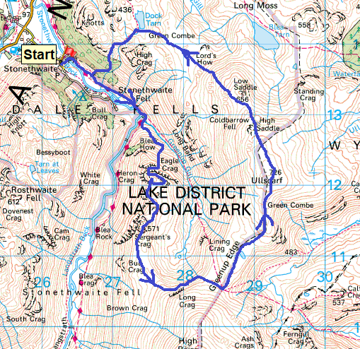
Start – Stonethwaite
Route – Stonethwaite Beck – Eagle Crag – Sergeant’s Crag – Long Crag – Greenup Edge – Ullscarf – High Saddle – Low Saddle – Green Combe – Dock Tarn – Lingy End – Stonethwaite
Distance – 8.5 miles Start time – 8am Time taken – 6hrs 30mins Highest Point – Ullscarf 726metres
Weather – Sunny, clouds and breezy, some drips of rain/hail around Long Crag
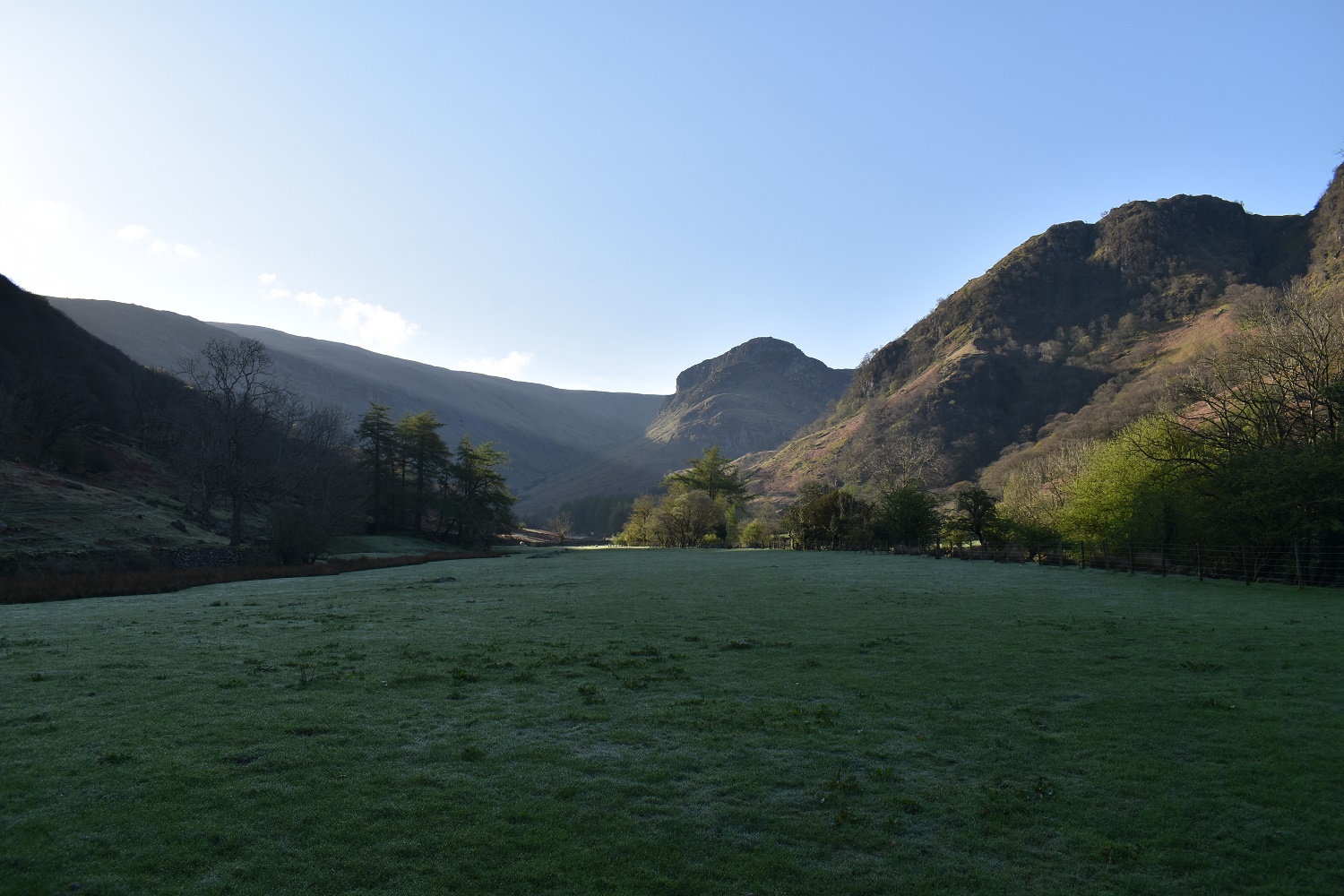
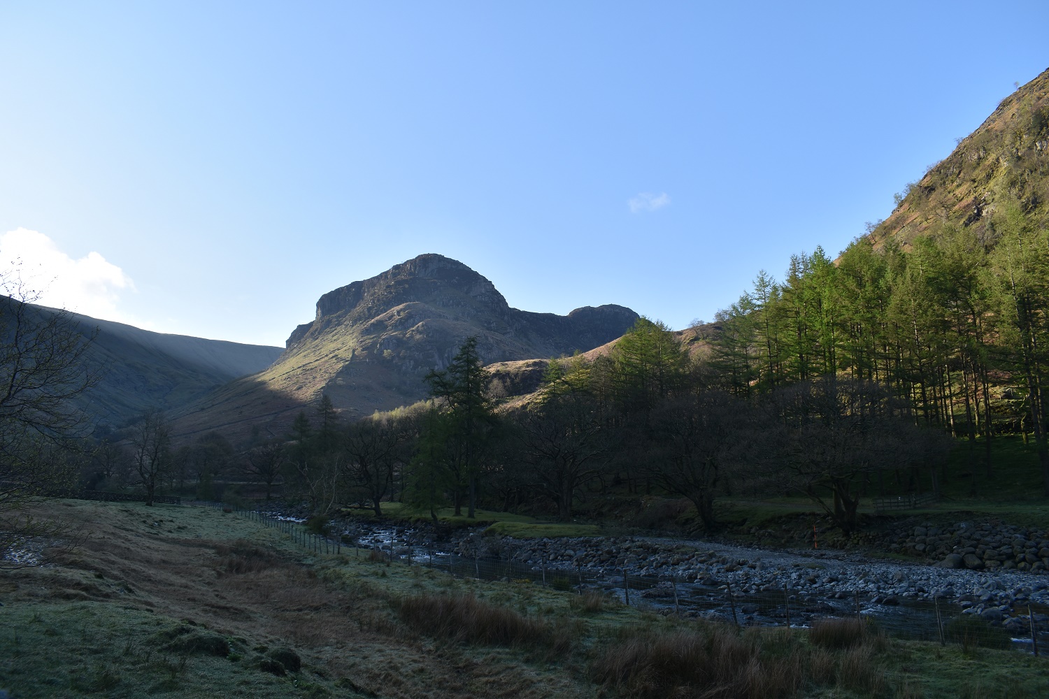
Early morning in Stonethwaite, I was the first one parking by the telephone box at 7.50am. The sun was out nicely already lighting up Kings How on the right and High Spy on the left, I’m heading to cross Stonethwaite Beck over the bridge before turning right and heading up towards Greenup GillFirst target comes into view Eagle Crag also illuminated by the morning sun rising over Ullscarf on the leftI’ve seen plenty of pictures and i know there is a path heading up there and have read about it, but it doesn’t look do able from down here. Sergeants Crag appears to the right at the back. There are two walls that run up the left hand side of Eagle Crag towards the summit. I will cross both and follow the second one up towards the stile.Having crossed the beck for the second time, I crossed the two walls and followed the second up. Rising quickly the views rapidly improve back along the valley towards Borrowdale and back to Stonethwaite. I had an early coffee here to enjoy the view.
I’m at the stile now, this is a new one which has replaced the old rocky one. That’s the grassy top of Bleak How below
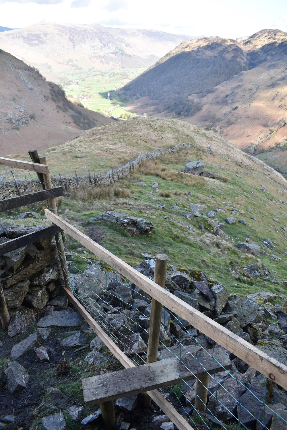
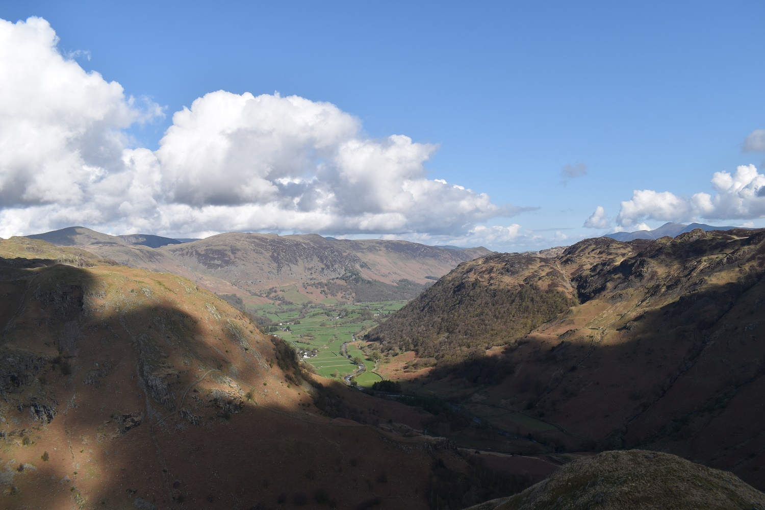
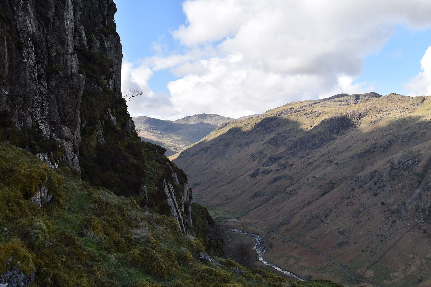
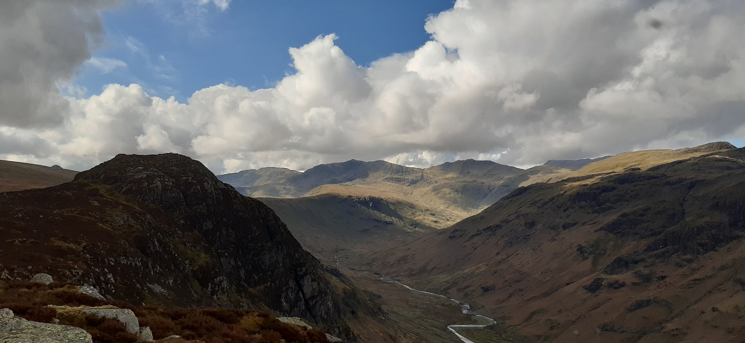
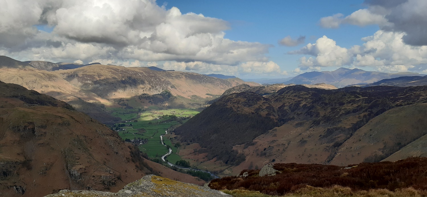
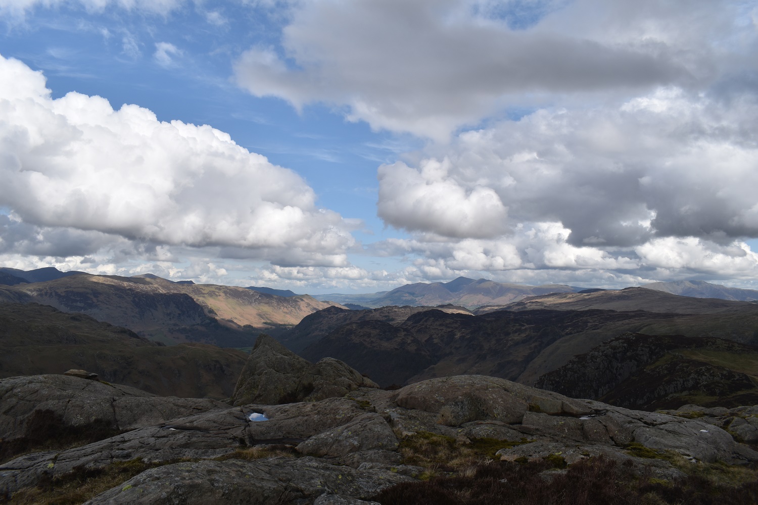
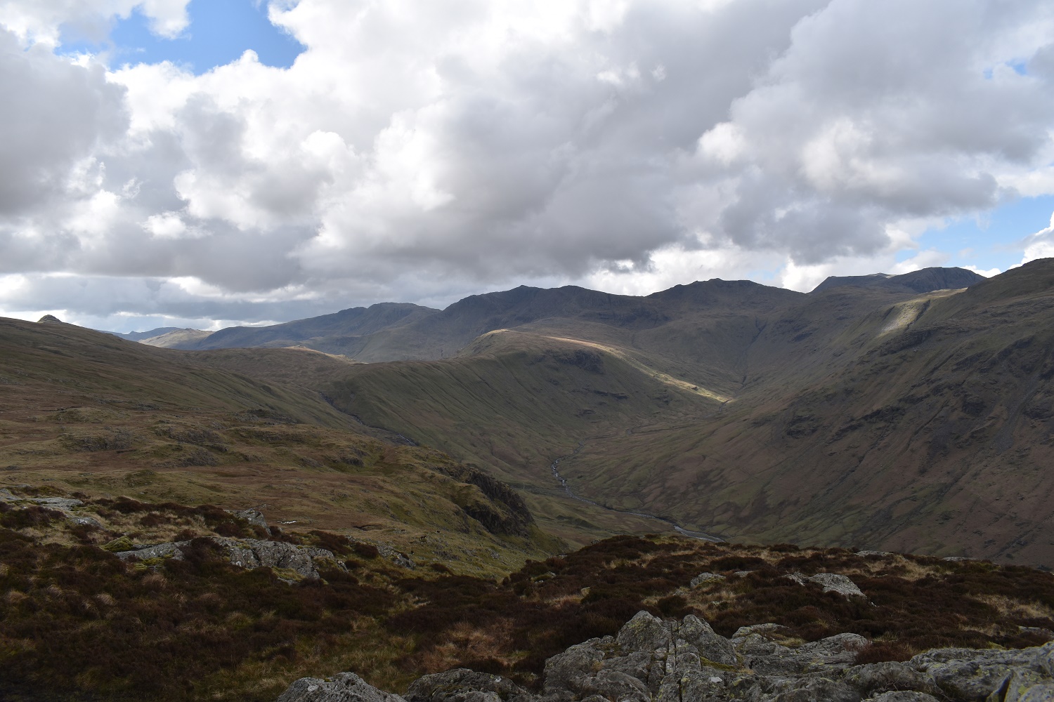
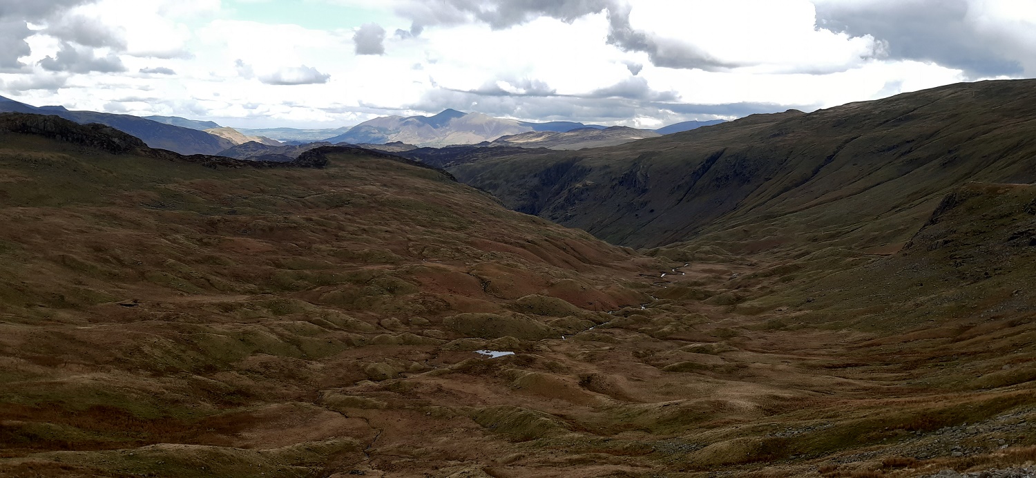
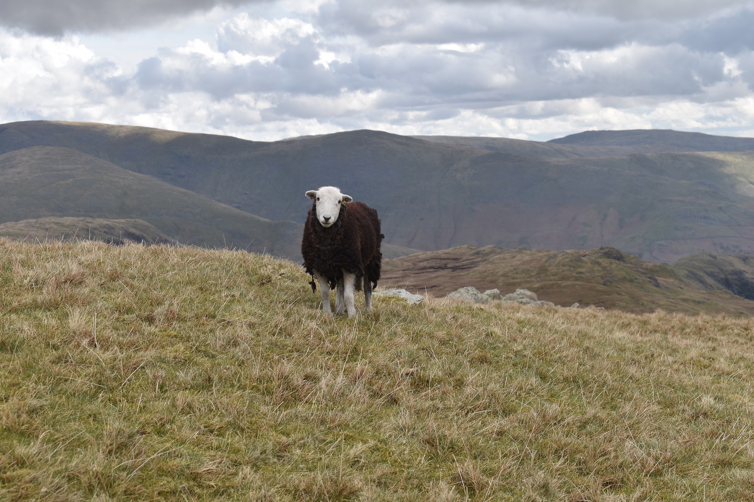
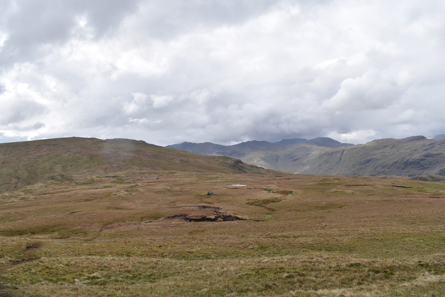
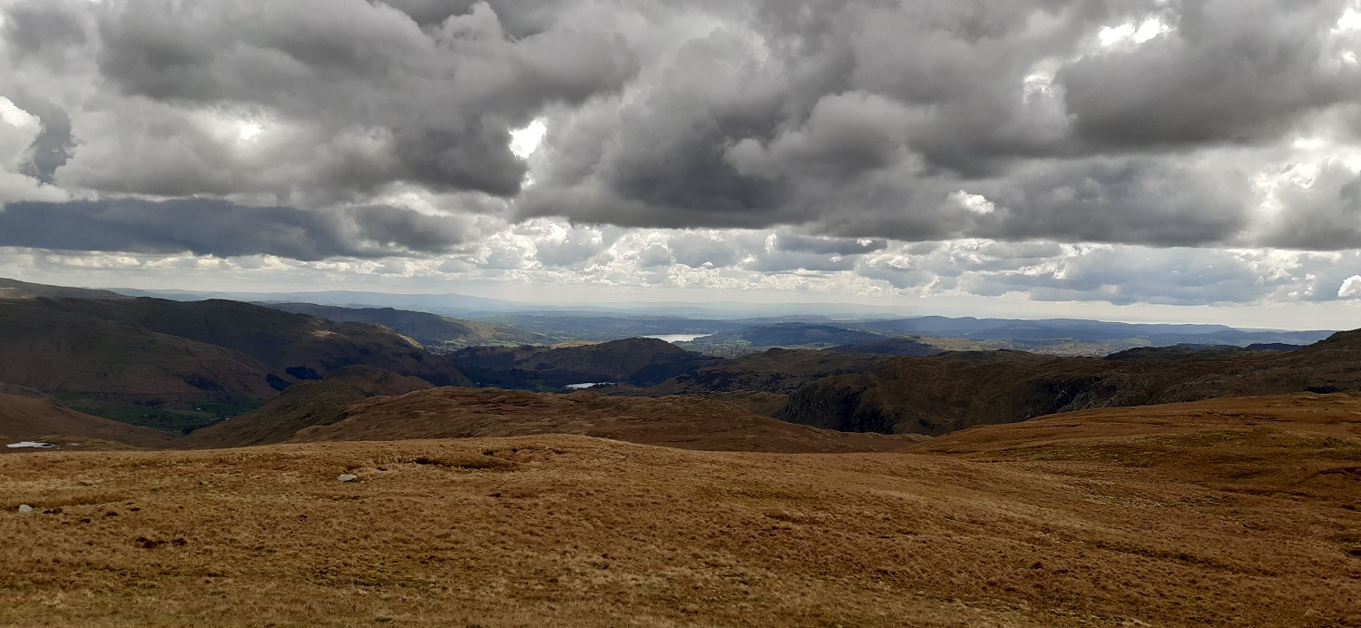
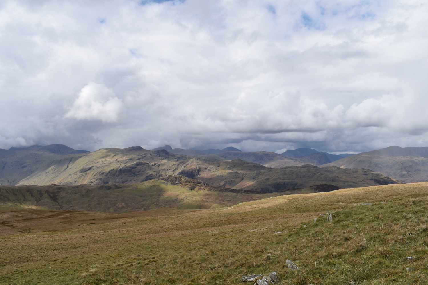
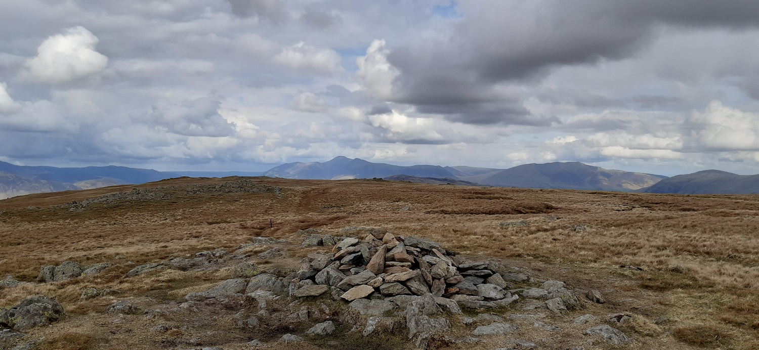
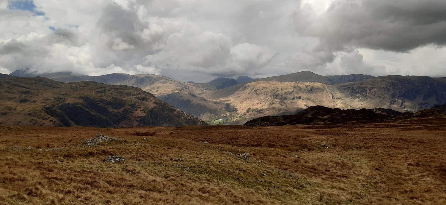
After following the grassy path above the stile I stopped here for another breather and look at the view. The fells are appearing in the distance now, Dale Head is back left and Skiddaw back right over Great Crag. From here you can see my descent route which will be down Willygrass Gill (the deep cleft on the hillside opposite) into those trees in the sun below.I’d climbed up the grassy, slightly rocky rake/scramble bottom centre of this photo. You can see the rowan tree mentioned by Wainwright in his book (not in leaf currently on the left of the rake as I look back down, on your right as you ascend). To follow the path you turn right on to that shelf above the rowan tree, seen here. I made a mistake here and went to look at the view that Wainwright speaks of, which is 40 metres on from here, the view is similar to the last photo above, I forgot to return here to carry on ascending. Don’t try to ascend from near to the viewpoint as I did. This view on this photo is along the glorious Langstrath, pointy Bowfell in view at the far end, Glaramara up on the right across the valley.To get here to this view was 30 minutes of messy, hellish crawling, descending to re-ascend, over heathery ground, mossy rocks and places I shouldn’t have been in. At one point I looked down and considered descending back to the valley above Greenup Gill and trying again. I saw an easy heathery rake though and once I’d descended the 10 metres down I could easily join the bottom and get up to the top, arriving from the eastern side of Eagle Crag instead of the west. Sergeant’s Crag is over on the left and an easy walk from here, left of Sergeant’s Crag is the dimple of Pike O’Stickle. Right of Sergeant’s Crag is (in order) Crinkle Crags, Bowfell, Esk Pike and in cloud is Ill Crag. Langstrath is belowFrom the summit of Eagle Crag (small cairn is gone). Skiddaw is clearly seen back right now and the ridge running from Catbells up past Maiden Moor to High Spy is in sun across the centre of the pictureIt was only 20 mins to Sergeant’s Crag with a similar view, after the excitement of Eagle Crag I was starting to enjoy the walk again now, and had a lovely chat with a couple who lived in the Lakes, and were ticking off the Wainwrights. They had done the sensible thing and walked up Greenup Gill to level with the saddle between Eagle Crag and Sergeant’s Crag, and then ascended over the moraines following the wall up to the small rock step by the stile.Sergeant’s Crag summit this time looking to a dark looking Fleetwith Pike over Bessyboot/Rosthwaite Fell, with Dale Head to the right of Fleetwith PikeLangstrath again and a good look at Crinkle Crags, Bowfell, Esk Pike, Ill Crag, Scafell Pike and Great End. Pike O’Stickle peeking up again on the leftI looped around Greenup Gill under Long Crag on a feint path, ascending at the end of Long Crag to cross a boggy area, you can see the moraines below from here. Lining Crag on the right hand side. Bit of hail was dropping here as the cloud came in a bit thicker.The crossroads between the Greenup Edge path and the one that crosses it from Borrowdale to Grasmere. This whole area is a bit squidgy with higher lumps of grass and rock to provide some refuge. The path is pretty clear though and can be followed closely to avoid the worst parts. rain or hail passing through at the backA lovely local giving me the head tilt as I follow Greenup Edge towards UllscarfHigh Raise rising up back left, with Long Crag on the downward slope. Backed by Bowfell, Esk Pike and the ScafellsLooking southeast with a bit of Grasmere and Windermere beyond that, layers of fells as well.Almost at Ullscarf and the cloud thickens further behind Glaramara which is hanging on to the sunUllscarf summit looking to Skiddaw in the distance, Blencathra and then Clough Head furthest on the right.The Scafells have vanished under the cloudWindermere from UllscarfBit of zoom whilst I have a brew with Ingleborough the shapely summit on the horizonThe rarely seen Blea Tarn, the boggy central ridge beyond that with High Seat the high point. The long Helvellyn ridge is on the rightAt the fence at High Saddle, Low Saddle down on the right sunshine lights up Grange Fell further on from that. And Derwent Water and Lake Bassenthwaite by SkiddawIts cleared up nicely again now as I look at Eagle Crag, I’ve drawn a red line which shows my route up Eagle Crag. Do not copy this, I certainly won’t be.More water in view now with Watendlath this side of Derwent Water. I’m heading down to the left here across another peaty boggy area towards Dock Tarn. Their is another feint path here from Low Saddle (where I am stood), which can easily be lost in the peaty parts, but a high hill in front of Dock Tarn can be used as an aiming pointSome lovely clouds passing through overhead casting a fantastic light over the fells, looking up along the Honister Pass here to Fleetwith Pike and High StileDock Tarn below, my next path heads out of photo to the left to the top of Willygrass GillFab view down Willygrass Gill, Lingy End is on the right and I will descend through trees to the valley floor. Eagle Crag and Sergeant’s Crag across the valley to the right of Greenup Gill
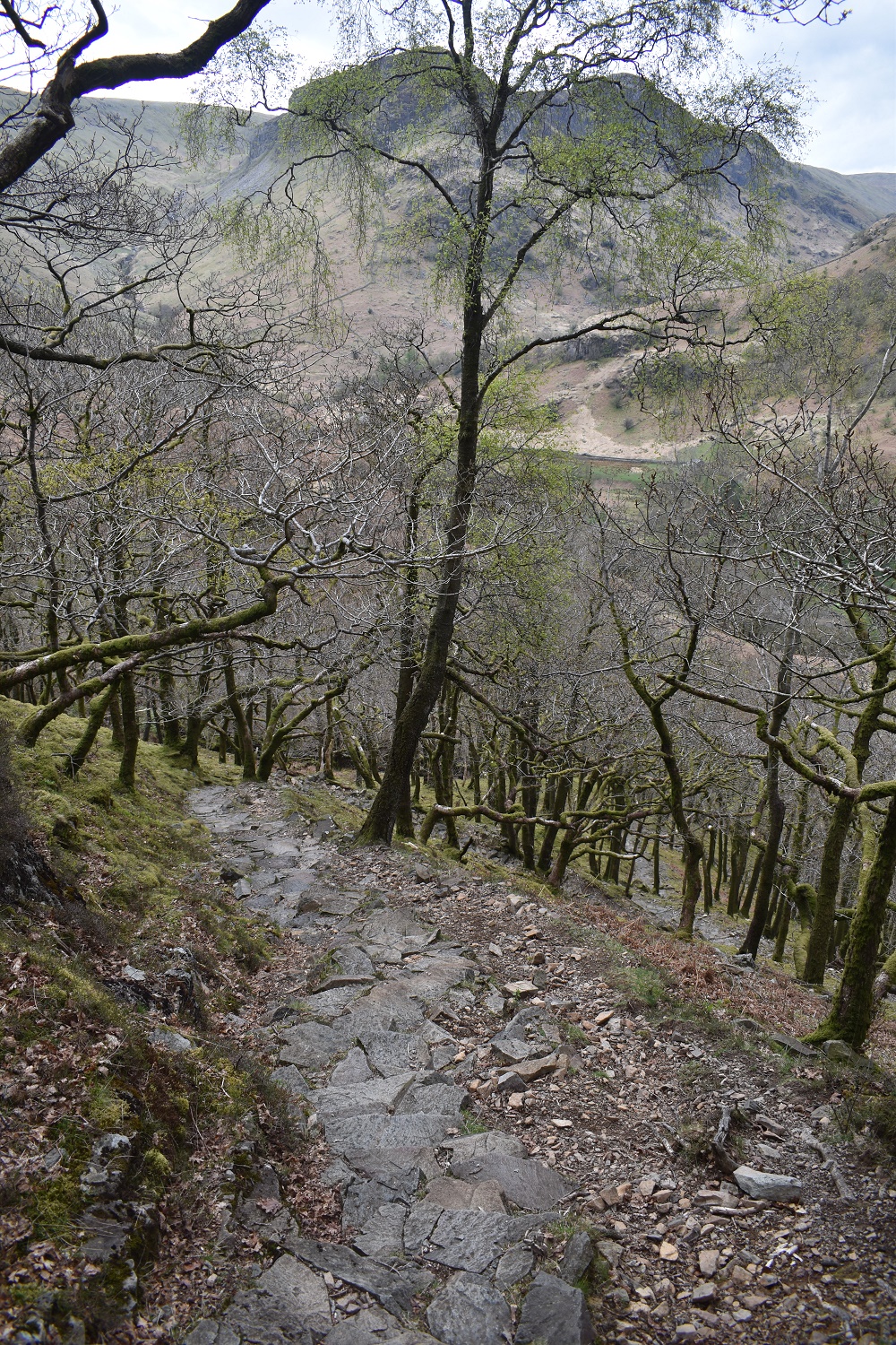
A steep pitched path through here
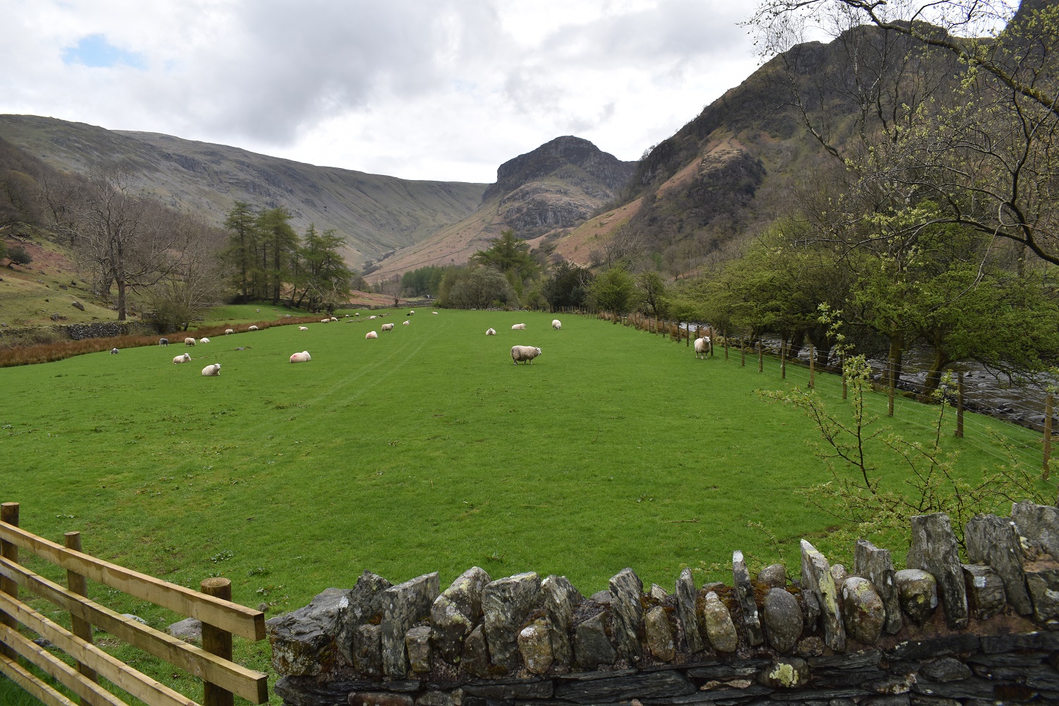
Down at the valley floor now, not as sunny as the same photo 6 1/2 hours ago, Stonethwaite Beck on the right
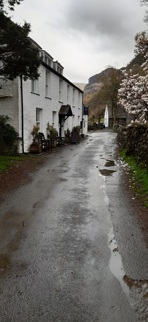
The Langstrath Inn, a well deserved pint from this lovely little pub at the end of the walk
13 thoughts on “Eagle Crag, Sergeant’s Crag and Ullscarf”
That looks way out in the wilds and way out of my comfort zone! I love the fell names. I have got a book to tick off the Wainwrights and am now at 10 after Dodd Fell. I seem to be doing the easy ones, lol. Eagle crag looks impressive from below. Well done on not getting lost!
The parking is at Stonethwaite for this one as nice little hamlet down a dead end road from Rosthwaite (Borrowdale). The path along Stonethwaite Beck and on to Greenup Gill is a good one (all the way to Grasmere). So you could certainly explore that part easily. At the end of Greenup Gill the path rises beside Lining Crag up to cross another path up to Ullscarf. That would be one easier way to get to Ullscarf. But as you say there are lots and lots of smaller or easier fells to tackle first. Even some of the harder ones, like Blencathra, have easier ascent routes (Blease Fell)
Great post. Eagle Crag is one of the ones that is bothering me but the ascent to the saddle sounds the way to go. How was the rock step at the wall corner? That doesn’t seem to be avoidable..
No the rock step isn’t avoidable because of the wall and you’ll get a good look at it on the way up, your extra crampon will be needed in descent I’d say, but its not too bad as its beside/on a wall and stile, which helps. There;s no exposure or drops and its grassy all around it.
Another great walk that you did and it seems you had a nice weather.
It is always annoying when you don’t take the right path and struggle to move to the next bit of the walk. It happened to us several time in the lakes. Happy that you finally managed to finish your walk.
Epic days of adventure and misadventure are the best days. We’ve all had our moments like that but as long as you walk away then it’s a result. Some brilliant cloud pictures here as well. Cracking day all round. In case you were wondering I’ve never done Eagle Crag. I have been warned!
There’s a good website called wainwrightroutes, which gives this route up Eagle Crag. If you do fancy a visit have a look at all the photos on there, they are good for helping with the route, just don’t forget them when you get up there like I did 😉
Well done in getting back in one piece after your Eagle Crag adventure!
You certainly were a bit of a masochist tackling the scary scramble on Eagle Crag and the boggy hell of Ulscarf. But we all have days like that. A pint well deserved at the end.
I don’t think I’ve ever been up either Eagle Crag or Sergeant’s Crag – I’ve always done Ulscarf from the Thirlmere side. Very much looking forward to that now – I didn’t realise there was all that excitement to be had! I have had a pint in the Langstrath Inn though! It was a nearly thirty years ago after a long dark walk down Langstrath one February when I was walking the Cumbria Way, was two days out from Ulverston, staying in a B’n’B in Stonethwaite and was feeling very, very weary.
I made a right mess of Eagle Crag if I’m honest, just one of those that if you follow the guide, and in particular the excellent Wainwright routes website, you’ll have no issues. I went to the viewpoint and tried to head straight up, just daft
Often a bit of adversity overcome makes for the most memorable days though, don’t you think? I’m thinking of a great day on Moal Chean Dearg (probably spelled that wrong) south of Torridon, when, after a late start, we found far more crags than the old 1:50 OS map showed and began to think we wouldn’t reach the top. Great feeling when, having contoured right around to the other side of the hill, we finally got there.
This is such a good post, really informative and love your photos too. They are so clear and looks like one hell of a day that you had walking this round route in the Lake District. We recently walked Eagle Crag and Sergeant’s Crag a couple of months ago and were blessed with great weather for the day. I know it can get quite boggy up there when they’ve had some rainfall, so we were lucky that the paths were pretty clear most of the way around. The walk up to Eagle Crag through is such a joy. It does look daunting from the valley below but we had a great time climbing to the top and having some scrambling along the way. I love how fells like this can help with confidence in the Lake District and hiking in general, and it’s a walk that we will certainly remember.
With regards to Eagle Crag and the route to the top, I believe we found our own path for some of the walk up, but this can be part of the adventure too. Although I am not one for hoping to get truly lost, hence why map stays by my side throughout most of the walk.
We did blog on this route ourselves minus Ullscarf, I’d love to hear your feedback on the blog, but if not then no worries either. Keep up the great work and shall be keeping an eye out for more from you too.
Reading your way up Eagle Crag, you started up the other side of the wall from my route, as I was left of Bleak How, however it made little difference as we ended up in the same place at the bottom of the gully, you did the right thing though turning right at the top of the gully on to the terraced path (the one where the path ends abruptly and drops off a cliff and you turn around and climb the rocks!). It looks as though you correctly ascended Eagle Crag, superb effort


That looks way out in the wilds and way out of my comfort zone! I love the fell names. I have got a book to tick off the Wainwrights and am now at 10 after Dodd Fell. I seem to be doing the easy ones, lol. Eagle crag looks impressive from below. Well done on not getting lost!
LikeLiked by 1 person
The parking is at Stonethwaite for this one as nice little hamlet down a dead end road from Rosthwaite (Borrowdale). The path along Stonethwaite Beck and on to Greenup Gill is a good one (all the way to Grasmere). So you could certainly explore that part easily. At the end of Greenup Gill the path rises beside Lining Crag up to cross another path up to Ullscarf. That would be one easier way to get to Ullscarf. But as you say there are lots and lots of smaller or easier fells to tackle first. Even some of the harder ones, like Blencathra, have easier ascent routes (Blease Fell)
LikeLiked by 1 person
Great post. Eagle Crag is one of the ones that is bothering me but the ascent to the saddle sounds the way to go. How was the rock step at the wall corner? That doesn’t seem to be avoidable..
LikeLiked by 1 person
No the rock step isn’t avoidable because of the wall and you’ll get a good look at it on the way up, your extra crampon will be needed in descent I’d say, but its not too bad as its beside/on a wall and stile, which helps. There;s no exposure or drops and its grassy all around it.
LikeLiked by 1 person
Another great walk that you did and it seems you had a nice weather.
It is always annoying when you don’t take the right path and struggle to move to the next bit of the walk. It happened to us several time in the lakes. Happy that you finally managed to finish your walk.
LikeLiked by 1 person
Epic days of adventure and misadventure are the best days. We’ve all had our moments like that but as long as you walk away then it’s a result. Some brilliant cloud pictures here as well. Cracking day all round. In case you were wondering I’ve never done Eagle Crag. I have been warned!
LikeLiked by 1 person
There’s a good website called wainwrightroutes, which gives this route up Eagle Crag. If you do fancy a visit have a look at all the photos on there, they are good for helping with the route, just don’t forget them when you get up there like I did 😉
LikeLiked by 1 person
Well done in getting back in one piece after your Eagle Crag adventure!
You certainly were a bit of a masochist tackling the scary scramble on Eagle Crag and the boggy hell of Ulscarf. But we all have days like that. A pint well deserved at the end.
LikeLiked by 1 person
I don’t think I’ve ever been up either Eagle Crag or Sergeant’s Crag – I’ve always done Ulscarf from the Thirlmere side. Very much looking forward to that now – I didn’t realise there was all that excitement to be had! I have had a pint in the Langstrath Inn though! It was a nearly thirty years ago after a long dark walk down Langstrath one February when I was walking the Cumbria Way, was two days out from Ulverston, staying in a B’n’B in Stonethwaite and was feeling very, very weary.
LikeLiked by 2 people
I made a right mess of Eagle Crag if I’m honest, just one of those that if you follow the guide, and in particular the excellent Wainwright routes website, you’ll have no issues. I went to the viewpoint and tried to head straight up, just daft
LikeLiked by 1 person
Often a bit of adversity overcome makes for the most memorable days though, don’t you think? I’m thinking of a great day on Moal Chean Dearg (probably spelled that wrong) south of Torridon, when, after a late start, we found far more crags than the old 1:50 OS map showed and began to think we wouldn’t reach the top. Great feeling when, having contoured right around to the other side of the hill, we finally got there.
LikeLiked by 2 people
This is such a good post, really informative and love your photos too. They are so clear and looks like one hell of a day that you had walking this round route in the Lake District. We recently walked Eagle Crag and Sergeant’s Crag a couple of months ago and were blessed with great weather for the day. I know it can get quite boggy up there when they’ve had some rainfall, so we were lucky that the paths were pretty clear most of the way around. The walk up to Eagle Crag through is such a joy. It does look daunting from the valley below but we had a great time climbing to the top and having some scrambling along the way. I love how fells like this can help with confidence in the Lake District and hiking in general, and it’s a walk that we will certainly remember.
With regards to Eagle Crag and the route to the top, I believe we found our own path for some of the walk up, but this can be part of the adventure too. Although I am not one for hoping to get truly lost, hence why map stays by my side throughout most of the walk.
We did blog on this route ourselves minus Ullscarf, I’d love to hear your feedback on the blog, but if not then no worries either. Keep up the great work and shall be keeping an eye out for more from you too.
https://truefreedomseekers.com/eagle-crag-and-sergeants-crag-walk/
LikeLiked by 2 people
Reading your way up Eagle Crag, you started up the other side of the wall from my route, as I was left of Bleak How, however it made little difference as we ended up in the same place at the bottom of the gully, you did the right thing though turning right at the top of the gully on to the terraced path (the one where the path ends abruptly and drops off a cliff and you turn around and climb the rocks!). It looks as though you correctly ascended Eagle Crag, superb effort
LikeLiked by 1 person