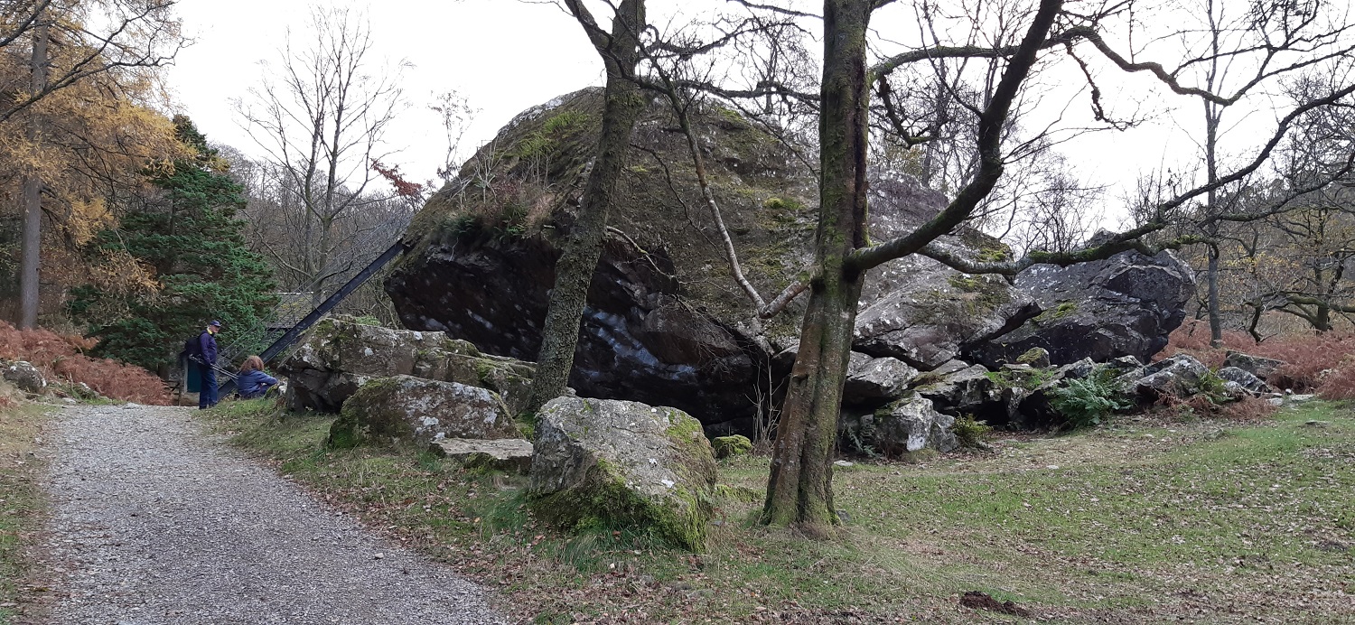
Our last walk in the Lakes for this week and finally we hit a day were the rain had stopped. At least for our location anyway. There was plenty of blue skies between the clouds, and a strong breeze was making sure those clouds moved quickly across the sky. There were rain showers but luckily none of them hit us this time. I looked for routes up Rosthwaite Fell and it came down to two options, Combe Gill or Big Stanger Gill. Whilst checking Sean’s Stridingedge.net website it was clear that descending via Stanger Gill isn’t wise in wet or icy conditions so that was the route sorted, we would ascend that way and come down via Combe Gill. This isn’t a long walk but it was my last fell in this area having done all the central fells, including those around Honister, Grange, Seathwaite and Langstrath. So this may turn out to be my last walk around Borrowdale, the finest square mile in all of Lakeland according to Wainwright, and its a great one to finish on. I loved the ascent up the gill, the pitched path was treacherous in the wet and I was glad we went up that way. But the rock steps provided quick passage and we were soon popping out of the top of the gill and making our way to the summit. The summit is a jumble of lumpy rocky mounds especially those named Racom Bands to the east of Bessyboot, however its an easy top to reach and if you are in doubt an out and back up Combe Gill would still make a great day. As for us we loved the descent and the views into an autumnal Borrowdale, finished with a pint in the Langstrath Inn, which is my second visit this year after my Eagle Crag walk at Easter. On our journey back to Bassenthwaite we stopped off at the Bowder Stone, I hadn’t been for maybe 10 or more years and it was nice to see this huge lump of rock again, embedded at its jaunty angle, where it landed. A lovely way to finish off a week here and finally no need to dry off our clothes at the end of a walk!
Start – Stonethwaite
Route – Big Stanger Gill – Bull Crag – Big Stanger Gill – High Knott – Bessyboot (Rosthwaite Fell) – Tarn at Leaves – Combe Gill – Stonethwaite
Distance – 3.5 miles Start time – 10.20am Time taken – 4hrs Highest Point – Bessyboot 550 metres
Weather – Breezy, but dry all around, bit of sunshine but mainly cloudy
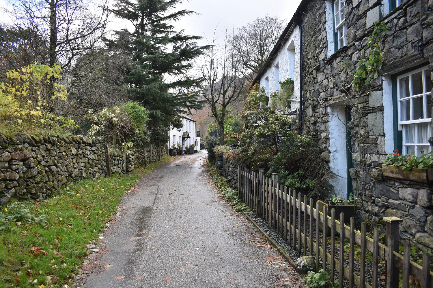
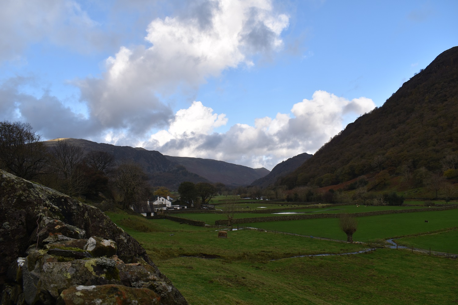
Down the lane from the phone box in the village and a view to the pub, we’ll be in there later, for now we just walked past and onwards towards the camping site.Looking back to Stonethwaite and BorrowdaleMy back is to the entrance of the camping site and I look up at Big Stanger Gill, I was expecting more water to be coming down but I guess its hasn’t gone very far to get to this point
Big Stanger Gill
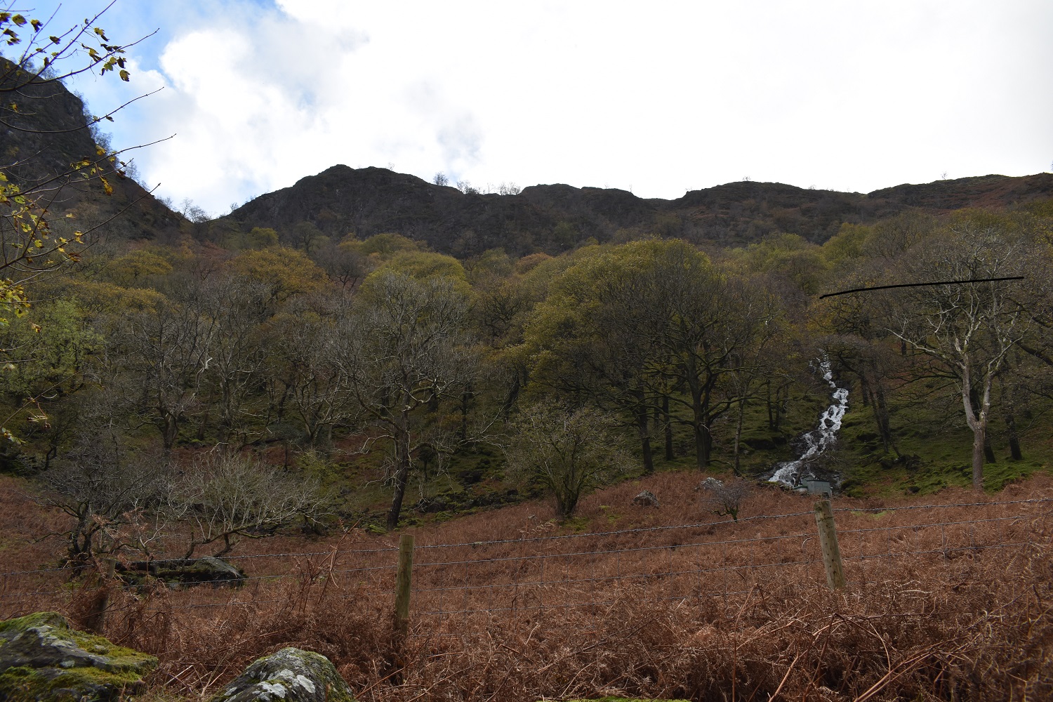
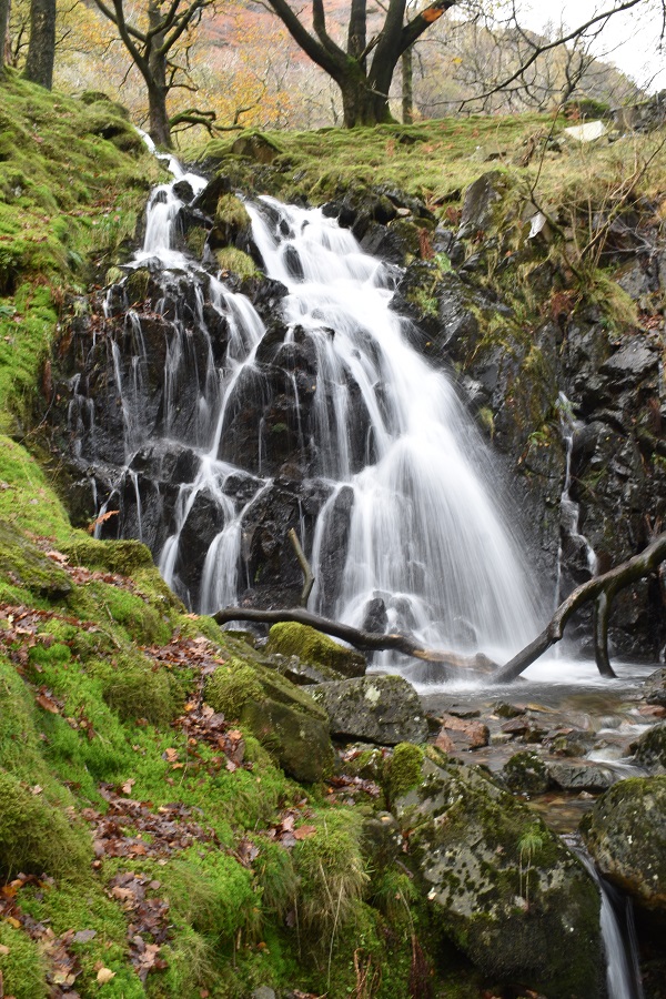
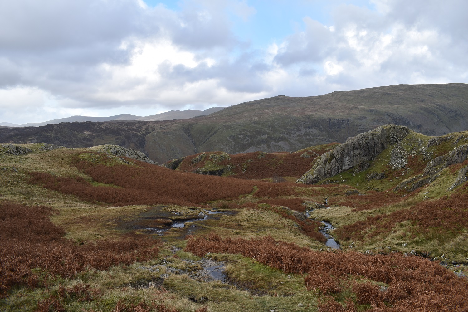
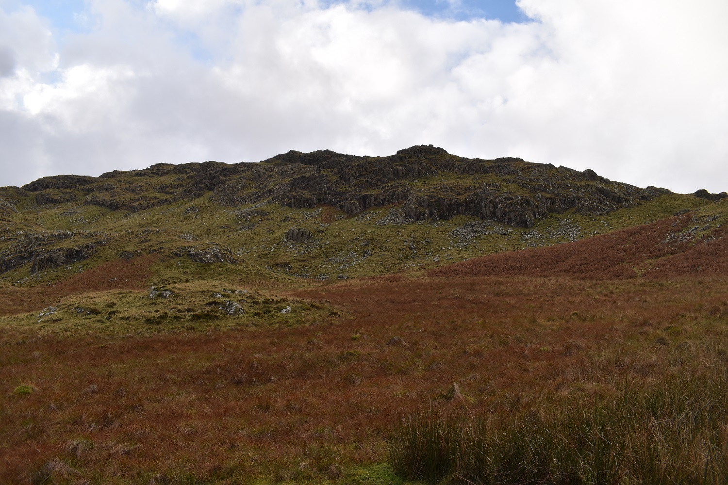
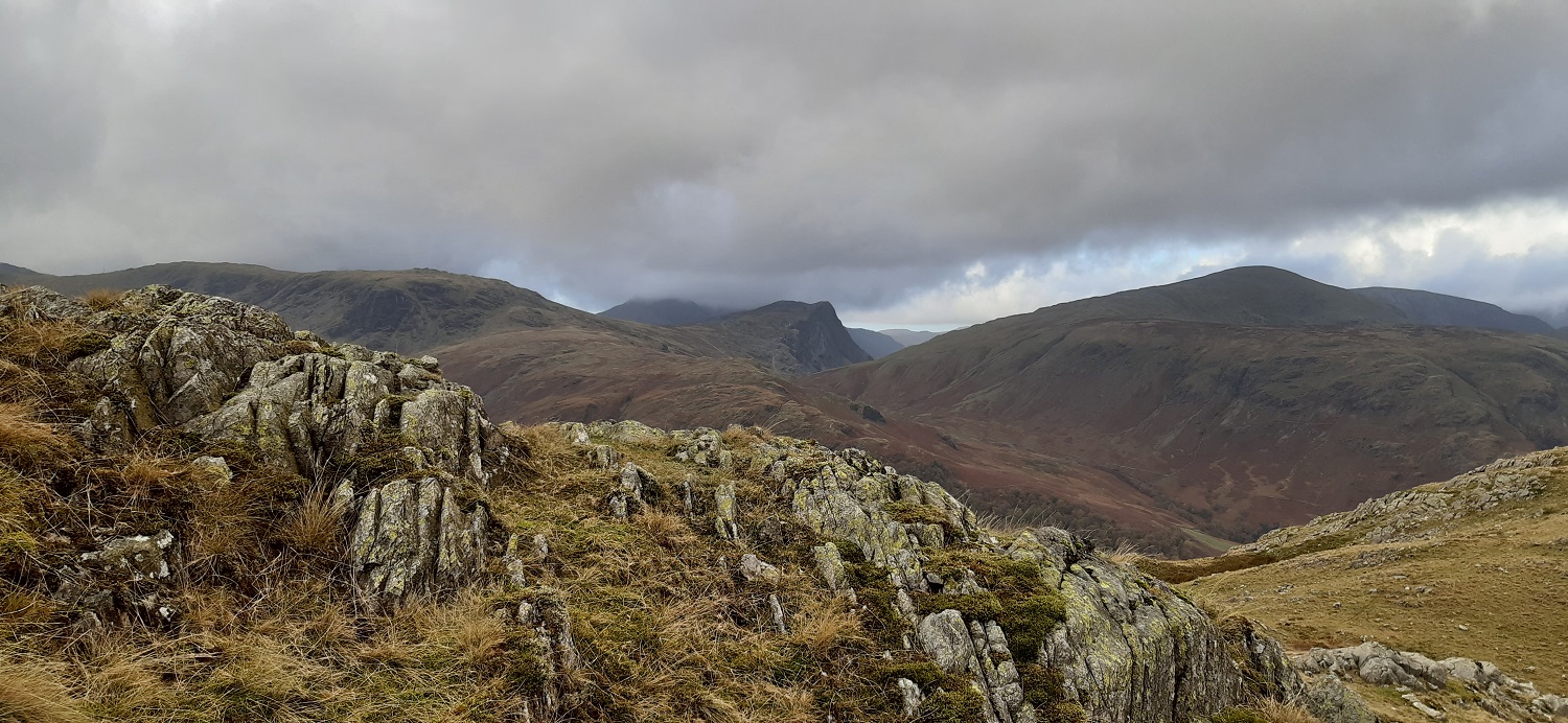
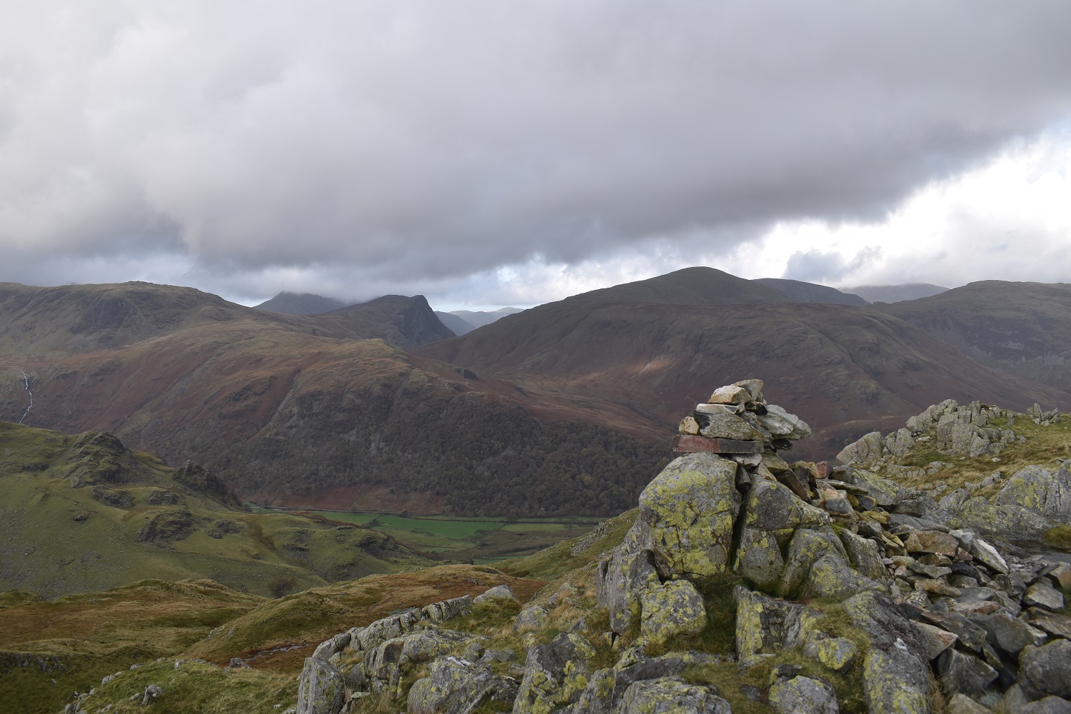
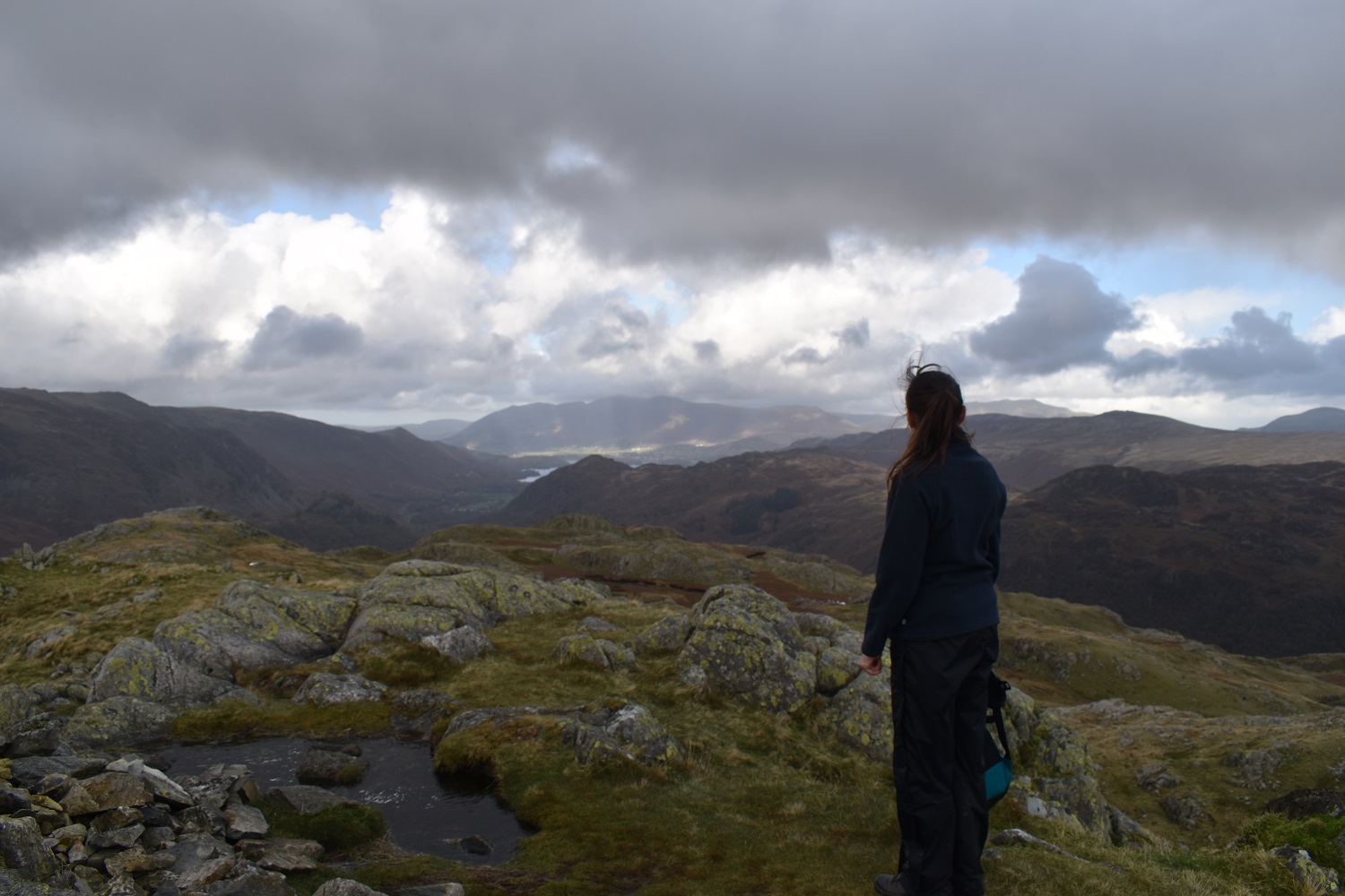
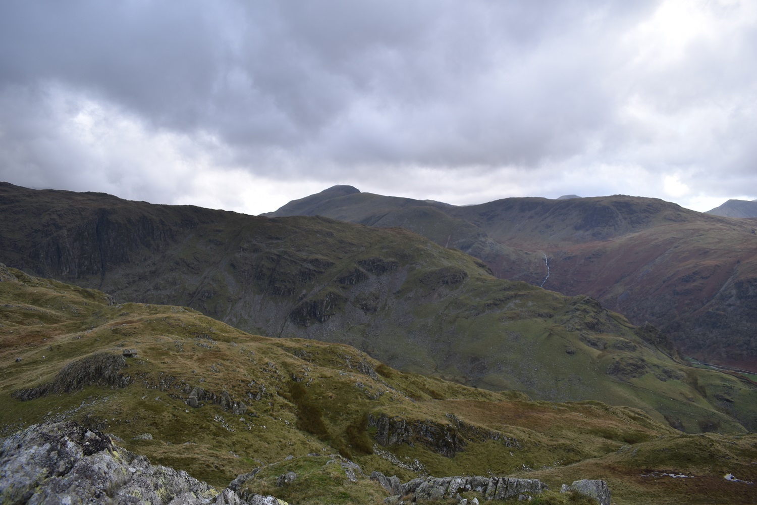
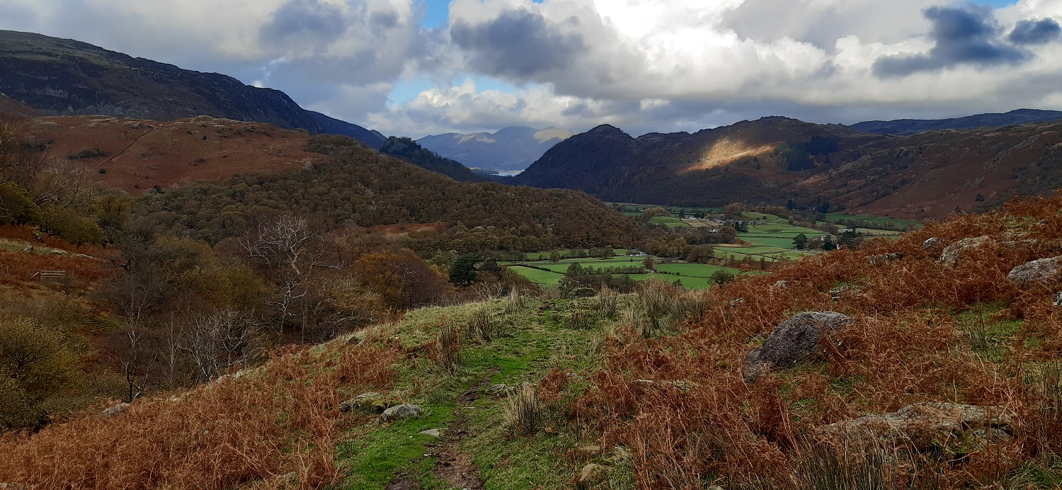
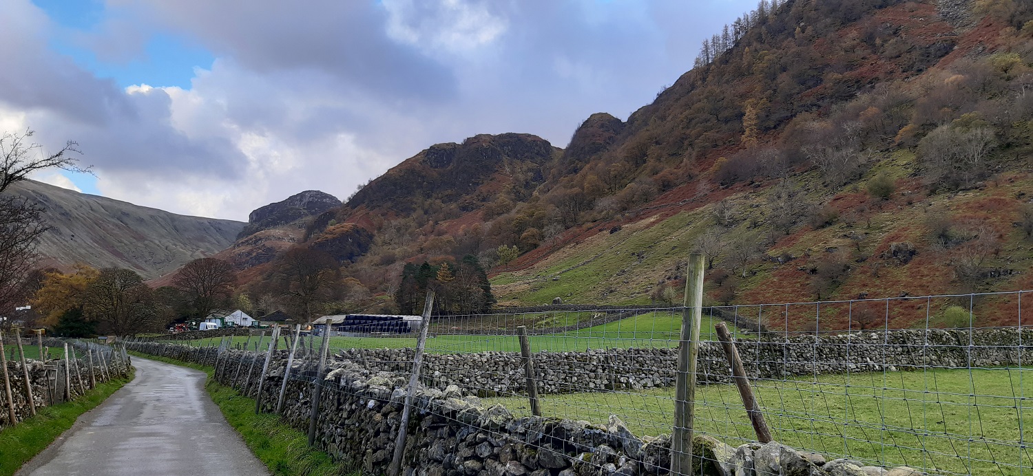
As you climb the stepped path there is the odd break in the trees to give these fabulous views to BorrowdaleA look back down the gill with Bull Crag on the rightAt the top of the steep climb, the path turns to follow the gill You then cross the gill under this waterfallStanger Gill on the right is no longer very big as the terrain opens out, here I’m looking back at the top of the gill and in the distance the views are opening out to the Helvellyn range, with Clough Head and the Dodds beyond UllscarfThe top of Bessyboot is up there but first we circle around to the right to pass this boggy sectionHeading past High Knott now and in the distance we can see Skiddaw with its head in the cloudsNearer the summit we get our first view to the west with Fleetwith Pike looking very angular, Dale Head on the right and the High Stile ridge behind Fleetwith Pike in the cloudThe summit cairn of Bessyboot looking to the unmistakable summit of Pike O’StickleAnother view from the cairn to Fleetwith Pike and Dale Head, Grey Knotts on the left at the top of the ridge rising from right to leftLinda looks north towards Keswick and Skiddaw, we next dropped down to the right here for some lunchBut not before one more photo towards Pike O’Stickle with Tarn at Leaves now fully in view, Rosthwaite Cam rising up behind the tarnFrom our lunch spot, the two very dark fells are Eagle Crag on the left and Sergeant;s Crag on the right, the sun is hitting the area around Greenup Edge and High Raise is back rightSummit selfieGreat Gable is seen at the back as we start our descentLinda heading down towards Combe Gill, we had walked down to Tarn at Leaves and joined the path that stayed right of the gill and contouring around under High KnottLower down and Borrowdale comes into view. High Spy is high up on the left, Castle Crag looks tiny in the centre, Kings How to the right of that looking pointy and Skiddaw at the backAutumnal BorrowdaleStonethwaite churchInside the churchWalking back now into Stonethwaite, Eagle Crag can be seen peeking out at the back, and our ascent route is up to the right and through that notch to the left of the thimble shaped crag. All that was left was to drop off the bags in the car and enjoy a pint in the pub. It was a brilliant walk, not too long and not too hard, steep ascent to get us up quickly and a gentle descent down. And no rain. PerfectOn the drive back we stopped off for a look at the Bowder Stone, it had been at least 10 years since I came here with the boys. The guy on the left was doing a bit of rock climbing on the stone. That was the end of our week, it had been a brilliant time, great house in a lovely village. Its left me with 20 Wainwrights to do and we have booked again for May, staying near Santon Bridge to try and clear out lots of fells in Wasdale and Eskdale. Fingers crossed.
Great little walk!
We’ll be up in Nether Wasdale over the May Day BH weekend. Can recommend the Strands Inn there for a pint and some food. They brew their own beer


What a way to end the week. Lovely
LikeLiked by 1 person
It was a relief to have a walk without rain and being in Borrowdale the views to the higher fells are always superb
LikeLiked by 1 person
I like the name BessyBoot. 🙂
Good to see The Bowder Stone too.
LikeLiked by 1 person
Yes i enjoyed going back to the Bowder Stone, forgot what it looked like, I hadn’t been for quite a while
LikeLiked by 1 person
Great little walk!
We’ll be up in Nether Wasdale over the May Day BH weekend. Can recommend the Strands Inn there for a pint and some food. They brew their own beer
LikeLiked by 1 person
We might just miss you as we get there on Friday 4th. Will make a note of the Strands Inn as we are in a little cottage in Irton Hall, so very near
LikeLiked by 1 person