I felt I’d done walking in Cornwall a bit of a disservice last week with my post on walking in northern Bodmin Moor, so I set out to put that right. This walk should do that nicely, and then some. This is arguably one of the best days coastal path walking in the country, you’ll hit the high point of the entire path in High Cliff (223metres), a waterfall dropping into the sea at Pentargon, the fantastic Boscastle harbour and pubs/cafes at both Boscastle and Crackington Haven. What I will say is, this walk is tough, the ascent over the 6 mile coastal path section was nearly 500 metres, so with the inland part as well you are around 800-900 metres of ascent here. The paths along the coast are spectacular and not for those with a fear of heights, vertiginous indeed. However the sections inland take you through a superb wooded valley before climbing up to high hills and farms giving expansive views along the coast to Lundy Island and west past Tintagel. Making you want to carry on the walking, I’ll be back, pronto.
Start – Crackington Haven
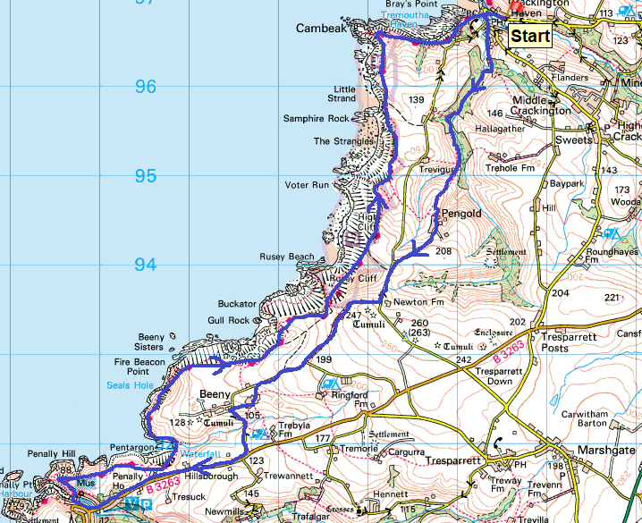
Route – Pengold Farm – Newton Farm – Beeny – Boscastle – South West Coastal Path – Penally Hill – Pentargon – Beeny Cliff – Rusey Cliff – High Cliff – The Strangles – Cambeak – Crackington Haven
Distance – 13 miles Start time – 9.30am Time taken – 7hrs Highest Point – Newton Farm 247 metres
Weather – Sunshine and lots of it, warm, perfect walking weather
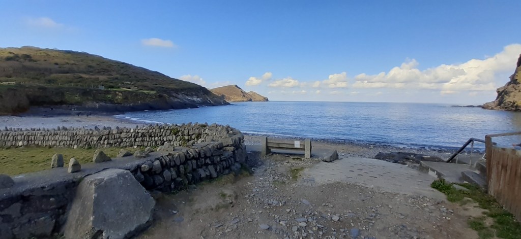
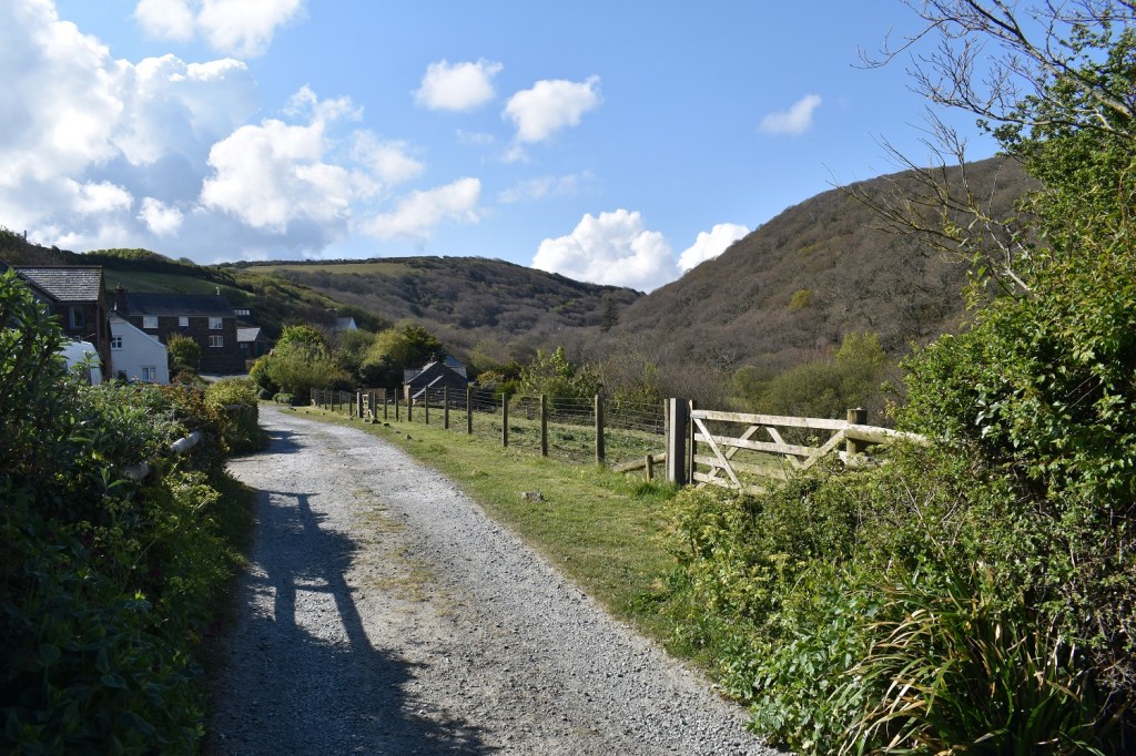
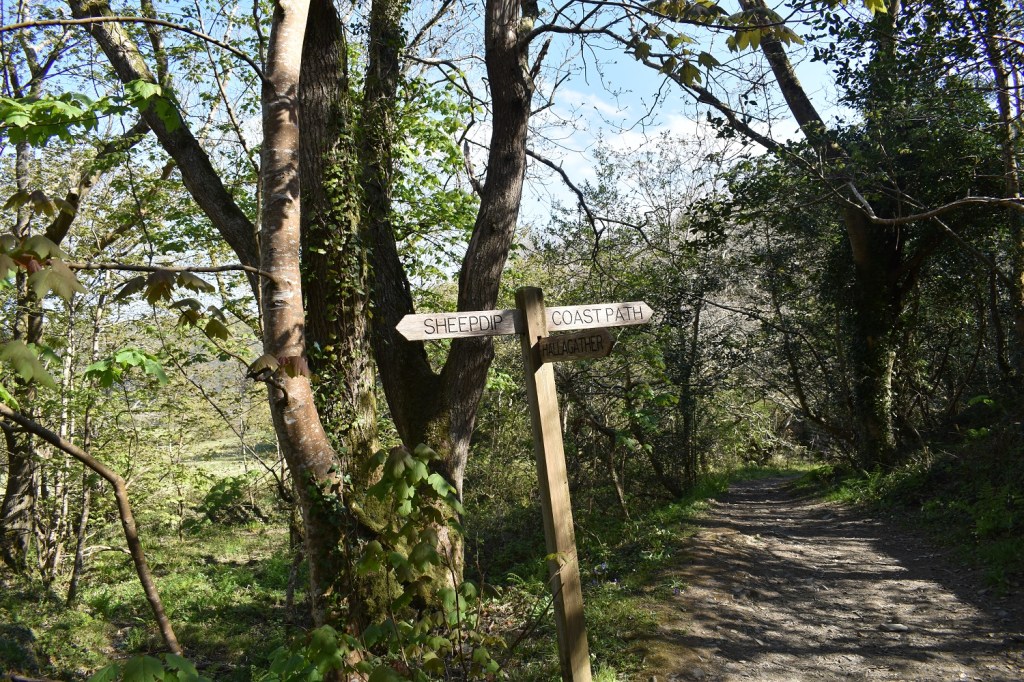
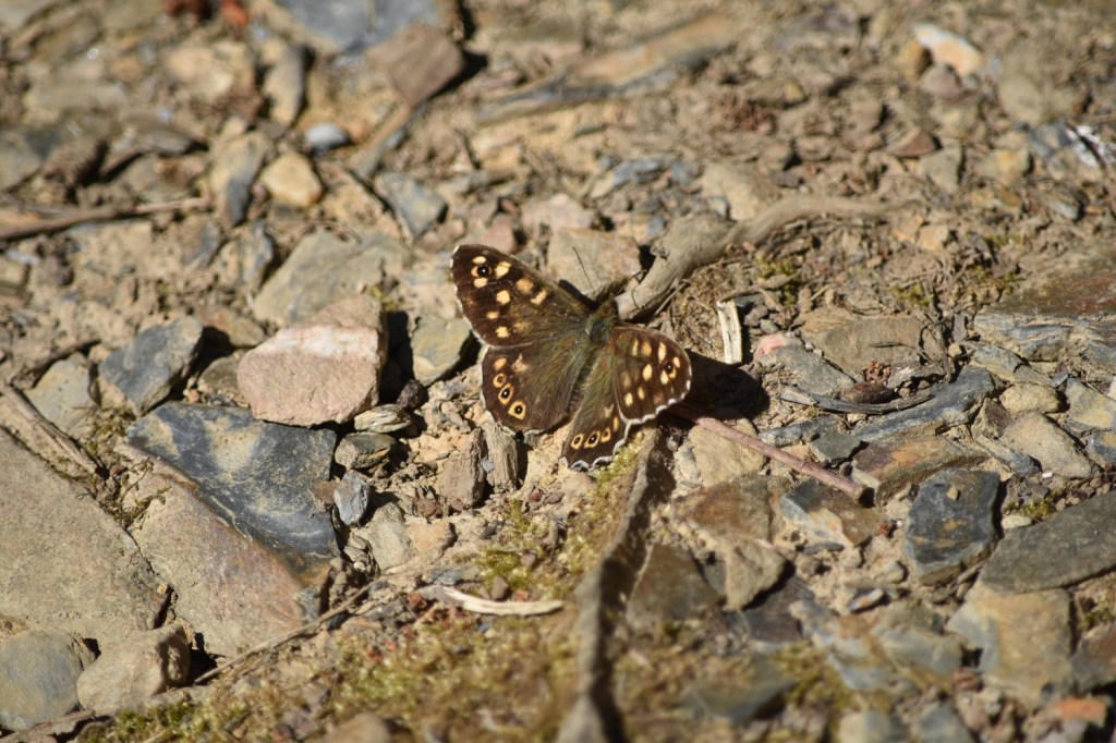
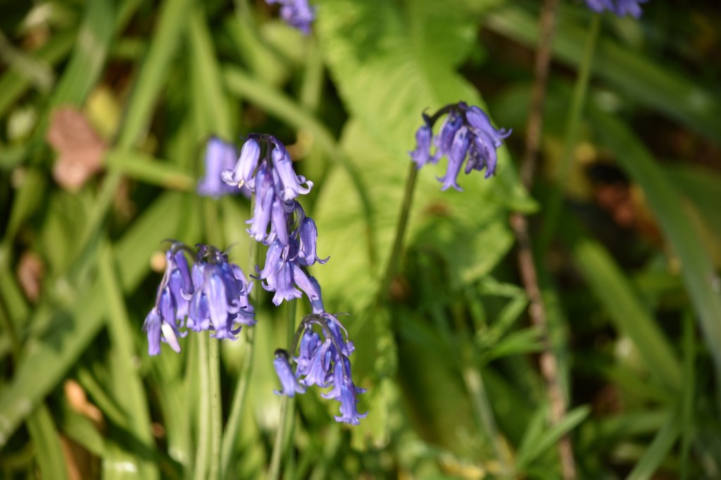
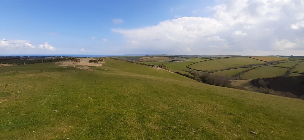
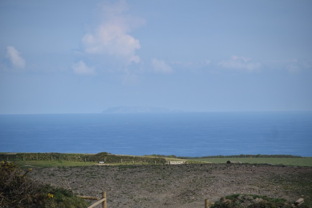
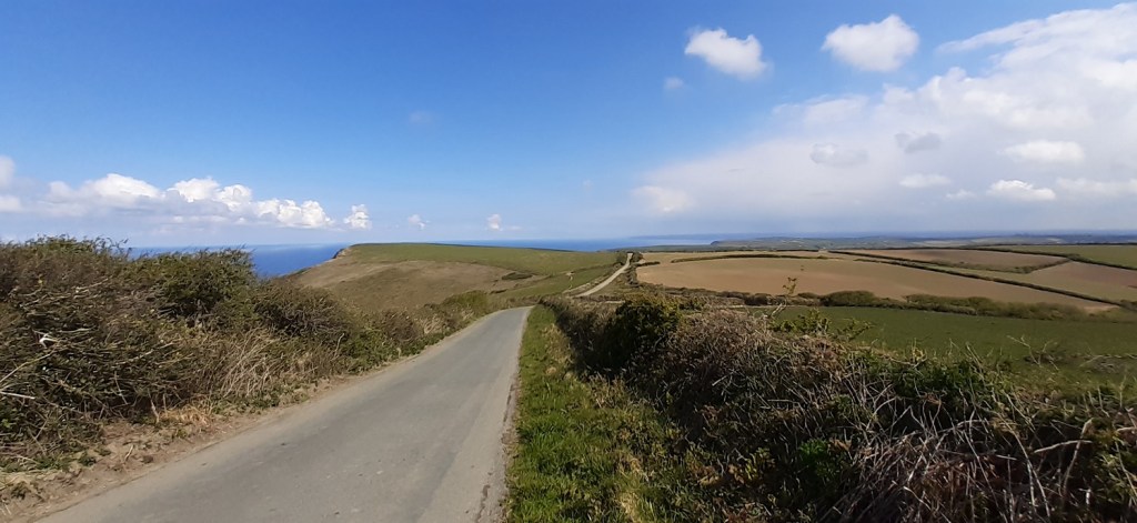
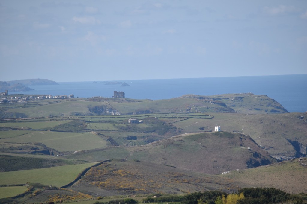
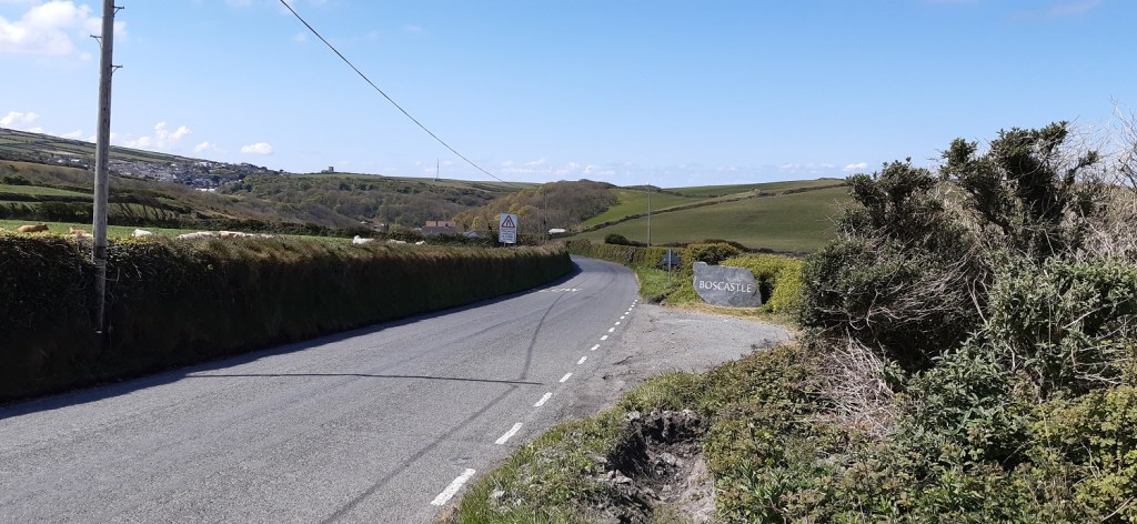
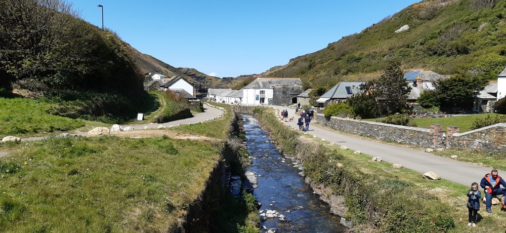
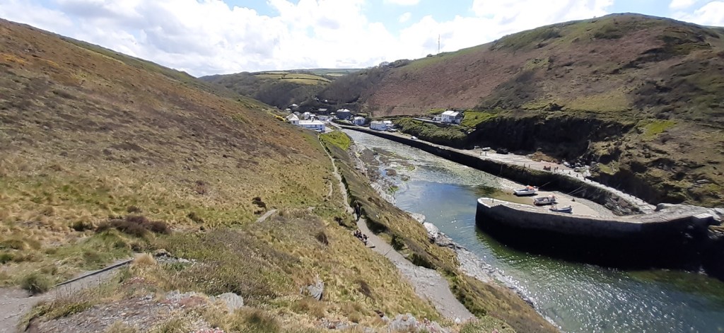
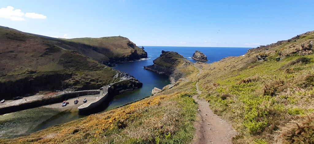
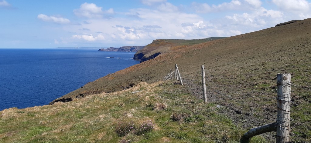
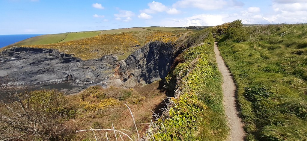
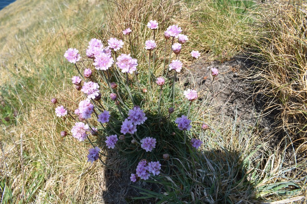
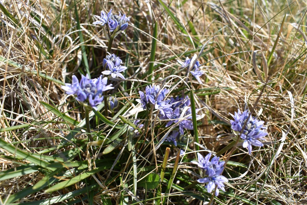
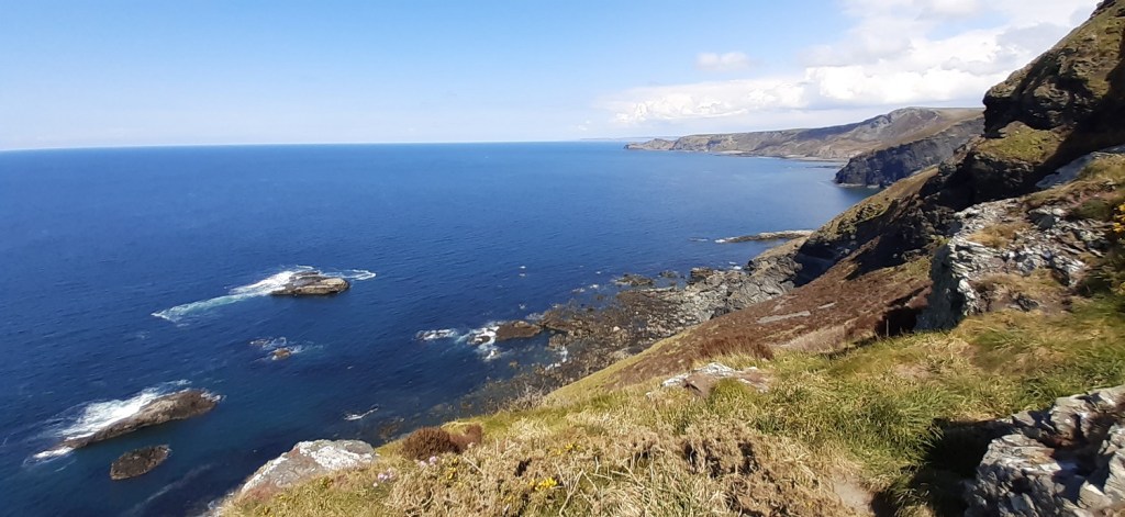
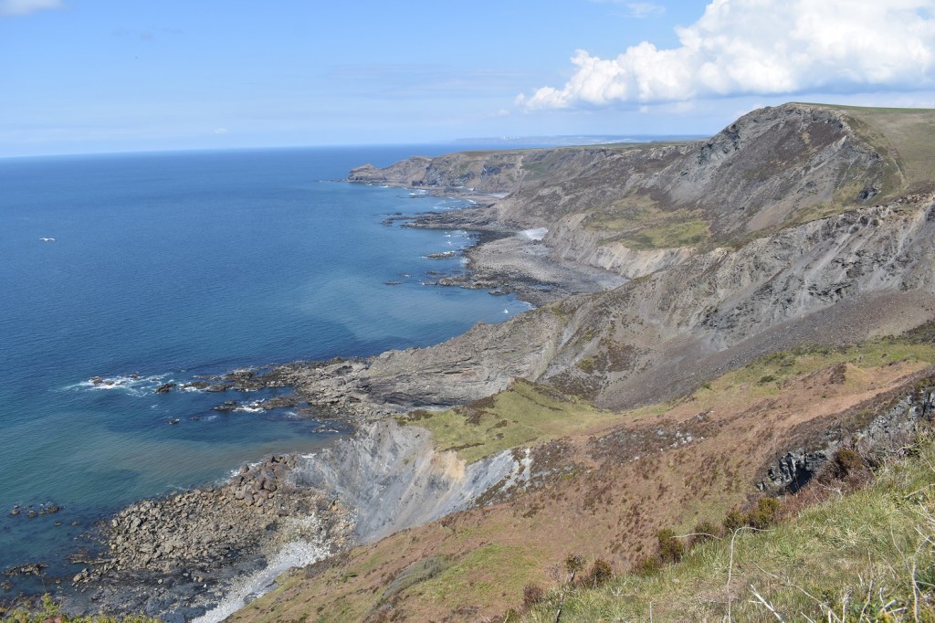
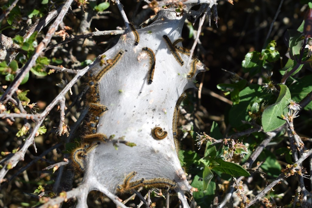
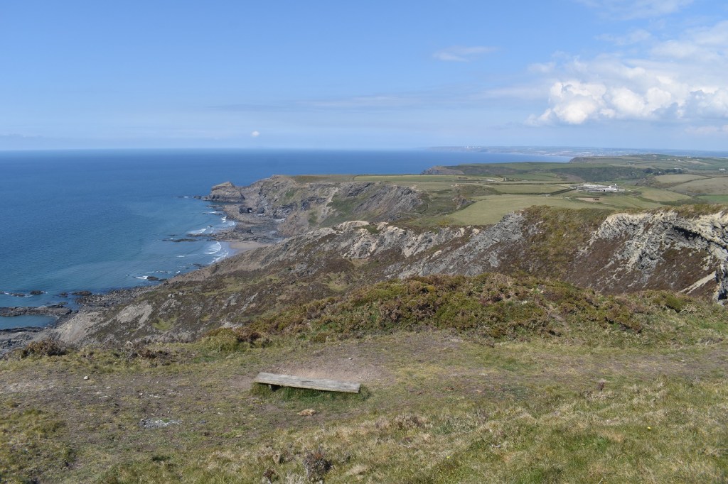
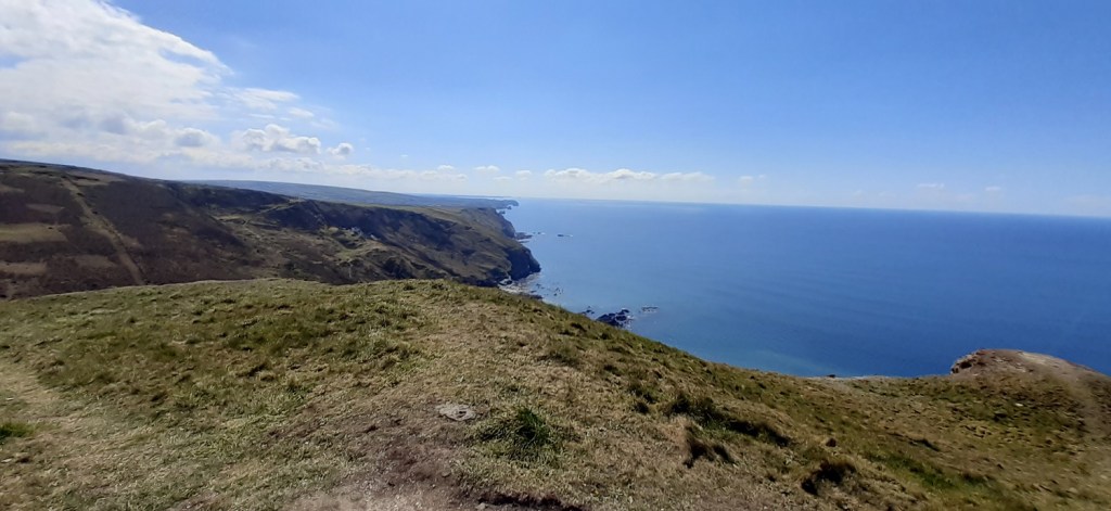
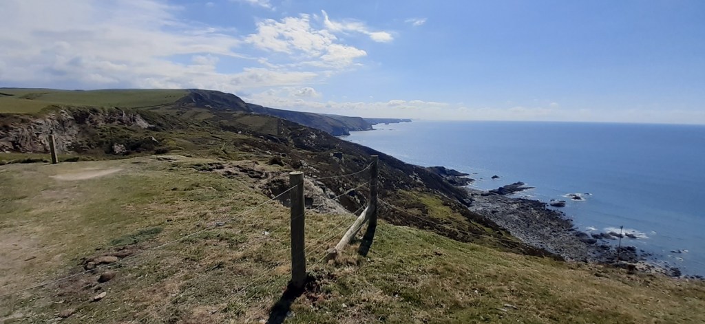
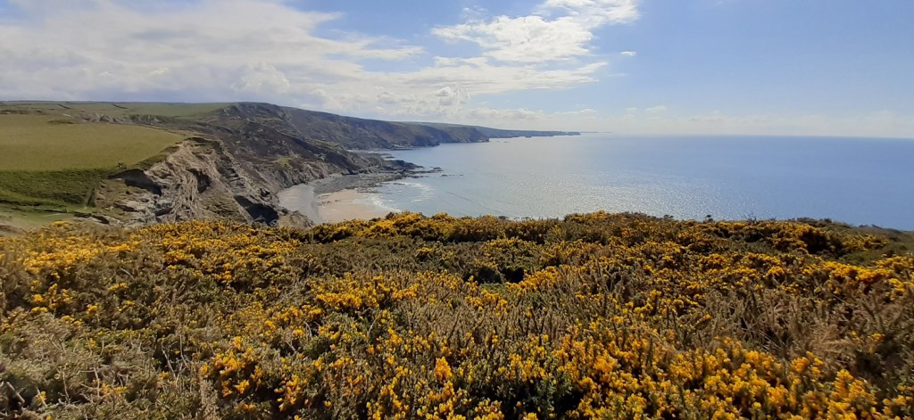
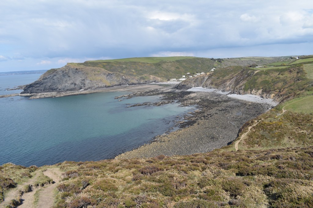
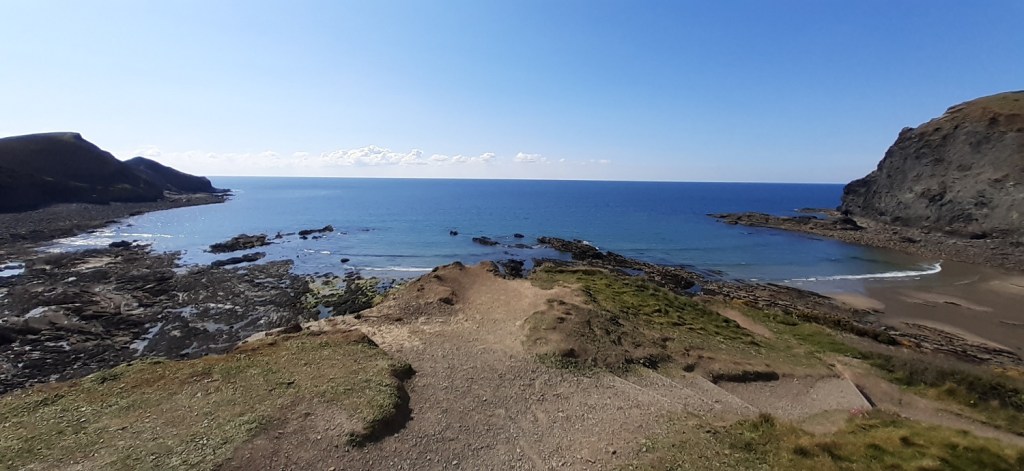
There are two car parks in Crackington Haven, One expensive, privately owned one by the beach. Or this one, where the proceeds go to the local area and is cheaper. Neither take a card payment currently, so this local one should win your business over the other. It a 2 minute walk to the beach from hereCrackington Haven beach. That’s Cambeak, the point in the sunshine and I will be there in about 6 1/2 hours. The cafe’s behind me were doing a decent trade at 9.30am, I grabbed a coffee and started walking. First I went inland in to the woodlandsThe wooden valley is seen and I will follow that towards a farm called PengoldOn the first couple of signs Pengold is not posted, instead follow Sheepdip!It was lovely in here and quite warm, so one layer came off leaving me with just a t-shirt for the rest of the walkA Speckled Wood getting some early raysLots of these around todays walk, not in enough thickness yet to make a carpet of them but getting thereAfter about 45 minutes you pop out of the far end of the woods and begin to climb to Pengold Farm (although I called it Penfold all the way around, ooo crumbs!)Well that was a work out, I’m heading up to around the 250 metres contour line and this is the first part of the pull up. The views start to open from here though, the coast line stretches north towards Bude and over the gate there on the left is……A slightly hazy Lundy IslandI’m nearing Newton Farm and get a view into the dip between Rusey Cliff left and High Cliff right, it was at this point that I realised that I would need to climb High Cliff around mile 10 on this walkHigh Cliff again on the left as I walk a short road section. Hartland Point can be seen in the far distanceI’ve turned off the road to follow a track towards the hamlet of Beeny. I’ve stopped for a brew to admire High Cliff which looks steep on the left with Cambeak sticking out into the Atlantic. Hartland Point again at the backThe track I’m following pops over the high point of the walk and unveils the westerly view down towards Boscastle, Tintagel and on towards Trevose HeadRed Admiral on the flowering gorse, I chased about 3 pairs of Orange Tips around this part as well to no avail. Still haven’t bagged a photo of one of those.Bit of zoom shows Tintagel Castle, the islands beyond are, from front to back, The Mouls, Newland and Gulland Rock, which sit off Trevose Head and Pentire Point. The white tower nearer to me is the Willapark Lookout Station, Boscastle sits in the valley this side of the LookoutLlama time. I’ve got him as my background on the laptop now, I’ve called him ReginaldAfter passing through the hamlet of Beeny I walk a mile of road towards Boscastle, the large slab of slate announces your arrival at the town.I’m sure many of you will recognise this view from the bridge along the River Valency towards the harbour part of Boscastle. The main village is up to the left and away from this river. But we all saw the photos in 2004 as a wall of water forced its way along this valley. There are 4 other small streams that feed into the river, one of which is just there by those rock steps on the left in the river. All these streams were flooded by 7 inches of rain in an afternoon on 16th August, one 60 minute spell dropped 3.5inches of rain. This helped the river to rise 3 metres higher than this as a result of the bridge collapsing and releasing a wave of backed up water. Today however, all was serene, in fact the girl on the right was trying to photograph the yellow wagtails flying back and forth along the riverThe narrow valley inlet into BoscastleThe outlet into the Atlantic a glorious view point to have a brew and enjoy. Willapark Lookout Station is on the headland with the island of Meachard at the mouth of the inletA climb up to Penally Point shows the route ahead, Cambeak looks a long way away and with around 6-7 miles already walked to here it not going to be easyThe majority of this path stays high above the steep cliff, but there are some drops down towards a beach, with a resulting steep ascent following. Another feature are the dark shale cliffs and crumpled grassland at their basePentargon, the path is down there on the right, so I’m steeply heading down steps to the waterfallThe waterfall to the beach at PentargonThe cliff paths are fun and vertiginous and no I haven’t tilted the cameraLots of Sea Pinks along hereSpring Squill on the side of Beeny Cliff, only saw it along this sectionI was huffing and puffing a bit by this point. The Meachard is the island which means I’ve only done about a third of the coastal section to here. The hard section was to come next as I climb to Fire Beacon PointFire Beacon Point, the Beeny Sisters in the bluest of seas and Cambeak in the distance. High Cliff still looks a long way awayIf Carlsberg did benches, they would probably have the best views in the world. The gorse along this part was sweet smelling and the views jaw droppingFrom Fire Beacon Point looking to Rusey Cliff and then High Cliff, the walking gets even tougher hereLots of inlets along here, next the steep pull up to Rusey CliffOn Rusey Cliff, High Cliff is on the right and the crumpling of the cliffs can be seen below, caused by millions of years of tectonic movementNext generation of butterflies are getting ready. The paths’ steep drop off Rusey Cliff was quite demoralising, knowing that a steep climb was next, up to the highest point on the whole South West Coastal Path. High Cliff sits around 223 metres above the sea, and I’ll be climbing around 200 metres of thatThe camera was stowed to climb High Cliff, the zigzags used to keep moving forward. I was elated to be up here as climbing such a steep part at the 10 mile marker. I lay on the grass in front of me enjoying the view and plenty of squash. The Strangles Beach can be seen belowLooking back west, past Rusey Cliff towards Fire Beacon Point and beyondOut the back of the cliffs is farmland, however the weather that way (Bodmin Moor) looked black for most of the afternoon, confirmed by the rain I hit on the way home. I’d struck gold with the sunshine todayI’m above The Strangles beach at this point looking back to High CliffAnd again over the gorse with the beach in view this time. Even after the climb to High Cliff, in no way is it all down hill to Crackington Haven. There are dips and rises and the coastal path continues, sapping on the energy levels.Cambeak, at last. Plus some goats which were grazing a little further downEven with Crackington Haven insight now, there are still a couple of steep staired climbs to finish you offAnd to finish, Crackington Haven beach, the end of a glorious section of coastal path. Not spoken about as much as Sennen Cove, Hartland Point, Porthcurno or the Lizard. But on its own its the hardest part of the path that I have walked to date. Brutal in its ascents but breath-taking in the views. Now where’s the pub for a Tribute
I’m walking these over the last month. Covid restrictions allow for daily travel here in England, and either return home at the end of the day or stay in self catering accommodation for the night
Sensational stuff. The coast is often a great spot to be on showery days when the inland hills attract the rain. That is one tough day with the circular route. Something about the continual up and down that’s seems more challenging than a single long climb you’d associate with the mountains.
By the end even the short climbs were difficult, trying to get some decent ascents in my legs though, ready for the bigger mountains. How does mid to late June sound for Pen Y Fan, probably on a Thurs or Fri? Would you be interested?
Wow. Stunning coastal scenery. And blue skies and sunshine – we need a bit more of that! Spring squill is a new plant to me – I shall be looking it up. I wonder whether it’s not a northern plant?
Spring squill likes a north and west coastal area (flower of County Down apparently), so it should be your way for sure. This one was indeed on a northly facing section steep sided spot, with a good chance of some spray heading up from below
One of my favourite parts of the country. As a child, half a century ago, I holidayed several times with my Mum and Dad in Crackington Haven, staying with a retired farmer and his wife in a house at the base of Penkenna Headland. He had donated some of his land to the village for a car park. The village has changed very little since then – at least in appearance, although of course a lot of money has come into the area, and houses that were lived in by locals are now often holiday or second homes, which is a little sad.
One of the pleasures I enjoyed, then and now, is watching the tide race in over the rocks at the side of the beach. It can move in very fast, and on a windy day in particular, with the waves whipped up high, can be exilerating – but you have to be careful not to get cut off…
I have walked from Crackington to Boscastle before now, but never there and back – that is some trek!
Keep up the good work…
Thanks Martin, such a good section of the coastal path, and including the highest point on the whole path. I loved walking both ways out of Crackington but some serious ups and downs as well


Are you traveling like right now? I hope these are previous trips, not a good time to travel during covid…..
LikeLiked by 1 person
I’m walking these over the last month. Covid restrictions allow for daily travel here in England, and either return home at the end of the day or stay in self catering accommodation for the night
LikeLike
I did not know, that’s interesting. 🙂 Safe traveling. Stay safe, and bless……if your Christian.
LikeLike
Sensational stuff. The coast is often a great spot to be on showery days when the inland hills attract the rain. That is one tough day with the circular route. Something about the continual up and down that’s seems more challenging than a single long climb you’d associate with the mountains.
LikeLiked by 1 person
By the end even the short climbs were difficult, trying to get some decent ascents in my legs though, ready for the bigger mountains. How does mid to late June sound for Pen Y Fan, probably on a Thurs or Fri? Would you be interested?
LikeLike
That sounds good for a meet up although I’m just about to start a new job next week so time off midweek might be a challenge. Keep me posted 🙂
LikeLike
Beautiful photos!
LikeLiked by 1 person
What a beautiful day for a walk. Your pictures should be calender shots. 🙂 I think Reginald suits his name.
LikeLiked by 1 person
Wow. Stunning coastal scenery. And blue skies and sunshine – we need a bit more of that! Spring squill is a new plant to me – I shall be looking it up. I wonder whether it’s not a northern plant?
LikeLiked by 1 person
Spring squill likes a north and west coastal area (flower of County Down apparently), so it should be your way for sure. This one was indeed on a northly facing section steep sided spot, with a good chance of some spray heading up from below
LikeLike
One of my favourite parts of the country. As a child, half a century ago, I holidayed several times with my Mum and Dad in Crackington Haven, staying with a retired farmer and his wife in a house at the base of Penkenna Headland. He had donated some of his land to the village for a car park. The village has changed very little since then – at least in appearance, although of course a lot of money has come into the area, and houses that were lived in by locals are now often holiday or second homes, which is a little sad.
One of the pleasures I enjoyed, then and now, is watching the tide race in over the rocks at the side of the beach. It can move in very fast, and on a windy day in particular, with the waves whipped up high, can be exilerating – but you have to be careful not to get cut off…
I have walked from Crackington to Boscastle before now, but never there and back – that is some trek!
Keep up the good work…
LikeLiked by 1 person
Thanks Martin, such a good section of the coastal path, and including the highest point on the whole path. I loved walking both ways out of Crackington but some serious ups and downs as well
LikeLike