A bit of sunshine on this Sunday as we headed out again, the day after our blowy walk up Cnicht. The clouds were still skudding across the sky, but at least we got plenty of views, blue skies and no rain on this walk. Instead of the normal starting point of Capel Curig, we decided that a shorter drive would give us an easier walk from Dolwyddelan, especially as half the 8 mile distance is on forest tracks. Most of the walks up to Moel Siabod will talk about the Daear Dhu ridge, a fine rocky scramble to the summit, for us we stuck to the quicker path next to the ridge and made for an easier route. The views were still superb, especially in the direction of Blaenau Ffestiniog and the surrounding mountains. This was a mountain that I’ve had on my list for a while now, probably longer than Tryfan and Snowdon, as a friend from Plymouth waxed lyrical about the walk. He was right, it is a fantastic mountain, it was just a shame we couldn’t get the much written about views into the Snowdon horseshoe due to the cloud being down to our west. So our second walk of our holiday and a cracker, we also grabbed a well earned pint in the Y Gwydyr pub as we finished, a fine end to this one.
Start – Dolwyddelan
Route – Foel Gynnud – Afon Ystumiau – Llyn y Foel – Daear Dhu – Carnedd Moel Siabod – Daear Dhu – Llyn y Foel – Afon Ystumiau – Dolwyddelan
Distance – 8 miles Start time – 11.45am Time taken – 6hrs Highest Point – Moel Siabod 872 metres
Weather – Sunshine and white clouds down on the top. Warm
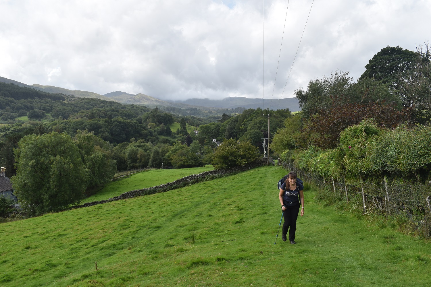
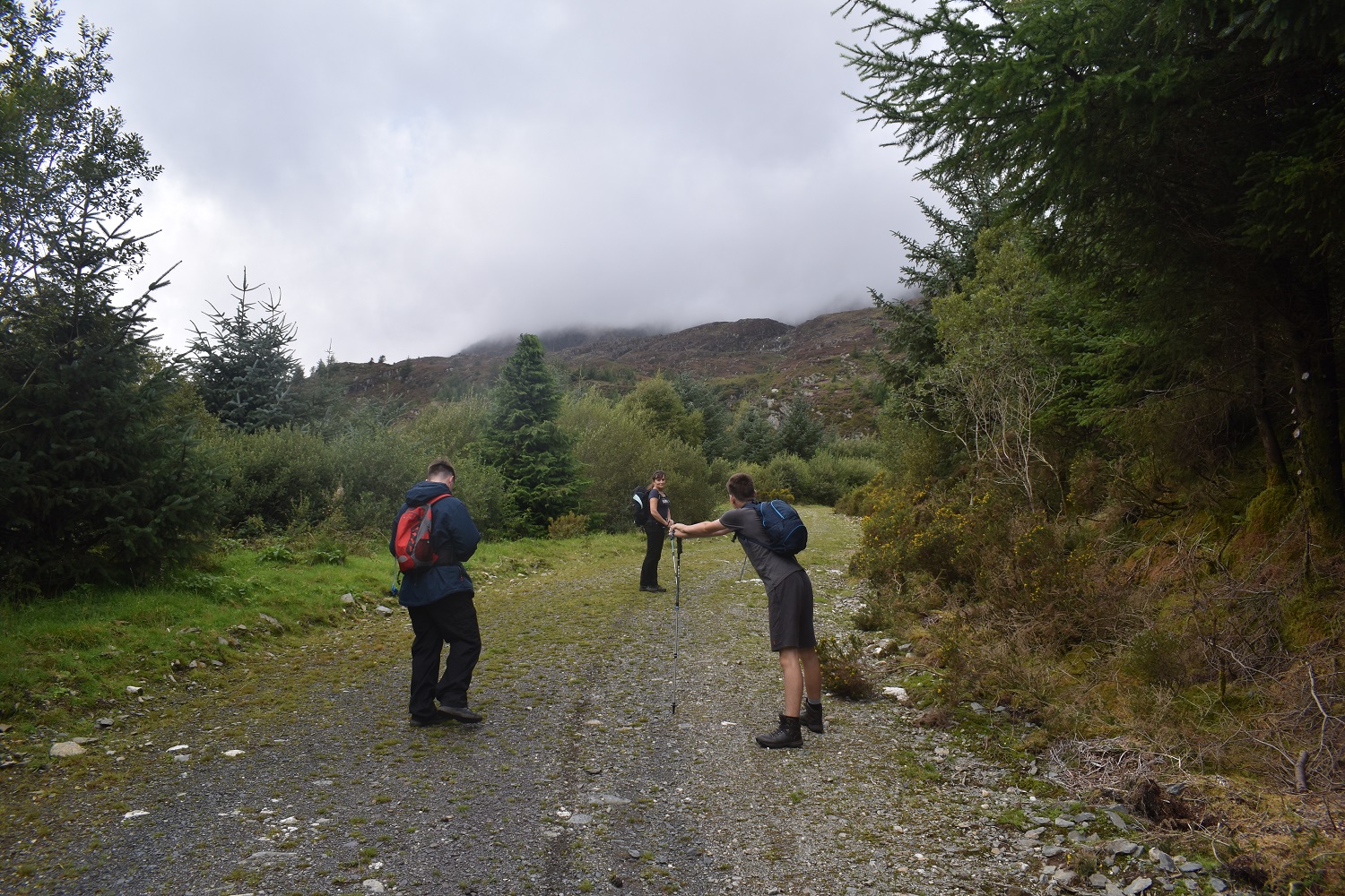
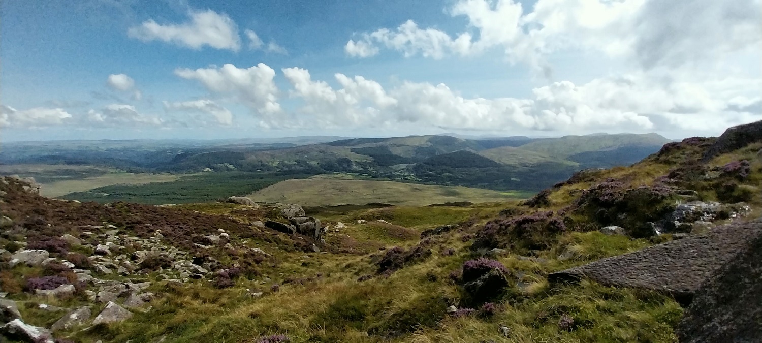
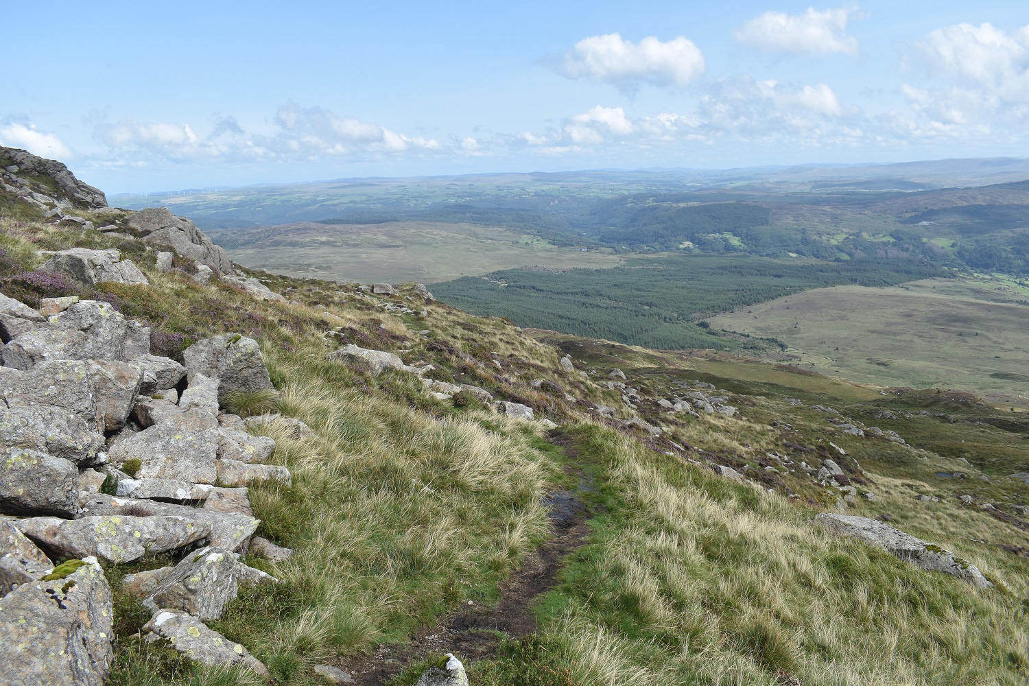
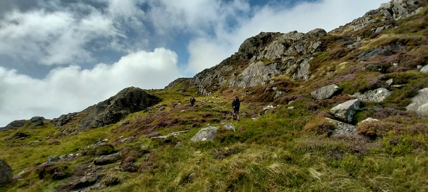
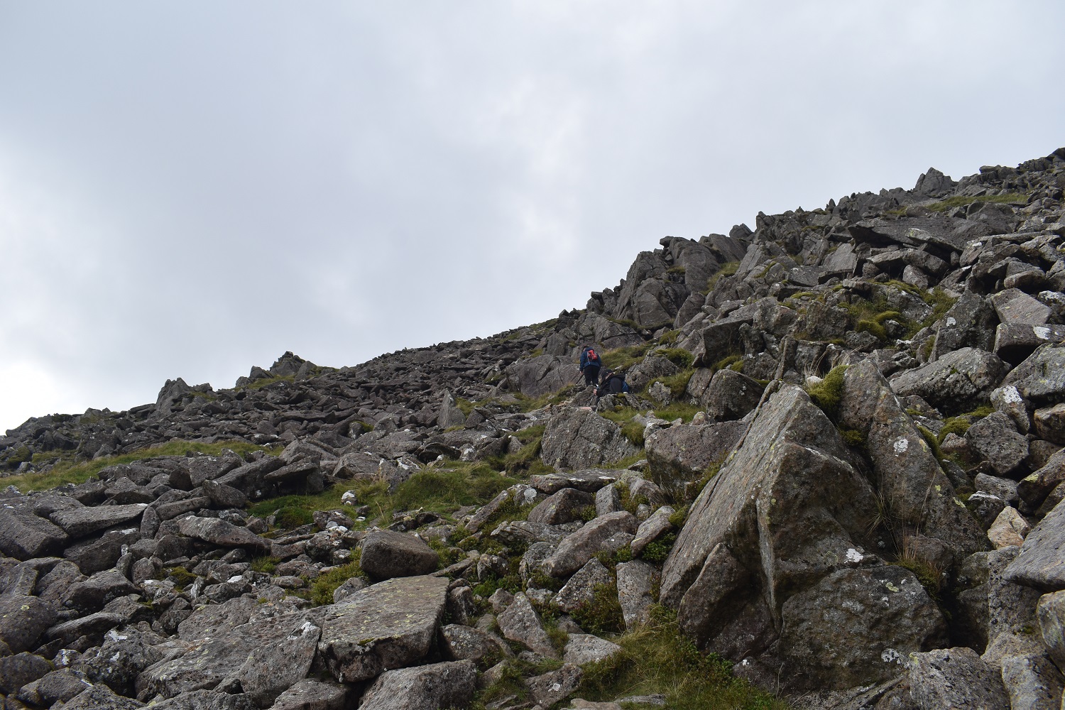
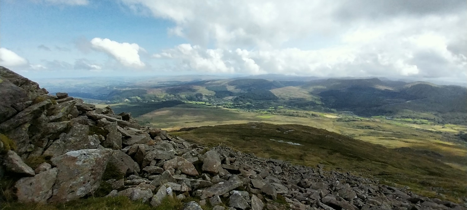
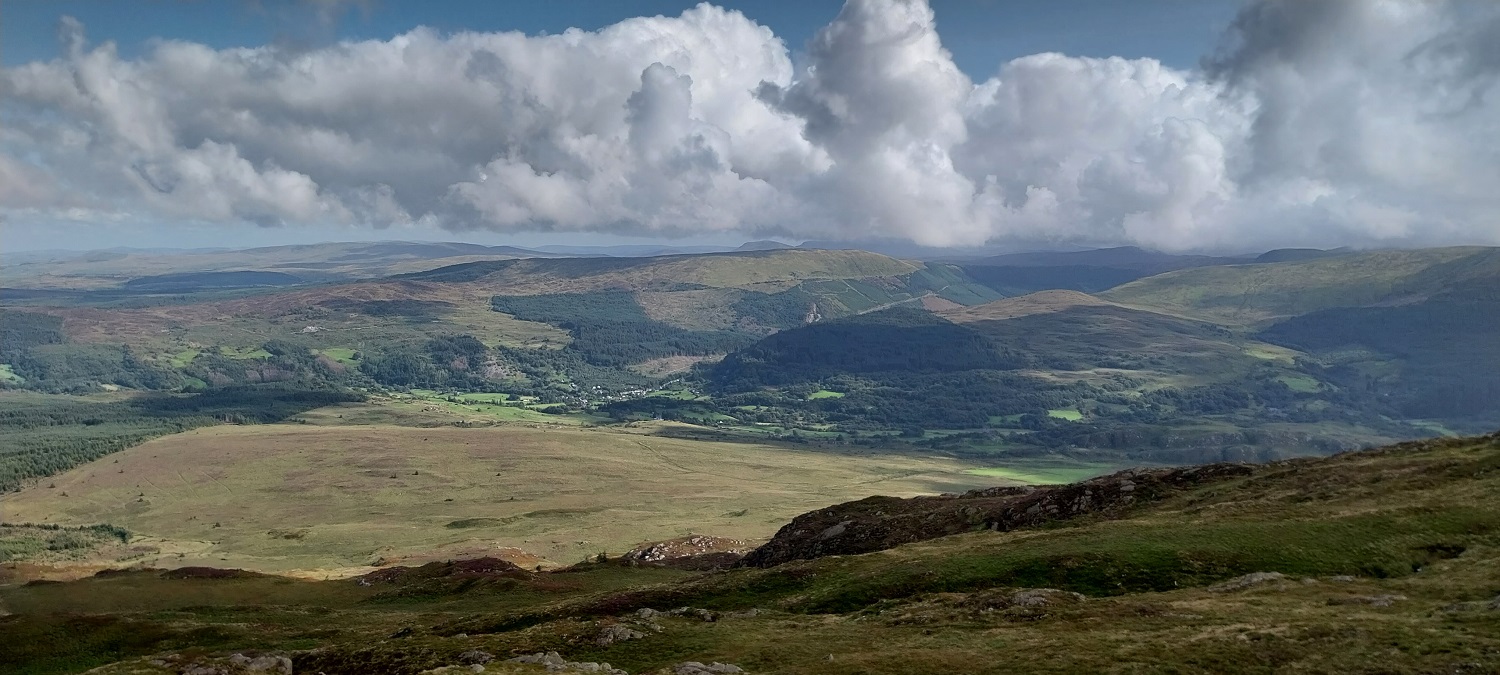
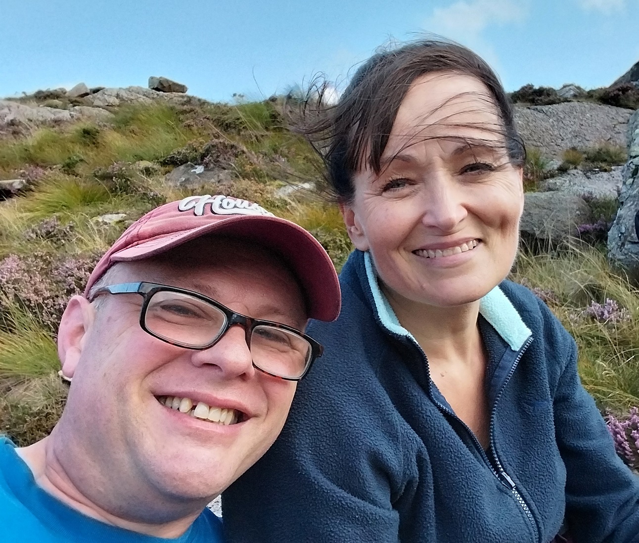
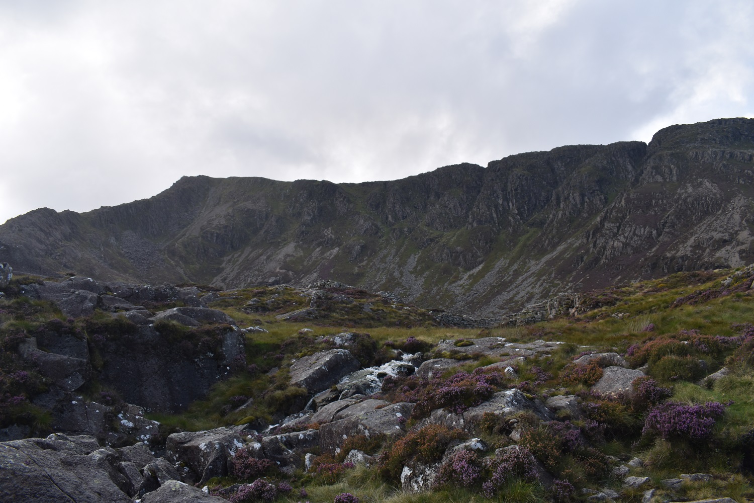
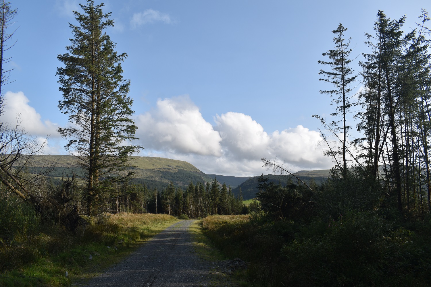
Starting out in the village of Dolwyddelan, we’d parked on some roadside parking opposite the Spar shop in the village. That’s Y Ro Wen beyond the villageLinda walking across the fields to reach the forest track, we’d already started shedding layers as it was a warm day. The hills at that back are those around the A470 Crimea Pass, and include Moel Farlwyd and Moel Dyrnogydd.A Peacock butterflyStopping for a rest on the forest track, the cloud was still down on Moel Siabod ahead but soon the sun would start to burn through and the wind blew the clouds away a bit.Climbing, we pass waterfalls created from the outflow of Llyn y FoelAs we stopped for a brew someone went bilberry picking, and eating! We were also bitten a lot by midges at this point and I spent the rest of the week with itchy lumps over my head.The hills behind Dolwyddelan that run towards Blaenau Ffestiniog. Including Moel Penamnen and Moel FarlwydThe other way (south east ish) is Penmachno ForestThe waterfalls marked on the map as we head up to Llyn y FoelAnd more waterfalls, it took a bit of care to cross these streams as there was plenty of water in them after Storm BettyLooking out across the forest we have walked through, the high point is Y Ro WenLlyn y Foel and Moel Siabod behind, its summit just catching the clouds. Daear Dhu ridge is on the left hand sideLooking out again as we head around Llyn y Foel to the bottom of Daear DhuThis is the path that runs 10 or so metres from the rocky scramble, easy to follow and threads its way through the rocks, there are a few bits to clamber over but nothing difficultOnwards. This was a theme for the walking on this holiday, with the boys ahead of us or waiting for us to catch upThe dip in the distance is the A470 Crimea Pass road as it then drops down beyond to Blaenau Ffestiniog. To the left of the dip is Moel Farlwyd and the right is Allt Fawr and Moel DrumanBit of a scrambly section of the path as we near to top of the ridge to turn right to the summitLooking back down to DolwyddelanMoel Siabod summit photo taken by Linda of me and the boysWe took a walk to the shelter to see if the cloud would clear enough to take some photos, but this was as good as it got to the north. Here looking down towards Capel Curig.Heading back up to the summit againDescending again the same route as we came up, again East Wales is stretching out ahead, as we look down to Dolwyddelan.Big white fluffy clouds over Y Ro WenBack at Llyn y Foel sitting in the bowl surrounded by Moel Siabod summit areaGorgeous selfie of two happy hikers. A stop for one last coffee break before we head into the forest again.Daear Dhu ridge from our brew stopBack at the top of the waterfalls and slowly picking our way back down the rocky steps to the forestOne last look back up to Moel Siabod, now clear of cloud although the far side never seemed to clear to give the views to Snowdon.Blues skies overhead, and midges biting my headMy youngest waiting for myself, againBack on the forest tracks, it was very warm in here as the early evening sun seemed to pick up in temperatureOne last photo as we reach the outskirts of Dolwyddelan. Moel Siabod is definitely one of the best mountains in this National Park, it has two sides to it, in a similar way to Helvellyn. One with a bowl, a lake and steep rocky face, and the other a grassier, sloped lump of a hill leading up to the rocky summit. Our route in took us through the better side on this great mountain. Now for that pint!
I’ve been up there just the once – like you a friend waxed lyrical about it.
I went up from the other side (from Capel Curig) and was lucky in that I had had good views of the Yr Wyddfa, the Glyders and beyond. But it’s always the luck of the draw when it comes to views – I’ve been disappointed when I’ve summited mountains before now – especially Great Gable!
There’s always a few summits that seem to always have cloud when you visit, Skiddaw for me, never seen a view from it. AT least we had good views east and south form Moel Siabod, but it would have been nice to see into the Snowdon horseshoe or the Glyders
Indeed a classic mountain – as it sits isolated from the rest of the Snowdonia ranges it provides fantastic views. Last time I went up there we were lucky that the forecast was poor but it turned into a glorious sunny day. Daer Ddu is a superb scramble. If you stick right to the edge it gives a feel of exposure but safe in the knowledge you can just step back onto the path if needed. Midges in Snowdonia can be as bad as Scotland!
The views we had south and east were glorious from up there, just a shame we didn’t get to see into the Snowdon Horseshoe with the lower cloud, but its a great mountain


I’ve been up there just the once – like you a friend waxed lyrical about it.
I went up from the other side (from Capel Curig) and was lucky in that I had had good views of the Yr Wyddfa, the Glyders and beyond. But it’s always the luck of the draw when it comes to views – I’ve been disappointed when I’ve summited mountains before now – especially Great Gable!
LikeLiked by 1 person
There’s always a few summits that seem to always have cloud when you visit, Skiddaw for me, never seen a view from it. AT least we had good views east and south form Moel Siabod, but it would have been nice to see into the Snowdon horseshoe or the Glyders
LikeLiked by 1 person
Next time – fingers crossed 🤞
LikeLiked by 1 person
Gorgeous walk.
LikeLiked by 1 person
Indeed a classic mountain – as it sits isolated from the rest of the Snowdonia ranges it provides fantastic views. Last time I went up there we were lucky that the forecast was poor but it turned into a glorious sunny day. Daer Ddu is a superb scramble. If you stick right to the edge it gives a feel of exposure but safe in the knowledge you can just step back onto the path if needed. Midges in Snowdonia can be as bad as Scotland!
LikeLiked by 1 person
The views we had south and east were glorious from up there, just a shame we didn’t get to see into the Snowdon Horseshoe with the lower cloud, but its a great mountain
LikeLiked by 1 person