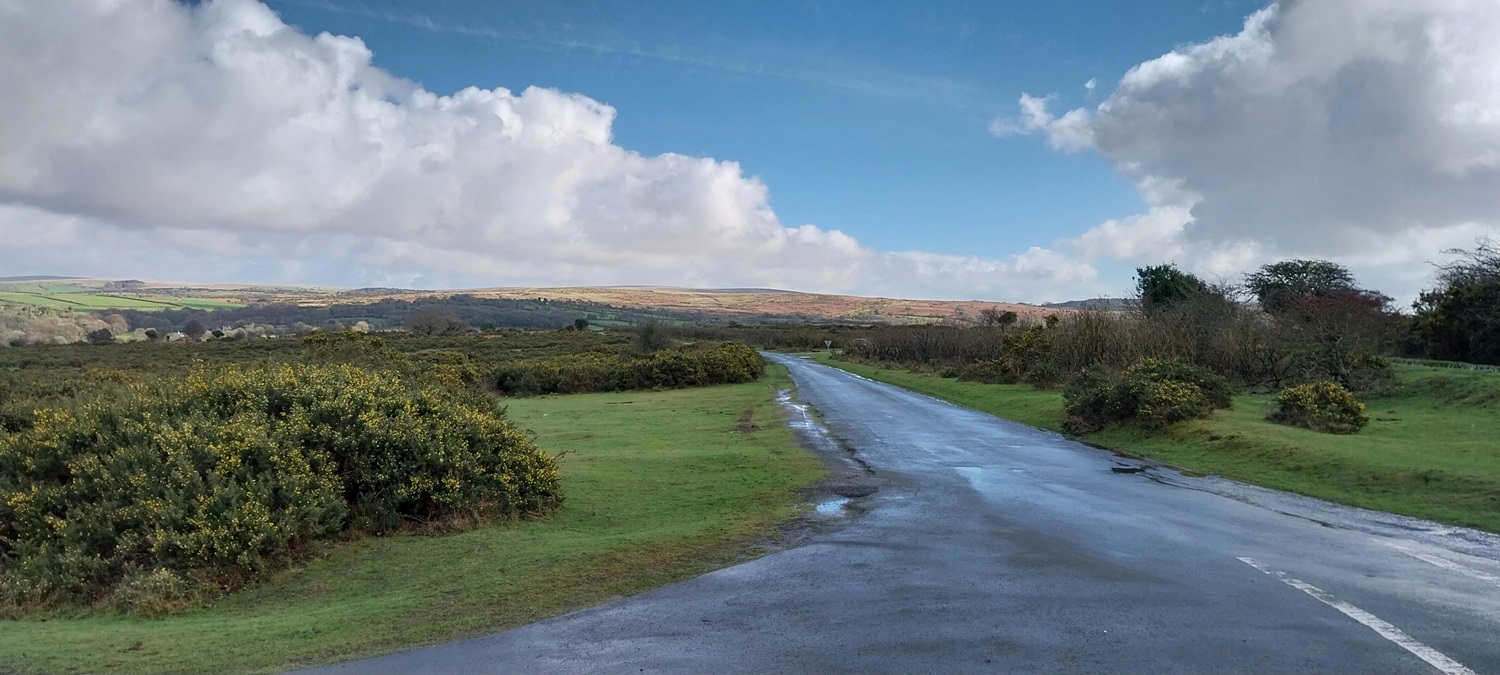
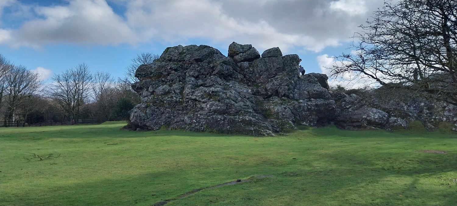
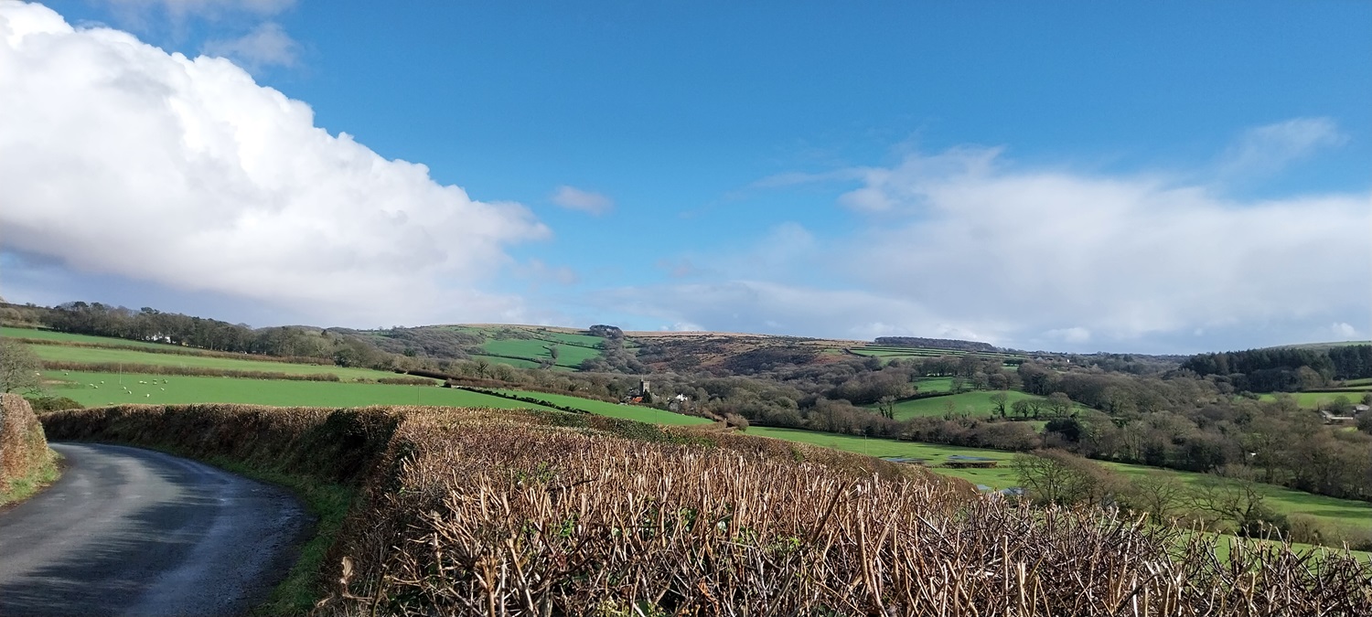
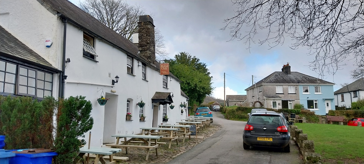
Another weekend and another head scratch to see where we could walk. The weather was looking pretty good around the south and southwest edges of the moor, but not so good when heading into the middle. Not that it would have been raining in Princetown and Postbridge, but more that there wouldn’t be any sunshine. We’ve missed on on the sun often enough this winter and I wanted to give us the best chance. We decided on a nice lane walk around Meavy and Yelverton, picking up a few Dartmoor 365 squares and a visit to Roborough Rock as well to tick that one off for Linda. This would be walk number 47 of my second round and it picks up squares R4, R5 and S4. I was pleased to read that the pub in Meavy had reopened and as a result I decided to start from this spot and hopefully grab a drink on our return. This walk takes in two other villages in Clearbrook and Yelverton, both of which have pubs as well, so you could choose to do this walk starting in any of those places, and get a drink at the end if you wished. After the rain we’d had the week running up to the weekend we decided to stay away from the higher moor and walk around the edge, mixed in with some lane walking. Originally we had planned to head for Wheal Betsy and the Willsworthy Firing Range, only at the last minute to check the firing times and see that the MOD had firing on both a Saturday and Sunday, which is not normally done. So we ended up here and had a lovely simple walk, perfect company, in lovely sunshine with a pint to finish. An ideal Sunday
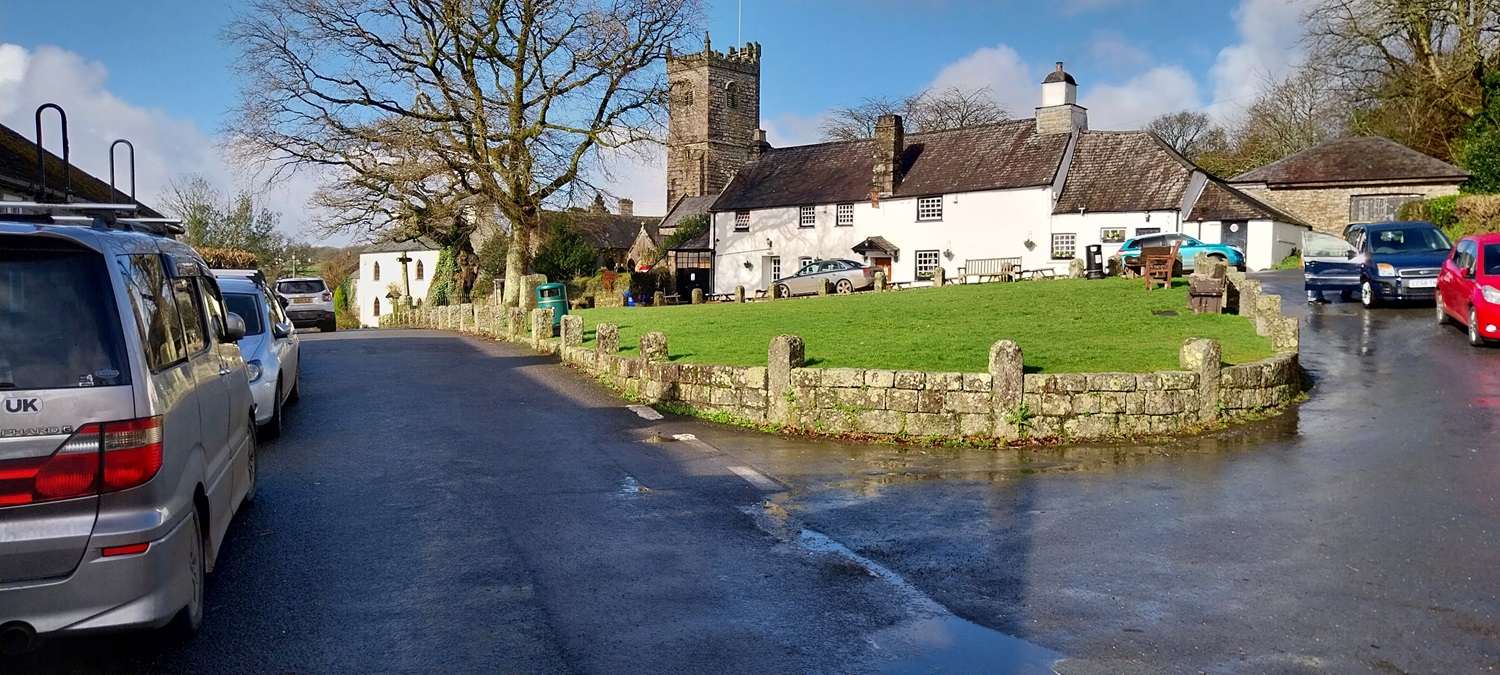
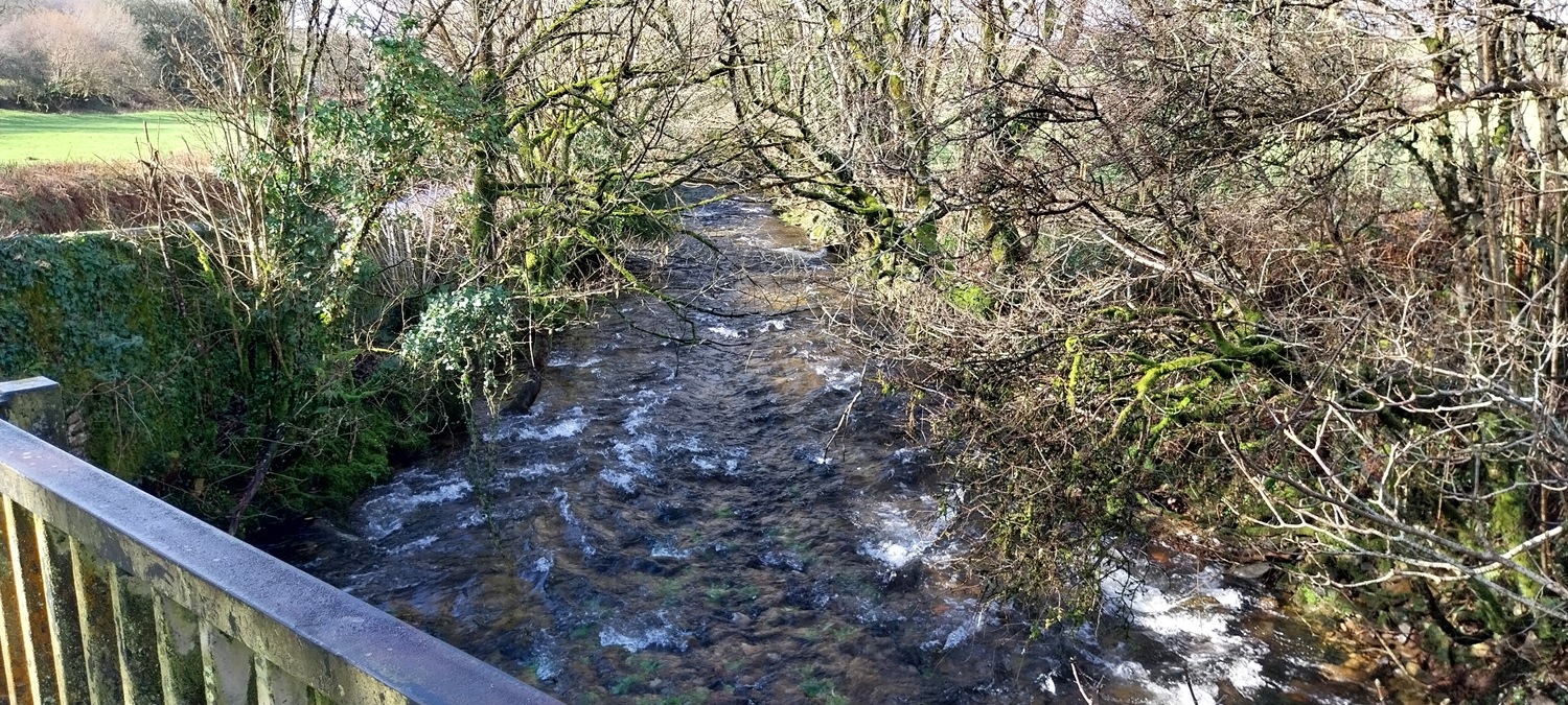
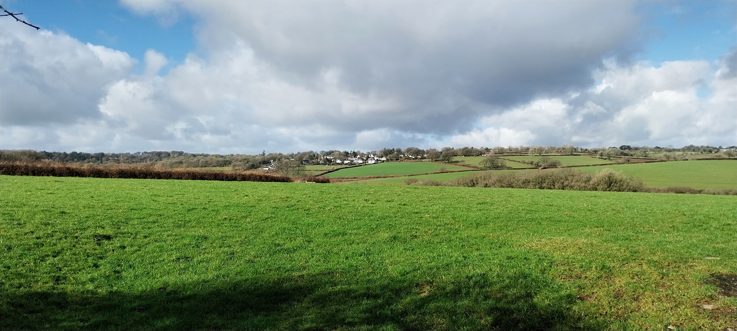
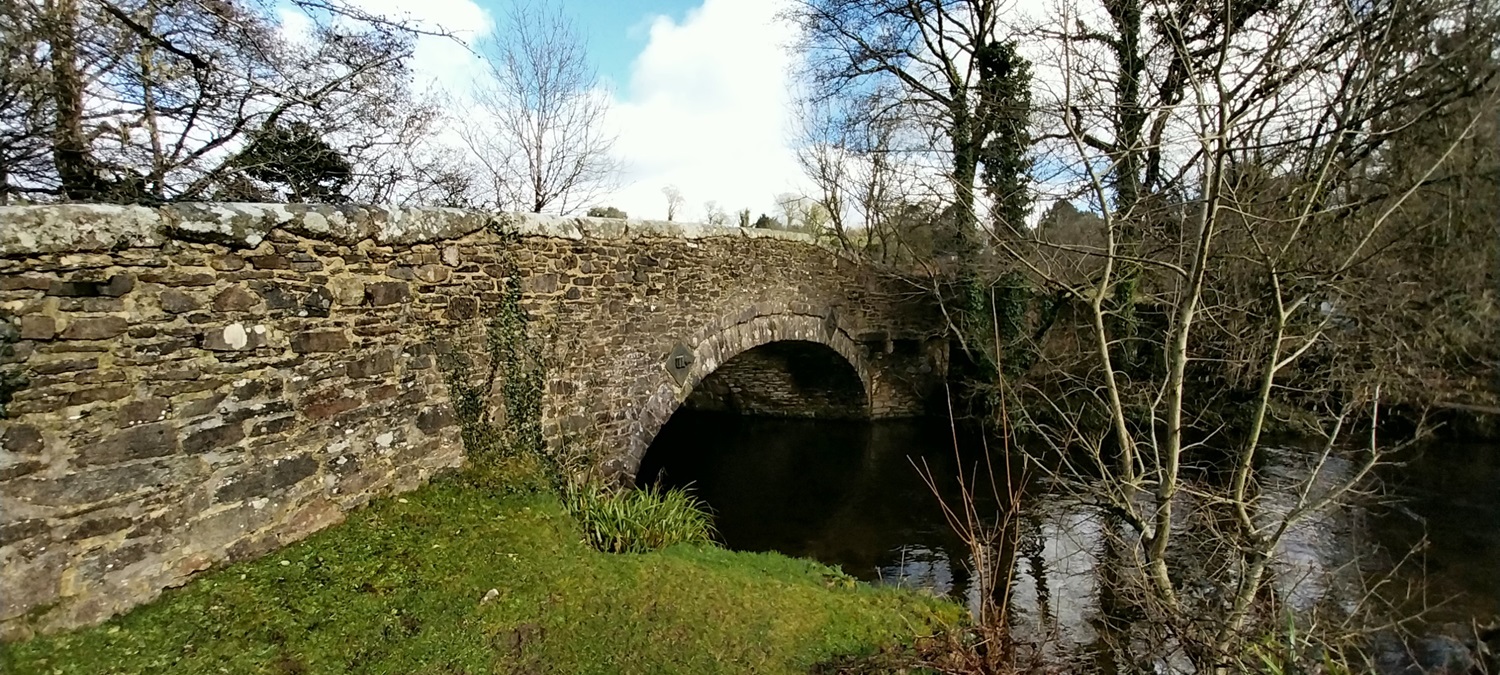
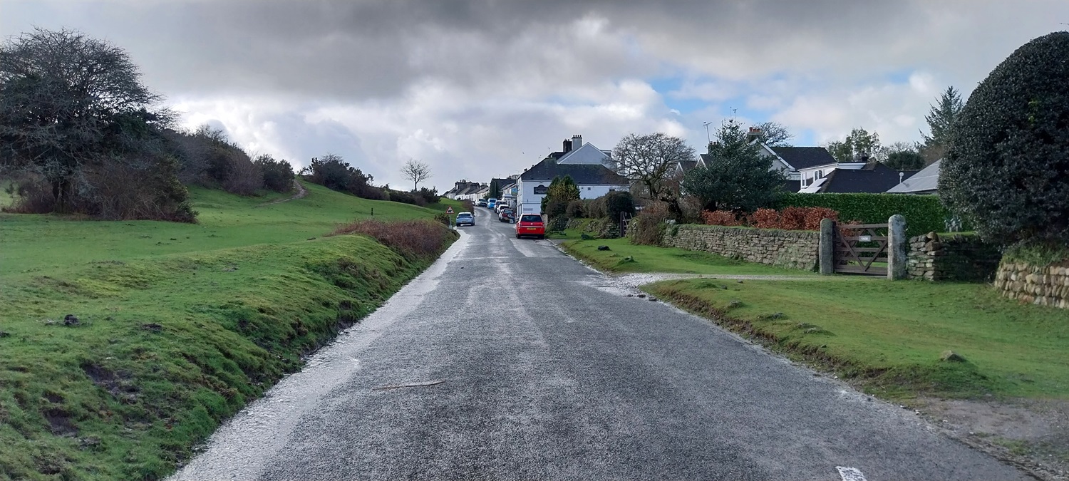
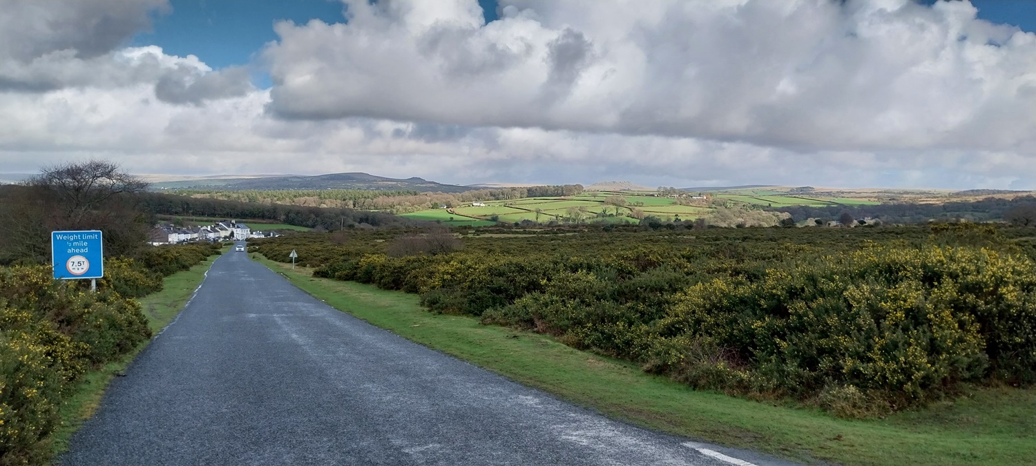
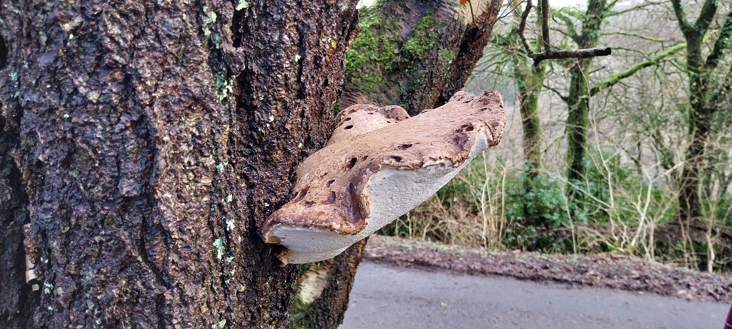
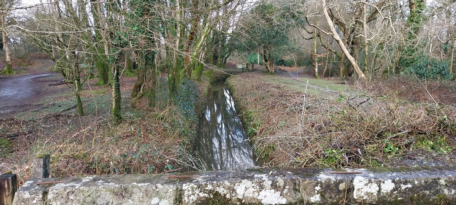
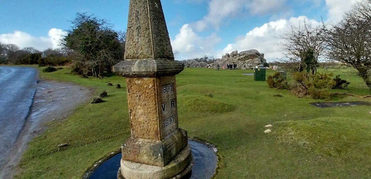
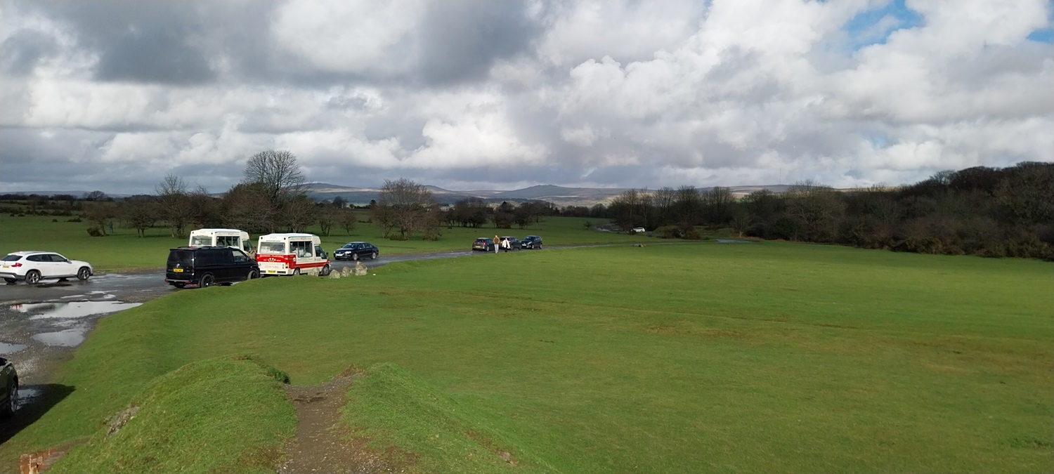
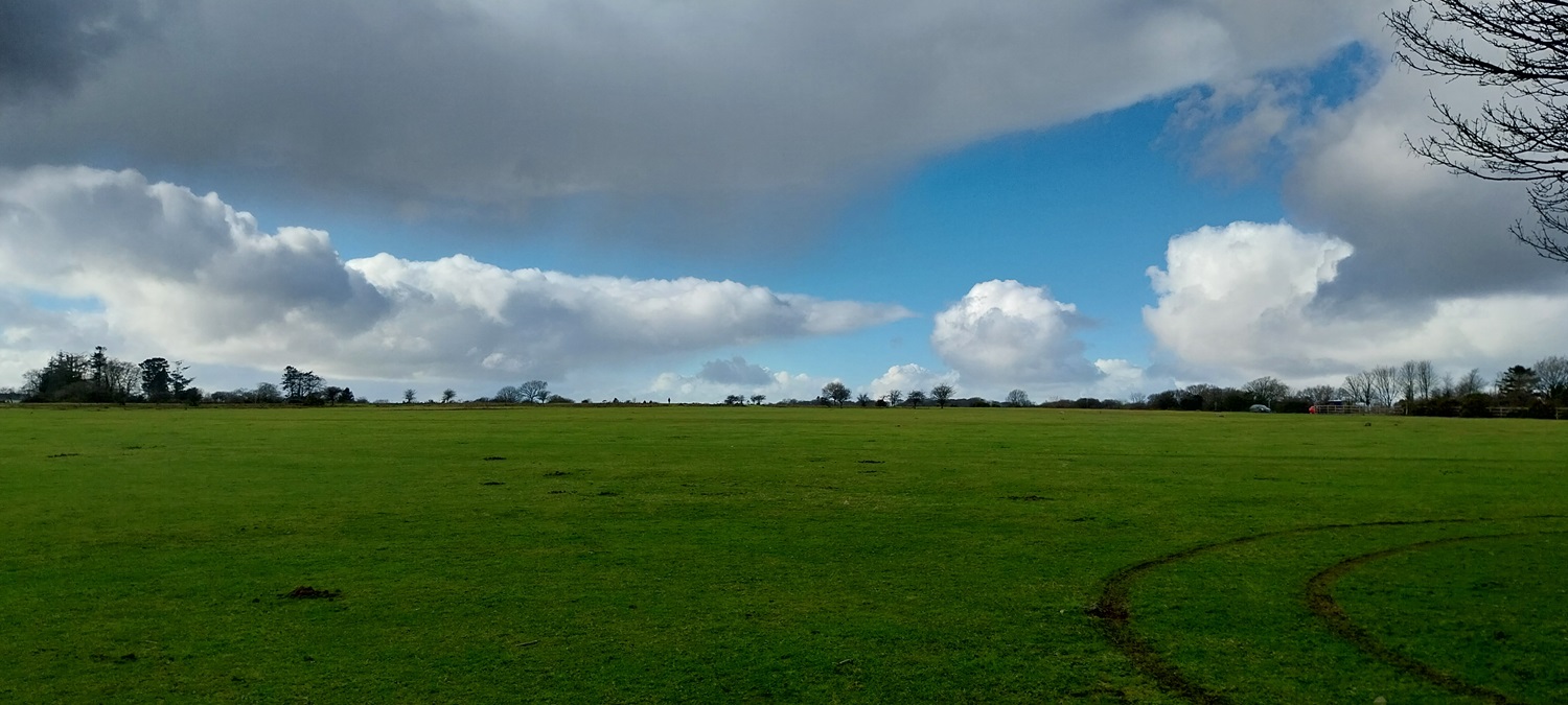
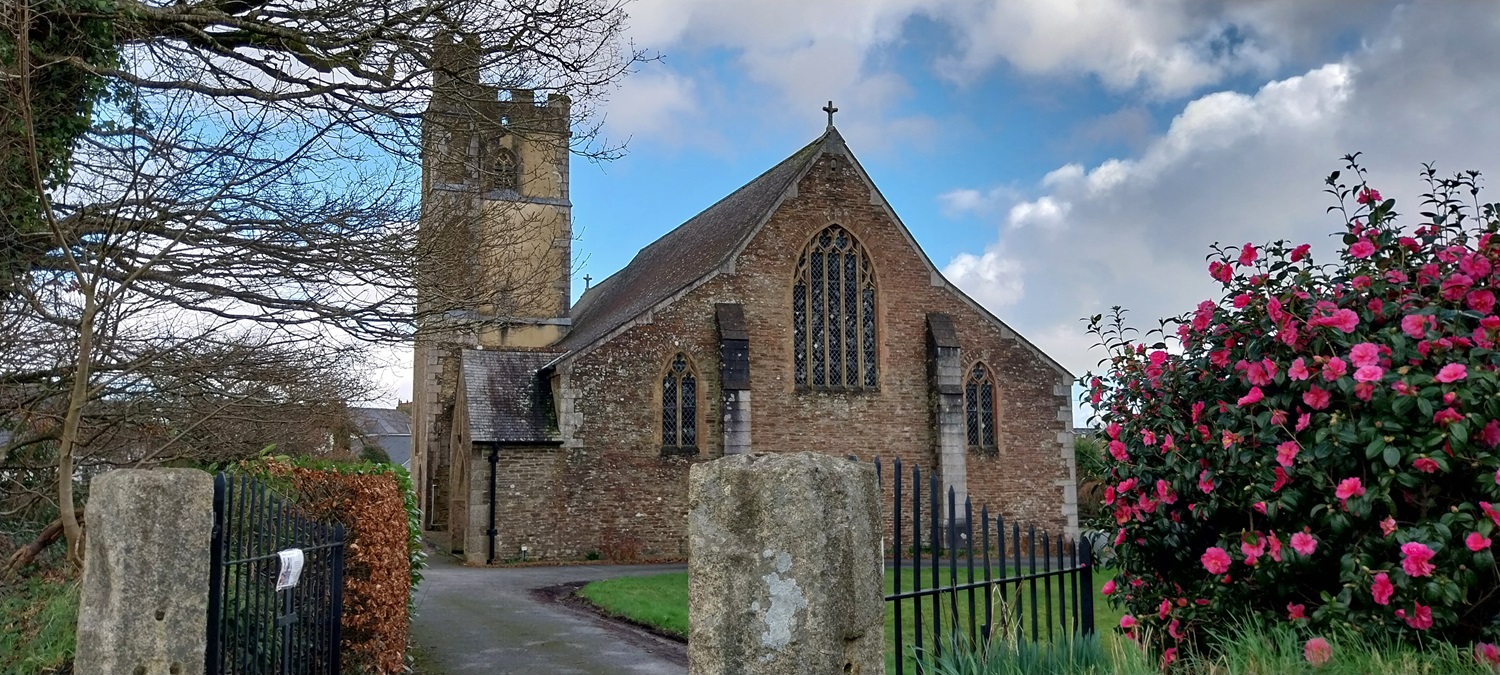
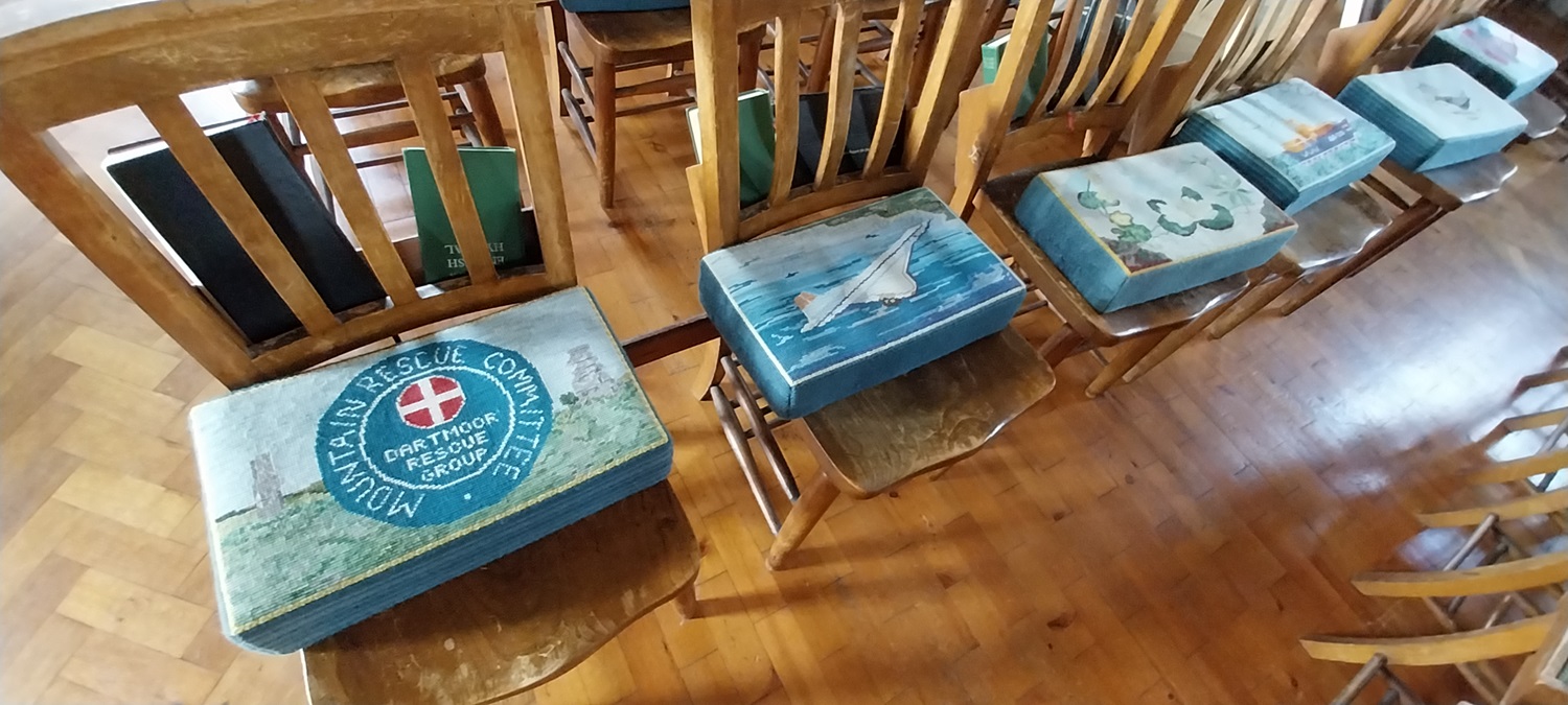
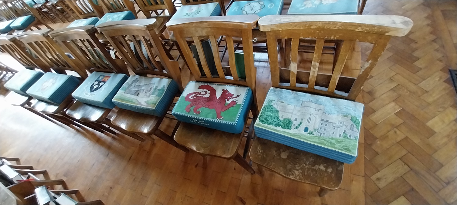
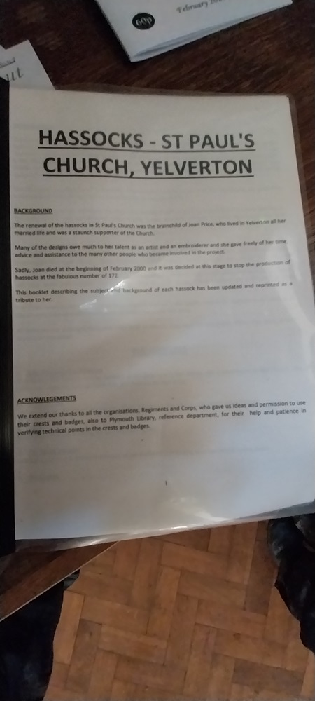
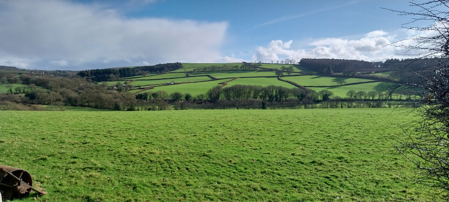
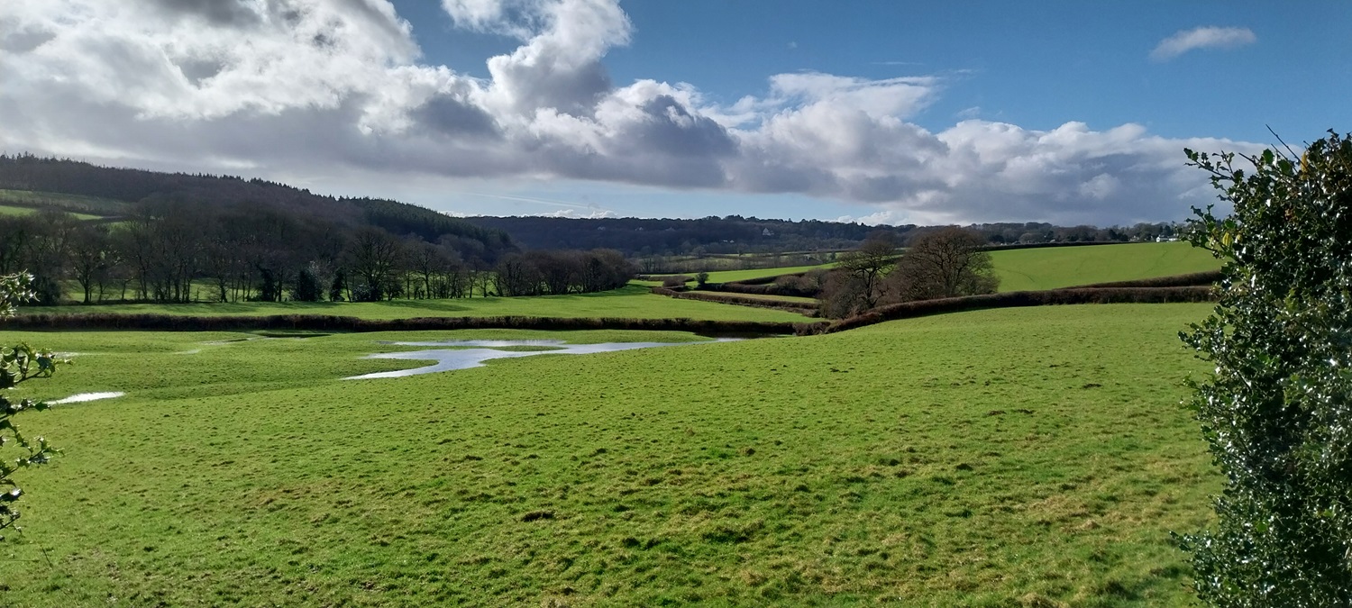
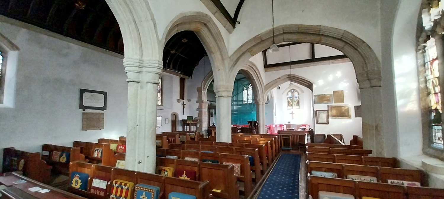
The green at Meavy, the hub of the village with the pub over there, the church behind and the 1000 year old oak tree and cross at the far end. The village hall is on my left here and the school a couple of hundred metres behind meThe cross and oak tree, the lych gate to the church to the leftWe headed towards Hoo Meavy crossing the River Meavy shortly after leaving the villageA distant Yelverton, we would be there in a couple of hoursPatchwork of fieldsThrough Olderwood Plantation towards Hoo MeavyHoo Meavy, the cottages over there were built in the 1600s for the local minersHoo Meavy Bridge, again the River Meavy belowWalking up into Clearbrook, the Skylark pub aheadClearbrook, a linear village. Peek Hill in the distanceThe other way to Lee MoorBack down to Clearbrook, sunshine and clouds passing overheadWe’d joined the path towards Yelverton now, which handrails the Drake’s Leat, built by Sir Francis to bring water to Plymouth, but apart from a handful of houses, few benefitted. Instead it was used to power mills owned by DrakeThe daffodils are outA large bracket fungus (a southern bracket I think)Drake’s Leat, most of the leat is now not used and has been swallowed by Burrator reservoirVictoria diamond jubilee memorial with Roborough Rock behindRoborough RockOur lunch spot and two ice cream vans, not sure there was a need for one to be honest. In the distance is the tors around Great Mis TorRoborough Down, used as airfield during WW2, there were two runways here and each year there is an event to celebrate its part in the war with old cars, costumes and stalls.Yelverton Church, the camellia bush in flower to the right. This is a fairly new church for Dartmoor, built in 1913The hassocks in the church had been individually made and each one different, they depicted animals, scenes, emblems and local buildingsAround 170 of them
The hassocks were the brainchild of local woman Joan Price, who organised the making of them.
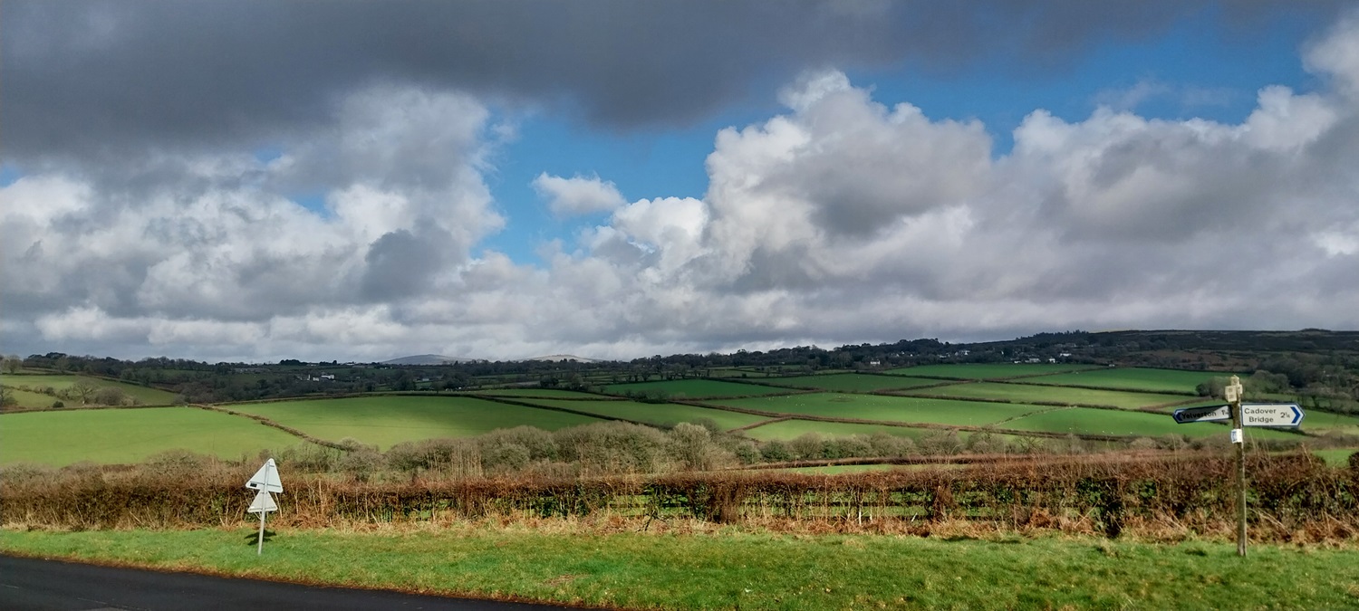
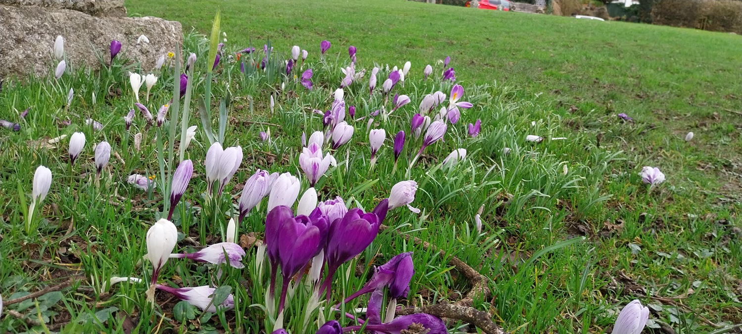
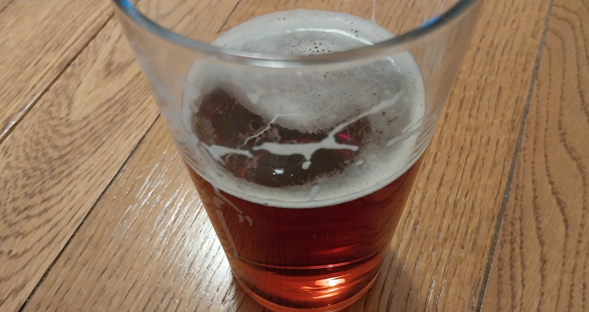
An old George V postbox as we walked back towards MeavyGlorious views with Meavy church sticking up bottom centreMore patchwork fieldsSome large puddles at the lower parts of the fields showing the recent rainGeorge VI postbox as we entered MeavyInside Meavy church, this one is considerably older, from Norman times (1066-1244) and the oak outside is said to have planted at a similar time to the building of the churchThe Royal Oak pubCrocus on the village green, plenty of spring flowers in view todayTime for a quick pint on the pub before home. Such a good area for walking around here. You could easily roam across Roborough Down or head to Doublewaters. Burrator isn’t too far away from Meavy and the West Devon Way cuts through this area giving a good long distance path to try out. With the weather as good as it was for us, it is a lovely place to be.
12 thoughts on “Meavy, Clearbrook and Roborough Rock”
So good to see blue skies! The whole world lights up, doesn’t it? Is Hoo Meavy a hill? The name is strange to me. Love to see hand sewn and tapestry hassocks in a church.
It was so good to finally get some walking in the sunshine, back to rain again now though. Hoo Meavy is just a small village between Meavy and Yelverton, there used to be a mine their and a chapel but both have gone now. The hassocks were brilliant and cleverly done
If you walk the edge of the main moor you can get some lovely scenery, mixing villages, lanes, patchwork fields and then some granite rock and moorland settings. I love these parts of the moor
Enjoyable read, Meavy village green had me humming ‘ village green preservation society’ a snapshot of all that is quaint and good about the English countryside, long history and simple pleasures.
Its a cracking little village, good food and beer in the pub, historic church, cross, old oak, school and village hall/ Right on the edge of Dartmoor. Perfect
Never knew that Drake also built these least or that he owned mills etc. Pint at the end of the walk. Have to have a think about that for the walk when we meet up!
Story goes that Drake rode a white horse ahead of the water as they opened the leat. Definitely happy with a pub at the end of our walk, before we head back down. I’ll be taking my laptop away with me so I’ll be keeping an eye on the weather for Blorenge or Ysgyryd Fawr


So good to see blue skies! The whole world lights up, doesn’t it? Is Hoo Meavy a hill? The name is strange to me. Love to see hand sewn and tapestry hassocks in a church.
LikeLiked by 1 person
It was so good to finally get some walking in the sunshine, back to rain again now though. Hoo Meavy is just a small village between Meavy and Yelverton, there used to be a mine their and a chapel but both have gone now. The hassocks were brilliant and cleverly done
LikeLiked by 1 person
Nice walk. You already have crocus 😊.
LikeLiked by 1 person
Yes the weather has barely dropped below 10 degrees this winter down here so the flowers are well underway
LikeLiked by 1 person
That looks quite bucolic. You have so much to explore up there.
LikeLiked by 1 person
If you walk the edge of the main moor you can get some lovely scenery, mixing villages, lanes, patchwork fields and then some granite rock and moorland settings. I love these parts of the moor
LikeLiked by 1 person
Enjoyable read, Meavy village green had me humming ‘ village green preservation society’ a snapshot of all that is quaint and good about the English countryside, long history and simple pleasures.
LikeLiked by 1 person
Its a cracking little village, good food and beer in the pub, historic church, cross, old oak, school and village hall/ Right on the edge of Dartmoor. Perfect
LikeLiked by 1 person
It looks it!
LikeLike
Never knew that Drake also built these least or that he owned mills etc. Pint at the end of the walk. Have to have a think about that for the walk when we meet up!
LikeLiked by 1 person
Story goes that Drake rode a white horse ahead of the water as they opened the leat. Definitely happy with a pub at the end of our walk, before we head back down. I’ll be taking my laptop away with me so I’ll be keeping an eye on the weather for Blorenge or Ysgyryd Fawr
LikeLike
Plenty of other walks I have in mind for when we meet up
LikeLiked by 1 person