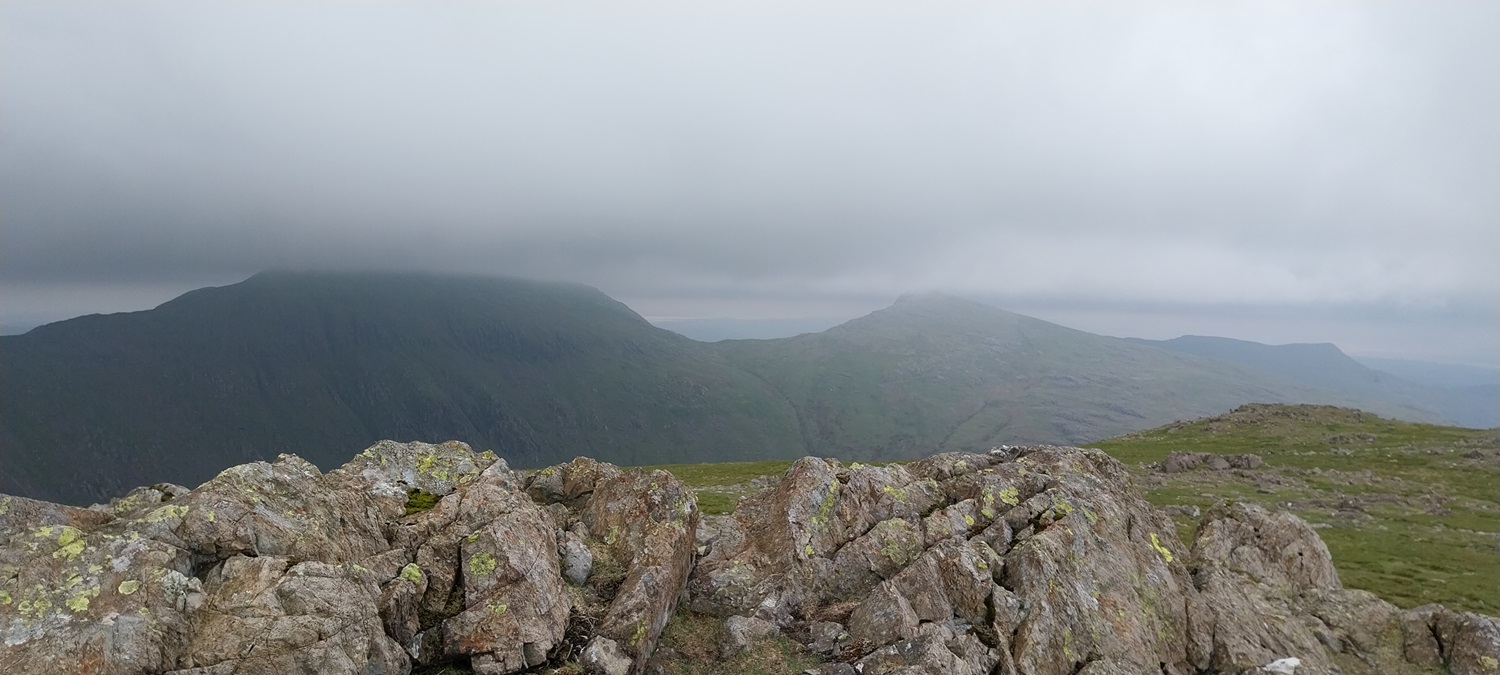
After a day around Ambleside we headed off to bag my last Southern fell, in Grey Friar. I’d looked at various routes up to Grey Friar and done a couple of walks of the Coniston Fells that could have taken it in, but in the end it was left as a solo fell, needing to be bagged. Linda hadn’t been up either Swirl How or Great Carrs so the clear decision was a walk from Wrynose Pass, heading up Wet Side Edge. You start high at the top of the pass and the path up to the edge, zigzags steeply up, leaving you a nicely climbing path to the summit area of Great Carrs. Before reaching the summit, you branch off to the right heading to Grey Friar. This is another simple climb to the summit with views to Seathwaite, Duddon estuary, Wrynose Bottom and to the Scafells, that’s if the weather plays ball. The view for us however got poorer as we climbed, eventually it dropped down to the summit, as we left and stayed down during our visits to Swirl How and Great Carrs. On Swirl How a gentleman arrived at the summit, we got talking about his route and he had a guide book with a rough map showing his route. He’d done well to find his way up the Prison Band to the summit, in low cloud. His next fell was Dow Crag, he then looked at the paths and set off towards Great Carrs. I pointed him the correct way, and after he’d dithered a while, I eventually convinced him using my GPS maps. We then headed off to Great Carrs and then down to Wet Side Edge again, with the cloud rising a little as we did. All that was left was the simple zigzags down to Wrynose and the final Southern fell was in the bag, number 208 for me. This leaves me with 2 Northern, 3 Eastern and one Western fell to do. Next we would head out east.
Start – Wrynose Pass
Route – Wet Side Edge – Little Carrs – Grey Friar – Swirl How – Great Carrs – Little Carrs – Wet Side Edge – Wrynose Pass
Distance – 5 miles Start time – 10.15am Time taken – 4hrs Highest Point – Swirl How 802 metres
Weather – Lots of cloud which lowered in the middle of the walk, some bits of sun but not much
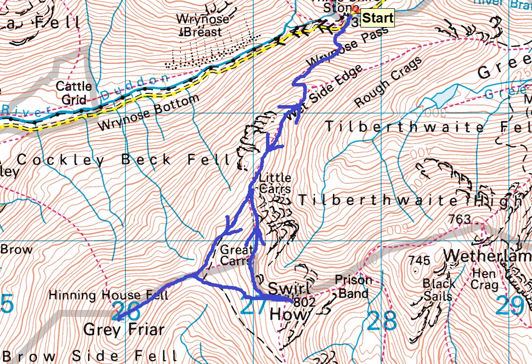
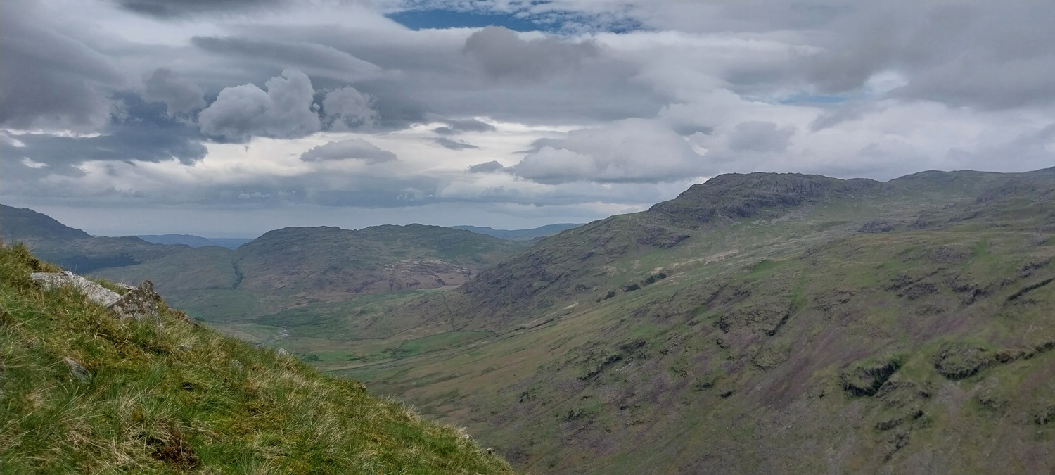
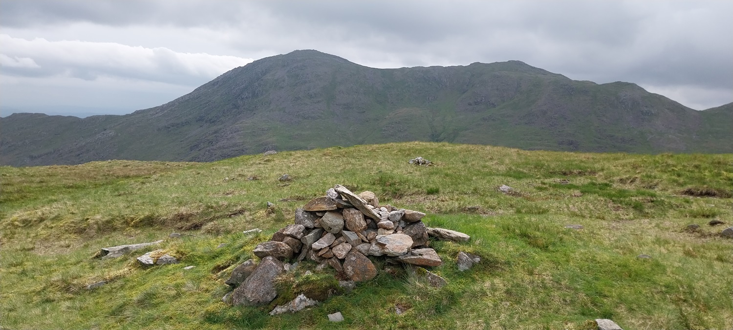
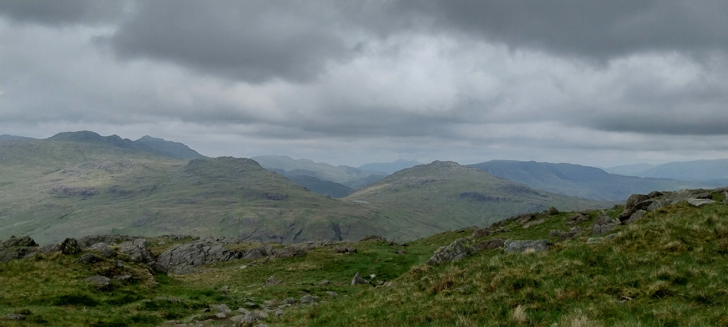
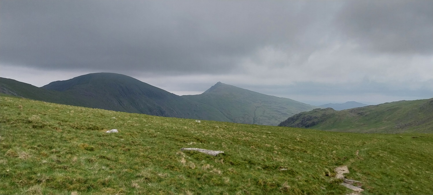
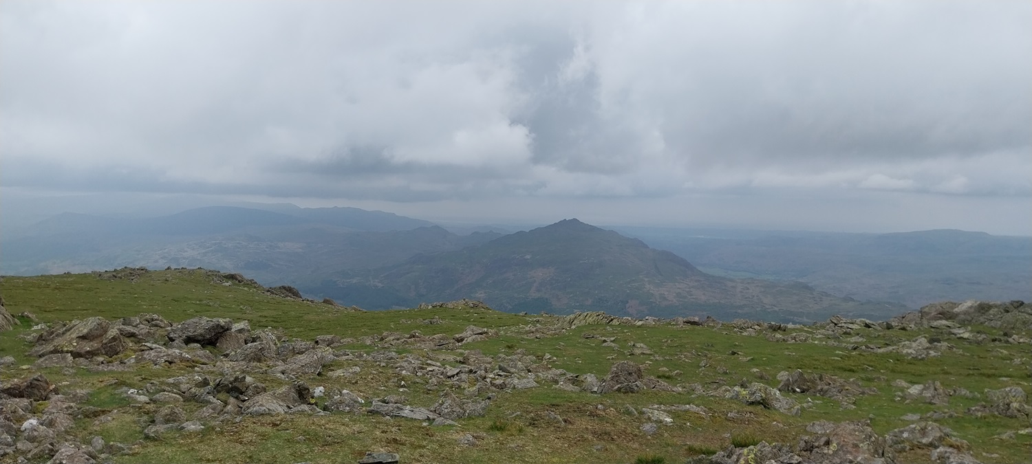
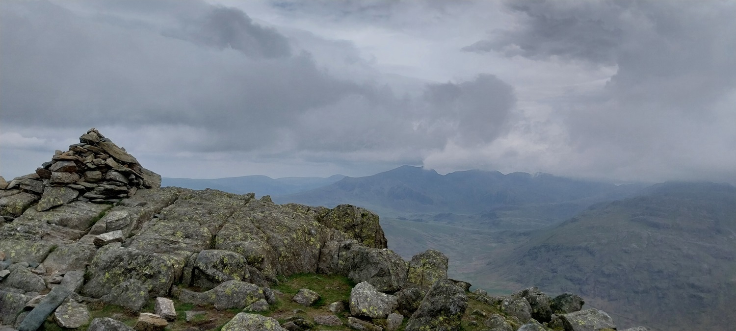
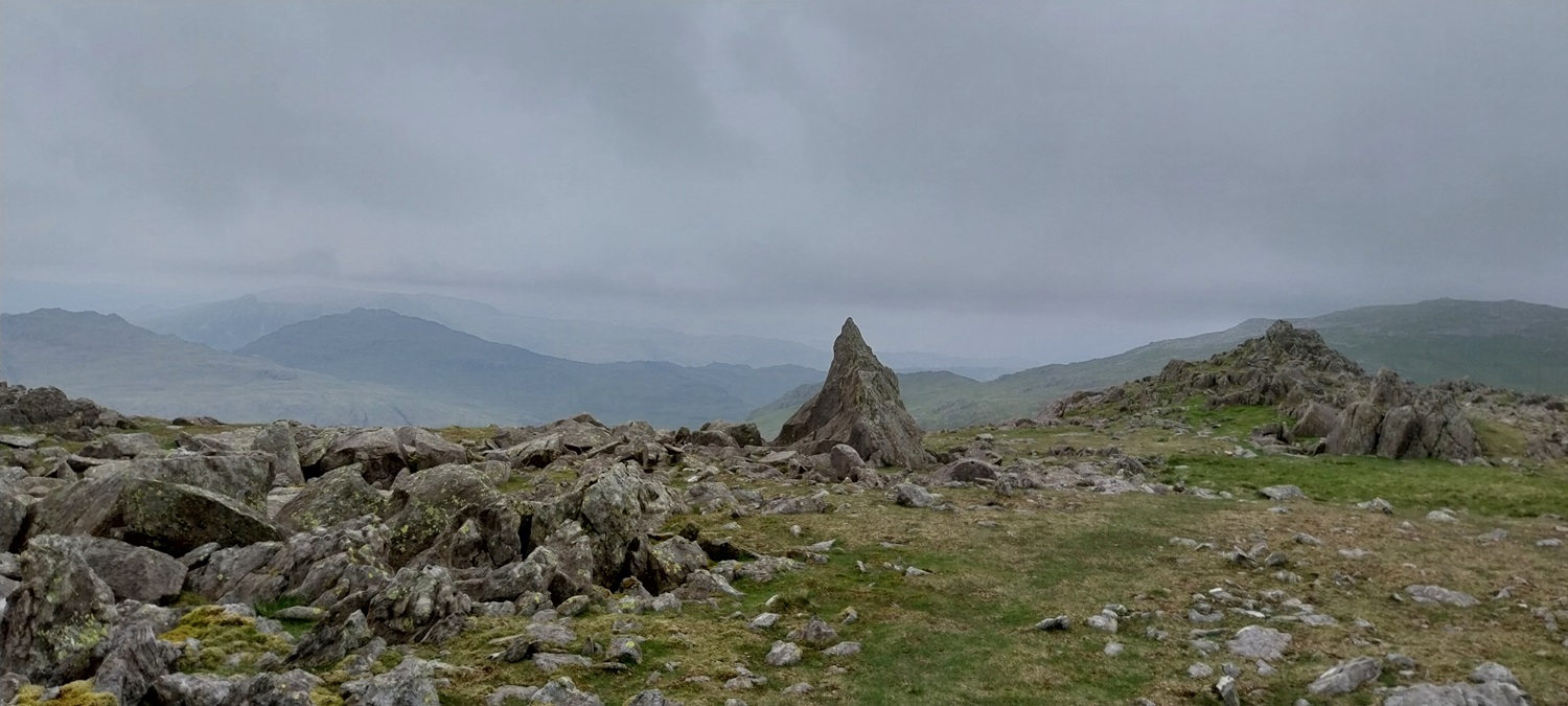
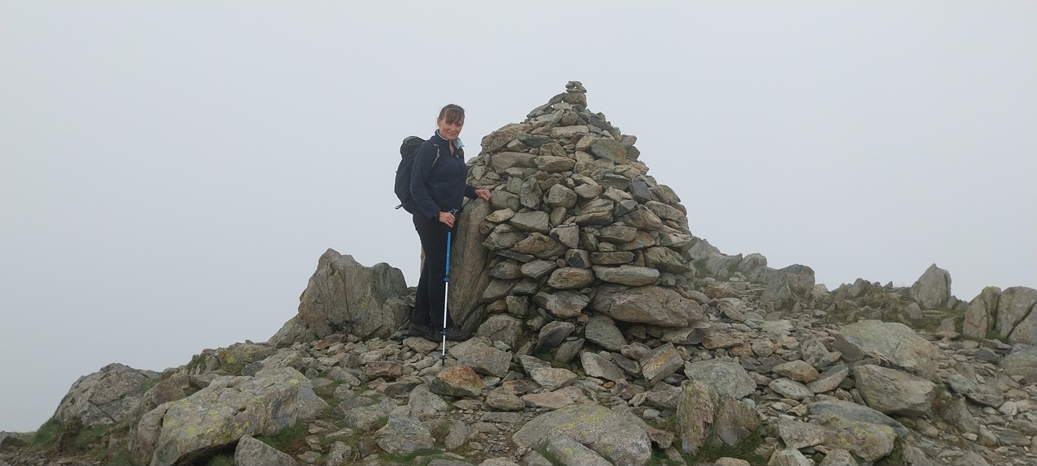
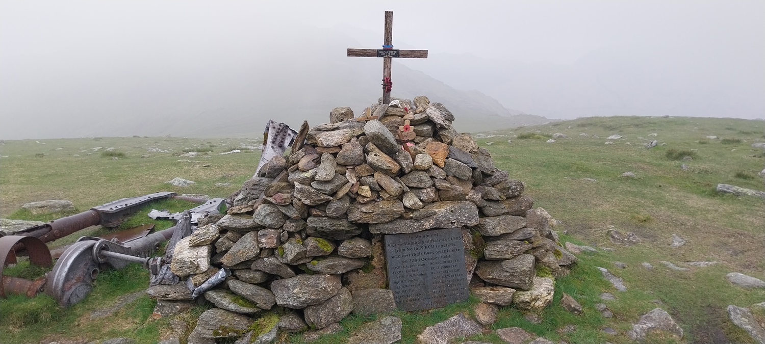
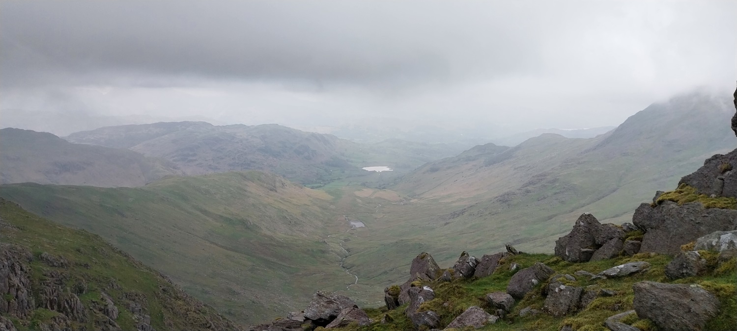
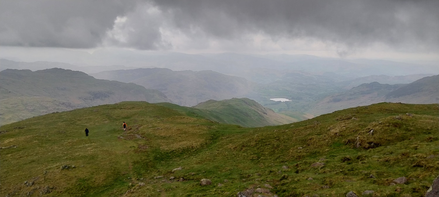
A bit of sunshine as we parked up at the top of the Wrynose Pass, there are a few spots up here, but probably no more than 12 cars can park. We parked in one of the layby spots slightly off the top of the pass, and walked to the Three Shires stone here, the path to Wet Side Edge start from here, as well as one in the opposite direction towards Cold Pike/Pike O’BliscoLooking down the Wrynose Pass into the Langdale side, the views improve and lengthen as you climbPike O’Blisco on the right, Cold Pike is left with Crinkle Crags peeking up behind it. Away at the back is the mighty Bowfell.Wrynose Bottom and the dark looking Harter Fell on the left, with Hard Knott to the right, in between the two is the Hard Knott passReaching Wet Side Edge you can see Helvellyn in the distanceOn the other side of Wrynose Bottom is Little Stand, at over 700 metres it is an odd omission from Wainwright’s listThe cairn on Wet Side Edge, showing where the path drops down to the Wrynose Pass, Wetherlam stands proud as we turn right to head up the edge.Wet Side Edge, Great Carrs and then Swirl How. Prison Band falls down to the left from Swirl HowThe valley of Greenburn and its tarn down to the right, in the distance is Little Langdale TarnA sunny Cold Pike (and Little Stand), with some moody fells behind. The Scafells are on the left at the back, the Crinkles and Bowfell just to the right looking even darkerA bit further right, with the Crinkles back left this time. The sliver of water is Red Tarn, in the dip between Cold Pike and Pike O’BliscoHeading up Wet Side Edge, Wetherlam over on the left hand side. Little Carrs is ahead of us, we would head there and then branch off rightAgain Cold Pike, Little Stand and the Crinkles all seem to merge together. The Scafells are at the back as we contour over towards Grey Friar.As you near the col between Grey Friar and Swirl How you get views down to Seathwaite. Troutal Fell is the crag sticking up on the hillside over there. Dow Crag is the pointy fell in the centre, left is Brim Fell with the cloud dropping down to near its summit.Ahead is Grey FriarAs we reached the summit of Grey Friar we see that the cloud has dropped on Brim Fell and Dow CragThe other direction is Harter FellGrey Friar summit cairn, the Scafells have the clouds swirling around themThe Matterhorn rock on Grey Friar as we started out for Swirl HowLinda at Swirl How, the cloud has dropped all around.Seathwaite Tarn in the distance as the cloud rises and fallsThe memorial to the Halifax bomber on Great Carrs, all 8 crew members died in October 1944Great Carrs summit ahead.Cloud swirling around the summit of Great Carrs and Swirl HowGreat Carrs summit selfieGrey Friar just coming out of the cloud, pointy Harter Fell at the backAll along Greenburn, the beck wriggles away through the tarnsPassing Little Carrs we drop down along Wet Side Edge, with Pike O’Blisco coming into viewWet Side Edge, Little Langdale Tarn in the distanceLinda dropping down into WrynoseThe top of the pass below, a few cars parkedCold Pike left and Pike O’Blisco rightThe path which heads up towards Red Tarn and Cold Pike as we reach Wrynose PassWalking back to the car along the Wrynose Pass at he end of the walk. Number 208 in the bagDriving back down the Wrynose Pass we followed this group of herdies pretty much the whole length. A fun end to a great walk. Next we would head east to Patterdale.
Three unheralded fells and when walked from Wrynose they make a nice 3 or 4 hour walk. The other option would be to add in Wetherlam up its edge and pick off these 3 and back down the full Wet Side Edge
Grey Friar is the highest of the Lakeland mountains I’ve never done. Been in around the area a couple of times recently and thwarted by dreary weather and forestry hassle. Always looks a decent view point out on its own and I should have wandered out to bag on one of my many rounds of the Coniston Fells
It is one that gets missed off as a lot of people turn and head down Prison Band heading for Wetherlam. It gives some great views into Eskdale and Scafells from the top


Nice up there.
LikeLiked by 1 person
Three unheralded fells and when walked from Wrynose they make a nice 3 or 4 hour walk. The other option would be to add in Wetherlam up its edge and pick off these 3 and back down the full Wet Side Edge
LikeLiked by 1 person
Another great walk. It is a shame the weather wasn’t that good.
LikeLike
I’m delighted to see swirling up on Swirl How because that’s a great name for a fell.
LikeLiked by 1 person
Grey Friar is the highest of the Lakeland mountains I’ve never done. Been in around the area a couple of times recently and thwarted by dreary weather and forestry hassle. Always looks a decent view point out on its own and I should have wandered out to bag on one of my many rounds of the Coniston Fells
LikeLiked by 1 person
It is one that gets missed off as a lot of people turn and head down Prison Band heading for Wetherlam. It gives some great views into Eskdale and Scafells from the top
LikeLiked by 1 person
No idea how I missed this one! Nice report and useful too as I still have these to do (except Swirl How which I did years ago)
LikeLiked by 1 person