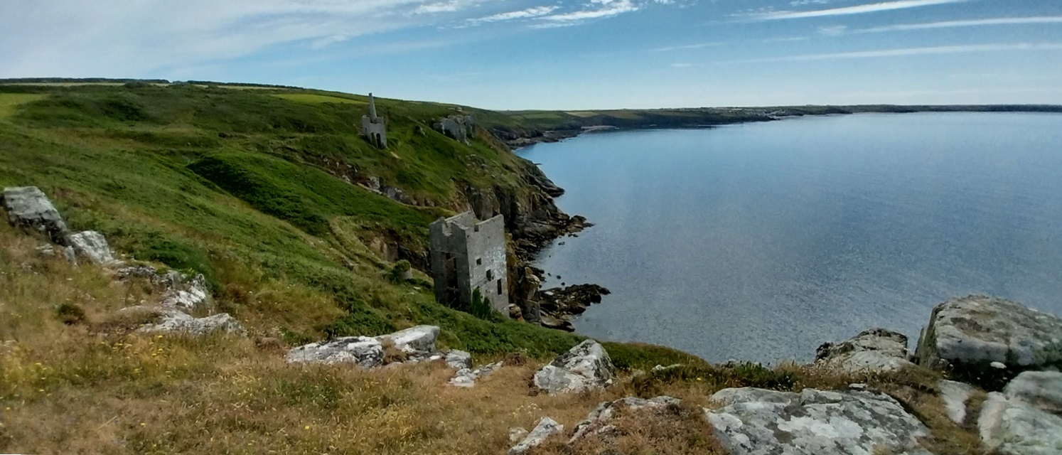
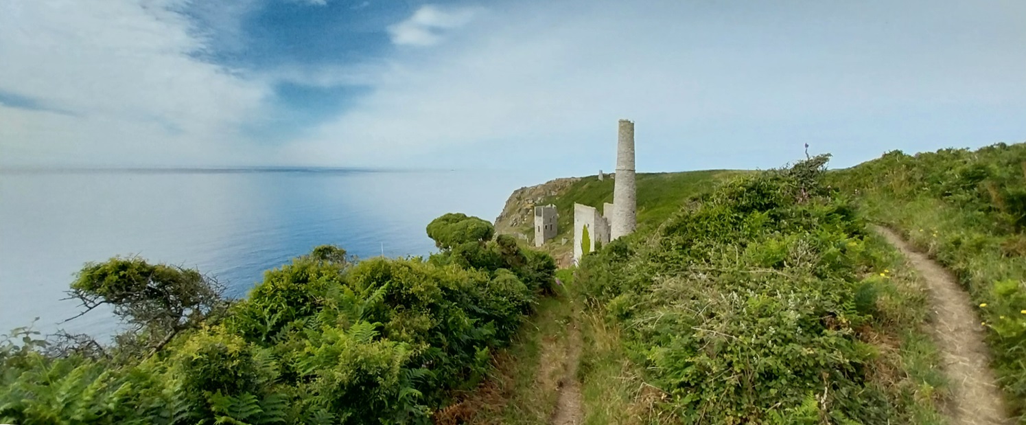
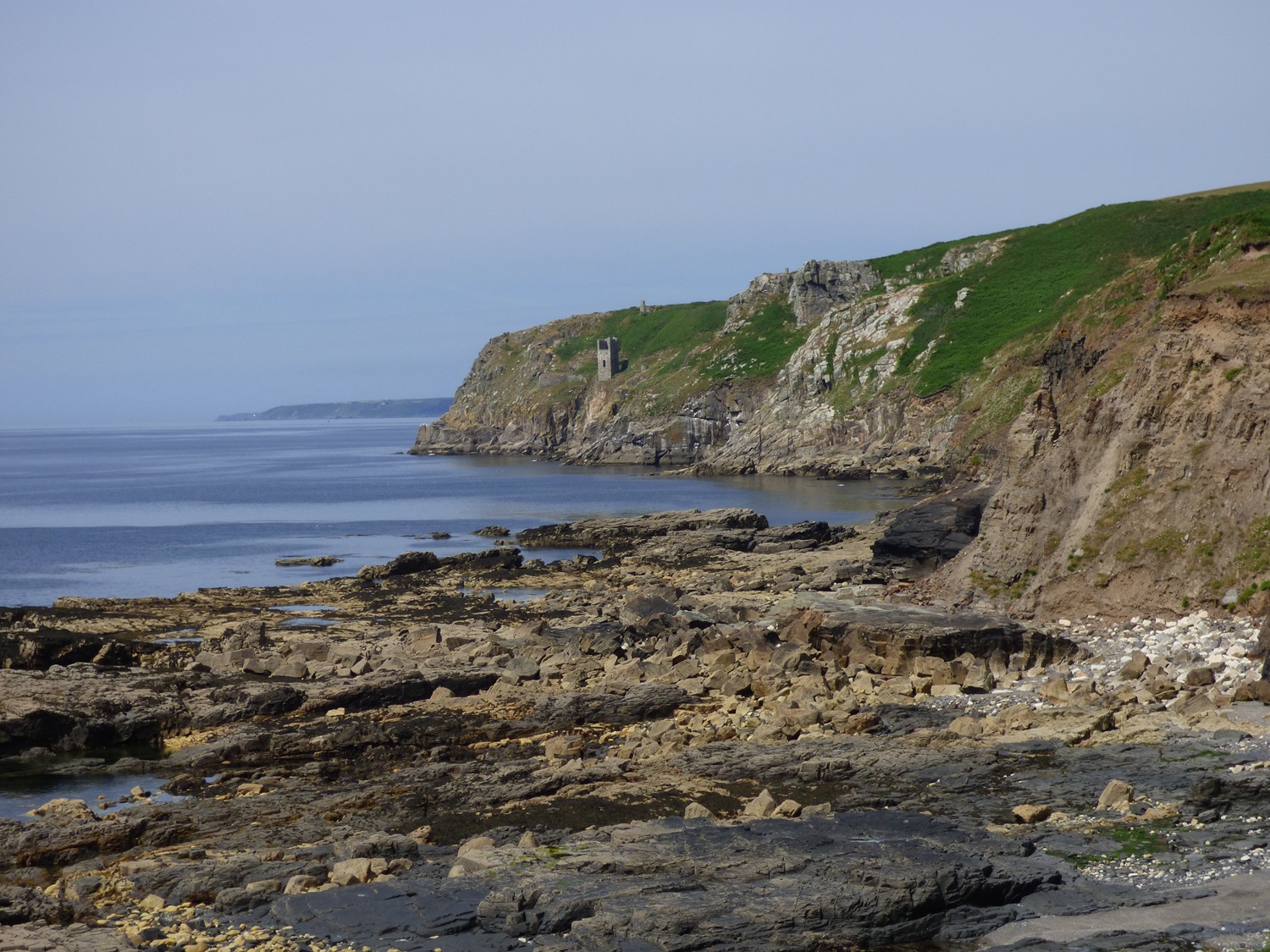
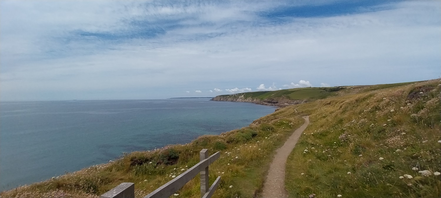
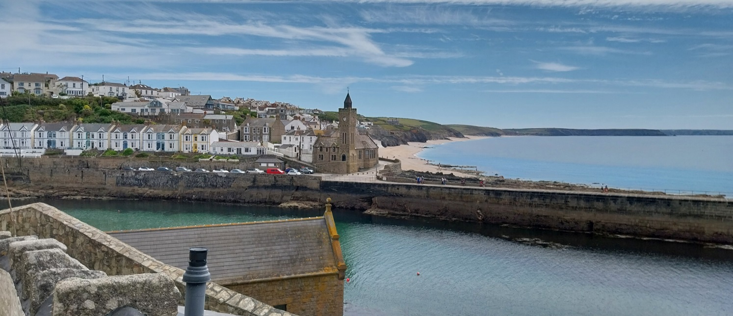
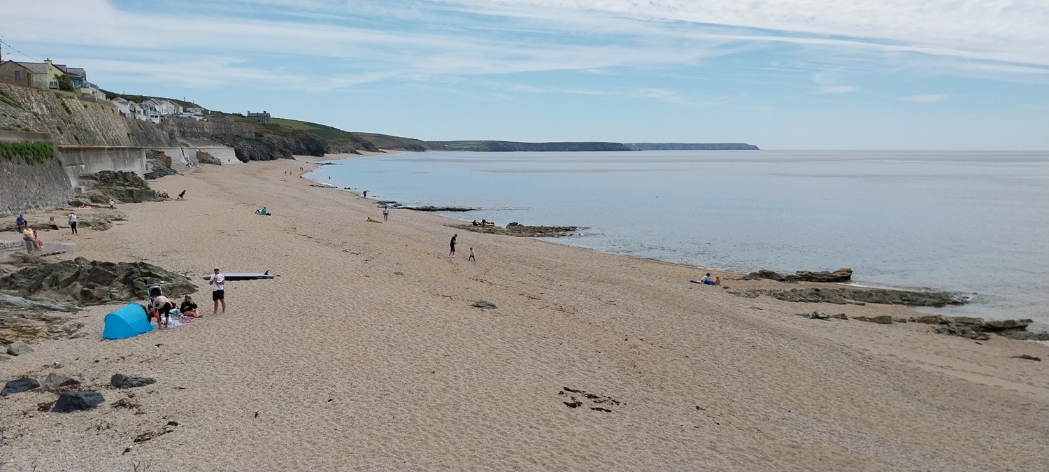
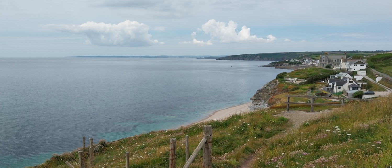
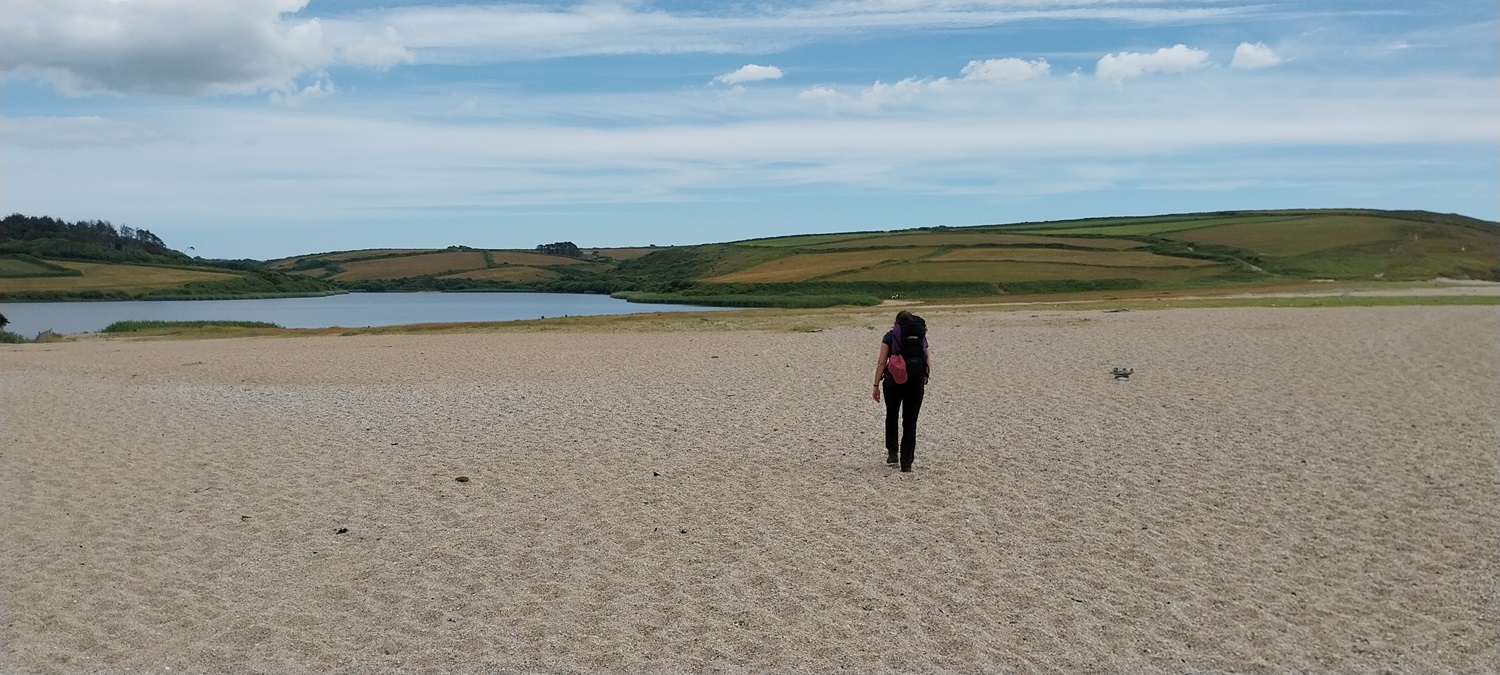
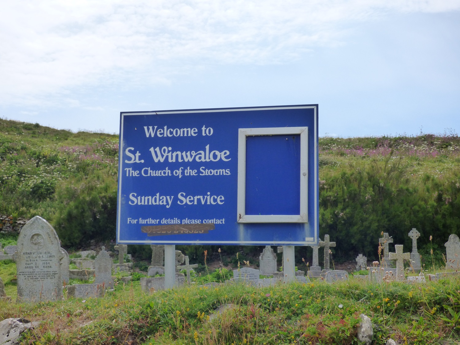
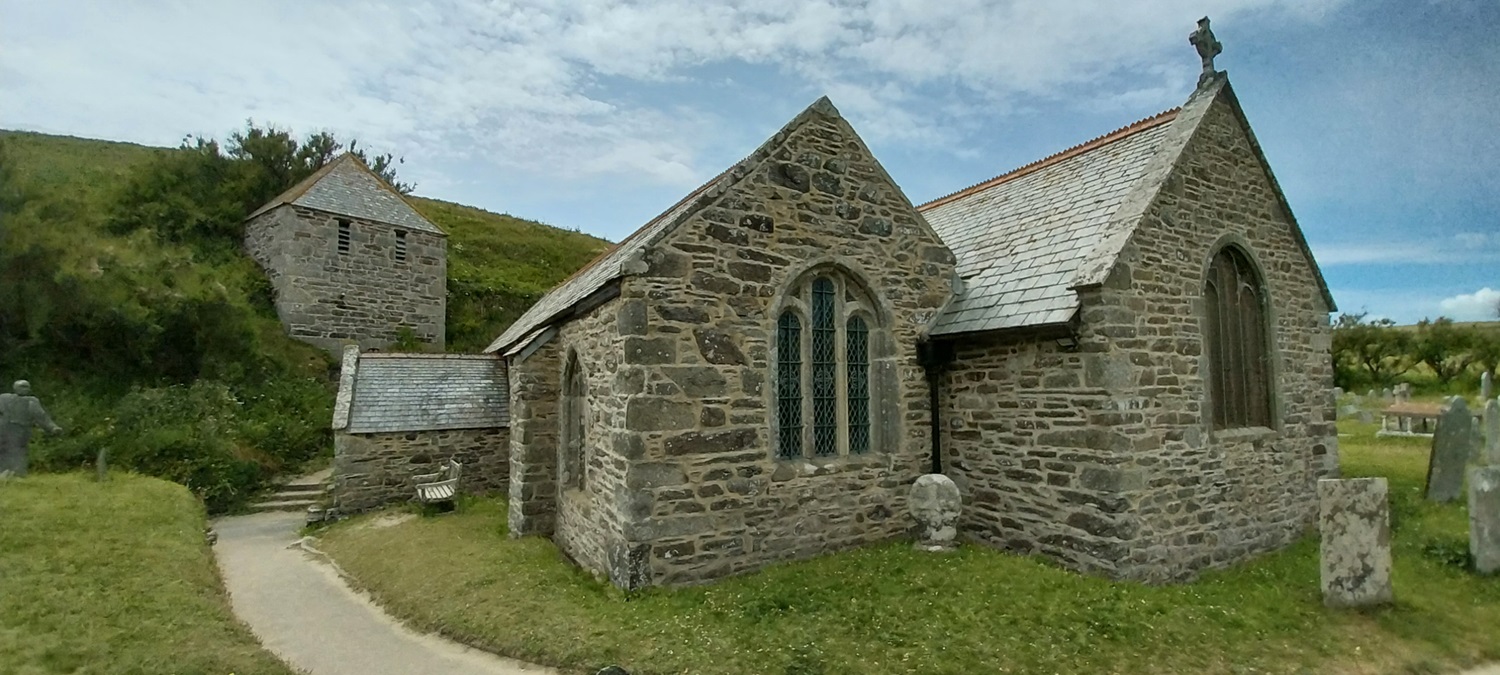
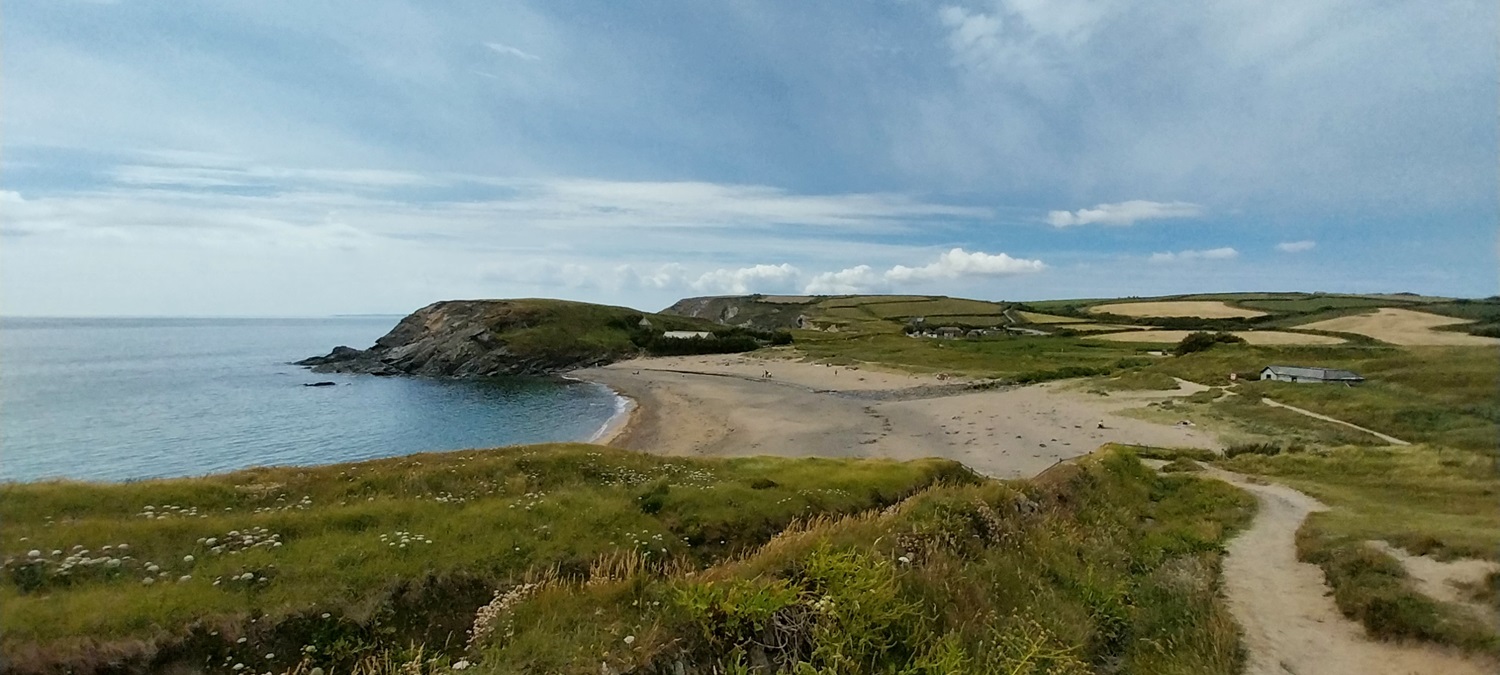
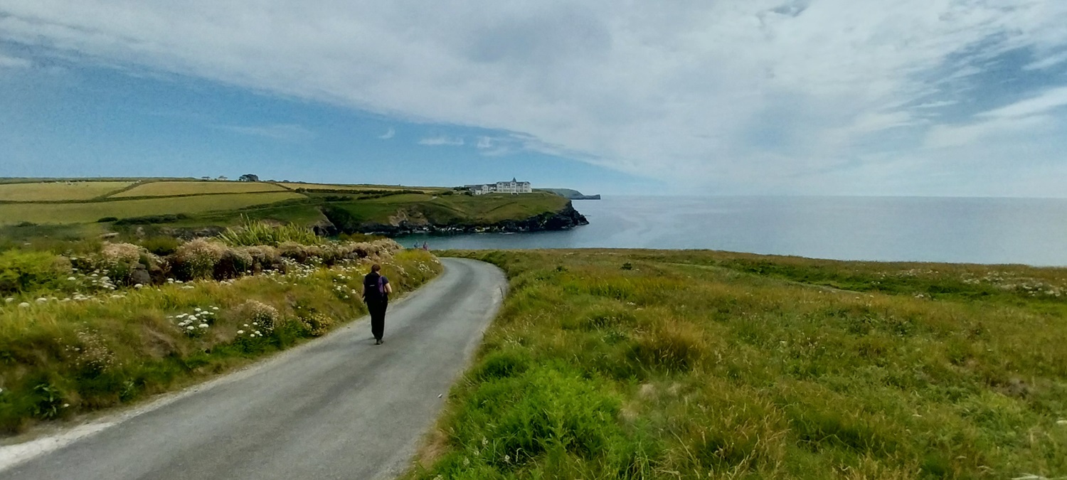
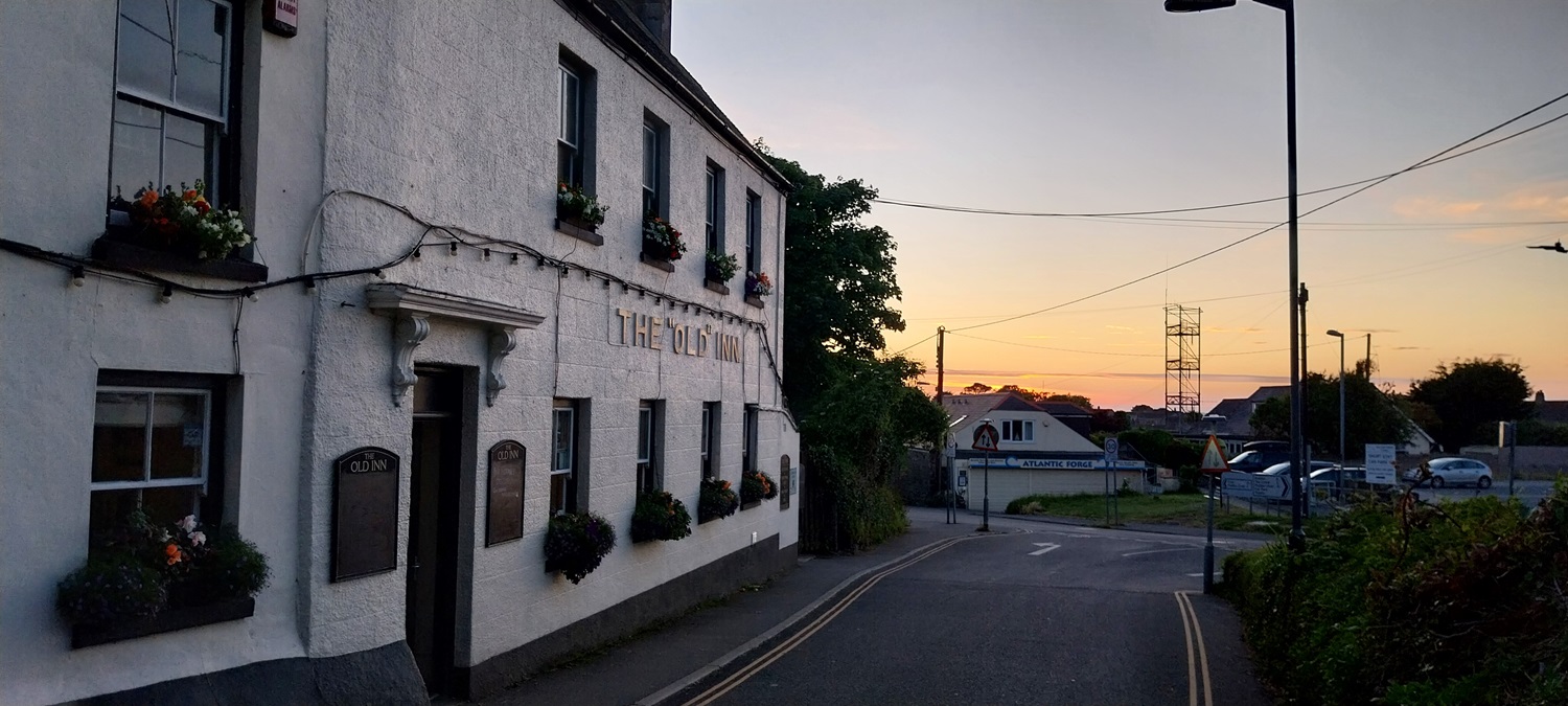
So, day 2 of our walk from Penzance to Lizard Point and we leave our little overnight cottage in Rinsey Croft, heading for Mullion and specifically the Old Inn, where we had a night booked. The distance would be exactly the same as the day before, but with no driving before the walk it felt an easier day. Also, like day 1, there was very little rise and fall in the path, and certainly no huge drops followed by 100 metre climbs. We left Rinsey Croft in cloudy conditions, but turning at the NT car park at the bottom of the road we saw blue sky ahead, in fact there was a clear line drawn between the cloud and the sunshine and we had just a short walk to hit the rays. First though we hit two tin mins and the engine houses associated with this trade, they looked superb against the blue seas, perched precariously of the cliff edges. Next up was Porthleven, were we picked up some food and stopped off in a cafe for cold drinks and pasties and admired the harbour. Next we walked over a slight hill and dropped down to the Loe Bar, a shorter version of Cogden Beach in Dorset, where we toiled through stony sandy ground for a mile or so. We were thankful that in 10 minutes we were across the Bar and heading for Gunwalloe and then the gorgeous Church Cove. The Church of the Storms at Church Cove stands hidden from the waves by a bank, its tower strangely separate from the main part of the church, the lovely beach curves around the cove inviting you in for a swim. Next up came Poldhu Cove and the Marconi Centre where Marconi sent the first radio transmitted wireless signal to St John’s in Canada on 12th December 1901. We were then heading inland from Poldhu Cove to Mullion to our pub accommodation, with England vs Denmark playing that evening, we watched that in our room before eating. There was a lovely sunset that evening but we were a little too far inland to see the best of it, so we rested well ready for the next day and Lizard Point
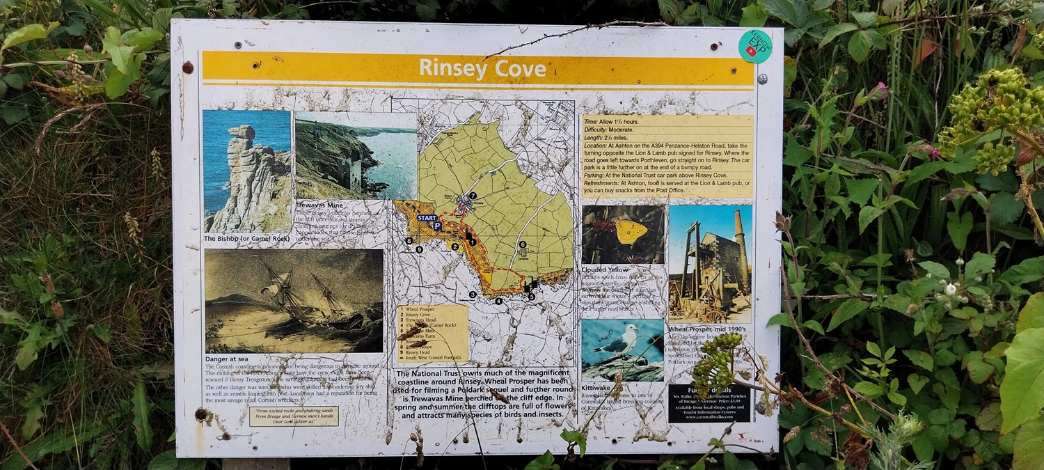
Start – Rinsey Head
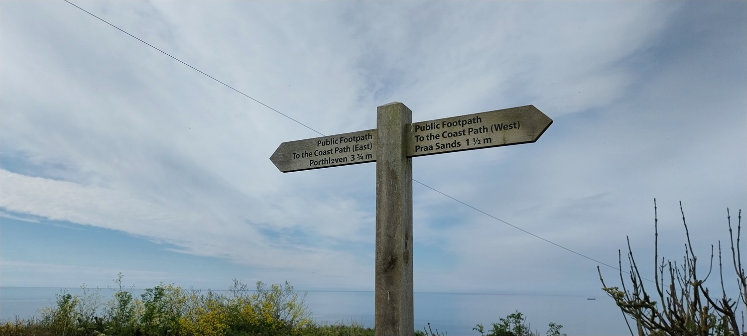
Route –South West Coastal Path – Wheal Prosper – Trewavas Head – Wheal Trewavas – Porthleven – Loe Bar – Gunwalloe – Halzephron Cliff – Church of the Storms – Church Cove – Poldhu Cove – Poldhu Point – Mullion
Distance – 10.5 miles Start time – 9.45am Time taken – 6hrs 50mins Highest Point – Rinsey Head 74 metres
Weather – More sun today than yesterday and warm, some bits of cloud
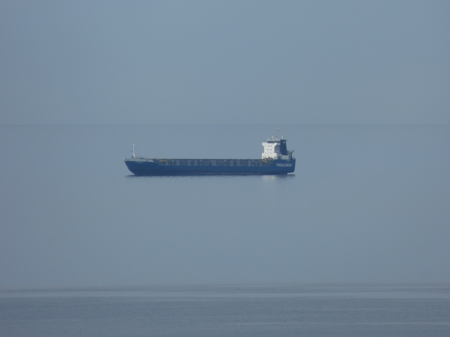
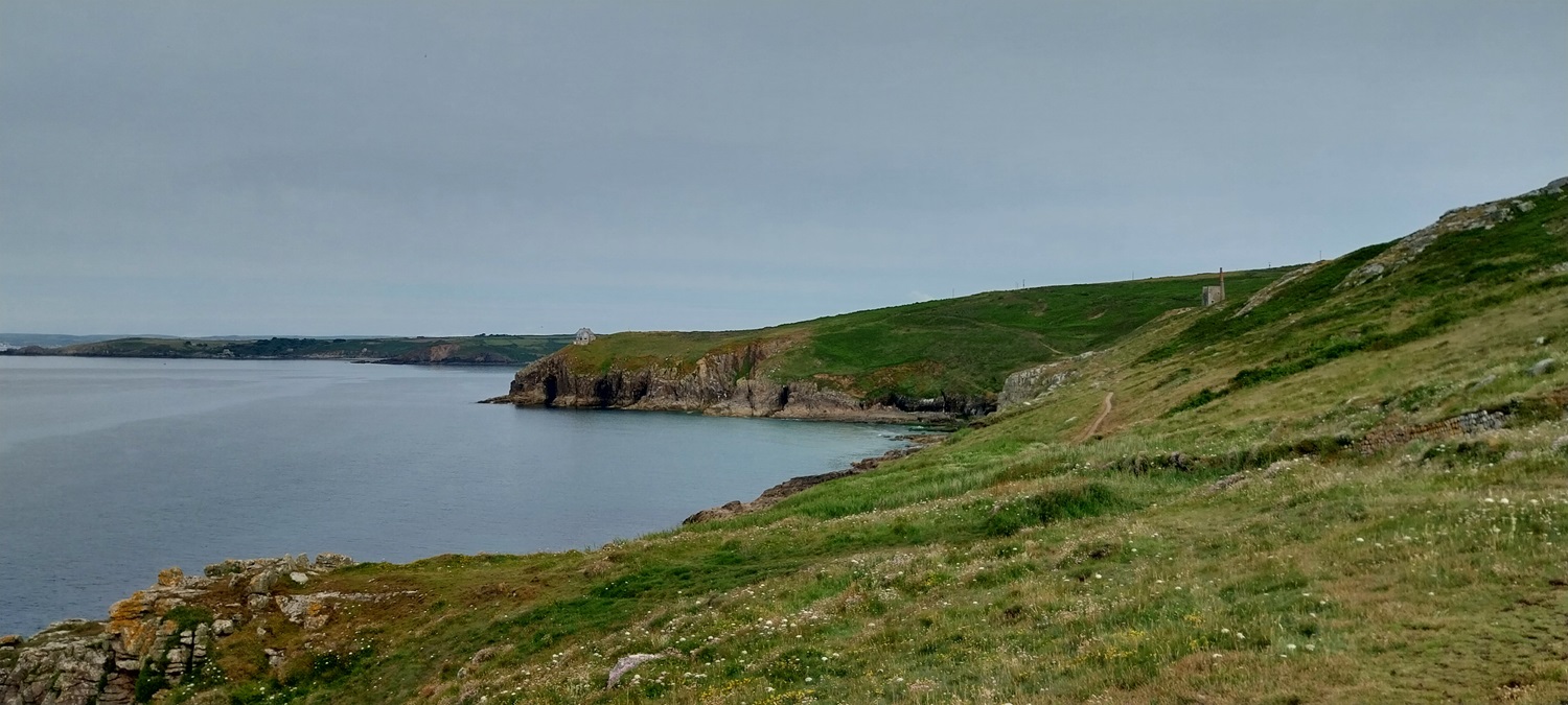
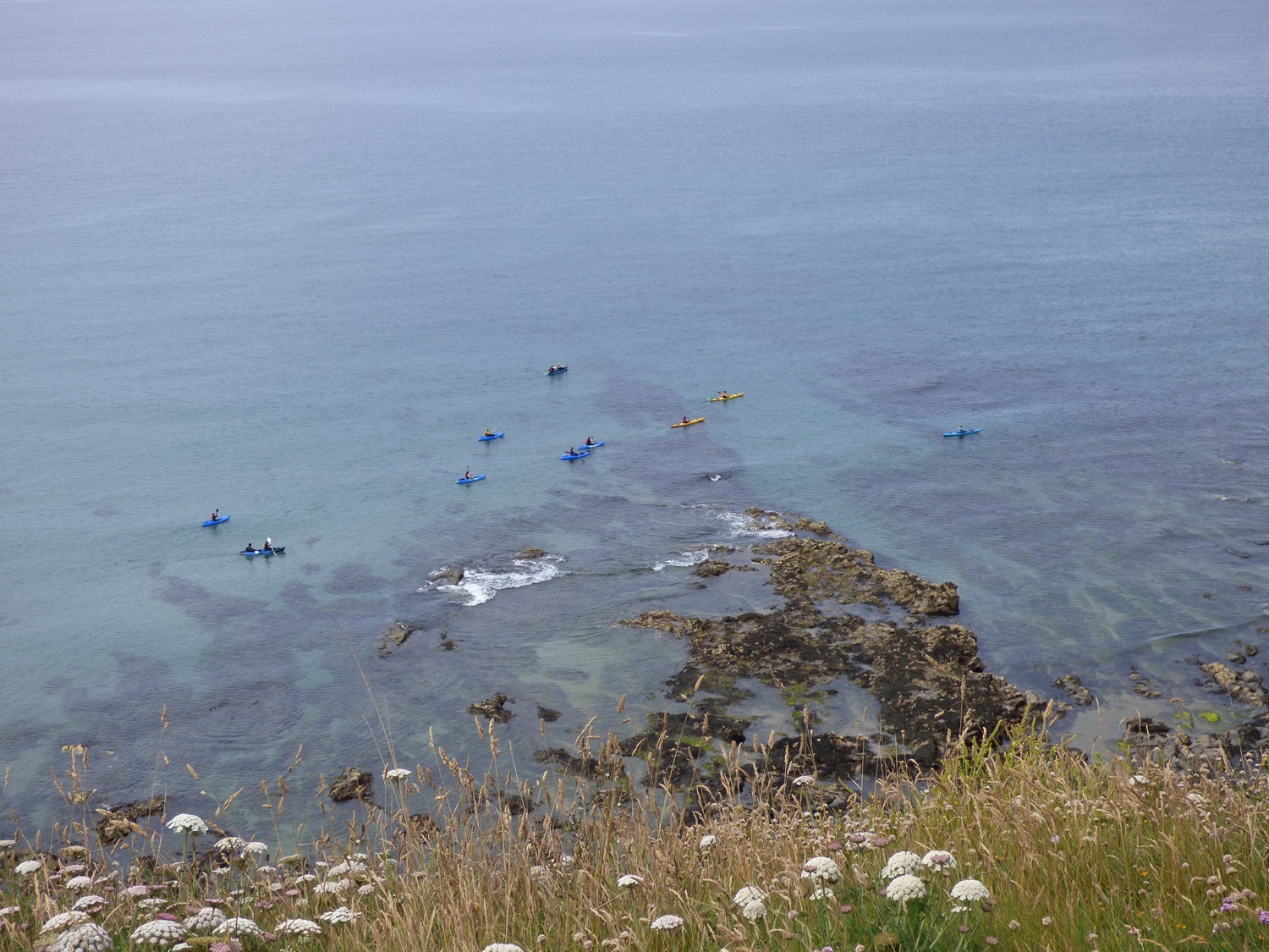
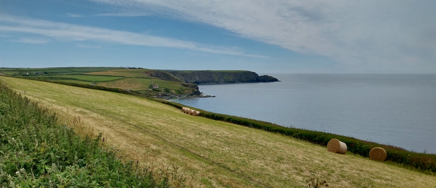
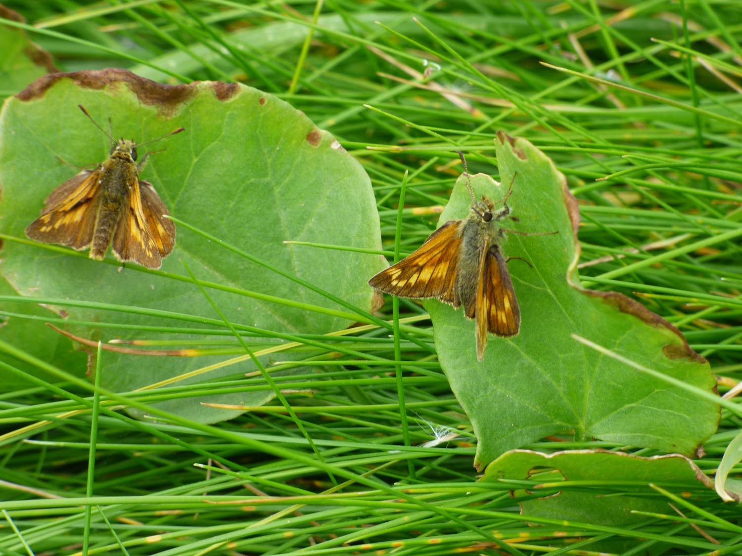
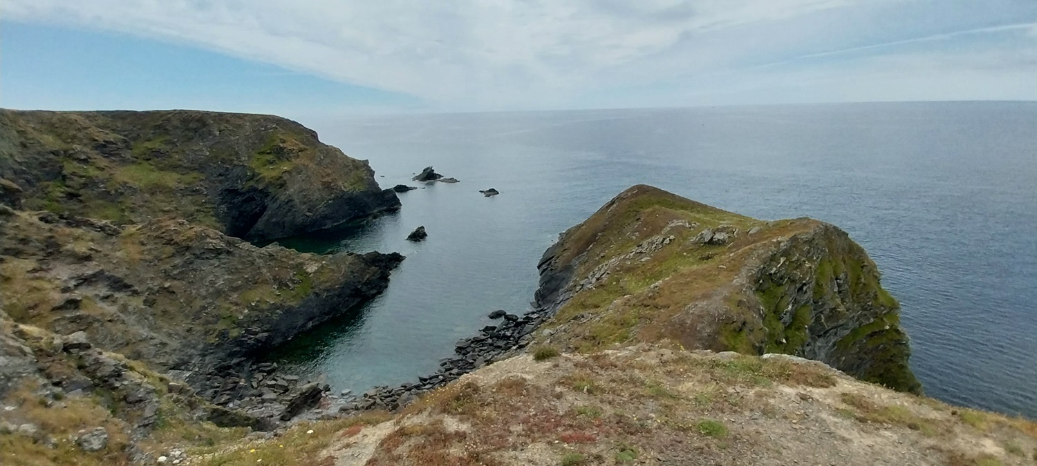
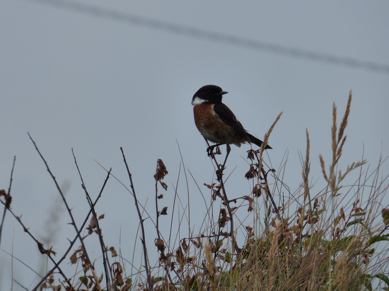
The sign regarding Rinsey Head and Cove as we walk through the hamlet of Rinsey heading back to the coastal pathQuite dull and grey to the north, Cudden Point is the nearer headland, with Gwennap Head behindOn the coastal path now and Porthleven will be our first main target, it was around 10am at this point so we reckoned lunch in Porthleven would be good.First up was Wheal Prosper, the building is Grade II listed and ran from 1860 to 1872, bringing up 55 tons of tin and 290 tons of copper ore. That’s Lizard Point at the backA floating ship, Mount’s Bay was like a millpond as we walked to Mullion.The house on Rinsey Head with Wheal Prosper on the right as we rounded Trewavas HeadCamel Rock at Trewavas Head. Porthleven now in view by the nose of the camelWheal Trewavas, this copper mine ran from 1834 to 1846, with workings heading south east out to sea, it brought up over 17000 tons of copper ore and was very successful, the mine only closed as the sea broke into the shafts and flooded the mine.Wheal TrewavasCoffee time and Linda admiring the view, the sun was getting warm nowMeadow BrownGlorious Cornish coastline to Lizard PointLooking back to Trewavas Point and Wheal Trewavas, perched on the cliffsA bit of sea kayaking, I guess these had come out of Porthleven and were heading to Praa SandsStill some thinner clouds behind us, but blue sky above us so we are enjoying the sunAs we reached Porthleven we passed this memorial to all fisherman who have lost their lives over many yearsPorthleven harbour as Great Britain’s most southerly port, the clock tower is part of the town council building and if you search the internet for Porthleven and storms you will get lots of videos and photos of the waves engulfing that clock tower, harbour wall and the the whole of this part of the coast. Winter can be challenging here in the frequent storms that batter this part of the coastPortleven harbour, we headed for pasties and cold drinks as it was lunchtime and we felt we needed to keep water levels topped up on this hot day.Porthleven SandsAnd looking back as we walk the road and then track to Loe BarLeaving Porthleven nowMount’s Bay and around to Gwennap HeadLoe Bar is below a mix of sand and small round pebbles, as you walk you sink in. Tough walking on the calf musclesPloughing through, the Bar protects the freshwater lake on the left here, called The Loe. We were heading part way up the hill on the rightA nice part of the path with the fields tilted towards the sea, the silage had been collected nicely into the normal bales and then rolled off down the hillAfter seeing a single Large Skipper the day before we now see two here at Gunwalloe. The male is on the left and female on the rightThis below is called Halzephron Cove as we climb gently to the cliffs of the same nameWe’d seen lots of these Six Spotted Burnet Moths on this day but this was the only photo I managed to grab of one, and this one clearly has been in a scrap and lost badly. Thanks to Shazza at https://sunshineandcelandines.wordpress.com/ for the correction on this.The huge curve of Mount’s BayOn the map this is called PedngwinianGoonhilly Downs and RAF Culdrose was inland at this point. Goonhilly is famous for receiving the UK’s first live transatlantic TV signal (one is Brittany was the first on this side of the ocean). The dish Antenna One (Arthur) picked up a signal from Telstar in 1962. It was also key in bringing back signals broadcasting the Apollo 11 landings, Olympic Games and Live Aid. Other dishes have been built alongside Arthur named in the same Arthurian way with Merlin (largest one), Guinevere, Tristan and Isolde.Sign for the church at Church CoveSt Winwaloe, the large bank behind on its westerly side helps protect the church from the worst of the storms. the tower at the back is separate from the main churchInside St WinwaloeGorgeous Church CoveThe huge Poldhu care home sits on the headland opposite. The tiny Marconi hut is behindI thought this was a bullfinch, but Shazza again (at https://sunshineandcelandines.wordpress.com/) correctly spotted this one as a StonechatLovely fields of wheat to finish as we made our way into Mullion. The Marconi Centre is along a path to my left hereAnd the sunset glow at the end of the day. England had drawn 1-1 against Denmark in an unassuming start to the Euros but for us we need our sleep ready for Kynance Cove and Lizard Point tomorrow.
The Church of the Storms – interesting. I would love to do the coastal walk. Beautiful part of the UK. You both certainly had some brilliant weather to walk it. Plus, it’s never too far between small villages or towns, a big bonus with walking in the Uk and Europe.
Indeed there is always a town or village every few miles for provisions or a change of scenery. The scenery certainly looks better in this weather as well, as I type it has been raining now for nearly 48 hours! In July!
I think your bird is a stonechat. Great spot! I’ve seen a few on coastal walks in scrubby bushes. Your moth could actually be a Six spotted Burnet maybe…
This looks less exhausting than the previous! I used to work in Pleumeur-Bodou satellite station in Brittany, but not I hasten to add when it was receiving signal from Telstar!
Another fine stretch of coast. In my local village we have a small collection of Satellite dishes which I believe are the backup site for whatever happens at Goonhilly
I need to catch up with your posts. I’ve got behind with my blog reading of late.
You have such a stunning coast down there. Great walking but I bet it’s hard work – all those ups and downs.
We’ve found parts that aren’t too bad, the section from Tintagel to Hartland Point is very tough, alongside the South Devon coast from Prawle Point to Wembury. But there are lots of sections that aren’t too bad to be honest and nothing more than a hilly walk


The Church of the Storms – interesting. I would love to do the coastal walk. Beautiful part of the UK. You both certainly had some brilliant weather to walk it. Plus, it’s never too far between small villages or towns, a big bonus with walking in the Uk and Europe.
LikeLiked by 1 person
Indeed there is always a town or village every few miles for provisions or a change of scenery. The scenery certainly looks better in this weather as well, as I type it has been raining now for nearly 48 hours! In July!
LikeLiked by 1 person
Tropical😄
LikeLike
It looks so very peaceful but it must be very different when those storms blow in.
LikeLiked by 1 person
When you look at the videos and photos of Porthleven ini the storms the waves are so high
LikeLike
Gorgeous walk 😍. The coast is beautiful
LikeLiked by 1 person
Its a stunning place, and looks amazing when you have some sunshine to go with it
LikeLiked by 1 person
Seems like a lifetime since I walked that.
LikeLiked by 1 person
I think your bird is a stonechat. Great spot! I’ve seen a few on coastal walks in scrubby bushes. Your moth could actually be a Six spotted Burnet maybe…
LikeLiked by 1 person
That’s definitely a stonechat, thanks for that and you are right about the 6 spotted Burnet. Love how we can all fix these things for each other
LikeLike
This looks less exhausting than the previous! I used to work in Pleumeur-Bodou satellite station in Brittany, but not I hasten to add when it was receiving signal from Telstar!
LikeLiked by 1 person
Yep Pleumeur Bodou was the first to receive the signal from the USA, and a nice badge of honour that you worked there
LikeLike
Another fine stretch of coast. In my local village we have a small collection of Satellite dishes which I believe are the backup site for whatever happens at Goonhilly
LikeLiked by 1 person
Now this is a good fact. I also didn’t mention that the longest underwater submarine cable lands at Goonhilly!!
LikeLiked by 1 person
I need to catch up with your posts. I’ve got behind with my blog reading of late.
You have such a stunning coast down there. Great walking but I bet it’s hard work – all those ups and downs.
LikeLiked by 1 person
We’ve found parts that aren’t too bad, the section from Tintagel to Hartland Point is very tough, alongside the South Devon coast from Prawle Point to Wembury. But there are lots of sections that aren’t too bad to be honest and nothing more than a hilly walk
LikeLiked by 1 person