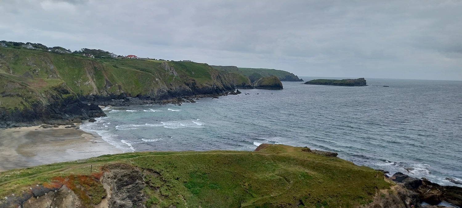
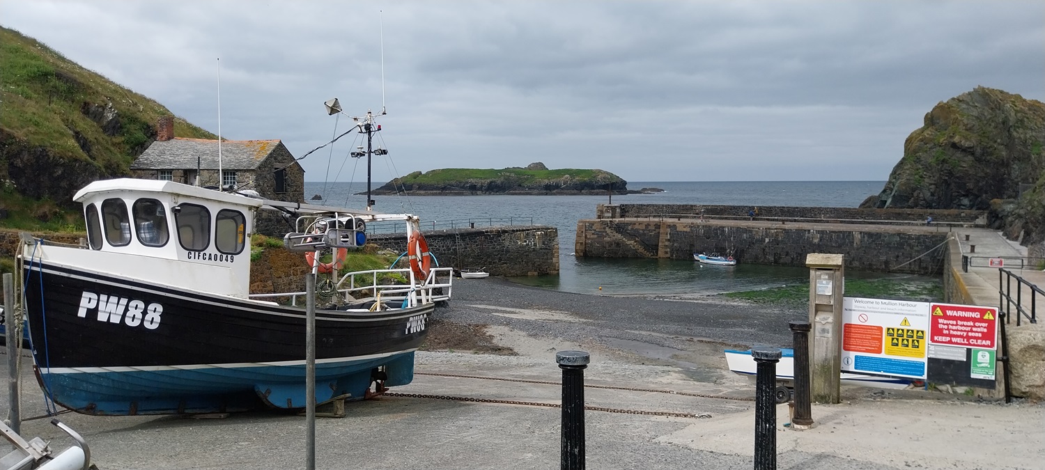
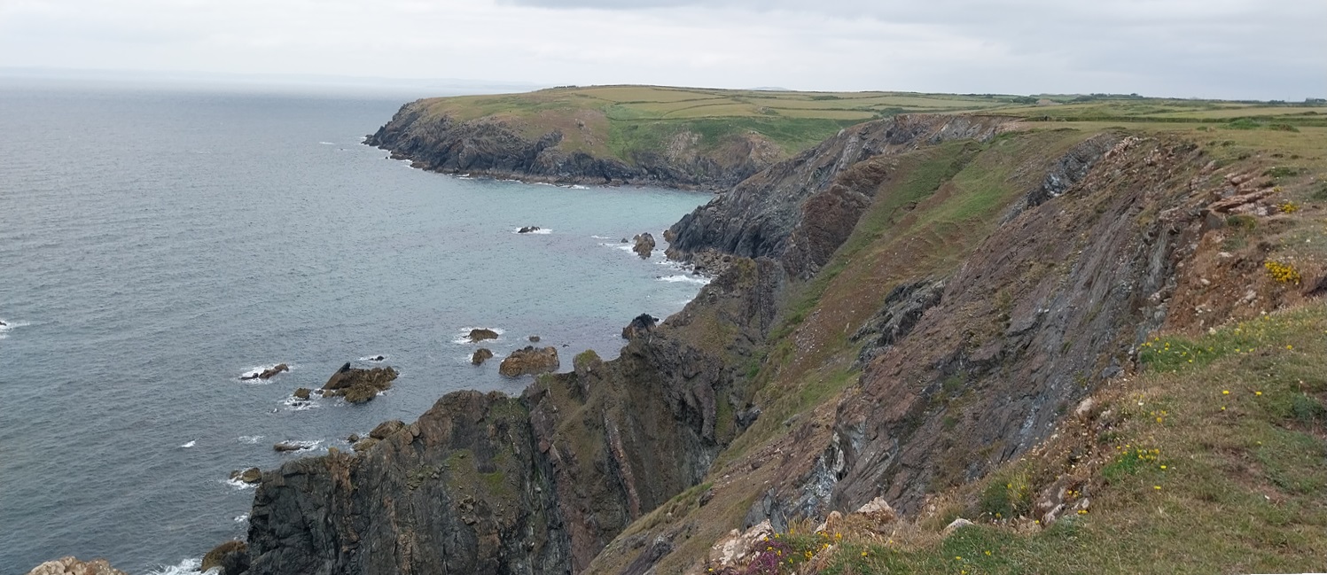
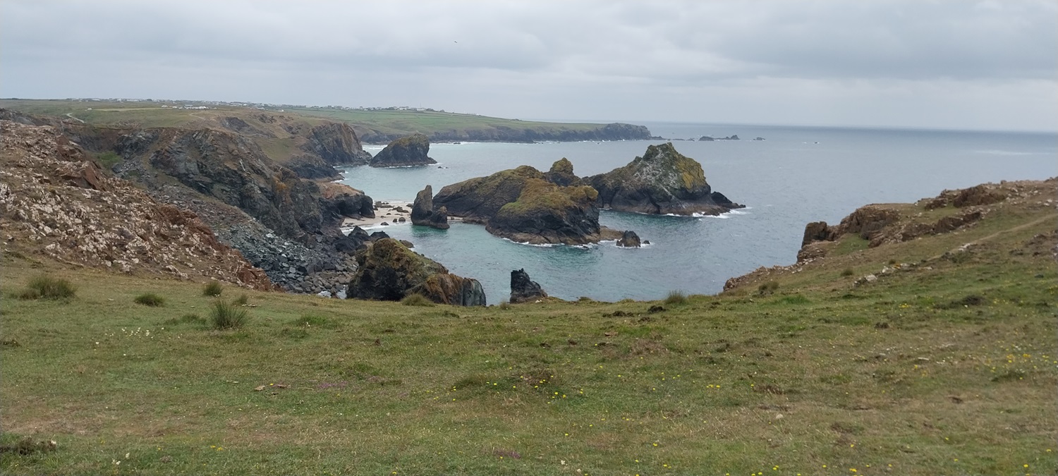
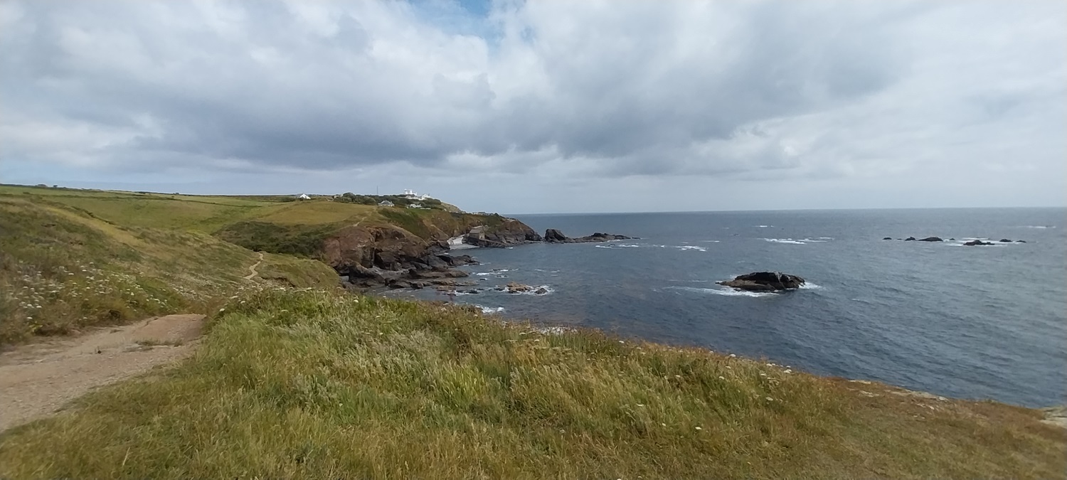
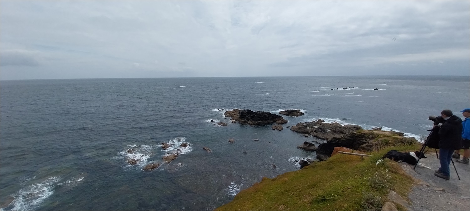
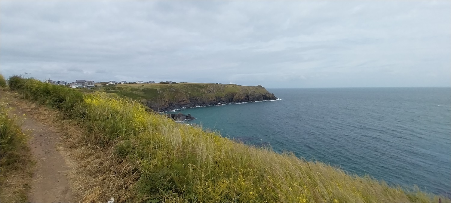
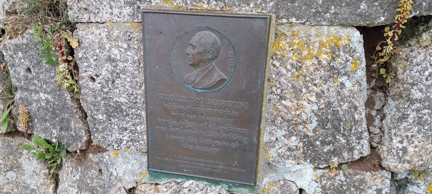
So this was day 3 and the final section from Mullion to the most southerly point in the UK, Lizard Point. Unlike Land’s End which feels like the most westerly point in the mainland, but it isn’t, the Lizard is the most southerly. The good news is the Lizard also doesn’t have the tacky fun fair approach of Land’s End, and therefore is a much nicer place to visit. The weather had been saying all week that rain would arrive at midday, but having got to this day it moved to 4pm, thankfully. The route out of Mullion followed a road and then a lane, then a path towards Polurrian Cove, before dropping down and climbing to the hotel on the other side. Next was Mullion Cove and a small cafe by the harbour, we didn’t stop at the cafe but pushed on to Ogo Dour Cove for our stop. This walk had far more rise and fall about it with drops to Mullion Cove, Ogo Dour Cove, Soapy Cove and then Kynance, which was far more than the previous two days. On our way to Soapy Cove we dodged a herd of cows before climbing to Kynance Cliff to capture the first view down to the cove. This place keeps getting voted as one of the best beaches in the UK, and with the golden sands and islands around the cove you can see why. The sunshine was starting to come out, so we saw some of the cove at its best, although the tide was in a fair way so the golden sand was mostly missing. All that was left was the walk along the path to Lizard Point. Unfortunately this path has been changed recently, as the National Trust look to control the walkers, funneling them along narrow roped paths. Now these paths have become a mess and during the wetter months it looks like they were very muddy. I think they’ve made a mistake, as when there wasn’t a roped path the traffic was spread out and caused far less erosion in one area, which is spreading badly. Having turned the corner at Quadrant we headed for the most southerly point. There were a few people around at the cafe, and others looking through the scopes at the many grey seals bobbing in the ocean. I sat with an ice cream (bought from the most southerly cafe) and we had a drink before heading around to Housel Bay and the Marconi site. This was the site were he perfected the wireless transmissions, sending signals to the Isle of Wight, before moving around the coast to Mullion to send them across the Atlantic. All that was left was the walk into Lizard itself, still avoiding the rain and we arrived in Lizard at 3.15pm. There was no bus due (except a school bus at 3.30pm) so we headed into the pub for a well earned drink at the end of 3 days walking. The rain came in earnest around 5pm and we boarded a bus shortly after. The bus seemed to follow any route it wanted to, heading down tiny lanes to tiny villages, before eventually reaching Helston and our car. A superb 3 days, lots of sunshine and no rain. Now to plan the next one!
Start – Mullion
Route –South West Coastal Path – Polurrian Cove – Mullion Cove – Predennack Head – Ogo Dour Cove – Soapy Cove – Kynance Cliff – Kynance Cove – Lizard Point – Housel Bay – Lizard
Distance – 9 miles Start time – 9.30am Time taken – 6hrs Highest Point – Predennack Head 80 metres
Weather – More cloud this day, but the sun came out at Kynance and Lizard Point
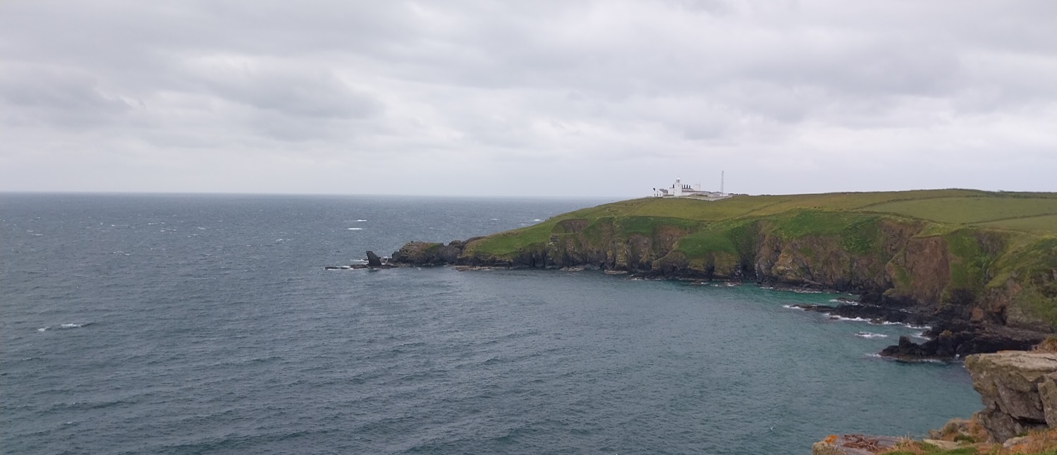
Our overnight accommodation, the Old Inn, a fine breakfast had us on our way heading down towards Polurrian CovePolurrian Cove and a grey slate of a day to start us off. Mullion Island sits just off Mullion Cove.We’d enjoyed the path out to Polurrian Cove, where it seems people take to building a house nearer to the sea than their neighbour. The grey one at the top of the cliff might be the last one unless another comes along on stilts.Along the cliffs towards Mullion IslandAbove Mullion Cove, a hotel is behind us and a cannon infront, for some reasonMullion CoveLooking down to Mullion Cove after our first climb of the day, a bit of a theme of the day. The hotel with the cannon was aboveBack along the coast we have walkedAnd ahead to what we need to do, Ogo Dour Cove is nextAnother down and up had us at this sign, Soapy Cove is our next task and not far now to Lizard PointSteep cliffs as we walk to Soapy Cove, that’s Ogo Dour Cove down there, its now time for a stop and a brew to get us ready for the next down and up.Soapy Cove down thereIt was fairly breezy across here as this fine cow demonstratesSoapy Cove, or at least part of it. More to our left here as we headed down through cows and steeply up the other sideSoapy CoveA short walk brings you to the first view of Kynance Cove and the islands off the cove named The Bellows, Asparagus Island and Gull RockSelfie overlooking Kynance as the sun comes outHeading around to KynanceWe’d passed the busy cafe and walked down to the beach, a few people swimming but not too many, seems most people just want to come to the cafeWe sat here instead for a brew, the sun when it was out was warm and our drinks were free!!A short climb up from Kynance brings us to the last section of cliffs to Lizard PointLion Rock below and Quadrant in the distance, not far nowThis is the fenced in path that has been created, no doubt to protect the landscape. After 3 years its already a state. I came here 3 years ago and it was lovely across here with barely a footprint to be seen and some very thin pathsFinnlines, heading in along the English channelPentreath Beach belowStanding at the corner, Quadrant is behind me and that over there is the most southerly point of the UK. Grey seals abound to my right and the old lifeboat station can be seen below the buildings on Lizard PointIce cream time, and then we headed to sit on a bench to enjoy the view. It was probably the UK’s most southerly bench!Grey seals, lots of themSelfie at the LizardMore sealsLooking over to the lighthouseFrom our bench we watched those watching the marine life of Lizard PointOn the path to the lighthouse looking back at the most southerly bitLizard lighthouseHeading around to Housel Bay, that’s Bass Point over thereTo be honest we could have headed inland at Lizard Point but we wanted to walk a little further, here we are heading past Housel Bay hotel, I’m guessing this is the most southerly hotel in the UKThe Marconi Lizard Wireless Station, he sent messages to the Isle of Wight from here, to test his theories, before moving around to Mullion to send them over the AtlanticMarconi plaque Across Housel Bay to the lighthouse as we turn inlandStill a couple of hours before the rain started but we headed inland along a quiet lane into LizardLizard Argyle ground, the most southerly football team in the UK! There’s a theme around these partsAnd whilst we waited for the bus we had time for a pint in the Top House Inn, for me a pint of Southern Point because when you are here, why wouldn’t you. A superb 3 days that has ticked off a large chunk of the Cornish coast for me, it does leave a tricky bit from the Lizard around to Falmouth with very little public transport in the area, but we’ll work that out another time. For now we’ve loved this section of the path and the weather we’ve enjoyed.
Sometimes the actions of landowners like NT who should know better, defy logic. An object lesson in how to create erosion where there previously wasn’t any. Otherwise a fine walk. I’ve been lucky enough to see Kynance on a blue sky day when the tide was out and it is picture perfect, albeit rammed with people. We used to grab pasties from Lizard and eat the on the grass overlooking the cove.


Looking at that cow on my phone I thought you’d found the yeti.
LikeLiked by 1 person
😂😂😂
LikeLike
Sometimes the actions of landowners like NT who should know better, defy logic. An object lesson in how to create erosion where there previously wasn’t any. Otherwise a fine walk. I’ve been lucky enough to see Kynance on a blue sky day when the tide was out and it is picture perfect, albeit rammed with people. We used to grab pasties from Lizard and eat the on the grass overlooking the cove.
LikeLiked by 1 person
Its a stunning spot and give me Lizard over Lands End any day
LikeLiked by 1 person