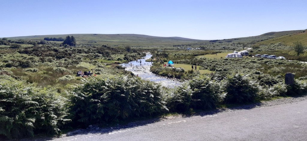
As we all know the weather recently has been hot, days without a breeze are rare down in the south west but when coupled with hot sunny weather, it makes for unpleasant walking conditions. This was one of those days and as a result I was up early and parked at 8.30am for my favourite walk. The bracken was high so I headed first across the open Wigford Down, hoping to be in the trees for just after 9am and some welcome shade. It was still hot at this hour but it wasn’t stifling and I love this part of the moor, as it gives so much in such a short walk. By the time I got back to Cadover, tents and sun shades were going up, kids were jumping in the river and the foldaway chairs were being placed in the best spot. It was like Butlins. So I was glad to get home and out the way.
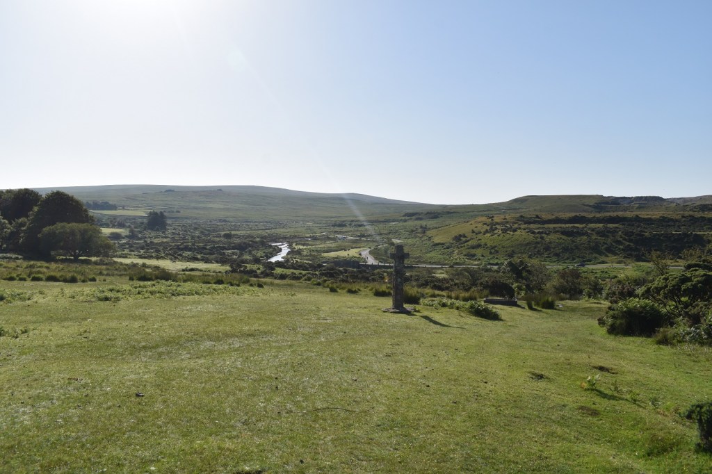
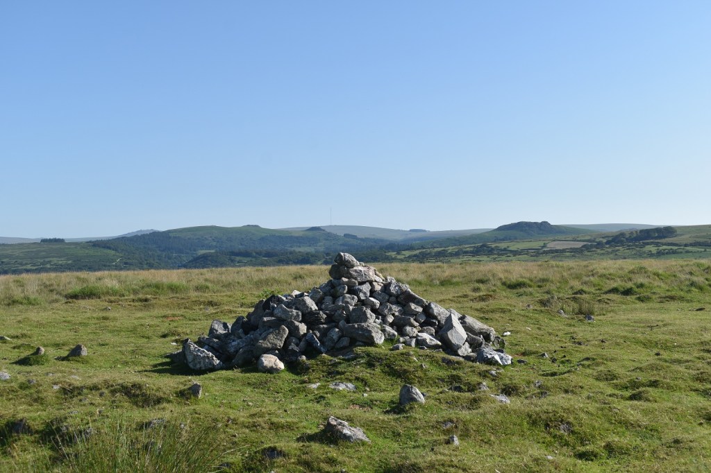
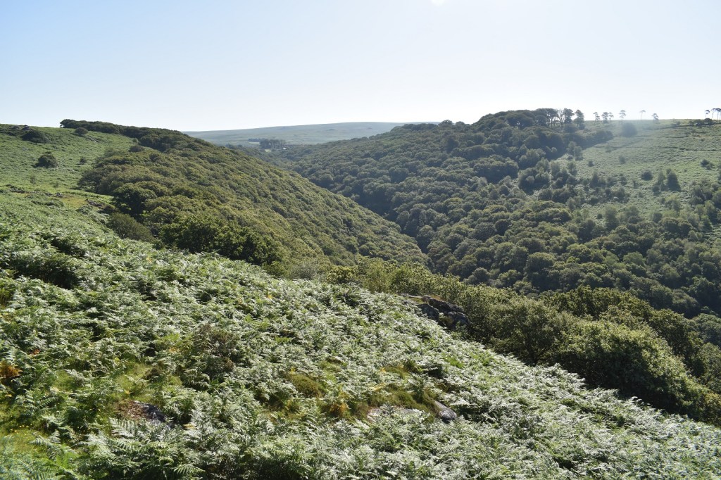
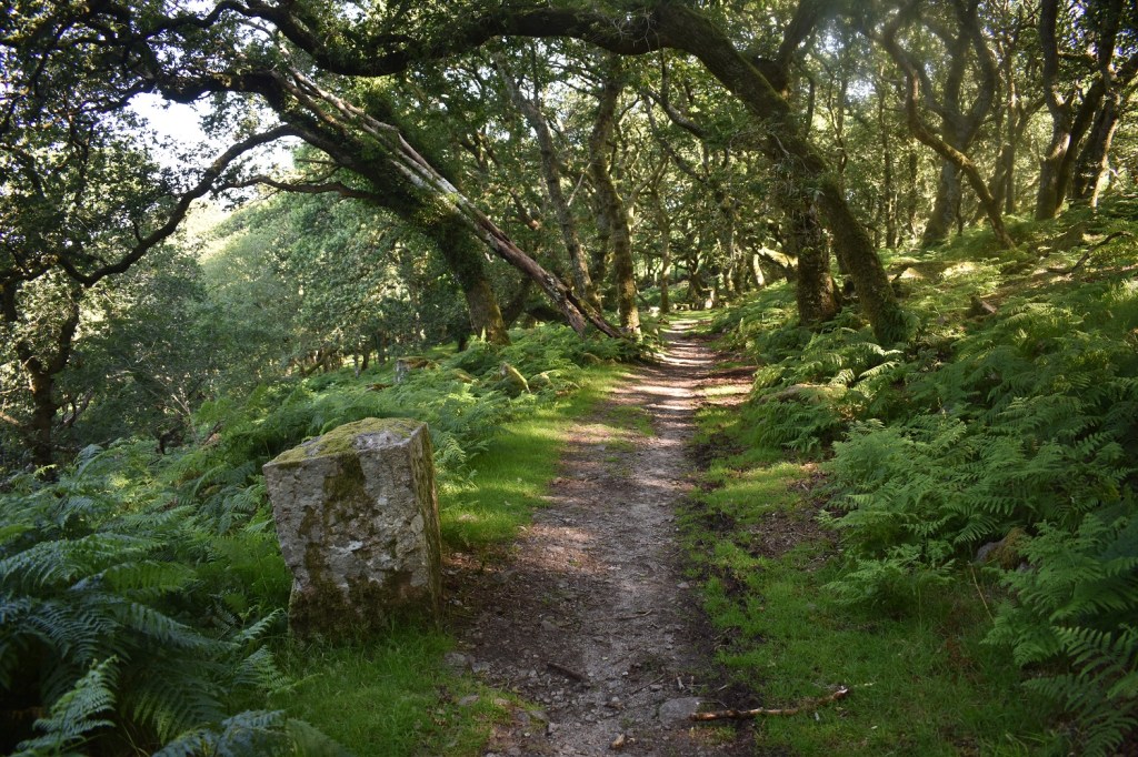
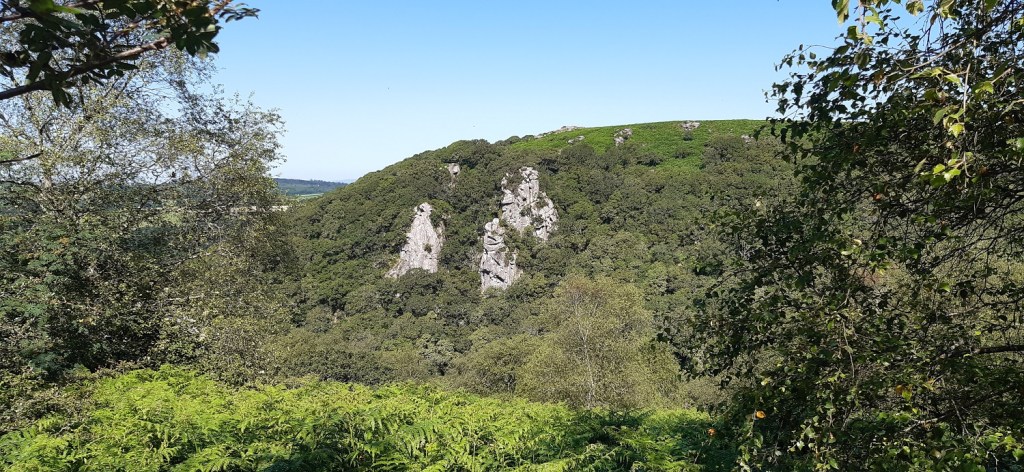
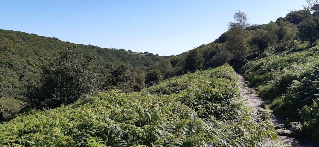
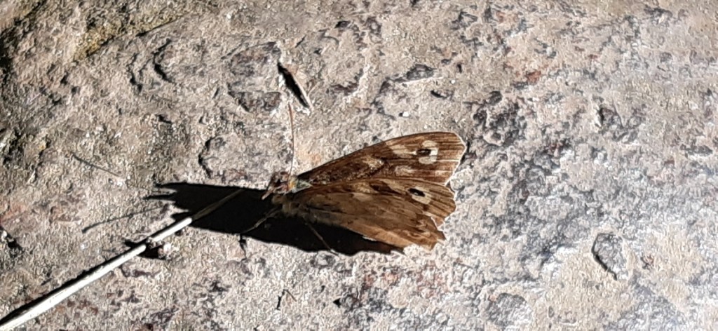
Cadover Cross at the start of the walk, it was already 26 degrees at half eight, I was right to walk the open section first and then into the trees for the return, as I normally head the opposite way aroundBit further up the hill, up on the left is Lee Moor, with Shell Top and Penn Beacon running away from the camera. The two Trowlesworthy Tors are on the hill side over thereWigford Down and the views to the tors, on the right is Sheeps Tor, at the back is the mast at Princetown and to the left of that Leather Tor and SharpitorThe pool at Wigford Down, these wild ponies (more horse than Dartmoor pony) were taking a drink. Cox Tor and the Staple Tors are far leftOne of the boundary markers on Wigford Down and a glorious view to Plymouth Sound beyondCadworthy Tor, the paths to the Dewerstone are obvious through the brackenThe Dewerstone sticks high above the trees down there, Plymouth Sound again in the backgroundI’m stood above the Dewerstone here looking back up the Plym valleyOn the top of the Devils Rocks, also called Dewerstone West by the Tors of Dartmoor team, this set of rocks runs down in the direction I’m looking rather than towards the Dewerstone way to my left here. The views here are magnificent and worth a stop for a brew, or today a cold juice!Brent Tor and its church away in the distanceDown in the trees now and a few degrees cooler straight away, this is the old track that they used to take the granite away from the quarry works up around Dewerstone WestThe brake house which helped stop the granite from ending up in the River MeavyDewerstone West, the lower parts, you can clearly see the track has been blasted through the rocks here and the granite taken away for building worksI’d seen more butterflies than I could count across Wigford Down but this was the first that sat still long enough to get my phone camera ready. A lovely Red AdmiralDown by the meeting of the rivers Plym and Meavy. Shaugh Bridge is behind me but the photos were awful of that (I blame the phone!!)Shaugh Bridge car park is pretty full by 9.30am, these structures on the right covered in bracken are the settling tanks for the clay works up on the moor beyond Cadover Bridge (where I am parked). I will follow the clay pipe path back that way. The clay was taken from here to the nearby train station and onwards to make clay things!Climbing up from Shaugh Bridge is always warm work, more so today. I love these views though across the fields which give you a breatherWest Down Tor (names by the guys at Tors of Dartmoor), plenty of outcrops in this area and before here, but these are the biggest. Shaugh Beacon is just up beyond this tor but I’m not heading there todayThe Dewerstone looks glorious across the valley, there were plenty of people carrying ropes, heading that way, as I passed them heading down to Shaugh BridgeThe path across West Down which heads into North Wood, the Plym valley to my leftOk not sure on this one, but I think this is a skipper of sorts. Grizzled maybe or is it Silver Spotted (but the wrong habitat) or maybe a Dingy skipper. Anyone have any idea on this one?
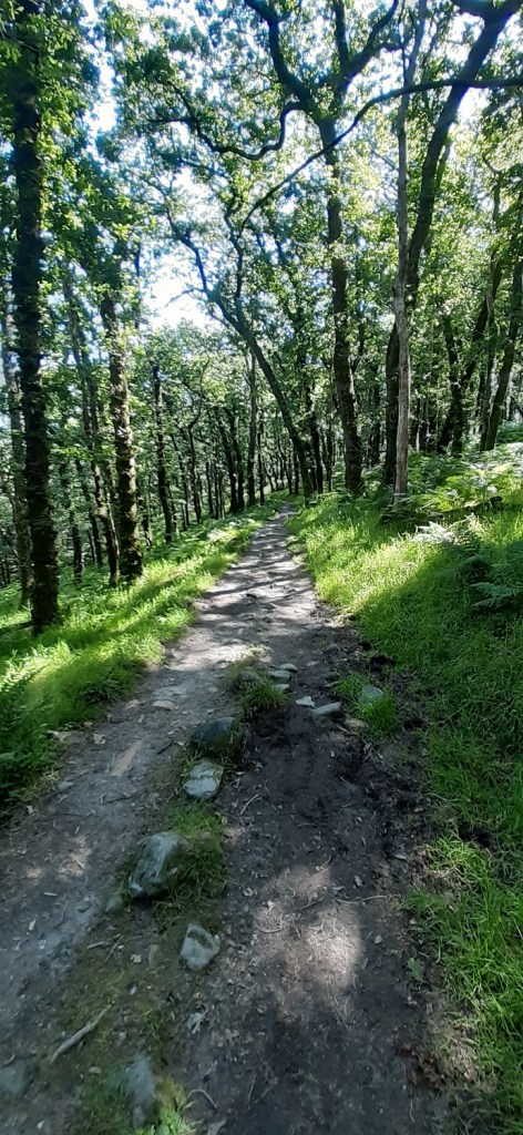
North Wood, it was lovely walking through here
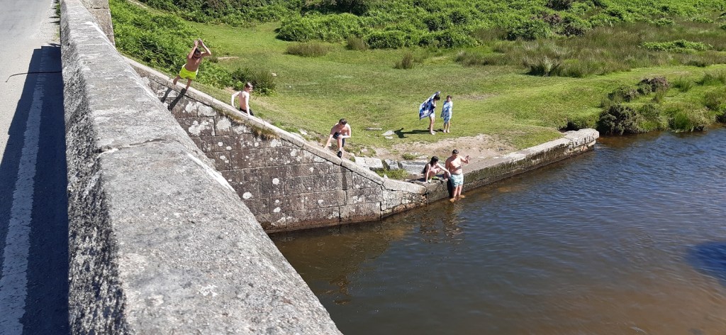
The clay pipe has been seen all along this side of the river and finally its in a photoSpeckled Wood sat on the clay pipe in the photo aboveBack at Cadover Bridge now and they are all setting up for a day of sunbathing, river swimming, BBQ and funCadover BridgeThe lad on the left is leaping, his friends had jumped already from lower down so he went better than them. The water is a few metres deep at this point so all was well. No doubt lots more of this as the day went onTents, shady covers all being setup. Cadover is like Butlins by the river and most of the folk from Plymouth will have done this at some point, its a different option from the beach with similar results. For me I knew it would be here so I came early to leave early, although this is 10.30am and earlier than I though it would be!! Now home for a shower and a beverage!!
5 thoughts on “Dewerstone, Wigford Down and Cadover Bridge”
Nice one, Stephen. It seems that your Devil’s Rocks are what we have down as Dewerstone Hill, or Tor (with the Noel Carrington inscription), with Dewerstone West being below this to the west and being possibly known as Devil’s Rocks. I see you found the Pixie Rock of Dewerstone West where the track has been cut through the tor. Lots of names, easy to get confused.
I’ve always known the top rocks as Devils Rocks, having spoken to a number of locals from Shaugh Prior, around 10 years ago, who gave me that name. I’m happy to stick with that name. The Dewerstone (Rock) is clearly to the south east and doesn’t involve the top rocks for me. I see your Dewerstone West which for me are connected to the top rocks especially just down to the western side, within 50-75 yards of the top rocks where the quarry starts, and continues down to Pixie rock and then beyond towards Shaugh Bridge. Either way on my list I’ve just included the Dewerstone as the whole spot is clearly a promontory that stick out on its own with outcrops across it
Stunning clear skies. I went for a walk in the hills at 7am earlier in the week and it was still sweltering hot.late evening as the sun sets is the best time. Daytime is for lazing in the sun and swimming. That water under the bridge doesn’t look deep enough for jumps but it does look a gorgeous spot, if very well known (it’s in my wild swimming guide)
I reckon maybe 8 foot deep, perhaps a bit deeper. There’s a nice spot about 300 metres downstream from the bridge on a bend, the outside part has a rope attached to a fallen tree trunk for swinging and dropping into the water


Nice one, Stephen. It seems that your Devil’s Rocks are what we have down as Dewerstone Hill, or Tor (with the Noel Carrington inscription), with Dewerstone West being below this to the west and being possibly known as Devil’s Rocks. I see you found the Pixie Rock of Dewerstone West where the track has been cut through the tor. Lots of names, easy to get confused.
LikeLiked by 1 person
I’ve always known the top rocks as Devils Rocks, having spoken to a number of locals from Shaugh Prior, around 10 years ago, who gave me that name. I’m happy to stick with that name. The Dewerstone (Rock) is clearly to the south east and doesn’t involve the top rocks for me. I see your Dewerstone West which for me are connected to the top rocks especially just down to the western side, within 50-75 yards of the top rocks where the quarry starts, and continues down to Pixie rock and then beyond towards Shaugh Bridge. Either way on my list I’ve just included the Dewerstone as the whole spot is clearly a promontory that stick out on its own with outcrops across it
LikeLike
Reminds me of my rock-climbing days. Worth reading Carrington’s Dartmoor poem. Not the greatest poem, but some interesting Dartmoor descriptions.
LikeLiked by 1 person
Stunning clear skies. I went for a walk in the hills at 7am earlier in the week and it was still sweltering hot.late evening as the sun sets is the best time. Daytime is for lazing in the sun and swimming. That water under the bridge doesn’t look deep enough for jumps but it does look a gorgeous spot, if very well known (it’s in my wild swimming guide)
LikeLiked by 1 person
I reckon maybe 8 foot deep, perhaps a bit deeper. There’s a nice spot about 300 metres downstream from the bridge on a bend, the outside part has a rope attached to a fallen tree trunk for swinging and dropping into the water
LikeLiked by 1 person