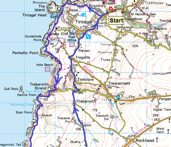
Back to the northern coast this week and a good forecast which looks very promising indeed. I was a bit worried driving over Bodmin Moor area, driving through low and some very dark clouds. As I descended towards Bossiney the cloud cleared but not enough for the sun. I needn’t have worried, before long the sun came through and the day warmed up nicely. This walk pushes me further south and west along the North Cornwall coast heading towards Padstow, in fact looking at the map I have two more day walks before I reach Padstow probably both of them starting at Port Quin. The highlight of this walk would normally be the area around Tintagel, with the castle and island (English Heritage), however this stretch of coastline has some other gems, which for me, were far better. The slate quarry at Hole Beach (Lanterdan Quarry) is stunning and I loved the small waterfall in to the sea at Jacket’s Point. I even had time on the return for a pint in a pub to finish off the day(Cornwall’s Pride, Tintagel Ales). A cracker of a day out
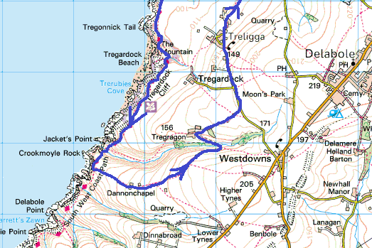
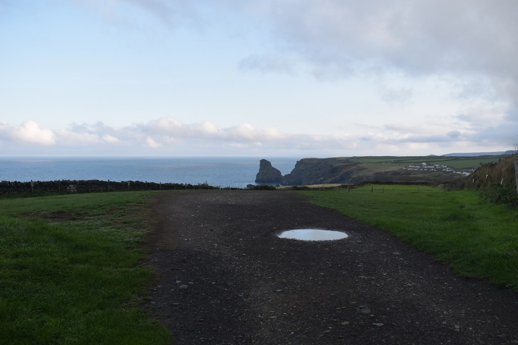
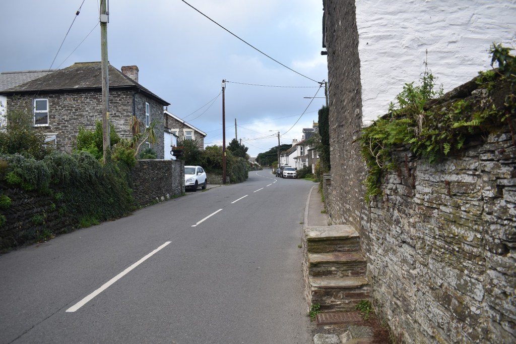
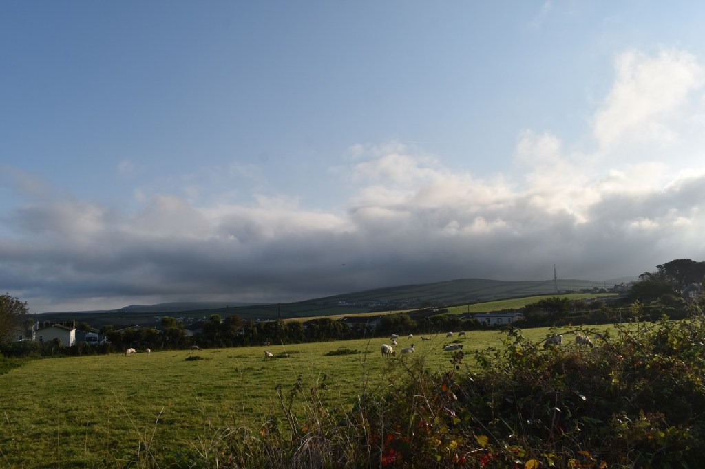
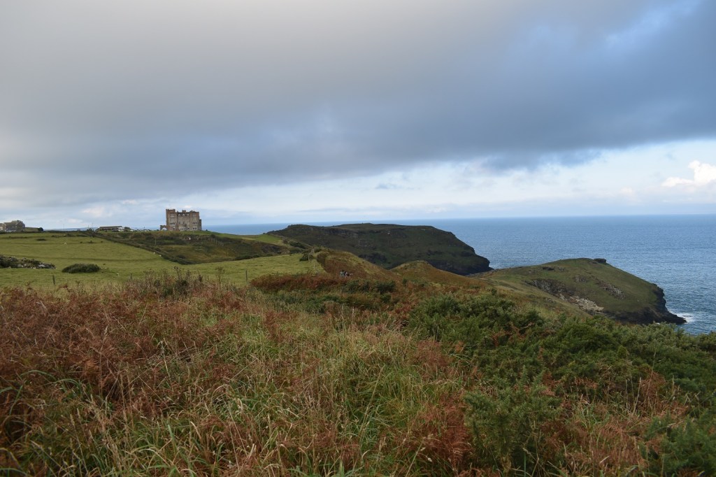
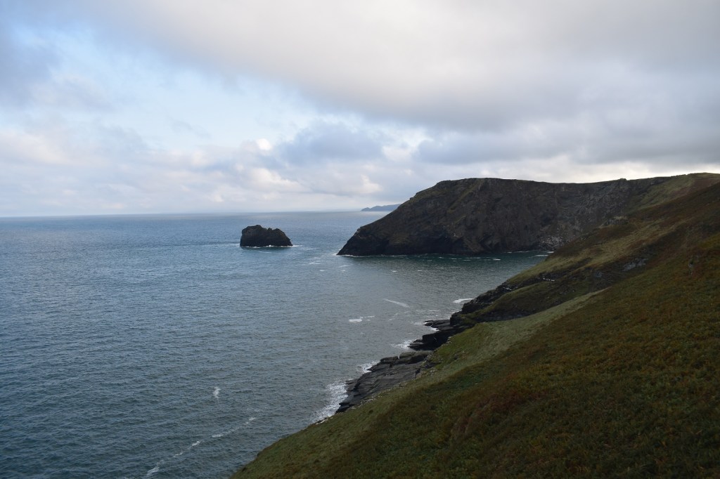
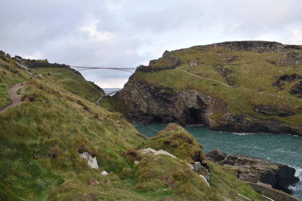
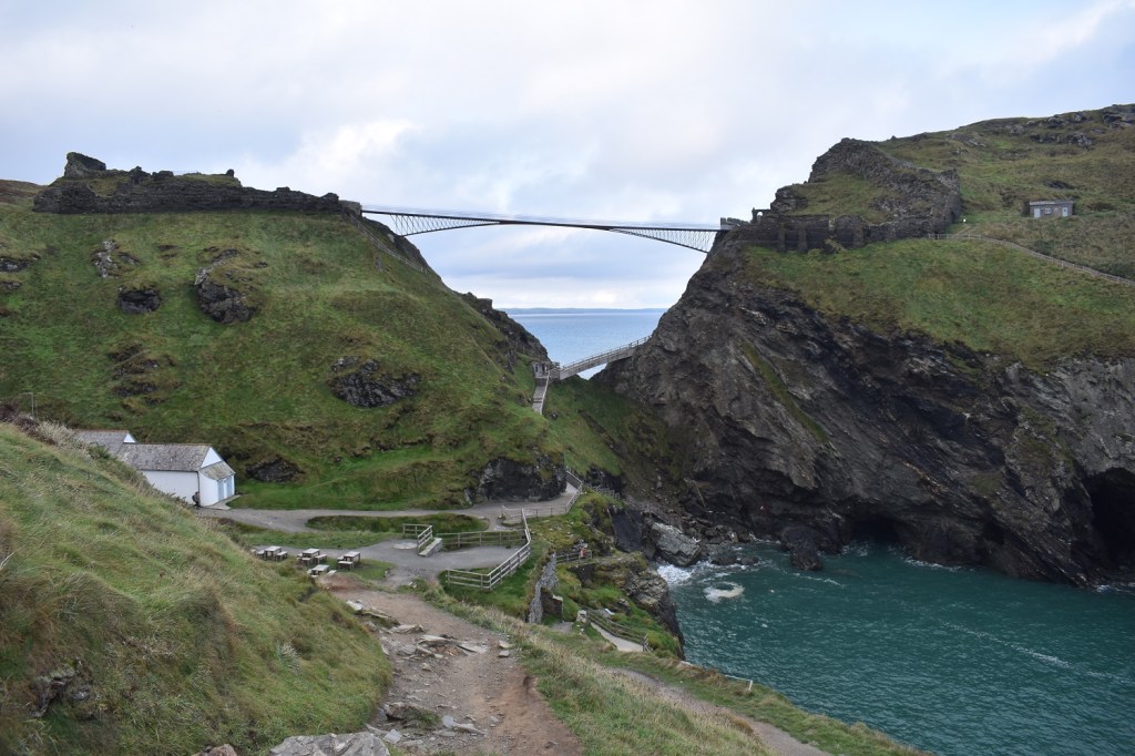
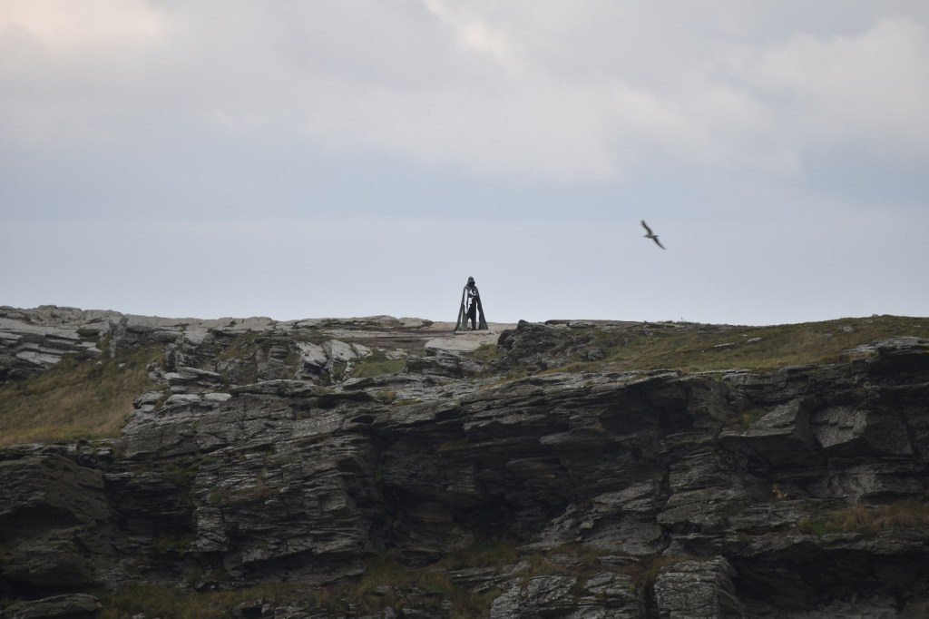
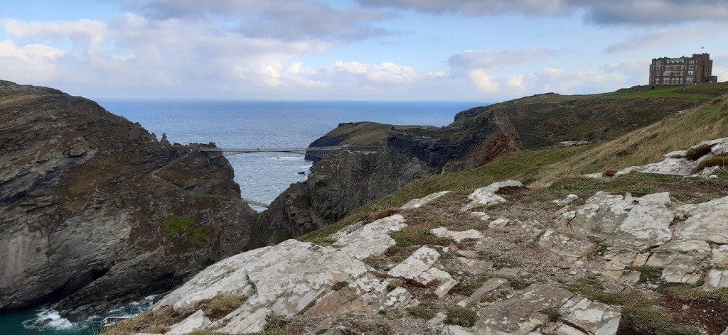
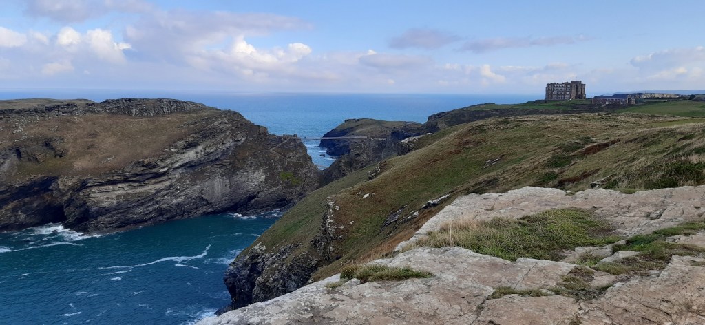
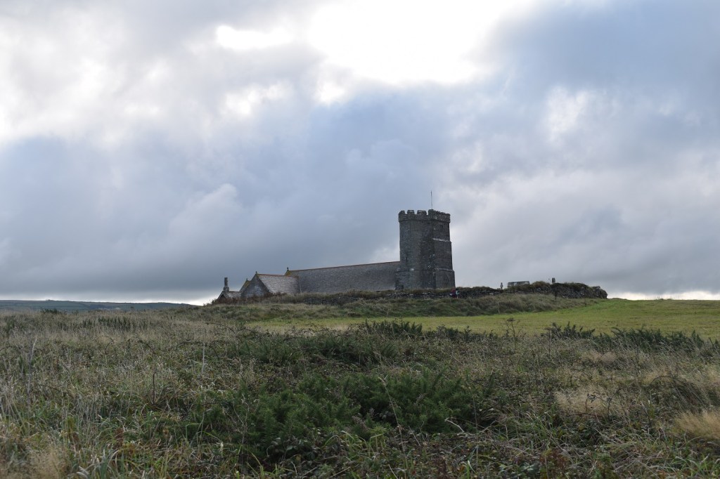
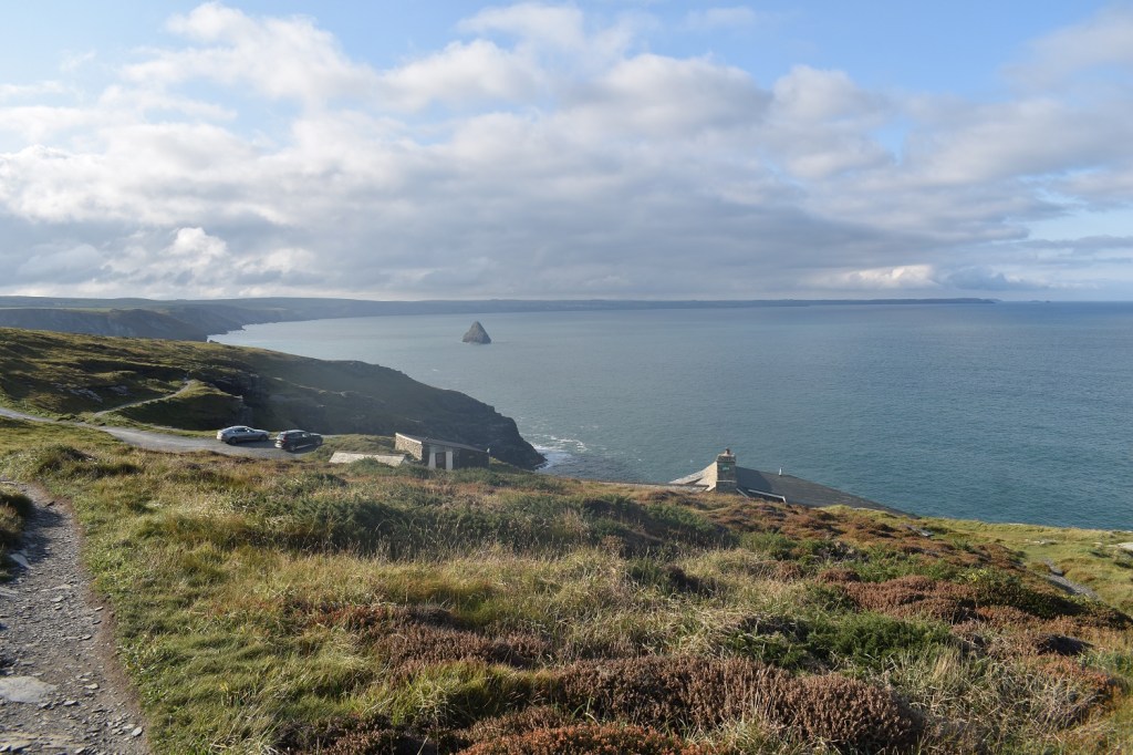
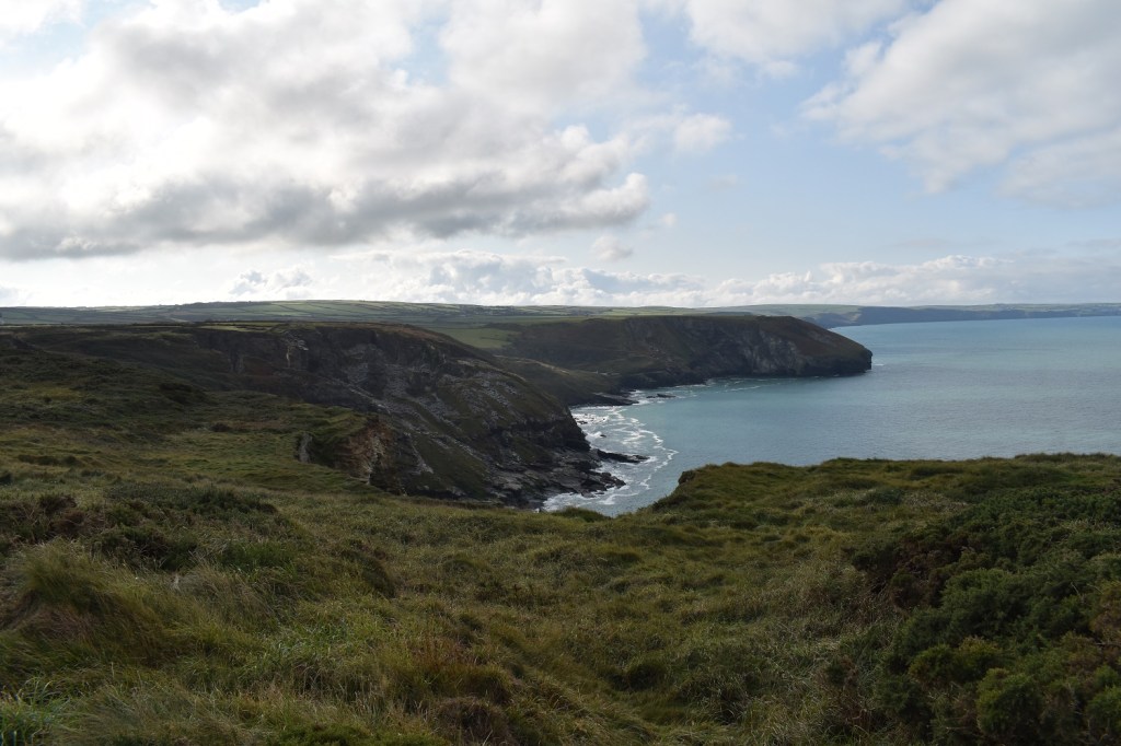
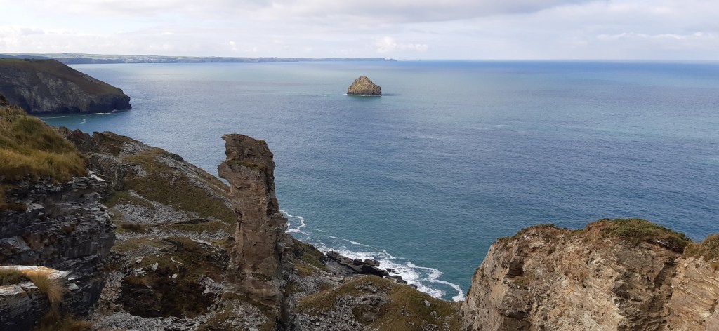
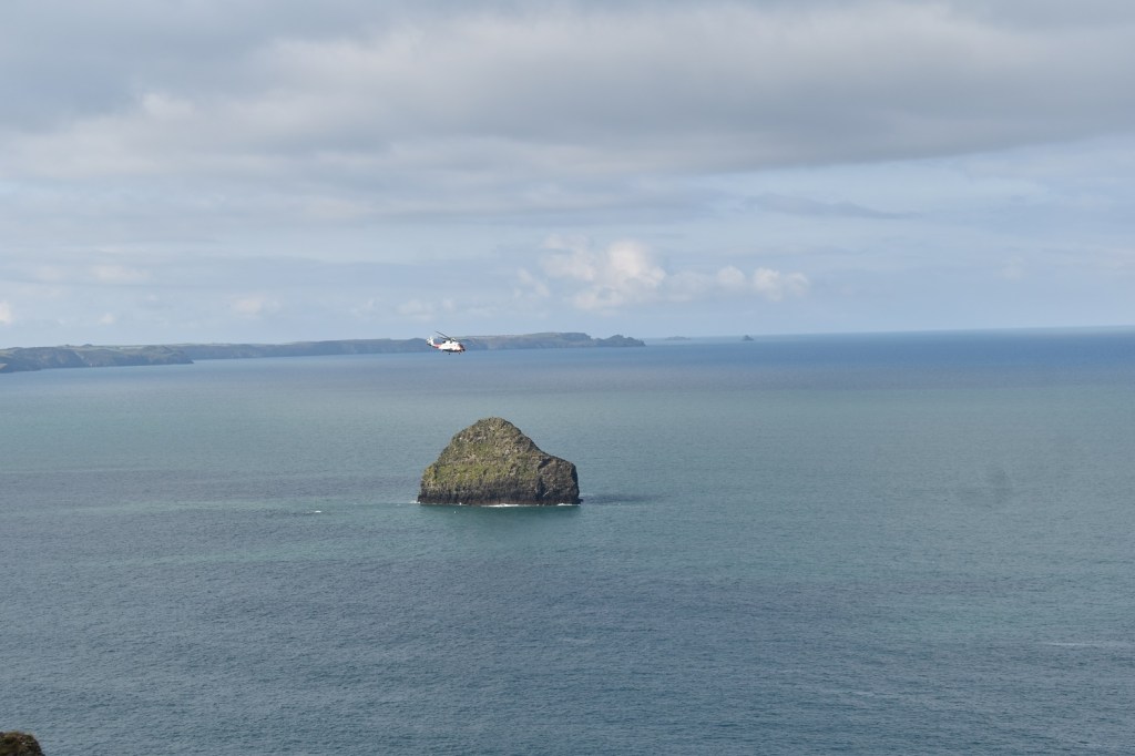
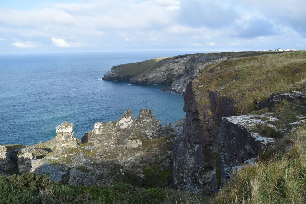
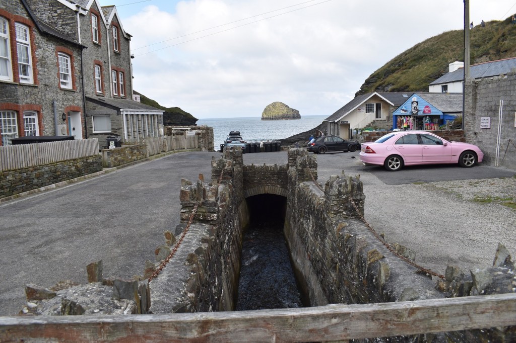
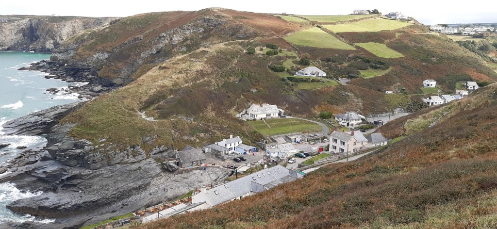
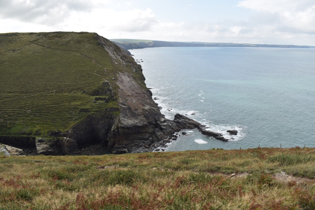
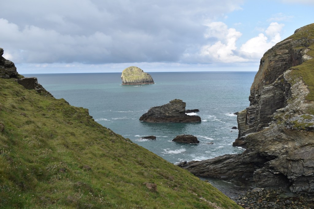
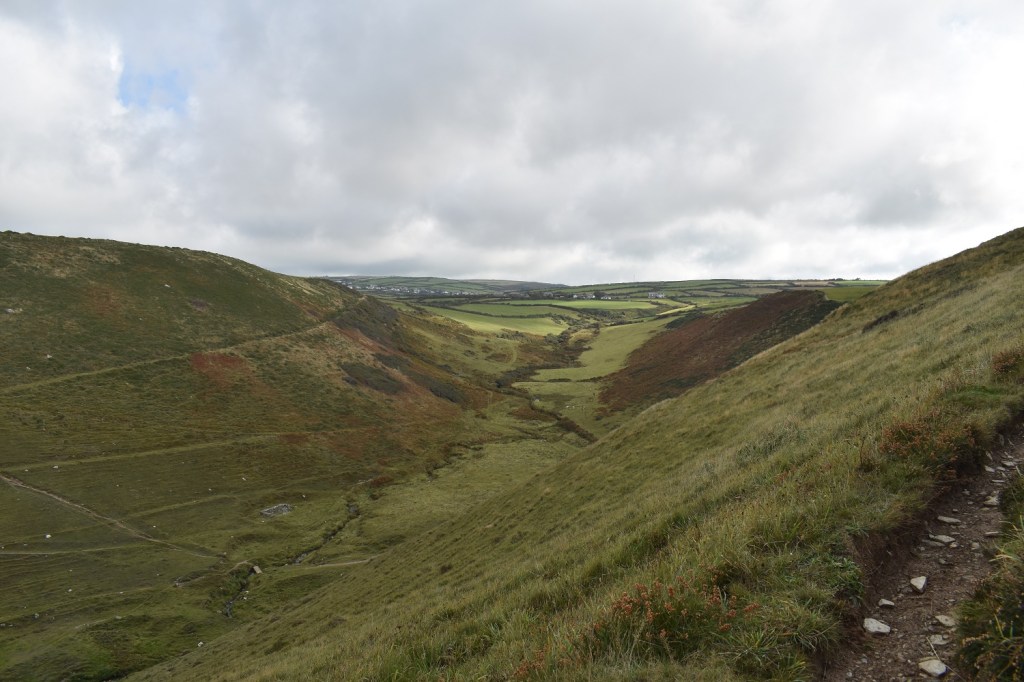
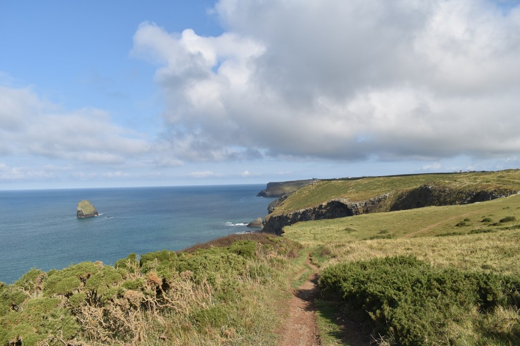
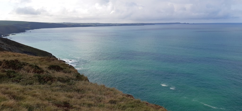
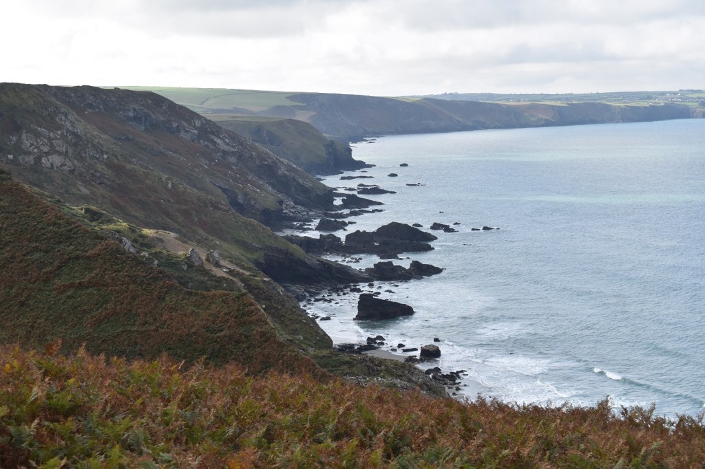
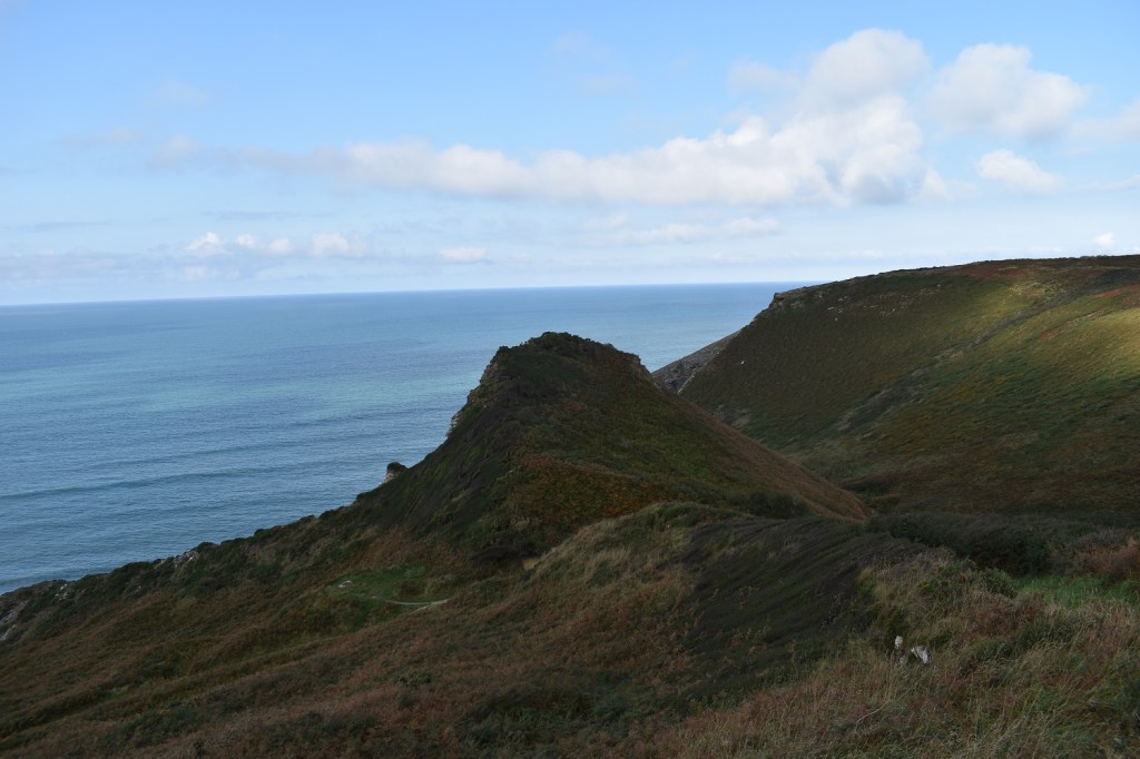
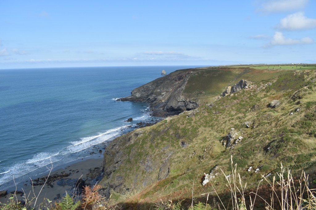
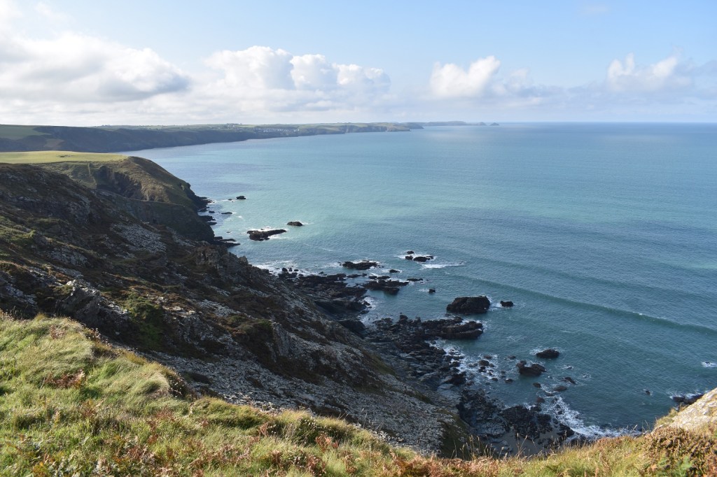
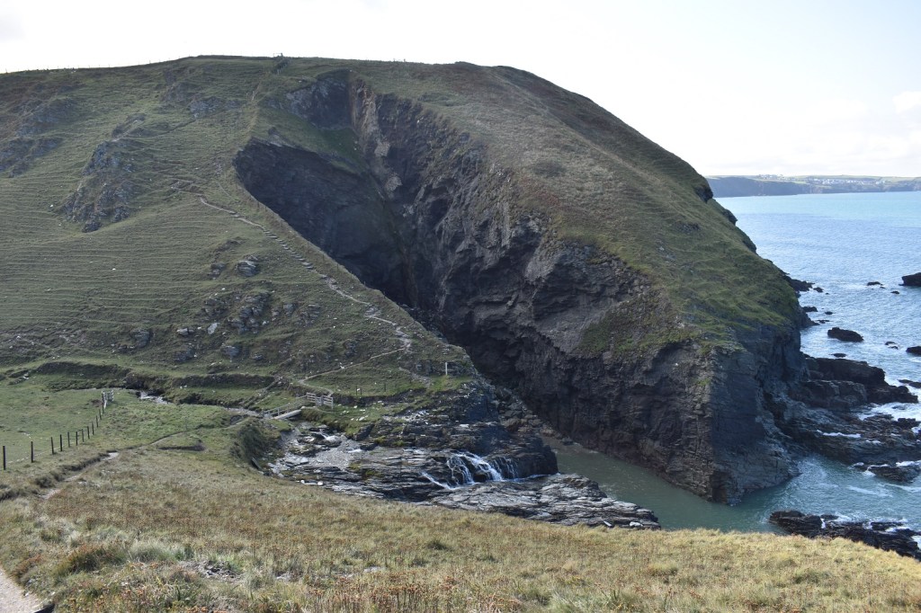
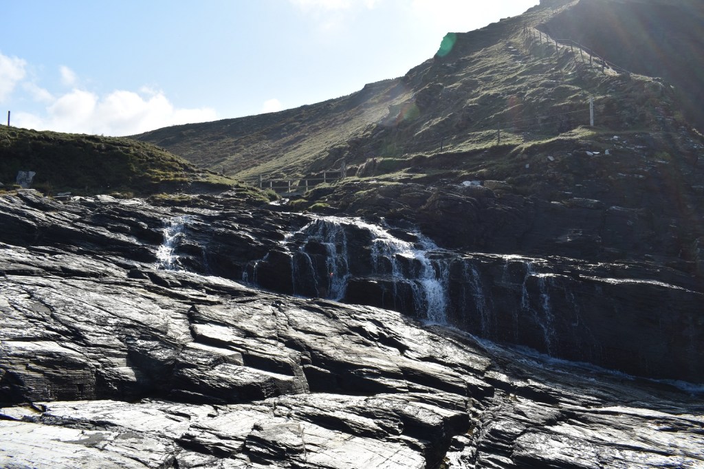
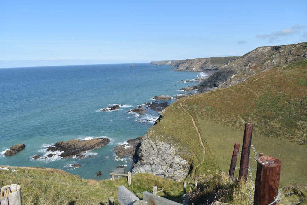
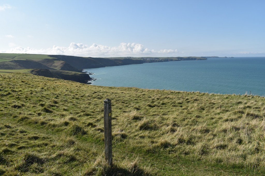
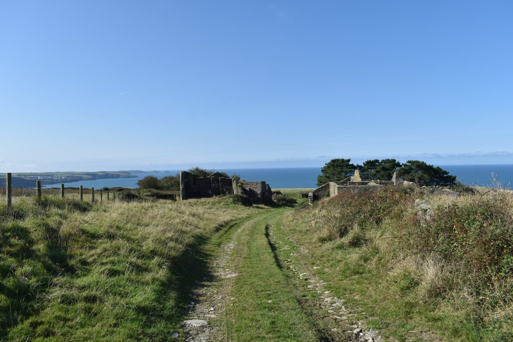
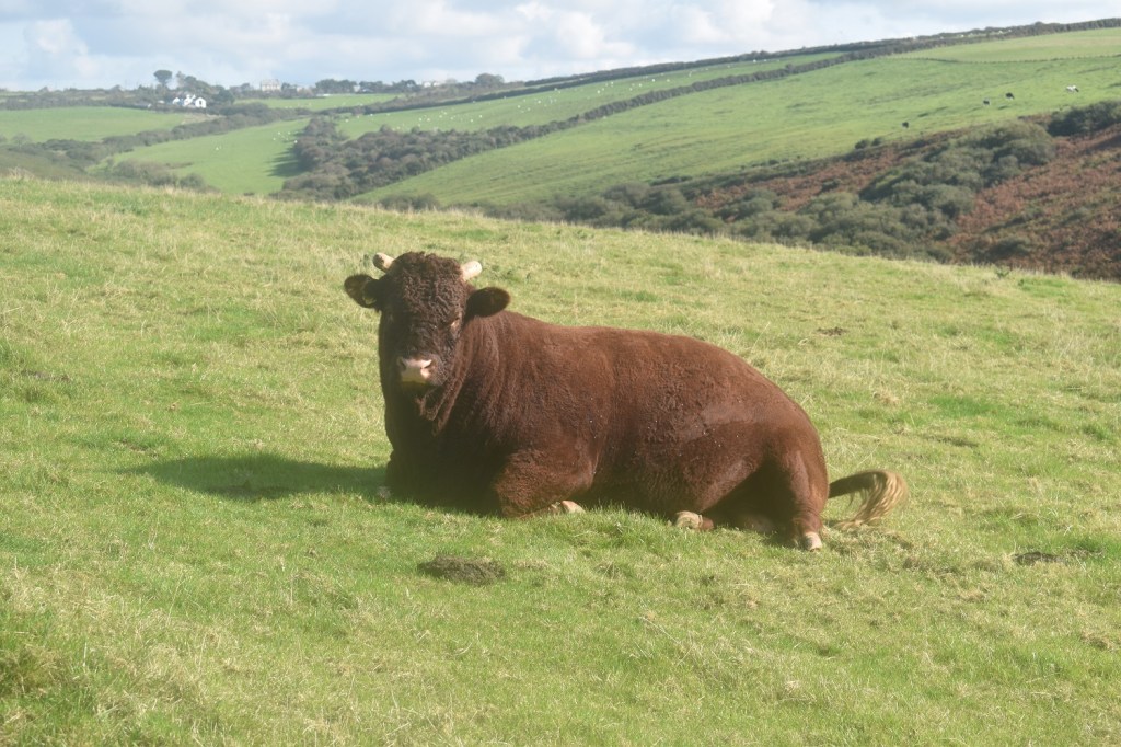
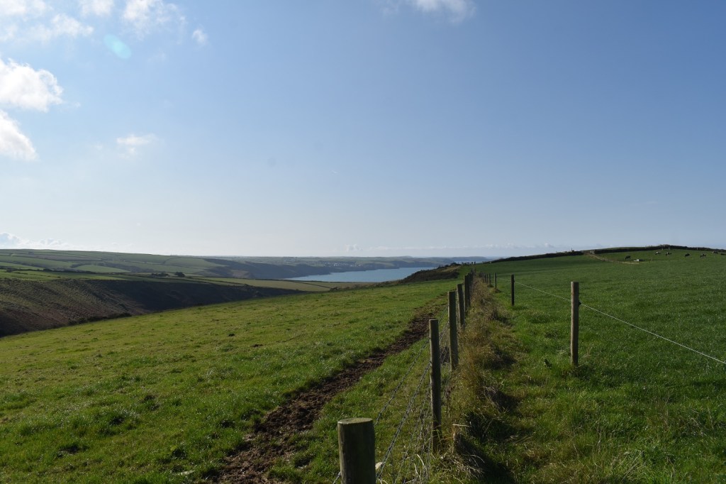
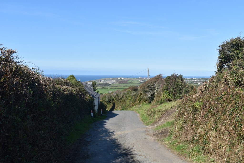
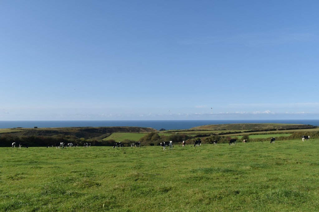
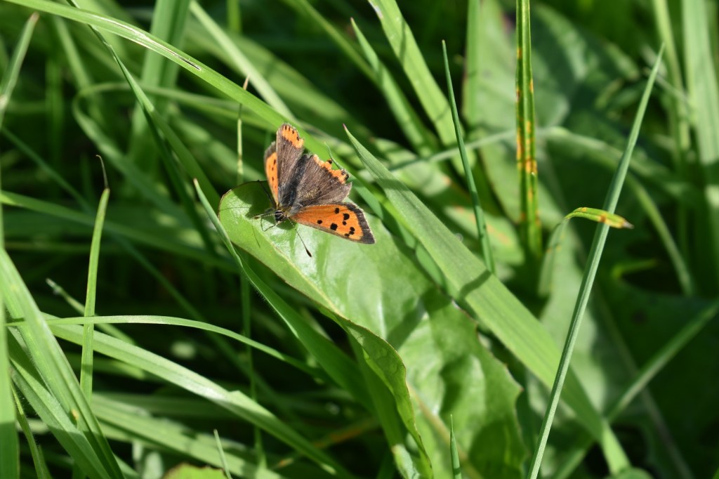
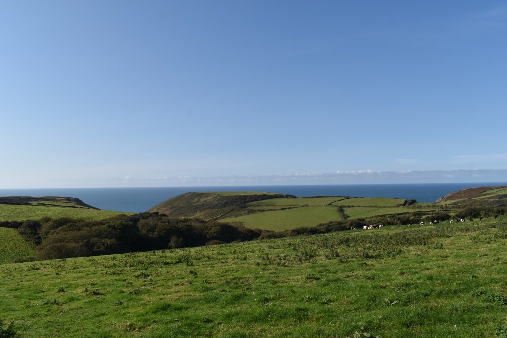
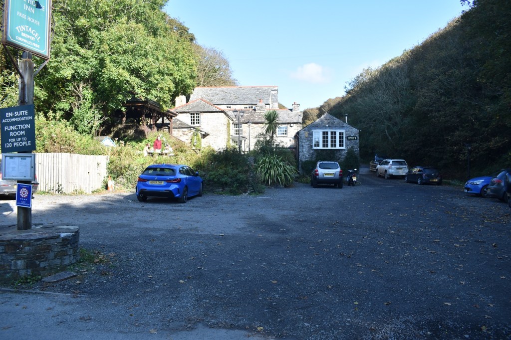
This car park in Bossiney is usually open, £1 to park. However today it was closed all day, the small car park outside the gate was empty so I had no issues (it was full when I got back though). Looking down to Long Island and Firebeacon Hill is the headland pointStarting out through the village of Bossiney, which is an extension of Tintagel really, myself and the boys had come out of a lane on the right just after the cars down there (we’d walked from Boscastle to this point before heading back along the lanes here)Heading out along the lane to the coastal path and looking back at the black clouds that I’d driven through to get hereThe fancy hotel on the cliffs, Barras Nose is down to the right, and the island to the right of the hotel is the English Heritage part, with the bridge connecting the land to the “island” (its not an island as such as it is connected)The Sisters off Willapark head and in the far distance is Cambeak, which seems to feature regularly on a few of my walks around this areaThe bridge to the island, down on the right hand side is Merlin’s Cave. There was a guy down to my right fishing off the rocks, the guy up there on the left perched enjoying the scene and a girl with family trying to clamber over the rocks to get in the cave. She needed to wait a couple of hours for the tide to retreat a bit further really as the sea was far too roughBetter photo, the English Heritage cafe and shop down to the left, the castle, or what’s left of it is up to the left. You walk through the castle and then across the bridge to the other side. I’m guessing the lower bridge/walkway is for when its too windy. I headed down and left before climbing to the left of the castle, banging my empty coconut halves together, no sign of my trusty servant Patsy however!!Arthur’s statue on the island, don’t think the bird is a swallow however, African nor EuropeanI sat on a bench here and had breakfast and a coffee. The blue skies were heading my way as wellOne last look back and onwards, all the time wondering if a swallow could indeed grip a coconut by its husk!St Materiana’s ChurchA short distance along is the youth hostel with a magnificent view of Gull Rock and all the way to Pentire Point, I could also see the lighthouse on Trevose Head behind, but the two headlands are difficult to differentiate at this distanceHole Beach is down there and Dennis Point sticks out beyond the beach, however I’d spied some workings in the cliffs on the left over thereLanterdan slate quarry, located in the cliffs above the beach. It was worked as far back as 1305 with slate being removed from here and in full swing by 1493 and only closed just before WW2. The staggering pillar of rock in the photo was left because it is poor quality stone, so they went around it. I was trying to fathom how they dug out slate here 600 years ago, in all weathers. A truly unbelievable featThe coastguard helicopter flies over Gull RockMore stacks at Lanterdan Quarry, fascinating placeTrebarwith Strand, toilets, a pub, cafe and shop here, plus views to Gull Rock out of the harbour area. Another drop to get here which means a climb outLooking back down to Trebarwith Strand, the pub is the nearest building to me, however it was only 10:40am so I figured a drink could wait until later!!Straight after the climb out of Trebarwith Strand I get to this, another drop and re ascent, as is the way along the coastal path. This is Backways CoveA sunny Gull Rock out to seaAnd inland as I climb, think that is Treknow village back left. I’ll be there laterAfter the second climb came a good section with one slight drop and ascent, but generally I had a couple of miles of cliff top walking to comeLovely colour to the sea in Port Isaac bay. Port Isaac itself can be seen midway along the coast to Pentire PointTregardock Cliff and the rocks below as I arrive at The MountainI think this is The Mountain. Its certainly a shape for oneYou can see The Mountain peaking up on the right, the seaward side of it is a more rocky aspect. Tregardock Beach belowMore stunning coastlineOne last gem as I descended again, you can see a waterfall dropping into the sea. I’m at Jacket’s Point. And a huge chuck of land has been eaten out of the opposite cliff, with the path climbing up alongside it. I could have not climbed the other side as a path headed inland left along the valley, however I was aware that there are another 2 of these after this one and decided to get one out of the way to make the next walk a little easier. So up I went before turning inland towards DannonchapelA part of the waterfall, which runs down the rocks to the right here and off into the sea. A look down to Jacket’s PointI stop here and turn left to Dannonchapel, one last look to the islands off Pentire PointDannonchapel, not actually a chapel anymore, but an abandoned farm. There is a chance that there was a Saxon chapel here prior to 1086. But no remains are found here nowI bravely walked past this fellaActually this photo shows that I was actually the other side of a fence from the bull. Not that he moved at all, very placid fellaHeading down to Treligga now, the distant views are to areas around where my car is parked, showing I’m making decent progress on the way back. I always find that with coastal walks, at least 3/5ths of the walk, timewise, is on the coastal path, and the remainder on the inland tracks and lanesPastoral scene out to seaA small copperTwo dips, the left is Backways Cove and the right holds Trebarwith StrandUp the hill from Trebarwith Strand lies this pub, nestled in the valley but serving as fine pint of Tintagel Ales, Cornwall’s Pride for me, although I could have done with the pub being at the top of the hill that I’m about to climb up to Treknow. It was a brute with a beer in me!! All that was left was a bit of road and pavement walking to TintagelIn Tintagel this fine road greeted me, my own lane, where do I start building my house then!!


That look’s like a tough section, plenty of up and down but views and a pint to reward that effort. Uphill with in beer in the belly is hard work!
LikeLiked by 1 person
Just after that last down and up there are another 2 of those, so turning off to Dannonchapel was the right thing
LikeLiked by 1 person
The bridge is amazing. Very nice landscapes.
LikeLiked by 1 person