I’d booked a couple of days off work and planned a walk or two, I was pouring over the maps to see where was best to go. The first outing was the Cox Tor one on my previous walk here, this was number two and I have one more to write about. Everything was set, or so I thought, I pulled up with blue skies and fluffy clouds above, the temperature on the car said 2 degrees, all good so far. The weather report had it clouding over after a couple of hours so that was ok, the issue was my phone, the battery was sitting just below half way which would mean I needed to be careful. Being a diabetic I need to have some elements of safety around my walks and my phone is one small part of it. So I started out with one eye on the phone, as I climbed to Bell Tor and on to Chinkwell Tor. As I climbed, the wind was biting and dropping the temperature probably, below freezing. My phone wasn’t happy and was losing battery, as not new phones can do. Then it turned off and that was that. I’d had this before and sometimes as the temperature warms it can turn back on, however there was no need to risk anything. Disappointed I shortened the walk, and as I got within a few hundred metres of the car, the expected happened and the phone came on, only 20% left but plenty to send a text to tell of my changed plans. With the text sent I added a visit to Ausewell Rocks and woods which is now open to walkers, with some paths signposted. Plus a visit to the quarry at Ashburton on the way back to tick off another Dartmoor 365 square, the original idea of this walk was to bag 5 squares alongside quite a few tors, as it was the tors count was about the same and I got 3 squares, 2 of which were a bit out of the way so it was good to tidy these up. As for my other walk in this period, well it picked up what I missed out on, on this walk, so no harm done.
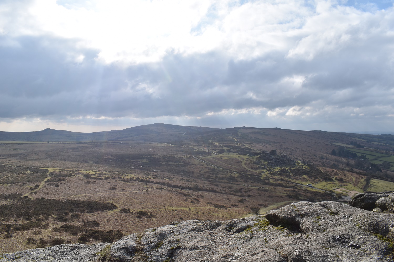
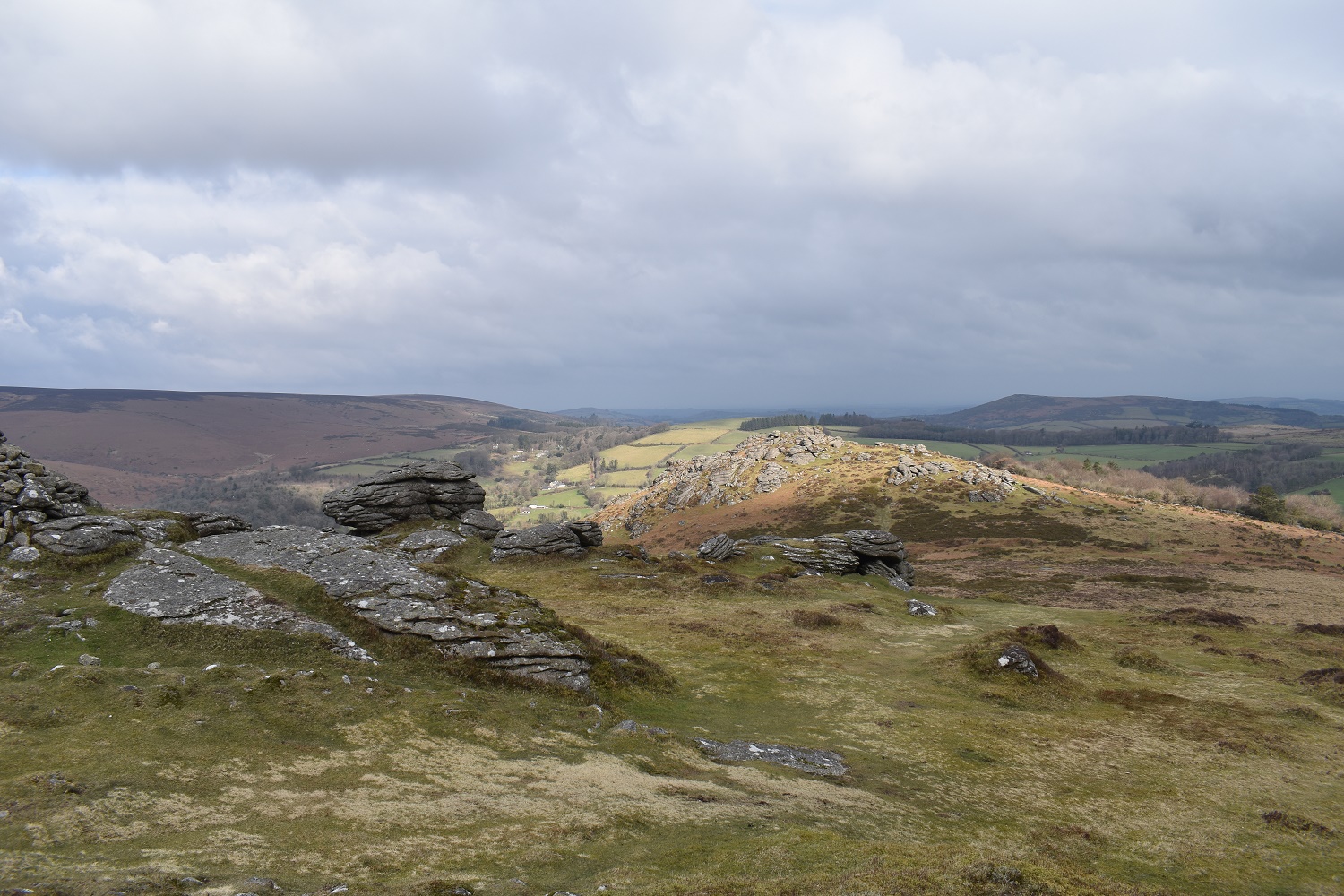
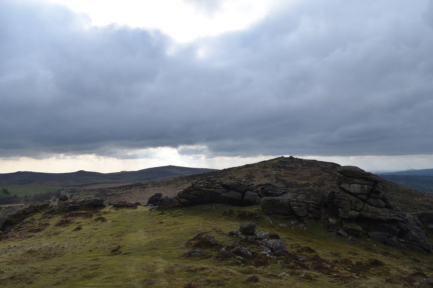
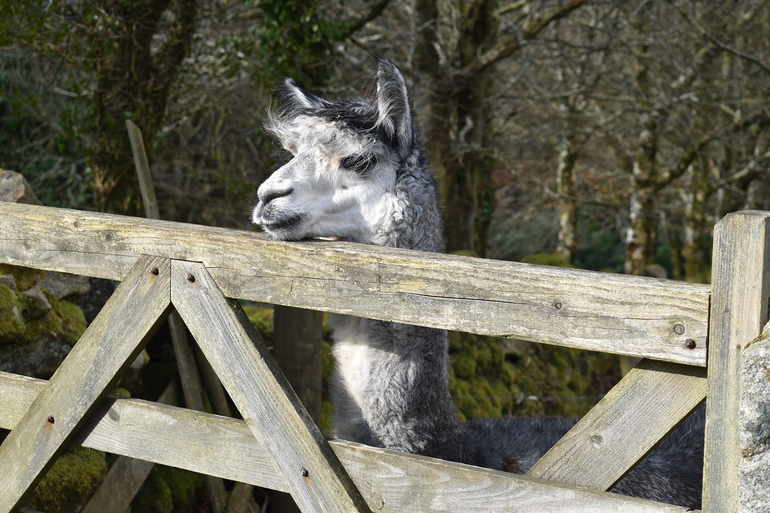
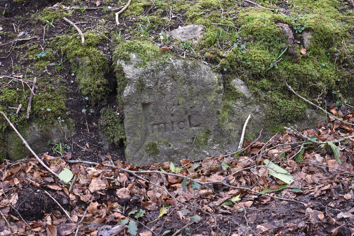
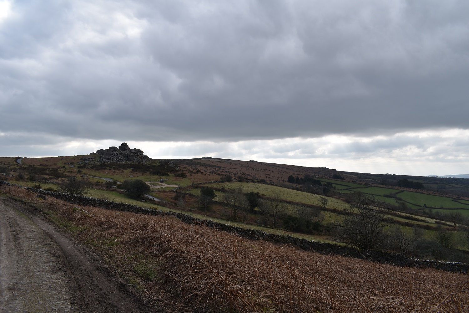
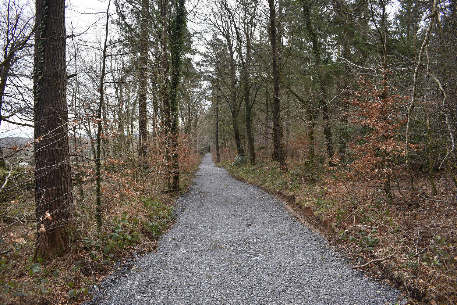
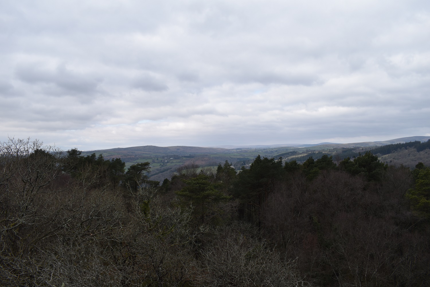
Bonehill Rocks at the start of the walk, looking very resplendent in the early morning sunshineWider shot as I start out, Bonehill Rocks again, Widecombe in the Moor below and the hills rising up to Corndon Tor behind the green fieldsThe way I’m going, Bell Tor with Chinkwell Tor behind and more sunshine, it was a bitterly cold walk across hereBell Tor down to Widecombe in the Moor and the churchInto the sun a bit, with Saddle Tor on the left, Rippon Tor in the centre and Bonehill Rocks down there on the rightChinkwell Tor summit, it was here I lost my mobile completely as it switched off. Honeybag Tor in the sun over there. I decided I would walk out to that and then descend left down to the road to try and pick up the Dartmoor 365 square of the Miolstone before returning to the carChinkwell Tor cairn summit, looking in the direction of PrincetownOn Honeybag Tor now looking at Chinkwell Tor, with Saddle Tor and Rippon Tor on the left in the distanceHound Tor from Chinkwell Tor, the original plan was to head over there and out past Easdon TorPlenty of outcrops at the back of Honeybag Tor as I look over to HameldownOn the lane below Honeybag Tor now, plenty of felled trees along hereLlama or Alpaca? Not sure to be honest, either way this one looked fed up!The 1 mile stone, Miolstone in Dartmoor 365 speak. Its a mile from the church door in WidecombeMiolstone on the left and the road it is on. Now there is a gate on the right over there which is a permissive path, the gate was loose when I walked here, possibly due to the felling of trees so I went through, no private signs on this black dashed path on the OS maps, so I’m heading that way.The gate at the other end was tied with looped string, so I went through that and onto open moor again, passing this old bit of farm machineryAlong the valley with Widecombe in the Moor in it, Bell Tor is up behind me hereBonehill Rocks is close. Think that’s Top Tor to the right behind itAt Bonehill Rocks. Rippon Tor looks massive from here in the distance. Having sent a text I headed to Ausewell Cross and woodsThis is Ausewell Cross one of the D365 squaresThe new path around the woods, plenty of signs, easy walking and some rocks in the middleIf you follow the short path you will pass these, Ausewell RocksA scramble to the top gives good views to the northAnd also to Buckland BeaconSign at the car park, you can see there is plenty more of the woods they could open up, but for now this is pretty goodThe car parkAfter a short drive downhill I stopped to pick off this D365 square, the quarry at Ashburton, nothing exciting here and it was next to the A38 as well so pretty noisy.To finish the day we had a decent sunset at home, for those that are familiar with my walks from home posts, that’s the masts at Staddon Heights on the right of the sunset. A good end to a day which could have been more adventurous but which ended up with making the best of a problem and it working out just fine.
9 thoughts on “Chinkwell Tor, Honeybag Tor and the Miolstone”
Excellent as ever, and a favourite place of mine too. For what it’s worth, I recently bought a portable mobile power bank for the simple reason that l use OS software on my phone for most of my navigating, which drains the battery on my 4 year old phone quite quickly. It’s light, fits in my coat pocket, charges my phone as I walk and can do so from empty 3-4 times before needing to be charged itself. Could be a good solution for you. Mine’s an INNIU, bought from Amazon for around £25 I think… 😊
I’ve heard about these but never really looked into them, great advice Terry thank you. I have a GPS and extra batteries for the mapping so mapping isn’t an issue for me, but having the phone is always a good reassurance (although I’m realising that I need to update my gps maps now!)
I was leading a walk along that bit, after doing the walk along Hameldon and returning to Bonehill, when the man next to me said “What a beautiful view” and immediately dropped dead!
I need to look more into the battery packs that extend the charge on the phone battery . I’ve just been told there’s one small enough to fit into a coat pocket which sounds like a sensible option for me
And another area I’ve walked a bit of. I think I walked past Bonehill Rocks on a wander around Haytor and the Bluebells at Holwell Lawn.
Like the other comments there are loads of portable power packs out there for phones. I have a couple about the size of a cigarette lighter and they live in top pocket of my pack just in case. I also always plug my phone into charge up while I’m driving to the start.
One of those things that I never really considered until it happened to me. Can hear my grandad telling me now to “prepare for the worst”. Apologies grandad, will get it sorted!


Excellent as ever, and a favourite place of mine too. For what it’s worth, I recently bought a portable mobile power bank for the simple reason that l use OS software on my phone for most of my navigating, which drains the battery on my 4 year old phone quite quickly. It’s light, fits in my coat pocket, charges my phone as I walk and can do so from empty 3-4 times before needing to be charged itself. Could be a good solution for you. Mine’s an INNIU, bought from Amazon for around £25 I think… 😊
LikeLiked by 1 person
I’ve heard about these but never really looked into them, great advice Terry thank you. I have a GPS and extra batteries for the mapping so mapping isn’t an issue for me, but having the phone is always a good reassurance (although I’m realising that I need to update my gps maps now!)
LikeLike
Thanks for highlighting the access to Ausewell Wood.
LikeLiked by 1 person
I was leading a walk along that bit, after doing the walk along Hameldon and returning to Bonehill, when the man next to me said “What a beautiful view” and immediately dropped dead!
LikeLiked by 1 person
Wow, what a way to go John
LikeLiked by 1 person
Looks like you still had a great walk at the end. I changed my phone because as well it couldn’t last more than 5h during a walk.
LikeLiked by 1 person
I need to look more into the battery packs that extend the charge on the phone battery . I’ve just been told there’s one small enough to fit into a coat pocket which sounds like a sensible option for me
LikeLiked by 1 person
And another area I’ve walked a bit of. I think I walked past Bonehill Rocks on a wander around Haytor and the Bluebells at Holwell Lawn.
Like the other comments there are loads of portable power packs out there for phones. I have a couple about the size of a cigarette lighter and they live in top pocket of my pack just in case. I also always plug my phone into charge up while I’m driving to the start.
LikeLiked by 1 person
One of those things that I never really considered until it happened to me. Can hear my grandad telling me now to “prepare for the worst”. Apologies grandad, will get it sorted!
LikeLiked by 1 person