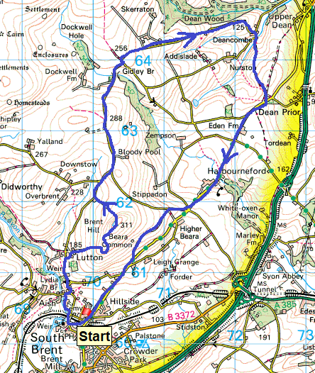
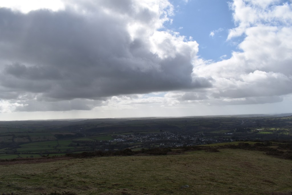
I’ve been slowly creeping further east on each of my walks recently, with this walk being about 15-20 minutes from home. I probably won’t go any further east until we get into April now and have a couple of walks in the Yelverton area planned next, to finish off this lockdown. This walk is a revisit to an old favourite, Brent Hill is a fun little hill with an old fort on top, a trig point and views down through South Hams. In fact the 360 views from here are pretty good, they remind me a bit of somewhere like Meldon Hill or Easdon Tor, in that the top is separated from the main part of the moor by fields and farmland, and it sits higher than the ground around it, especially on one side. Giving great views in good weather. The hill is a sharp climb up but not long at all and provides shelter from winds of any direction, with some handily placed rocks, gorse and humps. The rest of the walk is mainly road based, but allows for you to pick up four Dartmoor 365 squares, which otherwise would be tricky to link together. Finally at the start of the walk you get to see a couple of tor outcrops as well, one which is a great spot for a brew. A fine walk on the southern edge of Dartmoor and you wouldn’t know you were so close to the A38.
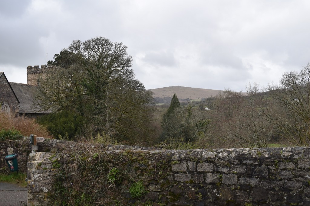
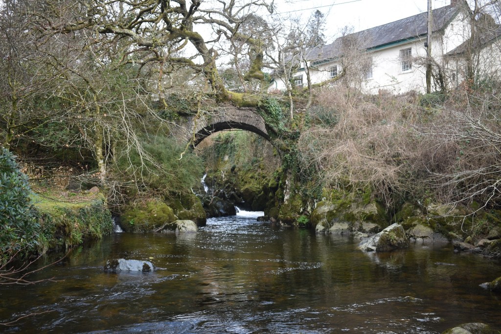
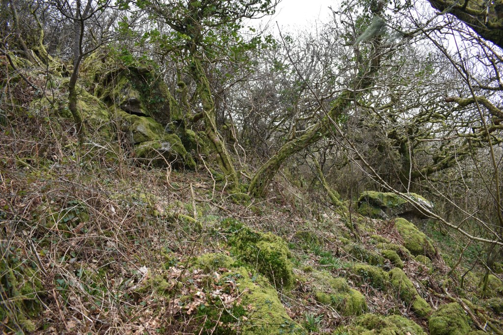
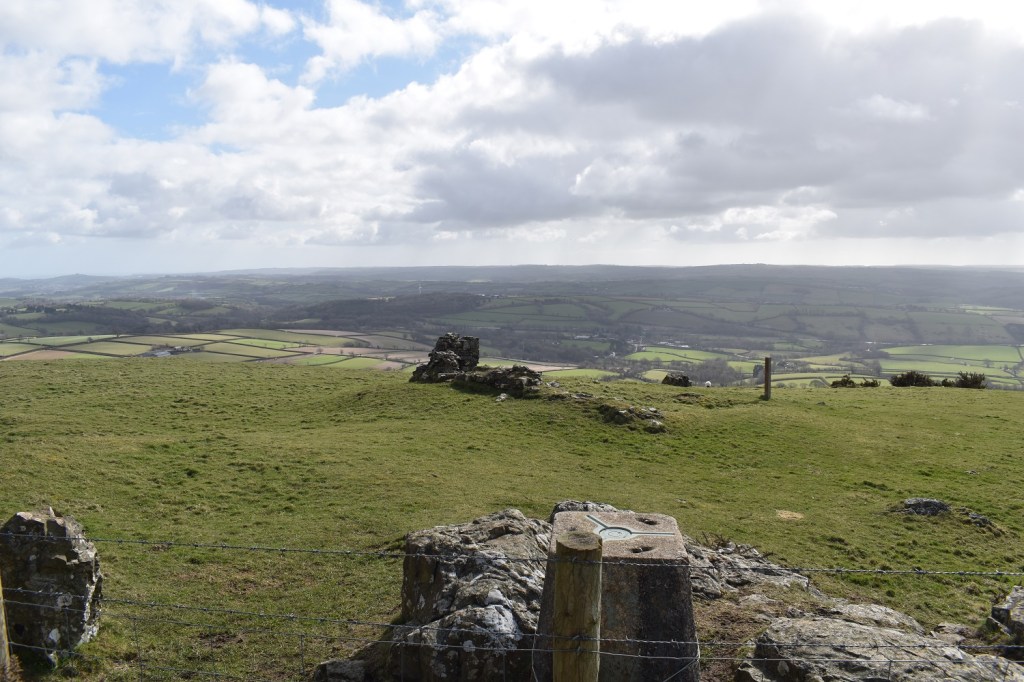
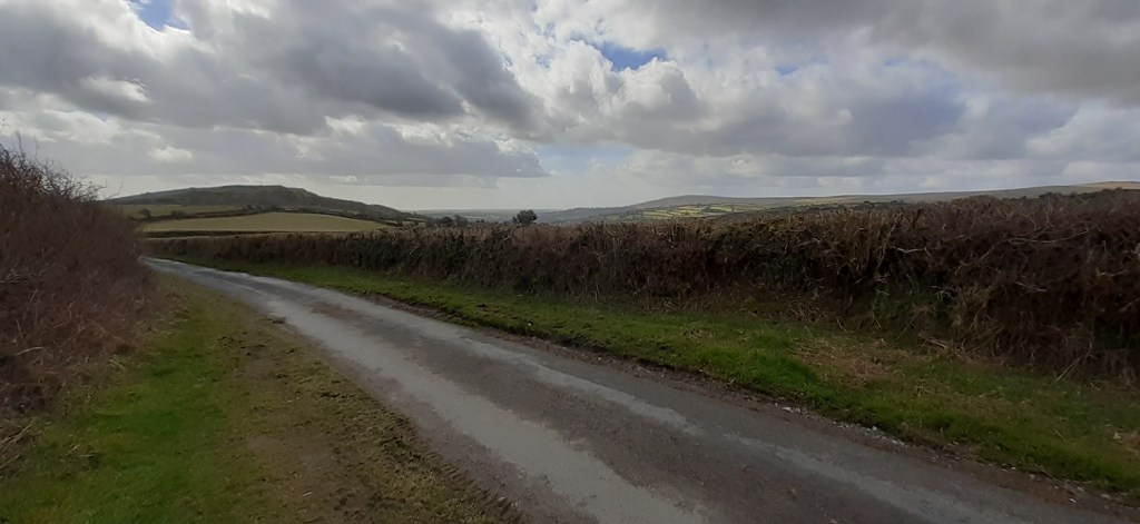
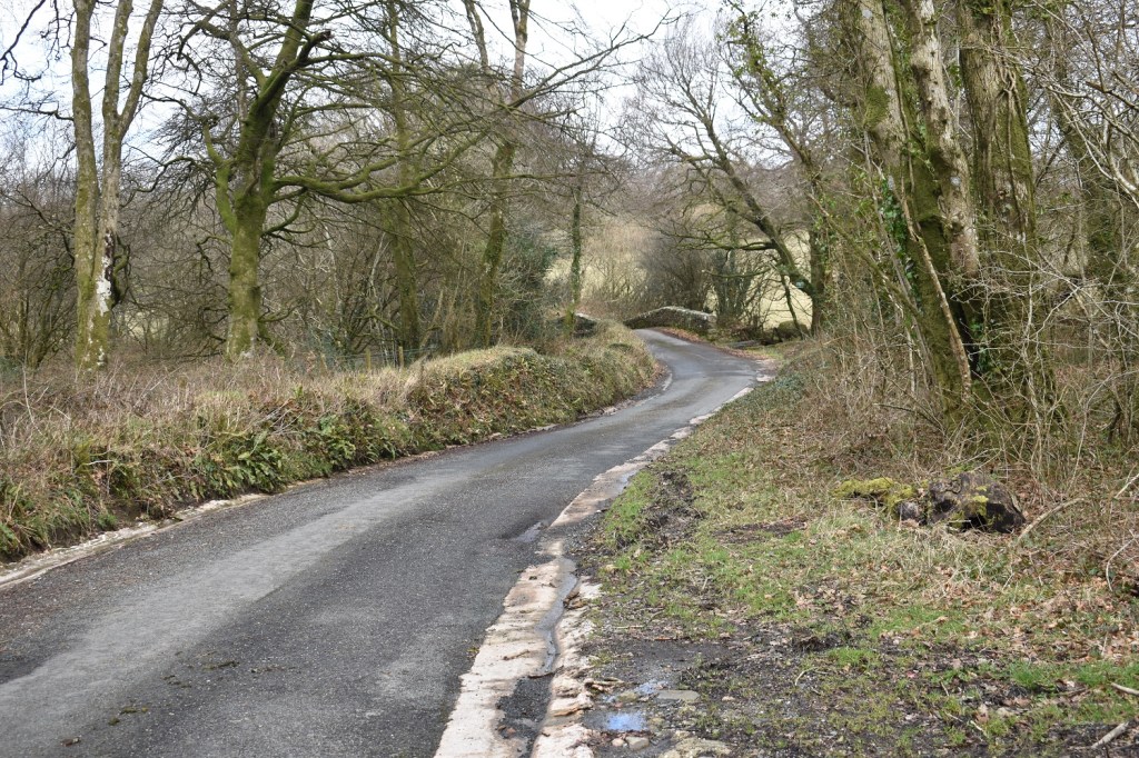
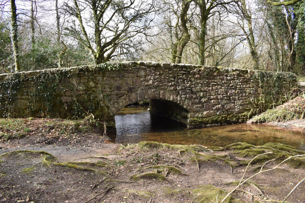
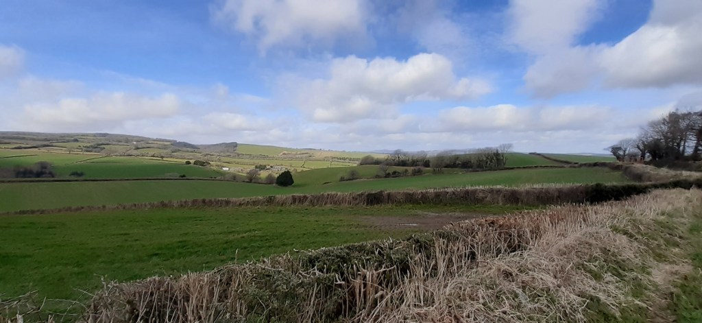
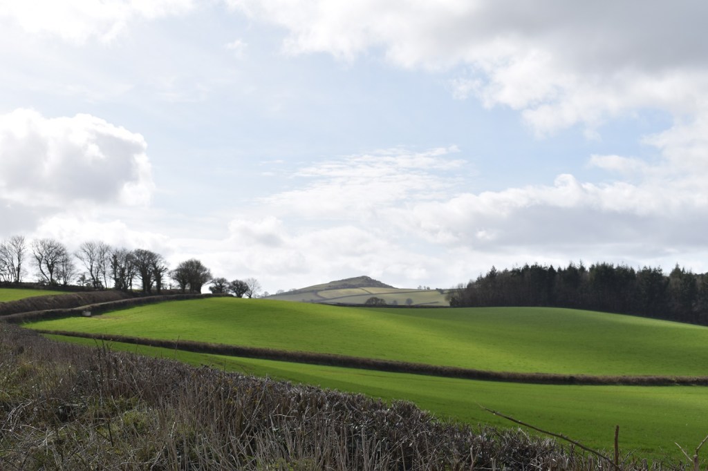
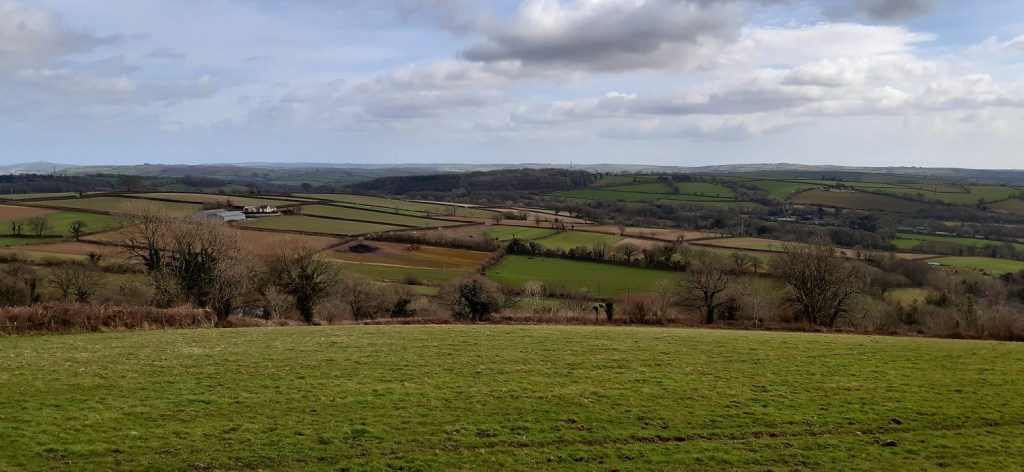
Starting out from South Brent, St Petroc’s church on the left and Ugborough Beacon in the distance, where I was last weekend (here)Following a track by the river I come to Lydia BridgeThe falls under the bridgeLooking along the Avon valley with the water treatment works in a field in front of Eastern White Barrow, I’m heading to Lutton to pick up a track which leads up towards Brent HillUnderhill Tor is the first outcrop reached. You get here by heading through the gate on to Brent Hill and turning slightly right and then uphill in the trees (the gate and fence is not there anymore, so you have access to this tor more easily)Looking north into Dartmoor from Underhill Tor, I have a brew stop here to enjoy the vistasThis is Lutton Tor or a part of it anyway, you get here by heading a short distance from Underhill Tor towards Brent Hill summit. There is more of it, but its fairly overgrown and I didn’t fancy heading into itThis is the path around the middle of Brent Hill, you keep returning to this path from each of the summits to progress to the next one, meaning you have a bit of up and down. I’m looking through the trees to Ugborough Beacon here and the sun has started to come out after some early drops of rain and lots of cloudSunshine to the north as I climb Brent Hill, you see from the farmland how it is split away from Dartmoor properSouth Brent is the other way and the rolling South Hams terrainSummit of Brent Hill, there is a path that roughly follows the fence line before dropping steeply off the end, and down to a track back to the road below, to my left hereThe old hillfort from the trig pointLovely views to the south eastern side of Dartmoor and the area around Rippon Tor and Buckland BeaconA strange place name and one of the Dartmoor 365 squaresFrom a little further along from Bloody Pool, the road rises to a spot height and gives views back to Brent Hill left and Ugborough Beacon rightNext up Gidley BridgeThe River Harbourne and Gidley BridgeMoor Cross, used to navigate by the monks moving from priory to priory. The A stands from Ashburton, T is Tavistock, there will be a P on the there for Plympton as wellThousands of primroses along the roadsides todayAt Deancombe now, a tiny little hamlet with just a few housesI picked up this unmetalled road which takes me towards Harbourneford. At the start of the track two guys were felling Ash trees infected with Ash dieback. This track is uphill slowly all the way for nearly a kilometreBut when you stop there are some nice views. Brent Hill is hiding behind those trees over thereLooking back towards Buckland Beacon with Hameldown back leftFarmland within the park boundaryBrent Hill in view as I pick up the road to HarbournefordNot sure who Clampit was!Into Harbourneford, and the first thing to see is the clapper bridge which is just on the left hereAgain its the River Harbourne heading under the clapper. Can’t decide whether I like the iron railings which have been there a while or whether they should be removed as they aren’t neededNo mistaking what type of road/track is beyond this sign. I’m taking the right hand of the unmetalled roadsSouth Hams stretching awayI stopped again for a brew leaning against a gate and looking down to South Brent, not much more to go nowThe long lane into South BrentMy car is parked there on the left and I take one photo of the railway line through South Brent, 30 seconds after taking this photo a train came which would have made a better final photo! Still it had been a good day, new territory for me, which is what the Dartmoor 365 book helps you to do. Nearly there now folks.
7 thoughts on “Brent Hill, Gidley Bridge and Harbourneford”
I remember being on Brent Hill one night in the 70s and seeing the most wonderful Moonbow – I should think, alongside Easdon, it’s the least visited big hill on the Moor.
Interesting that there are two Brent hills in Dartmoor, both isolated and pointy. Like you I’m staying within 10-15 miles of home until the shackles are released and I can head a bit wider afield. I’ve discovered a few new routes to follow as well as enjoying some classics. I agree, they need to remove those railings off that clapper bridge!
Lovely views. I like the look of the Harbourne – it looks very clear. I take it you’re ticking off the Dartmoor 365 – quite an undertaking which will leave you very acquainted with all that there is to see.
Absolutely, I’d done about 200 of the 365 squares from my normal Dartmoor wanderings. Most of the remaining ones are around the edge, plus some more central that need a photo to prove I went through there. John Hayward’s book is a brilliant piece of work


I remember being on Brent Hill one night in the 70s and seeing the most wonderful Moonbow – I should think, alongside Easdon, it’s the least visited big hill on the Moor.
LikeLiked by 1 person
Interesting that there are two Brent hills in Dartmoor, both isolated and pointy. Like you I’m staying within 10-15 miles of home until the shackles are released and I can head a bit wider afield. I’ve discovered a few new routes to follow as well as enjoying some classics. I agree, they need to remove those railings off that clapper bridge!
LikeLiked by 1 person
I’m most looking forward to getting back to a new coastal walk, but for now walking nearer will do. Less than 10 days now
LikeLiked by 1 person
Lovely views. I like the look of the Harbourne – it looks very clear. I take it you’re ticking off the Dartmoor 365 – quite an undertaking which will leave you very acquainted with all that there is to see.
LikeLiked by 1 person
Absolutely, I’d done about 200 of the 365 squares from my normal Dartmoor wanderings. Most of the remaining ones are around the edge, plus some more central that need a photo to prove I went through there. John Hayward’s book is a brilliant piece of work
LikeLike
It sounds like the sort of quirky, slightly obsessive enterprise which is right up my street!
LikeLiked by 1 person
I enjjoyed reading this
LikeLike