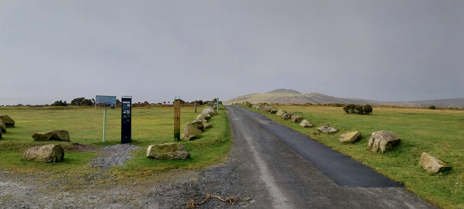
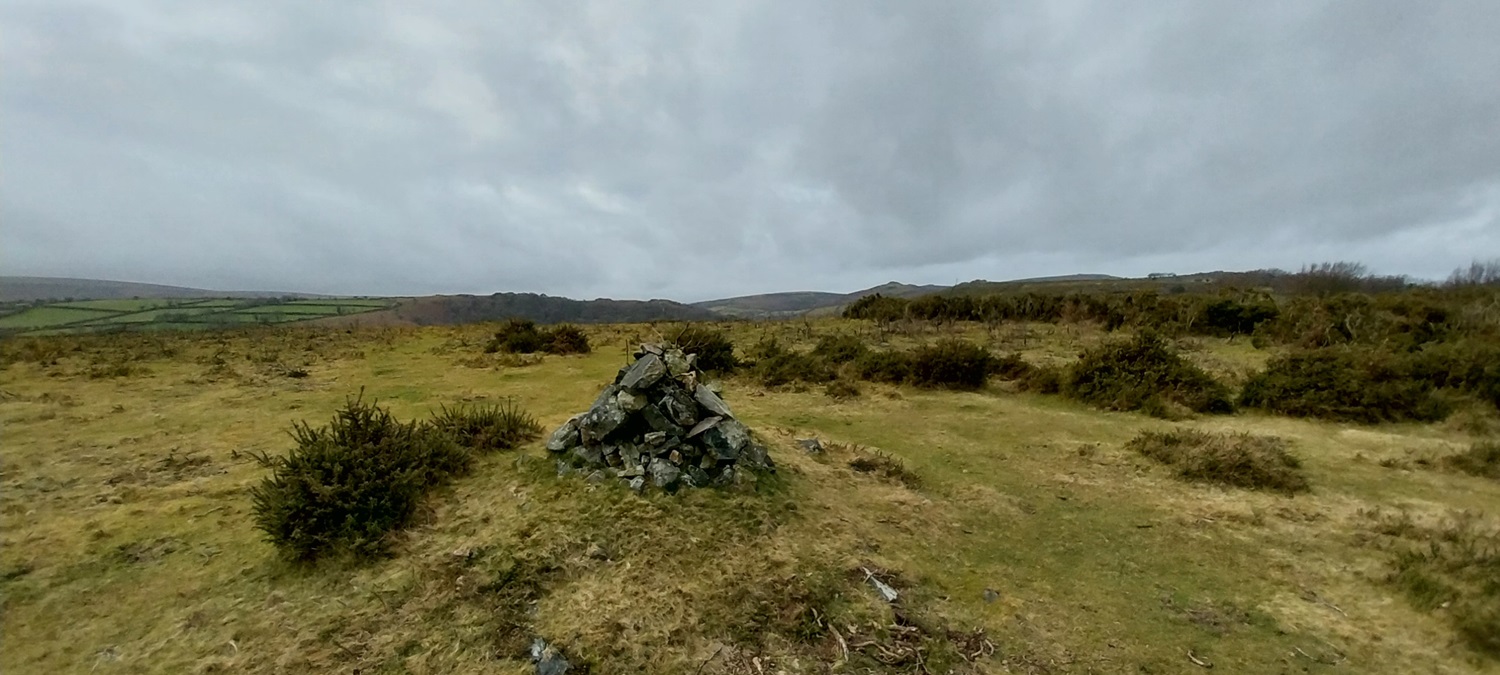
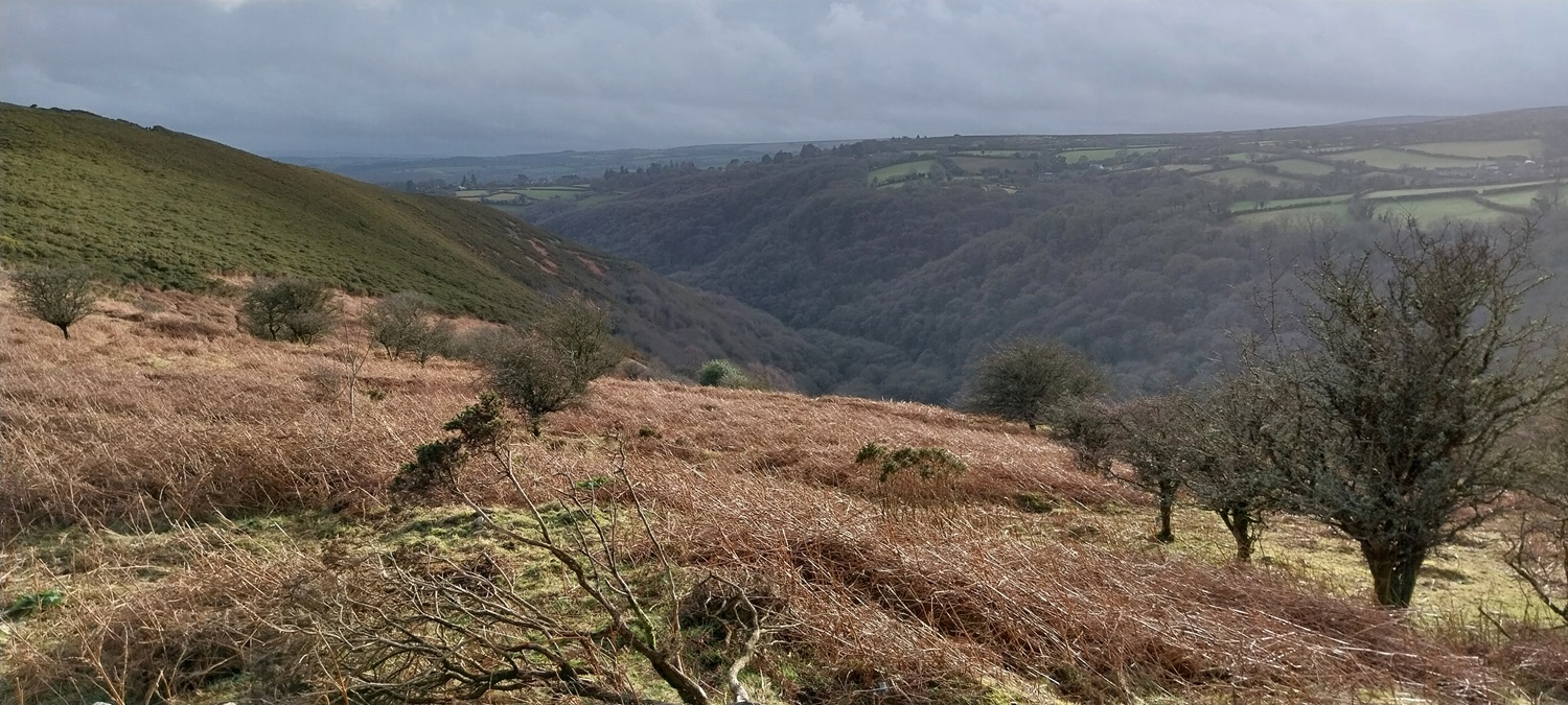
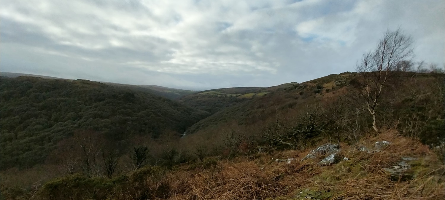
The first difficult walk of the year, and probably the hardest walk since we headed out to Flat Tor and Kit Rocks in September. We’ve had lots of walks of around 6, 7, 8 miles at most recently, but nothing with the steep rise and fall of this area. This was walk number 46 of my second round of the Dartmoor squares, taking in O15, O16 and P15. The area around Poundsgate always surprises me, there are tors in Blackadon Nature Reserve which involve a drop down towards the river and a climb back up out. Then we have The climb up from Deeper Marsh to Aish Tor, which is around a 200 metre climb and finally you have the Dart Valley and the steep woodlands down to Hockinston Tor. This was a walk with lots of descent and climb, some lanes, woodlands, tors and some lovely houses in hamlets. All that however meant parking at the Bel Tor Corner car park, which now has a parking meter courtesy of the owners of Spitchwick. Well we parked the opposite side of the narrow lane to Rowbrook, opposite the car park, in a small pull in spot for one car, and ignored the pay machine. The machine stated you must park within the bays and pay £3 to park there, well there weren’t any bays marked out so enforcement would have been very difficult. We set out with a light drizzle coming down, which quickly cleared, leaving us a mainly cloudy day with some sunny spells as the walk wore on, especially around Aish Tor. Another lovely part of the moor, the section along Dr Blackall’s Drive is superb with the plunging views down to the River Dart. I would recommend this part of the walk as an out and back from Bel Tor Corner, on its own, just for the views alone. Plus you have Mel Tor at one end, a lovely outcrop with the views as well. A place that showcases another side to Dartmoor, away from the open ground and large outcrops, instead steep woodland with outcrops buried within.
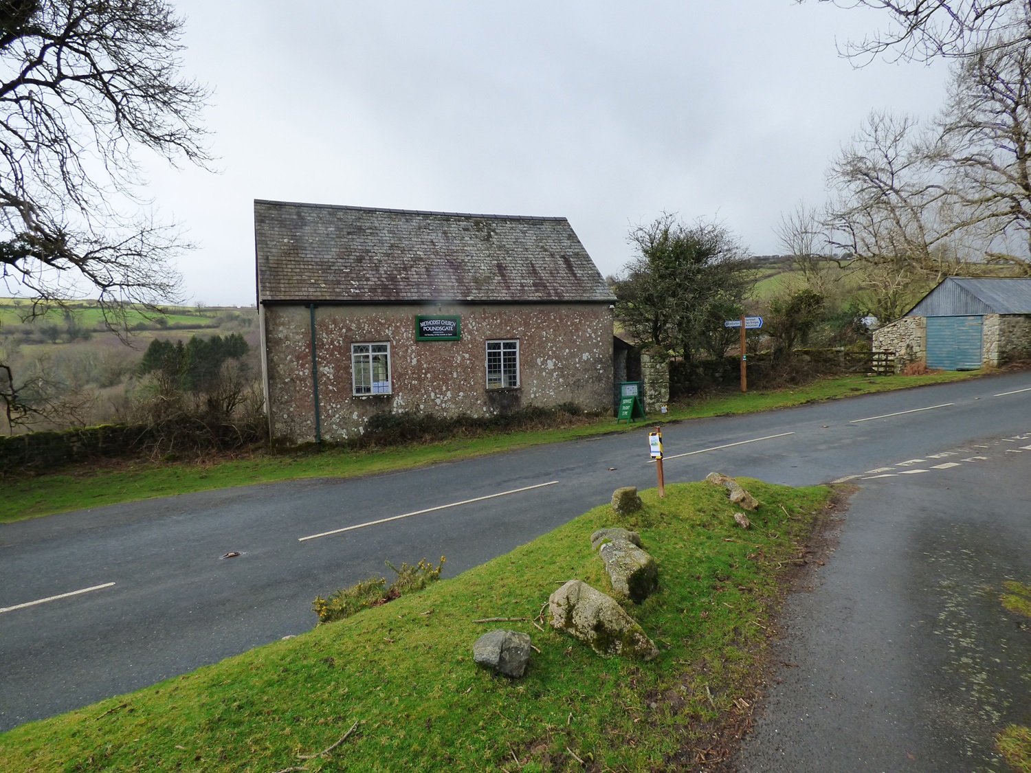
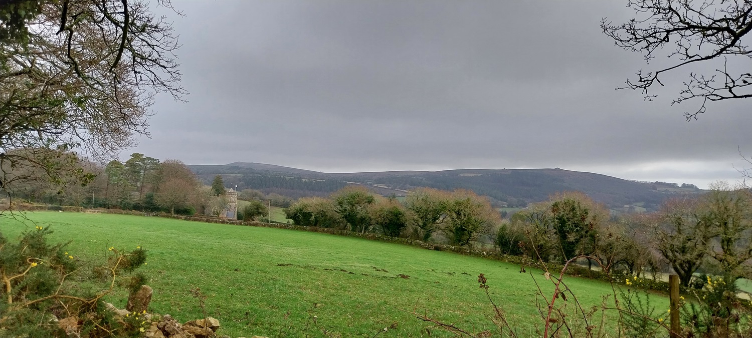
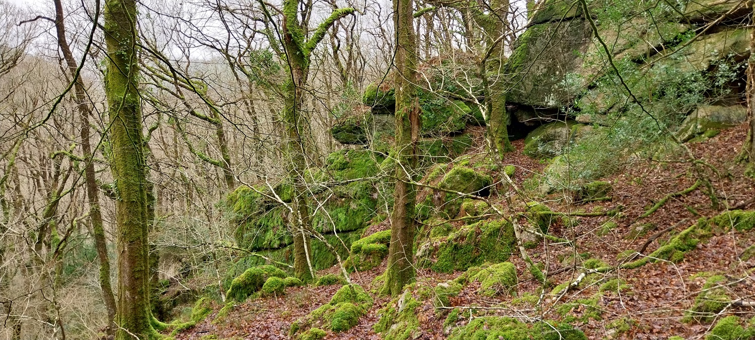
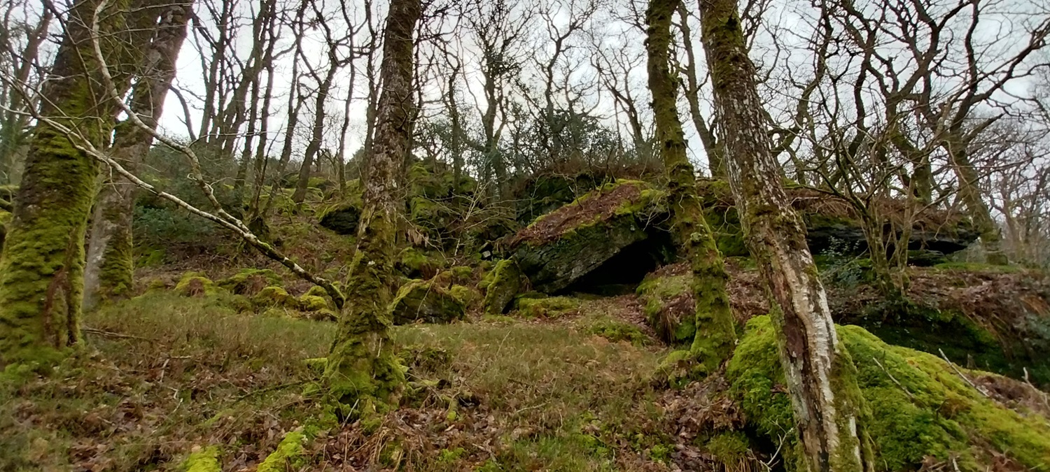
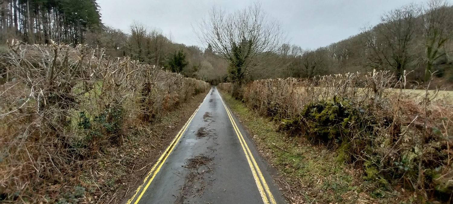
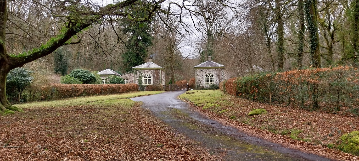
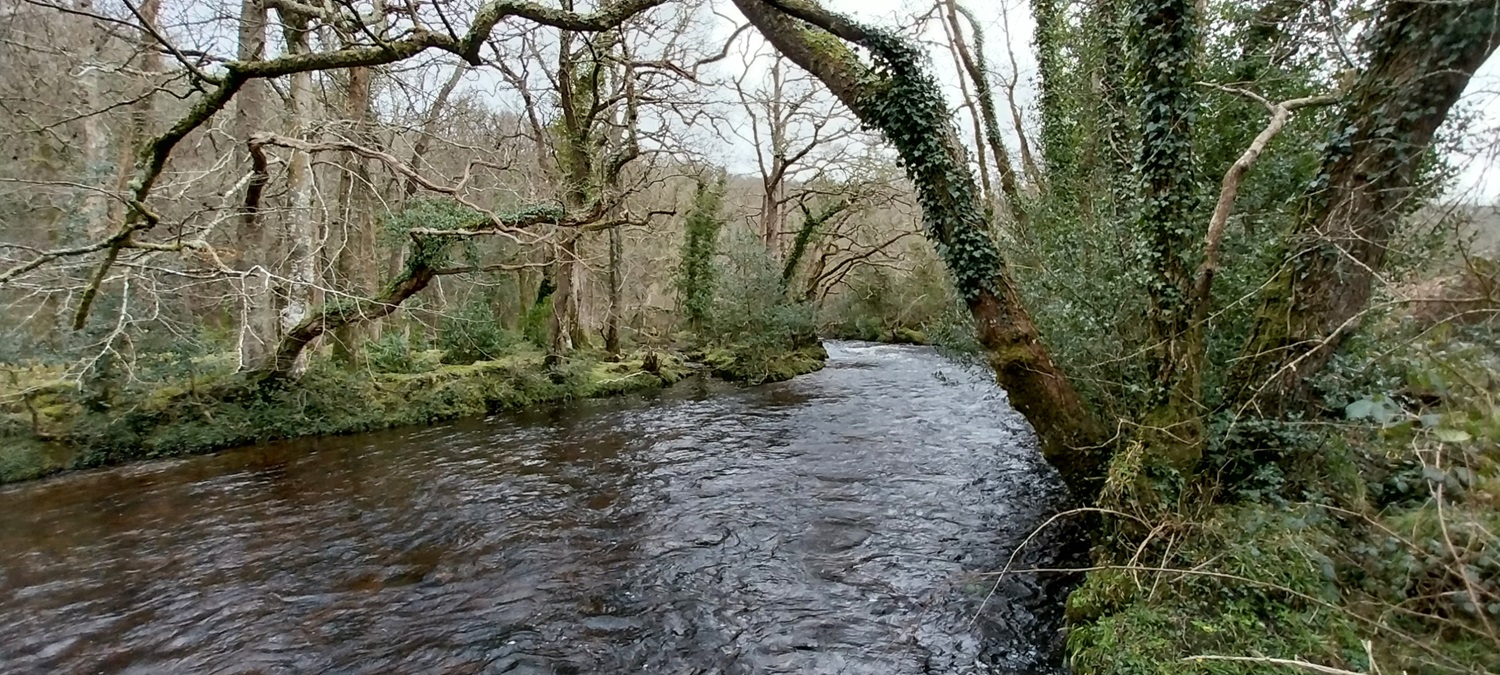
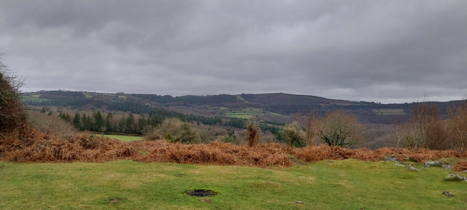
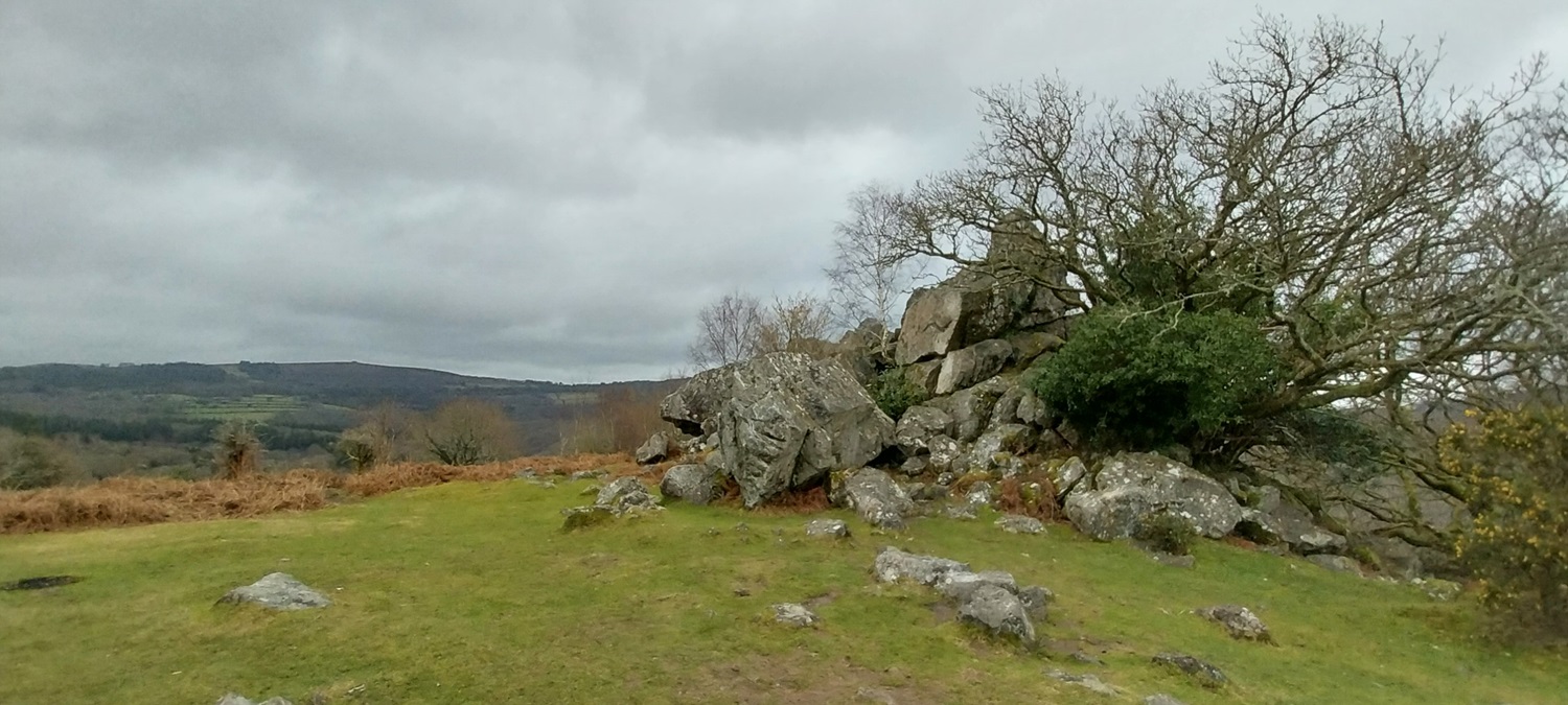
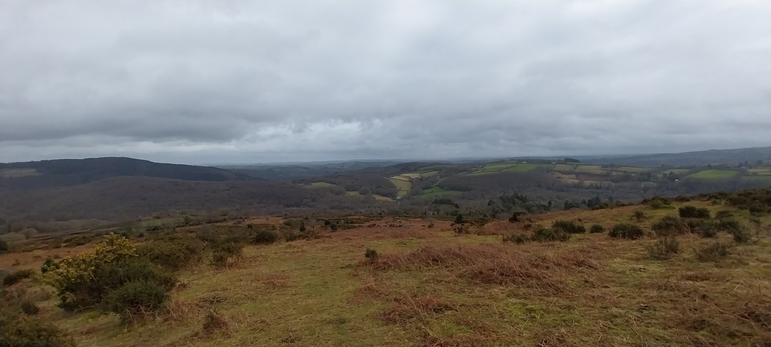
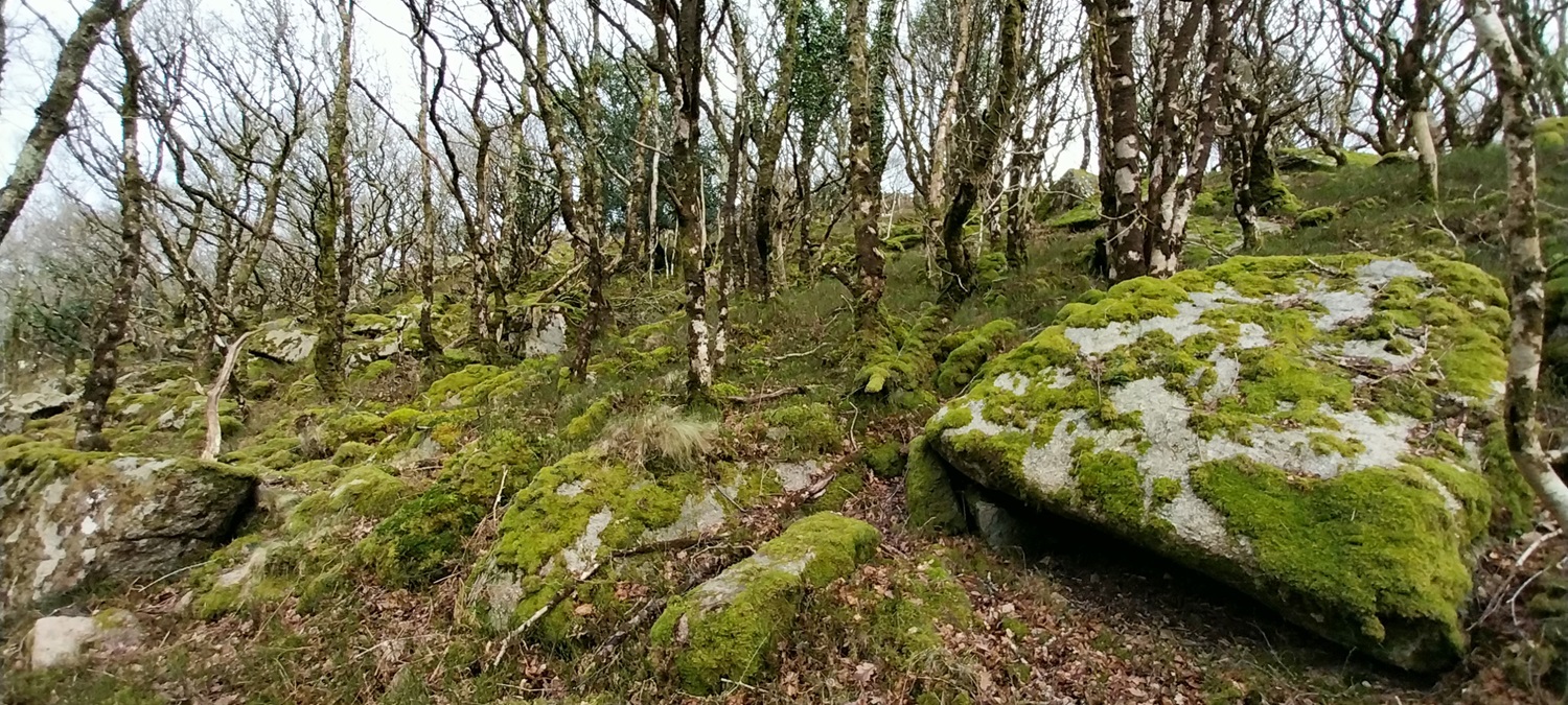
Parking meter with Sharp Tor in the distance, sun was bursting through over that way, however a bit of drizzle was falling on us here. We’d parked just on my right hand side here, the lane separating me from the car park. The stones all put in place to prevent people parking on the verges.Walking down the B3357 towards Leusdon, we looked over the wall at Bel Tor, marked as private on lots of the gates, but not on some others. Never sure if it is fully private this one, however you get within 40 metres of it along hereHigher Uppacott and Farm and a Dartmoor 365 square. This is a historic farmstead, longhouse and Grade 1 listed building as modeled by LindaSun piercing the cloudsLeusdon methodist chapel, there was service that afternoon.And the village hallViews to the church at Leusdon with Buckland Beacon at the back on the right, Rippon Tor back leftThere are two standing granite stones In Leusdon to mark Queen Elizabeth’s jubilee, this one is the silver one from 1977. The other, the golden one from 2012.Snowdrops at the back of Leusdon churchAnd inside, a fairly simple looking interior with lots of world war memorials to locals who had lost their life in the warsAlong a lane and into Blackadon Nature Reserve, this is Blackadon Tor, we headed into the woods behind this next, following the wall to the leftMisty views to Pudsham Woods as the cloud lowers a bit First up was Logwell Rock, but we headed through this one, returning back to the larger parts lower down in a bit.First we visited Leusdon Tor, large rocky outcrops tilted on steeply sloping groundLeusdon TorAnd back to Logwell Rock, there is a small piece of open ground between these two tors, but both tumble down the hillside within the woods (to be honest I need to take a photo of the floor between tors in woodlands, especially in Shaptor Woods, so when I get home I can work out which tor is which on each picture!).Logwell Rock againAfter a walk across and down a bit, heading in the direction of the convergence of the East and West Webburn Rivers, we neared Lizwell Rock, passing first a smaller outcrop Blackadon North Tor (as named by the guys at Tors of Dartmoor)Lizwell Rock and the crack that runs down the middleAfter heading back up hill passing near to Blackadon Tor again we headed for a path that would take us down towards Buckland Bridge. In all honesty we could have remained in the woods and head to the Webburn River and followed it downstream as that emerges by Buckland Bridge, however we chose the easier path, rather than the awkward riverside one. There was a bench just down from here so we had some lunch on it.Now I’m sure everyone can see that this road is only just wide enough for one car, so why you might ask, is there a need for two sets of double yellows. Well the River Dart is just to the right here, popular with kayakers, swimmers, families and Uncle Tom Cobbly and all. And there are plenty who wouldn’t think twice about parking here.Buckland Bridge, another Dartmoor square and required a short out and back to bag this one.More snowdrops by the roadI think this is the entrance to Spitchwick Lower lodge and an onward driveway to Spitchwick Manor itselfApproaching Deeper Marsh, another 365 square, we walk beside the Dart watching the kayakers/canoeists (feel free to correct me on which one), passing by. This was another short out and back to bag the squareAgain the Dart, and an outcrop I believe is called Spitchwick Common Rocks, as named by the Tors of Dartmoor teamRiver Dart againThe view from beside Leigh Tor, Buckland Beacon in the centreLeigh Tor, we’d had a second break here as we were half way up the long climb to Aish TorAfter about 7 or 8 mini stops we near the summit of Aish Tor, its a 200 metre plus climb from Deeper Marsh to this one and we were feeling it.Aish Tor summit, there are some very small rocky outcrops to the south east of this cairn but they aren’t really worth a visitStarting to see the view down into the Dart Valley, with Sharp Tor at the far end. We would join the path to the right here which is the Two Moors Way, the Dartmoor Way and named Dr Blackall’s Drive, we wouldn’t head far along it as we needed to descend to Hockinston Tor, by heading through that brown bracken section middle right of photo to get under the gorse section and into the trees belowSome dark clouds as we look the other way, as we start the descentHockinston Tor clitter sections, these are higher up than the actual outcrops, watch your footing in here as there are lots of animal burrows under the leaves and rocks. Both myself and Linda lost a foot down a couple of them.Hockinston Tor and the magnificent view along the Dart Valley to Sharp Tor at the far endAs we climbed out we got another fabulous view, Bench Tor and North Tor are on the left of photo here across the valleyMel Tor, it had been a hard slog to get back out of the woods, lots of uphill today. Rippon Tor is the high spot at the backMel Tor looking to Venford Reservoir and Ryders Hill at the backJust one more look along the valley, this time with Sharp Tor to the right. We have a walk planned for that section of the valley that you can see from here, it includes Luckey TorNearly back at the car and a view across to Bel Tor again, along the tree line. A superb walk with Linda and hard on the legs, given that we hadn’t done anything like this for 4 months or so.
14 thoughts on “Mel Tor, Leusdon and the difficult Hockinston Tor”
Minor correction: your Lizwell Rock photo is actually Blackadon Lower North Tor. This is the best time of year to visit this area. I was here recently, the colours were stunning – at Webburn Gap especially.
Did wonder if I had that wrong, I’ve added a photo of Lizwell rock with the crack running down the middle. I took it on my other camera and forgot about it and that Lizwell has that obvious crack, only my second visit here
Sad to see Spitchwick profiteering in this way. Belt Tor corner always used to be free. It would never have happened in the days when Jack Simpson ran the estate.
Congratulations on reaching Hockinston Tor. I walked that way a while back with my husband and he refused to try to go down off the path. Having read your comments I don’t think I’ll be in a hurry to try as I already broke my ankle in 2022 in a hole in the Outer Hebrides. I was wearing walking boots with good ankle support but was carrying a weighty backpack for camping though.
We’ve got crocus as well now. We;ve hardly had any cold days here. Pretty much the same weather, heavy showers/drizzle, windy and 11 degrees every day since the middle of October
Top walk that. As always, packed with interesting stuff. Is that church as wonky as it looks in your photo!?
To keep you straight, kayaks are the ones you sit inside a cockpit, or ones you sit completely on top of, a canoe is one with bench type seats, a Canadian style.
I think these were kayaks, but not overly certain. The church is straight my photo is wonky!! Heading to the Brecons mid March, will send an email with the dates if you wanted to meet for a walk.


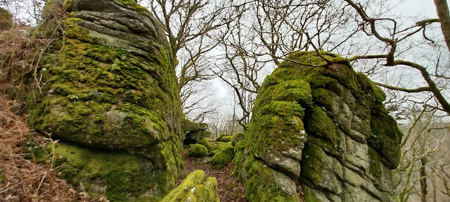


Minor correction: your Lizwell Rock photo is actually Blackadon Lower North Tor. This is the best time of year to visit this area. I was here recently, the colours were stunning – at Webburn Gap especially.
LikeLiked by 1 person
Did wonder if I had that wrong, I’ve added a photo of Lizwell rock with the crack running down the middle. I took it on my other camera and forgot about it and that Lizwell has that obvious crack, only my second visit here
LikeLiked by 1 person
And mine!
LikeLike
Sad to see Spitchwick profiteering in this way. Belt Tor corner always used to be free. It would never have happened in the days when Jack Simpson ran the estate.
LikeLiked by 1 person
Those skies look so heavy to me, but I guess it’s easier to climb when it’s overcast. Well done to the pair of you.
LikeLiked by 1 person
There was definitely some showers around on Dartmoor on Sunday, we got a little lucky as there was very little near us
LikeLiked by 1 person
Congratulations on reaching Hockinston Tor. I walked that way a while back with my husband and he refused to try to go down off the path. Having read your comments I don’t think I’ll be in a hurry to try as I already broke my ankle in 2022 in a hole in the Outer Hebrides. I was wearing walking boots with good ankle support but was carrying a weighty backpack for camping though.
LikeLiked by 1 person
I still think it is the hardest tor to get to, even when you include the ones in the middle of the moor like Fur Tor or Great Kneeset
LikeLike
I agree – Fur Tor and Great Kneeset are both a long trek but easy to locate unless the weather is particularly bad.
LikeLiked by 1 person
Looks like a good winter walk. And snowdrops – none out around here yet.
LikeLiked by 1 person
We’ve got crocus as well now. We;ve hardly had any cold days here. Pretty much the same weather, heavy showers/drizzle, windy and 11 degrees every day since the middle of October
LikeLiked by 1 person
I spotted some cocus on the lawn at the top our street this morning. Perhaps Soring is onit’s way to Wigan after all.
LikeLiked by 1 person
Top walk that. As always, packed with interesting stuff. Is that church as wonky as it looks in your photo!?
To keep you straight, kayaks are the ones you sit inside a cockpit, or ones you sit completely on top of, a canoe is one with bench type seats, a Canadian style.
LikeLiked by 1 person
I think these were kayaks, but not overly certain. The church is straight my photo is wonky!! Heading to the Brecons mid March, will send an email with the dates if you wanted to meet for a walk.
LikeLiked by 1 person