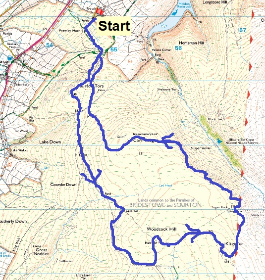
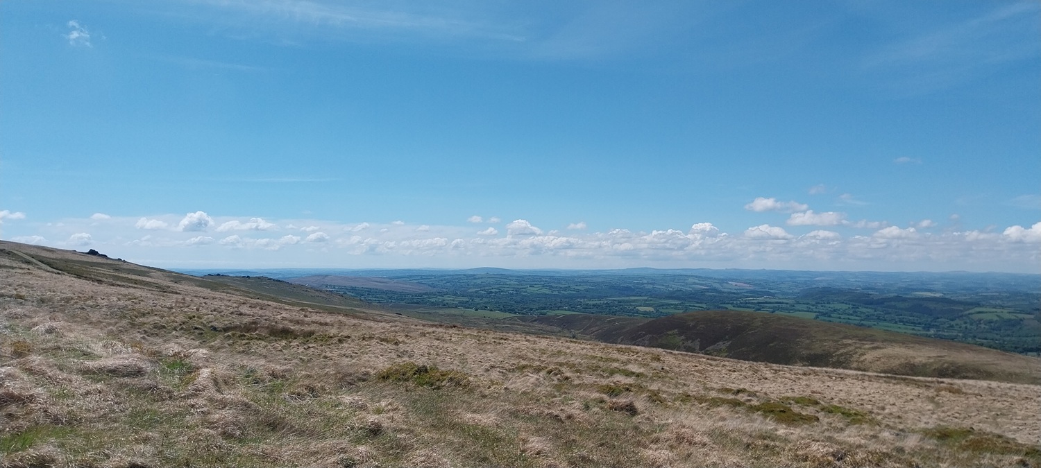
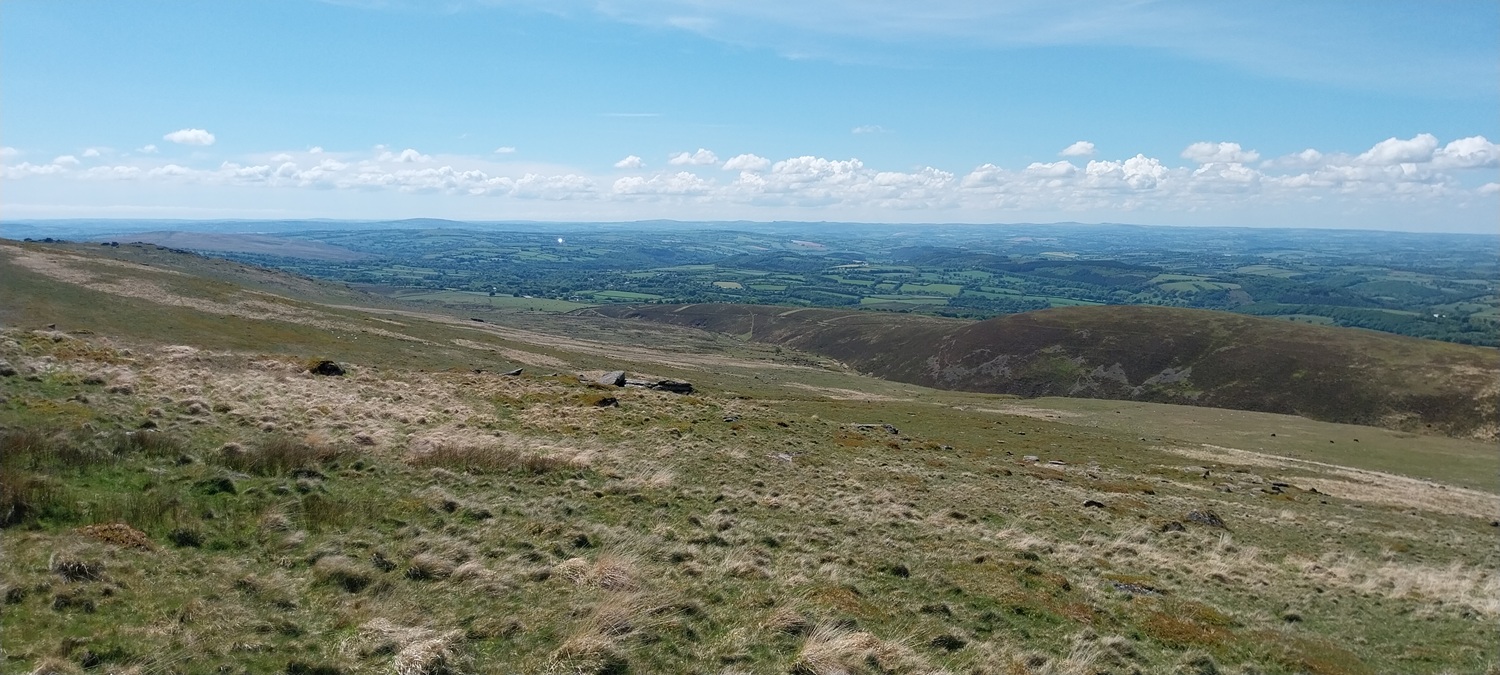
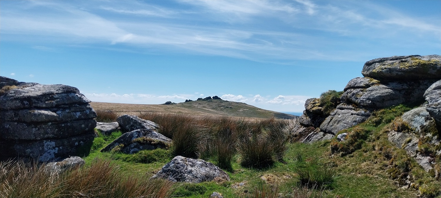
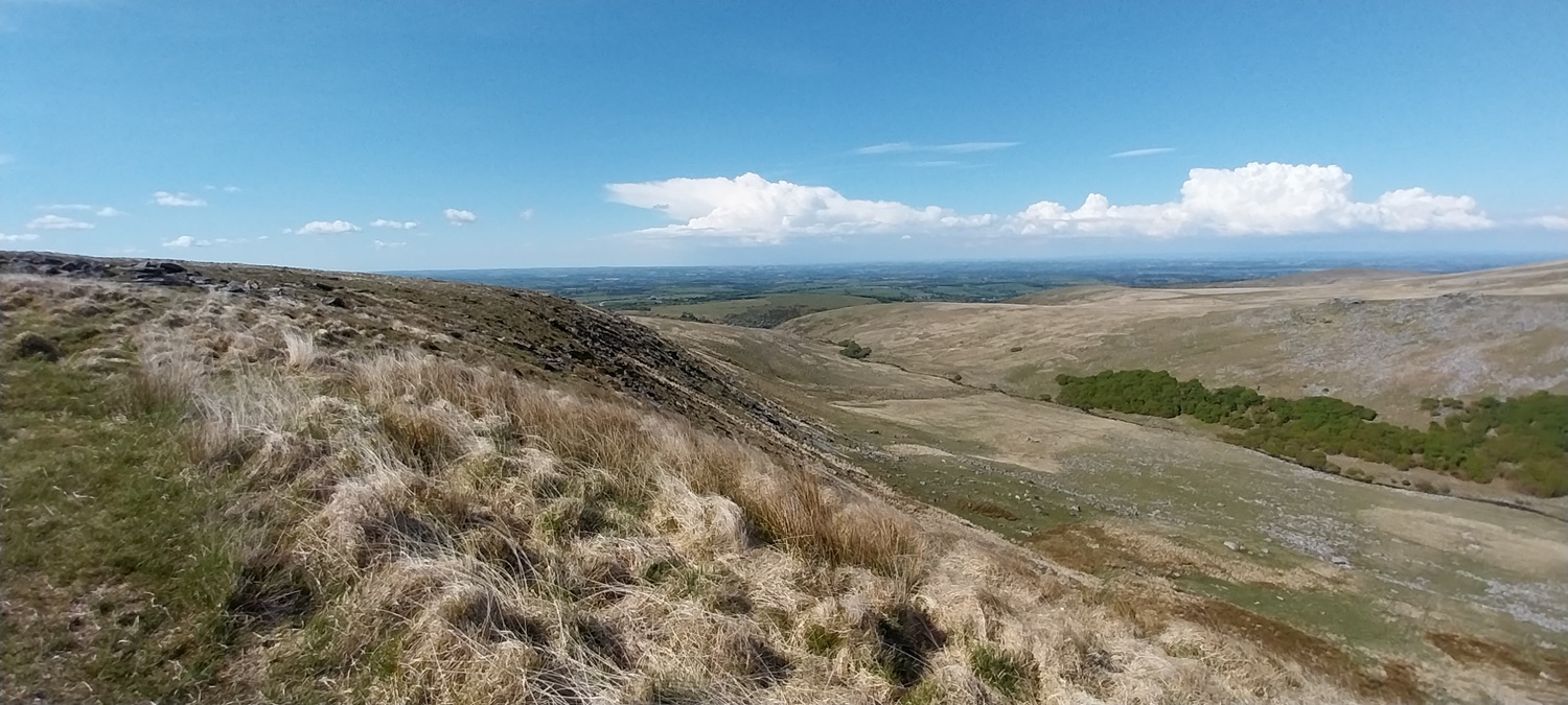
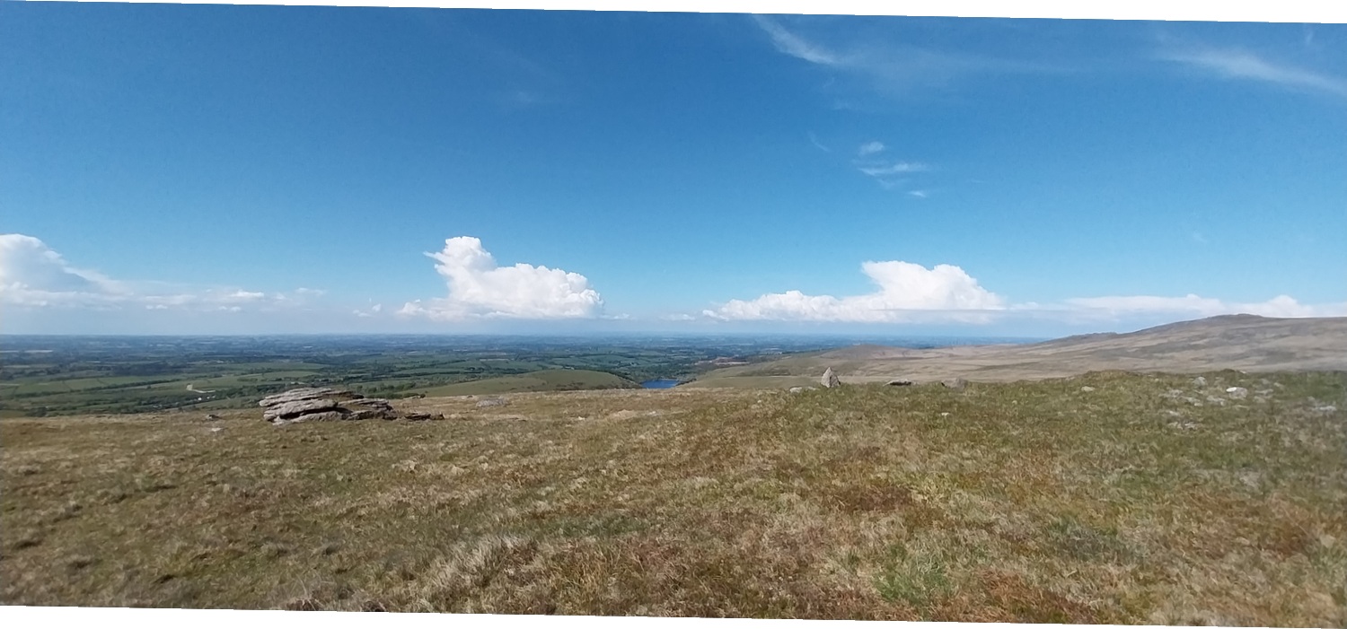
We’d really enjoyed our last trip out to Dartmoor, along the western side around Bagga Tor and Standon Hill, so we decided to repeat a trip to that side of the moor. The area around the Corn Ridge has the same far reaching views as those from Standon Hill, with added tors and the West Okement valley at its rear, views into the centre of the moor are also as spectacular. We we packed rucksacks and headed off for Prewley Moor to start the walk. The weather was superb and after pretty much 2 1/2 months of dry weather, the boggy parts of this walk, should be good. The area around Kitty Tor can be soggy and the less said about Stenga Tor, the better for me. I really don’t like it, and have had words with that tor on at least 2 occasions, when I’ve gone over my knees in some very questionably smelling gloop. Still we set out in a positive frame of mind, with 9 tors and 2 new Dartmoor squares on the menu, plus one we’d visited before. First up was Sourton Tor and lovely views for most of the 360 degrees around it, before we headed off to the Rattlebrook railway path and the other tors dotted on either side of that track. Next we headed over to Kitty Tor, on the edge of the Okehampton Firing Range, views into the centre of the moor open up here, with improving views down into the West Okement valley. Before long we’d reached Stenga Tor, which is best approached from the Kitty Tor side, it was a bit squishy, but not too bad. We then stayed low below the tor to head to our next target, but still had to cross some horrid sections of bog. I was glad of my walking poles, as I prodded ahead for terra firma, only for it to disappear completely at one point (around a metre deep!!). We reached the top of the Slipper Stones unscathed before heading off the Branscombe’s Loaf, another boggy section of path. All that was left was the drop off from Corn Tor back down to Prewley Moor and the car. A fine walk and so much to see and avoid!!
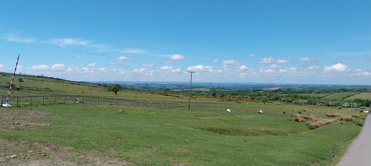
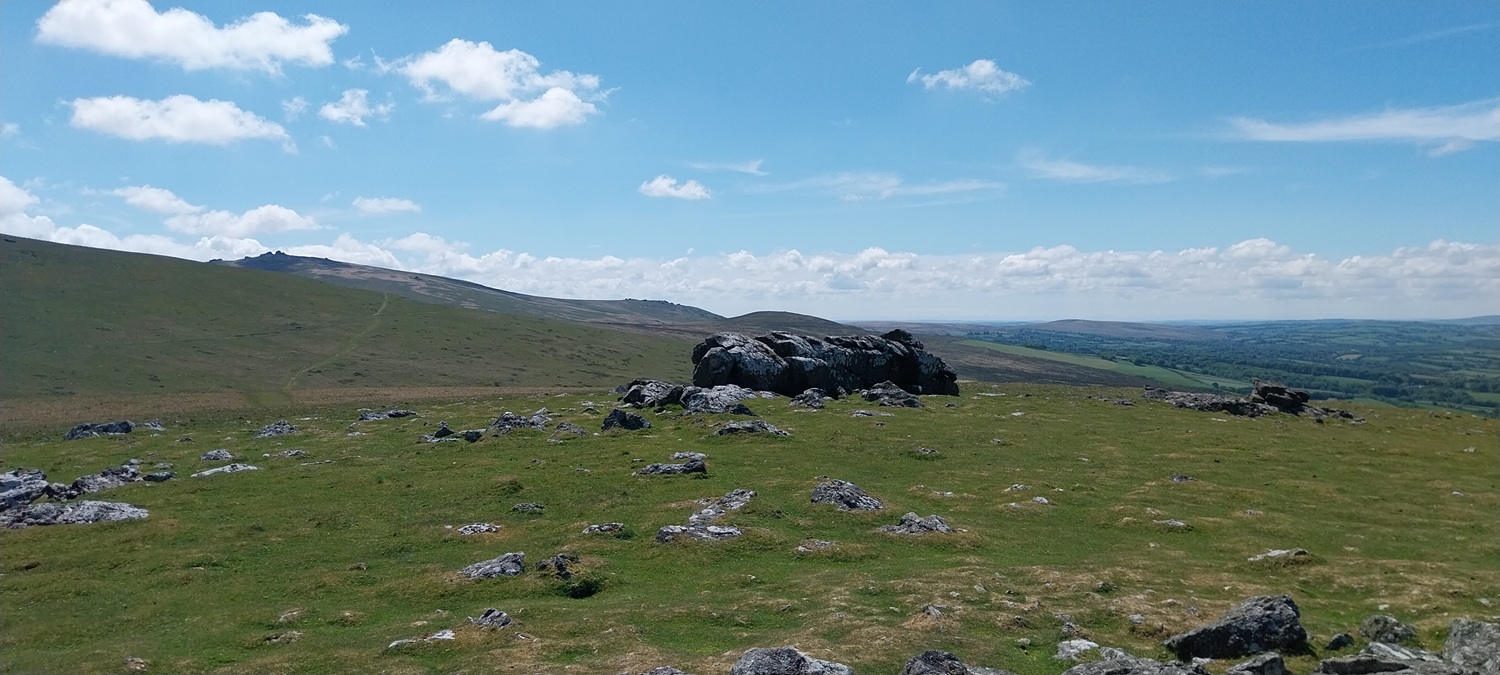
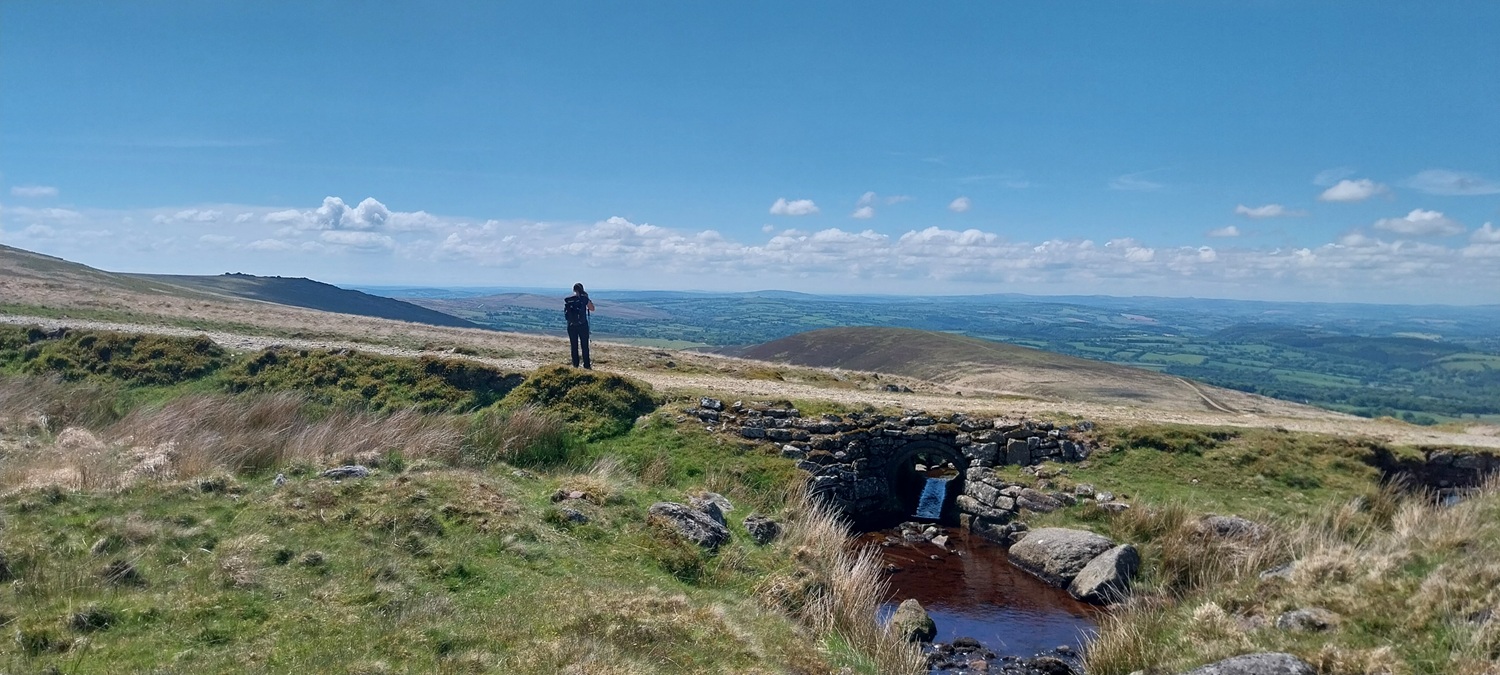
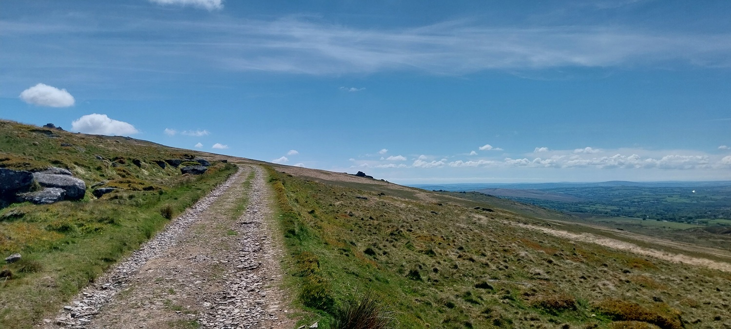
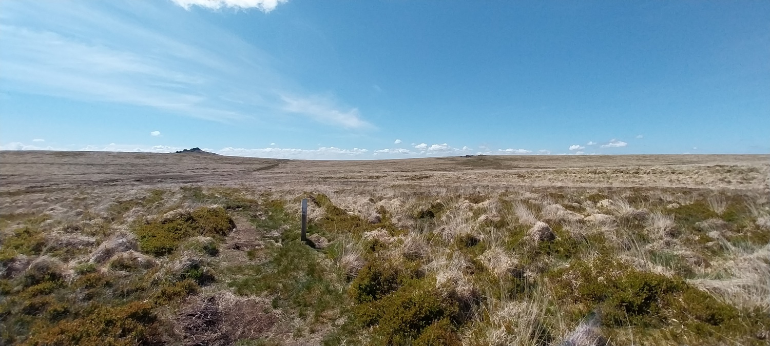
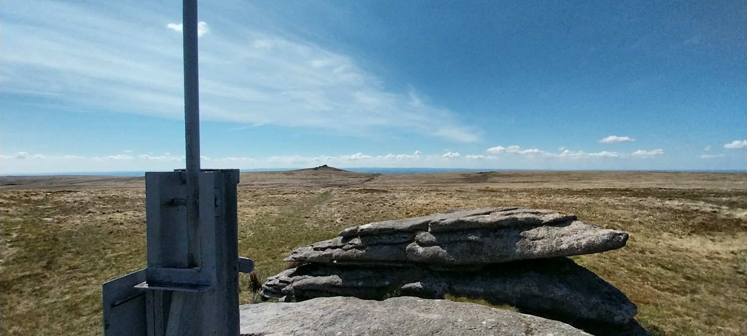
Prewley Moor parking, still parts fenced off by South West Water who have been running a pipe across here for a long time now, forcing walkers through two narrow entrances on to the moor, which become sludge fests in the winter.Views north with South Down on the right, Exmoor could be seen in the distance as wellBefore long Meldon reservoir came into view between South Down on the left and Homerton Hill on the right. Further up to the right is Rowtor and West Mill TorSourton Tor and those lovely views west to CornwallThe way we are heading. Great Links Tor is the big one at the back, we wouldn’t quite get that far but instead head around to the leftMeadow Brown butterfly, a bit washed out compared to some you seeWe’d picked up the Rattlebrook railway path, here Linda stands on Lydia Bridge, which has the infant River Lyd passing under it. Turning around I look into Tiger’s Marsh one of the Dartmoor squares today, the River Lyd starts in hereThe Lyd valley runs away down the middle, Great Nodden on the right. Cornwall in the distance. This was our lunch stop, after a late start we decided sandwiches were needed on Gren Tor with this viewThe Rattlebrook railway path, Great Links Tor back left and Little Links Tor half way down the slope. This is the start of Woodcock Tor here, more of it down to the rightDown there is Woodcock Tor, with Great Nodden further down the slopeThe route we took had us zig zagging around the Rattlebrook path, with first Gren Tor, then Woodcock Tor and this one, Hunt Tor. Views down to the Rattle brook itself from hereAnd also to Great Links Tor, which dominates the landscape on the western side of DartmoorWe’d rejoined the path that leaves the Rattlebrook railway, heading to Kitty Tor, these white tipped posts give you a route through some very boggy ground seen as a dip ahead here. With Great Links Tor beyond the boggy bits, and Hunt Tor over to the rightMy guess is this is a Common Heath Moth, might be one of the Carpet Moths as well. Anyone know for sure?Kitty Tor and the unmistakable flagpole marked the edge of the firing ranges (Okehampton in this case)The bleak moorland surrounding Kitty Tor. Great Mis Tor away in the distanceThe rest of Kitty Tor is down there by the huts. High Willhays and the roof of Devon ahead of us on the other side of the Okement valley, which is tricky to pick out on this photoLints Tor is down there in the Okement valley, and the centre of the north moor opens out behind
Not the best picture but we spotted this piece of live ammunition on the track to Stenga Tor, we moved it off the track for safety
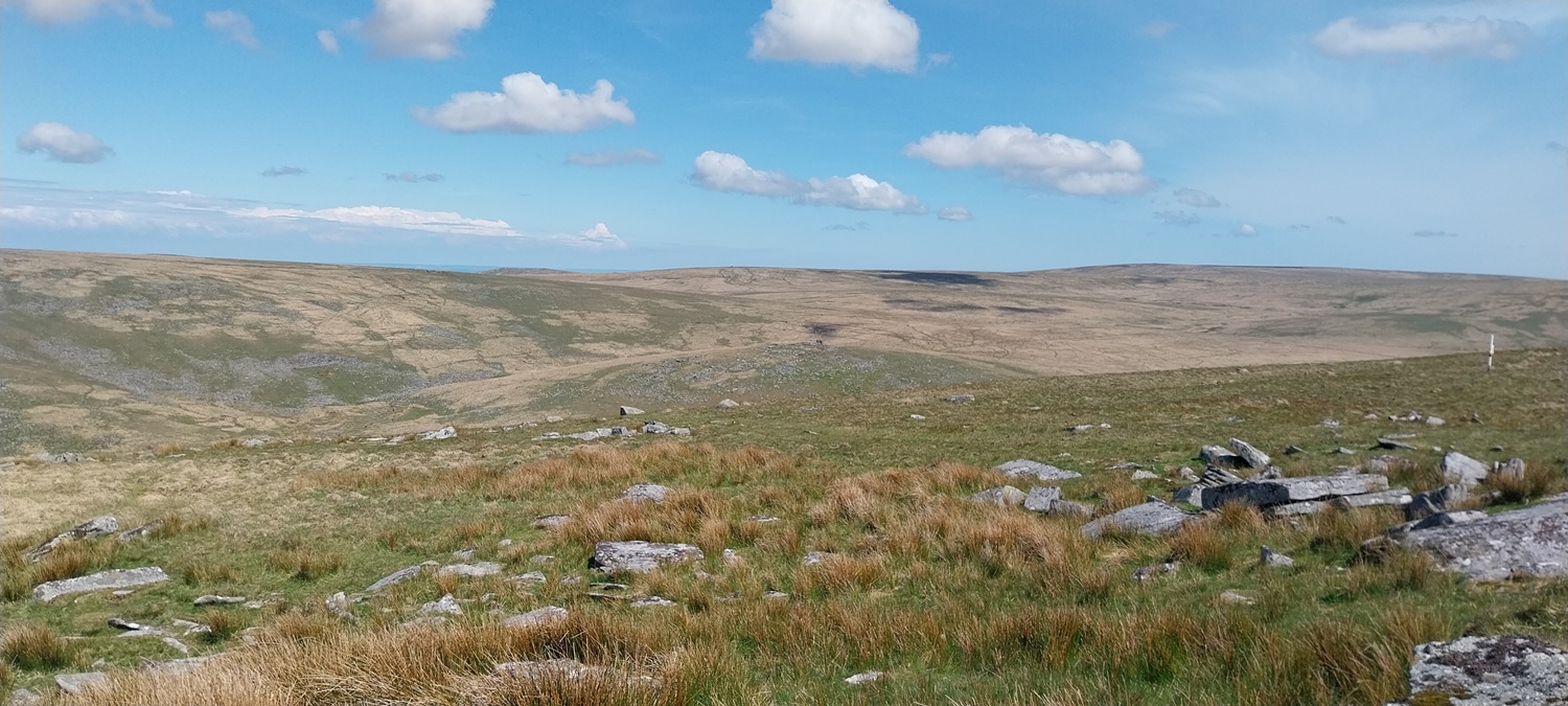
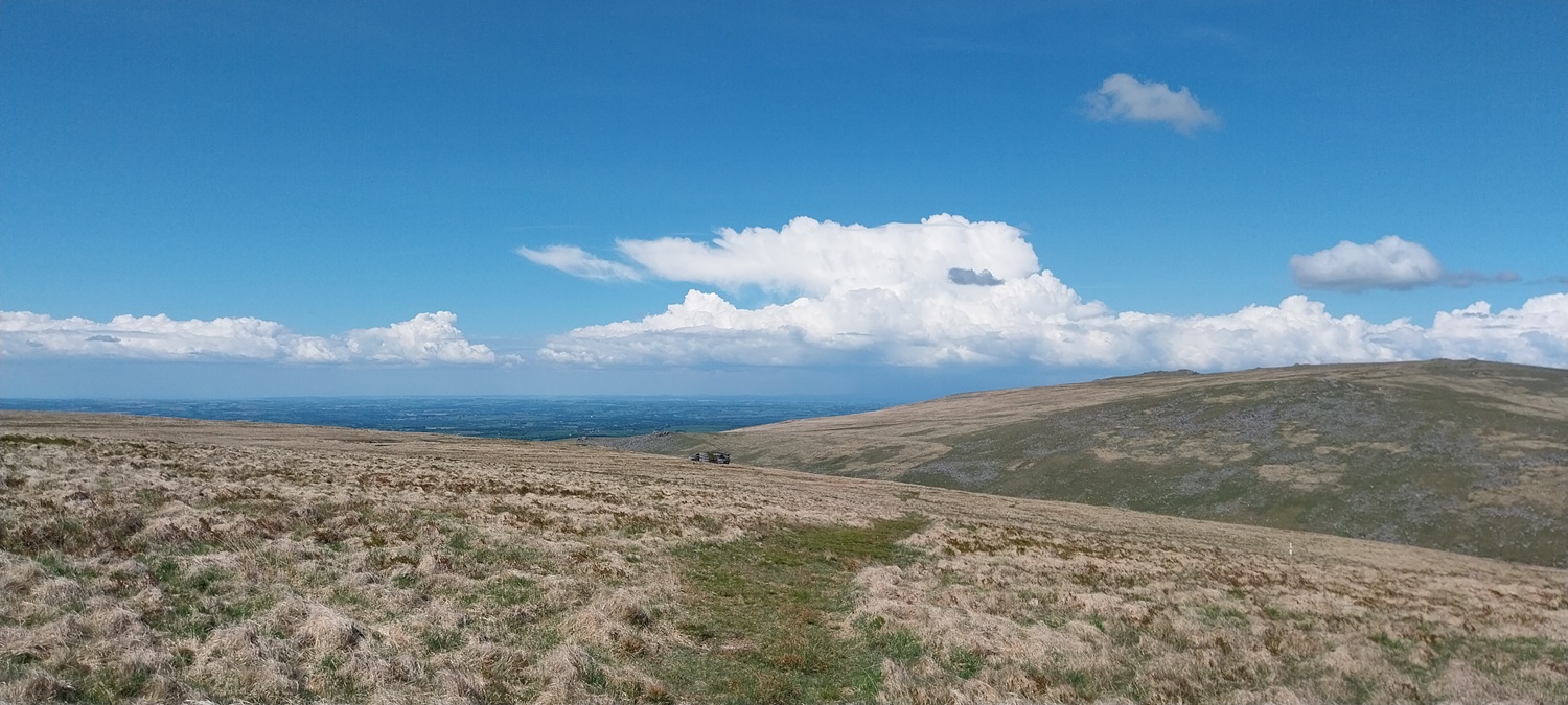
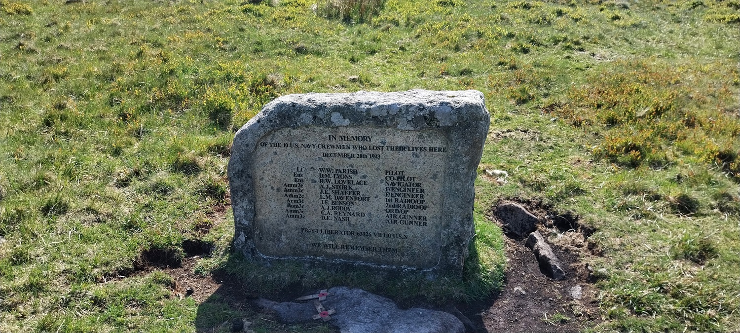
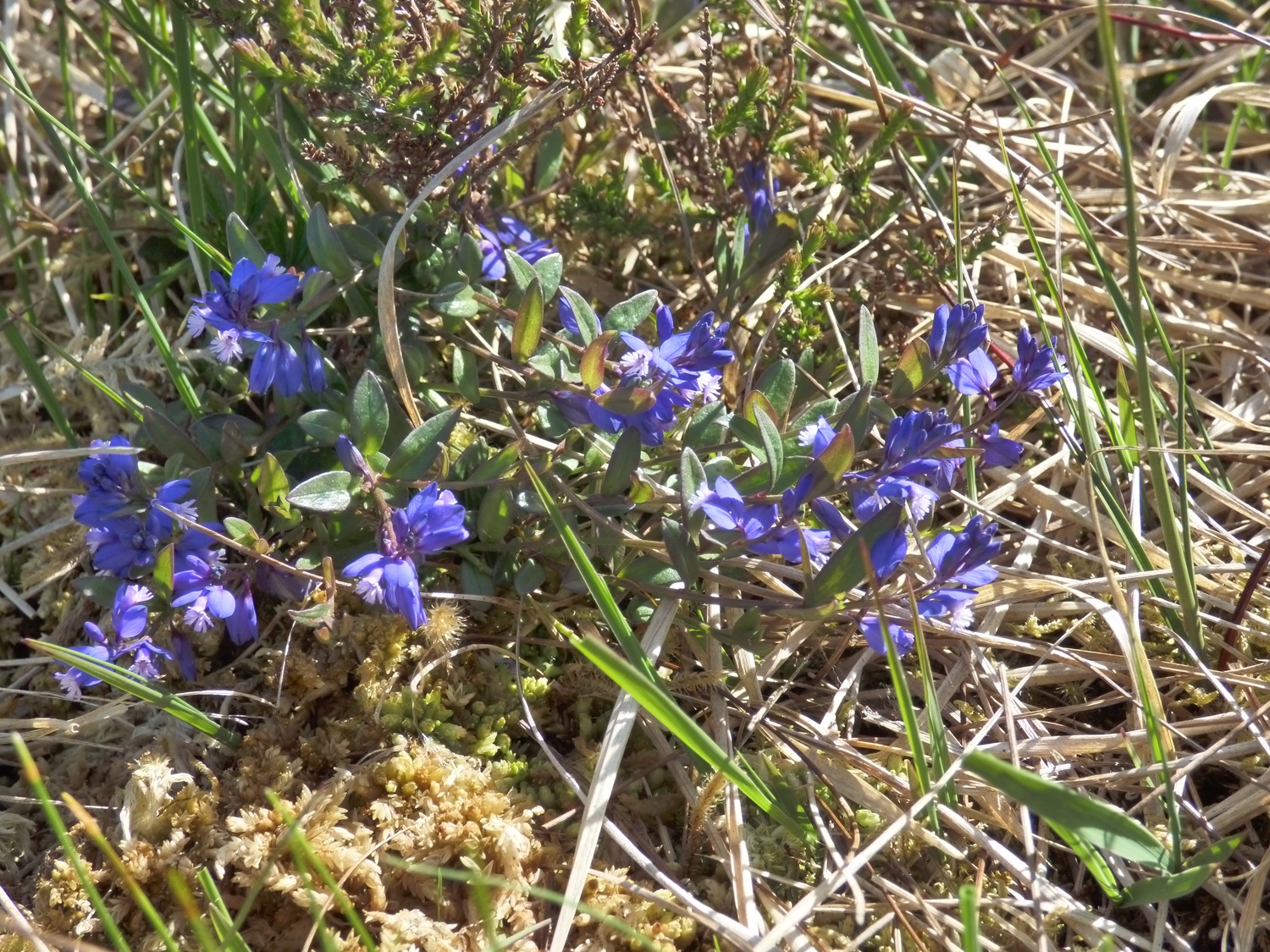
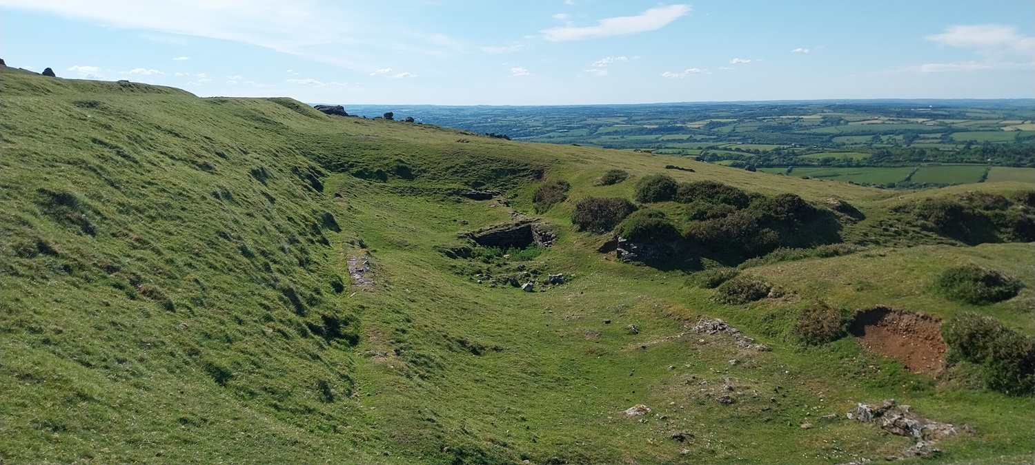
On our way down to Stenga TorStenga Tor, its surrounded by boggy ground, the Kitty Tor side is ok normally, but below and onwards to Slipper Stones is always hideous, it was no different this time even after 2 months of dry weatherThe war memorial to those who crashed hereNearing the Slipper Stones, the West Okement below to the right. Black- a-tor copse on the right across the West Okement riverThe top of the Slipper Stones, more slabs appear as you descend down the hill into the valley. High Willhays is opposite, with Yes Tor back leftCommon milkwort, lots of this about today in the boggy groundLinda at Branscombe’s Loaf, another great Dartmoor story cover this one, Walter Branscombe was the Bishop of Exeter back in the 13th century. He was riding home across the Corn Ridge with his servant when a stranger appeared offering them food in the form of bread and cheese. Being hungry from their ride Walter reached out for the offering. Luckily the servant noticed the cloven hoof of the stranger and recognised him as the Devil himself. Knocking the food out of his masters hand immediately, saving him from losing his soul, the bread and cheese flew through the air and landed in their current position on top of the Corn Ridge. The Devil vanished as soon as the food landed. I think that is the cheese over there, and again Meldon reservoir is in the distanceCorn Tor now, our last one of the day. The second time I’ve been here which leaves me with one to do on my second round of my own tors. Stunning views to Cornwall and lots more as well, you can see the north coast of Devon/Cornwall from here, alongside the southern coast around Plymouth meaning you and see the full width of the county!Heading across Prewley Moor and the views are still there with Meldon reservoir, Rowtor, West Mill Tor and South Down all in shotLovely views as we descendFinally we reach the Ice factory, yep that’s right they tried to make ice here on a north facing slope in the 1870s during the colder months. To help transport food around and bring ice to the masses. Fascinating stuff all around on Dartmoor. The end of our walk and another done in superb weather, although we definitely could do with a little rain, overnight, so it doesn’t spoil the days. 😁
People have camped throughout without any worry as they are two hours more walk from a road. The fear is it now attracts idiots who think its Christmas with a BBQ down here now. If I go again I’ll wait a year and start again when it calms a bit
Superb day! In my very limited experience of Dartmoor I’ve never come across the worst of the boggy stuff but everywhere always gives the impression your just a short squelch away from something nasty!
I concur with you on Stenga Tor – as part of my 176 Tors of Dartmoor challenge (there’s a book listing them that I’m following but I can’t work out how they got the 176!) I did a large loop around Meldon reservoir, Great Links and High Willhays on Saturday (19th July) and Stenga was part of it.
Worst tor so far and I’ve done over 100 of them, even with the fairly dry year we’ve had. Also, Green Tor to Kitty Tor was very damp!
Must also take this opportunity to thank you for your fabulous website – it’s been invaluable in planning routes and finding tors, let alone being very informative.
Thank you Robin, that’s very kind of you to say. I’m not sure on the 176 tors number. I thought at first it was related to tors on Dartmoor that could be reached from the open access land, so no need to walk lanes/footpaths between them, which ruled out the tors around Haytor and the east of Dartmoor, but I’m not certain.
The tors come from this book but no idea on their criteria – Combestone Tor isn’t on it despite it being large, and marked on the map but Stannon and Kinghead Tors are!
Despite that I’m adding in a good number from your walks and maps so I should be up to 200 by end of the year 🙂


You can go camping again now! But probably best not near those firing ranges
LikeLiked by 1 person
People have camped throughout without any worry as they are two hours more walk from a road. The fear is it now attracts idiots who think its Christmas with a BBQ down here now. If I go again I’ll wait a year and start again when it calms a bit
LikeLiked by 1 person
Yes, the idiots will, no doubt, be out.
LikeLike
If look up from the West Okement, Stenga looks just like Brian the Snail in The Magic Roundabout,
LikeLiked by 1 person
I’ve always called it Snail Tor, simply due to the slimey nature of its immediate surroundings
LikeLiked by 1 person
I well remember.
LikeLiked by 1 person
Fabulous views and nice ‘cheese’, Steve, but oh that boggy stuff! Well done to the pair of you xx
LikeLiked by 1 person
Glad to get this one ticked off for Linda completing her first round of tors
LikeLiked by 1 person
Superb day! In my very limited experience of Dartmoor I’ve never come across the worst of the boggy stuff but everywhere always gives the impression your just a short squelch away from something nasty!
LikeLiked by 1 person
I’d avoid Stenga Tor like the plague. Rarely head that way. Linda first and maybe only visit!
LikeLiked by 1 person
Another walk with beautiful views 😍.
LikeLiked by 1 person
I concur with you on Stenga Tor – as part of my 176 Tors of Dartmoor challenge (there’s a book listing them that I’m following but I can’t work out how they got the 176!) I did a large loop around Meldon reservoir, Great Links and High Willhays on Saturday (19th July) and Stenga was part of it.
Worst tor so far and I’ve done over 100 of them, even with the fairly dry year we’ve had. Also, Green Tor to Kitty Tor was very damp!
Must also take this opportunity to thank you for your fabulous website – it’s been invaluable in planning routes and finding tors, let alone being very informative.
LikeLiked by 1 person
Thank you Robin, that’s very kind of you to say. I’m not sure on the 176 tors number. I thought at first it was related to tors on Dartmoor that could be reached from the open access land, so no need to walk lanes/footpaths between them, which ruled out the tors around Haytor and the east of Dartmoor, but I’m not certain.
LikeLike
The tors come from this book but no idea on their criteria – Combestone Tor isn’t on it despite it being large, and marked on the map but Stannon and Kinghead Tors are!
Despite that I’m adding in a good number from your walks and maps so I should be up to 200 by end of the year 🙂
https://herbertpublishing.com/project/dartmoor-tors-challenge/
LikeLiked by 1 person