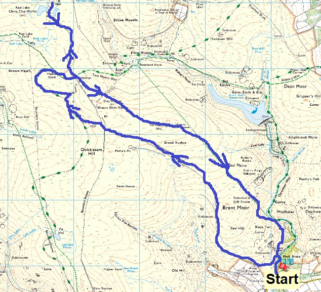
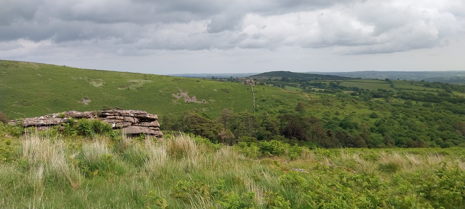
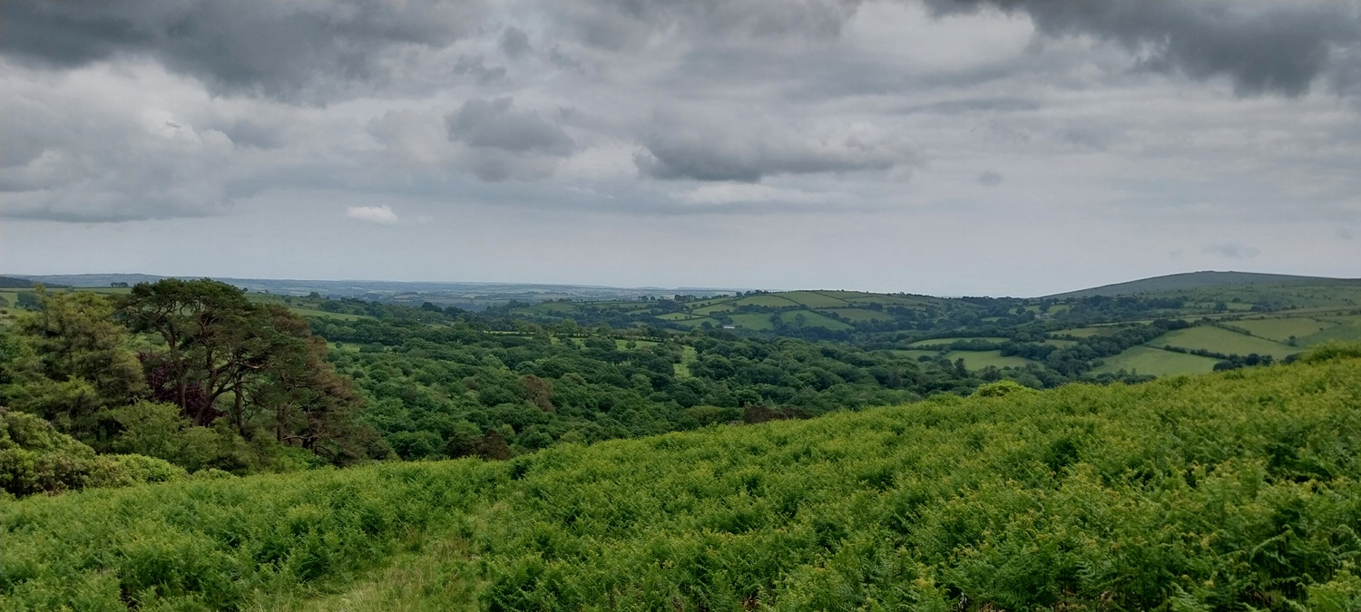
It had been 4 years since I’d done a similar route and walked out to Redlake from Shipley Bridge. Since then they had installed pay meters at the car park and managed to re open the toilets. If the money from the car park goes into keeping the loos open then I’m for it, but as luck would have it, the meter was broken so we were happy. This walk starts off heading uphill, in fact its 2 1/2 miles in before you start a gentle drop down to the Two Moors Way path, that said the Zeal tramway path isn’t steep at any point and is a good way to get up above the 450metre contours. You’ll pick off a number of Dartmoor squares in this area and plenty of parts were industry has left its mark on the moor. We next followed the Two Moors Way path around towards Redlake, doing an out and back before heading up to Western Whitebarrow and then on to its Eastern cousin. The ground between the two was very boggy, which considering the dry spring was a bit of a surprise, but I suppose we have had some rain in early June. At Eastern Whitebarrow we came across rubbish, with plastic bottle and cans around, this was clearly a family picnic as the plastic bottles were for kids drinks, we picked up as much as we could see, but this is a terrible lessons to teach your kids. We descended down towards Black Tor and then back to Shipley Bridge, a fine walk and an area I tend to neglect as it can get very, very busy around Shipley Bridge, but today it wasn’t too bad and the walk was a cracker, even with the soggy ground.
Broken metre at the start of the walk. Errors came up when pressing any button, That’s a shame eh?!!
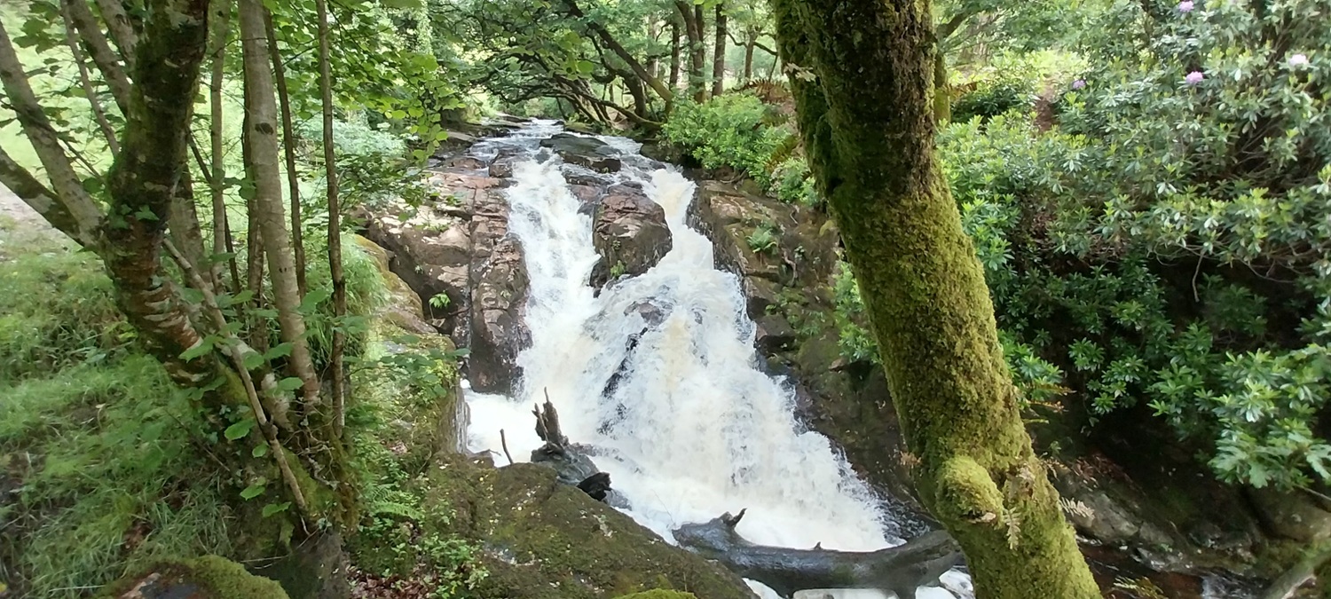
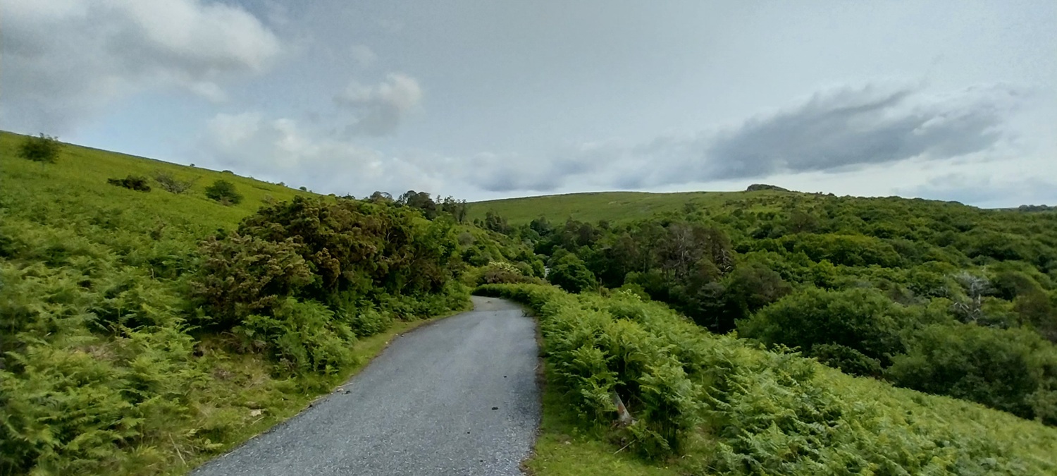
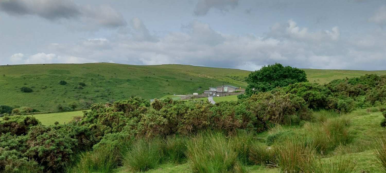
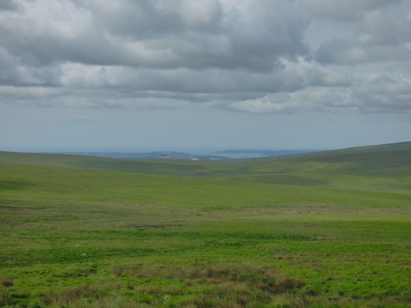
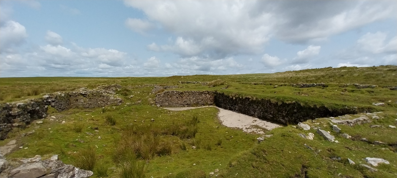
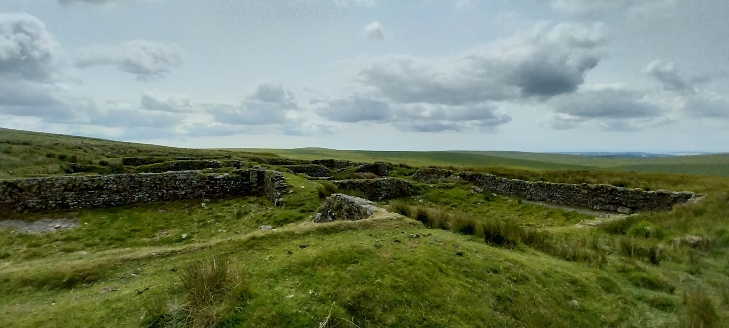
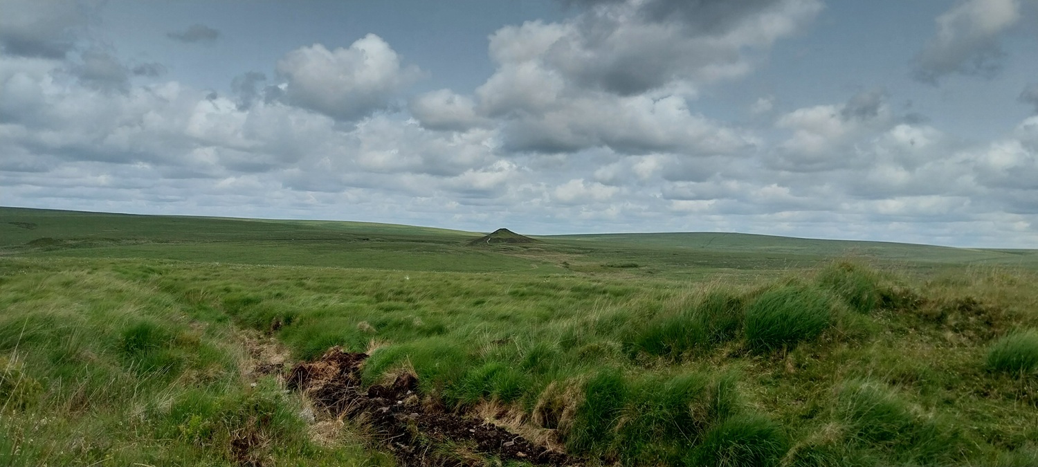
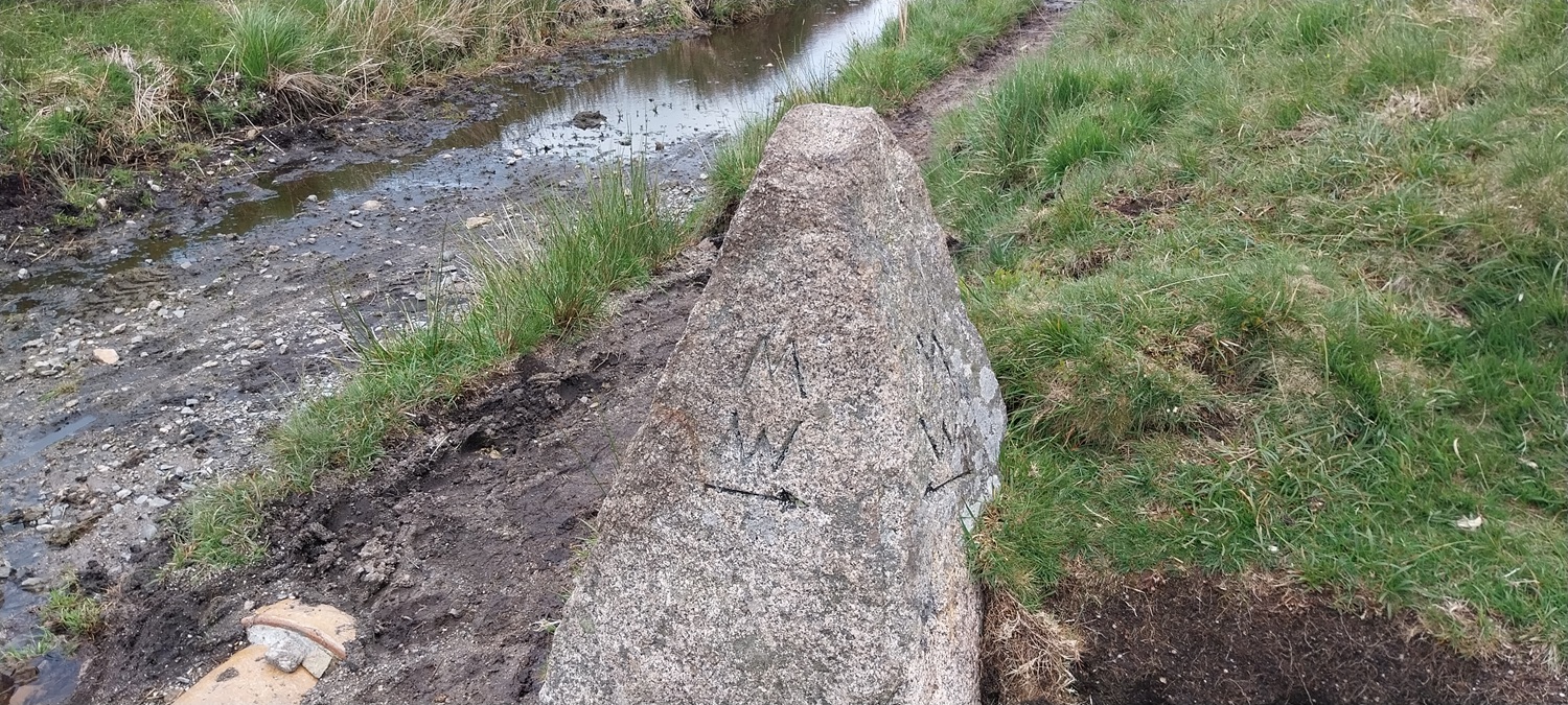
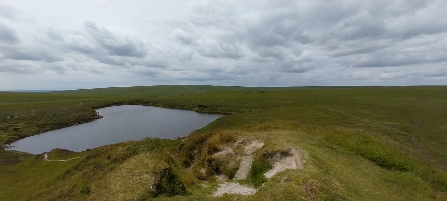
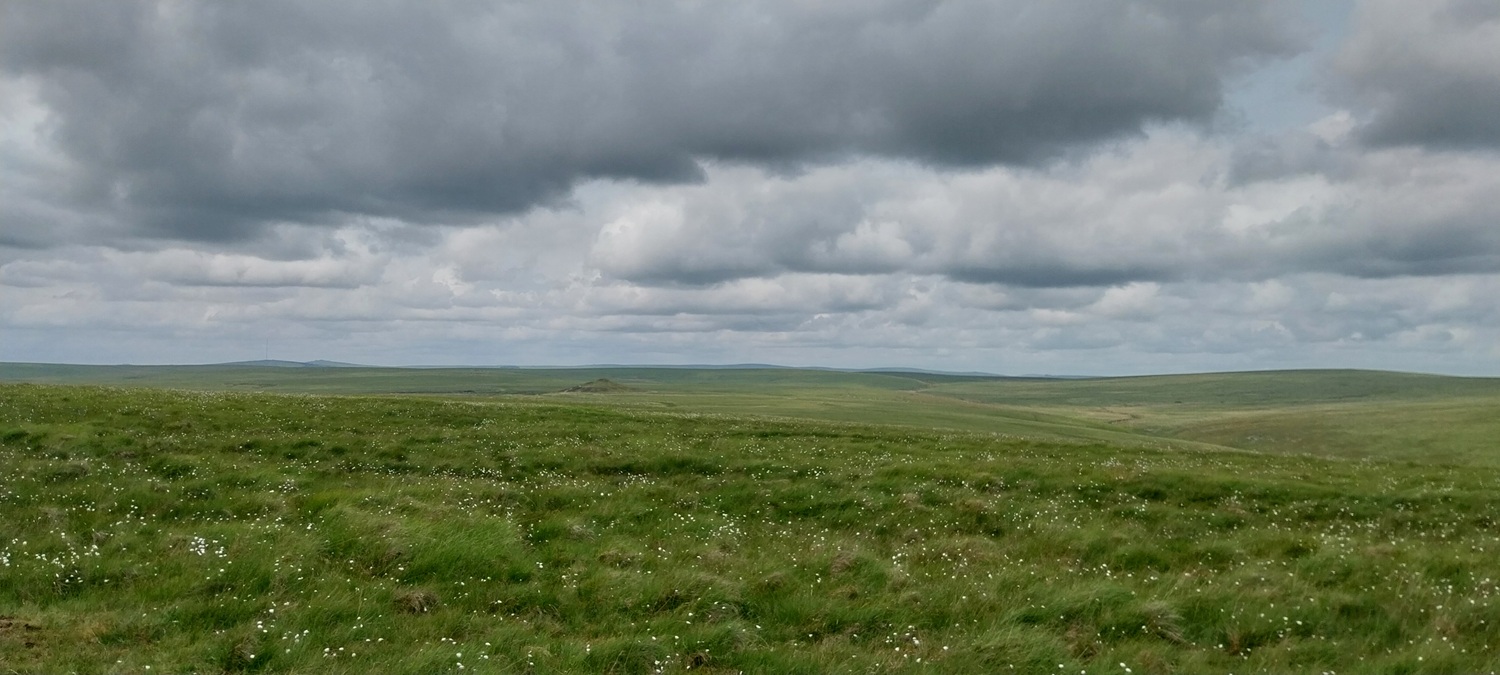
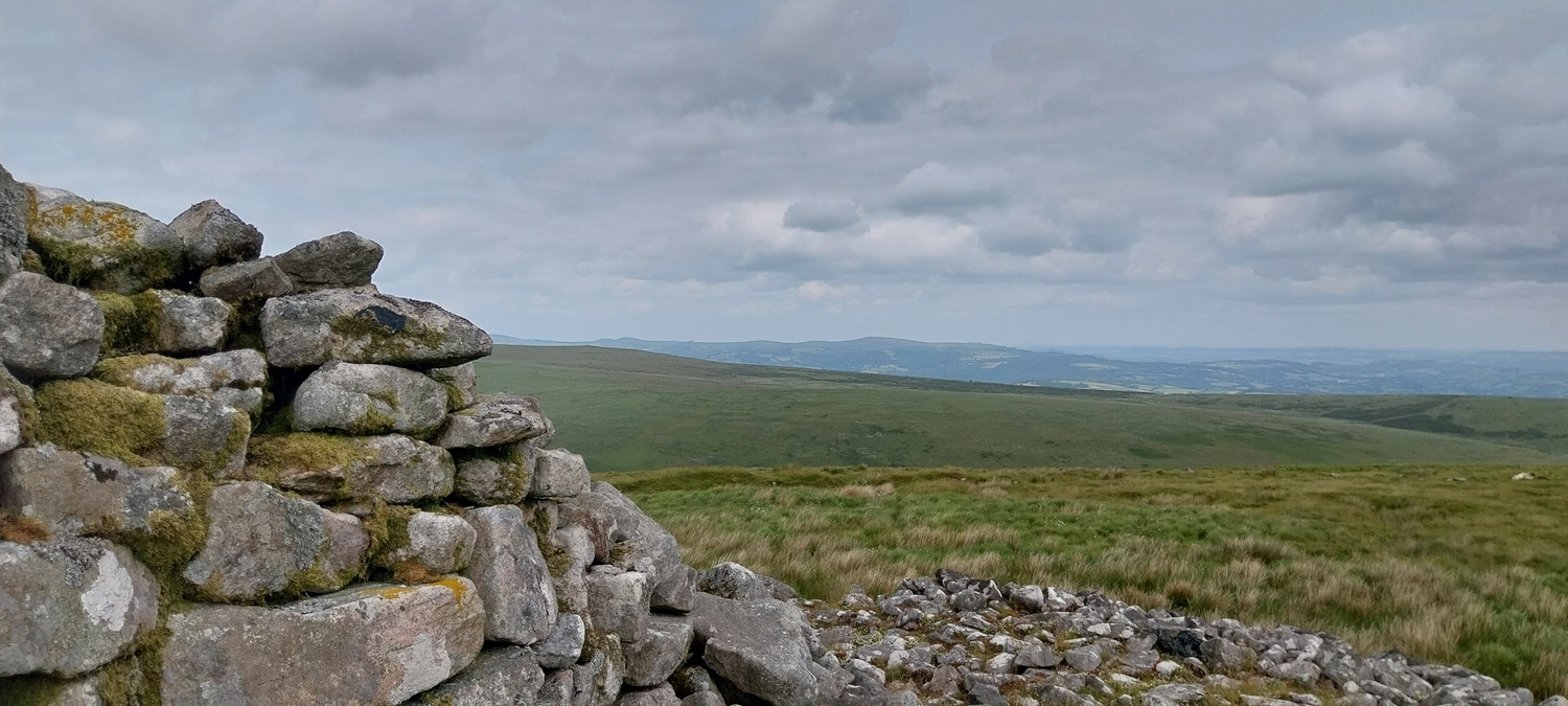
A fair few days of heavy rain had preceded this walk, as a result the River Avon was running at a more healthy level, this waterfall is always a highlight as you walk to Avon Dam and is only 50 metres or so from the car parkWe turned off the Avon Dam road, heading instead for the Water treatment plant and the Zeal TramwayThe Water Treatment works, backed by Wacka Tor and Old HillLooking back beyond the Water Treatment plant to Brent Hill on the left and South Hams stretching away in the distanceOn the Zeal Tramway, in parts you can see the old sets for the tracksTo my right here is Petre’s Pit, an area of tin mining, this is the second Dartmoor square of the day, the first is the Zeal Tramway, which I’m stood on hereWe’d dropped down to the Two Moors Way now and from here you get views to Plymouth SoundQuickbeam Hill and the settling tanks for the clay works at Redlake, once here you’ll also see the pipes running alongside the settling tanks which brought the clay here and then away.Stonechat on the walls and rocks around the settling tanksPlymouth Sound away on the right as we look out from behind the settling tanks, there are more behind us up the hill as well, but we rejoined the Two Moors Way pathMeadow BrownRedlake comes into view, Nakers Hill behindTwo Moors Way marker stone, we spoke to two people at Redlake who’s missed this stone and gone a bit off track meaning a boggy trudge across some tussocky grass to get back on the pathOn Redlake now, a manmade mound from the leftovers after the China Clay was taken to the settling tanks The path heading off to Ryders Hill behind Redlake, it can be very boggy around the back of hereLooking to Western and Eastern Whitebarrow across the pools. The two people mentioned who had strayed from the Two Moors path are between the two ponds down there on the strip of dry ground, they are heading left down to the River Avon around the Huntingdon Clapper area to pick up the path again. They had decided not to return to the marker stone, again its boggy on the route they are takingThe path out to Redlake (Redlake Tramway)Some of the settling tanks near to Western Whitebarrow, again Plymouth Sound in the distanceWestern Whitebarrow looking to the Eastern oneWalking between Western and Eastern, plenty of bog cotton which signifies soggy groundHuntingdon Warren, there is a dip between me it that hill, which holds the Avon reservoirBog cottonEastern Whitebarrow, we’d cleared up a fair few plastic bottles (kids drinks) and some cans. Pathetic public behaviour againOur route downEastern Whitebarrow is easily identified from a distance due to the submarine like appearanceBlack Tor (Shipley) is in front of Brent Hill, we head down that way, contouring around the slopesLooking up the valley which holds the River Avon, the dam and reservoir are just around the corner to the left behind that hillBlack Tor with Shipley Tor at the top of the wall opposite. Brent Hill again at the backGreen bracken is up 😡. Not a fan.The Hunters Stone lists the masters of the hunt from this area and the dates they were in chargeBack at the River Avon after a nice walk, the boggy sections today have meant work needed on re-waterproofing our shoes when getting home, but nice to be back here after a 4 year gap.
The first part of the walk feels very remote, but the Zeal tramway is a good path to follow in all weathers, but having the maps and compass as a backup is always the best practice
What a shame people are still so careless littering 😦 well done for picking up what you could. Like a backwards karma getting free parking for the good deed 😀. I do agree though, I’m far less upset paying for parking when carparks are well kept and provide amenities!
It’s the self entitled people who think someone will always deal with the aftermath of their lives. Sad that it seems such a prevalent attitude these days.


Heavy skies again, but you obviously enjoyed it, Steve, and that’s the whole point xx
LikeLiked by 1 person
Luckily the rain stayed away and the clouds did nothing more than provide a bit of excitement in the photos
LikeLiked by 1 person
Sad about the litter. Much like the first walk I ever led for a rambling group – thick mist the though and every step on a compass bearing!
LikeLiked by 1 person
The first part of the walk feels very remote, but the Zeal tramway is a good path to follow in all weathers, but having the maps and compass as a backup is always the best practice
LikeLiked by 1 person
What a shame people are still so careless littering 😦 well done for picking up what you could. Like a backwards karma getting free parking for the good deed 😀. I do agree though, I’m far less upset paying for parking when carparks are well kept and provide amenities!
LikeLiked by 1 person
Litter louts!! 😡
It’s the self entitled people who think someone will always deal with the aftermath of their lives. Sad that it seems such a prevalent attitude these days.
LikeLiked by 1 person
Absolutely infuriating to see it
LikeLiked by 1 person
I like the vastness of the moors and the open view on this walk.
You could have pay using the ring go app 😉.
LikeLiked by 1 person
Thankfully the car park is out of signal. Obviously I was disappointed 😂
LikeLiked by 1 person
I love all the wide open (and very green) views!
LikeLiked by 1 person