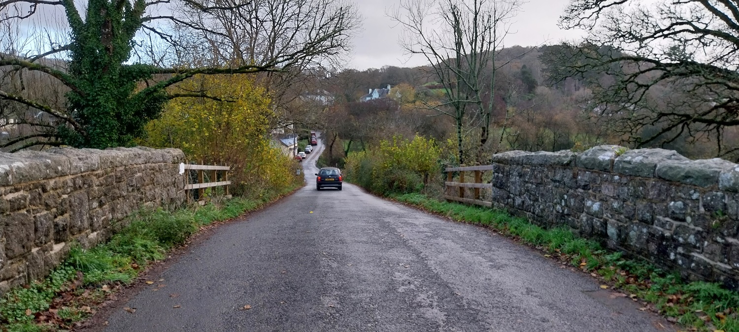
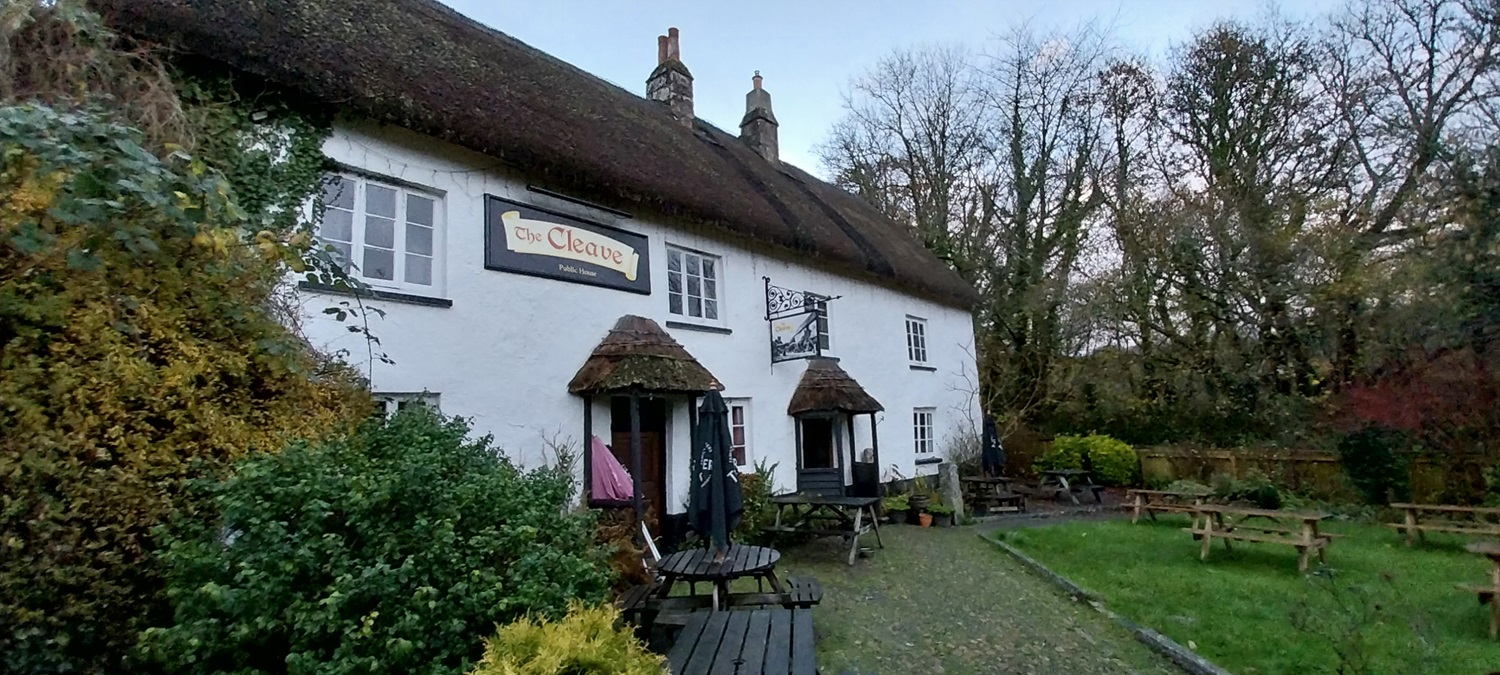
A walk which is more about bagging tors and having a good nosy around a village than anything else. We decided to head over to Lustleigh to grab the tors in Castor woods, to tick them off Linda’s list, and to tick them off a second time for myself. We would then right a wrong by having a pint in The Cleave, the lovely pub in the village and have a proper look around the church. Parking in Lustleigh is always a challenge, not helped on this occasion by our tardy start time! Still we got some good roadside parking and headed out quickly from near to the old railway bridge. We passed a burnt down house, before crossing some soggy fields to reach the A382 and Kelly Mine. Being a Sunday, the mine museum was open, its a small shed but has some nice pieces inside, showing the mining tools used here at Kelly and in the other mines around. We then headed uphill steeply to reach Kelly Mine Tor, like lots of the woodland tors on the eastern side the outcrops are pretty big here, and Kelly Mine Tor is no exception. Next we headed into Castor Wood, one of those pieces of public access land that it encircled by private land, apparently/ Not that you have issues or fences in the way when walking over from Kelly Mine Tor. After leaving Great Warmpit Copse Tor (great name), we headed back up to Lower Castor, and then jumped a fence into a field, which gave us access to the road down to Slade Cross. Once in the field we could see the gate was linked by a track to a gate into Castor Wood, so maybe it is possible to get into Castor after all, or maybe a farmers access? Not sure to be honest, either way we were in the field less than a minute, before we had our feet on the road. Re crossing the A382 we walked a lane, past Slade Copse Tor and into Knowle Wood, where we got a bit lost for a moment. The track on the floor was covered in leaves and we lost it a few times after passing the Wood Tor in the midst of woods, reaching Knowle Rocks I got confused thinking I was at a different tor, eventually I realised we needed to head further across. Once on the right path we headed down into Wreyland and the lovely cottages of Lustleigh. A visit to the church and the pub was in order to finish off this short bimble around a superb corner of Dartmoor.
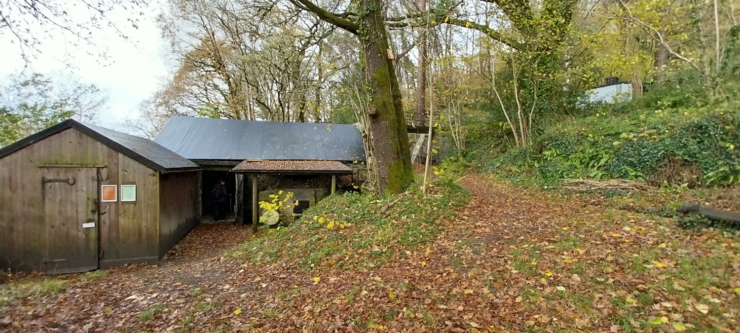
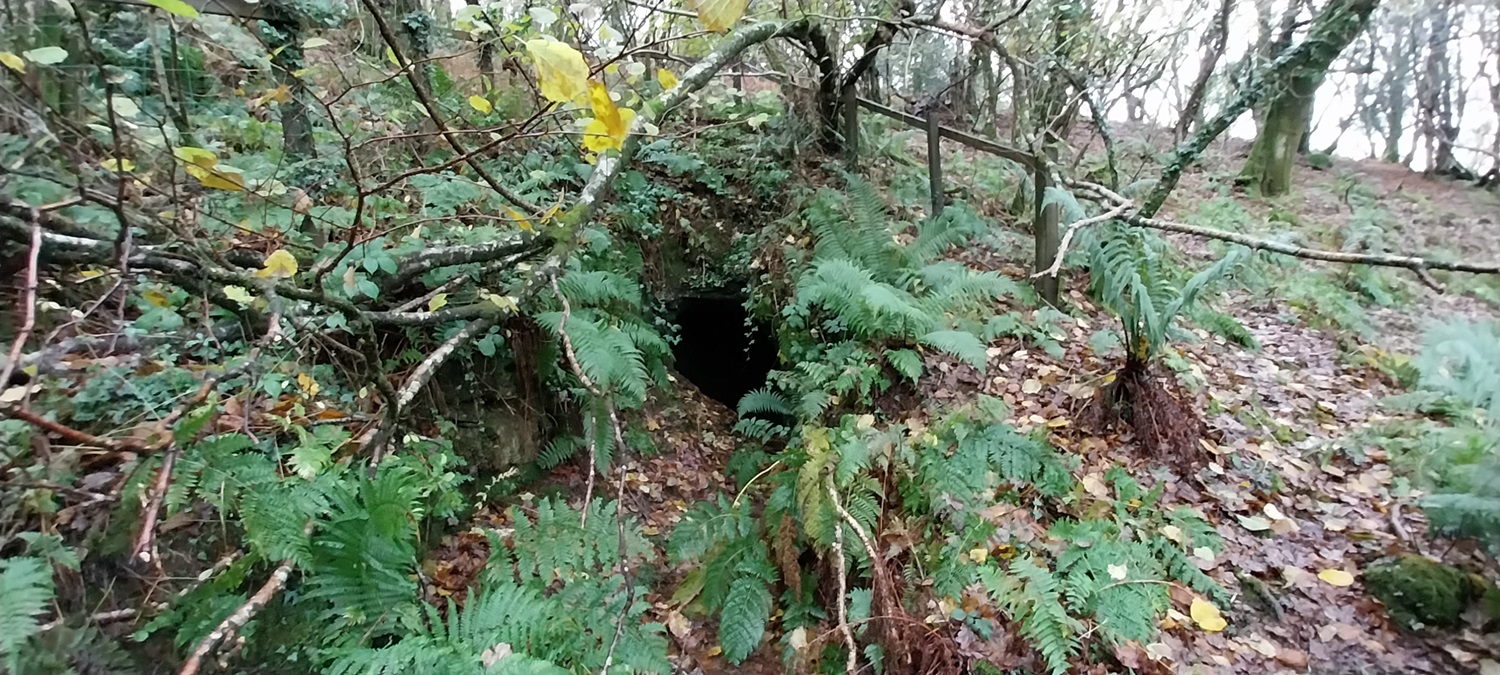
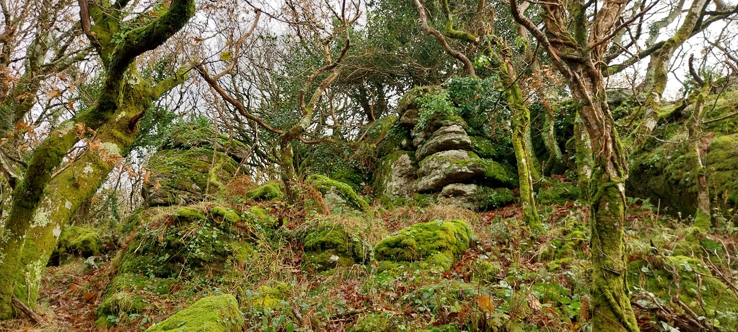
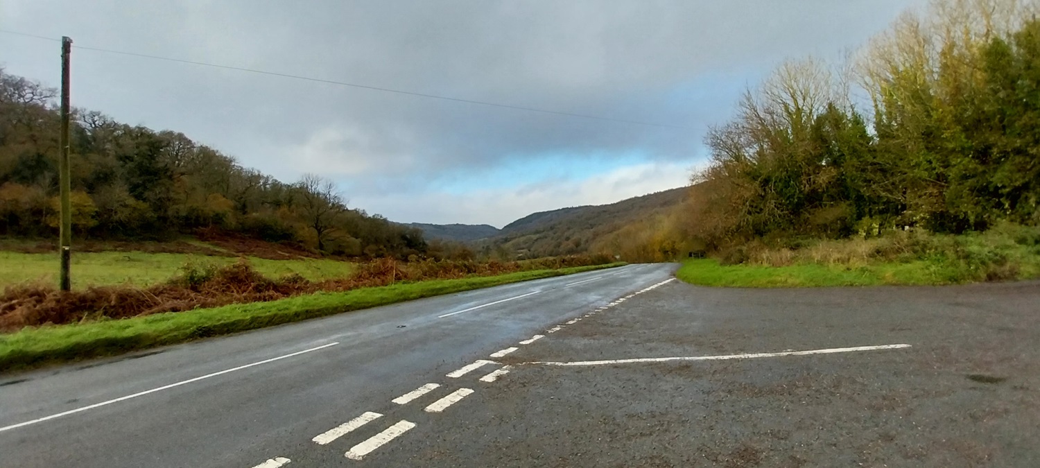
I’m stood on the old railway bridge in Lustleigh, we’ve parked over there behind that big vanOur way ahead, the railway used to run from Newton Abbot to Moretonhampstead as part of the South Devon railway, it closed in 1959 but the station in Lustleigh was used in the film, the Hounds of the BaskervillesA burnt house in Lustleigh, looks nasty, a search of the internet has a fire in a wooden house in September this year, so I assume its this one. The owner has smoke inhalation but nothing more thankfully.Along the valley, looking towards MoretonhampsteadAfter a soggy crossing of fields we reached Kelly MineInside the small museum hut (open most Sundays) is plenty of mining artifacts from the area and this map of all the mines on this side of the moorKelly Mine, there was wood cutting going on just up the hill by those that look after the mineLooks very wintry as we look out from the mine. This is the A382 infront of meA steep climb takes us past this reservoir, used for the mine to power the waterwheelNext is Kelly Mine TorKelly Mine Tor, the main outcrop, heading right here takes us to CastorMine adits near to Little CastorTitchy Little Castor
Turkey tail fungi
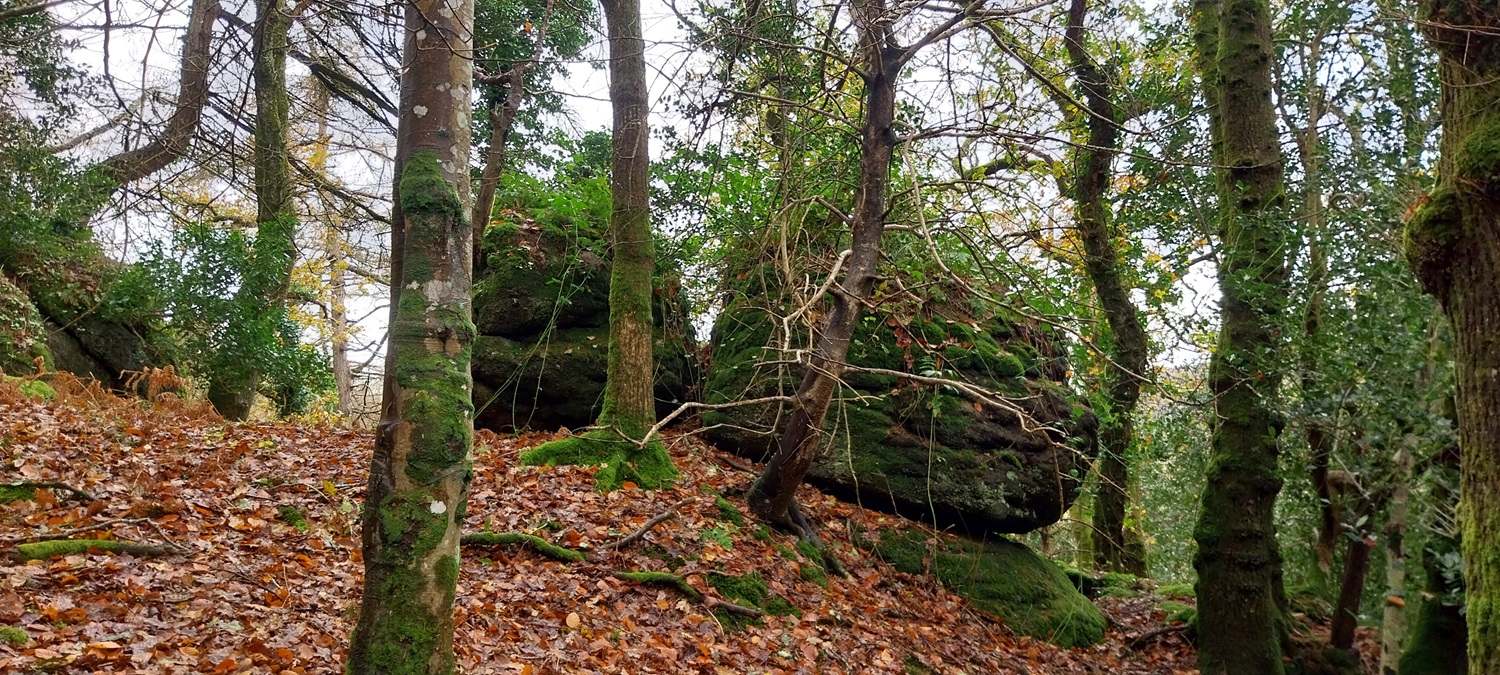
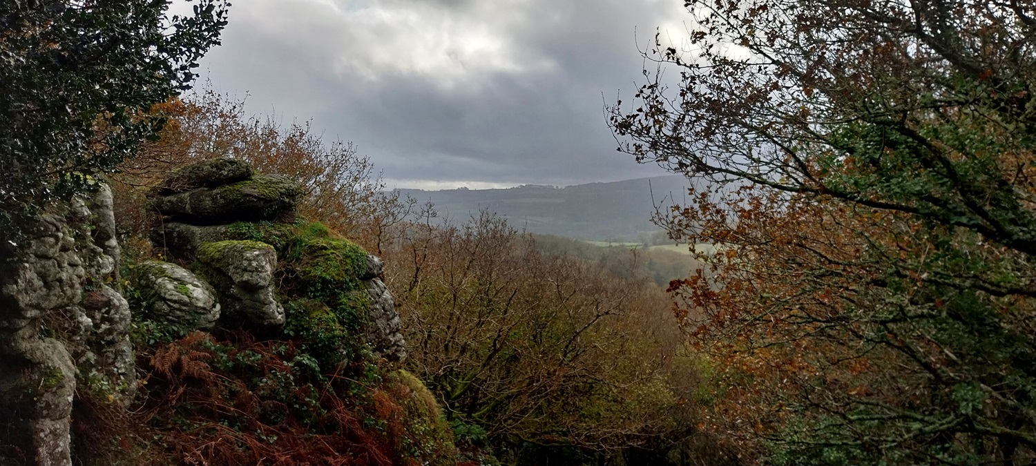
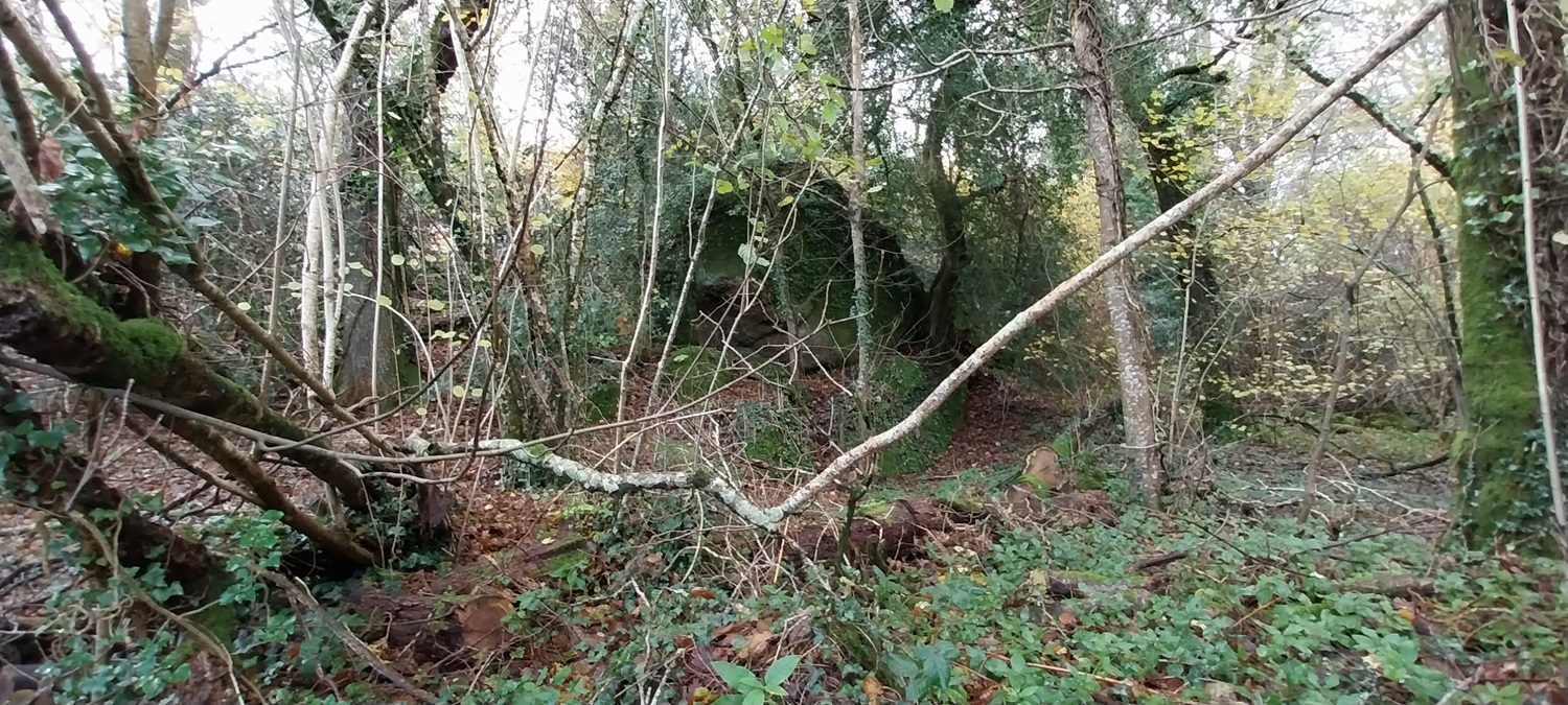
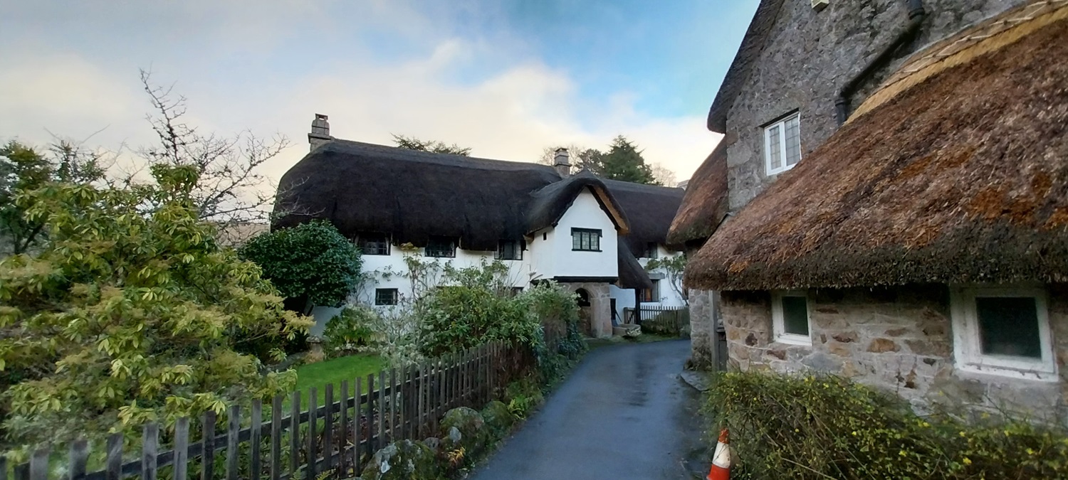
Reaching High Castor gives you views to Bovey Tracey, or at least it would do if it wasn’t so drearyHigher CastorHigher Castor has some nice big outcrops with views out of the woodlandHigher Castor againNot far downhill you reach Lower Castor, which straddles the fence into Great Warmpit CopseThe top of Great Warmpit Copse Tor, and a steep drop off after itThis tor tumbles down the hillWe’d done some creative walking to get to here, by crossing what looked like a farmers field, although there are gates linking Castor Woods, which is public access land, to the road going up on my right here. So maybe its now accessible? This is Slade Cross and the A382 againA lane took us the Slade Copse TorWhich is a big tor, lots of it can be seen from the roadA patch of blue sky, the clouds lit up by the sun. Hatherleigh Tor is in the woodland on the leftKnowle Rocks, as we walked and got lost in Higher Knowle Woods, I blame the excessive amounts of leaves on the floor hiding the path. Who’d have thought woodlands would have leaves on the floor after autumn!!The sign to let you know where you are leaving!Lovely houses in WreylandThe stream which starts in Castor Woods and also at the reservoir to Kelly Mine, ends up here passing under an old railway bridge and into LustleighLustleigh Village CrossSt John the Baptist church in LustleighInside the 13th century church
Certainly the oldest thing I’ve seen in a church, this latin stone is called a Datuidoc’s stone which has been here since 450-600 AD
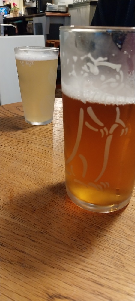
Pub time, Thatchers Haze for Linda and Holly Pale Ale from Otter Brewery for me
The old railway sign and clock now in the pub15th century pub, The CleaveAnd finally a photo of the church and Lustleigh, a lovely village to explore. A place with rocky paths, streams, tors in gardens, walls, woodlands and tiny lanes weaving around the hillside. They also have a Mayday parade here each year. Worth a visit.
Not the easiest tors to reach, with a bit of a woodland trudge, but they were nice when we got there. Lustleigh is one of the best villages on the moor without a doubt
I think the OS has around 160-170 named ones on their maps, however the guys over at Tors of Dartmoor have checked woodlands, private land, nooks and crannies and found 926 rocks, outcrops and tors of note within Dartmoor. I’ve done most of them, my list has 500 on it which I’m pleased with and is just about manageable to complete them in 3-4 years
Yes, some have done the 926, lots more have done the named ones on the OS maps. They don’t have anywhere the gravitas of the Munros or wainwrights however. The guys at Tors of Dartmoor keep finding ones as well, there was one not on their database that I found last year, which they say they may add in
These look like scenes taken from Middle Earth! Including a pub either on or at the end of a walk is something I should do more often. An essential part of whatever plan we come up with when we meet up in March 😀🍻
Absolutely, I’m happy to bow to your wisdom on a start and finish point in March. I’ve got Hay Bluff/LHK marked or Mynydd Troed, plus Fan Y Big and I would love to do the Black Mountain/ Llyn y Fan Fach area. But we may have to see how we get on


That’s a beautiful village! Creative walking is right. It’s not always easy to know where you should or shouldn’t be. Lovely tors though.
LikeLiked by 1 person
Not the easiest tors to reach, with a bit of a woodland trudge, but they were nice when we got there. Lustleigh is one of the best villages on the moor without a doubt
LikeLiked by 1 person
Max Piper’s book on the little tors is well worth seeking out. Gives names to many of the forgotten rocks.
LikeLiked by 1 person
Yes I’ve seen his book, the tors of Dartmoor website has them listed on there as well
LikeLiked by 1 person
I’ve been reading Peter Caton’s latest too, Hope to review it here soon.
LikeLiked by 1 person
Enjoyable read Steve, is there a definitive list of tors? I imagine there must be hundreds
LikeLiked by 1 person
I think the OS has around 160-170 named ones on their maps, however the guys over at Tors of Dartmoor have checked woodlands, private land, nooks and crannies and found 926 rocks, outcrops and tors of note within Dartmoor. I’ve done most of them, my list has 500 on it which I’m pleased with and is just about manageable to complete them in 3-4 years
LikeLiked by 1 person
That’s a lot of tors! Like the Wainwright’s are there people who are visiting every tor?
LikeLiked by 1 person
Yes, some have done the 926, lots more have done the named ones on the OS maps. They don’t have anywhere the gravitas of the Munros or wainwrights however. The guys at Tors of Dartmoor keep finding ones as well, there was one not on their database that I found last year, which they say they may add in
LikeLiked by 1 person
The sounds good 😀
LikeLike
A walk absolutely packed with interest and a pint to. Can’t be bad!
LikeLiked by 1 person
Trying to sneak in walks that start and therefore end near to a pub whenever possible. Probably been one of my best years to date for doing this!
LikeLike
I suppose it’s not that hard to do, so long as you know where the pubs are!
LikeLike
Some great photos during this lovely walk. Like all the mushrooms on the trees.
LikeLiked by 1 person
Always struggle to identify the fungi which is why I don;t take too many photos of them. Managed to find the name of this one when I got home though
LikeLiked by 1 person
I am the same I know nothing about fungi or plants name.
LikeLiked by 1 person
These look like scenes taken from Middle Earth! Including a pub either on or at the end of a walk is something I should do more often. An essential part of whatever plan we come up with when we meet up in March 😀🍻
LikeLiked by 1 person
Absolutely, I’m happy to bow to your wisdom on a start and finish point in March. I’ve got Hay Bluff/LHK marked or Mynydd Troed, plus Fan Y Big and I would love to do the Black Mountain/ Llyn y Fan Fach area. But we may have to see how we get on
LikeLike
All good walks there. I have a plan for all of them!
LikeLiked by 1 person